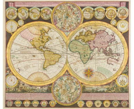
NO RESERVE London.- Mogg (Edward) Mogg's Forty-Five Miles Round London, showing the home counties from Saffron Walden to Rye, and Basingstoke to Faversham, engraved map early outline hand-colouring, 970 x 1180mm. (38 1/4 x 46 1/2 in), dissected and mounted on linen, minor spotting and browning, light surface dirt, folding with brown endpapers into contemporary green marbled slipcase, with printer's label, worn, 4to, [Howgego 287 (1)], 1821.
534325 Preisdatenbank Los(e) gefunden, die Ihrer Suche entsprechen
534325 Lose gefunden, die zu Ihrer Suche passen. Abonnieren Sie die Preisdatenbank, um sofortigen Zugriff auf alle Dienstleistungen der Preisdatenbank zu haben.
Preisdatenbank abonnieren- Liste
- Galerie
-
534325 Los(e)/Seite
London.- Mogg (Edward) Mogg's Twenty Four Miles Round London, circular map from Crowhurst to Stapleford in the north, and from Windsor to East Tilbury in the east, engraved map with early hand-colouring, 615 x 580 mm. (24 1/4 x 22 3/4 in), dissected and mounted on linen, one small split to fold, minor offsetting, very light browning and surface dirt, folding into later slipcase, rubbed, [c.f. Howgego 235, unrecorded state between (7) and (8)], 1824.
Scotland.- Collins (Capt. Greenville) [The Moray Firth], sea chart with decorative cartouche in the upper right corner, engraving with some hand-colouring, sheet 495 x 590 mm. (19 1/2 x 23 1/4 in), laid onto old paper support, central vertical fold, minor worm-hole damage with repair in the upper centre, and upper margin, minor handling creases, light surface dirt, unframed, [circa 1693 and later].
NO RESERVE Somerset.- Greenwood (Christopher) Map of the County of Somersetshire, from Actual Survey Made in the Years 1820 & 1821, county map with vignette of Wells Cathedral in the lower left, decorative calligraphic title in the upper left corner, engraving with early hand-colouring, platemark 630 x 730 mm. (24 3/4 x 28 3/4 in), sheet 650 x 800 mm. (25 1/2 x 31 1/2 in), central and vertical folds with some splitting, handling creases, light surface dirt, 1829; together with Greenwood's 'Map of the West Riding of the County of York', engraving with hand-colouring, sheet 605 x 850 mm. (23 3/4 x 33 1/2 in), some off-setting and browning, folds with minor splitting, unframed, 1834 (2).
Wales.- Speed (John) Wales, decorative map with the four corners showing the diocesan cities of Bangor, St. Asaph, Llandaff and St. David's, while the compass rose bears the arms of the Prince of Wales, the two side panels show the twelve county towns of Wales, excluding Monmouth, engraved map with early hand-colouring, platemark 380 x 510 mm. (15 x 20 1/8 in), under glass, central vertical fold, light even-browning, minor nicks to extremities, and surface dirt, framed and glazed, Basset & Chiswell, [1676]
Cape Verde.- Coronelli (Vincenzo Maria) Bocche del Fiume Negro et Isole di Capo Verde, showing Cape Verde Islands and of part of the coast of Senegal to the right, engraved map, an excellent impression on laid paper with swallowtail flag watermark, platemark 460 x 615 mm. (18 1/8 x 24 1/4 in), central vertical fold, light offsetting and surface dirt, unframed, Venice, Padovani, [circa 1696].
NO RESERVE America.- Foster (J.W.) & Whitney (J.D.) Geological Map of the Lake Superior Land District in the State of Michigan, showing the geology of the Upper Michigan Peninsula, Isle Royale and the north shore of Lake Superior and indicates copper, iron, silver, marble furnaces, iron forages and active/inactive mines, lithograph with hand-colouring, three sections joined, total approx. 620 x 950 mm. (24 1/2 x 37 1/2 in), mounted on linen, with handling creases, minor surface dirt and light browning, unframed, J. Ackerman, 1847.
Caribbean.- Curaçao.- Kobell (Hendrik, 1751-1799), after. Het springen van 's landsch oorlog schip Alphen, in de haven van Curaçao, engraving by J. Punt, on laid paper with watermark of fleur-de-lis, platemark 330 x 420 mm. (13 x 16 1/2 in), sheet 345 x 440 mm. (13 1/2 x 17 1/4 in), handling creases, minor nicks to edges, light surface dirt, unframed, Johannes Allart, 1779.⁂ In 1778 a Dutch Marine frigate, named De Alphen, exploded in the Curaçao harbour, the St. Anna Bay. Many of the artefacts which survived from the blast are now housed in The Curaçao Maritime Museum.
China.- Sewall (John Kirk) Map of the Western Hills, including a detailed description of the spots of interest and of the roads leading to same, title and 9 pp. of descriptive text, with map 'Trips Outside Peking' showing Beijing with old city wall, the inner city wall and the Imperial City, and other locations of interest in the surrounding area, lithograph printed in dark-green, 580 x 470 mm. (22 3/4 x 18 1/2 in), two tears into map, folding into original paper wrappers, printed title to upper cover, some surface dirt and finger-soiling, with original slip-case, rubbed and slightly worn, 8vo, Peiyang Press, Ltd. 1935 § Wyld (James) Map of China Compiled from Original Surveys & Sketches, showing China and Korea, with The Great Wall and the Imperial Canal both depicted, engraving with some hand-colouring, 650 x 830 mm. (25 5/8 x 32 3/4 in), dissected and mounted on linen, some minor off-setting and light browning, folding with blue marbled ends, surface dirt, without slip-case, 1841 (2).
America.- New York.- Montresor (John) A Map of the Province of New York, with Part of Pensilvania, and New England, wall map of New York to the east and west of the Hudson River Valley, including all of Long Island and parts of Connecticut and New Jersey, engraving with hand-colouring, total approx. 1455 x 935 mm. (57 1/4 x 36 3/4 in), dissected and mounted on linen, but split along horizontal fold, three sections up from the bottom, otherwise some light off-setting, minor browning and surface dirt, folding into later cloth drop-back box, 4to, A. Dury, 1775.
NO RESERVE France.- Anonymous (18th century) Environs de Barcelonette et de Beuil [on sheet with] Environs de Coni, Tende, et Albenga [and] Environs de Castellane et Antibes [and] Environs de Monaco, Vintimille, et Oneille, four maps printed on one sheet, engravings, on laid paper, with outline hand-colouring, numbered '5' in pen and ink upper right, and '5/13/ Suite' on the reverse, total sheet 524 x 667 mm. (20 5/8 x 26 1/4 in), central vertical fold, small split to lower margin, light handling creases, minor spotting and surface dirt, unframed, [early 18th century].
NO RESERVE France.- Ardèche.- Paris to Lyon and the Mediterranean Railway Co. A group of eight large folding plans of the southern section of the rail network, covering areas from Lyon to the Mediterranean, with a small group of accompanying documents, lithograph plans printed in colour, folding pamphlets with paper wrappers, all with printed title to upper cover, some spotting and light surface dirt, 4to, [circa 1840s and later] (Qty.).
NO RESERVE France.- Côte d'Azur.- Tassin (Charles, publisher) Description Du Cap De La Croix Isles Ste Marguerite et St Honorat, map showing Cannes and the Cap de la Croisette, with the islands of St Marguerite and St Honorat, including many ships, sea monsters, and with title cartouche upper right, engraving with hand-colouring, sheet 520 x 370 mm. (20 1/2 x 14 1/2 in), trimmed to borderline and re-margined, handling creases and light folds, minor nicks, surface dirt, unframed, [circa 1640].Literature:Pastoureau, M. Tassin II-33
NO RESERVE France.- Côte d'Azur.- Merian (Matthaeus) Eigentliche Delineation der insulen S. Margarite und St. Honorat, engraving, on laid paper with watermark of the letter M, sheet 318 x 380 mm. (12 1/2 in), central vertical fold, minor surface dirt and light browning, unframed, [circa 1650].⁂ Merian's map illustrates the French campaign against the Spanish that resulted in the return of the islands to French control in 1637.
NO RESERVE France.- Côte d'Azur.- A group of eight framed maps of the region from Cannes to Antibes, several showing ports and fortifications, with maps by Georg Christophe Kilian, Charles Inselin, John Luffman, and others, engravings, three with hand-colouring, various sizes, largest 200 x 270 mm. (8 x 10 3/4 in) and smaller, all under glass, minor handling creases and light surface dirt, [mainly 18th century] (8).
NO RESERVE France.- Mediterranean.- Coronelli (Vincenzo Maria, publisher) La Costa di Linguadocha, Provenza, et una Parte d'Italia, showing the coastline from the region of Languedoc-Roussillon, with part of Spain, across the Provence-Alpes-Côte d'Azur to Albenga in Italy, with part of Corsica in the lower right, engraving, by Francesco Maria Levanto, on laid paper without watermark, platemark 400 x 515 mm. (15 3/4 x 20 1/4 in), sheet 500 x 660 mm. (19 3/4 x 26 in), central vertical fold with small split to centre and light browning, minor nicks to extremities, light handling creases and surface dirt, unframed, [circa 1696].
France.- Provence.- Homann (Johann Baptiste) Provincia Indigenis dicta la Provence, map of the Provence from Arles to Monaco, with inset plan of Toulon harbour in the lower right corner, and pictorial cartouche in the lower left, engraving with full hand-colouring, on laid paper with indistinct watermark device, platemark 495 x 585 mm. (19 1/2 x 23 in), numbered '45' in brown ink on verso, central vertical fold with small rust-stain at upper section, some light spotting and surface dirt, unframed, Nuremberg, [circa 1730].
Holy Land.- Ortelius (Abraham) Terra Sancta, map of the Holy Land oriented to the east, showing from Beirut to Gaza, with strap-work title cartouche with three vignette roundels depicting Christ's crucifixion and resurrection, and with large sea monster and vessel in the lower left corner, engraved map with early hand-colouring, on laid paper with armorial watermark, platemark 370 x 500 mm. (14 1/2 x 19 3/4 in), sheet 445 x 540 mm. (17 1/2 x 21 1/4 in), Latin text verso, central vertical fold, small nicks and tears to extremities of margins, minor surface dirt and light browning, unframed, [Antwerp, 1603].Literature:VdB 173.1
Holy Land.- Jansson (Jan) Judaeae seu Terrae Israelis, map showing the divided kingdoms of Judea and Israel, with large title cartouche supported by the figures of Moses and Aaron in the upper left corner, and two figures in rustic costume carrying oversized grapes in the lower right corner, engraving with hand-colouring, on laid paper without watermark, platemark 360 x 485 mm. (14 1/4 x 19 1/8 in), sheet 490 x 610 mm. (19 1/4 x 24 in), central vertical fold with parallel light crease, some spotting and browning, mainly visible in the margins, unframed, [Amsterdam, circa 1650].
India.- Joseph (Charles) Map of the Grand Trunk Road from the Karamnassa to the Sutledge, Part Second, from Agra to Ferozepoor, large folding road map of one of the oldest and longest trade routes linking the Indian subcontinent with Central Asia, lithographed map with hand-colouring, 2270 x 1075 mm. (89 1/2 x 42 1/4 in), dissected and mounted on linen, some surface dirt and light abrasion, folding with blue endpapers into original cloth covered boards with publisher's label on upper cover, worn, oblong 4to, 1854⁂ Scarce. The present map is the second part published to accompany an earlier publication, in 1851, of the area between Agra and Benares. Little is known about Charles Joseph, but he appears to be listed as a surveyor in the Surveyor General's office.
Indian ocean.- Sayer (Robert) Carte du Sisteme des Courants des Mers de l'Inde ... N.E au N.; Carte du Sisteme des Courants des Mers de l'Inde ... S.O au N., two charts detailing monsoons in the Indian Ocean, engraving, each platemark approx. 460 x 520 mm. (18 1/8 x 20 1/2 in), sheets 475 x 640 mm. (18 3/4 x 25 1/4 in), some worm-hole damage to margins, minor surface dirt and light browning, 1776; together with a another impression of Sayer's '95 (a)' chart of monsoons, and Carte Reduite de l'Archipel du Nord-Est de l'Isle Madagascar, depuis la Ligne Equinoctiale jusqu'au 21d. 30m. de Latitude Meridional after Mannevillette, and Captain W.F.W Owen's Chart of the East Coast of Madagascar, engravings, 810 x 650 mm. (31 7/8 x 25 5/8 in), and smaller, occasional surface dirt and handling creases, all unframed, [18th and 19th century] (5).
Iran & Iraq.- Mercator (Gerard) Tab. V. Asiae, repraesentans Mediam Hyrcaniam, Assyriam, Susianam, ac Persidem, Ptolemaic map showing much of Persia (Iran), Mesopotamia (Iraq) and part of Armenia, from the Persian Gulf to the Caspian Sea, with Babylon (Baghdad), the Tigris and Euphrates Rivers, engraving with some outline hand-colouring, platemark 350 x 465 mm. (13 3/4 x 18 1/4 in), sheet 400 x 510 mm. (15 3/4 x 20 1/8 in), central vertical fold with small repairs to splitting, light handling creases and surface dirt, minor spotting in the upper left section, unframed, [Amsterdam, 1578 but circa 1695].
Italy.- Rossi (Giacomo Giovanni) Patrimonto di S. Pietro, olim Tuscia Suburbicaria, regional map of Tuscany, with large decorative title cartouche upper left, etching and engraving on four sheets, unjoined, excellent clean impressions, each on laid paper with watermark of an encircled fleur-de-lis, each platemark approx. 440 x 570 mm. (17 3/8 x 22 1/2 in), sheets approx. 470 x 675 mm. (18 1/2 x 26 1/2 in), minor drying creases visible, light spotting and surface dirt, unframed, rolled, 1696; together with the four sheet map Il Lazio ..., etching and engravings, each on laid paper with watermark of an encircled fleur-de-lis, each platemark approx. 435 x 570 mm. (17 1/4 x 22 1/2 in), all with full margins, light spotting and surface dirt, unframed, rolled, 1693, (2 maps, 8 sheets).⁂ Excellent impressions of Rossi's scarce regional maps of Italy.
Malta.- Pozzi (G.) Gruppo delle Isole di Malta, map of the Maltese archipelago, with inset plan of Valletta in the lower left corner, engraving with outline hand-colouring, on wove paper without watermark, sheet 410 x 580 mm. (16 1/8 x 22 3/4 in), minor surface dirt and light handling creases, unframed, Milan, [circa 1850].
New Zealand.- Harden (O.B.) Isthmian Canal Commission Economic Report- New Zealand Showing Location of Resources and Industries, map of New Zealand showing the North and South Islands, including railroads and projected railroads, from the Report of the Isthmian Canal Commission 1899-1901, photo-lithograph, on thin wove paper, sheet 485 x 350 mm. (19 x 13 3/4 in), folds with minor repairs to splitting, light surface dirt, unframed, 1901.
Sicily.- Ortelius (Abraham) Siciliae Veteris Typus, map of ancient Sicily, with an inset plan of Syracuse, with three decorative cartouches, ships and sea monsters, engraving, on laid paper with crossed arrows watermark, with early hand-colouring, platemark 370 x 485 mm. (14 1/2 x 19 1/8 in), sheet 405 x 530 mm. (16 x 20 7/8 in), central vertical fold, minor damp-stains and surface dirt, light handling creases, unframed, [Antwerp, 1584].Literature:VdB 211.2
Southern Hemisphere.- Ottens (Reiner & Joshua) Hemisphere Meridional pour voir plus distinctement Les Terres Australes, featuring De L'Isle's map of the Southern Hemisphere with the tracks of the explorers and circumnavigators around the southern oceans, including Magellan in 1520, Abel Tasman in 1642, and Edmund Halley in 1698-1700, engraved map with descriptive text in French and German, on laid paper with watermark initials of 'PL' in ligature, map 465 x 610 mm. (18 1/4 x 24 in), sheet 540 x 640 mm. (21 1/4 x 25 1/4 in), central vertical fold with minor creasing and discolouration, light spotting and surface dirt, unframed, Amsterdam, [circa 1740].
South America.- Falklands.- Bellin (Jacques Nicolas) Carte Reduite des Isles Malouines ou Isles Nouvelles que les Anglois Nomment Aujourhui Isles de Falkland ... sur les Observations Memoirs et Journaux des Francois et des Anglois, detailed chart of the Falkland Islands with depth soundings and the tracks of recent French and English ships, with coastal profile views at the top, engraving with hand-colouring, on thick laid paper with double-headed eagle watermark and text-based countermark, platemark 595 x 900 mm. (23 1/2 x 35 1/2 in), sheet 635 x 935 mm. (25 x 36 3/4 in), central and vertical folds, minor nicks and tears, some repaired, light spotting and browning, numbered 88 in brown ink in the upper right corner, unframed, 1771 § Chatelain (Henry Abraham) Carte de la Terre Ferme, du Perou, du Bresil, et du Pays des Amazones ..., engraved map with hand-colouring, 415 x 530 mm. (16 1/4 x 20 7/8 in), central vertical fold with minor splitting at ends, light surface dirt, unframed, [circa 1720] (2)
World.- Rosaccio (Giuseppe) Orbis Terrae Compendiosa Descriptio, double-hemisphere world map based on Mercator's map of 1587, from Rosaccio and Ruscelli's edition of Ptolemy's Geographia, engraving with stipple, a good impression on laid paper without watermark, platemark 195 x 255 mm. (7 3/4 x 10 in), sheet 230 x 335 mm. (9 x 13 1/4 in), Italian text verso, central vertical fold with minor repairs to splitting, light surface dirt, unframed, [1598].
World.- Ruscelli (Girolamo) Ptolemaei Cognita, Ptolemaic world map with the Indian sub-continent missing, from Ruscelli and Rosaccio's edition of Ptolemy's Geographia, engraving with stipple, a good impression on laid paper without watermark, platemark 190 x 270 mm. (7 1/2 x 10 5/8 in), sheet 230 x 335 mm. (9 x 13 1/4 in), Italian text verso, central vertical fold with minor repairs to splitting, light surface dirt, unframed, [1598]; together with Bellin's map of China 'L'Empire De La Chine ...', 1748, and Blaeu's panoramic view of Ninove, and another of Roeselare, various sizes, all unframed, (4).
World.- Zurner (Adam Friedrich) and Pieter Schenk. Planisphaerium Terrestre cum utroque Coelesti Hemisphaerio, sive Diversa Orbis Terraquei, double hemisphere map of the World, with California show as an island, featuring two celestial charts and 26 further scientific projections, with two vignette landscapes in the lower corners, engraved map with hand-colouring, 510 x 590 mm. (20 x 23 1/4 in), trimmed to image and re-margined, total sheet 555 x 615 mm. (21 7/8 in), central vertical fold with light parallel creasing, several small well-repaired tears to extremities, unframed, [circa 1700].
NO RESERVE World.- Tardieu (Pierre François) Mappe-Monde, from 'Atlas Universel...', engraving with outline hand-colouring, 340 x 440 mm. (13 1/2 x 17 3/8 in), central vertical fold with some light browning, minor spotting and surface dirt, Mentelle et Chanlaire, Paris, [1806]; together with six further maps from the same, showing North and South America, including Canada, and Mexico, engravings, each approx. 340 x 450 mm. (13 1/2 x 17 3/4 in), some spotting and browning, all unframed, [1806]; and with another map of North America by Thomas Kitchin, (8).
1950s Klira archtop guitar, made in Germany; Finish: cherry sunburst; refinish, light surface marks; Fretboard: rosewood; Frets: good, refret; Electrics: working, later fitted lipstick neck pickup; Hardware: generally good; Case: contemporary Gear For Music hard case; Other: binding restored; Overall condition: good
Johnny Meeks - 1965 Fender Stratocaster electric guitar, made in USA, ser. no. L5xxx9; Finish: Dakota red, refinish, minor checking, various light blemishes; Fretboard: maple, rare maple cap with "A" nut width stamp; Frets: generally good, but with visible dent wear to the first position; Electrics: working, green bottom pickups appear original, cloth wire to original CRL three-way switch and pots which all appear to date to 1965, areas of resoldering, replaced capacitor; Hardware: earlier type green guard scratchplate, original screw holes visible on body underneath the plate, tin backing shield with holes in the correct place for year, so most likely original to the guitar, two replaced pickup covers, replaced decal; Case: 1960s Fender hard case; Overall condition: fair * Originally owned by USA guitarist Johnny Meeks ( 16 April 1937 - 30 July 2015, a former member of Gene Vincent & His Blue Caps. A longtime member of the Rockabilly Hall of Fame, he was inducted into the Rock and Roll Hall of Fame as a member of the Blue Caps in 2012. He was an accomplished guitarist who played on several Gene Vincent tracks, including "Lotta Lovin'" and "Say Mama," which Meeks wrote. When the Blue Caps broke up in late 1958, Meeks joined the Tune Toppers, followed by the Champs. He went on to perform with Merle Haggard, Elvis Presley and former Monkee Michael Nesmith. This guitar is sold with a copy of facsimile documentation dating to 1997. Written by Meeks, it states that he sold the guitar to a friend, a Mr. Jackson, for a favourable sum of $2000 and that he was "hurt and disappointed" that Mr Jackson had sold it on. Also included it a facsimile copy of a picture showing Meeks with the guitar, also signed "To Peter Johnson, Keep on Rockin, Johnny Meeks 'Blue Caps' guitar, 6 April '97". It is thought that Meeks made a custom order to have Fender make this guitar for him with an 'A' width maple cap neck
1970s Kimbara twelve string acoustic guitar, made in Korea; Fretboard: rosewood; Frets: generally good, some minor dent wear to first position; Back and sides: Indian rosewood, light blemishes; Table: natural spruce, light blemishes; Case: semi-rigid case; Other: action requires attention; Overall condition: good
Late 1970s Marshall model 2200 100 watt lead combo guitar amplifier, made in England, outer tolex in good general condition with some scuffs, missing screws to back panel, missing pilot light, appears to be in working order, although would require servicing as pots are noisy and occasionally intermittent
An early 19th century trencher glass salt, the underside with painted portrait (with numerous frits), h.7.5cm; together with a pedestal dram glass, having drawn trumpet bowl, h.10.5cm (2) Condition Report / Extra Information Salt - chip to one end of bowl, small nibbles, wear to base. Glass - light wear and scratches.
A Clarice Cliff W pattern pottery sandwich set, comprising long octagonal tray with black printed backstamp verso (10x7mm chip to underside edge of rim towards one corner), and a set of six octagonal dishes, dia.14.5cm (7) Condition Report / Extra Information Side plates - one with small chip to underneath, all with small scratches throughout consistent with age and light use. Large plate - chip to underside of one end, graze to the other end, glaze crazed (mostly to base), small losses and scratches throughout.
A Clarice Cliff Delecia pattern Bonjour shaped cream jug, black printed backstamps and further hand-painted number 23356 verso (6x3mm chip to inside edge of top rim), h.9.2cm; together with a small Clarice Cliff Taormina orange pattern pottery Bonjour shaped cream jug (long running vertical hairline crack to body); with matching sugar; and further Secrets Green Bonjour shaped sugar (vertical hairline crack to body), each with printed backstamps verso (4) Condition Report / Extra Information Large jug - chip to inside edge of top rim, light graze to one corner. Small jug - hairlines to both sides, crack to upper edge of one side. Sugar - hairline to one side. Second sugar - fair-good.
A Laura Knight for Clarice Cliff Fair Ladies first edition beer tankard, circa 1934, of painted stylised ladies within a black and orange bordered backdrop, purple printed backstamp 'Designed by Laura Knight' and dated verso, h.16cm Condition Report / Extra Information Very light wear. Overall good.
A Victorian engraved glass tumbler, decorated with leaves and flowers, inscribed 'Mrs Allott' and dated 1891, h.11.5cm; another decorated with a bird amidst fauna, h.10.5cm, and one other decorated with flowers, thistles and wheat-ears, monogrammed SAP and dated 1867, h.10cm (3) Condition Report / Extra Information Mrs Alcott tumbler - couple of small scratches. Bird glass - wear to base, other light wear throughout. Monogrammed glass - light wear, mainly to base.
A 19th century pedestal glass goblet, the bowl engraved with bird supporting swags of flowers, within further C-scrolls (chip to foot), h.19cm; together with an early 19th century engraved conical rummer on square footed base, h.12cm (2) Condition Report / Extra Information Pedestal glass - chip to base, light wear. Rummer - light wear.

-
534325 Los(e)/Seite