We found 109182 price guide item(s) matching your search
There are 109182 lots that match your search criteria. Subscribe now to get instant access to the full price guide service.
Click here to subscribe- List
- Grid
-
109182 item(s)/page


Lot 576
Wilson (Edward). Diary of the Discovery Expedition to the Antarctic Regions 1901-1904, reprint edition, 1975, numerous colour and black and white illustrations, original cloth in price clipped dust jacket, spine lightly rubbed to head and foot, 4to, together with Priestley (Raymond E.), Antarctic Adventure, Scott's Northern Party, 1974, 150 black and white illustrations, plus a map, original cloth in dust jacket, spine slightly faded, 8vo, and Hattersley-Smith (Geoffrey, editor), The Norwegian with Scott (Tryggve Gran's Antarctic Diary 1910-1913), HMSO, 1984, 24 black and white plates, plus 3 maps, original cloth in dust jacket, spine slightly faded, 8vo, plus other modern Arctic & Polar exploration reference and related, all original cloth, mostly in dust jackets, G/VG, 8vo/4to (3 shelves)
Lot 525
Norbury (Henry F.). The Naval Brigade in South Africa During the Years 1877-78-79, 1st edition, 1880, black and white engraved frontispiece, period inscription to half-title, some light spotting, original gilt-decorated blue cloth, boards and spine lightly rubbed, head of spine repaired, 8vo, together with Granville (A.K.), With the Cape Mounted Rifles, four years service in South Africa, 1st edition, 1881, period inscription and minor loss to front endpaper, some light toning and spotting, original gilt-decorated brown cloth, slightly rubbed to head and foot, 8vo, and 14 further volumes of late 19th and 20th-century military reference, including Military Operations France and Belgium, 1914 (History of the Great War), volumes 1 & 2 plus map volumes 1 & 2, by J. E. Edmonds, 1926, all original cloth, some in dust jackets, G/VG, 8vo/4to (a carton)
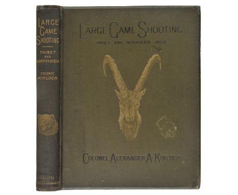
Lot 46
Kinloch (Alexander A.A.). Large Game Shooting in Thibet, the Himalayas, and Northern India, 1st edition, Calcutta, 1885, frontispiece, 28 sepia plates, folding map, 16 pp. publisher's catalogue at end, a few minor spots, one or two plates with light marginal water stain, rear endpaper with short repaired tear, original green cloth gilt, a little rubbed, small damp stains to margins of lower cover, 4to (1)
Lot 107
Stanley (Henry M.). The Congo and the Founding of its Free State: A Story of Work and Exploration, 2 volumes, 1st edition, 1885, folding map contained in rear pocket of each, maps and illustrations, some light spotting, volume I rear hing broken, volume II front hinge broken, previous owner inscription, original pictorial cloth gilt, spine ends a little rubbed with small tears, 8vo, together with In Darkest Africa or the Quest, Rescue and Retreat of Emin Governor of Equatoria, 2 volumes, 1st edition, 1890, folding maps (one with with tears and reinforcemants to verso), illustrations, light spotting, bookplates, original red pictorial cloth gilt, edges rubbed, a few small stains, 8vo, plus Through the Dark Continent, 2 volumes, later edition, 1899, folding map, illustrations, light spotting, original red pictorial cloth, spines faded, a little rubbed with stains to volume II upper cover, 8vo, with other Stanley related (25)
Lot 116
Armstrong (Alexander). A Personal Narrative of the Discovery of the North-West Passage; with Numerous Incidents of Travel and Adventure during nearly five years' continuous service in the Arctic Regions while in search of the Expedition under Sir John Franklin, 1st edition, 1857, colour lithographed frontispiece, folding map, some light spotting at front, all edges gilt, contemporary calf, spine with green label and gilt decoration, a little rubbed and scuffed, 8vo Sabin 2017. Sir Alexander Armstrong (1818-1899) served as naval surgeon aboard HMS Investigator under the command of Robert McClure, which went in search of Sir John Franklin's lost expedition from 1850-54 and discovered the Northwest Passage in 1850 by traversing from west to east by ship and sledge. (1)
Lot 75
Baines (Thomas). The Gold Regions of South Eastern Africa, 1st edition, 1877, portrait frontispiece, three photographic illustrations, folding facsimile letter, folding map contained in rear pocket, advertisements at end, a few spots, blindstamp to front endpaper, previous owner signature, original green cloth gilt, spine a little darkened and rubbed at extremities, 8vo (1)
Lot 159
Gloucester. Map of the City and Borough of Gloucester from an Actual Survey made in 1843, Respectfully dedicated to the subcribers by their obedient servant Arthur Causton, Gloucester, Surveyor, published by James Wyld, [1843], hand-coloured engraved map, sectionalised on linen, 118 x 93.5cm (46.5 x 37 inches), contained within contemporary half morocco covers, joints cracked, 4to, together with Gloucestershire, The Gloucestershire Directory, containing the Names & Residences of Professional Gentlemen, Merchants, Manufacturers, and Tradesmen..., with a Brief History of the City of Gloucester..., Gloucester: Printed by J. Roberts, 1820, folding engraved map frontispiece (by R. Gell & T. Bradshaw), some spotting and toning, contemporary marbled sheep, boards detached, 12mo (2)
Lot 189
British Isles. Seutter (Matthaus), Tabula novissima accuratissima Regnorum Angliae Scotiae Hiberniae, published Augsburg, circa 1720 - 1730, engraved map with contemporary hand colouring, uncoloured cartouche, mileage scale and heraldic shields, slight water staining, old folds, 580 x 495 mm R. W. Shirley. Printed Maps of the British Isles 1650 - 1750. Seutter 1. Intermediate state between 1 & 2. (1)

Lot 232
Yorkshire. Speed (John), The North and East Ridins of Yorkshire, published John Sudbury & George Humble, circa 1646, hand coloured engraved map, inset town plans of Richmond and Hull, central fold partially strengthened on verso and a little toned, some creasing, right hand vertical margin trimmed, 395 x 520 mm, English text on verso (1)
Lot 500
Folio Society. The Source of the Nile, The Lake Regions of Central Africa, by Richard Burton, 3rd printing, 1996, black and white folding map to rear, Nostromo, A Tale of the Seaboard, by Joseph Conrad, 1984, The Diaries, by William Allingham, 1990, Mistress Masham's Prose, by T.H. White, 1989, Chartress, The Making of a Miracle, by Colin Ward, 1986, together with 78 further volumes, all original cloth in slipcases, G/VG, 8vo (83)
Lot 69
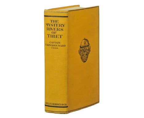
Ward (F. Kingdon). The Mystery Rivers of Tibet. A Description of the little-known land where Asia's Mightiest Rivers gallop in harness through the narrow gateway of Tibet, its peoples, fauna & flora, 1st edition, 1923, folding map, three sketch maps, half-tone illustrations, Easton Neston Library shelf number label at fromt, original yellow cloth, spine a little faded, 8vo, together with From China to Hkamti Long, 1st edition, 1924, folding map, illustrations, a few light spots, Peter Hopkirk library label, original cloth, edges a little rubbed, 8vo, plus A Plant Hunter in Tibet, 1st edition, 1934, folding maps, illustrations, original cloth, dust jacket, reinforcements to verso, light soiling, 8vo, with seven others by Ward including Plant Hunting on the Edge of the World, 1st edition, 1930 (10)
Lot 191
British Isles. Walker (John), Map of the Inland Navigation, Canals, and Rail Roads with the Situations of the various Mineral Productions throughout Great Britain, from actual surveys projected on the basis of the trigonometrical Survey made by order of The Honourable The Board of Ordnance..., published Richard Nichols, Wakefield, January 1st, 1830, very large engraved map with contemporary hand colouring, sectionalised and laid on linen, large calligraphic title and dedication, compass rose and table of explanation, inset map of Scotland, slight overall toning, marbled endpapers, 1920 x 1560 mm, contained in a contemporary calf book box, worn and rubbed Published and intended to accompany Joseph Priestleys "Historical Account of the Navigable Rivers, Canals, and Railways, of Great Britain", The map contains and wealth of detail bringing together many aspects of the Industrial revolution, namely the mining industry and the canal and railway networks. (1)
![London. Munster (Sebastian), Londin oder Lunden die Haupestatt in Englellande..., published Basel, [1628] hand coloured woodb](https://cdn.globalauctionplatform.com/dacdcb76-b286-4880-b37f-a7f20103e9c5/bc3c503c-1783-4d63-e535-8c9bf5283aa3/468x382.jpg)

Lot 100
Sparrman (Anders). A Voyage to the Cape of Good Hope, Towards the Antarctic Polar Circle, and Round the World: But Chiefly into the Country of the Hottentots and Caffres from the Year 1772 to 1776..., translated froem the Swedish Original, 2 volumes, volume I 1st English edition, 1785, volume II 2nd edition corrected, 1786, folding engraved map (repaired and laid down), 10 engraved plates, some offsetting and spotting, bookplates, contemporary calf, morocco rebacks, rubbed, 4to Sparrman's account of Cook's second voyage. Mendelssohn II, p.414. (2)
Lot 43
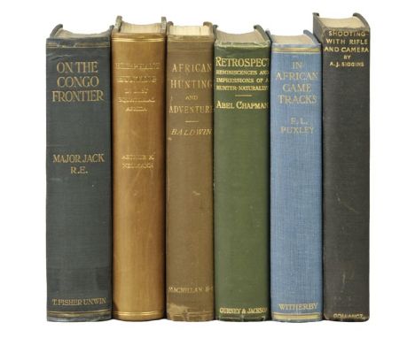
Jack (Major E. M.). On the Congo Frontier. Exploration and Sport, 1st edition, 1914, folding map, half-tone illustrations, a little light marginal toning, blue ink stamp to title verso, endpapers renewed, top edge gilt, original blue cloth gilt, light clear tape residue mark across foot of spine and covers, 8vo (Czech p. 138), together with Neumann (Arthur H.), Elephant-Hunting in East Equatorial Africa. Being an Account of Three Years' Ivory-Hunting under Mount Kenia and among the Ndorobo Savages of the Lorogi Mountains, Including a Trip to the North End of Lake Rudolph, 1st edition, Rowland Ward, 1898, folding map contained in rear pocket (with Intelligence Division ink stamp), chromolithographed plate of butterflies, illustrations, modern half calf, small water stains at foot of lower cover, 8vo (Czech p. 207), plus Baldwin (William Charles), African Hunting and Adventure. From Natal to the Zambesi including Lake Ngami, the Kalahari Desert from 1852 to 1860, 3rd edition, 1894, portrait frontispiece, folding map, four colour lithograph plates, wood-engravings, scattered light spotting, upper area of half title excised and repaired, original cloth gilt, rebacked with original spine relaid, a little rubbed, 8vo (Czech p. 17), with three others related: Abel Chapman's Retrospect. Reminiscences and Impressions of a Hunter-Naturalist in Three Continents 1851-1928, 1928, Frank Puxley's In African Game Tracks, 1929 and A.J. Siggins' Shooting with Rifle and Camera, 1931 (6)
Lot 186
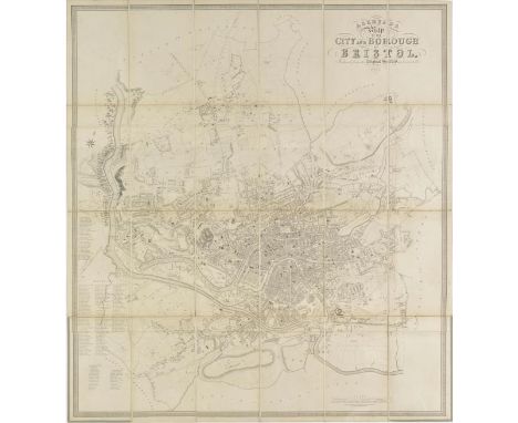
Bristol Ashmead (G.C.), Ashmead's Map of the City and Borough of Bristol, Reduced from the Original Survey and Corrected to 1855, published G. C. Ashmead, Bristol and E. Mardon, Clifton, 1855, uncoloured engraved map, sectionalised and laid on linen, 935 x 855 mm, contained in a contemporary cloth slipcase with manuscript label to upper board, faded along spines, together with Shiercliff (E.), The Bristol & Hotwell Guide..., fourth edition, published Bristol, circa 1810, frontispiece of a folding engraved plan of Bristol, three engraved plates, including one with contemporary hand colouring, later endpapers, uncut, re-backed but retaining original printed boards, worn and scuffed, 8vo, with Evans (Rev. John), The Picture of Bristol or a guide to objects of curiosity and interest in Bristol, Clifton, The Hotwells and their vicinity..., published Bristol, 1814, frontispiece of a folding engraved plan of Bristol, three folding engraved plates, bookplate of B. M. H. Rogers, contemporary half calf, worn at extremities, 8vo, plus three other similar bound guides to Bristol, together with Ordnance Survey, (publisher), Untitled map of Bristol, 1887, engraved plan of Bristol, sparse hand colouring, sectionalised and laid on linen, 675 x 960 mm, marbled endpapers, plus Herapath (W.), The Hand Book for Visitors to the Bristol & Clifton Hotwells (Illustrated by Plates) containing a chemical analysis of the Spa, published Bristol, Clifton and Weston-Super-Mare, circa 1860, frontispiece of a folding engraved geological cross-section with contemporary hand colouring, two engraved plates, advertisements bound at rear, publisher's blue cloth with gilt title to upper board, slight wear to extremities, slim 8vo, with four loose 19th maps of Bristol and its environs, various sizes and condition (12)
![Cornwall. Saxton (Christopher), Promontorium hoc in mare projectum Cornubia dicitur, [1579], engraved map with early hand col](https://cdn.globalauctionplatform.com/dacdcb76-b286-4880-b37f-a7f20103e9c5/e199991a-7048-4c8b-91e7-e9f827546dfb/468x382.jpg)
Lot 192
Cornwall. Saxton (Christopher), Promontorium hoc in mare projectum Cornubia dicitur, [1579], engraved map with early hand colouring, strapwork cartouche and mileage scale, the title cartouche surmounted with the royal coat of arms, with an additional armorial of Thomas Seckford, some chipping to margins but not affecting image, the map shows signs of earlier cleaning, 365 x 485 mm Engraved by Lenaert Terwoort. (1)
Lot 125
Crantz (David). The History of Greenland: containing A Description of the Country, and its Inhabitants.., volumes 1 & 2, printed by Brethren's Society, 1767, 8 folding plates, including frontispiece map to volume 1, modern endpapers, some marks and toning, uniform modern tan calf spines retaining contemporary full calf boards, slightly rubbed with minor loss, 8vo, together with Pinkerton (John), A General Collection of the Best and Most Interesting Voyages and Travels in All Parts of the World..., volume 1 only, 1808, 10 black and white plates including frontispiece, some light spotting and offsetting, modern tan calf spine retaining contemporary full calf boards, slightly rubbed to head and foot, 4to, and Schwatka (Frederick), Nimrod in the North..., New York, 1885, numerous black and white illustrations, ex library copy with associated stamps, front gutter split, some light marks and toning, original gilt decorated blue cloth, boards and spine slightly rubbed to head and foot, 4to, plus 48 further volumes of 18th and 19th century Polar and Arctic referece, mixed leather and cloth bindings, condition is generally good/very good, 8vo/4to (52)
Lot 163
Ingram (James). Memorials of Oxford, 3 volumes, published John Henry Parker, Oxford, Charles Tilt, London, 1837, title and dedication, advertisement for 'Le Keux's Memorials of Cambridge' loosely inserted, sixty-six (only of 100) uncoloured engravings, one uncoloured engraved map, numerous wood engravings to text throughout, uncoloured lithographic view of Oxford loosely inserted into volume 3, some scattered spotting, top edge gilt, publisher's cloth gilt, spines faded, worn at extremities, 4to Large paper copy. Sold as a collection of plates, not subject to return. (3)
Lot 164
Leigh (Samuel). Leigh's New Atlas of England & Wales, circa 1830, decorative engraved title, table of the 'Price of Posting' detached, fifty-five (complete) uncoloured engraved maps by Sidney Hall, descriptive text and index, folding engraved map with contemporary hand colouring of England & Wales bound at rear, long closed tear affecting map, a duplicate map of England & Wales (without a tear) is loosely inserted, ownership signature to front pastedown, contemporary green morocco gilt worn and frayed at extremities, 12mo, together with another later edition similar, with Reynolds (James), Reynold's Travelling Atlas of England with all the railways and stations accurately laid down, circa 1850, title and index, thirty-two uncoloured engraved maps by John Emslie, gutta percha perished, contents shaken and loose, upper hinge broken, book plate of John Matthew Jones, publisher's cloth gilt, faded and worn, 8vo, with another copy similar but containing only thirty maps, plus, Cobbett (William), A Geographical Dictionary of England and Wales, 1832, frontispiece of a map of England & Wales with early 20th century ownership address to verso, forty-two uncoloured outline maps, some spotting throughout, index bound at rear, old newspaper cuttings to endpapers and pastedowns, text block detached, later cloth with crude ownership stamp to upper and rear sidings, stained and spotted, 8vo Sold as a collection of maps, not subject to return. (5)
![[Grant, Colesworthy]. Rural Life in Bengal; Illustrative of Anglo-Indian Suburban Life; more particularly in connection with](https://cdn.globalauctionplatform.com/dacdcb76-b286-4880-b37f-a7f20103e9c5/c8c65375-f507-4b34-c5d6-a0a2986ee549/468x382.jpg)
Lot 37
[Grant, Colesworthy]. Rural Life in Bengal; Illustrative of Anglo-Indian Suburban Life; more particularly in connection with the planter and peasantry, the varied produce of the soil and seasons, with copious details of the culture and manufacture of indigo. Letters from an artist to his sisters in England, 1st edition, 1860, colour lithograph map, wood-engraved illustrations, publisher's catalogue at end, slight offsetting to title, lacking front endpaper (front pastedown replaced?), bookplate, original green cloth gilt, spine ends a little rubbed, 8vo (1)
Lot 149
Besley (Henry publisher). H.Besley's Views in Cornwall, circa 1865, title printed to upper board, twenty-four uncoloured engraved views, upper hinge broken, book plate of 'The Steel Collection', publisher's blindstamped cloth gilt, a liitle faded and bumped at extremities, oblong 8vo, together with Besley (H. publisher), H. Besley's Views in Devonshire, circa 1865, five engraved views, publisher's printed gilt boards, oblong 8vo, with Fearnside (William Gray & Harrel Thomas, editors), Holmes's Great Metropolis : or views and history of London in the nineteenth century..., published Thomas Holmes, circa 1855, additional decorative title page, forty-nine uncoloured engraved views, some spotting, contemporary cloth gilt, worn and frayed, 8vo, plus Shepherd (Thomas H.), Metropolitan Improvements or London in the nineteenth century..., 1827, decorative title, dedication, 140 uncoloured engraved views and one folding map, some spotting and staining throughout, contemporary diced calf gilt, worn and rubbed, 8vo, with Morris (Rev. F. O.), A History of British Birds, volumes 3 & 5 (only). 1870, numerous colour plates, very occasional spotting, publisher's cloth gilt, large 8vo, with another seven mixed volumes of natural history, topographical views and similar, mixed bindings, various sizes (13)

Lot 92
Livingstone (David & Charles). Narrative of an Expedition to the Zambesi and its Tributaries; and of the Discovery of the Lakes Shirwa and Nyassa. 1858-1864, 1st edition, 1865, folding wood-engraved frontispiece, folding map, illustrations, 32 pp. Murray catalogue at end, first few leaves detaching, bookplate, original cloth gilt, spine faded and rubbed at ends, 8vo, together with Stanley (H.M.), How I Found Livingstone; Travels, Adventures and Discoveries in Central Africa; Including Four Months' Residence with Dr. Livingstone, 1st edition, 1872, photographic portrait frontispiece, four folding maps (torn without loss), illustrations, publisher's 8 pp. catalogue at end, occasional light spotting, hinges tender, original red cloth gilt, spine and edges a little rubbed, 8vo, plus Monk (William, editor), Dr Livingstone's Cambridge Lectures, together with a prefatory letter by the Rev. Professor Sedgwick, 1st edition, 1858, portrait frontispiece (with light water stain), two folding maps, a few light spots, endpapers renewed, original blue cloth, rebacked, most of original spine relaid, 8vo, with a presentation inscription from the editor at head of title, with others, Livingstone related etc (19)
Lot 95
Mounteney-Jephson (A.J.). Emin Pasha and the Rebellion at the Equator. A Story of Nine Months' Experiences in the Last of the Soudan Provinces, 1st edition, 1890, portrait frontispiece, folding map, folding facsimile letter, illustrations, advertisement leaf at end, a few light spots, previous owner inscription, library shelf label of Lord Carew to front pastedown, original red pictorial cloth gilt, edges a little rubbed, 8vo, together with Emin Pasha in Central Africa. Being a Collection of his letters and journals. Edited and Annotated by Professor G. Schweinfurth; Professor F. Ratzel; Dr. R.W. Felkin; and Dr. G. Hartlaub, translated by Mrs. R.W. Felkin, 1st edition, 1888, two portraits, folding map (detached), one or two light spots, original cloth, a little rubbed, 8vo, plus My Personal Experiences in Equatorial Africa as Medical Officer of the Emin Pasha Relief Expedition, by Thomas Heazle Parke, 1st edition, 1891, portrait frontispiece, folding map contained in rear pocket, illustrations, original green cloth gilt, slightly rubbed, a couple of small bumps and indentations, 8vo, with others related (24)
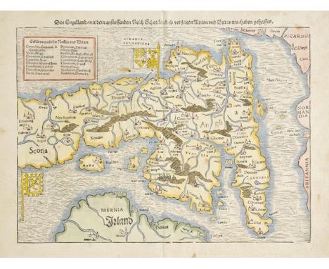
Lot 198
England & Wales. Munster (Sebastian), Das Engelland mit dem anstossenden Reich Schottland so vor zeiten Albion und Britannia haben geheissen, published Basel [1578], hand coloured woodcut map orientated to the east, 250 x 340 mm, German text on verso displayed in an embellished arch which shows contemporarily dressed figures dining on human remains R. W. Shirley. Early Printed Maps of the British Isles 1477 - 1650, no. 120. (1)
Lot 36
Gerning (Johann Isaac von). A Picturesque Tour Along the Rhine, from Mentz to Cologne: With Illustrations of the Scenes of Remarkable Events and of Popular Traditions, Ackermann, 1820, slight staining to title page, dedication and list of subscribers, 24 aquatint plates with contemporary hand colouring (complete as list) folding engraved map with contemporary outline colouring bound at rear, slight staining to gutter, occasional light offsetting, early 20th century half sheep, scuffed and bumped at extremities, folio Abbey Travel 217. (1)

Lot 23
De Vaugondy (Robert). Nouvel Atlas Portatif destine principalement pour L'instruction de la Jeunesse d'apres la Geographie Modern de seu L'Abbe Delacroix, published S. Delamarche, Paris, 1784, decorative engaved title, introduction and contents list, fifty-three double page engraved maps, all with contemporary outline colouring, (fifty-two called for in the index), duplicate of 'Carte des premiers ages du monde', one map detached, contemporary quarter calf, worn and frayed with spine partially lacking, 4to (1)

Lot 188
British Isles. Hondius (Henricus), Magnae Britanniae et Hiberniae tabula, circa 1640, engraved map with contemporary outline colouring, inset map of the Orkney islands, central fold partially split and repaired on verso, one repaired closed tear, toned overall, slight text showthrough, 380 x 510 mm, German text on verso, together with Ogilby (John), A New Map of the Kingdom of England & Dominion of Wales whereon are projected all ye principal roads..., [1675 or later], hand coloured engraved map, trimmed to neatline on right hand vertical border, margin replaced, 380 x 500 mm, with Speed (John), The Kingdome of England, 1st edition, published John Sudbury & George Humble, [1611], hand coloured engraved carte-a-figures map, toned overall, central fold strengthened on verso, margins a little frayed and chipped, strengthened with tape on verso, 385 x 520 mm, English text on verso (3)

Lot 130
Kennedy (William). A Short Narrative of the Second Voyage of the Prince Albert in Search of Sir John Franklin, 1st edition, 1853, lithographed frontispiece, three lithographed plates, folding map by Arrowsmith, subscribers list at end, front endpaper and frontispiece detached, a little minor spotting and soiling, original blindstamped cloth, spine faded with small splits to ends and lower joint, 8vo Sabin 37443. Presentation copy, inscribed to front endpaper: "A.J. Wylie, with Lady Franklin's kind regards, July 1853". A.J. Wylie was a solicitor and Town Clerk of Stromness in the Orkney Islands, and agent there to this expedition. He is mentioned on page 40: "Two bottles, containing papers addressed to Mr. Wylie, our agent at Stromness, giving notice of its recovery were immediately thrown overboard. One of them, we have since learned, was picked up four days after at Rapness, Westray, one of the northernmost of the Orkney Islands." VERY RARE. Only one copy recorded at auction in the last 30 years at Sotheby's in 1985 and the same copy again in 2015. The book's dedicatee, Lady Franklin sponsored seven expeditions in search of her husband, this being the second under William Kennedy, which although found no trace of Sir John did discover the Bellot Strait, after Kennedy and Joseph Bellot undertook a dog sledging journey from Batty Bay. (1)
![*North Africa. Ortelius (Abraham), Barbariae et Biledulgerid nova descripito, [1606], engraved map with contemporary hand col](https://cdn.globalauctionplatform.com/dacdcb76-b286-4880-b37f-a7f20103e9c5/e691efe3-6c6e-4a99-9f56-2a1de5a82a9a/468x382.jpg)
Lot 27
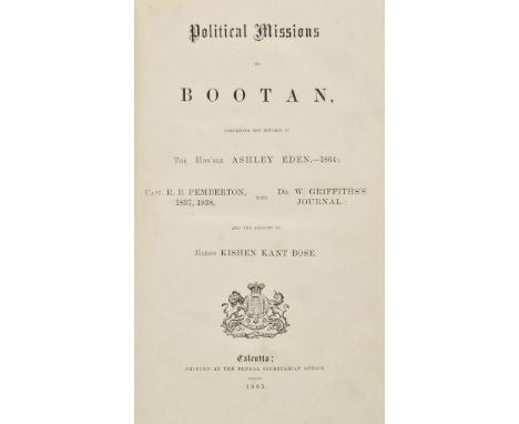
Eden (Hon. Ashley and others). Political Missions to Bootan, comprising the Reports of The Hon'ble Ashley Eden, 1864, Capt. R.B. Pemberton 1837, 1838 with Dr. W. Griffiths's Journal and the Account by Baboo Kishen Kant Bose, 1st edition, Calcutta, 1865, folding cross-section, folding map contained in rear pocket, a little light spotting and marginal toning, modern half mottled calf gilt, 8vo Yakushi E15. Account of various missions to remote Bhutan, including Eden's mission to obtain a treaty which failed, and resulted in a punitive war with Britain in 1864-1865 and the resultant ceding of territories. (1)

Lot 550
Ludlow (W.R.). Zululand and Cetewayo..., 2nd edition, 1882, 30 black and white illustrations, including frontispiece and map, later inscription to half title, some minor marks, original gilt decorated brown cloth, spine lightly rubbed to head and foot, 8vo, together with van Frish (Karl), The Dance Language & Orientation of Bees, 1st edition, Harvard University Press, 1967, numerous black and white illustrations, original cloth in dust jackets, covers rubbed with minor tears, 8vo, and Huxley (Anthony, et al, editors), The New Royal Horticultural Society Dictionary of Gardening, volumes 1-4, 1999, numerous colour and black and white illustrations, uniform original green cloth in slipcase, large 4to, plus other mostly modern travel, natural history and horticultural reference, mostly original cloth, many in dust jackets, G/VG, 8vo/4to (6 shelves)
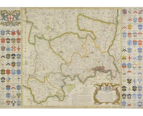
Lot 211
*Middlesex. Seale (R. W.), To the most noble Thomas Holles Pelham, Duke of Newcastle..., this map of the county of Middlesex is dedicated..., published T & J Bowles, Robt. Sayer & John Tinney, circa 1760, hand coloured engraved map, vertical borders decorated with ninety-two heraldic shields, slight creasing, 510 x 715 mm, mounted, framed and glazed Originally published in 'The Large English Atlas'. (1)
![[Mazuchelli, Mrs. Elizabeth Sarah]. The Indian Alps and How we Crossed them. Being a Narrative of Two Years' Residence in the](https://cdn.globalauctionplatform.com/dacdcb76-b286-4880-b37f-a7f20103e9c5/861c4a53-9331-48a7-aa47-ae4049773115/468x382.jpg)
Lot 54
[Mazuchelli, Mrs. Elizabeth Sarah]. The Indian Alps and How we Crossed them. Being a Narrative of Two Years' Residence in the Eastern Himalaya and Two Months' Tour into the Interior, by a Lady Pioneer, 1st edition, 1876, folding map, 10 chromolithographed plates, some light offsetting and spotting, blindstamp to title, contemporary presentation inscription at head of title, top edge gilt, original green morocco gilt in bright condition, spine ends a little rubbed, 4to (1)
Lot 117
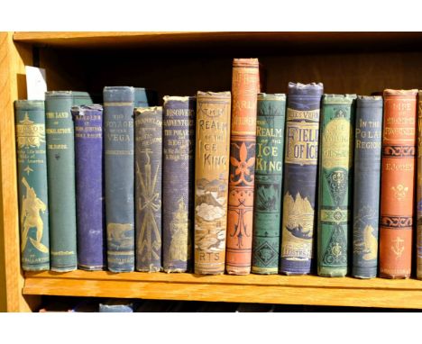
Ballantyne (Robert Michael). Hudson Bay: or, Everyday Life in the Wilds of North America, 1888, 50 black and white illustrations, period inscription to front endpaper, some minor spotting, original gilt decorated green cloth, spine lightly rubbed to head and foot, 8vo, together with Hayes (Isaac I.), The Land of Desolation: being a personal narrative of observation and adventure in Greenland, New York, 1872, 40 black and white illustrations, including frontispiece, period inscription to front endpaper, some minor toning, original gilt decorated green cloth, boards lightly marked, spine lightly rubbed to head and foot, 8vo, and Parry (Edward), Memoirs of Rear-Admiral Sir W. Edward Parry, late 1858, black and white portrait frontispiece, colour map to front, advertisements to pastedowns, original embossed blue cloth, boards and spine rubbed, front hinge split, 8vo, plus 44 further volumes of 19th century Polar and Arctic reference, all original decorative cloth, condition is generally good/very good, 8vo (47)
Lot 138
Peary (Robert E.). Northward over the "Great Ice". A Narrative of Life and Work along the Shores and upon the Interior Ice-Cap of Northern Greenland in the Years 1886 and 1891-1897, 2 volumes, 1st UK edition, 1898, folding map, half-tone illustrations, endpapers a little toned, top edge gilt, original blue cloth gilt, short tear at foot of volume II spine, a couple of small indentations, 8vo, together with The North Pole. Its Discovery in 1909 under the Auspices of the Peary Arctic Club, 1st edition, New York, 1910, colour frontispiece, folding map, illustrations, top edge gilt, original pictorial cloth gilt, spine ends a little rubbed, 8vo, plus Notes by a Naturalist on the "Challenger," being an Account of Various Observations made during the Voyage of H.M.S. "Challenger" Round the World in the Years 1872-1876... by H.N. Moseley, 1st edition, 1879, two colour lithographed plates, folding map, some light spotting, top edge gilt, original cloth, spine a little darkened and rubbed at ends, 8vo, with others related including Adolphus Greely's Report on the Proceedings of the United States Expedition to Lady Franklin Bay, Grinnell Land, 2 volumes, Washington, 1888 (with Greely's compliments slips pasted at front) and William Gilder's Ice-Pack and Tundra. An Account of the Search for the Jeannette and a Sledge Journey through Siberia, 1st UK edition, 1883 (16)
Lot 143
Simpson (Alexander). The Life and Travels of Thomas Simpson, the Arctic Discoverer, 1st edition, 1845, engraved portrait frontispiece, folding map, light toning and spotting, original broen blindstamped cloth, rebacked with original spine relaid, a little rubbed, 8vo, together with A Tarantasse Journey through Eastern Russia in the Autumn of 1856, by William Spottiswoode, 1st edition, 1857, folding map (torn without loss, a little frayed), six colour lithographed plates, scattered spotting, original green cloth, spine faded with splits, 8vo, plus Arctic Searching Expedition: A Journal of a Boat Voyage through Rupert's Land and the Arctic Sea, in search of the Discovery Ships under the Command of Sir John Franklin, by Sir John Richardson, 1st US edition, New York, 1852, wood-engraved illustrations, publisher's catalogue at end, some spotting, a couple of leaves roughly opened, previous owner signature, original cloth, 8vo, with eight others related, some defects (11)

Lot 230
Yorkshire. Speed (John), The West Ridinge of Yorkeshyre with the most famous and fayre citie Yorke described, published John Sudbury & George Humble, circa 1646, hand coloured engraved map, inset town plan of York, central fold partially strengthened on verso, 385 x 510 mm, English text on verso (1)
Lot 89
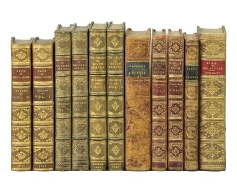
Kolben (Peter). The Present State of the Cape of Good-Hope: Or, a particular account of the several nations of the Hottentots: their religion, government, laws, customs, ceremonies and opinions; their art of war, possesions, language, genius &c. Together with a short account of the Dutch settlement at the Cape, 2 volumes, 1st English edition, 1732, engraved frontispiece to each, folding map, 28 engraved plates, some spotting and marginal water stains, contemporary calf, gilt morocco rebacks, a little rubbed, 8vo (Mendelssohn I, pp. 844-845), together with Wanderings and Adventures in the Interior of Southern Africa, by Andrew Steedman, 2 volumes, 1st edition, 1835, engraved titles, folding linen-backed map, 12 lithograph and wood-engraved plates, scattered spotting, previous owner inscription, bookplates, contemporary green half calf gilt, a little rubbed, 8vo, plus Ten Years in South Africa: Including a Particular Description of the Wild Sports of that Country, by Lieut. J.W.D. Moodie, 21st Fusiliers, 2 volumes, 1st edition, 1835, lithograph frontispieces (spotted), two engraved plates of music, light marginal toning, top edge gilt, modern green half morocco gilt, spines a little faded, 8vo, with others including John Campbell's Travels in South Africa, Undertaken at the Request of the Missionary Society, 1815, [and] Travels in South Africa, Undertaken at the Request of the London Missionary Society; Being a Narrative of a Second Journey in the Interior of that Country, 2 volumes, 1822, Mungo Park's Travels in the Interior of Africa in the Years 1795, 1796, 1797, Abridged from the Original Work, 2nd edition, corrected, 1800 and Hugh Murray's Historical Account of Discoveries and Travels in Africa, 2 volumes, 2nd edition, 1818 (20)

Lot 226
*Surrey. Bowen (Emanuel), An accurate map of the county of Surrey divided into its hundreds..., published Carington Bowles and Robert Sayer, circa 1770, engraved map with contemporary outline colouring with some later enhancement, toned overall, slight creasing, 530 x 715 mm, mounted, framed and glazed Originally published in 'The Large English Atlas'. (1)

![*Cornwall. Bickham (George), Cornwall, 1754, but Laurie & Whittle edition, [1796], hand coloured bird's eye view map, 235 x 1](https://cdn.globalauctionplatform.com/dacdcb76-b286-4880-b37f-a7f20103e9c5/bab762c4-d29a-44d6-e51f-89a7b56a3eac/468x382.jpg)
Lot 185
*Bowen (Emanuel & Owen John). A Map of Glamorganshire, [1720 or later], uncoloured engraved map, 185 x 115 mm, mounted, framed and glazed, with another framed and glazed road map by Owen & Bowen and a further nine county, regional and road maps including examples by Bowen, Senex, Cary and Basire, various sizes and condition (11)

Lot 195
Dorset. Speed (John), Dorsetshyre with the Shyre-towne Dorchester described as also the armes of such noble families as have bene honored with the titles thereof since the Normans conquest to this present [1614], hand coloured engraved map, inset town plan of Dorchester, slight toning, 385 x 510 mm, English text on verso (1)
Lot 438
Athanasius (Saint). Opera Omnia quae extant [Greek and Latin text], 3 volumes bound in 4, Passau, 1777, titles with engraved vignettes, 1 map and 5 engraved plates including frontispiece to volume 1, some spotting, a few leaves browned or marked, accession labels from Rev. Franke Parker to Bishoprick of Cornwall dated 1883, later quarter calf gilt over marbled boards with leather corner tips, red and green spine labels, minor adhesion marks and paper library labels at foot of spines, folio (4)
Lot 229
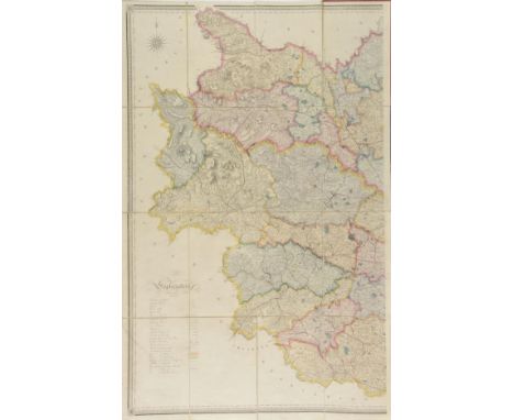
Yorkshire. Hobson (William Colling), This Map of Yorkshire is most respectfully dedicated to the nobility, clergy, gentry, landowners and manufacturers of the county, 1848, large scale engraved map by J. & C. Walker, contemporary outline colouring, sectionalised and laid on linen on two sheets, calligraphic title, compass rose and table of explanation, slight offsetting, marbled endpapers, old paper library label to one endpaper, old library stamps to verso of map, each sheet approximately 1250 x 800 mm, contemporary red cloth gilt with metal clasp, stained and worn, rebacked in red cloth with old manuscript library number to base of spine (1)
Lot 28
Everest (Robert). A Journey through Norway, Lapland, and Part of Sweden; with some remarks on the Geology of the Country; its Climate and Scenery; the ascent of some of its principal mountains - the present political relations of the two countries - statistical tables, meteorological observations &c., 1st edition, 1829, engraved frontispiece, folding maps and geological sections with hand-colouring, light offsetting to title, a few spots, contemporary polished calf, rebacked, a little rubbed, 8vo, together with Modern Egypt, by the Earl of Cromer, 2 volumes, 1st edition, 1908, portrait frontispiece and folding map to volume I, partly unopened, light toning to endpapers, oraiginal cloth, small tears at volume I head of spine, 8vo, plus Palestine, by Major C.R. Conder, Worlds Great Explorers and Explorations series, 1889, eight colour maps (one folding), illustrations, prize label, contemporary calf gilt, a little rubbed, 8vo, with other travel etc, including Letters from Snowdon: Descriptive of a Tour through the Northern Counties of Wales, 2nd edition, 1777 (16)

Lot 575
Dyer (G.). History of the University and Colleges of Cambridge; including Notices relating to the Founders and Eminent Men, volumes 1 & 2, 1814, numerous black and white engravings, period inscriptions to front endpapers, some minor spotting, uniform contemporary gilt decorated full calf, spines rubbed and partially split, 8vo, together with Tulley (Richard), Letters Written During A Ten Year's Residence at the Court of Tripoli..., volume 1 (of 2), 3rd edition, 1819, 7 hand coloured plates plus black and white folding map, some minor spotting and offsetting, split front gutter, contemporary gilt decorated 2/3 calf bound by Root & Co., spine toned and rubbed to head and foot, 8vo, and Marier (Jacques), Voyage En Perse, En Arm‚nie, En Asie-Mineure, Et A Constantinople, fait dans les ann‚es 1808 et 1809, Atlas volume only, 1813, 25 black and white plates, lacks map, some minor marks, lacks front board, contemporary full calf, oblong 4to, plus other 18th and 19th UK topography and world travel reference and related, including many illustrations, plates and maps, mostly leather bindings, condition is fair/good, some volumes partially excised, 8vo/folio Sold as seen, not subject to return. (3 shleves)

Lot 201
Folding maps. Dyonnet (Charles), Plan de Paris et ses Fortifications, published Paris, 1844, engraved folding maps, sectionalised and laid on linen, sparse outline colouring, 700 x 1000 mm, printed label to endpaper, marbled card chemise, marbled card slipcase, split along spine, a little worn, together with Lapie (Pierre), Carte historique, physique & politique de l'Egypte..., published Paris, 1828, uncoloured engraved map, sectionalised and laid on linen, inset plans of Cairo and Alexandria, 995 x 765 mm, printed label to endpaper, marbled card chemise, marbled card slipcase, with Dressler (T.), Situations plan der K. Stadt Carlsbad und deren Umgebung, circa 1870, lithographic map with contemporary hand colouring, sectionalised and laid on linen, 500 x 700 mm, marbled card slipcase with publisher's printed label to upper siding, plus Denecourt (C. F.), Carte topographique de la Forˆt & des environs de Fontaineblaeu..., circa 1860, uncoloured lithographic map, sectionalised and laid on linen, 465 x 625 mm, marbled card slipcase with publisher's printed label to upper siding, split along spine, with four others similar, various sizes and condition (8)
Lot 104
Stanley (Henry M.). The Autobiography of Sir Henry Morton Stanley, G.C.B., edited by Dorothy Stanley, 1909, photogravure portrait frontispiece, photogravure plates and portraits, folding map, folding facsimile letter, a few light spots, top edge gilt, original blue cloth gilt, dust jacket, small tear and loss to rear panel, a few stains, thick 8vo, together with a 1st US edition of the same work, Boston, 1909 and Jakob Wassermann's H.M. Stanley-Explorer, 1932 (3)
Lot 55
Moll (Herman). Atlas Geographus: or a compleat System of Geography, Ancient and Modern..., 5 volumes, 1711 - 1717, printed title to each volume, lacking all maps, book plate of the Earl of Guildford, hinges and joints weak, contemporary blind panelled speckled calf, hinges and joints weak, contrasting morocco labels to spines worn and rubbed at extremities, upper board on volume 5 near detached, 4to, together with D'Urville (Dumont), Voyage pittoresque autour du monde, volume 2 (only), published Paris, 1835, additional half title, two folding maps (Tonga and Australasia) but lacks the map of New Zealand, numerous uncoloured enrgaved plates, contemporary cloth, worn and frayed, 4to (6)
Lot 6
Barrow (John). An Account of Travels into the Interior of Southern Africa, in the Years 1797 and 1798, 1st edition, 1801, large folding engraved map with outline colour (loss and repair to upper right blank portion, reinforcements to verso), previous owner inscription to title, some light spotting and toning, contemporary half calf, modern reback, a little rubbed, 4to (volume II was published in 1804), together with Agate (W.), Diary of a Tour in South Africa, 1st edition, Paisley, 1912, numerous half-tone illustrations, original morocco-backed boards, small chip at head of spine, a little rubbed, small 4to (2)
Lot 111
Sparrman (Anders). A Voyage to the Cape of Good Hope, Towards the Antarctic Polar Circle, and Round the World: But Chiefly into the Country of the Hottentots and Caffres, from the Year 1772 to 1776... translated from the Swedish original, 2 volumes, printed for R. Marchbank, Dublin, 1786, engraved frontispiece to volume I, folding map (with closed tear), nine engraved plates, including two folding (one with tear along fold), occasional light soiling, bookplates, contemporary calf, volume I lacking one label, joints cracking, some edge wear, 8vo, together with Travels in the Interior of Africa, from the Cape of Good Hope to Morocco, by Christian Frederick Damberger, faithfully translated from the German, 1801, three hand-coloured aquatint plates, folding engraved map (with tear and clear tape marks), light spotting and offsetting, hinges reinforced, bookplates, contemporary tree calf, spine labels renewed, spine rubbed and chipped, edges rubbed, 8vo, plus The Eldorado of the Ancients, by Dr. Carl Peters, 1902, portrait frontispiece, two folding maps, illustrations, some light spotting, bookplate removal residue, original cloth gilt, label removed from upper cover, spine a little wrinkled and rubbed at ends, 8vo, with other African related (approx 78)
Lot 136
Osborn (Sherard). Stray Leaves from an Arctic Journal; or Eighteen Months in the Polar Regions, in search of Sir John Franklin's Expedition, in the Years 1850-51, 1st edition, 1852, folding map, four chromolithographed plates, 32 pp. publisher's catalogue at end, pp. 87-9o detached, some light offsetting and a few spots, previous owner signature and blindstamp to front endpaper, original brown blindstamped cloth, small splits to spine ends, some light fading to covers, slight lean, 8vo, together with Shillinglaw (John J.), A Narrative of Arctic Discovery, from the earliest period to the present time. With the details of the measures adopted by Her Majesty's Government for the relief of the Expedition under Sir John Franklin, 1st edition, 1850, engraved portrait frontispiece, two folding maps contained in front pocket, original blue cloth gilt, tear at head of spine, small nick at foot, 8vo (2)
Lot 200
Folding maps. Smith (Charles), A New Map of the County of Berks divided into Hundreds, 1801, A New Map of the County of Cambridge divided into Hundreds, 1801 [and] A New Map of the County of Buckingham divided into Hundreds, 1804, together three county maps with contemporary hand colouring, each sectionalised and laid on linen and edged with blue silk, each approximately 515 x 455 mm, together with Cary (John), A New Map of Dorsetshire divided into its hundreds and liberties exhibiting its roads, rivers, parks &c., 1818, engraved map with contemporary hand colouring, sectionalised and laid on linen, slight spotting, marbled endpapers, 485 x 540 mm, with another fourteen late 19th and early 20th century folding Ordnance Survey maps of parts of London, Surrey, Sussex and South east England, various sizes and condition, plus Stanford (Edward, publisher), A New Map of Metropolitan Railways, Tramways & Miscellaneous Improvements, 1904, colour lithographic map, sectionalised and laid on linen, 680 x 1040 mm, contemporary cloth boards with publisher's printed label to upper siding, a little frayed on spine (18)
-
109182 item(s)/page