We found 109198 price guide item(s) matching your search
There are 109198 lots that match your search criteria. Subscribe now to get instant access to the full price guide service.
Click here to subscribe- List
- Grid
-
109198 item(s)/page


Lot 1020
Later 6th-7th century AD. A silver sword mount formed as a central square panel with cell above, four beast-head arms; the cell with inset garnet cloison and crimped gold foil behind; the centre hollow with slider-bar to the reverse; each arm a stylised beast-head with bilinear collar, bilinear brow-ridge and nasal, pellet eyes and nostrils with bilinear frames. See Franceschi, G., Jorn, A. & Magnus, B. Mennesker, Guder og Masker i Nordisk Jernalderkunst, vol.1, Borgen, 2005; Hammond, B. British Artefacts vol.1 - Early Anglo-Saxon, Witham, 2009; Menghin, W. Das Schwert im Frühen Mittelalter, Stuttgart, 1983; Pollington, S., Kerr, L. & Hammond, B. Wayland's Work: Anglo-Saxon Art, Myth & Material Culture from the 4th to 7th century, Ely, 2010; Mortimer, P. Woden's Warriors. Warriors and Warfare in 6th-7th Century Northern Europe, Ely, 2011. Supplied with a positive X-Ray Fluorescence analysis certificate. Sword pyramids were once a very rare class of find, discovered only in very high-status burials such as Niederstotzingen (Germany), Sutton Hoo Mound 1 (Suffolk, England) and the Broomfield barrow (Essex, England). Since the 1980s, a quantity of such finds have come to light and the object-class is now better understood. They are found predominantly in England, the Rhineland, central Europe and southern Scandinavia, and were a short-lived display item. The classic form is a truncated hollow gold (or silver, or bronze) pyramid with a bar to the reverse, inset garnet and glass plaques to the four faces and top (Pollington et al., fig.8.52 and plates 19, 54, 55; Hammond, p.73-4; Menghin, map 22). Several variant forms do exist, such as the octagonal-base and the conical types (Hammond, 2009, item 1.4.2.2-f; Mortimer, 2011, p.117). Another common Continental variant includes a flat-section rectangular plaque, as well as a form with curved edges to the plaque (Menghin, map 23). The present example with four beast-heads is apparently unique, although it has parallels in later harness and other mounts. The beast-heads have close parallels on the headplate of a 6th c. silver bow-brooch from Stora Gairvide, Gotland (Franceschi et all, item 75) and on the footplate of another from a burial mound at Sandal, Norway (Franceschi et al., item 66). The exact purpose of the pyramids is not known, but when they occur in graves they are usually placed in pairs high on the sword's scabbard (Menghin, p.150 and fig.90) which suggests that they were used in the suspension of the scabbard from its belt, or more evocatively in the fastening of textile 'peace-bands' which secured the sword in its scabbard and provided a very visible demonstration that the owner did not intend to draw it in haste (Mortimer, p.116). 18 grams, 39mm (1 1/2"). Property of a Scottish gentleman; acquired from continental Europe in the early 1960s; gifted to his daughter in the early 1980s; thence by descent 2004. "Fine condition, usage wear to upper face."

Lot 1780
19th century AD. A map of the Temple Mount in Jerusalem with German-language legend, titled Grvndriss des Tempels zv Jervsalem, durch den König Saloman erbaut nach Anzeige der Bücher derer Könige und der Chroniken; mounted in a glazed frame. 1.2 kg, 46cm (18"). Property of a Norfolk, UK, collector; part of a family collection by descent. [No Reserve] Fine condition.

Lot 1781
Published 1732 AD. Framed map of Arabia by Christophe Cellarius, author of Geographia Antiqua, first published 1686; this edition published Leipzig by Gledisch, 1732; depicting the region of Arabia to Babylonia and including the Holy Land area from the Mediterranean Sea in the east to Chaldea in the west, with vignette of two camels in top corner. 1.1 kg, 44 x 34cm including frame (17 1/4 x 13 1/2"). Property of a Norfolk, UK, collector; part of a family collection by descent. [No Reserve] Fine condition. Scarce.

Lot 1838
Published 1777 AD. First edition, by John Gibson (Merchant in Glasgow), published 'for the author' [title; preface, vii pp.; text, 391 pp.], original full calf boards, later spine reinforcement, text block solid. Walter Steinberg has been a well-known figure at fairs, sales and events for many years. Born in 1922 in Philadelphia, Walter has had a life-long passion for collecting. A long-time resident in London, he has now retired to New York and decided that the time has come to pass on the antiquities and coins he has collected over his lifetime. Walter acquired coins and artefacts that interested him, so his collection, although containing many lovely examples, also contains many affordable specimens. Much of the material has been unavailable to the market for 30 to 50 years. Walter hopes that the items he collected will now find new homes with the next generation of collectors. 550 grams, 21.5 x 14cm (8 1/2 x 5 1/2"). Ex Walter Steinberg collection. [No Reserve] "Good condition; some browning, boards rubbed and corners bumped; no map."
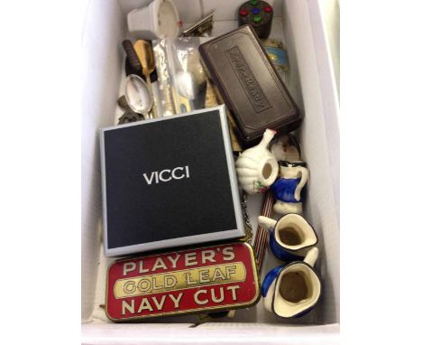
Lot 227
A box of vintage miscellaneous items to include: Brown bakelite Ever Ready razor, Rolls razor blades, miniature spirit level, tin whistle, propelling pencil, Coronation 1937 calendar, nail polish papers, map measuring gauge, mini iron, pill box, Players tobacco tin, EPNS salt spoon, Vicci powder compact, Ronson lighter, miniature ceramics & collectors spoons


Lot 609
Mainly Military: British Battles on Land and Sea by James Grant. Pub: London Cassell Petter & Galpin. Vol 2. Note page 302 - Bravery of the Irish. Three quarter maroon leather with coth boards. Contains many illustrations and maps of battles; Sir Douglas Haig's Despatches ed. by J H Boraston. Pub: London Dent. N.d. but c. 1919. 1st. ed. Does not include the map volume. Red cloth binding with gilt lettering and decorative stamping on spine and front; Professional Papers of the Corps of Royal Engineers. Pub: Chatham 1878-1887. 7 Vols. Broken run of 7 volumes. Green cloth with gilt lettering to front board and spine. Spines faded, and some staining to most covers. However, each of these volumes is replete with detailed plates. Absolutely fascinating books for anyone interested in history and military matters and those who appreciate excellent prints and maps; Story of the Rear Column of the Emin Pasha Relief Expedition by James S. Jameson. London: Porter 1890. 1st Ed. Original publishers olive green cloth with gilt lettering and decorative stamping to the front board. 96 illustrations, folding coloured map of 'River Congo from Stanley Falls to Kassongo to illustrate the journey of James S. Jameson'. Very scarce with maps and fontis of Jameson tissue guard intact. Many full page illustrations throughout the text, by C. Whymper from the author's original sketches. Thick 8vo; The Franks from their First Appearance in History to the Death of King Pepin by Walter C Perry. Longmans...1857. 1st Ed.,Full brown leather, with gilt tooling. Eton College pres. copy. Austria. Vienna Prague Hungary Bohemia and the Danube by JG Kohl. Chapman 1844; also Topographical Issues of: Picturesque Excursions in Devonshire and Cornwall by T. H. Williams. London Murray 1804. 1st Ed. Scarce and Collectible. Recently rebound in three quarter red leather and marbled boards. Gilt tooling to spine and maroon Morocco label & Devonshire Illustrated in a Series of Views by J.Britton & E W Brayley. London: Fisher 1832, etc. (14).


Lot 314
Potoki, Sport in Somaliland, Rowland Ward, London 1900, Limited Edition numbered 43 of 200, signed by Rowland Ward, cloth CONDITION REPORT: Front cover slightly dirty, slightly marked, corners bumped 18 photogravure plates Spine rough at bottom at top rubbed Some spotting to the pages particularly the protective plate sheets, some slight transference to plates particularly 'A Brace of Lions' opp p55 See images Pages generally clean and bright Book plate oninside cover left Pg32 annotated note by Henry Courtenay Morland with individual text (in ink) Plate 'Stalking Beisa' foxing lower left of margin and slight to other areas of margins Map present at back

Lot 316
Group of early 20th century books on Somaliland language including a Hand Book of Somaliland by Adam 1900 for HM Stationery Office, Official History of Operations in Somaliland 1907, Colonial Office List Map Supplement 1948, Drake Brockman, Mammals of Somaliland 1910 and Herbert, two Dianas in Somaliland

Lot 321
Mainwaring, A Soldier's Shikar trips, Grant Richards, London 1920, Frances, Three Months Leave in Somaliland, London 1895, and Gleichen, Mission to Menelik, London 1898 (3) CONDITION REPORT: One double map present and two images Frontis illustration One further illustration Two page map 'Country Round Route'

Lot 322
Pearce, Rambles in Lion Land, London 1898, Mellis Lion Hunting in Somaliland, London 1895, Wolverton, Lord, Sport in Somaliland, Chapman and Hall, London 1894 and Stockley, Big Games Shooting, London 1913 (4) CONDITION REPORT: Sport in Somaliland:- One large fold out map '5 months' sport in Somaliland 23 plates present Lion hunting in Somaliland - all plates present Rambles - map missing, plates all present Big game shooting:- Yak plate pg 220 missing, rest of plates present


Lot 792
A late 1920s/early 1930s children's map of London (for Great Ormond Street Hospital) a book of 'scraps' and drawing book of Winnie Owen aged about 7/10 years - 1914-1918, a photograph album with London scenes post war 1960s and motor bike scenes, etc and a pack of snap shots - Torquay, also four Pewter tankards, last half of the 20th Century (8)


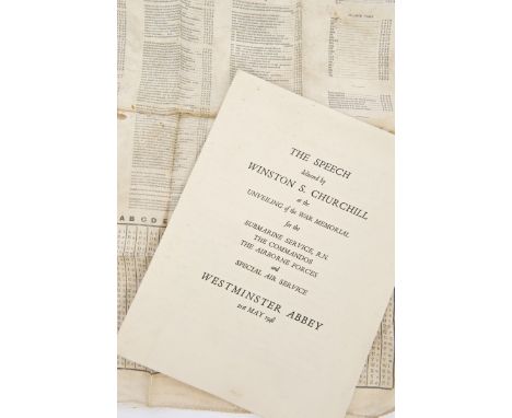
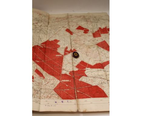
Lot 604
Unusual Second World War S.O.E. / Special Air Service type silk Coding Map, detailing various messages and their relevant codes alongside a coding table, together with a copy of the Speech Delivered by Churchill, at the Unveiling of the War Memorial for the Submarine Service, R.N., The Commandos, The Airborne Forces and Special Air Service, Westminster Abbey 21st May 1948 CONDITION REPORT Copy of speech has some light foxing and creases from being folded. Silk map complete and untorn. Edges are fraying. Some visible staining, blotches. Overall condition good, commensurate with age
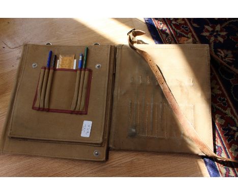
Lot 618
First World War canvas trench map, dated 1918, together with a 1914 On War Service badge CONDITION REPORT Some splits along creases. Handwritten ink pen notes along bottom border. Creases on corners. Some patches of discolouration and small tear along top. Overall good condition commensurate with age


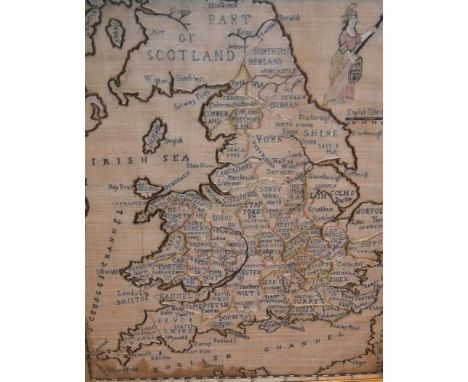
Lot 522
George III map sampler, English, late 18th/early 19th century, 22in. x 17in. 56cm. x 43cm. Fine open weave linen ground embroidered in coloured silks depicting the counties of England and Wales, outline of Part of Scotland and the coast of Ireland; part of the French coast and the Channel Islands. Embroidered by Elizabeth Swayne. Hole to lower left corner; time stains in places. The combined practice of teaching needlework and geography was particularly popular in schools at the end of the 18th century and beginning of the 19th century.


Lot 442
Romeyn de Hooghe (1645-1708) Dutch. A large hand coloured map of the South Coast of England, 'Carte Nouvelle des Costes D'Angleterre depuis la Riviere de la Tamise jusques a Portland & des Isles Voisines ou lon voit, tout les Ports de Mer Bancs de Sable & Rochers a Lusage des Armees de sa Majeste Britannique, Parle Sr.Romain de Hooge'. Dated 1693. Framed. 58.5 x 94 cm


-
109198 item(s)/page