We found 109182 price guide item(s) matching your search
There are 109182 lots that match your search criteria. Subscribe now to get instant access to the full price guide service.
Click here to subscribe- List
- Grid
-
109182 item(s)/page


Lot 502
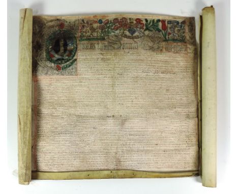
ORIGINAL ILLUMINATED CHARTER OF CHARLES II WITH DETAILS OF PROPERTY GRANTS IN CORK CITY Co. Cork: A magnificent original charter of Charles II dated 19 August in the 19th year of his reign (1667), listing many properties in the city of Cork with the names of forfeiting proprietors and new tenants. The purpose of the charter was to satisfy the demands for compensation of the "Forty-Nine Officers" - those officers who had served in the royalist army during the wars in Ireland prior to 5 June 1649, remaining loyal to the King thereafter and who had not therefore been granted lands by the Cromwellian government. It lists property in Cork City which had been held by Irish Catholics in 1641 and consequently forfeited under Cromwell, and which is now granted to the officers who had petitioned. They are represented by their trustees Captain Hercules Langford and Robert Fitzgerald Esq., and there is also a separate grant of land in counties Antrim and Armagh to Captain Langford. The charter consists of three membranes of vellum, measuring respectively approx 78 x 77, 78 x 59 and 75 x 34 cm (30 ¾ x 30 ½, 30 ¾ x 23 ¼ and 29 ¾ x 13 ½ inches). It is in fine condition but lacks its seal. The text (approx 6500 words) is in English. The head of the first sheet is exuberantly illuminated, the first six words being gilded with a silver background. The initial letter "C" of Charles is contained within a separate scrollwork panel in the left hand corner and surrounds a portrait of the King. To the right are the royal arms, with the lion and unicorn supporters also shown separately, together with national emblems such as the rose, thistle and fleur-de-lis (for England, Scotland and France), and a butterfly and dragonfly. The survival of the charter is miraculous: it was discovered by chance during a waste-paper campaign in the city, and rescued. The lengthy text (misdated to 1666) was transcribed and published in 1964 in the Journal of the Cork Historical and Archaeological Society, together with a brief introduction, tabular summary, and map. This document is of major importance in tracing the development of Cork in the early modern period, especially as the Civil Survey for Cork city and county (apart from the barony of Muskerry) has not survived. It compares interestingly with a valuation of Cork City carried out in 1663-64 and published in vol. VI of the Civil Survey, edited by R.C. Simington. As a m/ss, w.a.f. *A highly important survival. (1)
Lot 503
Rolled Maps: Taylors Map of The Environs of Dublin, c. 1840; Index to the Townland Survey of the County of Meath, D. 1889, cold.; Stanford's Ireland, c. 1880; and Ordnance Survey of Ireland - Dublin & Co. & Parts of Co. Meath, c. 1870, all linen backed, & on mahogany rollers. as maps, w.a.f. (4)

Lot 511
Famous Irish Estate - Ballysaggartmore Co. Waterford interest: Incumbered Estates Court - In the Matter of the Estate of Arthur Ussher, Owner and Petitioner. Descriptive Particulars of the Settled and Unsettled Estates Situate in the Counties of Waterford, Tipperary, and Cork which will be Sold by Public Sale in Lots during the Spring and Summer of 1854 8vo D. (Hodges & Smith) 1854. Litho frontis & 2 other litho plts., lg. fold. plt. & fold. map hd. cold., 10pp orig. ptd. wrappers, stapled. V. Rare. As a pamphlet, w.a.f. (1)

Lot 518
Maps: Wallis (J.) New and Correct Map of the Post Roads of England and Wales, L. 1798. Lg. fold. linen backed map, hd. cold. in outline, approx. 23" x 19 1/2"; Cary's New Pocket Plan of London, Westminster and Southwark, with all the adjacent Buildings in St. Georges Fields etc., .. with Penny Post Receiving Houses.. Hackney Coach Fares ... etc. L. c. 1790. Fold. engd. map, linen backed & hd. cold. in outline, & in orig. marble slipcase; Simencourt - Carte Itineraire de la France, c. 1800, fold. linen backed map, in slipcase; & 4 small folding maps of English Counties, c. 1820, hd. cold. in outline. As a coll. of maps, w.a.f. A lot. (1)

Lot 58
Special Handbound Edition Limited to 25 Copies Co. Kilkenny: Carrigan (Rev. Wm.) The History and Antiquities of the Diocese of Ossory, 4to 4 vols. Kilkenny 1981 Reprint. Lg. fold. cold. map, illus. thro-out, attractive green mor. with marble sides, & matching slipcase. * Special edition signed by publishers, printers & binders.
Lot 586
Kilkenny Ordnance Survey Atlas: Ordnance Survey of Ireland - Townland Survey of the County of Kilkenny and the County of the City of Kilkenny. Large Atlas folio D. 1842. With dbl. page hand coloured Index Map, & 47 lg. dbl. page maps, hd. cold. in outline, a.e.g., later hf. mor. As an Atlas, w.a.f. * M/ss note inside front cover by Mr. D. O'Neill Flanagan, dated 1980, states his father purchased this atlas at Duke of Ormonde's Sale at Kilkenny Castle, 1935. (1)


Lot 622
African Travel: Selous (Fred. Courteney) Travel and Adventure in South East Africa, roy 8vo L. 1893. First Edn., hf. title, port. frontis, 22 full page plts. & fold. cold. map, 4pp. adverts at end, pict. cloth, gilt; & A Hunters Wanderings in Africa, L. 1911, hf. title, frontis fold. map & plts. cloth, worn. (2)


Lot 629
Young (R.M.) Historical Notices of Old Belfast and its Vicinity, 4to Belfast (Marcus Ward) 1896. First Edn., cold. frontis dbl. page map, plts. illus. etc., Orig. cloth, gilt; Stuart (J.) Historical Memoirs of the City of Armagh, 4to D. 1900. New Edn., port. frontis maps & illus. cloth. Both V. good. (2)


![Travel: Milton (Viscount) and Cheadle (W.B.) The North-West Passage by Land, L. n.d. [1865], frontis plts. & fold. map, hd. c](https://cdn.globalauctionplatform.com/dd961d01-4329-4a9a-a0bd-a55500ac460b/c307a69a-7c2a-4059-b275-dd94258eb5dc/468x382.jpg)
Lot 661
Travel: Milton (Viscount) and Cheadle (W.B.) The North-West Passage by Land, L. n.d. [1865], frontis plts. & fold. map, hd. cold. in outline in pocket at front; Chisholm (Mrs.) Stories of Arctic Adventure, L. 1874, fold. map & plts.; Knight (E.F.) The 'Falcon' on the Baltic, L. 1889, illus.; Soddard (Chas. Warren) Summer Cruising in the South Seas, L. n.d. [c. 1873]. First, plts.; & 2 other sim., all orig. pict. cloth. Good. (6)

Lot 669
Travel Le Comte (Louis) Memoirs and Observations Topographies .. Mechanical... Natural, Civil and Ecclesiastical, made in a late Journey Through the Empire of China, 8vo L. 1699. Third Edn. engd. port. frontis, fold. map, 3 engd. plts. (2 fold.) fold. table & 2 small vignette map in text, orig. panel calf. (1)

Lot 674
English Guides: Haughton (J. Brotherston) A New Historical Topographical and Parochial Guide to the Isle of Man, sm. 8vo Douglas 1842. Fold. litho frontis, fold.map, text illus., cloth backed pict. boards; A Panorama of Falmouth, 12mo Falmouth n.d. c. 1830, First Edn., litho frontis hd. cold. plt. of Flags, fold. map, wd. cut plt. & attractive engd. & other advers. at end, uncut boards; Cockran's Tourists Guide to Torquay and its Neighbourhood, 12mo Torquay n.d. c. 1850. Engd. frontis & 11 plts., cloth; A Descriptive Guide to Bournemouth... 12mo Bournemouth n.d. Orig. photo frontis & fold. map; also Three Weeks in Wet Sheets, .. Diary and Doings of a Moist Visitor to Malvern. 12mo L. 1851. First, text illus., boards. Scarce. (5)
![London Maps & Guides: The New Complete Guide,... [to] The City of London and Parts Adjacent. sm. 8vo L. n.d. [c. 1765]. Engd.](https://cdn.globalauctionplatform.com/dd961d01-4329-4a9a-a0bd-a55500ac460b/0ed2466b-22c2-4af7-df76-71bccec263a9/468x382.jpg)
Lot 675
London Maps & Guides: The New Complete Guide,... [to] The City of London and Parts Adjacent. sm. 8vo L. n.d. [c. 1765]. Engd. frontis & fold. map, cont. calf; Wyld's New Plan of London, lg. fold. linen backed map, hd. cold. with engraved inset vignette of buildings etc., c. 1851; Wyld's New Map of London 1879, hd. cold. fold. linen backed map; Reynolds - The Oarsman's and Angler's Map of the River Thames, lg. fold. hd. cold.map, L. 197; also Bacon's & Smith's Maps of London, together 6 items. Good As maps, w.a.f. (6)
![Atlas: Hill (P.) & Co., publ. Travelling Map of Scotland, 12mo Edin. n.d. [c. 1820] engd. title, engd. contents, 64pp. includ](https://cdn.globalauctionplatform.com/dd961d01-4329-4a9a-a0bd-a55500ac460b/132f9998-69f2-4daa-97f0-3899338de458/468x382.jpg)

Lot 685
English Guides etc: Phippen (James) Colbran's New Guide for Tunbridge Wells, 1844. Second, frontis fold. map & plts.; Richardson (H.S.) Greenwich: its History, Antiquities, Improvements and Public Buildings, Greenwich 1834, frontis & plts., cloth; Jesse (Ed.) A Summer's Day at Windsor, and A Visit to Eton, L. 1841, plts. & illus., cloth; Tugwell (Rev. Geo.) A Guide to the North of Devon, Ilfracombe n.d., engd. frontis & fold. map; White (J.T.) The History of Torquay, Torquay 1878. First Edn., frontis, fold. map & plt. orig. cloth, gilt; & 1 other. A lot, w.a.f. (6)
Lot 686
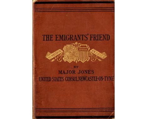
Signed Presentation Copy U.S.A.: Jones (Major E.R.) The Emigrants' Friend: Containing Information and Advice for Persons intending to Emigrate to the United States. Sm. 8vo L. 1880. First Edn., lg. fold. map frontis (with straight tear) a lg. fold. table, adverts at end, orig. soft cloth, gilt decoration. * Signed Presentation copy from author to his friend Mr. George Rutland, dated 9th Dec. 1880. Scarce. (1)
Lot 688
English Maps: Stanford's Railway and Road Map of England and Wales, L. 1858, hd. cold. fold. linen backed map, approx. 98cms x 84cms (38 1/2" x 33"), in orig. slipcase; Johnston (K.) Scotland, Edin & L.c. 1860, approx. 90cms x 62cms (35 1/2" x 24 1/2"); Collins (A.G.) Norfolk, & Cambridgeshire, 2 hd. cold. fold. maps, L. c. 1840, each approx. 38cms x 49cms (15" x 19 1/4"); also maps of Warwickshire, Yorkshire, & Exeter, together 7 items, as maps, w.a.f. (7)

Lot 692
European Maps: Cary (J.) A New Map of the United Netherlands, L. 1816, v. large hd. cold. fold. map, approx. 109cms x 113cms (43" x 44 1/2") orig. slip case; Goujon (A.) Carte Physique & Politique de l'Europe et du Bassin de la Mediterranee, Paris 1878, fold. linen backed hd. cold. map, in slipcase; Nichols (R.C.) The Alpine Club Map of Switzerland with Parts of the Neighbouring Countries, In 4 parts, published by Stanford, London 1876, lg. hd. cold. fold. maps, in mor. slipcase; Wyld (J.) Map of the Republic of Switzerland describing its Twenty-Two Cantons, L.c. 1860, hd. cold. fold. map,in slipcase; Smulders (J.) Het Koningrijk der Newerlandsen, Gravenhagec 1870?, hd. cold. fold. map. As a lot, good., w.a.f. (5)

Lot 693
Continental Maps: Ziegler (J.M.) Dritte Karte der Schweiz 1830, approx. 73cms x 101cms (22" x 40"); Mayr's (G.) Karte Von Tyrol, c. 1880; Pinsard (C.) Carte die chemin de Fer D'Amiens a Boulogne, fold. linen backed map, engraved views & hd. cold. in outline, c. 1850; Mullhaupt (F.) Carte Relief de la Suisse Occidentale, c. 1840, hd. cold. fold. map; & 8 others, guide etc., as a lot, w.a.f. (12)

Lot 696
Maps: Wyld (James) To the Secretary for the Colonies .. This Chart of New Zealand, lg. fold. hd. cold. linen backed map, c. 1850, approx. 86cms x 60cms (34" x 23 1/2"), in cloth slipcase; Johnston (Keith) Dominion of Canada, Western & Eastern Sheets, 2 lg. fold. linen backed maps, c. 1870; Wyld (James) Map of the British Possessions on the Gold Coast and the Territories of Ashanti and Fante, L. 1873, fold. linen backed hand cold map; Picquet (Chas.) Carte du Theatre de la Guerre en Turquie, Paris 1828, hd. cold. folding linen backed map, slip case & 1 other, 5 items. As maps, w.a.f. (5)

Lot 697
Maps of France: Andriveau (J.) Carte Generale des Routes de France, Paris 1840, New Edn., hd. cold. fold. linen backed map, approx. 64cms x 80cms (25" x 31 1/2") in slip case; de Simencourt - Carte Itineraire Complete de La France, Paris 1846, fold. linen backed map, hd. cold. in outline, approx. 66cms x 96cms (26" x 38"), in slip case; Dumont (A.) Carte des Travaux Publics en France, .... des Chemins de Fer et l'ensemble des Voies Navigables,... Paris (E. Andrievau - Goujon) 1868. Lg. linen backed map, hd. cold., approx. 67cms x 82cms (26 1/2" x 32 1/2"), slipcase; Coutaut (E.) Carte Routiere et Vinicole Department de la Gironde, Bordeaux 1876. lg. hd. cold. linen map, approx. 99cms x 77cms (39" x 30 1/2"), cloth., together 4 maps, as a coll., w.a.f. Good. (4)

Lot 698
Scandinavian Map: Busching (H.) & Kilinger (J.G.) Carte des Couronnes du Nord Comprenant La Suede, Le Danemarc, La Norvege La Prusse etc N Burember (J. Friedrich Frauenholz) 1789. In cont. hand colouring, linen backed, approx. 95cms x 68cms (37 1/2" x 27"), v. good condition, with fine cartouche. As a map, w.a.f. (1)
Lot 699
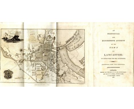
English Guides: Clark (C.)publ. An Historical and Descriptive Account of the Town of Lancaster, 8vo Lancaster 1807, hf. title. Fold. plan frontis & 2 other fold. plans, & engd. plt., cloth backed boards; Jollie & Sons - Jollies Cumberland Guide and Directory, 8vo Carlisle 1811. First Edn. uncut, boards; Rowe (Sam.) A Perambulation of the Ancient and Royal Forest of Dartmoor, and the Vanville Precincts, 8vo Plymouth 1848. Litho frontis & title vignette, fold. map & 9 litho plts. complete, list of subs, cloth. (3)
Lot 700
Engraved Maps: Controret (Kong Gen. Landrm. Karta ofver Langswagarner uti Sverige och Norrige, 1831 approx. 91cms x 63cms (36" x 25"), hd. cold. linen backed folding map; Johnston (K.) Sweden and Norway (Scandinavia) fold. linen backed cold. map, Edinburgh c. 1850; Whitelock - Le Scandinevie, Lithograph au Bureau de l'etat major de l'Armee, hd. cold. & folding linen backed, 1837, approx. 94cms x 68cms (39" x 27"), in slip case; Charot (Victor) Carte Generale d'Europe - Nouvelle Carte des Chemins de Fer de l'Europe, lg. folding linen backed map, hand coloured, Paris 1866, approx. 71cms x 98cmns (28" x 38 1/2"), cloth folder. All good. As maps, w.a.f. (4)

Lot 701
Rome: Monaldini (Ven.) Planta Della Citta di Roma con la Indiczione di tutte le Antichita e Nuevi Abbellimenti Rome 1843. Lg. engd. map / plan with 16 engd. inset views of principal buildings etc., approx. 76cms x 113cms (30" x 44 12"), in orig. slipcase; Gell's (Sir Wm.) Rome and its Environs from A Trigonometrical Survey, L. 1834, lg. fold. linen backed map, partly hd. cold., approx. 72cms x 98cms (28 1/2" x 38 1/2"), cloth; Pianta della Citta di Roma, Rome (Libreria Spithover) 1876, hd. cold. fold. linen map, in slip case; & 1 other sim. (4)

Lot 703
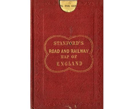
Maps: England & Wales: Faden (W.) A Map of England, Wales & Scotland, describing all the Direct and principal Cross Roads in Great Britain... L. 1801, lg. fold. linen backed map, 76cms x 62cms (30" x 24 1/2"), fully hd. cold., slip case; Stanford (Ed.) Railway Map of the British isles and Part of France, by B.R. Davies. L. c. 1880. Lg. folding map on linen, bright hand colouring, 97cms x 81cms (38" x 32") approx. in slip case; Stanford's Portable Map of England and Wales with The Railways... L. c. 1881, fold. linen backed map, fully hand cold, 83cms x 76cms (32 1/2" x 30"), fold. cloth covers. As maps, w.a.f. (3)
Lot 705
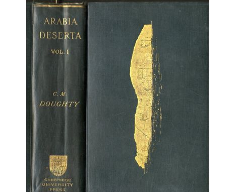
Doughty (Charles M.) Travels in Arabia Deserta, 2 vols. Cambridge 1888. First Edn., 2 hf. titles, 8 plts. some fold., lg. fold. lined backed cold. map in pocket, 32pp. Cat at end dated Dec. 1887, both front loose blanks with piece cut away, orig. Victorian green cloth, gilt decor. V. good. (2)
Lot 710
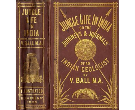
Ball (V.) Jungle Life in India; or the Journeys and Journals of an Indian Geologist, 8vo L. 1880. First, frontis & plts., errata slip, fold. map, pict. gilt cloth; de Carne (Louis) Travels in Indo-China and The Chinese Empire, 8vo L. 1872. Hf. title, fold. frontis map, hd. cold. in outline, & 6 plts. (browned), orig. decor. cloth. Both Good Copies. (2)
Lot 712
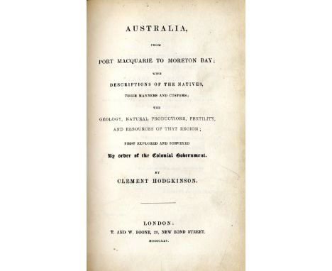
Rare Work on Australia, with Plates Hodgkinson (Clement) Australia from Port Macquarie to Moreton Bay; with descriptions of the Natives, their manners and customs; The Geology, Natural Productions, Fertility, and Resources of that Region, 8vo L. 1845. First Edn., full page map, & 7 plts. (include frontis) bound with, Roscoe (Wm.) Illustrations,.. of the Life of Lorenzo de Medici, called The Magnificent... 8vo L. 1822. Port. frontis & 3 plts. (1 dbl. page), cont. hf. calf, mor. label. Rare. (1)

Lot 717
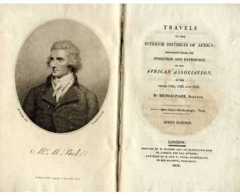
Travel: Park (Mungo) Travels in the Interior Districts of Africa, L. 1810. Sixth, port. frontis, lg. fold. map, hd. cold. in outline, 4 engd. plts. (2 lg. fold.) uncut, boards; Irving (Washington) A History of the Life and Voyages of Christopher Columbus, 4 vols. L. 1828. First, hf. titles, 2 lg. fold. maps, uncut cloth backed boards; also Tales of a Traveller, by Geoffrey Crayon. 2 vols. L. 1824. First English Edn. 2 hf. titles, uncut, orig. boards. (7)


Lot 727
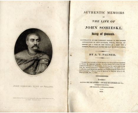
Palmer (A.T.) Authentic Memoirs of The Life of John Sobieski King of Poland, 8vo L. 1815. First Edn., port. frontis. list of subs., uncut, orig. boards; Labaume (Eugene) A Circumstantial Narrative of The Campaign in Russia, .. Trans. Ed. Boyce L. 1815. Fifth, fold. hd. cold. map frontis & 2 other fold. maps, advert. leaf at end, uncut orig. boards. (2)
Lot 738
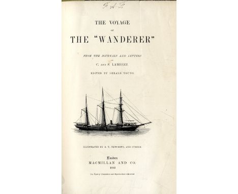
Travel: Lambert (C. & S.) The Voyage of The 'Wanderer', Ed. by Gerald Young. Sm. folio L. 1883. First Edn., hf. title, frontis, decor. title, fold. map, 24 cold. litho plts., numerous wd. engraved illus. all by R.T. Pritchett & others unopened copy, orig. blue cloth, with cold. pict. overlays front & back. Clean copy. (1)
Lot 741
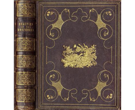
Engraved Plates: Pardoe (Julie) & Bartlett (W.H.) The Beauties of The Bosphorus, 4to L. 1838. First, port. frontis, add. engd. title, engd. map, & numerous engd. plts. a.e.g., fine full gilt decor. mor. by Bellew, Bookbinder, Dublin. A very good copy; also Beattie (Wm.) & Bartlett (W.H.) Switzerland Illustrated, 2 vols. lg. 4to L. 1836. First Edn. engd. add. titles, & plts. cont. hf. crimson mor. As a coll., w.a.f. (3)
Lot 752
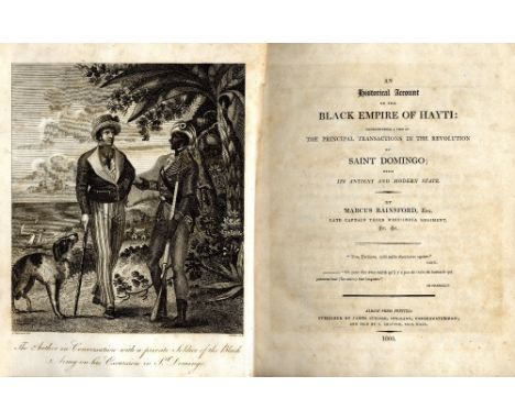
Travel: Rainsford (Marcus) An Historical Account of the Black Empire of Hayti, Comprehending a View of The Principal Transactions in the Revolutions of Saint Domingo. 4to L. 1805. First Edn., engd. frontis, fold. map, fold. plan, fac-simile letter & 8 full page plts. (1 more than called for), cont. hf. calf, spine dam. Sabin 67531. (1)
Lot 77
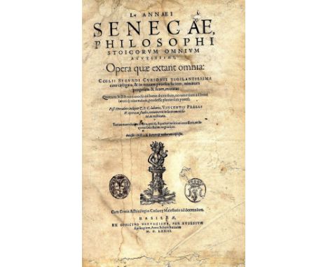
Classics: Senecta (L.A.) ... Philosophi Stoicorum Omnium Acutissimi, Opera quae extant omnia, Folio Bale 1573. Wd. cut device on title, some browning, orig. vellum; Smith (trans) Zenophon's History of the Affairs of Greece, lg. 4to L. 1770, lg. fold. map. Cont. calf, tooled gilt spine, armorial of Thomas Conolly, & B.P. of Carton Library; Beresford (James) trans. The Aeneid of Virgil, Translated into blank verse, 4to L. 1794. First, list of subs, hf. calf. (3)
Lot 96
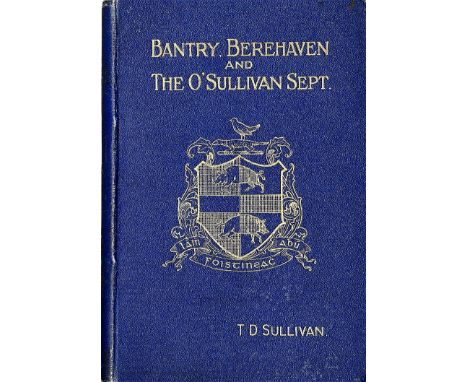
Co. Cork: Sullivan (T.D.) Bantry, Berehavan and The O'Sullivan Sept, sm. 8vo D. 1908. First, frontis port. fold. map, blue gilt cloth; Keogh (Capt. T.M.) A Short Account of the History and Antiquities of Bere Island and Berehaven, 8vo Bournemouth [1913] Sole Edn, map frontis, orig. wrappers. Rare. (2)

Lot 69
Three designer scarves,an André Claude Canova silk scarf, yellow ground with an exotic themed motif and map of northern America,84 x 87cm,a Gucci silk scarf, black ground with jewellery pattern motifs,88 x 85cm, anda Biba silk scarf, pink ground with black and grey floral pattern, 88 x 86cm (3)
Lot 648
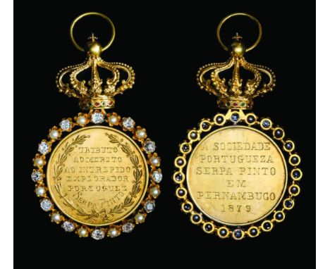
The Unique Portuguese Serpa Pinto Society of Pernambuco Gold Medal, presented to Alexandre Alberto da Rocha de Serpa Pinto, Viscount of Serpa Pinto, by King Luis, 16 June 1879 for his Expedition from the Atlantic Coast of Angola to the Indian Ocean Coast of Mozambique November 1877-March 1879, in gold, with gold wreath surround set alternately with twelve diamonds and twelve natural pearls, the whole surmounted by gold openwork Portuguese crown, with alternate red and green enamel lozenges on base, obverse engraved within wreath tributo ao merito ao intrepido explorador portuguez serpa pinto, reverse engraved a sociedade portugueza serpa pinto em pernanbuco, 69mm (including crown suspension) x 35mm, light surface marks, extremely fine. NOTE: Alexandre de Serpa Pinto was born at Poldaras Castle, Cinfaes, 10 April 1846, and in 1856 he entered the Colegio Militar. Following his graduation in 1864 he held various military commands both in Portugal and Africa, seeing combat in the lower Zambezi area and rising to the rank of Major. Following his service in Africa Serpa Pinto proposed a scientific expedition to explore Africa between the Portuguese colonies of Angola and Mozambique; his proposed expedition was to be a scientific survey, noting the geographical, astronomical details and the flora and fauna of the region. From 1876-1877 he studied the astronomy and geography of currently known Africa. On 25 May 1877 the government approved and funded an expedition to map the Congo and Zambezi which was to be led by Serpa Pinto and accompanied by the Naval Captain Capello and Lieutenant Roberto Ivens. The expedition left Bihe, Angola on 12 November 1877. Capello and Ivens remained behind in order to gather more porters and intended to join Serpa Pinto once this had been achieved; instead, however they decided they would explore North Eastern Angola thus abandoning the expedition, which Serpa Pinto discovered by letter a few days later. Undeterred by this Serpa Pinto spent the next seventeen months overcoming mutinous porters, hostile tribes, rivers in full spate, dangerous animals, venomous snakes, persistent fevers and virtual starvation. Despite these obstacles he kept daily measurements, accompanied by drawings, of geographical, geological, meteorological, astronomical, anthropological, zoological and botanical data which he carefully logged. He finally reached the coast of Mozambique on 19 March 1879 having covered 3,400 miles and was the first explorer to cross from west to east Africa. On his return he travelled extensively in Europe and Brazil presenting his finding to various geographical societies, fellow scientists and members of the public. In 1881 his book describing the journey ‘How I crossed Africa’ was published in London, it was an immediate success, and was soon republished in two popular editions. It is still considered a classic in its genre and was last republished in 2012. In 1881 he was honoured with the Founder’s Medal of the Royal Geographical Society. During his tour of Portugal King Luis presented him with this medal in the Trindate hall in Lisbon. The city of Pernambuco had been home to his family and he had spent some time there as a child, the medal was designed by the noted artist Bordalo Pinheiro and manufactured by Brazilian jewellers. From 1881 Serpa Pinto served in various parts of Africa and in 1884 he was appointed Portuguese consul to Zanzibar. Up until 1889 he continued to explore the various unknown regions to the west of Mozambique toward Lake Nyassa and the Shire Highlands. After his accession King Carlos, based on Serpa Pinto’s expeditions, laid claim to all previously unknown lands between Angola and Mozambique, this was ultimately to lead to a clash with Britain over the territories now known as Malawi and Zambia, resulting in an ignominious climb-down by the Portuguese government. He was subsequently appointed Brigadier General and A.D.C. to King Carlos in 1894 and on 24 January 1899 the king honoured Serpa Pinto with the title of Viscount. He died on 28 December 1900 laden with honours from all over the globe. He was also honoured by having various places named after him, his image has also been placed on postage stamps and banknotes. He is still remembered as a major figure in the golden age of African exploration.
Lot 891
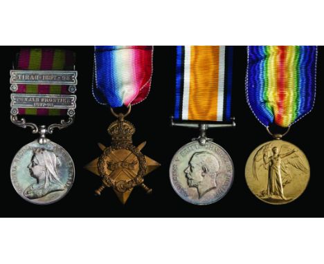
The India General Service and Great War Group of 4 awarded to Lieutenant-Colonel Charles Burrard, 9th (Service) Battalion, Royal Welsh Fusiliers, late 21st Bombay Infantry, who was Second In Command of his Battalion during the action at Pietre, part of the Battle of Loos in 1915, and later Commanding Officer upon the death of Lieutenant Colonel Madocks, comprising: India General Service, 1895-1902, 2 clasps, Punjab Frontier 1897-98, Tirah 1897-98 (Captn: C. Burrard 21st Bo: Infy), 1914-15 Star (Major C. Burrard. R. W. Fus.), British War and Victory Medals (Lt. Col. C. Burrard.), toned, good extremely fine (4) NOTE: The 9th Bn R.W.F. made a diversionary attack on German trenches during the Battle of Loos in September 1915 at Pietre. The attack did not go according to plan, as recorded in ‘Carmarthen Pals’ by Steven Johns: ‘The men were tired but in good heart when dawn broke on the 25th September. The gas when turned on did not reach the enemy trenches opposite the Battalion, but only served to put them on the alert, and brought down shelling. The short concentrated bombardment by field guns was insufficient to do real damage, and when the Battalion gallantly advanced over the perfectly open ground it was mown clown by machine gun fire before it had gone a 100 yards. In a few minutes it had lost 13 officers and 221 other ranks. Had the advance of the 5th Brigade been successful as reported, a different tale might have been told. Many a demonstration has been turned into a real attack by the fortune of war. In this case fortune did not favour the brave. The conduct of the Battalion may well be gauged by extracts from this private letter received by the C.O., Colonel C. H. Young, from one of the Battery Commanders who supported the demonstration. “May I be allowed to offer you my very real and sincere sympathy on the losses sustained by your Regiment... If ever a Regiment had won a V.C. pendant to their regimental crest, it is yours, for they knew what they were in for, and went forward without demur. The regrettable losses and behaviour of the men at all events show the nature of the Kitchener regiments, and if all are imbued with the same spirit as your command the ultimate issue of the war cannot be in doubt.” The first action of the 9th Welsh had been a tragedy, but had stamped them as fighters of no mean order.’ Sold with an original photographic portrait of the recipient, his original I.G.S.M. miniature, his own hand-drawn trench map of the Battle of Loos, and an original envelope.
Lot 929
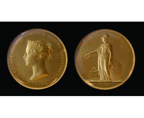
The Royal Geographical Society’s Victoria Medal awarded to Colonel Sidney Gerald Burrard, K.C.S.I., Royal Engineers, Surveyor of India, for his work on the Topography of the Himalayas (including Everest) in 1913 and who was considered ‘the eminent, member of the Community of Surveyors of the Empire’, together with his Baronet’s Badge, comprising: (i) Royal Geographical Society, Victoria Medal, in gold, by W. Wyon, young head of Queen Victoria, rev. the draped figure of Athena standing holding a wreath and map, at her feet a globe and sextant (Colonel S.G. Burrard, C.S.I., R.E., F.R.S. 1913), 55.5mm, 131g all in, glazed with gold rim, in original fitted Wyon case of issue (Eimer 1229); (ii) Baronet’s Badge, United Kingdom type, in silver-gilt and enamels (Burrard of Walhampton 3 April 1769), hallmarked London, 1935, in original Royal Mint case of issue, two tiny marks to glass near edge of the first, extremely fine (2) NOTE: C.S.I.: London Gazette, 12 December 1911: ‘Coronation Honours’; K.S.C.I.: London Gazette, 22 June 1914: ‘Royal Engineers, Surveyor-General in India’; 1913: S. G. Burrard Indian Survey - ‘For his distinguished contributions to geography and geodesy.’ Colonel Sidney Gerald Burrard (1860-1943) was born at Yarmouth on the Isle of Wight, and was the eldest son of Lieutenant Colonel Sidney Burrard of the Grenadier Guards. After being educated at Uppingham and at Wellington College he was sent to Woolwich to join the Royal Engineers. He was a talented Cadet, particularly in Mathematics, receiving his first commission in April 1879. He sailed for India in 1882, and spent two years at Roorkee at the Head Quarters of the Bengal Sappers and Miners, before joining the Survey of India in September 1884. In this role he performed important work in accurately calculating and revising longitudes in India, and establishing tidal observatories at either end of the Suez canal, but it was in his work as Superintendent of the Trigonometrical Survey in Calcutta from 1899 onwards that he performed much of his greatest work. Written in collaboration with Sir Henry Hayden, Director of the Geological Survey of India, he wrote the book ‘A Sketch of the Geography and Geology of the Himalayan Mountains and Tibet.’ This work published a mine of hitherto unknown information regarding the Himalayas, including names, heights of peaks, classification into ranges, rivers, glaciers, lakes etc. In 1911, Burrard was made Surveyor-General of India in 1911, and was made C.S.I. at the Durbar in Delhi. In 1907 he had become a Fellow of the Royal Geographical Society and in 1913 he was awarded the Victoria Medal. The President of the Society, Lord Curzon, commented at the presentation: “There is not a scientific explorer of our time who has not consulted and in some measure been guided by Colonel Burrard, and there has not been a Surveyor-General of equal scientific attainments since the days of Everest.” He was later made K.S.C.I. in 1914, and continued an extended tenure as Surveyor-General until the end of WWI, retiring in 1919.


-
109182 item(s)/page