We found 109198 price guide item(s) matching your search
There are 109198 lots that match your search criteria. Subscribe now to get instant access to the full price guide service.
Click here to subscribe- List
- Grid
-
109198 item(s)/page


Lot 88
SIR PAUL DUKES - 'THE STORY OF "ST 25" Adventure and Romance in the Secret Intelligence Service in Red Russia', published by Cassell and Company Ltd. 1938, a very rare book albeit in poor condition Condition Report:Spine cocked, faded, titles faded. Remains of a Boots sticker on front board, ex-owners name on endpaper. Map, title page and initial pages up to No. 14 partially detached, pages 15,16,17,18 completely detached but present. Photograph detached and then taped in. Various other pages detached but none are missing.
Lot 96
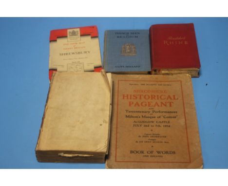
"A NEW AND UNIVERSAL GEOGRAPHICAL GRAMMAR" BY E. JONES, PUBLISHED 1772 WITH FOLDOUT MAP A/F, BAEDEKER'S RHINE 1903, AN OS MAP OF SHROPSHIRE ETC.there are no boards present. There are worm holes in the first block of pages including the frontispiece. The folded map of the world is very torn. The map of England & Wales is better but very creased in the middle with small loss to margins. Also has mostly in good order:Map of EuropeView of city of YorkMap of ScotlandMap of IrelandMap of Sweden, Denmark, Norway & FinlandMap of Russia or Moscovy in EuropeMap of Poland, Lithuania & PrussiaMap of GermanyView of the city of ViennaView of the city of BerlinMap of FranceView of the city of Paris Also has two plates in the Introduction


Lot 1173
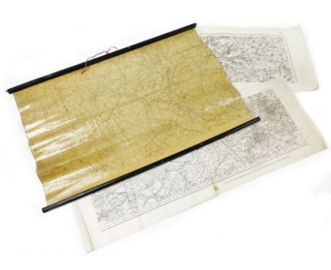
British Army WW2 Northamptonshire Regiment and Burma interest typed notes on 'Battle Experience' being the account of the advance on Budalin by Major Webb. Hand-written notes 'Battle Experiences' on Budalin, Irrawaddy Crossing etc. Comprehensive land-drawn map of Baudazin with typed notes and two maps, one being silk


Lot 267
Fuller (T), THE HISTORIE OF THE HOLY WARRE, full leather, laid paper, engraved frontispiece, fold out map (at fault), inscribed 'David Jepson' in brown ink to front flyleaf, and 'John Halson' to rear flyleaf, printed by Thomas Buck, one of the printers to the University Of Cambridge, 1639 For condition information please view this lot on our website HERE.Please note: We do not publish any condition reports on the-saleroom.com, all requested condition reports will be available to view at trevanion.com once a request has been submitted.Please only bid if you are entirely satisfied with the condition of your lot. The absence of a condition report does not guarantee that the lot is free from faults or defects.

Lot 268
DECORATIVE BINDINGS: A collection of decorative bindings, to include Bancroft (G) and Bottas (C), HISTORY OF THE UNITED STATES OF AMERICA, 2 vols, full green leather, gilt decoration to spines, marbled end papers, engraved North American map frontispiece, engraved monochrome plates throughout, A. Fullerton & Co, London, Cooper (E), PRACTICAL AND FAMILIAR SERMONS, 4 vols, 3/4 leather, marbled boards, T. Cadell And W. Davies, London 1816, Hope (A.S.R.), STORIES OF OLD RENOWN, full red leather, gilt decoration to spine, marbled end papers, engraved illustrations throughout, Blackie & Son, London 1883, Church (Rev A.J.), STORIES FROM LIVY, full red leather, gilt decoration to spine, marbled end papers, tinited engraved plates throughout, Seeley, Jackson & Halliday, London 1883, Gibbon (E), THE HISTORY OF THE DECLINE AND FALL OF THE ROMAN EMPIRE, vol 1, second edition, W. Strahan And T. Cadell, London 1776, with Churchill (W), THE SECOND WORLD WAR, Emerson (R.W), EMERSON'S ESSAYS, Lucas (E.V.), A WANDERER IN LONDON and other similar volumes (Qty) For condition information please view this lot on our website HERE.Please note: We do not publish any condition reports on the-saleroom.com, all requested condition reports will be available to view at trevanion.com once a request has been submitted.Please only bid if you are entirely satisfied with the condition of your lot. The absence of a condition report does not guarantee that the lot is free from faults or defects.

Lot 271
After Johann Gabriel Doppelmayr (1677-1750), 'Tabula Selenographica in qua Lunarium Macularum exacta Descriptio secundum Nomenclaturam . . .', a German 18th century engraved and hand tinted double-hemisphere map of the surface of the moon, created from the lunar maps of Johannes Hevelius (1611-1687) and Giovanni Riccioli (1598-1671), framed with images of cherubs with a telescope, Diana (lady of the moon) and phases of the moon, text boxes under, printed on laid paper circa 1740s, 61.5cm x 72cm mounted, unframed

Lot 275
After Johann Gabriel Doppelmayr (1677-1750), two German 18th century engraved and hand tinted celestial maps, one of the northern hemisphere sky ('Hemisphaerium Coeli Boreale'), the other of the southern hemisphere sky ('Hemisphaerium Coeli Australe'), each map illustrated with classical mythological figures and framed by cherubs carrying scientific instruments, with flanking tables of the constellations giving their magnitudes and the locations of their main stars, each published by Johann Baptist Homann (1664-1724), printed on laid paper and dated 1730, 53cm 62cm, unframed (2)


Lot 2373
POPE (A), THE WORKS OF HOMER, seven vols, speckled calf, London, Martin and Bain, 1794; MOSS (W), THE HISTORY AND ANTIQUITIES OF THE TOWN AND PORT OF HASTINGS, folding map and engraved plates, London, Kennington, 1824; WEBSTER (W), THE LIFE OF GENERAL MONK, London, Bowyer, 1723; LABORDE (M LEON), JOURNEY THROUGH ARABIA PETRAEA TO MOUNT SINAI, second edition, boards detached, London, 1838; SAINTSBURY (G), THE ADVENTURES OF GIL BLAS, three vols, ¼ leather, London, Nimmo, 1881, and four other books (as found).
Lot 2375
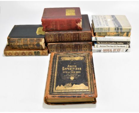
MURRAY SMITH, D; ‘Arctic Expeditions from British and Foreign Shores from the Earliest of Times to the Expedition of 1875-76’, with coloured illustrations, maps and engravings, pub. J. G . Murdock, London 1877, in pictorial gilt tooled boards, further Arctic interest including ‘The Heart of the Antarctic’ by E. H. Shackleton, Vols I & II (bindings af), ‘The Crossing of Antarctica’ by Sir V. Fuchs and Sir E. Hillary, ‘The Last Continent’ by D. Liversidge, etc, also ‘Report of the Hopwood Will Case’, pub. G. Simms, Manchester 1855, in tan calf boards with gilt tooled spine and ‘The Illustrated Family Bible’ vols I & II by J. Kitto (bindings af).Additional InformationArctic Expeditions binding quite heavily scuffed, visible foxing and yellowing, cannot guarantee all original illustrations, maps and engravings are present, there are some visible tears, folding and creasing to at least the first map in the book. Possibly similar relating to other maps and/or illustrations. Further general heavy wear to bindings, covers, dust covers, where applicable, etc. Several bindings are af, please refer to illustrations and request additional if necessary.

Lot 2383
PIGOT & CO; 'Royal National and Commercial Directory and Typography of the Counties of York, Leicester & Rutland, Lincoln, Northampton and Nottingham [...] Classified Directories of the Great Manufacturing Towns of Manchester and Salford [...]', pub. J. Pigot & Co London, August 1841, in chequered calf boards with gilt tooled spine.Additional InformationBoards with heavy general wear, further heavy wear throughout. Yellowing, foxing, tears to maps, mottling, scuffs and scrapes, etc. There is a map for Manchester and Salford present, but it has been torn, similarly for Manchester 'A New Plan of the Manufacturing District'. We are unable to confirm if all the text for all the counties is present, there do not appear to be any further missing pages, but again, we cannot guarantee the presence of absolutely every page relevant to each page in this volume, as it is such a large one.


![WITCHCRAFT BOOK,'Salem Witchcraft with An Account of Salem Village' by Charles W Upham. [2 volumes] Boston, Wiggin and Lunt 1](https://cdn.globalauctionplatform.com/3931d079-acf6-41f0-9c01-acef00cb5085/beeae467-1a3b-44a9-9fa2-acef00d53704/468x382.jpg)
Lot 38
WITCHCRAFT BOOK,'Salem Witchcraft with An Account of Salem Village' by Charles W Upham. [2 volumes] Boston, Wiggin and Lunt 1867. Size: 19 x 22cm, hardback, good condition with scuffed covers however the binding of volume 2 is slightly damaged. 469 pages [Vol. 1], 553 pages [Vol. 2]. Both volumes have a frontispiece and volume 1 has a fold-out map and index. Note: This is the First Edition and is No. 67 of a limited edition of only 100 copiesCondition report: Good condition with scuffed covers however the binding of volume 2 is slightly damaged.


Lot 121
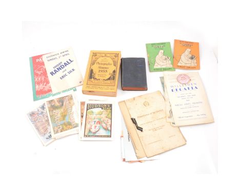
A collection of concert, theatre, sports and event tickets; various ages and types, a shoebox full including London's Festival Ballet 1957; Whitney Houston 'The Moment of Truth World Tour' Wembley Arena 14th May 1988 (pair); Dail Mail Ideal Home Exhibition Olympia 1952; (x4) Arsenal v Leicester City Arsenal Stadium Sept 25th; Ice Hockey The Empire Pool, Wembley, 1947; British Games White City Stadium, 1953; Cunard White Star Limited no.4923, 1948; The Everly Brothers, Wembley Arena, 21st Oct 1984; Neil Diamond, Earls Court, 24th June 1984; London Lawn Tennish Championships, Empire Pool, 1957; Olympic Games London 1948 programme and map; and many others.
Lot 122
Collection of ephemera, theatre programmes and sporting brochures; booklets and magazines; including 1947 London underground travel map; Dolphin Holiday Camp booklet, Brixham, Devon; Dunbille's Old Irish Whiskey certificate; Willesden Regatta, Welsh Harp Sailing, 1954, with a badge; London Palladium; Freddy Randall and Eric Silk, Chiswick Empire; and others.


Lot 2822
-- Französische Ausgabe des berühmten Himmelsatlas' Flamsteeds-- Flamsteed, John. Atlas céleste. VIII, 40 S. Mit 30 doppelblattgroßen und in der Platte nummerierten Kupfertafeln. 22 x 15 cm. Halbleder d. Z. (Kapitale mit kleinen Fehlstellen, leicht berieben und bestoßen) mit goldgeprägtem RSchild und RVergoldung. Paris, F. G. Deschamps, 1776.Warner, Sky explored, 84, 1. Shirley C. Flam 1-a Anm. Roller-G. I, 402. Nederl. Scheepvaart Mu. I, 645. Vgl. DSB V, 22f. - Erste Fortin-Ausgabe des berühmten Himmelsatlas. Das englische Original war 1729 erschienen. Die vorliegende Ausgabe wurde um zwei Karten erweitert und im Format verkleinert. "The first 26 [maps] are centered on major constellations visible from Greenwich; the 'extra' map published by Fortin depicts Corvus and the rear half of Hydra, which were omitted from Flamsteed's 'Atlas Coelestis'. For Sharp's northern and southern hemispheres Fortin substitued those of Le Monniert; and he added Lacaille's map of the southern stars and a map for the alignments of the principal northern ones" (Warner). - Stellenweise in der oberen Ecke mit kleinem gebräunten Feuchtigkeitsfleck. Die Tafel 30 im unteren Bug mit längerem Einriss. Gelegentlich mit montierten hs. Zettelchen und selten mit hs. Randanmerkungen. Minimal fleckig.


-
109198 item(s)/page