Eppli Auktionshalle
Lot 23
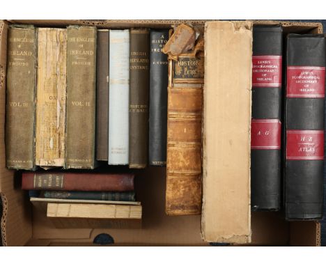
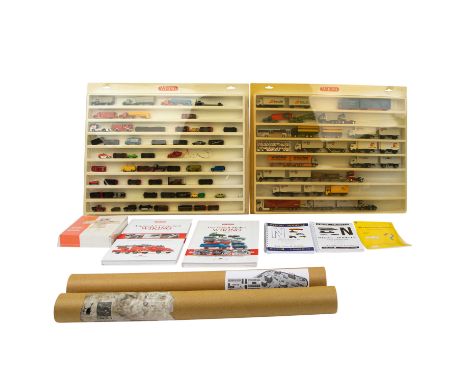
WIKING/I.M.U/HERPA Konvolut Modellfahrzeuge und Zubehör im Maßstab 1:87, bestehend aus 2 Setzkästen aus Kunststoff, B 62 x H 50 cm, GK 1/1, (Deckel vergilbt, rs. verschmutzt), bestückt mit ca. 25 LKW und ca. 50 PKW verschiedener Hersteller (überwiegend nach 1985), dazu Straßenplan I und Gebäudebogen, je in Transportrolle, L 64 cm, 1 'Straßenbausatz' sowie 2 Bücher vun Ulrich Biene: 'Der Modell-Mythos Wiking' und 'Automodell-Faszination', dazu 2 Kataloge der Spur N von 2011/12 und 2007/08 und 1 Modellauto-Farbkarte, orig.-eingeschweißt, Lagerspuren, Zustand der Fahrzeuge nur oberflächlich geprüft.| WIKING/I.M.U/HERPA convolute model vehicles and accessories in the scale 1:87, consists of 2 plastic boxes, W 62 x H 50 cm, yc. 1/1, (cover yellowed, reverse soiled), equipped with approx. 25 trucks and approx. 50 cars from various manufacturers (mostly after 1985), with map I and building arch, each in a transport roll, L 64 cm, 1 x 'road construction kit' and 2 books by Ulrich Biene: 'Der Modell-Mythos Wiking' and 'Automodell-Faszination', plus 2 N-scale catalogs from 2011/12 and 2007/08 and 1 model car color card, originally shrink-wrapped, traces of storage, condition of the vehicles only superficially checked.


![Antique map of Bark Shire by Robert Morden. [43x49cm-frame]](https://cdn.globalauctionplatform.com/bcc5307b-049a-4fb4-930f-ae2000aed038/1c5eb186-7ad9-452a-8a88-ae2000f77e58/468x382.jpg)


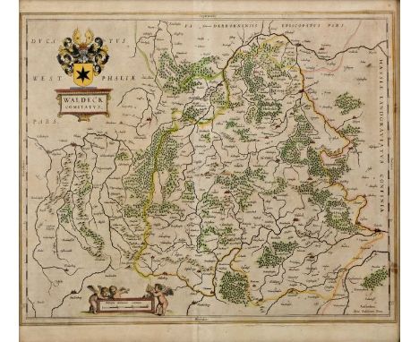


![Maps. Six engraved antique maps, 17th-19th century, including: Johannes Kip, Wiltoniae Comitatus [Wiltshire], c.1607; Petrus](https://cdn.globalauctionplatform.com/c9576737-505f-444f-bf57-ade9009d18b3/f540c271-ace0-4183-b9be-ae22011071f3/468x382.jpg)


