We found 109198 price guide item(s) matching your search
There are 109198 lots that match your search criteria. Subscribe now to get instant access to the full price guide service.
Click here to subscribe- List
- Grid
-
109198 item(s)/page


Lot 642
Abraham Ortelius (1527-1598, Brabantian) 16thC map of Iceland, 'Illustriss.AC. Potentiss. Regi Federico II Daniae, Norvegiae, Slavorum, Go Thorumqve regi, etc, prin cipi, svo clementissimo, Andreas Velleivs, describeb, et, dedicabat', Script verso Ortelius' description of Iceland which includes the legends of the creatures he depicts. Script to top left reads 'Privilegio Imp. et Belgico decenneh A.Ortel exrud 1585', 33.3 x 48.3cm
Lot 274
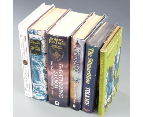
J.R.R. Tolkien The Silmarillion 1977 first edition with folding map in dust-wrapper, Robert Jordan The Gathering Storm 2009 first edition (signed), William Horwood The Wolves of Time, Gregory Maguire A Lion Among Men, Rick Riordan Percy Jackson and The Greek Gods, Champion of Charlemagne (6)
Lot 286
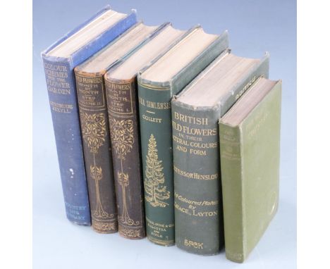
Wild Flowers Month by Month in Their Natural Haunts by Edward Step, 2 volumes 1905 fully illustrated and with mounted colour frontispieces in gilt decorated half leather, British Wild Flowers in their Natural Colour & Form by Professor Henslow with over 200 coloured illustrations 1910, Flowers of The Field by Rev. Johns 1916 illustrated, Flora Simlensis with over 200 illustrations & map 1902, Colour Schemes for the Garden 1914 and The Old Country 1917 (7)


Lot 274
ENOLA GAY: A large signed printed 18 x 14 colour chart, by Paul W. Tibbets (1915-2007, American Brigadier General, pilot of the Enola Gay), Thomas W. Ferebee (1918-2000, American Colonel, bombardier of the Enola Gay) and Theodore Van Kirk (1921-2014, American Major, navigator of the Enola Gay) individually, the chart being a facsimile copy of the Navigator's Log of the Enola Gay, displaying three sections of the log, detailing in timed intervals the mission to deliver the atomic bomb on Hiroshima, 6th August 1945, and with a short piece of text and a map explaining the mission superimposed over the log. Signed by each of the crew members in bold blue ink with their names alone to the foot, above a printed title bearing their role during the mission. With a tear to the upper right corner and left edge, not affecting the text or signatures, otherwise VG


Lot 150
Delkeskamp, J. W., Panorama des Rheins von Mainz bis Coln, monochrome map, 1825, slip case; Keller, La Suisse, hand coloured map, canvas backed; Henschel, Central Europa, hand coloured map, canvas backed; Ravenstein, Nassau & Theilen, hand coloured map, canvas backed; Perthes, Deutschland, hand coloured map, canvas backed, slip case; Keller, La Suisse, monochrome map, canvas backed. (Qty: 6)


Lot 156
Three books on the subject of cartography together with three framed antique map prints, the prints being of; 'Irelande', 'The Isles of Guernsey, Herm, Sark and Alderney' and a John Tallis and Company print of the 'Eastern Hemisphere' from an engraving by J.Rapkin, internal dimensions of the largest 35.5cm x 27cm (6)

Lot 592
ALMA AGNES EMERY (BRITISH 1931-2007) a sunset London cityscape with St Pauls Cathedral, signed and dated 1991 bottom right, oil on canvas , framed, approximate size 59cm x 75cm along with two hundred and fifty years of map-making in the County of Sussex, a folio of reproduction maps published between 1575 and 1825, approximate size 64cm x 90cm


Lot 817
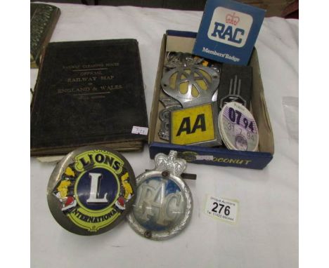
TWO BOXES OF SUNDRIES, to include a modern cast weather vane, brass candlesticks, cast iron framed map of Radnorshire and a matching car badge. A RAC badge, various cameras (Petri, Coronet, Brownie etc) two pairs of binoculars (boots Admiral) 10x50mm (cased) and Delacois, Paris 8 x 25 cased, cutlery, miniature Royal commemorative coach and horses etc


Lot 898
A George III steel engraved map 'Atlantic Islands' (Cape Verdis, Canaries, Azores and Madeira) by T Clerk for Thomson's New General Atlas 50 x 60 cm, mounted framed and glazed to/w a French map engraving of the West African Coast and Atlantic Islands, by Andre after Harrison, 36 x 24 cm, mounted framed and glazed, and an unframed map engraving of Great Britain (3)


-
109198 item(s)/page