We found 109198 price guide item(s) matching your search
There are 109198 lots that match your search criteria. Subscribe now to get instant access to the full price guide service.
Click here to subscribe- List
- Grid
-
109198 item(s)/page


Lot 562
A BOX AND LOOSE SCALES, STAMPS, EPHEMERA AND SUNDRY ITEMS, to include a set of cased electronic scientific balance scales by Baird and Tatlock Ltd of London, case height 47.5cm x width 43cm (including control dial) x depth 32cm, a Salter No 46 set of scales with weights, an envelope containing mainly Queen Elizabeth II UK commemorative stamps, with some older examples and some worldwide stamps (all used), a bound 'Geographia' map of England and Wales by Alexander Gross FRGS, with index booklet, a Round the Horne 1974 script book (spine damaged), etc (1 box + loose) (sd)


Lot 12
GWR Towns & Places the GWR Carry Goods from and to South Wales, red hardback covers with internal, fold-out colour map, an excellent example. Together with the following: Aberdovey Signal Box Train Register, fully completed, started April 9th 1965 finished 25th November 1965, ex box condition; a GWR Subject Register started 1926 and finished 1962; a GWR Register of Machinery, Swansea Division dated 1920, to be returned to G.J. Churchward Swindon and of January each year; a very substantial Book Of Rates ex Towyn Station. (5 items)

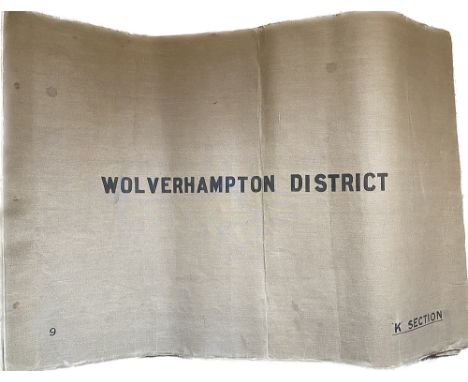
Lot 152
British Railways large canvas folder containing 10 hand coloured section plans of Wolverhampton District Stations and Signal Boxes with mileage circa 1953. Plans include Ashchurch; Worcester; Kings Norton; Stourbridge; Tyseley; Stratford-on-Avon; Leamington Spa; Kingham; Banbury and Wolverhampton plus a small index/key and an additional map of the overall district. Measures 29.5in x 20in and although there is some edge loss to the diagrams, this is a very good and most useful document.
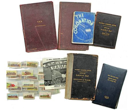
Lot 514
RCH linen Railway Map of Ireland in hard cover bearing profuse GER 1906 stampings and a similar England & Wales with similar stampings 1910 together with a hardback GER Appendix No 22 dated June 1919; hardback GER Appendices Feb 1911 and June 1912; a CAV Dual Scale Map of Greater London City & West End; LNER The Coronation; Lambert & Butler Cigarette Cards World's Locomotives; Argo Transacord EP Gresley Pacifics.


Lot 220
Miscellany comprising: An extremely early, small GWR sepia Carriage Print Cockington Forge, mounted in very thick glass, some damage but certainly a rarity; GWR Swindon Works St Johns Ambulance Accident Book about half full, early 50’s onwards; a GWR marked two headed Hammer; GWR Insulator; reproduced map of Swindon Works; GWR later, enamel cufflinks and tie-clip; reproduction Cup & Saucer; 150 year commemorative plate showing Directors of GWR; SVR Rule Book dated January 1973.


Lot 4106
George Cole and John Roper (British 1771-1810): 'Durham', engraved map with hand colour pub. 1804, 25cm x 20cm;'Map of the Black Lead Mines &c. in Cumberland', engraved map with hand colour c.1751, 19cm x 23cm; John Cary (British 1754-1835): 'Durham', 19th century engraved map with hand colour first pub. 1787, 22cm x 27cm; 'Isle of Wight', 18th century engraved map with later hand colour attributed to Owen and Bowen 25cm x 17cm (4)


Lot 4105
Jacques Nicolas Bellin (French 1703-1772): 'Carte de la Tartarie Occidentale' - Map of Western Tartary, engraved map with hand-colour pub. Abbe Prevost (1697-1763), 'Histoire Generale des Voyages', Paris c.1749, 23cm x 31cm; 'Carte Reduite Du Detroit De Magellan' - Reduced Map Of The Strait Of Magellan, engraved map with hand colour pub. 1764, 20cm x 35cm; John Rapkin (British 1813-1899): 'Islands in the Indian Ocean', steel engraved map with hand colour, with illustrations by H Winkles, pub. John Tallis (1817-1876), London 1851, 26cm x 34cm; 'Chart of the Strait of Sunda, by WM Kellar, Master of HM Ship Belliqueux, under the direction of George Byng Esq Captain in March 1811', engraved sea chart with hand colour 13cm x 21cm (4)


Lot 513
Merionethshire - Speed (John), described George Humble, circa 1627, hand coloured, engraved map, large strapwork cartouche, mileage scale and compass rose, approx. 3600mm x 500mm, mounted, framed and glazed, together with Montgomeryshire - Speed (John), described by Christopher Saxton, circa 1627, approx. 3600mm x 500mm, margins hidden behind mount (2)


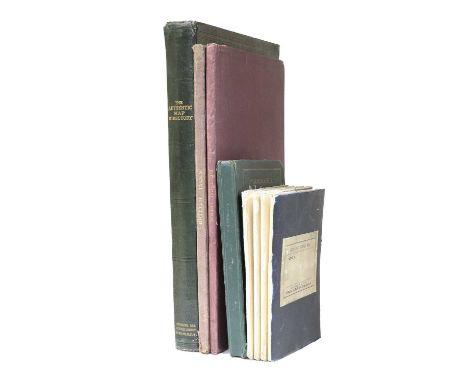
Lot 188
Ordnance SurveyCity Plan of Leeds.Linen-backed folding map, Sheet CCXVIII.2.21, 1891 first edition, surveyed 1889, 64 sections, 137.5cm x 104 cm, original cloth covers with paper label;'Geographia', Plan of Leeds. linen-backed folding colour map, no date (c1935 in pencil), 114cm x 104cm, with index (taped) in original cloth gilt covers;Bain (James), The Authentic Map Directory of South Lancashire. 'Geographia', no date, quarto atlas, 208 pages plus index, original cloth gilt;Bacon (G.W.), New Commercial & Reference Chart of the British Isles,.Folding linen-backed colour map on two sheets, each approx 62cm x 97cm, 1 inch to 15 miles, original cloth gilt covers;Richardson's New Map of the British Isles.Folding linen-backed colour map on two sheets, each approx 61cm x 94cm, repairs to rear fold intersections, original cloth gilt covers. (5)
![YorkshireSpeed (John), York Shire.Sudbury and Humble, 1610 [1611 or later], hand-coloured engraved map, 380mm x 504mm, some w](https://cdn.globalauctionplatform.com/fae0aeac-16b7-4b2f-80fe-afc000c1f7cf/290d5391-4cdb-4da1-873e-aff900a0a93b/468x382.jpg)
Lot 190
YorkshireSpeed (John), York Shire.Sudbury and Humble, 1610 [1611 or later], hand-coloured engraved map, 380mm x 504mm, some wear to lower edge, mounted, framed and glazed;[Blaeu (Joannis)], Ducatus Eboracensis Anglice York Shire.[1645 or later], hand-coloured engraved map, plate mark 396mm x 505mm, mounted, framed and glazed;[Blaeu (Joannis)], Ducatus Eboracensis, The Northriding of York Shire.[1648], hand-coloured engraved map, plate mark 387mm x 500mm, French text to rear (pages 329/330, signature 5S, framed, glazed front and rear [Whitaker p.29]. (3)
![Morden (Robert)The West Riding of YorkShire, Swale and Churchill, no date [1695 or later], hand-coloured engraved map, plate](https://cdn.globalauctionplatform.com/fae0aeac-16b7-4b2f-80fe-afc000c1f7cf/2ffb1a29-9f5e-487a-be35-aff900a0c211/468x382.jpg)
Lot 170
Morden (Robert)The West Riding of YorkShire, Swale and Churchill, no date [1695 or later], hand-coloured engraved map, plate mark 360cm x 413mm;idem, Britannia Romana, no date [1695 or later], engraved map 355mm x 425mm;idem, Britannia Saxonica, no date [1695 or later], 367mm x 296mm visible, individually mounted, framed and glazed; (3)
![Speed (John)Yorkshire, Thos. Bassett and Richard Chiswell, no date [1676], hand-coloured engraved map, plate mark 387mm x 516](https://cdn.globalauctionplatform.com/fae0aeac-16b7-4b2f-80fe-afc000c1f7cf/1f04aa76-80bb-408c-b698-aff9009fc093/468x382.jpg)

Lot 199
County and Regional MapsJansson (Joan), Principatus Walliae pars Borealis vulgo North Wales.No date, hand-coloured engraved map, plate mark 408mm x 510mm, French text to rear with signature Iiiii, pages 295/6, idem, Comitatus Northumbria vernacule Northumberland, no date (1647), hand-coloured engraved map, plate mark 413mm x 500mm, German text to rear with signature Xxxxxx 29, pages 421/2 [Whitaker 93];[Blaeu (Joan)], Westmoria Comitatus Anglice Westmorland. No date, hand-coloured engraved map, plate mark 383mm x 502mm, Latin text to rear with signature Mmmmmm, pages 357/8;With Cambridgeshire and Durham (Morden), Essex (Newcourt) and Barkshire (Blome); and a Yorkshire distances chart. (8)
![Overseas MapsVaugondy (Sir Robert de), Partie Septentrionale du Cercle D' Autriche ... 1752. [Austria].Hand-coloured engraved](https://cdn.globalauctionplatform.com/fae0aeac-16b7-4b2f-80fe-afc000c1f7cf/93e96713-fd31-4a83-b6a4-affe00e716cd/468x382.jpg)
Lot 178
Overseas MapsVaugondy (Sir Robert de), Partie Septentrionale du Cercle D' Autriche ... 1752. [Austria].Hand-coloured engraved map, plate mark 495mm x 628mm, blank reverse;With twelve other engraved maps of Sardinia (Lizars); Europe (Bowen); Spain and Portugal (Faden, 1796); Spain and Portugal (Lizars); Gallia (Sanson, 1649); Arabia (Lizars); Travels of the Apostles (?Blome); Jerusalem; Palestine (W. H. sc.), China (Lizars); East India Islands (Lizars); Chart of the Pacific Ocean [1748] (13)

Lot 175
British Isles MapsNouvelle Carte D'Angleterre D'Ecosse et D'Irlande avec des Instructions pour Connoitre ...., no date, hand-coloured engraved map, plate mark 480mm x 620mm, blank reverse;Moll (Herman), The South Part of Great Britain called England and Wales ... 1710.Large engraved map, hand-coloured in outline;Scotland, With All the Railways, Lizars, no date, engraved map on two sheets, hand-coloured in outline;Halley (Dr.), A New and Correct Chart of the Channel between England and France ...., Page & Mount, no date, large engraved sea chart;With three others. (8)

Lot 177
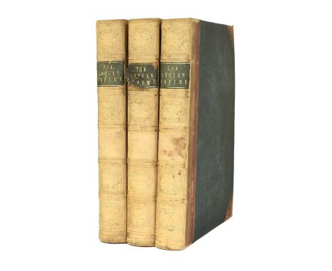
Trollope (Anthony).How the 'Mastiffs' Went to Iceland.Virtue, 1878, first edition, quarto, colour map frontis, sixteen plates as called for (14 lithos. by Mrs Hugh Blackburn and 2 mounted photographs), all edges gilt, original cloth gilt (endpapers split at hinges, cloth rubbed with wear to head and tail of spine and corners). Spruggins (Richard Sucklethumkin), Portraits of the Spruggins Family.Private printing, 1829, quarto, frontis, 43 full page litho illustrations, additional plate (1835) tipped-in at rear, cloth;Dickinson (H.N.), Thomson's Friend.Arthur L. Humphreys, 1917, 12mo. in eights, original boards. (3)
Lot 193
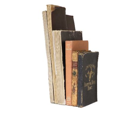
MapsPaterson (Capt Daniel), Paterson's British Itinerary, Being a New and Accurate Delineation and Description of the Direct and Principal Cross Roads of Great Britain. In two vols (Vol II only), 1785, engraved title, strip maps, worn contemporary calf;Ordnance Survey - Halifax and Huddersfield (Sheet 230/231).Large hand-coloured, linen-backed, folding OS map (six inch to the mile), surveyed 1848-9, published 1854, 60 sections, 128cm x 193cm;Ordnance Survey - Burley in Wharfedale.Large linen-backed folding OS map (1/2500, 25.344 inches to the mile), surveyed 1889, reprinted 1893, 32 sections, 135cm x 106cm, hand-coloured areas identifying ownership (with key in margin), linen fragile;Ordnance Survey - llkley and Otley.Large linen-backed folding OS map, Sheets CLXIX and CLXX (six inches to the mile), 1895, 32 sections, 129cm x 192cm, waterways coloured on second sheet; Jackson's Map of the Bramham Moor Hunt.Richard Jackson, no date, linen-backed folding map, 32 sections, 71cm x 95cm, original roan gilt covers (worn);Jeffreys (Thomas), The County of York, Survey'd in MDCCLXVII, VII, IX and MDCCLXX, 1775 (1973), large folio reproduction, foxing to edges and endpapers, original bindings;Whitaker (Harold), A Descriptive List of the Printed Maps of Yorkshire ....1577-1900, YAS, 1971, original cloth. (7)
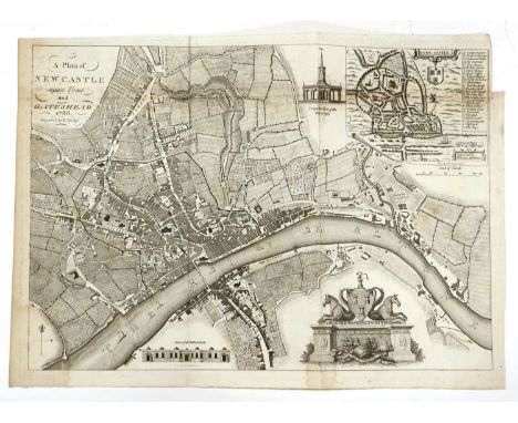
Lot 171
City PlansA New and Complete Plan of London Westminster and Southwark with the Additional Buildings to the Year 1777, engraved map, plate mark 281mm x 506mm;London and Westminster in the Reign of Queen Elizabeth, Anno Dom 1563, no date, engraved map, plate mark 212mm x 560mm.With two others of London and:Matthew (William) and Bielby (R.), A Plan of Newcastle and Gateshead, 1788, engraved plan, plate mark 328 mm x 463mm, (5)
![Lake District[West (Thomas)], A Guide to the Lakes in Cumberland, Westmorland and Lancashire, 1784, frontis, folding map, con](https://cdn.globalauctionplatform.com/fae0aeac-16b7-4b2f-80fe-afc000c1f7cf/d2bac4af-71ff-41ae-bf0e-b00000b6f9ba/468x382.jpg)
Lot 183
Lake District[West (Thomas)], A Guide to the Lakes in Cumberland, Westmorland and Lancashire, 1784, frontis, folding map, contemporary calf (worn);[Tattersall (George)], Tablets of an Itinerant or The Lakes of England, [1836], with engraved title page but probably lacking printed title, folding coloured map, plates, original cloth;Ford (William), A Description of Scenery in the Lake District, Intended as a Guide to Strangers, 1840, 3 double page coloured maps, folding table, lacking folding map, original boards (spine taped). (not collated). (3)Tattersall - foxing to frontis and plates, 43 plates including map as called for, a little wear to head and tail of spine, upper front joint split.West - armorial bookplate, name obscured on half title, fep and fly leaf torn at hinge, a little staining in places, pages a little rippled but generally good, top edge dust marked, binding worn.Ford - Spine and hinges taped, boards rubbed, light foxing to early and final leaves, top edge dust marked. Sold with pagination not collated.

Lot 205
Bowen (Eman.)An Accurate Map of the County of York, Divided into its Ridings ...; An Accurate Map of the North Riding of York Shire, Divided into Wapentakes ...; An Accurate Map of the West Riding of York Shire, Divided into Wapentakes ...; Kitchin (Thos.), An Accurate Map of the East Riding of York-Shire, Divided into Wapentakes ...; Bowles/Sayer, 1777, four engraved maps, hand-coloured in outline, uniformly mounted framed and glazed. (4)
![[Blaeu (Joannis)]Ducatus Eboracensis Pars Occidentalis. The Westriding of Yorke Shire. No date [1645 or later], engraved map,](https://cdn.globalauctionplatform.com/fae0aeac-16b7-4b2f-80fe-afc000c1f7cf/377ff2ba-3a3e-4b6b-b34c-aff9009fb9c3/468x382.jpg)
Lot 203
[Blaeu (Joannis)]Ducatus Eboracensis Pars Occidentalis. The Westriding of Yorke Shire. No date [1645 or later], engraved map, latin text on reverse (signature Iiiii, pages 293/4), mounted, framed, glazed front and rear;[Jansson (Joannis)], Ducatus Eboracensis Pars Borealis. The Northridinge of Yorkeshire. No date [1646 or later], engraved map, latin text on reverse (signature Ooooo, pages 305/6), mounted, framed, glazed front and rear;idem., Ducatus Eboracensis. Anglice Yorkshire. No date [1646 or later], engraved map, latin text on reverse (signature Hhhhh, pages 291/2), mounted, framed, glazed front and rear. (3)
![Speed (John)The North and East Ridins of Yorkshire, Thos Bassett and Richard Chiswell, no date [1676], hand-coloured engraved](https://cdn.globalauctionplatform.com/fae0aeac-16b7-4b2f-80fe-afc000c1f7cf/a096436a-6801-4b19-9b4b-aff9009fc315/468x382.jpg)
![Speed (John)The West Ridinge of Yorkshyre, Thos. Bassett and Richard Chiswell, no date [1676], hand-coloured engraved map, im](https://cdn.globalauctionplatform.com/fae0aeac-16b7-4b2f-80fe-afc000c1f7cf/b7668bcc-f6ab-438d-af25-aff9009fbe03/468x382.jpg)

Lot 187
Speed (John) York Shire. Bassett and Chiswell, no date [1676[, hand-coloured engraved map, plate mark 390mm x 516mm, English text on reverse, famed, glazed front and rear; with a hand-coloured engraved map of North Yorkshire (single sheet, possibly from Teesdale's 1828 map), image 465mm x 542mm, mounted, framed and glazed. (2)

Lot 189
Saxton (Christopher)Five County Maps, comprising County Durham (Kip); Cumbria (Kip) Lincolnshire (Kip); Northumbria (Hole); Westmorland (Kip);[1607 or later], hand-coloured engraved maps, mounted, framed and glazed. Bowen (Eman.), An Improved Map of the County of Somerset ...hand-coloured engraved map, plate mark 536mm x 710mm, framed and glazed.with two others. (8)

Lot 174
Maps of the AmericasEight engraved maps, comprising;United States of America with River St Laurence adjacent; Chart of the Atlantic Ocean (Lizars); Partie du Nord de L'Amerique Septrionale (Bonne); Mexico or New Spain ... (Kitchin); Province of Nova Scotia in North America; An Accurate Map of South America (Thos. Bowen); Chart of the Pacific Ocean (with coastal California and Mexico, Philipines and Japan, on two sheets). (8)

Lot 331
Five pictures comrising:a pair of early 18th century engravings - 'The South-West View of Cold-Norton Priory in the County of Oxford' and 'The South-West View of Clattercote Priory', both dated 1729. (Later glazed ebonised frames 23 x 39 cm);a limited edition map,'The Parish of Chadlington' (Glazed gilt frame 78 x 62 cm);after Atkinson Grimshaw. (Glazed gilt frame 57 x 83 cm);after Sir Robert Atkyns, 'Cirencester Park from the ancient and present state of Gloucestershire'. (Glazed parcel-gilt frame 39 x 47 cm).

Lot 191
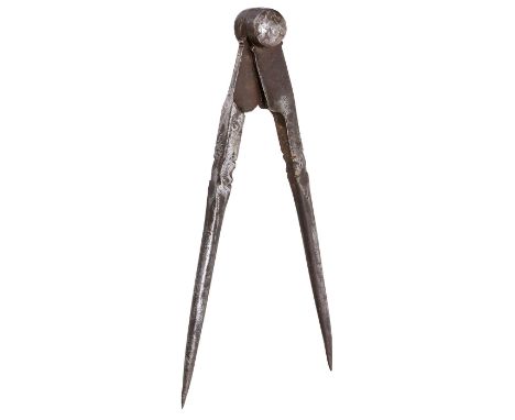
Früher deutscher Stechzirkel, 16. Jh.Zirkel mit 2 Spitzen, handgeschmiedetes Eisen, Länge 28 cm. - Verwendet in handwerklichen Berufen, um genaue Maße auf Werkstücke zu übertragen, oder in der Navigation, um einen Abstand zwischen zwei Punkten auf einer Karte zu messen. Start Price: EUR 80 Zustand: (3/3)Early German Dividing Caliper, 16th CenturyCompass with 2 points, wrought iron, length 11 in. - Used to mark out locations or on nautical chart to measure a distance between two points on a map. Start Price: EUR 80 Condition: (3/3)

-
109198 item(s)/page