We found 109182 price guide item(s) matching your search
There are 109182 lots that match your search criteria. Subscribe now to get instant access to the full price guide service.
Click here to subscribe- List
- Grid
-
109182 item(s)/page


Lot 221
FIVE FRAMED AND GLAZED PICTURES, INCLUDING FOUR PRESENTED TO MAJOR HOLMES the first depicting a line infantryman (Clairon); the second a footsoldier (Clairon); the third the camp of the 4th division, dated July 15th 1855; the fourth a poster for the Hampshire Regiment dance; the fifth a map of Operation Joint Guardian, signed by General Sir Mike Jackson KCB CBE various sizes (5)

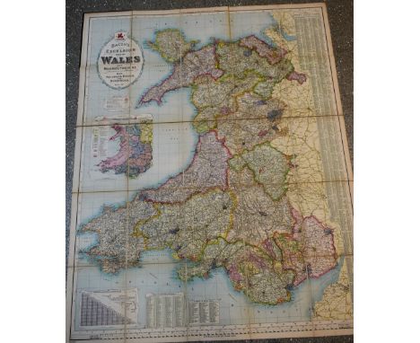
Lot 1360
Bacon's Excelsior Map of Wales and Monmouthshire, Revised According To The Latest Ordnance Survey, With Railways, Roads, and Distances, [printed and published by] G.W. Bacon & Co. Ltd., London [c. 1900], twenty-five chromolithographic and hand-coloured folds laid on canvas, maroon buckram boards, marbled endpapers, square 4to

Lot 135
Jerusalem.- Adrichem (Christiaan van) A briefe description of Hierusalem and of the suburbs therof, as it florished in the time of Christ. Wherto is annexed a short commentarie concerning those places which were made famous by the Passion of Christ, and by the actes of holye men, translated by Thomas Tymme, first edition in English, woodcut head-pieces and decorative initials, lacking map, water-stained, contemporary limp vellum, upper cover with gilt stamp 'Traquair House', [STC 152], small 4to, Printed by Peter Short for Thomas Wight, 1595.Provenance: 'John Chereie' (17th century ink inscription, with 'is an ass' added by another 17th century hand); 'H. Bailey, Spalding, Lincolnshire...1774' (ink inscription); Traquair House, near Peebles, Scotland, purportedly Scotland's oldest inhabited house.
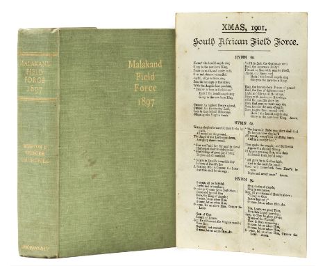
Lot 210
Churchill (Sir Winston Spencer) The Story of the Malakand Field Force, first edition, issue with the errata slip facing first folding map and without advertisements, frontispiece portrait, 6 maps (2 folding), half-title, some foxing, ink stamp "R.A. Wilson" on recto of frontispiece, bookplate on front pastedown, "Xmas, 1901 South African Field Force" printed hymn loosely inserted, original cloth, spine very slightly darkened, some light rubbing and surface soiling but a sharp and excellent example overall, [Woods A1(a)], 8vo, 1898.
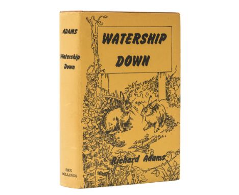
Lot 258
Milne (A. A.) Winnie-the-Pooh, first edition, illustrations by E.H. Shepard, map endpapers, small book label to pastedown, original pictorial cloth, gilt, fine, t.e.g., dust-jacket, spine slightly rubbed and browned, a fine copy otherwise, preserved in custom drop-back box with upper board of book replicated on upper cover, 8vo, 1926.
Lot 307
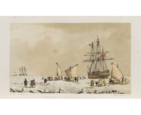
Arctic.- M'Dougall (George F.) The Eventful Voyage of H.M. Discovery Ship "Resolute" to the Arctic Regions in search of Sir John Franklin..., first edition, half-title, folding engraved map with partial hand-colouring and routes supplied in red and blue, 8 tinted lithographed plates, some finished by hand with colouring of flags, wood-engraved illustrations, old ink inscription "Ducie Oct. 1903" at head of title, some spotting, modern book-label of Charles Benson, later half morocco, spine gilt, t.e.g., spine a little faded, joints very slightly rubbed, [Sabin 43183], 8vo, 1857. ⁂ The Resolute set out as part of Belcher's relief expedition in 1850 but became stuck in the ice and was abandoned in May 1854. It was found by a American whaler, bought by the U.S. government and returned to Britain where it was presented to Queen Victoria. A desk was later built using its timbers and presented to the President of the United States in thanks; it is now situated in the Oval Office in the White House where it has been used by most of the intervening Presidents.
![China.- [Staunton (Sir George)] [An Authentic Account of An Embassy from the King of Great Britain to the Emperor of China],](https://cdn.globalauctionplatform.com/5d8dce2e-5231-4872-adfb-a825010f01aa/6dbe3f8b-f330-4a0f-8fee-efa2740d0811/468x382.jpg)
Lot 309
China.- [Staunton (Sir George)] [An Authentic Account of An Embassy from the King of Great Britain to the Emperor of China], Atlas only (without 2 text vol.), first edition, 38 engraved maps, charts, plates and plans only (of 44, lacking nos.20, 24, 25, 30, 33 & 36), 7 folding or double-page, most plates after W.Alexander, a few of natural history after S.Edwards, plate 2 lightly soiled and very slightly stained at edges, some other occasional marginal soiling but generally clean and bright, plate 29 torn at inner margin extending c.4cm. into plate at head, contemporary half russia, rubbed, [Cordier, Sinica, 2381-83], folio, [1797]; sold as a collection of plates, not subject to return⁂ Atlas illustrating the official account of Lord Macartney's voyage and embassy to the Qianlong emperor in 1792-94, the failure of which lead to the establishment of the British trading post at Hong Kong. The fine plates by Alexander include views of palaces, temples, barges and a military post, and there is also a detailed map of Macao.

Lot 311
India.- Hodges (William) Select Views in India, drawn on the spot, in the years 1780, 1781, 1782, and 1783, 2 vol. in 1, first edition, first issue, titles, dedications and text in English and French (all double-page leaves mounted on stubs), lacking titles to vol.1 but with titles to vol.2 bound at beginning and two dedications, lists of plates single leaves and in English only, with 48 fine aquatint plates printed in bistre and engraved map of River Ganges, two plates of Gwalior with small stain (fainter on second plate), some other light spotting or soiling to plates, mostly marginal, a few with faint horizontal line at head from edge of mount of preceding leaf, contemporary diced russia, gilt, rubbed, a few stains and scratches, spine ends and corners worn, [cf. Abbey, Travel 416 & Tooley 263, both later coloured issues], folio, n.p., [1785-88].⁂ Some of the earliest views of India by an English artist and including the first printed depiction of the Taj Mahal (plate 15 'View of the Fort of Agra'). Hodges had been draughtsman on Cook's second voyage of 1772-5, and oversaw the engraving of the plates for the published account A Voyage towards the South Pole and around the World of 1777. He then travelled in India under the patronage of Warren Hastings and these views are said to have inspired Humboldt to travel. This is the earliest issue of the work, originally published in 12 parts and with the plates uncoloured.
Lot 312
India.- Rennell (James) A Bengal Atlas: containing Maps of the War and Commerce on that side of Hindoostan, second edition, letterpress title and contents leaf, engraved index map, double-page view and 20 maps, all but one double-page, some also folding, the first ten with outline hand-colouring, with a further 3 maps of Hindostan by Rennell on 8 double-page and/or folding engraved sheets bound in at end, all with outline hand-colouring, some with cartouches, additional maps added to list of contents in manuscript, all mounted on stubs, some light spotting and soiling, one or two browned, with some military manuscript maps and other material loosely inserted, modern half red morocco over marbled boards, spine elaborately gilt, folio, 1781.⁂ The 3 additional engraved maps by Rennell bound in are: Map of Bengal, Bahar, Oude and Allahabad, 1786 (2 sheets); General Map of Hindoostan, 1782 (2 sheets); General Map of Hindoostan, 1788 (4 sheets).The loosely-inserted additional material comprises: Sketch of Roads by Maj.F.Abbott, ink & watercolour on tracing paper, c.620 x 275mm.; Sketch of the Bheta-ki-Puttun on the River Beas by Capt. W.Abercrombie, ink & watercolour, c.280 x 210mm., some worming with loss; [Sketch of roads east of Amritsir], ink & watercolour, c.230 x 185mm.; Map of Cantonments of Agra, printed with hand-colouring, c.250 x 330mm.; Plan of a Church...in the Nizam's Station of Bolarum 1845/46 constructed by Capt. G.F.C.FitzGerald, lihograph with caption in manuscript, c.320 x 200mm.; Explanation of a View of the City of Calcutt, exhibiting at the Panorama, Leicester Square, engraving, c.285 x 450mm.

Lot 318
South America.- Schomburgk (Robert Hermann) Twelve Views in the Interior of Guiana , first edition, hand-coloured additional tinted lithographed pictorial title by M. Gauci after Charles Bentley and 12 hand-coloured tinted lithographed plates by George Barnard, Coke Smith and P. Gauci after Bentley, engraved map with routes in red and blue, dedication leaf to the Duke of Devonshire with his arms printed in gold, list of subscribers, wood-engraved vignettes, foxed, title soiled and chipped at lower outer corner (also final plate), many leaves crudely reinforced at inner margin, ex-library copy with stamp to verso of plates, contemporary cloth-backed boards with original lithographed pictorial wrapper mounted on upper cover, rather worn and stained, rebacked, [Abbey, Travel 720; Sabin 77796; Tooley 447], folio, Ackermann & Co., 1841. ⁂ During this expedition Schomburgk discovered and then despatched to England the Victoria Regia waterlily. In 1840 he proposed the "Schomburgk line" - a possible border between British Guiana and neighbouring Venezuela.
![Voyages.- Cook (Capt. James) [First Voyage].- Hawkesworth (John) An Account of the Voyages...for making Discoveries in the So](https://cdn.globalauctionplatform.com/5d8dce2e-5231-4872-adfb-a825010f01aa/a6a14b1d-7503-4bee-8d06-85dea6918341/468x382.jpg)
Lot 320
Voyages.- Cook (Capt. James) [First Voyage].- Hawkesworth (John) An Account of the Voyages...for making Discoveries in the Southern Hemisphere..., 3 vol., first edition, 51 engraved maps and plates only (of 52, lacking one from vol.2), most folding, including map of 'Straights of Magellan' but no list of plates (as often), map of 'Straights of Magellan' with a couple of short tears at edges but no loss, folding plate of War Canoe in vol.3 with patch of slight surface damage to sky, some light spotting or soiling, mostly marginal to plates, tear to lower margin of 5G3 in vol.3, contemporary calf, spines ruled in gilt with red and green morocco labels, rubbed, a few worn or wormed patches, spines a little worn at foot, [Mitchell Library Cook 648; Sabin 30934], 4to, for W.Strahan and T.Cadell, 1773.
Lot 327
Africa.- Andersson (Charles John) Lake Ngami; or, Explorations and Discoveries during Four Years' Wanderings in the Wilds of South Western Africa, first edition, lithograph frontispiece, 15 plates, illustrations, large folding map at end (small marginal tear), occasional light spotting, marginal staining to 2 leaves and 1 plate, original cloth, rebacked, slight bumping to corners, [Czech p5], 8vo, 1856.
Lot 330
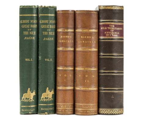
Africa.- Baker (Sir Samuel White) The Albert N'Yanza, Great Basin of the Nile, 2 vol., 2 maps (1 folding), short tear to folding map, illustrations, slight offsetting, cracked hinges, bookplates, original decorative cloth, spotting, bumping to corners and extremities, 1866; The Nile Tributaries of Abyssinia, 2 maps (1 folding), occasional finger-soiling, modern half calf, 1867; Ismailïa, 2 vol., 2 maps (1 folding), presentation label, later calf, spines faintly faded, vol. 2 rebacked with original spine laid down, 1874, first editions, frontispieces, plates, occasional faint spotting, [Czech pp.10-11], 8vo (5)

Lot 332
Africa.- Barth (Heinrich) Travels and Discoveries in North and Central Africa, 5 vol., first English edition, lacking half-titles in vol.1, 4 & 5 (not called for in vol.2 & 3), with 15 folding maps and 60 tinted lithographed plates, folding plan, numerous illustrations, lacking advertisement leaf and 24pp. publisher's catalogue at end of vol.1 & 4 but with errata leaf at end of vol.5, a little browned, vol.1 with marginal water-staining and one map torn in two, maps in vol.5 with some tears and repairs, trimmed, modern half brown morocco, spines gilt with red morocco labels, [Abbey, Travel 274], 8vo, 1857-58.⁂ Barth's five-year expedition with the British explorer James Richardson covered large parts of North and sub-Saharan Africa.
![Africa.- [Beverley (Robert Mackenzie)] The Wrongs of the Caffre Nation, ink inscription, 2pp. publisher's advertisements boun](https://cdn.globalauctionplatform.com/5d8dce2e-5231-4872-adfb-a825010f01aa/5e3bb6c3-9e9f-48c5-bc6d-4b7596204102/468x382.jpg)
Lot 334
Africa.- [Beverley (Robert Mackenzie)] The Wrongs of the Caffre Nation, ink inscription, 2pp. publisher's advertisements bound at end, original drab boards, rubbed, slight bumping to corners and extremities, [Hosken p112], 1837 § Kay (Stephen) Travels and Researches in Caffraria, engraved frontispiece, 4 plates, engraved folding map, occasional light spotting and offsetting, modern half morocco, [Hosken p113], 1833 § Holden (Rev. William C.) The Past and Future of the Kaffir Races, lithograph frontispiece, plates including 7 lithographs, folding map, 4 folding tables, occasional spotting, modern half morocco, [Hosken p 101], [1866], first editions; and 2 others, similar, 8vo (5)

Lot 335
Africa.- Bindings.- Selous (Frederick Courteney) Travel and Adventure in South-East Africa, plates, illustrations, folding colour map, occasional light finger-soiling, modern half morocco, [Czech pp.145-146], 1893 § Bailey (Henry) "Bula N'zau" Travel and Adventure in the Congo Free State and its Big Game Shooting, illustrations, folding map, ink inscription to title, modern half calf, [Czech pp.26-27], 1894 § [Bird (William Wilberforce)] State of the Cape of Good Hope, folding plan (small hole on fold line), spotting, ink inscription to title, occasional annotations, modern calf, [Hosken p17], 1823 § Bateman (Charles Somerville Latrobe) The First Ascent of the Kasaï, plates (4 chromolithographed, 6 etched), 2 maps (1 folding), occasional light spotting, original upper cover bound in, modern half morocco, 1889, all but the last first editions, frontispieces; and 11 others, Africa, in bindings, 8vo (15)

Lot 340
Africa.- Chapman (James) Travels in the Interior of South Africa, comprising Fifteen Years' Hunting and Trading, 2 vol., first edition, half-titles, wood-engraved frontispieces and illustrations, 2 folding colour maps, errata leaf in vol.2, one map browned and frayed at edges (repaired), ex-New College Oxford library copy with cancelled label, original pictorial green cloth, gilt, a little rubbed, traces of label at foot of spines, [Czech p.36], 8vo, 1868.

Lot 341
Africa.- Chapman (Abel) On Safari, first edition, frontispiece, plates, illustrations, ink inscription, original decorative cloth, slight bumping to corners and extremities, [Czech p.35], 1908 § Selous (Frederick Courtney) Travel and Adventure in South-East Africa, first edition, portrait frontispiece, illustrations, folding colour map, cracked hinges, ink inscription, original decorative cloth, a little rubbed, slight bumping to corners and extremities, [Czech pp.145-146], 1893 § Stigand (Capt. C. H.) The Game of British East Africa, plates, occasional scattered spotting, pencil inscription, original cloth, slight stain to upper cover, slight bumping to extremities, 1913; 8vo & 4to (3)
Lot 342
Africa.- Christopher (J. S.) Natal, Cape of Good Hope. A Grazing, Agricultural, and Cotton-Growing Country., first edition, 4 tinted lithograph plates, several small tears (many repaired), occasional light spotting, bookplates, ex-library with small ink-stamp to verso of frontispiece, small blindstamp to blank prelim, a little rubbed, [Hosken p46], 1850 § Grogan (Ewart S.) and Arthur H. Sharp, From the Cape to Cairo, first edition, plates and illustrations, 3 maps, 2 colour and folding (2 small tears, 1 repaired), occasional light spotting, [Czech p69], 1900 § Kerr (Walter Montagu) The Far Interior, 2 vol., plates and illustrations, folding map, cracked hinges, occasional spotting, spines a little faded, 1887, frontispieces, original cloth, slight bumping to corners and extremities; and 7 others, similar, 8vo (11)

Lot 344
Africa.- Colomb (Capt. Philip Howard) Slave-Catching in the Indian Ocean. A Record of Naval Experiences, folding colour map, occasional spotting, bookplate, ink inscription, contemporary calf, slight bumping to spine head, 1873 § Baker (Sir Samuel W.) Ismailïa, 2 vol., 2 maps (1 folding, small repair to fold line), occasional light finger-soiling, modern half morocco, [Czech p11], 1874 § Blanc (Henry) A Narrative of Captivity in Abyssinia, occasional spotting, modern half morocco, 1868, first editions, frontispieces, plates; 8vo (4)

Lot 345
Africa.- De L'Isle (Guillaume) Carte du Congo et du Pays des Cafres, southern Africa and Madagascar, title panel above, engraved map with outline hand-colouring, 505 x 630 mm. (19 7/8 x 24 3/4 in), central vertical fold, slight browning and surface dust, Amsterdam, Covens and Mortier, [circa 1730]; and with two other maps of Africa, including James Wyld's Map of Part of the Western Coast of Africa, showing Sierra Leone and the Southwestern Part of Guinea, and a map of Abyssinia, Nubia &c., from Pinkerton's Modern Atlas, engravings, with some hand-colouring, the former 670 x 960 mm. (26 1/2 x 27 3/4 in), all unframed, [circa 1843 and 1819], (3).
![Africa.- Junker (Dr. Wilhelm) Travels in Africa during the years 1875-1878 [1879-1883; 1882-1886], translated by A.H.Keane,](https://cdn.globalauctionplatform.com/5d8dce2e-5231-4872-adfb-a825010f01aa/118d7e76-0629-48a8-c513-94c9857b9a2b/468x382.jpg)
Lot 354
Africa.- Junker (Dr. Wilhelm) Travels in Africa during the years 1875-1878 [1879-1883; 1882-1886], translated by A.H.Keane, 3 vol., first edition in English, half-titles in vol.2 & 3, 3 portrait frontispieces, 3 folding colour maps, plates and illustrations, some light spotting and soiling, map in vol.1 torn and defective at lower inner corner (not affecting Junker's routes, laid down), others with short tears to folds, original pictorial green cloth, uncut, a little rubbed, 8vo, 1890-92.⁂ Junker's travels took him from Alexandria down the Nile to Khartoum, around the southern Sudan to Lake Albert, and back to the Red Sea port of Suakin.

Lot 356
Africa.- Laing (Major Alexander Gordon) Travels in the Timannee, Kooranko, and Soolima Countries in Western Africa, engraved folding map frontispiece, 7 aquatint plates, ink inscription to title, modern crushed morocco, 1825 § Reade (W. Winwood) Savage Africa, frontispiece, 8 plates, folding map at end, occasional light spotting, contemporary calf, rebacked with original spine laid down, 1863 § Freeman (Richard Austin) Travels and Life in Ashanti and Jaman, frontispiece, plates and illustrations, folding colour map, scattered faint spotting, 16pp publisher's advertisements at end, later half morocco, 1898, first editions; and 7 others, similar, 8vo & 4to (10)

Lot 364
Africa.- Ludolf (Hiob) A New History of Ethiopia, being a Full and Accurate Description of the Kingdom of Abessinia..., first English edition, engraved plate of Ethiopic alphabet, 6 engraved plates only (of 8, lacking plates of elephants and sheep), 5 folding, folding genealogical table, ?also lacking map, old ink inscription "The Erall of Dundonald 1768" at head of title, soiled and browned, some stains, one causing two holes to G3 with loss of a few letters, folding plates torn with occasional loss (some repaired and partly laid down), modern morocco-backed marbled boards, [Wing L3468], folio, for Samuel Smith, 1682; sold not subject to return⁂ Including important material on Ethiopic languages.
Lot 369
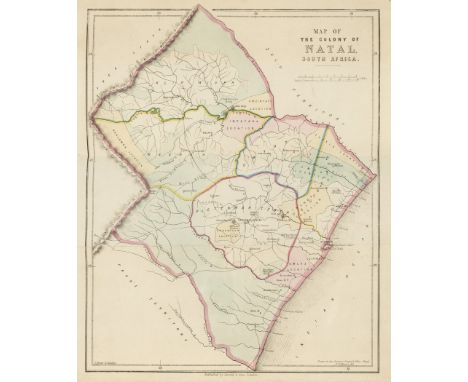
Africa.- Mann (Dr. Robert James) The Colony of Natal, folding hand-coloured map frontispiece, area of loss to half-title, faint abrasion mark to pastedown, original cloth, slight bumping to corners and extremities, [Hosken p135], [1859] § Boyce (W. B.) Notes on South-African Affairs, occasional light spotting, bookplate, original cloth, a little spotted, rubbed joints, bumping to spine extremities, [Hosken p24], 1839 § Holden (Rev. William) History of the Colony of Natal, South Africa, tinted lithograph frontispiece, 9 plates (3 tinted lithographs), illustrations, ink inscription to title, bookplate, occasional damp-staining, occasional light spotting, original cloth, slight bumping to corners and extremities, [Hosken p101], 1855 § Latrobe (Rev. C. I.) Journal of a Visit to South Africa in 1815, and 1816, folding linen-backed map frontispiece, lacking all plates, ink annotation to title, 2P1 in facsimile, small tear (2I4), occasional light spotting, later calf, lightly marked, [Hosken p120], 1818, first or first English editions; and 4 others, similar, 8vo & 4to (8)
Lot 370
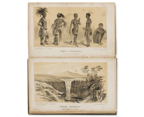
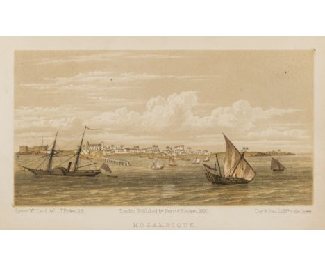
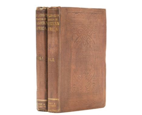
Africa.- McLeod (Lyons) Travels in Eastern Africa, 2 vol., engraved portrait and tinted lithograph frontispieces, title vignettes, folding map (small tear, repaired), contemporary half calf, neatly and sympathetically rebacked with original spine labels laid down, [Hosken p133], 1860 § Cooley (William Desborough) Inner Africa Laid Open, lacking folding map, occasional light spotting, ink inscription, original cloth, rebacked with original spine laid down, a little rubbed, [Hosken p50], 1852, first editions; and 2 others, similar, 8vo (5)
Lot 371
Africa.- McLeod (Lyons) Travels in Eastern Africa, 2 vol., first edition, engraved portrait and tinted lithograph frontispieces, folding map (tear, repaired), occasional spotting, original cloth, a little rubbed, slight bumping to corners and extremities, [Hosken p133], 1860 § Donkin (Lieut.-Gen. Sir Rufane) A Letter on the Government of the Cape of Good Hope, second edition, ink owner's inscription to upper cover, discreet blindstamp to title, occasional spotting, several small holes and tears, disbound, housed in a modern cloth folding chemise, [Hosken p61], 1827 § Rankin (Daniel J.) The Zambesi Basin and Nyassaland, first edition, frontispiece, plates, 3 folding colour maps, modern half morocco, [Hosken p165], Edinburgh, 1893; and 7 others, similar, 8vo (11)
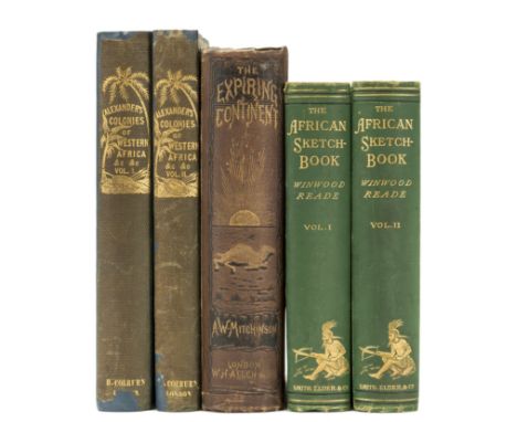
Lot 372
Africa.- Mitchinson (Alexander William) The Expiring Continent: A Narrative of Travel in Senegambia, 15 plates (some damp-staining to corners), folding map (browned edge), ink inscriptions, small abrasion mark to front free endpaper verso, occasional light spotting, 1881 § Alexander (James Edward) Narrative of a Voyage of Observation Among the Colonies of Western Africa, 2 vol., 16 plates, 2 maps, occasional spotting, rebacked with original spine laid down, [Hosken p.3], 1837 § Reade (Winwood) The African Sketch-Book, 2 vol., plates, maps (2 folding), occasional light spotting, [Hosken p.166], 1873, first editions, frontispieces, original cloth, rubbed; 8vo (5)

Lot 375
Africa.- Philip (Rev. John) Memoir of Mrs. Matilda Smith, Late of Cape Town, Cape of Good Hope, contemporary calf, rebacked with original spine laid down, slight bumping to corners, 1824 § Goodwin (Harvey) Memoir of Bishop Mackenzie, 3 lithograph plates (1 folding), 3 maps (2 folding), original cloth, slight bumping to corners and extremities, Cambridge, 1864 § Gillmore (Parker) The Great Thirst Land, map, cracked hinges, pencil inscription, original cloth, a little rubbed, chipping and small loss to spine extremities, [1878], frontispieces, occasional faint spotting; and 14 others, similar, v.s. (17)
Lot 376
Africa.- Philip (Rev. John) Researches in South Africa, 2 vol., first edition, engraved frontispiece (vol. 1) and linen-backed folding map frontispiece (vol. 2), engraved plan, occasional pencil annotations, scattered faint finger-soiling, modern half calf, [Hosken p157], 1828 § Livingstone (David) Missionary Travels and Researches in South Africa, first edition, folding lithograph frontispiece, folding plan, plates (including 1 lithograph), illustrations, 2 folding maps (1 in pocket at end), occasional faint spotting, modern morocco, [Czech p97], 1857 § Young (E. D.) The Search After Livingstone, revised by Rev. Horace Waller, lithograph frontispiece, 5 plates, folding map, spotting, prize label to front pastedown, contemporary calf, rebacked with original spine laid down, 1868; and 7 others, similar, 8vo & 4to (11)

Lot 377
Africa.- Pinto (Maj. Serpa) How I Crossed Africa, 2 vol., plates, illustrations, 8 maps including large folding map in pocket at end, original cloth bound in, occasional light spotting and marginal staining, modern half morocco, [Hosken p160], 1881 § Kollmann (Paul) The Victoria Nyanza, illustrations, folding map, ex-library with discreet ink stamp to title, original cloth bound in, modern half morocco, [Hosken p117], 1899 § Du Chaillu (Paul B.) A Journey to Ashango-Land, frontispiece, plates, folding map, modern half morocco, [Hosken p63], 1867, first or first English editions; and 2 others, Mungo Park, 8vo & 4to (6)

Lot 378
Africa.- Richardson (James) Narrative of a Mission to Central Africa Performed in the Years 1850-51, 2 vol., ink inscription to titles, short marginal tear to first few leaves, occasional light spotting, faint marginal water-staining to last few leaves (vol. 2), modern half calf, housed in a slipcase, 1853 § Coillard (François) On the Threshold of Central Africa, plates, folding map (2 large tears), occasional light spotting, original pictorial cloth, cracked upper joint, slight bumping to extremities, [Hosken p48], 1897 § Thomas (Thomas Morgan) Un-Mlynedd-Ar-Ddeg yn Nghanolbarth Deheuol Affrica, plates, occasional finger soiling, original cloth, slight bumping to corners and extremities, n.d., all but the last first editions, frontispieces; and 5 others, similar, 8vo (9)

Lot 380
Africa.- Smith (A. Donaldson) Through Unknown African Countries, photogravure frontispiece, plates, illustrations, 6 folding maps, occasional light spotting, cracked upper hinge, [Czech pp.149-150] 1897 § Dutton (E. A. T.) Lillibullero or the Golden Road, limited to 100 copies, double-page map, Zanzibar, 1944 § Worsfield (W. Basil) Portuguese Nyassaland, frontispiece (loose), plates and illustrations, 2 folding maps in pocket at end, cracked hinges, [Hosken p221], 1899, first editions, original cloth, a little rubbed; and 14 others, similar (17)
Lot 382
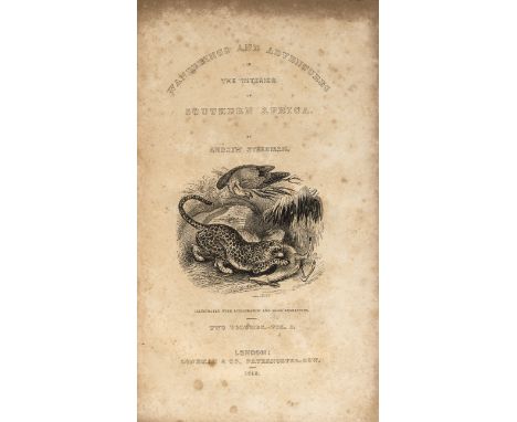
Africa.- Steedman (Andrew) Wanderings and Adventures in the Interior of Southern Africa, 2 vol., first edition, engraved titles, lithograph frontispieces, 10 plates, engraved folding map, browning to title and plates, bookplates, original ribbed green cloth, vol. 2 upper cover a little stained, a little rubbed, [Czech p153], 8vo, 1835.⁂ "Steedman spent ten years in South Africa, with a fair amount of time hunting big game." Czech, p153

Lot 394
Middle East.- Fraser (James Baillie) Travels in Koordistan, Mesopotamia, &c., 2 vol., first edition, engraved frontispieces, modern calf-backed cloth, red roan labels, 1840 § Koran (The), edited by George Sale, folding engraved frontispiece with plan and view of Mecca, folding engraved map, 3 engraved genealogical tables, 2 folding, modern half mottled calf, spine gilt with red morocco label, 1857, spines very slightly faded; and another, 8vo (4)

Lot 399
South-East Asia.- Symes (Michael) An Account of an Embassy to the Kingdom of Ava, sent by the Governor-General of India, first edition, half-title, one folding engraved map only (of 2, lacking 'Draught of the Irrawaddy'), 26 engraved plates, 4 folding, one or two trimmed at foot, light foxing to and offsetting from plates, particularly the botanical plates, contemporary half russia, spine gilt, rubbed, corners worn, joints split, 4to, for J. Debrett, 1800.⁂ Including a description of the plants of Burma, with 8 plates.

Lot 404
World.- De l'Isle (Guillaume) Mappemonde a l'usage du Roy, double-hemisphere world map with large armorial cartouche, engraved map with outline hand-colouring, 450 x 670 mm. (17 3/4 x 26 1/2 in), trimmed within platemark to left edge, two vertical folds, surface dirt and some light browning, handling creases, Amsterdam, Covens and Mortier, [circa 1741] § Blaeu (Johan and Willem) Natolia, quæ olim Asia Minor, Turkey in Asia, with Cyprus, title banderole above, ships and sea monster, engraved map with outline hand-colouring, 380 x 495 mm., Latin text verso, surface dirt and browning, Amsterdam, [circa 1634]; together with Sebastian Münster's Tabula Asiae X [India], woodcut, on laid paper, sheet 295 x 405 mm. (11 3/4 x 16 in), central vertical fold, some worm hole damage to lower margin, unframed, Basel, [1550], (3).

Lot 407
Africa.- Bosman (William) A New and Accurate Description of the Coast of Guinea, Divided in the Gold, the Slave, and the Ivory Coasts, 2 parts in 1, Second edition, folding engraved map and 7 plates, lacks catalogue at end, slightly browned, ink inscription on front pastedown, contemporary calf, gilt, corners and edges rubbed, rebacked in modern calf, red and green morocco labels, 8vo, London, Printed for J. Knapton, D. Midwinter, B. Lintot, G. Strahan, J. Round, and E. Bell. 1721.

Lot 409
Africa.- Denham (Maj. Dixon) and Capt. Hugh Clapperton. Narrative of Travels and Discoveries in Northern and Central Africa, in the Years 1822, 1823, and 1824, 1826, first edition, engraved portrait frontispiece, 36 plates (1 hand-coloured) and a folding map, some offsetting, occasional spotting, modern half calf, spine in compartments and with red leather label, 4to, 1826.⁂ An expedition to discover the course of the Niger with the starting point of Tripoli.
![Africa.- [Telles (Balthazar)] The Travels of the Jesuits in Ethiopia, first edition in English, folding engraved map (3 small](https://cdn.globalauctionplatform.com/5d8dce2e-5231-4872-adfb-a825010f01aa/bf5979c9-929a-4ebd-c00e-861ca8aeda0f/468x382.jpg)
Lot 410
Africa.- [Telles (Balthazar)] The Travels of the Jesuits in Ethiopia, first edition in English, folding engraved map (3 small tears in outer margin repaired), slightly browned, bookplate of Lord Farnham of Co. Cavan, Ireland, later endpapers, 19th century half calf, gilt spine, 2 red morocco labels, sm. 4to, J. Knapton, A. Bell, [and others], 1710.

Lot 419
France.- Paris.- Turgot (Michel Etienne) Plan de Paris, engraved throughout with folding key map and 20 detailed maps by Claude Lucas after Louis Bretez, on thick laid paper, all double-page and mounted on stubs, maps 18 and 19 incorporating title in elaborate cartouche, key map with partial hand-colouring, some light spotting or browning and marginal soiling, one or two with light marginal water-staining, a couple with short tear to lower margin reinforced, modern red morocco with French royal arms in gilt in centre of on both boards, light fading to upper cover, edges slightly rubbed, [Berlin Kat. 2506; Cohen-de Ricci 807; Millard, French 39], large folio, Paris, [c.1739]. ⁂ Turgot's magnificent plan of Paris comprises twenty sheets forming a single birds-eye plan within a decorative engraved border, measuring approximately 2.5 x 3.2 metres. The extraordinary detail provides a fascinating guide to the city prior to its development by Haussmann in the 19th century.

Lot 422
India.- Hodges (William) Travels in India, During the Years 1780, 1781, 1782, and 1783, first edition, large folding engraved map and 14 plates, some plates corners slightly foxed and stained, 1 plate with very small red stain, some foxing and browning, new endpapers, modern half calf, gilt spine, 4to, 1793.

Lot 441
Tibet.- Turner (Captain Samuel) An Account of an Embassy to the Court of the Teshoo Lama, in Tibet; Containing a Narrative of a Journey Through Bootan, and Part of Tibet, first edition, folding engraved map and 13 engraved plates (1 folding), occasional light offsetting title foxed and some other minor foxing, new endpapers, contemporary calf, gilt, rubbed and edges slightly darkened, rebacked in modern light calf, gilt, old morocco spine label preserved, slightly rubbed, [Yakushi T227], 4to, G. and W. Nichol, 1800.⁂ First eye-witness account in English of Tibet and Bhutan.

Lot 456
Somerset.- Saxton (Christopher) Somersetensem Comitat (agri fertilitate Celebrem), an excellent well-inked impression, with strapwork title cartouche surmounted by the royal arms, putti and drapery, upper left, arms of Thomas Seckford lower right, large compasses, scale and banderole lower left, ships and sea monster, engraved map, on laid paper without watermark, 395 x 520 mm. (15 1/2 x 20 1/2 in), central vertical fold with minor splitting to lower edge, slight browning, minor handling creases, unframed, 1577.
![FOUR ORIGINAL MAPS TO INCLUDE JOHN SPEEDE (British, 1552-1629), 'Brecknock' [sic], later coloured, Henry Overton edition, 39](https://cdn.globalauctionplatform.com/078f8859-48f5-405a-beb1-a7f300f36df8/4867413b-e557-4631-8537-a9239f8335ab/468x382.jpg)
Lot 173
FOUR ORIGINAL MAPS TO INCLUDE JOHN SPEEDE (British, 1552-1629), 'Brecknock' [sic], later coloured, Henry Overton edition, 39 x 50.5cm, together with John Ogilby, (British, 1600-1675), 'The Road from St. David's to Holywell, St. David's to Talabont [sic]', sparsely coloured, 36.5cm x 45.5. Together with Captain Greenville Collins, uncoloured map of St. George's Channel, 46 x 58cm and another 'Cardigan Bay', 45 x 57cm. All framed. (4)
![ROBERT MORDEN, (flourished 1650, died 1703), 'Darbyshire' [sic], original uncoloured map, 37 x 42cm, together with Christophe](https://cdn.globalauctionplatform.com/078f8859-48f5-405a-beb1-a7f300f36df8/3d93075e-df3c-4d89-e66c-54d7edb563c6/468x382.jpg)
Lot 175
ROBERT MORDEN, (flourished 1650, died 1703), 'Darbyshire' [sic], original uncoloured map, 37 x 42cm, together with Christopher Saxton (1542-1610), coloured map of Cornwall (Cornubia) and John Speede (1552-1629) 'Denbighshire', sparsely coloured, 35 x 48cm and 39 x 52cm approx. (3)(B.P. 24% incl. VAT) CONDITION REPORT: The map of Darbyshire has heavy overall spotting and is rather creasy, the map of Cornwall is heavily cropped with no visible margin or border and the map of Denbighshire may be a later facsimile with overall tea stained look.


Lot 421
Italy, Speed (John): Italia Newly augmented, George Humble, bearing date 1626, hand coloured engraved map, bordered with six city views above with arms of the Pope and Venice in upper corners, and with four costume figures and the arms of Sardinia and Corsica to sides, mounted, framed and glazed and with text verso, 47cm x 59cm overall
-
109182 item(s)/page