We found 109198 price guide item(s) matching your search
There are 109198 lots that match your search criteria. Subscribe now to get instant access to the full price guide service.
Click here to subscribe- List
- Grid
-
109198 item(s)/page


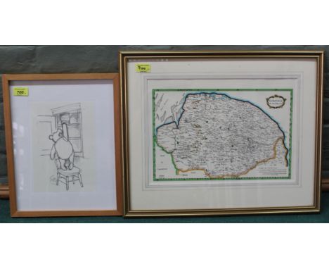


Lot 372
Official Royal Air Force Scampton Information Handbook Signed by Artist Paul Rolhard And One Other? Includes a map attached. 79 pages. Paperback. Good condition. All autographs come with a Certificate of Authenticity. We combine postage on multiple winning lots and can ship worldwide. UK postage from £5.99, EU from £7.99, Rest of World from £9.99
Lot 100
A large contemporary formed fiberglass model / wall art of a Hammerhead Shark fully graffitied by members of Icon Film Studios. Graffitied in pen and ink featuring various sea creatures, classic sailor lady tattoo, lighthouses, map of the world, skull etc. Painted features to the shark with iron wall mounting bracket to the verso. Measures approx; 80cm x 225cm x 60cm. COLLECTION; Anyone wishing to collect this item in-person, please note this lot is located offsite and collection will be required from a 'BA' (Bath) postcode, by appointment only. Exact location given after payment received. For anyone else, our usual courier service is available as usual, please find details on the shipping tab .
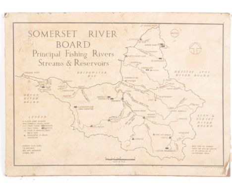
Lot 184
Somerset River Board Survey - A vintage mid 20th Century Ordnance Survey map for the Somerset River Board Principal Fishing Rivers, Streams & Reservoirs. Mounted upon a hardboard back. Measures approx; 34cm x 46cm. COLLECTION; Anyone wishing to collect this item in-person, please note this lot is located offsite and collection will be required from a 'BA' (Bath) postcode, by appointment only. Exact location given after payment received. For anyone else, our usual courier service is available as usual, please find details on the shipping tab .


Lot 113
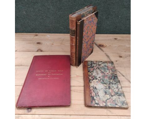
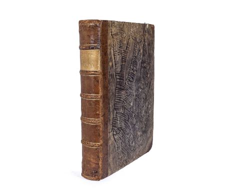
BAILEY J & CULLEY G. General View of the Agriculture of the County of Cumberland. Large paper. Rebound half calf, half title relaid & reps. & relaying to some other leaves (concludes at p51). 1794; also Andrew Pringle, General View of the Agriculture of the County of Westmoreland, orig. wrappers, worn cond., Edinburgh, 1794 (but should be 1796?); & William Dickinson, Essay on the Agriculture of East Cumberland, col. map & fldg. plate, orig. wrappers, Carlisle, 1853. (3).


Lot 152
FULLER JOHN. The History of Berwick Upon Tweed. Fldg. eng. plan & eng. plates. Rebound half calf. Edinburgh, 1799; also Marchmont & the Humes of Polwarth, col. frontis, eng. plates & illus., quarto, orig. green cloth, 1894. (2).Condition report:Seven plates excluding folding map. (No plate list).

Lot 167
MURRAY HON. MRS. of Kensington. A Companion & Useful Guide to the Beauties of Scotland, to the Lakes ... & to the Curiosities in the District of Craven. 2 vols. Diced calf, bdg. of vol. 2 defective. 1799 & 1803; also A Tour in 1787 from London to the Western Highlands of Scotland including Excursions to the Lakes, fldg. map hand col. in outline, 12mo, rebound qtr. calf, n.d. but late 1780's & 1 other vol. (4).

Lot 172
SLATER ISAAC. Slater's (late Pigot & Co.) Directory of the Counties of Cumberland, Durham, Northumberland, Westmoreland & the Cleveland District. 4 fldg. col. maps. Thick quarto, Orig. blue cloth gilt. 1877.Maps of Cumberland, Durham, Northumberland and Westmoreland only. No map of Cleveland.


Lot 216
PROCTOR RICHARD ANTHONY. The Moon, Her Motions, Aspect, Scenery & Physical Condition. Albumen-print original photograph frontis by L. M. Rutherfurd & 22 plates numbered I to XVI followed by an albumen print, a fldg. lunar map & another albumen print (representing plate XVII-IXX?) followed by a text illustration & plates numbered XX to XXII. Orig. red cloth, some rubbing & wear, tending loose internally. 1873. The collation of this work appears to vary & this is sold as described above. The three albumen-prints are by Lewis Morris Rutherfurd (1816-1892).


Lot 797
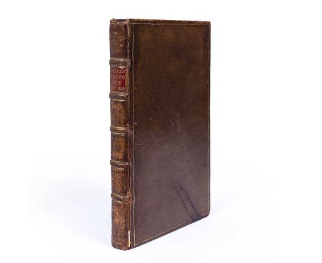
Mises, Ludwig von (1881-1973). Human Action. A treatise on Economics. 1st Ed. William Hodge, London 1949. Green cloth with d/w. plus Lagerlof, Selma. 'Gosta Berlings Saga'. Copenhagen 1936. Half calf, marbled boards plus Powell, F York. Trans. The Tale of the Thrond of Gate. David Nutt, London 1896 with folding map. Card boards with losses plus an eclectic collection of six titles (9)
Lot 468
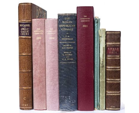
Ducarel, Andrew Coltée. English Antiquarian (1713-1785). A Series of above two hundred Anglo-Gallic or Norman or Aquitain Coins...'. With portrait frontispiece after A Soldi, London 1758 with folding map and multiple plates. 4to. with ACD bookplate (loose). Rebound with marbled boards, red title plus Martin-Leake, Stephen. 'An Historical Account of English Money...'. 2nd Ed. Meadows, London 1745. 8vo. Full calf re-backed. plus seven associated titles/catalogues etc (9)
Lot 472
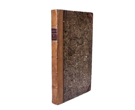
Ogilby, John, Translator, Nieuhoff, Jan (1640-1672) ‘An Embassy from the East India Company of the United Provinces to the Grand Tartar Cham, Emperor of China’ 2nd Ed. 1673, Engraved frontispiece and red and black title page. Double page map. 17 engraved full page plates c100 in text, engravings, tears and repairs. Collates well except pp. 428-430 deficient and some mispagination pp. 216/220. Marbled boards. Half calf rebacked (380 x 230mm) Selbourne b/p
Lot 481
Raynal, Guillume Thomas Francois (1713-1796) 'Atlas de Toutes Les Parties Connues du Globe Terrestre...' fifty engraved maps by Rigobert Bonne (1727-1794) 18th century French cartographer, including a folding world map, plus text and index of maps, plus tables. Half calf with marbled boards and decorative end papers. Some tears, stains and mis-folding, edges bumped (254 x 200mm)
Lot 577
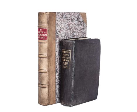
Roscoe, Thomas. History and Description of the London and Birmingham Railway. Charles Tilt, London, Wrightson and Webb, Birmingham 1839. 1st Ed(?). Eighteen plates and folding map. Rebound marbled boards, half calf. 4to. (230 x 145mm) plus Osborne's Guide to the Grand Junction. Birmingham, Liverpool and Manchester, 1838 with folding map. Original cloth (160 x 100mm) both with de Spon b/ps. Used condition (2)
Lot 582
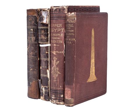
Belzoni, Giovanni Baptista (1778-1823). Narrative of the Operations and Recent Discoveries with the Pyramids, Temples, Tombs and Excavations in Egypt and Nubia. 3rd Ed. 2 vols. John Murray, London 1822 with portrait frontispiece, preface to 3rd/2nd Ed. Folding Map of the Course of the Nile reduced from Col. Leakes Map of Egypt, Vol I. and folding Plan of the Temple of Jerusalem in Vol II. 8vo. Full calf with splits/losses etc., plus Wilson, Erasmus. 'Cleopatra's Needle'. Brain & Co, London 1877. Gilt decorative red cloth. 8vo. Ex lib with stamps plus Klunzinger, C.B. 'Upper Egypt It's People and It's Products'. Blackie, London 1878. Red cloth. 8vo. In used condition with splits. All with de Spon b/ps (4)
Lot 604
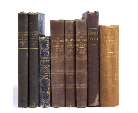
A group of 19th century titles including 'The Antiquarian and Topographical Cabinet...Great Britain'. 2 vols. Murray et al, London 1817. Numerous engravings plus 'A Physician's Holiday or a month in Switzerland' with folding map. Orr & Co, London 1852 plus 'The Heimskringla' or 'The Sea Kings of Norway' by Samuel Laing. Longman, London 1844. 3 vols. plus Dickens, Charles. 'Little Dorrit'. Chapman and Hall, London n/d c1890 plus one further title. All in used condition (8)
Lot 606
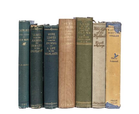
Dixon, John H. Gairloch in North West Rosshire...with a guide to Gairloch and Loch Maree. With many illustrations and folding map. Cooperative Printing Co. Edinburgh 1886. 8vo. Blue cloth, edges bumped etc. plus Queen Victoria 'Leaves from the Journal of our Lives in the Highlands'. Smith Elder 1868. Contemporary owners signature plus 'More Leaves...' Smith Elder 1884. Owners signatures, green cloth. 8vo. plus four titles relating to fishing and shooting in the Highlands of Scotland (7)
Lot 660
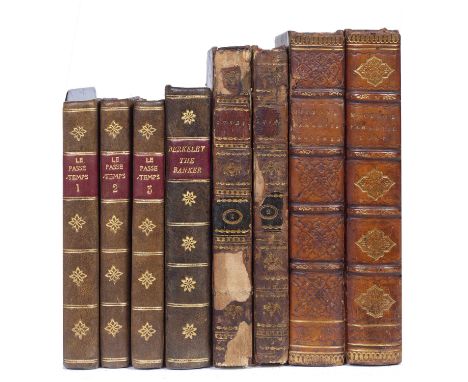
Bertin, T.P. Trans. Le Passe-Temps De L'Enfance. Paris 1810. 3 vols. Small format. Half calf plus Mickle, William Julius. The Lusiad or the Discovery of India. Vols. I/II only of three. Harding, London 1807 with folding map and plates, full calf (loose) plus Milton, John. 'Paradise Lost and Paradise Regained'. John Sharpe, London 1816. Half calf plus one other small format title (8)
-
109198 item(s)/page