We found 109198 price guide item(s) matching your search

Refine your search

Year

Filter by Price Range
  • List
  • Grid
  • 109198 item(s)
    /page

Lot 758

An Antique Hand Coloured Map ""Iauva Insula"" in later frame 39cm x 45cm

Lot 782

A Continental Coloured Map ""Territorio Padovano"" in gilt frame, 40.5cm x 51cm

Lot 783

Robert Morden Black and White Map ""Norfolk"" in gilt frame, 38cm x 45.5cm

Lot 784

A Continental Hand Coloured Map of Huntington Northamptonshire etc in Hogarth frame, 44cm x 55cm

Lot 785

John Morden Hand Coloured Map ""The Earls of Essex"" in Hogarth frame, 41.5cm x 54cm

Lot 722A

Boxed Folio Society Hereford World Map `Hereford Mappa Mundi Trust` limited edition no 362 together with a Limited Edition Pharoh Plaque

Lot 167

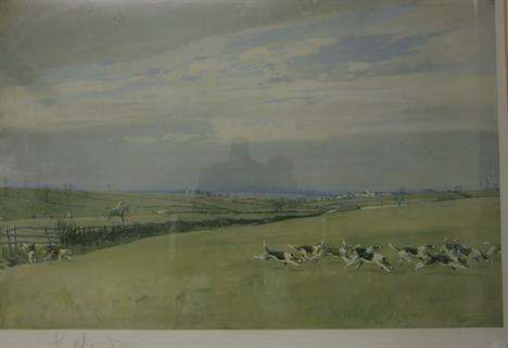
Signed Print of the Beaufort Hunt by Badminton House with blindstamp together with a Map of the Duke of Beaufort Hunt Country with a List of meets

Lot 1106

A hand painted on paper 'The new map of Worcestershire divided into hundreds'' exhibiting it's roads, rivers, parks, etc. By John Cary engraver, 1801.

Lot 1118

A framed Map of Cardiganshire and a framed Map of Montgomeryshire

Lot 1128

A John Speede Map of ''Denbighshire'', AD 1610, the reverse having alphabetical table of all the towns. Some creases and restoration. 20 3/4'' x 16 1/4''. Glazed front and back

Lot 1129

An uncoloured John Speede Map of Cambridgeshire AD 1610. 20 1/2'' x 15 1/2''. Glazed both sides.

Lot 1130

A coloured John Speede Map of ''Wilshire'', showing an image of Stonehenge, AD 1627. 20 3/4'' x 15 1/2''. Glazed on both sides.

Lot 1131

A coloured John Speede Map of Caernarvon, AD 1610. 20 3/4'' x 16 1/4''. Glazed both sides.

Lot 1134

A John Speede ''Map of Breknoke'' both shyre and Towne described AD 1610. The reverse having alphabetical table of all the Townes. In Hogarth frame glazed front and back. 21 1/4'' x 16''

Lot 1188

An early Map of Montgomeryshire

Lot 1273

An excellent early map of North India including present day Pakistan, gulf of Bengal etc.: Magni Mogolis Imperium by Jan Jansson, Amsterdam, c. 1640. In very good condition, framed and glazed. Old hand colour.

Lot 1274

Jan Jansson, an early map of Meironeth and Montgomery, c. 1645, framed and glazed, text verso. Some foxing, central crease with small split. Early hand colour.

Lot 490

Joseph Lucas Limited - A 1930s table globe lamp with a glass sphere decorated with a printed map of the world, mounted to a chrome plated ring and domed black base, height 37cm. S/D.

Lot 1106

A hand painted on paper 'The new map of Worcestershire divided into hundreds'' exhibiting it's roads, rivers, parks, etc. By John Cary engraver, 1801.

Lot 1118

A framed Map of Cardiganshire and a framed Map of Montgomeryshire

Lot 1128

A John Speede Map of ''Denbighshire'', AD 1610, the reverse having alphabetical table of all the towns. Some creases and restoration. 20 3/4'' x 16 1/4''. Glazed front and back

Lot 1129

An uncoloured John Speede Map of Cambridgeshire AD 1610. 20 1/2'' x 15 1/2''. Glazed both sides.

Lot 1130

A coloured John Speede Map of ''Wilshire'', showing an image of Stonehenge, AD 1627. 20 3/4'' x 15 1/2''. Glazed on both sides.

Lot 1131

A coloured John Speede Map of Caernarvon, AD 1610. 20 3/4'' x 16 1/4''. Glazed both sides.

Lot 1134

A John Speede ''Map of Breknoke'' both shyre and Towne described AD 1610. The reverse having alphabetical table of all the Townes. In Hogarth frame glazed front and back. 21 1/4'' x 16''

Lot 1188

An early Map of Montgomeryshire

Lot 1273

An excellent early map of North India including present day Pakistan, gulf of Bengal etc.: Magni Mogolis Imperium by Jan Jansson, Amsterdam, c. 1640. In very good condition, framed and glazed. Old hand colour.

Lot 1274

Jan Jansson, an early map of Meironeth and Montgomery, c. 1645, framed and glazed, text verso. Some foxing, central crease with small split. Early hand colour.

Lot 1409

Orbis Terrarum Typus De Integro Multis In Locis Emendatus auctore Petro Plancio A reproduction of this 1607 Twin-Hemispherical World Map by Pieter Van Den Keere - Framed & Mounted.

Lot 1622

Antique map The Countie and Citie of Lyncolne

Lot 184

A Mrs Punch brass doorstop, 29.5 cm high, a brass warming pan, a John Senex map of Scotland, and a silver plated canteen of cutlery (qty)

Lot 210

A 3D Map of Southern Railway, Showing Connections with the Channel Islands and Continent (repaired), 92 x 250 cm, framed

Lot 350

A John Ogilby map, The Road from London to Portsmouth, and another, From London to St Davids (2) Condition report Report by NG Portsmouth: central fold. Paper ripples as though not stuck down. Some heavy creases in paper. Some heavy scratches to paper's surface. A couple of small brown marks in image. St Davids: central fold, a couple of heavy creases in paper. Again paper ripples as though not stuck down. Several heavy scratches to surface. Paper grubby and discoloured. A couple of dark spots also.

Lot 351

A Lionel Edwards artist's proof hunting print, another Lionel Edwards print, and a Morden tinted map of Dorsetshire (3)

Lot 379

A hand coloured map of Cyprus Condition report Report by RB Not a modern re-production, the central crease indicates previously in a book, the tinting probably of a later date, in a frame which is probably 30 to 40 years old. It is impossible to tell whether it has been stuck down but if I was to advise then I suspect that this is not the case. Generally good condition, the paper verging more towards a light brown/grey than being crisp white. No real signs of foxing/staining, 36.5 x 49.5 cm. Yes, the engraving has hand colouring (watercolour)

Lot 424

A Robert Morden map of South Wales, with hand colouring, other maps and prints (10)

Lot 1041

A Ford dealer desk calendar, an Alexander Chater Limited 1934 catalogue and a Duckham`s map of historical London.

Lot 654

An Associated Motorways Booking Office part pictorial enamel sign with some restorations including two patches to the map, lower left corner etc. 17 x 34 1/2".

Lot 658

A Pratts High Test Petrol `Tit-Bits` road map of England, Wales and Scotland, 23 x 32 1/2".

Lot 706

A Pratts Hi-Test Map of The Great North Road, framed and glazed, 17 x 38".

Lot 966

A pair of vintage dashboard map reading lamps of cylindrical form.

Lot 201

2 vintage ticket counters and a map measurer

Lot 1625

A Mughal painting on salt stone, framed, another painted copy of Radha and a portfolio of Mughal prints and a 19th Century map of India (4) (British India) drawn and engraved by J. Rapkin

Lot 2000A

A 1562 edition (possibly 18th C printing) of Russia (by Henrico Syduea Wallie) and surrounds together with a map of the Med, Arabia, Arab desert etc Both in Hogarth Frames

Lot 2002

John Cary Map of Cheshire published by John Stockdale , dated 26th March 1805, engraved by Cary, some hand colour, map size 51.5cm x 39cm, frame size 61cm x 48.8cm

Lot 2011

An Ireland, the 'Kingdom of Ireland' John Speede (1552-1629), divided into several provinces and the again divided into counties newly described, reproduction of a hand coloured original antiquarian map by John Speede, circa 1610

Lot 2035

A late 19th Century map of South Wales by J and C Walker, hand coloured, framed and glazed, map size 610x390mm, frame size 760x550mm. details of Parliamentary Boroughs shown. Borders hand coloured

Lot 2067

A large 1950s Phillips commercial map of England, Wales and Southern Scotland, 1958, 5ft by 6ft approx

Lot 2080

Five prints including a John Rocque map of Cumberland, published 1746 and later, map size 20cm x 15.5cm (5)

Lot 2113

I.T.S, The Lower Lake of Killarney from Rough Island and "The Lower Lake of Killarnery" a pair of watercolours, signed with initials and inscribed under mount, 9.5 cm x 22 cm approx together with D D Nowalke, village street scene, titled Verso Stanton in the Peak , Derbyshire, a watercolour signed lower right and hand tinted map of Derbyshire (4)

Lot 3295A

Railway Clearing House official railway map of England 1918

Lot 3298

Railway Clearing House official railway map of Scotland 1902

Loading...Loading...
  • 109198 item(s)
    /page

Recently Viewed Lots