We found 109182 price guide item(s) matching your search
There are 109182 lots that match your search criteria. Subscribe now to get instant access to the full price guide service.
Click here to subscribe- List
- Grid
-
109182 item(s)/page


![London.- Kelly & Co., publishers. [Directories of London], 14 vol., comprising: Kensington and Paddington, [2 issues], 18](https://cdn.globalauctionplatform.com/930746d6-967c-4255-8b85-a9ff00c2f777/890f637c-4ca0-4ad0-ac55-a9ff00c825a2/468x382.jpg)
Lot 170
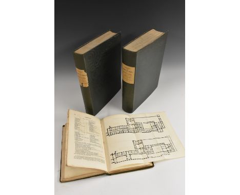
London.- Kelly & Co., publishers. [Directories of London], 14 vol., comprising: Kensington and Paddington, [2 issues], 1891 & 1896; Ealing, 1891; Wimbledon, 1891; Barnet, 1891-2; Blackheath, 1892, Croydon, 1892; Brixton, 1892-3; Camden Town, [2 issues], 1894-5 & 1896; Stratford, 1894-5; Kilburn, 1895; Kingston, Norbiton & Surbiton, contemporary cloth, 1898; Paddington & Bayswater, original printed wrappers, 1929, all with large folding map, advertisements, ex-library copies with stamps, all but the last original cloth, rubbed, spines a little brittle with one or two chipped or torn, 8vo; sold not subject to return (14)

Lot 163
France.- Taillard (C.) Les Jeunes Voyageurs en France, 6 vol., second edition, engraved frontispiece, 12 plates, and 88 maps hand-coloured in outline including folding map of France, occasional foxing, contemporary mottled calf, spines gilt with red morocco labels, 8vo, Paris, E.Ledoux, 1824.

Lot 169
Venice.- Venezia e le sue Lagune, 4 parts in 3 vol., limited edition, 16 lithographed views, 4 plates of coins, large folding lithographed map, 1 (of 2) folding lithographed plans, some spiotting or foxing to views, original printed boards, corners worn, chipped and rubbed, 4to, Venice, 1847.

Lot 160
Australia.- A group of 12 acts relating to Australia, including An Act to empower His Majesty to erect South Australia into a British Province or Provinces, and to provide for the Colonization and Government thereof (15th August 1834), wood-engraved arms, disbound, 1834, also, Tasmanian railways, agriculture, and Van Diemen's land; and a 1910 map of the Queensland gold fields, folio (13)
Lot 183
Lisle (Edward) Observations in Husbandry, first edition, woodcut illustration, faint even browning, a very little soiling, contents separating, [Fussell pp.94-95], Dublin, for G.Faulkner, 1757 § Marshall (William) The Rural Economy of the Midland Counties..., 2 vol., second edition, half-titles, folding map, vol.II 2ff. publisher's catalogue, ?lacking plate, vol.I newspaper clipping pasted to front free endpaper, browning and offsetting, for G.Nicol & others, 1796, ink stamps of the Lawes Agricultural Trust, second also stamps of the Birmingham Free Library, hinges splitting, contemporary calf, worn, first loss at spine ends, second crudely rebacked; and 2 vol. of Dossie's Memoirs of Agriculture, 8vo (5)

Lot 7
Good (John Mason) Pantologia. A new Cyclopedia, 12 vol., c.360 engraved plates, of which c.180 hand-coloured (mostly natural history subjects), engraved double-page map, offsetting, occasional spotting or staining, contemporary tree calf, joints splitting, but holding, spine ends and corners worn, rubbed,1813; and 7 others, Encyclopaedias or Dictionaries, 8vo & folio (19)

Lot 14
NO RESERVE Malta.- Geology.- Adams (Andrew Leith) Notes of a Naturalist in the Nile Valley and Malta: A Narrative of Exploration and Research in Connection with the Natural History, Geology, and Archaeology of the Lower Nile and Maltese Islands, half-title, colour geological map, 14 wood-engraved plates, wood-engraved illustrations, a little spotting, original cloth, label removed from upper cover, faded, rebacked in modern green calf, gilt, 8vo, Edinburgh, Edmonston and Douglas, 1870.

Lot 136
Gill (Eric).- Propsectus for Capel-Y-Ffin School Llanthony. Boarding School for Girls, single sheet, folded, title vignette by Gill, map, 8vo, 1937⁂ A scarce survival. The school was founded by Gill in 1935 and was situated in the Black Mountains near Abergavenny. The curriculum included Gardening, dairy work, cooking and handwriting and drawing which are "specially cultivated in connection with history and geography". Fees were £20 a term.
Lot 4
Dictionaries.- Antiquities.- Danet (Guillaume) A Complete Dictionary of the Greek and Roman Antiquities, first English edition, approbation f. at beginning, 3 folding engraved maps, advertisement f. at end, 1 map trimmed to border and laid down, occasional spotting, a few small stains, contemporary calf, rebacked, rubbed, [Wing D171], for John Nicholson, 1700 § Chambers (E.) Cyclopaedia: or, an Universal Dictionary of Arts and Sciences, 2 vol., second edition, titles in red and black, engraved plates, contemporary calf, worn, but holding firm, for D. Midwinter [and others], 1734; and 4 others, Dictionaries of arts, sciences or religions, most with engraved plates, v.s. (7)
Lot 167
Japan.- Morse (Edward S. ) Japanese Homes and Their Surroundings, first edition, illustrations, attractive modern half calf, spine gilt, Boston, 1886 § Ayrton (M. Chaplin) Child-Life in Japan, plates and illustrations, original pictorial cloth, gilt, splitting to upper joint, light wear to spine ends and corners, 1879 § Fortune (Robert) Yedo and Peking. A Narrative of a Journey to the Capitals of Japan and China, first edition, half-title, wood-engraved folding frontispiece, 8 plates, and illustrations, folding map at end, frontispiece a little browned and creased at folds, modern bookplate of Cliff Parfit and with ink ownership stamp on half-title and final leaf, modern black morocco, by Coleman, t.e.g., 1863, 4to & 8vo (3)

Lot 117
Presented to William Wordsworth.- Wilson (James) A Voyage round the coasts of Scotland and the Isles, vol 1. only (of 2.), signed presentation copy from the author to William Wordsworth, engraved frontispiece, folding map and plates, spotted, contemporary half calf, gilt spine in compartments and with double leather leather labels, corners worn, rubbed, 8vo, Edinburgh, 1842.⁂ The inscription reads 'To William Wordsworth, with sincere & grateful regar[ds] (final 2 letters rimmed), James Wilson'.


![[TOPOGRAPHY]. DEVON A catalogue for the sale by auction of The Major Portion of the Freehold, Agricultural, Residential and](https://cdn.globalauctionplatform.com/1f542b74-f338-45af-8db8-aa000161eb1c/5c846d21-6921-467d-85a0-aa0300e7c72c/468x382.jpg)
Lot 400
[TOPOGRAPHY]. DEVON A catalogue for the sale by auction of The Major Portion of the Freehold, Agricultural, Residential and Sporting Clinton Estate, held at Great Tottington, 1958, by Strutt & Parker, Lofts & Warner, stiff paper covers, map frontispiece, illustrations from photographs, 250 pages, 37.5cm x 25cm (covers detached and lacking most of spine strip).


Lot 452
BIRKIN, Lieut.Col. R.L - History of the 3rd Regiment Imperial Yeomanry, 28-1-00 to 6-8-02 : illust, maps, cloth a little worn, oblong folio, (possibly lacking a frontispiece folding map before the title-page),1905. With - Thompson, Colonel C.W, Seventh (Princess Royal's) Dragoon Guards : illust, maps, org. half morocco, 4to, 1913.(2)


![SPEED, John - Sussex Described : hand coloured map, 500 x 385 mm, George Humble, [English text], f & g, c1610 (or later).](https://cdn.globalauctionplatform.com/38798e61-9ed1-4fe6-9839-a9e8015d730a/74e4de69-bc2f-4100-8631-a9ec00fbc27a/468x382.jpg)

Lot 518
MARTIN, George A - The ' Undercliff ' of the Isle of Wight; its Climate, History, and Natural Productions : folding panoramic lithograph, half calf, 8vo, author's presentation copy, 1859. With - Pledge, F. W, Crawley : Glimpses into the Past of a Hampshire Parish : frontis, half calf, 8vo, privately printed, 1907. With - Brayley, E.W & Britton, John, A Topographical and Historical Description of the County of Hampshire : folding map, vignette title, 15 plates, full calf, 8vo, 1805.*Note attractive binding. With 2 others on Hampshire(5)
![CAMDEN'S Britannia : [Gibson edition], 44 folding county maps, 6 other maps, 9 plates of coins, calf worn, folio, short tears](https://cdn.globalauctionplatform.com/38798e61-9ed1-4fe6-9839-a9e8015d730a/57b530b5-689f-4699-a6ab-a9ec00fb7634/468x382.jpg)


Lot 308
BINDINGS : Smolletts History of England - eleven volumes and four continuation, cont. calf lacking a few labels, possibly lacking a portrait frontispiece, or map, 8vo, 1758. With six other bindings.(21)Now also includes a framed map of England and Wales by T Kitchen, uncoloured, 490 x 380mm, f & g, laid down, Circa 1750


Lot 470
NEVILLE, Captain J.E.H - History of the 43rd and 52nd (Oxfordshire and Buckinghamshire) Light Infantry in the Great War, 1914-1919 : Vol. 1 [all published]. illust, maps, org. cloth, 4to, 1938. With - The Northamptonshire Regiment, 1914-1918 : map in rear pocket, org. cloth, 8vo, no date.(2)


![Local Interest - Sterndale (Mary), Vignettes of Derbyshire, Printed for G. and W.B. Whittaker, London 1824, pp: vii, [i], 135](https://cdn.globalauctionplatform.com/6b29b9c9-e055-458d-9837-aa01011b2b26/14535a2e-25cc-499d-af8c-aa02009076f6/468x382.jpg)
Lot 3605
Local Interest - Sterndale (Mary), Vignettes of Derbyshire, Printed for G. and W.B. Whittaker, London 1824, pp: vii, [i], 135, [i]. contemporary publisher's boards, small 8vo; A Topographical and Statistical Description of the County of Derby [...], A Particular Description of The Wonders of the Peak [...] Travelling Guide [...] County Itinerary, Also, A List of Fairs [...] Illustrated by a Map of the County, Printed for C. Cooke, London [n.d., 1830], pp: 143, [i], engraved fold-out county map, 20th century green buckram, printed paper title label to spine, 16mo; Provincial Imprint, Glover (Stephen), The History and Directory of the Borough of Derby, Intended as a Guide to Stangers Visiting the Town, Printed [...] by Henry Mozley and Sons, Derby 1843, pp: [iv], 168, adverts [18], illustrated with wood engraved named-view vignettes throughout, contemporary publisher's board, upper-cover with printed title label, 20th century calf spine with gilt lettered title label, 8vo, [3]
![History - Local Interest, Memoirs of the Life of Colonel Hutchinson, Governor of Nottingham Castle and Town [...], third edit](https://cdn.globalauctionplatform.com/6b29b9c9-e055-458d-9837-aa01011b2b26/e70ca374-0df3-4f43-a5db-aa0200909a84/468x382.jpg)
Lot 3656
History - Local Interest, Memoirs of the Life of Colonel Hutchinson, Governor of Nottingham Castle and Town [...], third edition, two-volume set, Printed for Longman, Hurst, Rees, and Orme, London 1810, stipple-engraved portrait frontispieces of Colonel John and Mrs Hutchinson, further plates, fold-out map and family pedigree, contemporary quarter-calf and marbled boards (repairs), Pictorial bookplate to volume I endpaper: Ex Libris Peter Denis Anthes, Wells, Dated 1959, 8vo, (2); Nugent (Lord [George Nugent-Grenville, 2nd Baron]), Memorials of John Hampden: His Party and His Times [...], Illustrated with Twelve Portraits Engraved on Steel, fourth edition, Henry G. Bohn, London 1860, 20th century red half-morocco and marbled boards, gilt lettered black leather title label to spine, 12mo; Vaughan (Robert), Memorials of the Stuart Dynasty [...], volume I only, Holdsworth and Ball, London 1831, contemporary publisher's cloth, contemporary book label to pastedown: Mrs Beaufoy, 8vo; [Brydges (Egerton)], Memoirs of the Peers of England, During the Reign of James the Firft (sic), Volume I (of I, no further volumes followed publication), Printed for John White, London 1802, illustrated with two full-page stipple enravings, contemporary panelled calf gilt, marbled edges, marbled endpapers, lady's Plain Armorial bookplate to pastedown: Emilia Mary Bowater [(née Barnes), Lady Bowater, wife of the soldier-courtier General Sir Edward Bowater KCH)], 8vo; The History of John, Duke of Marlborough [...], [presumably London] 1754, engraved portrait frontispiece of the general, 20th century buckram, 16mo; Memoirs of the Court of Charles the Second, by Count Grammont, [...] Edited by Sir Walter Scott [...], Henry G. Bohn, London 1846, contemporary publisher's cloth, 12mo, [7]
Lot 3589
Local Interest - Glover (Stephen): The History and Gazetteer of the County of Derby: Drawn up from Actual Observation and from the Best Authorities; Containing a Variety of Geological, Mineralogical, Commercial and Statistical Information, Illustrated by a Map of the County, and Numerous Copper-Plate and Wood Engravings by the First Artists, edited by Thomas Noble, Esq., two-volume set, Henry Mozley and Son, Derby 1831 - 1833, illustrated with a fold-out map to title page of volume I, further engraved full-page and text illustrations throughout both volumes, conforming contemporary publisher's green cloth, printed paper labels to spines, Plain Armorial bookplates to each pastedown: John Gretton, Stapleford, large paper copies, 4to, (2); Hopton Hall Copy, The Peak Guide, Containing the Topographical, Statistical, and General History of Buxton, Edensor, Castleton, Bakewell, Haddon, Matlock, and Cromford: with an Alphabetical List of Noblemen and Gentlemen's Seats, and Several Road Sketches; Ornamented with a Map, Plans and East View of Chatsworth House, Haddon Hall, Willersley Castle, Bakewell and Matlock Churches, Ancient Monuments and Armorial Bearings, edited by Thomas Noble, Esq., Printed for the Publisher by Henry Mozley and Son, Derby 1830, contemporary publisher's cloth boards, upper cover with printed paper title label, as issued, 20th century buckram spine, contemporary ink manuscript ownership inscription to recto pastedown: Charles Hurt junior, Wirksworth, Derbyshire, April: 5: 1831, 8vo, [3]

Lot 3616
London Topography - Elmes (James, M.R.I.A.), Metropolitan Improvements; or, London, in the Nineteenth Century: Being a Series of Views, of the New and Most Interesting Objects, in the British Metropolis & Its Vicinity: from Original Drawings by Mr. Thos. H. Shepherd, with Historical, Topographical & Critical Illustrations, two-volume set, Jones & Co., London 1827, volume II lacking preliminary pages, full-page engraved plates, contemporary mottled calf boards (volume I upper cover detached), gilt spines, 8vo, (2); Evans (John), Richmond and its Vicinity; with a Glance at Twickenham, Strawberry Hill, and Hampton Court, second edition, Printed for James Darnill, Richmond [c. 1825], three-fold engraved map of environs to title-page, full page architectural and topographical engravings throughout, original boards (upper cover detached, spine split but intact), 16mo; Hughson (David), Walks through London, including Westminster and the Borough of Southwark with the Surrounding Suburbs [...], volume I only, Sherwood, Neely, & Jones, London 1817, fold-out map, engraved plates, contemporary quarter-calf and boards (faults), 16mo; Thornbury (Walter), Old and New London [...] Illustrated with numerous Engravings from the most Authentic Sources [...], six-volume harlequin set, Cassell and Company, Limited, London 1897 onwards, volumes I & II pictorial buckram as issued, volumes III - VI Edwardian quarter-calf and green buckram, 4to, (6); List of Antiquities in the Administrative County of Surrey [...], fourth edition, Surrey County Council, Kingston-upon-Thames 1951, pictorial buckram as issued, 4to; etc, [12]

Lot 3584
Local Interest - Derby, The Derby School Register, 1570 - 1901, edited by B. Tacchella, Bemrose & Sons, Limited, London 1902, full contemporary school prize binding of gilt calf, upper cover with school arms, marbled endpapers and edges, Plain Armorial bookplate to recto pastedown: Derby School arms, 8vo; County Borough of Derby: Celebration of the Eighty-Second Birthday of Alderman Sir Thomas Roe, M.P., Albert Hall, Derby, Saturday, July 12th, 1913; Reunion of Fellow Citizens, red buckram gilt, 8vo; Bemrose (H.H.), The House of Bemrose, 1826 - 1926, The Bemrose Press, Derby 1926, contemporary maroon cloth, 4to; Borough of Derby: Calendar of Ancient Records, Prepared by Mr I.H. Jeayes [...], J.W. Simpson, Derby 1904, contemporary buckram gilt, 8vo; The Alfred E. Goodey Collection of Old Derby Pictures, Given to His Fellow Townsmen, April 24th, 1936, County Borough of Derby Museum & Art Gallery, contemporary printed card boards, signed and dated 1936 in ink MS by Goodey, 8vo; Unsworth (W. Leslie), Seventy-five Years' Co-operation: A Historical Outline of the Birth, Growth and Development of The Derby Co-operative Provident Society Ltd., 1850 - 1925, Co-operative Wholesale Society, Manchester 1927, contemporary red buckram gilt, 12mo; The See of Derby: Being a Souvenir of its Foundation, edited by Canon A.W.F. Blunt, Issued by Authority of the Diocese Committee, [Printed by] Bemrose and Sons Ltd, Derby [n.d., 1927], blue buckram, gilt with the arms of the episcopal see, small 4to, (2); Davison (A.W.) Derby: Its Rise and Progress, signed by the author, Bemrose & Sons Ltd., London 1906, fold-out map, contemporary green buckram gilt, 12mo; Payne (Charles James), Derby Churches Old and New, and Derby's Golgotha, Illustrated, limited edition of 250, Frank Murray, Derby 1893, relaid contemporary buckram, 12mo; etc, [9]
Lot 3593
Local Interest - Matlock: Hopton Hall Copy, Bryan (Benjamin), Matlock: Manor and Parish, Historical & Descriptive, with Pedigrees and Arms, and Map of the Parish Reduced from the Ordnance Survey, Bemrose & Sons, Limited, London 1903, contemporary green buckram, Golden Age Armorial bookplate: Edith Lyttelton Gell, bookseller's ticket: Frank Murray, Derby, 12mo; Views of Matlock & Derbyshire, Published by Rock & Co., London 1860, comprising 50 steel-engraved topographical named-views, contemporary blue buckram, oblong 8vo; Thirty Six Views of Matlock and Neighbourhood, Newman & Co., London [n.d., c. 1869], contemporary green buckram gilt, oblong 12mo; Steer (Henry), The Smedleys of Matlock Bath: Being A Review of the Religious and Philanthropic Labours of Mr. and Mrs. John Smedley, Elliot Stock, London 1897, contemporary teal buckram, 12mo; Smedley (Alfred), Some Reminiscences [...] A Series of Experimental Seances Demonstrating [...] Spirits can Appear in the Physical Form [...], Office of "Light", London 1900, contemporary red buckram gilt, 12mo; Fitton (R.S.) & Wadsworth (A.P.), The Strutts and the Arkwrights, 1758 - 1830: A Study of the Early Factory System, Manchester University Press, 1958, red buckram, 8vo; Lugard (C.E.), The Saints and Sinners and The Inns and Outs of Ashover, limited edition, numbered 418/500, [Privately Printed], Ashover 1928, printed card covers, loosely inserted pamphlet and ephemera, 8vo; Parish of Ashover Weddings, 1642 - 1780, [Privately Printed by CEL, 1924 - 1925], loose leaves over two binders, 8vo, (2); another loose singular volume, Ashover Weddings, 1624 - 1724, volume I only, printed card covers, 8vo, [10]


Lot 3506
A New Map of the Country Twenty Miles Round (sic) London, Printed for Carington Bowles in St. Paul's Church Yard, London [n.d., c. 1780], copperplate engraving with hand-coloured delineations, laid on canvas, sixteen-fold, 55cm x 57cm, contemporary marbled paper sleave applied with contemporary publisher's label, 15.5cm x 15cm (folded, cased)
Lot 3516
Wales - Major-General Thomas Frederick Colby FRS FRSE FGS FRGS (1784 - 1852), by and after, a set of six Ordnance Survey maps: South Wales, Nos. 37 - 42, Published at the Tower of London [for] the Ordnance Map Office, Sold by James Gardner [...] Regent Street, London 1830 - 1832, each 40-fold map engraved and laid on canvas, tacked green watered silk borders, marbled covers, ink MS numbered tags, 67cm x 96cm overall, contemporary calf and marbled slipcase and cover, 27.5cm high, 8cm wide overall
![Robert Morden (c. 1650 - 1703), by and after, two-page map, Darbyshire (sic, Derbyshire), [Published and] Sold by Abel Swale,](https://cdn.globalauctionplatform.com/6b29b9c9-e055-458d-9837-aa01011b2b26/d009a8f0-5f61-4000-8a1d-aa0200903ab4/468x382.jpg)
Lot 3596
Local Interest - Miller Mundy of Shipley Hall Presentation Copy, Trueman (Edwin) & Marston (R. Westland), History of Ilkeston, together with Dale Abbey, Kirk Hallam, West Hallam, Shipley, and Cossall, Printed and Published by the Pioneer Printing Company, Limited, Ilkeston 1899, fold-out map and full-page plates, contemporary panelled calf gilt, well relaid contemporary spine, ilt edge, marbled endpapers, presentation inscription in ink MS: To Marie Phipps from G.M.M. 1899 [Phipps (née Miller Mundy), wife of Edmund Phipps, Secretary to the Embassy at Vienna, from Godfrey Miller Mundy], small crown folio; earlier 1880 edition in duodecimo, contemporary cloth, relaid, ownership calling card to recto endpaper: The Revd. R. Fosket,, The Vicarage, Ilkeston, Pictorial Seal bookplate to pastedown: Ex Libris Robert William Morell, 12mo; Ilkeston Sammelband, Foskett (The Rev. Canon R.), three pamphlets, bound with three further works, c. 1950, contemporary buckram, 8vo; Fox (Rev. Samuel), The History and Antiquities of the Parish Church of St. Matthew, Morley [...], with Seventeen Illustrations from Original Drawings by George Bailey, edited by Robert Bigsby, Bemrose and Sons, London 1872, contemporary maroon buckram gilt, small folio; Kerry (The Rev Charles): Smalley in the County of Derby: Its History & Legends, Bemrose & Sons Limited, London 1905, loosely inserted letter to the author from John Ward, F.S.A., on Museum and Art Gallery, Cardiff headed notepaper, dated '98; contemporary red cloth as issued, 8vo, & the supplementary volume, History and Antiquities of Smalley in the County of Derby, Chiefly Derived from Original Documents, Bemrose & Sons Limited, London 1907, bound en suite to the latter, 8vo, (2); Severn (Joseph Millott), My Village: Owd (sic) Codnor, Derbyshire and The Village Folk When I Was a Boy, Printed by the Westbourne Press, Hove 1935, contemporary blue buckram gilt, 12mo, [7]
-
109182 item(s)/page