We found 109198 price guide item(s) matching your search
There are 109198 lots that match your search criteria. Subscribe now to get instant access to the full price guide service.
Click here to subscribe- List
- Grid
-
109198 item(s)/page


Lot 692
Pair of Framed and Glazed Hugh Casson Signed Limited Edition Prints ' Football at Harrow ' and ' Harrow School Head Master's House ' both 292/500 together with a Framed and Glazed Print of a Map of Wiltshire, Framed and Glazed Picture of a Pharaoh and a Framed and Glazed Street Scene Watercolour


Lot 385
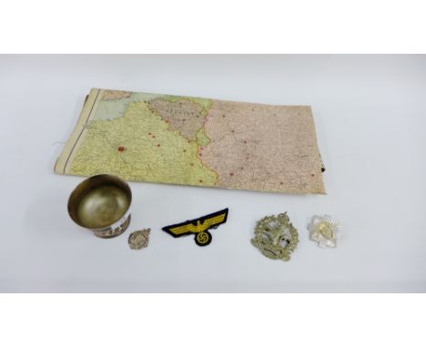
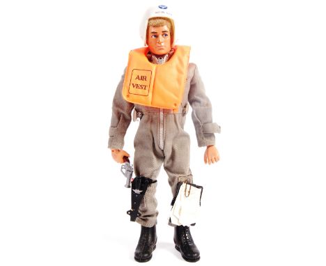
A rare vintage 1970's Palitoy Action Man figure ( with Eagle Eyes ) - wearing an original and complete ' Panzer Captain ' WWII Second World War tank captain's outfit. Complete with hat, binoculars, pistol, holster, map and other accessories. The outfit supplied with it's original card packing and blister. Rare.

Lot 204
Kitchin (T.) An Accurate Map of Cardiganshire and Pembrokeshire, hand-coloured, in sixteen folding sections laid on cloth, in original sleeve case with titles The Antiquarian Itinerary 1815-1818, London, published...by Wm. Clarke et al. VII volumes, leather bound together with various antiquarian and later works (qty)


Lot 1649
GUIDE FOR THE 1902 INTERNATIONAL EXHIBITION OF MODERN DECORATIVE ART, TURIN, thirty-two pace official guide with pull-out map, including 'Scozia' Note: The First International Exhibition of Modern Decorative Art was held in Turin from May to November 1902. The ‘Scottish Section’ was designed by Charles Rennie Mackintosh. In addition, one of the three rooms was dedicated to his and Margaret Macdonald’s work; in one half of the space they created the room setting for the famous ‘The Rose Boudoir’. The Guide fully covers the Exhibition and has a section titled ‘Scozia’ which mentions Rennie Mackintosh and his wife Margaret Macdonald, the head of Glasgow School of Art’s Francis H. (‘Fra’) Newbery, and the Glasgow School artists Herbert McNair, Frances Macdonald and Ann MacBeth, as well as others

Lot 316
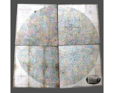
C & J GREENWOOD: 'MAP OF THE COUNTY OF GLOUCESTER' from an actual survey made in the year 1823, handcoloured map with an engraving of Gloucester Cathedral, published 1831, unframed, the sheet 64.5cm x 77.5cm; John Cary (c. 1754-1835) 'A Map of those Parishes in the Counties of Kent and Essex which lie within twelve miles of London, unframed, the sheet 29cm x 22cm; John Owen & Emanuel Bowen; a road map no. 213, part of the journey from Oxford to Cambridge, unframed, 18.5cm x 12.5cm (3)


Lot 305
A SAXTON COUNTY MAP OF WORCESTSHIRE, later coloured, published by 'John Speed' in 1610, 38cm x 51cm to plate mark, glazed with open back in slender wooden frame, together with A 'JOHN SPEED' COUNTY MAP OF HEREFORDSHIRE, 38cm x 51cm, close plain moun ted in black and gold frame, also open backed


Lot 101
GREENVILE COLLINS circa 1693 map of the Bristol Channel - entitled 'The Severn or Channell of Bristoll', coloured and with crest to the Right Honorable Sir Robert Southwell and a pictorial image of vessels, 47 x 59cms Condition reports provided on request by email for this auction otherwise items purchased `as seen`


Lot 2259
A map of the Battle of Waterloo, sold/published by John Booth and T. Egerton, March 18th 1816 and engraved by Sidney Hall. Entitled 'An Historical Map & Plan of the Campaign for Belgium, A.D. 1815, Exhibiting the Cantonments, Encampments, Positions, Bivouacs, Advance, Retrograde Movements, Retreat, Flight &c. of the forces of France, England and Prussia, with the attacks of the 15th Battles of Ligny and Quatre Bras ont eh 16th and the Battle of Waterloo gained over the French by the English and Prussians on Sunday the 18th of June'.


Lot 280
CUP SEMI-FINAL 1948 Official programme, Blackpool v Tottenham, Cup Semi-Final at Villa Park, 13/3/48, together with hand-drawn map showing where to get the "special" trams to Villa Park and two Birmingham tram tickets (presumably to Villa Park and back). Also included is a Western Region Railway flyer from Paddington to Birmingham for the game. Programme has scorers and attendance noted, slight fold whilst the flyer is in good condition. Generally good
Lot 299
JAMES B. A. 'JIMMY': (1915-2008) British Squadron Leader with the Royal Air Force. A Prisoner of War from 1940-45, James made numerous efforts to escape from various POW and Concentration Camps, most famously from Stalag Luft III in March 1944 as part of the 'Great Escape'. A varied collection of manuscript notes, drafts etc., unsigned, by Jimmy James, various places, 1950s onwards. The notes, written on various sheets of paper, within notebooks, on the back of envelopes and other scraps etc., relate to a wide subject matter including Europe (referring to Churchill and Thatcher and stating, in part, 'I have always felt that we have been betrayed by our politicians over Europe. Edward Heath started the rot by asserting that our entry in early 1970 involved trade with no political implications…..we are being flooded with migrants - many, some, probably criminals - living on benefits as a result of EU policy'), lists of individuals to be sent Christmas cards (a number of them marked RAF at the side), details of travelling routes between Ludlow and other places including Duxford and Folkestone, miscellaneous notes regarding Laurens van der Post, compost gardening, Japan, a map showing the directions to James's house in Germany, various German and Russian phrases and vocabulary prepared by James in the 1940s and 1950s (contained in a limp cloth bound folder), a folder containing manuscript notes on the Soviet Union, Russia and Communism, with comments on Eastern European countries, some having been prepared for a talk given to the Rotary Club in Durban, a further folder containing notes regarding potential investments on the stock exchange in the early 1970s etc., and also including a carbon copy typed Guide to Hamburg describing various venues ('mainly for drunks') and cabaret shows ('Recommended for football teams, but not for more polite social occasions') as well as other places of entertainment, museums, galleries etc., explaining that the basis of the notes were from a similar guide prepared by the Royal Air Force. FR to G, Qty
![[JAMES B. A. 'JIMMY']: (1915-2008) British Squadron Leader with the Royal Air Force. A Prisoner of War from 1940-45, James m](https://cdn.globalauctionplatform.com/57e05615-65d4-430a-bbbd-aa3000fe35d7/e5916075-6285-4cc0-83c8-aa3101676a0f/468x382.jpg)
Lot 315
[JAMES B. A. 'JIMMY']: (1915-2008) British Squadron Leader with the Royal Air Force. A Prisoner of War from 1940-45, James made numerous efforts to escape from various POW and Concentration Camps, most famously from Stalag Luft III in March 1944 as part of the 'Great Escape'. A small collection of personal belongings and artifacts etc. previously owned by Jimmy and Madge James including a large original pen and ink caricature of Jimmy James signed by the cartoonist Brian Platt, 25th May 1986 (folded and with some extensive surface creasing) an original pastel and chalk portrait of Madge James signed ('Dowse') by the artist, a small wooden box with floral carvings and an inlaid oval floral design to the top, a roughly cut stone paperweight (?), small leather wallets (2), letter and document folders, an insurance certificate and driving licence holder bearing the coat of arms of Canterbury to the cover, The Book of Common Prayer bearing a presentation inscription to the front free endpaper, 'Bertram A. James from his Mother & Father', 22nd September 1924, several notebooks of various sizes bearing miscellaneous notes in the hands of Jimmy and Madge James including his notes on Christian unity, the remission of sins etc., a small pocket-sized hardback edition of Celtic Prayers of Yesterday and Today with a presentation inscription from Jimmy James to his wife, November 1998, a Swiss made wrist watch with leather strap, paperback edition of The Lazy Man's Way to Riches with several loosely inserted notes in the hand of Jimmy James, a guide book to Prague, a large folded colour map of Hannover in Germany, Army/Air First Edition photolithographed at the War Office, 1943, a small cardboard box annotated by Madge James with her husband's name and the additional words 'Military Cross & other medals', also bearing a partial red wax seal and Jimmy James's initials, the contents now including a small number of Remembrance Day poppies and an envelope annotated by both Jimmy and Madge James individually, 'MC Ribbon', and including two pieces of purple and white vertical striped moire ribbon, presumably those issued with James's original Military Cross awarded in May 1946. FR to G, Sml Qty.


-
109198 item(s)/page