We found 109182 price guide item(s) matching your search
There are 109182 lots that match your search criteria. Subscribe now to get instant access to the full price guide service.
Click here to subscribe- List
- Grid
-
109182 item(s)/page


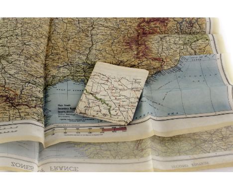
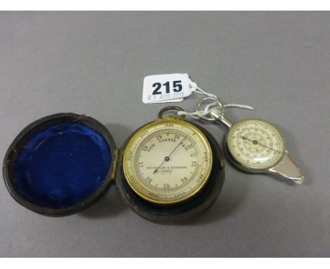
Lot 330
A WWII military silk map of the near east & black sea, together with a 1944 silk map of France and 4 war time HTL ( hold to light) postcards with puzzles, Find the dardenells, Find the Torpedoed German cruiser, What the scots gave the Kaiser/Find the Kaiser and Find the destroyed Zeppelin, fair


Lot 139
A reproduction antique style print on canvas depicting a child catching a magpie. A reproduction print 'The peaceable kingdom of the branch' depicting a nursery rhyme scene of child and animals. An unframed map of the island of Madeira, together with a framed picture of a cottage and picture of a bird.


Lot 1958
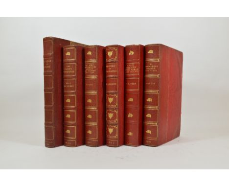
Aldin, Cecil. The Romance of the Road, first edition, coloured plates, illustrations folding map in pocket at end, original cloth, folio, London: Eyre and Spottiswoode, 1928; Edwards, Lionel. My Hunting Sketchbook, coloured plates, original cloth, 4to, London; Eyre and Spottiswoode, 1928; and 5 others similar (7)
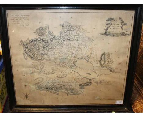
Lot 2036
Ireland, W.H. England's Topographer, or A New and Complete History of the County of Kent, 4 volumes, engraved title, folding engraved map, hand-coloured in outline, torn with slight loss, 122 engraved plates after George Shepherd, H. Gastineau, et al, somewhat browned, contemporary half calf, spines gilt, 8vo, London: George Virtue, 1828
Lot 2054
Britton, John. The Beauties of Wiltshire, displayed in Statistical, Historical and Descriptive Sketches. Illustrated by Views of the Principal Seats &c., with Anecdotes of the Arts, 3 volumes, first edition, 3 engraved titles and 28 engraved plates, with a further 13 plates as duplicate proofs before letters, hand-coloured folding engraved map, some spotting, contemporary calf gilt, joints slightly cracked, head of spine on volume one slightly chipped, 8vo, London: Printed for the Author, 1825
Lot 2058
Davis, Thomas. General View of the Agriculture of Wiltshire, first edition, engraved portrait frontispiece, engraved plate and hand-coloured folding engraved map, 16 page publisher's catalogue at end, title with previous ownership inscription neatly obscured by ink, some browning, late nineteenth century full morocco, tooled gilt with floriate motifs, dentelles gilt, spine faded, top edge gilt, others uncut, 8vo, London: Richard Phillips, 1811
Lot 2059
Davis, Thomas. General View of the Agriculture of Wiltshire, first edition, engraved portrait frontispiece, engraved plate and hand-coloured folding engraved map, 4 pages of advertisements at end, nineteenth century half morocco, all edges gilt, 8vo, London: Richard Phillips, 1811; Flower, Thomas Bruges. The Flora of Wiltshire [offprint], 9 parts in one volume, most inscribed 'From the Author', some spotting, contemporary half morocco gilt, original wrappers bound in, 8vo, [no place, no date] (2)
Lot 2061
Greenwood, Charles. Map of the County of Wilts, from Actual Survey made in the Years 1819 and 1820, engraved map in 48 sections, backed on linen, hand-coloured in full, engraved vignette of Salisbury Cathedral, extending to 1155mm x 1485mm, some slight browning, folded in original calf case, worn, London: C. Greenwood, Dec 12th, 1820
Lot 2082
Waylen, James. Chronicles of the Devizes, [one of 12 copies only on Large Paper], extra-illustrated with engravings, a few annotations by a previous owner, somewhat browned, contemporary half calf, rubbed, 8vo, London: For the Author, 1839; Bowles, Rev. W.L. The Parochial History of Bramhill, in the County of Wilts, first edition, engraved frontispiece and 4 engraved plates, somewhat spotted, nineteenth century half morocco, top edge gilt, others uncut, 8vo, London: John Murray, 1828; Daniell, John J. The History of Warminster, frontispiece, folding map backed onto linen, slight spotting, contemporary half morocco, all edges gilt, 8vo, London: Simpkin, Marshall & Co., 1879 (3)
Lot 2101
Fraser, David. Persia and Turkey in Revolt, first edition, folding map, plates, original publishers cloth gilt, spine faded, 8vo, London: William Blackwood and Sons, 1910; Heber-Percy, Algernon. Moab, Ammon, and Gilead, presentation copy from the author, folding map, plates, original cloth gilt, 8vo, London: Simpkin, Marshall, Hamilton & Co., 1896 (2)
Lot 2102
Hartwig, G. The Polar and Tropical Worlds, 2 volumes bound in one, new edition, engraved portrait frontispiece, illustrations in text, contemporary half calf, rubbed, 8vo, Springfield: C.A. Nichols & Co., 1880; Nansen, Fridtjof. Farthest North, folding map, torn, plates, one coloured, contemporary half morocco, rubbed, 8vo, London: George Newnes, 1898 (3)
Lot 2106
Millais, John Guille. Far Away Up the Nile, first edition, 50 plates, map, some spotting, original cloth, upper cover slightly waterdamaged, 4to, London: Longmans, 1924; Colvile, Colonel Sir Henry. The Land of the Nile Springs, first edition, 2 folding maps, one torn with loss, plates, some spotting, original cloth gilt, 8vo, London: Edward Arnold, 1895; Smith, Haskett. Patrollers of Palestine, first edition, plates, original pictorial cloth, 8vo, London: Edward Arnold, 1906; and 9 others, Middle East (12)

Lot 2108
Nansen, Fridtjof. 'Farthest North' Being the Record of a Voyage of Exploration of the Ship Fram 1893-96 and of a Fifteen Months' Sleigh Journey, first edition in 20 original parts, coloured plate (loose), plates, lacks the map, advertisements, original pictorial wrappers, somewhat chipped, 8vo, London: George Newnes, 1898

Lot 2116
Willyams, Cooper. A Voyage up the Mediterranean in His Majesty's Ship the Swiftsure, one of the Squadron under the Command of Rear-Admiral Sir Horatio Nelson, K.B.... with a Description of the Battle of the Nile on the First of August 1798, first edition, folding aquatint map and 41 aquatint plates, engraved dedication leaf, some soiling, publisher's original boards, worn, lacks spine, several sections loose, 4to, London: J. White, 1802
Lot 2160
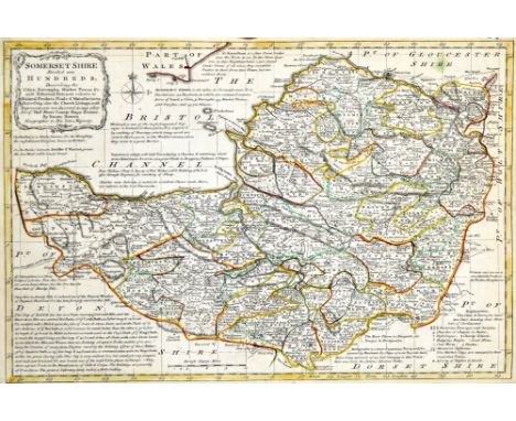
Vancouver, Charles. General View of the Agriculture of the County of Devon, first edition, hand-coloured folding engraved map, torn along folds, 26 engraved plates, some folding 2 hand-coloured, 16 page publisher's catalogue of books at end, contemporary boards, rather worn, lower joint broken, 8vo, London: Richard Phillips, 1808, sold w.a.f.
Lot 2182
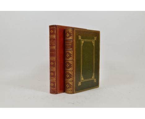
Ball, Richard Francis and Tresham Gilbey. The Essex Foxhounds, with Notes upon Hunting in Essex, first edition, plates, some spotting, 4to, London: Vinton & Co., 1896; Blagg, C.J. A History of the North Staffordshire Hounds and Country 1825 to 1902, first edition, plates, folding map, 8vo, London: Sampson Low, Marston and Company, 1902; Collins, George E. History of the Brocklesby Hounds 1700-1901, plates, folding map, 8vo, London: Sampson Low, Marston and Company, 1902; all bound in near uniform contemporary red half morocco gilt by Bickers and Sons, covers slightly affected by damp, top edges gilt, and 3 others, similar (6)
Lot 2187
Collyns, Charles Palk. Notes on the Chase of the Wild Red Deer in the Counties of Devon and Somerset, first edition, half-title, 18 tinted lithographed plates, illustrations in text, folding engraved map, later red straight-grained morocco by Sotherans, top edge gilt, 8vo, London: Longman, Green et al., 1862; Fortesque, John. Records of Stag-Hunting on Exmoor, first edition, illustrations by Edgar Giberne, folding map, some spotting, later crushed green full morocco gilt by Sotheran, spine faded, top edge gilt, 8vo, London: Chapman and Hall, 1887 (2)


Lot 2226
The Bible containing the Old Testament and the New, Newly Translated out of originall Tongues, Black Letter, B1, Q8, R1, Aa2 and Aa7 torn with substantial loss, without genealogies or map, 8vo, Cambridge: Thomas and John Buck, 1633, [Herbert 474] bound with; Concordance to the Bible of the Last Translation, title defective, waterstained, 8vo, London: Clement Cotton, 1633, contemporary leather boards, brass corner ornaments, one lacking, worn, sold w.a.f.

Lot 2290
Laborde, M. Leon de. Journey through Arabia Petraea, to Mount Sinai, plates, folding map, original publisher's cloth, 8vo, London: John Murray, 1836; Palmer, William. Egyptian Chronicles, 2 volumes, first edition, coloured frontispieces, original publisher's cloth, 8vo, London: Longmans, Green et al., 1861; and one other (4)
Lot 2303
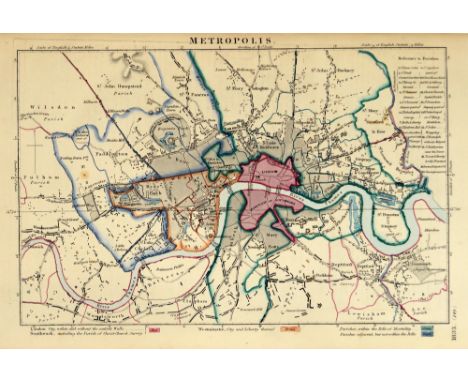
Population Act 1830. Abstract of the Answers and Returns Made Pursuant to an Act, passed in the Eleventh Year of His Majesty King George IV. Intituled, 'An Act for taking an Account of the Population of Great Britain, and the Increase or Diminution thereof.', 3 volumes, first edition, 18 hand-coloured maps, some spotting, original publisher's boards, somewhat worn, folio, [London], 1833; Comparative Account of the Population of Great Britain in the years 1801, 1811, 1821, and 1831, hand-coloured engraved map of London, original publisher's boards, shaken, folio, [London], 1831 (4)
Lot 2393
Bowen, Emanuel and Thomas. Atlas Anglicanus, or, A Complete Sett of Maps of the Counties of South Britain; Divided into Their respective Hundreds, Wapentakes, Wards, Rapes, Lathes, &c., first edition, engraved title, 45 engraved maps, hand-coloured in outline, frontispiece, title and first map with repairs to fore-edge, 5 maps shaved affecting plate number, later half calf, worn, upper cover detached, folio, London: T. Kitchen, [1767]
Lot 2398
Mogg, Edward. Paterson's Roads; being An Entirely Original and Accurate Description of all the Direct and Principal Cross Roads in England and Wales, eighteenth edition, 8 folding engraved maps, lacks general map, contemporary half morocco, 8vo, London: Longmans, et al., [c.1825]; Cary, John. New Itinerary, seventh edition, 7 folding engraved maps, repaired, contemporary half calf, 8vo, London: J. Cary, 1817 (2)
Lot 2402
Read, Lieutenant R.P. The Island & Forts of Saint Helena... dedicated by Permission to Field Marshall His Royal Highness The Duke of Kent and Strathearn, engraved map in 16 sections, hand-coloured and backed onto linen, descriptive text label verso, 590mm x 450mm, London: Burgis and Barefoot, [1815] The exile of Napoleon to Saint Helena in October 1815 created a surge in interest for the island and the enterprising publisher Burgis and Barefoot sought to answer the public demand with this map. Napoleon's lodgings of Longwood Farm are noted, but here as the residence of the Lieut. Governor. There would seem to be no note of the new buildings intended as the Emperor's permanent residence on the island, for which construction began in 1818.


Lot 261
After John Speede, 'The Kingdome of Great Britaine and Ireland', engraved by Hondius, hand coloured map, double glazed, 40 cm x 52 cm. CONDITION REPORT: Appears to be good with reasonable borders, centre crease but otherwise no obvious damage or repairs with the exception of some strengthening tape behind the central seam and along the bottom edge on the back
-
109182 item(s)/page