We found 109182 price guide item(s) matching your search

Refine your search

Year

Filter by Price Range
  • List
  • Grid
  • 109182 item(s)
    /page

Lot 133

Forster (E.M.), Alexandria: a History and a Guide, second edition, Alexandria: Whitehead Morris Limited, 1938, folding lithograph map, plates and in-text illustrations, enclosing a loosely-inserted pamphlet, Khalil (Khan), "The Scarab" (The Sacred Beetle of Egypt), Alexandria, s.n., n.d., 4pp, original publisher's papered boards, some wear, 8vo, idem, A Passage to India, first edition, sixth impression, London: Edward Arnold & Co., 1925, original publisher's red cloth, 8vo, (2)

Lot 298

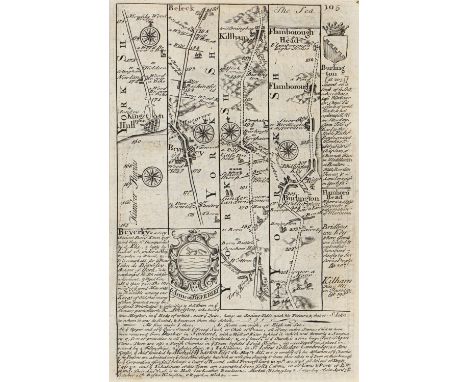
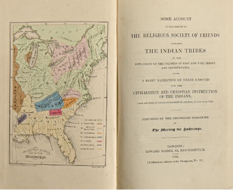
Topography. Cox (J. Charles), The Churches of Derbyshire, four-volume set, Chesterfield: Palmer and Edwards, et al., 1885-9, illustrated, contemporary red cloth, top-edge gilt, others uncut, 8vo, Baines (Thomas), Lancashire and Cheshire, Past and Present, four-volume set, London: William Mackenzie, n.d. [c. 1850], plates, original publisher's mauve cloth, pictorial gilt, all edges gilt, 4to, Robinson's Derbyshire Gatherings, 1866, illustrated, some movement, original cloth over boards, some worn losses, Pigot's Staffordshire Directory, 1829, folding map, 20th c half-cloth over marbled boards, 8vo,  4to, Bagshaw's Derbyshire, Sheffield: Printed for the Author, by William Saxton, et al., 1846, later cloth, uncut, 8vo in 4s, Adam's Dales, Scenery, etc., of Derbyshire, London: W. Kent & Co., et al., 1861, ex-lib, cloth, 8vo, idem, Gem of the Peak, third edition, London: Longman & Co., et al., 1843, defective folding map frontispiece, original publisher's cloth, worn, twisted, uncut, 8vo, Calabrella (The Baroness de, editor), Evenings at Haddon Hall, London: Henry Colburn, 1846, illustrated, original cloth, rebacked, worn corners, 8vo, Derby-related printed ephemera, including Fifth Midland Railway Annual Ball, 1920, etc

Lot 302

Travel, Yachting. [Beale (Reginald Evelyn Child)], The Voyage of the Angela, from Marseille to Shoreham, 1931. A Limited Edition for Private Circulation. [Teddington, Richmond upon Thames: Privately Printed], n.d. [1931], printed in gold-ruled borders, 95pp, 26 captioned silver gelatin photographic prints and a two-page map printed in polychrome, bound in original red morocco over boards, gilt-lettered upper-cover, all edges gilt, foliate rolled dentelles, marbled endpapers, 4to, idem., There and Back, 1934. A Limited Edition for Private Circulation. [Teddington, Richmond upon Thames: Privately Printed], n.d. [1934], printed in gold-ruled borders, [68]pp, 25 captioned silver gelatin photographic prints and a one-page map printed in polychrome, bound in original red morocco over boards, gilt-lettered upper-cover, all edges gilt, foliate rolled dentelles, marbled endpapers, 4to, (2)

Lot 472

Jan Janssonius/Jan Jansson (1588-1664) -  Derbyshire, Shropshire & Staffordshire, Middlesex, Wiltshire and Oxfordshire; five double-page county maps, mixed dates, but all mid-17th c, engravings, contemporary or contemporaneous hand-colouring, the largest 47 x 52cm, and Joan Blaeu (1596-1673) - Derbyshire, double-page county map, s.l., n.d. [1648], engraving, contemporary hand-colouring, 43.5 x 56cm, (6) Mixed condition as evidenced by images. The Essex sheet with holed loss. One of the Derbyshire maps repaired at the gutter. See images of the other maps in the lot.

Lot 299

Travel, Palestine, the Near and Middle East.  Gordon (Charles George, Pasha Gordon of Khartoum), Reflections in Palestine, 1883, first edition, London: Macmillan and Co., 1884, half-title, full-page map, original publisher's cloth, 8vo, Cox (Francis Augustus, DD), The Manners and Customs of the Israelites, Illustrated by Engravings. London: John Joseph Griffin and Co., 1852, original publisher's cloth, uncut, 8vo, Kinglake (A.W.) & Brangwyn (Frank, illustrator), Eöthen, London: Sampson Low, et al., n.d. [1913], cloth, 4to, Owen's Salonica, 1919, cloth, 8vo, Phillips' Qataban and Sheba, second impression, March 1955, dj, hb, 8vo, etc., (9)

Lot 475

John Overton (1640-1713) - A new mpp (sic) of ye Rodes of England, Showing the Townes (sic) you pass through with the reputed distance between Town & Town; road map, [London]: Printed & Sold by John Overton at the White Horse Against S:e Sepulchers Church, n.d. [c.1685], etching and engraving, 52 x 46cm, with five unassociated letterpress distance charts/tables, (6)

Lot 25

Atlas. John Bartholomew FRGS (1831-1893) - The Imperial Map of England & Wales according to the Ordnance Survey [...], On the Scale of 4 Miles to an Inch, London & Edinburgh: J. Fullarton & Co., n.d. [1866], 16 double-page chromolithographed maps, of which sheet 16 is divided into 3 separate maps, [2]ff (index), some foxing, original quarter-calf over cloth by W. Loxley of Melton, his ticket, upper-cover lettered in gilt, split, chipped and rubbed, but holding, folio (56 x 40.5cm), & Archer (Thomas) & Barnard (Frederick, illustrator), Charles Dickens: A Gossip about his Life, Works, and Characters, London: Cassell & Company, Limited, n.d. [1894], full-page photogravures and in-text illustrations, contemporary quarter-morocco over cloth, pictorial gilt, worn, folio (45.5 x 36cm), (2)

Lot 424

Shropshire. Auctioneers: Messrs. Lane, Saville & Co., London, W.1., & Messrs. Barber & Son, The Buildwas Park Estate, Ironbridge, Shropshire. Particulars, Plans & Conditions of Sale of the Remaining Portions of the Buildwas Estate, Freehold Residential, Agricultural and Sporting Property [...] for Sale by Auction in Lots (unless previously sold by private treaty) [...] at the Town Hall, Wellington, Salop, On 21st February, 1929 [...], frontispiece of the country house, 24, [1]pp, rear plan envelope with folding chromolithographed map of the estate, surveyed by Barber & Son and printed by Martin, Hood & Larkin, [London], 88 x 112cm, original wrappers, though soiled and split, folio (32 x 25.5cm)

Lot 485

William Kip (act. 1588-1635) after John Norden (1546-1625) - Hertfordshire, double-page county map, numbered 16 within the plate, s.l., n.d. [first-half 17th c], 29 x 36cm, Nicolas Sanson (1600-1667) - Anatolia, s.l. [Paris?], n.d. [17th c], engraving, some contemporary hand-colouring, 19.5 x 25cm, an Owen & Bowen road map, c. 1720, and an 18th c French map of ancient Greece, (4) Good condition. Unexamined out of frames.

Lot 8

Americana, Quakers. Some Account of the Conduct of the Religious Society of Friends Towards the Indian Tribes in the Settlement of the Colonies of East and West Jersey and Pennsylvania: with a Brief Narrative of their Labours for the Civilization and Christian Instruction of the Indians, from the time of their settlement in America, to the year 1843. Published by the Aborigines' Committee of The Meeting for Sufferings, first edition, London: Edward Marsh, 1844, pp: [iv], x, 11-247, most gatherings unopened, map frontispiece (Aboriginal America, East of the Mississippi) and folding map (A Map of North America, denoting the boundaries of the Yearly Meeting of Friends and the locations of the various Indian Tribes), lithographed by H. Clark after James Bowden, hand-coloured &/or delineated in watercolour, the folding map crudely repaired, original publisher's brown cloth, slight wear, chipped spine, 8vo    Provenance: 1) John Alderson, contemporary ink MS ownership inscription to ffep; presumably a member of the well-established Quaker family. 2) William H. Joad, 1919, dated ink stamp to same leaf.

Lot 184

Williams (David) The History of Monmouthshire, Illustrated and Ornamented by Views of its Principal Landscapes, Ruins, and Residences, by John Gardnor, Vicar of Battersea..., Printed H Baldwin, London, 1796, 4to, engraved county map by John Cary, 36 uncoloured aquatint plates, numerous pedigrees (two folding), bookplate for Charles William Earle Marsh, High Sheriff of Monmouthshire, 1899From the Library of Paul Stickler, a Gloucestershire collector of books and maps.

Lot 186

Warner (Richard) A Walk Through Wales in August 1797, London: R Crutwell, 1810, Fifth edition, half calf with gilt tooled titles, gilted page edges, frontispiece and one further plate with some vignette insertions and bound with A Second Walk Through Wales in August and September 1798, London: Crutwell, 1800, 8vo, second edition, frontispiece and vignettes to text; together with Malkin (Benjamin Heath), The Scenery, Antiquities and Biography of South Wales, London: Longman, 1804, 4to, rebound half calf and marbled boards, 12 plates, lacking fold out mapQty: 2From the Library of Paul Stickler, a Gloucestershire collector of books and maps.

Lot 175

Churchill, Winston S "A History of the English Speaking Peoples", Dorset Press 1956, boxed set, backstrips gilt rules and titles Roberts, Andrew  "Churchill Walking with Destiny", Alan Lane 2018, signed by the author on tp, map ep, grey cloth, dust wrapper Lough, David "No More Champagne, Churchill and his Money", published Head of Zeus 2015, signed on tp by the author, black cloth, dust wrapper not price clipped  Churchill, Winston S  "A History of the English Speaking Peoples", vols 1-4, Cassell & Company 1956, 1957 and 1958, all with dust wrappers which do bear some chipping and stained  

Lot 192

Lambert B. " The History and Survey of London and its Environs..." in four vols, Printed for T. Hughes 1806, frontis portrait, vol 1, map and folding map, plates etc. contemporary full leather, but all four vols with detached boards and in need of repair, " London and its Environs described..." R. and J. Donsley 1761 in six vols., folding map by Thomas Kitchin vol II, folding map vol.IV, plates, full contemporary leather but in disrepair, . Bunyan John. " The Pilgrim's Progress.... with Notes by Mr. William Mason..." printed for Alex Hogg..."  engraved plates by G. Burder, half leather, marbled boards, soiled and loss, and other antiquarian books (1 box)

Lot 198

Fuller, Thomas. " The Historie of the Holy Warre" third Edition, printed for Roger Daniel and are sold by John VVilliams 1647, engraved half title, the folding map is missing, margins, engraved portraits, contemporary full leather 

Lot 199

The Geneva 'Breeches' Bible 1607 - Imprinted at London by Robert Barker 1607, bound with the Booke of Common and Prayer and Psalms at the front, , engraved title page to the Booke of Common Prayer, wood cut map of the Garden of Eden, and then a map of 'The Description of the Holy Land' facing the title page of the New Testament, title page for 'The Whole Book of Psalms collected into English Metre by Thomas Sternhold, John Hopkins and others...." Printed for the London Companie of Stationers 1609, woodcut vignette, and music scores..... the book has damp stains, ink marks, the engraved title page is soiled and has a paper reinforcements (not recent), the front and back boards are detached, ink stains on the foredge, folio - Genesis Chapter III, verse 7 " Then the eyes of both of both them were opened and they knew they were naked, and they sewed figge leaves together and made themselves breeches"

Lot 218

Folio Society  Lewis, C. S.  Complete set of the Tales of Narnia in fitted box with the map of Narnia on either edge, illustrations by Pauline Baynes 

Lot 232

Robertson, William. "The History of America" Printed by A. Strahan etc. 1800, Ninth Edition in Four Volumes, two folding maps in vol I, folding map and plate in vol II, folding map vol III, full leather, with gilt titles to backstrips, uniform "India..." 1799, two folding maps, Third edition and three vols " Charles V" and two " Scotland", also "Works..." 1820, marbled endpapers, half leather with marbled boards and edges, 12 volumes (21 vols)

Lot 261

Collection of prints, postcards and letters of locomotive and local interest, predominately pre WWII, including a number of Victorian envelopes bearing Cheltenham addresses with 1d Penny Reds, an autographed photo of Val Doonican, a Cheltenham Gas Light Company receipt dated 1831, a folding Bacon's Cycling and Motoring Map of Cheltenham, a large collection of late prints of early 20th century locomotives, a group of Cheltenham Newspaper Company prints depicting heavy snowfall (mid-century) and others

Lot 280

Collection of memoirs and autobiographies signed by Norman Wisdom, a framed photograph and commemorative inscription relating to the Sir Norman Wisdom blue plaque unveiling 2011, signed by Robin Gibb of the Bee Gees, a framed reproduction blue plaque for Eric Morecambe and Ernie Wise, of the Heritage Foundation, and a signed photograph, 63cm x 43.5cm, a framed letter from Phil Collins to Ernie Wise, 1998 together with a photograph, a signed drawing titled Phil Collins' Band, signed by Collins, and a signature of Ernie Wise, with certificate of authenticity verso, 73cm x 43cm, and a copy of the Modern Wireless Broadcasting Map of the World, a signed photograph of Terry Wogan, Mike Longley and Fred the Ted, a collection of first day covers including 90 Years of the Royal Air Force, 2008 (x2), Greenwich Meridian 1884-1984, Alice's Adventures in Wonderland, Winnie the Pooh and others  Provenance: from the collection of Mr George Ridgeon, Gloucestershire 

Lot 293

A silk scarf printed with an early map "Map of the Railways of England & Wales shewing the Principal & Minor Stations, printed by Welch & Margetson, London", beige with a broad blue border, a tear in the lower part, a travelling oil lamp in the form of a brass small shell, a pair of opera glasses, a small glass scent bottle within fitted yewwood case, a medal on a red ribbon, a blue ribbon also and a matched pair of propelling pencil and biro in stainless steel ( 1 box)

Lot 311

John Speed (1552-1629), pocket-sized/miniature partially coloured map of China accompanied by four same-sized pages, circa 1666, printed on both sides (pages 189-196) on 'The description of the Kingdome of China', the map 12.7cm x 9cm

Lot 313

Map - Henricus Hondius (1597-1651), hand-coloured map - ‘India quae Orientalis dicitur et Insulae Adiacentes’, c. 1636, 39cm x 49cm double sided framed, foxing.

Lot 314

John Speed (1552-1629), pocket-sized/miniature partially coloured map of 'Darbyshire' accompanied by two same-sized pages, printed on both sides about 'Darbyshire' circa 1666, 13cm x 9cm ,Two 18th century hand coloured engraved maps, the first of Pembrokeshire and the second of Merionethshire, Wales, possibly by J. Seller, double sided, each with a printed list of antiquities worthy of note to verso, 18.5cm x 26.5cm ,Late 18th century hand coloured engraved map of Wiltshire, with the Arms of Salisbury, by T.Kitchin George, 22.5cm x 36.8cm (4)

Lot 324

Gerhard Mercator, an engraved map of Southeast England, late 16th century or later, black and white, inscribed with (in Latin) the SE Counties, printed on the back (in Latin) 'Angliae VI. Tabula.....XVII; mounted, 53.5cm x 41xm the map

Lot 325

Christopher Saxton (1540-1610) and John Speed (1552-1629), engraved by Abraham Goos, Amsteloda, 1646, a hand coloured engraved map of The Kingdome of England, with illustrations of noble and gentle men and women and other figures, 41.5cm x  53.5cmCondition ReportThe map appears to be in good condition overall. There are a couple of small brown marks towards the bottom left and a very small tear in the top right margin. Otherwise there is no apparent damage or restoration.

Lot 326

Sebastian Munster, an engraved map of England (German), on its side, titled 'Anglia Engelandt...', circa 1588, 39.5cm x 32.7cm 

Lot 330

Guiljelmus Blaeuw, hand coloured engraved map of Venezuela, 17th century, inscription verso in French of Venezuela, 60.5cm x 51cm 

Lot 235

A 17th century map of The Peloponnesus by Willem and Joan Blaeu, 41 x 50cm, framed and glazed.

Lot 368

A large collection of 19th century and later magic lantern slides. To include colour and black and white examples, religious scenes, landscapes, buildings and architecture, Bruges station, Heddon Mouth, Holland, winter scenes, Guild Houses Brussels, Cathedral form the Quay Antwerp, Funchal madeira, map slides. Many other examples with makers Newton Makers and Co. 

Lot 1316

POLAND, Centenary of the Kosciuszko Uprising, 1894, a white metal medal, unsigned, small bust of Kosciuszko left within wreath, map below, rev. eagle between two hemispheres, Polish legend above and English legend below, 38mm. Holed at top, otherwise extremely fine [certified and graded by NGC as MS 63] £100-£120 --- Importation Duty This lot is subject to importation duty of 5% on the hammer price unless exported outside the UK --- --- Tadeusz Kosciuszko (1746-1817), soldier and engineer; he fought for the United States in the Revolutionary War and led the Kosciuszko Uprising against Russia in 1794

Lot 45

Atlante di Geografia-Storica Universale. Raccolta di Tavole Cronologiche, Geografiche. F.C. Marmocchi. Illustrated with hand coloured maps and engravings. With folding map and multiple hand coloured plates. Half bound in leather. H.46 W.30cm.

Lot 59

Rerum Italicarum Scriptores ab anno Aerae Christianae Quingentesimo ad Millesimumquingentesimum. Antonio L. Muratori. Published by Palatina, 1723. In full leather bindings. Volumes 3-14 only. Complete with their frontis portrait and plate, and map. Some scattered foxing.

Lot 29

George Psalmanazar. Histoire Universelle depuis jusqu'à présent. Published Amsterdam, 1763. Forty-five volumes. Full leather bindings with five raised bands on the spine and marbled endpapers. Complete with its map. Volume VII not present. H.29 W.20cm.

Lot 1293

Piet Cornelis Kramer (1879-1940)Map various works including oil paintings, study drawings and a number of watercolors by Piet Kramer

Lot 1292

Piet Cornelis Kramer (1879-1940)Map various works including oil paintings, study drawings and a number of watercolors by Piet Kramer and H A van Ingen

Lot 241

MAP CARTE - EARTH B Y MILLENIUM HOPUSE - LIMITED EDITION GIANT BOOK

Lot 740

A population map of Great Britain

Lot 393

A quantity of paintings and prints. Includes Val Dillon watercolour, portrait depicting James Henry Barber, map, etc.

Lot 18

Reproduction coloured map of the Kingdom of Denmark, framed

Lot 248

A framed and glazed map by Geralus Mercator (1512-1594) depicting Britannia and Normandia, hand coloured by Mercation

Lot 288

A quantity of various pictures and prints and a map, to include watercolour study depicting a shoreline; pencil sketch contained in an Oxford frame AF; Birdseye maple framed print; coloured map

Lot 547

A framed and glazed "Saxons Map of Suffolk"; two watercolour studies; a framed and glazed print "In Days of Steam" and a wool work picture

Lot 83

SURVEY OF THE STRAITS OF SINGAPORE (EASTERN SHEET), C.1855 Samuel Congalton & J.T.Thomson, circa 1855, the present example being the eastern sheet of the two part map, showing the eastern part of the Straits of Singapore, with Bintan in the south and the Malay peninsular in the north. Extensive foxing and staining to paper, housed in mount and temporary frame 62 x 91cm Condition: For a condition report or further images please email hello@hotlotz.com at least 48 hours prior to the closing date of the auction. This is an auction of preowned and antique items. Many items are of an age or nature which precludes their being in perfect condition and you should expect general wear and tear commensurate with age and use. We strongly advise you to examine items before you bid. Condition reports are provided as a goodwill gesture and are our general assessment of damage and restoration. Whilst care is taken in their drafting, they are for guidance only. We will not be held responsible for oversights concerning damage or restoration.

Lot 84

JOHN SPEED, MAP OF THE ISLE OF WIGHT, C.1650 17th Century, titled 'Wight Island', Published by John Speed, sold by John Sudbury and George Humbell, Pope's Head Alley, engraving with hand colouring, with inset maps of Newport and Southampton, centre fold as issued, text verso, the reverse of frame with photocopies of the text 38.5 x 51.5cm, 62 x 74cm including frame Condition: For a condition report or further images please email hello@hotlotz.com at least 48 hours prior to the closing date of the auction. This is an auction of preowned and antique items. Many items are of an age or nature which precludes their being in perfect condition and you should expect general wear and tear commensurate with age and use. We strongly advise you to examine items before you bid. Condition reports are provided as a goodwill gesture and are our general assessment of damage and restoration. Whilst care is taken in their drafting, they are for guidance only. We will not be held responsible for oversights concerning damage or restoration.

Lot 81

JAMES WYLD, A NEW MAP OF GREECE, C.1850 'A New Map of Greece, Constructed chiefly from original materials, in which it has been attempted to improve the Ancient and Modern Geography of that Country', published by James Wyld, circa 1850, with hand colouring, folds as issued, some staining and marks to margins, mounted in temporary perspex holder 94 x 62cm Condition: For a condition report or further images please email hello@hotlotz.com at least 48 hours prior to the closing date of the auction. This is an auction of preowned and antique items. Many items are of an age or nature which precludes their being in perfect condition and you should expect general wear and tear commensurate with age and use. We strongly advise you to examine items before you bid. Condition reports are provided as a goodwill gesture and are our general assessment of damage and restoration. Whilst care is taken in their drafting, they are for guidance only. We will not be held responsible for oversights concerning damage or restoration.

Lot 551

Mid century Oak Plan or Map Chest, the green leather inset top over six drawers with long block handles, (comes in two parts), 77cm high x 123cm wide x 89cm deep

Lot 290

Europa Geolgische Ubersicht 1:3000000 Wall map by Helmut Langer

Lot 46

Collection of assorted walking sticks to include Bone Trout stylised handle, Rams horn, Canvas wall map in a Leatherette stick stand with applied crest Royal Coat of Arms

Lot 301

A Robert Morden 17th Century map

Lot 305

A Robert Morden map of Nottinghamshire

Lot 220

A framed coloured map of Scotland published 1751 in Paris by Robert De Vaugondy in his book "Atlas Universel" titled - "Le Royaume D'Ecosse". (50.5cmx59cm)

Lot 1022

Vintage Countryside Commission National Parks annotated map of The Lake District., pub 1970, National Savings Committee 'English Pottery and Porcelain 1650-1959' and 'Festival and Customs' posters, all unframed, 102cm x76cm max (3)

Lot 332

Large collection of approx. 70 various types of Cowry sea shells (Cypraea - Indo-Pacific) including, Map, Eyed, Poached egg, Cowrie etc. sizes 5-10cm in length.

Lot 1323

Venice Simplon Orient-Express folder containing ephemera incl. tickets, itinerary, map, writing paper, post cards, boarding passes, pen etc and a souvenir Art Deco style Orient-Express candlestick with shade, H21cm

Lot 6065

Hall, Captain Basil - 'Extracts from a Journal written on the Coasts of Chili, Peru and Mexico' two volumes fourth edition with folding map, 1825 in full calf, Matthews, Henry - 'Diary of an Invalid being the journal of a Tour in Pursuit of Health ...........' two volumes, third edition 1822, half calf, Head, Captain F.B.- 'Rough Notes taken during some rapid journeys across the Pampas' third edition 1828 half calf and Baker, James - 'Turkey in Europe' 1877 with two folding maps. Provenance ; From the Estate of the late Dowager Lady St Oswald

Lot 5101

Super Nintendo (SNES) Secret of Mana (PAL) Condition Report: Game is boxed but without its manual or map. The right hand flap is missing from the box, but the part that has been ripped off is inside the plastic insert that is inside the box.

Lot 355

William Stukeley - Early 18th century map of Britannia, 1723, 27cm x 24cm, framed under glassThe Steps Gallery, Christmas Steps, Bristol stamps to verso, dated '91

Lot 356

Framed map of Wiltshire, publ. Pigot & Co. Manchester, together with another framed map of Wiltshire, small unframed example and map of Gloucestershire, 36cm x 23.5cm and smaller (4)

Loading...Loading...
  • 109182 item(s)
    /page

Recently Viewed Lots