We found 108737 price guide item(s) matching your search
There are 108737 lots that match your search criteria. Subscribe now to get instant access to the full price guide service.
Click here to subscribe- List
- Grid
-
108737 item(s)/page


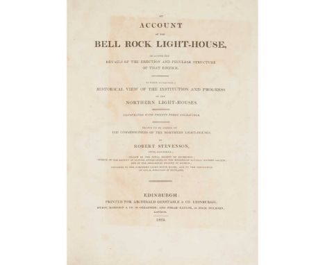
Lot 10
...including the details of the erection and peculiar structure of that edifice. To which is prefixed a Historical View of the Institution and Progress of Northern Light-Houses. Edinburgh: Archibald Constable and Co., 1824. First edition, royal 4to, 23 engraved plates including the frontispiece after Turner and secondary title vignette engraved after Miss Stevenson on India paper, engineering plates, map, and a double-page view, 19th century half calf neatly rebacked, red morocco gilt label, endpapers renewed, some foxing to plates as is usual, slight dampstain to fore-edges of many plates and to gutter of frontispieceFootnote: Note: Ruff 179; Todd & Bowden 176A. The book is described in these bibliographies of Walter Scott due to the presence of his poem "Pharos Loquitor" below Miss Stevenson's fine vignette on the secondary title. It is a facsimile of the six lines of verse he wrote in a visitors' album at a lighthouse in 1814, during his celebrated voyage round Scotland with Stevenson and the lighthouse commissioners. "Some" copies, as here, have the plate on India paper. Both bibliographies note that the total edition was of only 250 copies. The great civil engineer, Robert Stevenson, practically inaugurated the Scottish lighthouse system, and the Bell Rock lighthouse is one of his finest and most remarkable achievements.
Lot 132
Nicol, James Guide to the Geology of Scotland. Edinburgh: Oliver & Boyd, 1844. 8vo, frontispiece, 9 hand-coloured plates, hand-coloured folding map, modern quarter calf; Miller, Hugh The Testimony of the Rocks... Edinburgh: Thomas Constable & Co., 1857. 8vo, contemporary red calf gilt; another copy, dated 1862, contemporary calf neatly rebacked; another copy, dated 1890, red half calf gilt; [Idem] The Cruise of the Betsey. Edinburgh: William P. Nimmo, 1879. Twelfth edition, 8vo, contemporary half calf gilt; [Idem] Sketch-Book of Popular Geology. Edinburgh: William P. Nimmo, 1880. Ninth edition, 8vo, contemporary half calf gilt; [Idem] The Old Red Sandstone... Edinburgh: William P. Nimmo, 1882. Twenty-third edition, 8vo, contemporary half calf; Geikie, Archibald Text-Book of Geology. London: Macmillan and Co., 1885. 8vo, folding plate, blue calf gilt with the arms of the Royal Military College Canada; [Idem] An extract comprising pp.212-375 from an encyclopaedia being Geikie's entry on Geology, in green half morocco; MacGillivray, William A Manual of Geology. London: Adam Scott, [n.d.] Second edition, 12mo, hand-coloured folding map, contemporary calf gilt; Harker, Alfred [Memoirs of the Geological Survey of the United Kingdom] The Tertiary Igneous Rocks of Skye. Glasgow: HMSO, 1904. 8vo, later red half calf; Wilson, Ronald E. Two Hundred Precious Metal Years: A history of the Sheffield Smelting Company Limited 1760-1960. London: Ernest Benn Limited, 1960. 8vo, red crushed morocco gilt (12)
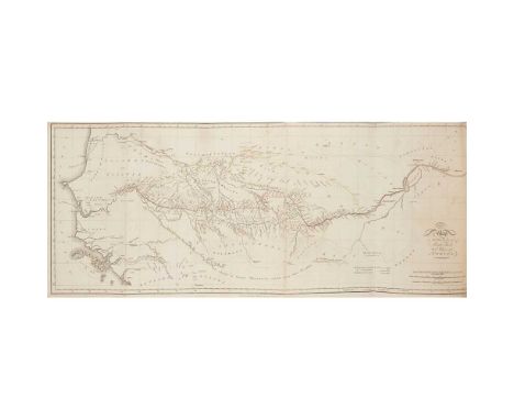
![[Basel: H. Petri, 1559] 38 x 29.5cm, engraved map, slightly trimmed along upper edge, a little repaired worming with loss to](https://cdn.globalauctionplatform.com/aaab4a07-72a1-4a32-90e4-ad9000bb169f/cf82382c-e1c7-4dac-84dc-ad9b00ab825f/468x382.jpg)
![Surtees, R.S. [Sporting Novels]. 1847-88, 7 volumes, hand-coloured plates by John Leech, contemporary calf, spines gilt, g.e](https://cdn.globalauctionplatform.com/aaab4a07-72a1-4a32-90e4-ad9000bb169f/94a118c4-94b5-4fb0-931f-ad9b00ab804d/468x382.jpg)
Lot 165
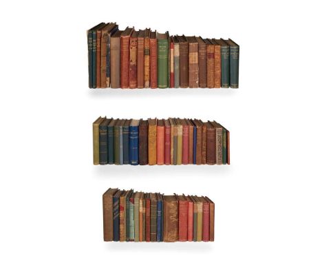
Surtees, R.S. [Sporting Novels]. 1847-88, 7 volumes, hand-coloured plates by John Leech, contemporary calf, spines gilt, g.e.; Dyer, T.H. Modern Europe. 1877, 5 volumes, contemporary calf gilt; Pepys, Samuel Memoirs, edited by Lord Braybrooke. 1828, 5 volumes, contemporary calf, spines gilt; Audubon, John J. The Life and Adventures of. 1869, blue calf gilt; Ramsay, E.B. Reminiscences of Scottish Life and Character. 1871, brown morocco gilt, g.e.; Sala, G.A. A Trip to Barbary. 1866., maroon half morocco, spine slightly faded; Hassell, J. Memoirs of the Life of the late George Morland. Albion Press Limited, 1806. 4to, engraved title and plates, green morocco gilt, upper board virtually detached; Arabian Nights' Entertainments 1865, blue half calf, spine gilt; Robinson, W. The English Flower Garden. 1896, brown half morocco, spine gilt, g.e.; White, Henry K. The Remains of. 1823, 2 volumes, grey calf gilt, g.e.; Strachey, Lady. Memoirs of a Highland Lady. 1898, blue half morocco, spine gilt, t.e.g.; Ramsay, Allan The Gentle Shepherd. 1808, 2 volumes, engraved plates, map, offsetting to titles, contemporary calf, neatly rebacked; Moore, T. Edward. Various Views of Human Nature. 1796, 2 volumes, contemporary half calf, neatly rebacked; d'Orleans, Duc Lettres. Paris, 1889, blue half morocco, slightly rubbed; and others similar (43)
Lot 197
Wotton, Sir Henry Reliquiae Wottonianae. or, A Collection of Lives, Letters, Poems. London: R. Marriot, G. Bedel and T. Garthwait, 1651. First edition, 12mo, 3 (of 4) engraved portraits, light dust soiling, some pages nibbled, edge of pp. 47-52 charred, later reversed calf, rebacked, lacks text after p.408; [Idem] Reliquiae Wottonianae. London: R. Marriot, G. Bedel and T. Garthwait, 1654. Second edition, 12mo, engraved frontispiece trimmed, engraved portraits, later calf, neatly rebacked; [Idem] Reliquiae Wottonianae. London: T. Roycroft for R. Marriott [&c.], 1672. Third edition, 8vo, 3 (of 4) engraved portraits, contemporary calf, worn; [Idem] Reliquiae Wottonianae. London: T. Roycroft for R. Marriott, &c., 1672. Third edition, 8vo, 3 (of 4) engraved portraits (lacking portrait of King Charles I), contemporary calf, repaired; [Idem] Reliquiae Wottonianae. London: for B. Tooke and T. Sawbridge, 1685. Fourth edition, 8vo, 4 engraved portraits, good 20th century half calf gilt, rusthole affecting text at p.695; [Idem] Reliquiae Wottonianae. London: for B. Took and T. Sawbridge, 1685. Fourth edition, 8vo, 4 engraved portraits (the first, frontispiece cut down and mounted), 19th century calf gilt, rebacked retaining original spine; [Idem] Reliquiae Wottonianae. London: B. Tooke and T. Sawbridge, 1685. Fourth edition, 8vo, 4 engraved portraits, title with library stamp and repairs at base, contemporary calf, somewhat spotted, rebacked; [Idem] Reliquiae Wottonianae. London: B. Tooke and T. Sawbridge, 1685. Fourth edition, 8vo, 1 (of 4) engraved portraits, contemporary calf, some spotting, neatly rebacked; Quarles, Francis The Shepheards Oracles. London: John Marriot and Richard Marriot, 1646. Small 4to, later calf, lacking engraved title-page, some leaves repaired with loss to text [ESTC R217945]; Roberts, Lewes The Merchants Map of Commerce. London: R. Horn, 1671. Second edition, folio, contemporary calf, lacking 3 (of 4) maps and 5 leaves [ESTC R235234]; De Pontis - Charles Cotton, translator Memoirs of the Sieur De Pontis. London: James Knapton, 1694. Folio, contemporary panelled calf, a little rubbing [ESTC R33977]; Wood, Anthony Athenae Oxonienses. London: R. Knaplock, D. Midwinter and J. Tonson, 1721. Folio, two volumes bound together, facsimile title page in volume 1, later calf retaining some of an older binding; sold not subject to return (12)
Lot 209
London: Macmillan and Co., 1874. 2 volumes, first edition, 8vo, 2 portrait frontispieces, hand-coloured folding map, single-page map and 51 plates, original green cloth gilt, a little rubbing to joints and bumping to spine ends and corners, folding map neatly repaired to reverse, a few light internal marks (2)

Lot 22
Cary, John Cary's Traveller's Companion... London: G. & J. Cary, 1828. 8vo, 42 single-page maps and folding map of Yorkshire (with closed tear), hand-coloured in outline, contemporary calf, rebacked; Plans of various Lakes and Rivers between Lake Huron and the River Ottawa... Toronto: John Lovell, 1857. 4to, 22 folding maps, red half morocco, rubbed; Moll, Herman A Set of Thirty-Six New and Correct Maps of Scotland. Stirling: R.S. Shearer & Son, 1896. Oblong 4to, contemporary quarter cloth; Oliver, Frank - Department of the Interior Canada Atlas of Canada. Toronto, 1906. Folio, original cloth; Brenna, Giovanni - Vittorio Angeli Carta-Topografica di Milano, 1833. 3 folding sections in original case (5)
Lot 231
Wallace, James An Account of the Islands of Orkney. London, 1700. 8vo, folding map, folding plate, contemporary panelled calf, tiny nick at head of spine, [ESTC R34706]; Neill, Patrick A Tour through some of the Islands of Orkney and Shetland. Edinburgh, 1806, later half morocco, title dust-soiled, rubbed; Liddell, Francis The Melancholy Case of Francis Liddell, Minister of Orphir, in the Orcades, together with his Last Speech and Dying Words to the General Assembly, 1807. Edinburgh, 1808, 19th century cloth, small repair to title; Landt. Rev. G. A Description of the Feroe Islands... translated from the Danish. 1810. First edition in English, 8vo, folding map and 2 plates (1 folding), contemporary half calf, rubbed; Low, George Fauna Orcadensis, or the Natural History of the Quadrupeds, Birds, Reptiles and Fishes of Orkney and Shetland. Edinburgh, 1813. 4to, contemporary half calf, slightly spotted, rubbed; Henderson, E. Iceland or the Journal of a Residence. Edinburgh, 1819. Second edition, 8vo, folding map, engraved plates, contemporary calf, rubbed; Peterkin, Alexander Rentals of the Ancient Earldom and Bishoprick of Orkney, 1820, original boards; Mackenzie, James The General Grievances and Oppression of the Isles of Orkney and Shetland. Edinburgh, 1836, 8vo; Dunn, Robert The Ornithologist's Guide to the Islands of Orkney and Shetland. 1837. First edition, 8vo, lithographed frontispiece (loose), 2 folding maps, original cloth; Wilson, James A Voyage round the Coasts of Scotland and the Isles. 1842, 2 volumes, in one, 8vo, plates, some spotting, worn; Monteith, Robert Description of the Islands of Orkney and Zetland. 1845 Baikie, W.B. and Robert Heddle Historia Naturalis Orcadensis. Zoology, part 1 (only), original cloth, lacks f.f.e.p.; Weld, Charles Richard Two Months in the Highlands, Orcadia and Skye. 1860, 4 chromolithographs, illustrations, upper hinge broken; Balfour of Balfour, David Odal Rights and Feudal Wrongs. a Memorial for Orkney. Edinburgh, 1860, presentation copy from the author to Rev. E.R. Larkin; Calder, James T. Sketch of the Civil and Traditional History of Caithness. Glasgow, 1861, p.xv loose, upper hinge broken; Dasent, G. W. The Story of Burnst Njal. 1861, 2 volumes, plates, original green cloth gilt; Clouston, Rev. Charles Guide to the Orkney Islands. Edinburgh, 1862, 12mo, folding map, errata slip, red half morocco, slightly rubbed; Crichton, A.W. A Naturalist's Ramble to the Orcades. 1866, lithographed frontispiece, pictorial cloth; Edmonston, Thomas An Etymological Glossary of the Shetland & Orkney Dialect. 1866, contemporary half calf, rubbed; Mitchell, J.M. Mesehowe: Illustrations of the Runic Literature of Scandinavia. Edinburgh, 1863. 4to, plates, original cloth, date in biro at foot of title, worn; Maxwell, Charles A. The Sea Kings of Orkney. 1870, rubbed; Fergusson, James A Short Essay on the Age and Uses of the Brochs and the rude stone monuments of the Orkney Islands. 1877, 8vo; Reid, John T. Art Rambles in the Highlands and Islands of Scotland. 1878, 4to, pictorial cloth, rubbed; Low, George A Tour through the Islands of Orkney and Schetland. Kirkwall, 1879. ex-library copy, original cloth; Reid, John T. Pictures from the Orkney Islands. Edinburgh, 1881, 4to, limited to 500 copies, rubbed; Traill, William A Genealogical Account of the Traills of Orkney. Kirkwall, 1883, plates; [Orkney] The Present State of the Orkney Islands Considered... published in 1775. 1884; Wallace, Rev. James A Description of the Isles of Orkney. 1883, number 119 of 260 copies; Fergusson, R. Menzies Rambles in the Far North. 1884. second edition, pictorial cloth, spine slightly rubbed; Hepburn of Birsay, Thomas A Letter to A Gentleman from his Friend in Orkney. 1885 (reprinted), number 82 of 110 copies; Mackintosh, W.R. Glimpses of Kirkwall and its People. Kirkwall, 1887, corner of title cut away; Sinclair, John Scenes and Stories of the North of Scotland. 1890; Fergusson, R. Menzies Our Trip North. 1892, pictorial cloth; Leighton, Robert The Pilots of Pomona, a story of the Orkney Islands. 1892, worn; Mackintosh, W.R. Curious Incidents from the Ancient Records of Kirkwall. Kirkwall, 1892; Baikie, Mrs W.D. The Queen of the Caves. Kirkwall, [c.1892]; Scott, E.E. The Erskine-Halcro Genealogy. 1895; Ployen, Christian Reminiscences of A Voyage to Shetland, Orkney and Scotland in the summer of 1839. Lerwick, 1896, rubbed; Fergusson, R. Menzies. A Village Poet. 1897; Ferguson, Malcolm. A Vist to Orcadia and the North of Scotland. 1898, Second edition; Young, Archibald Summer Sailings by an Old Yachtsman. 1898, plates; Brown, Thomas Diary of Thomas Brown writer in Kirkwall. Kirkwall, 1898; Russell-Jeaffreson, J. The Faroë Islands. 1898, map detached, pictorial cloth, rubbed; Hossack, B.H. Kirkwall in the Orkneys. Kirkwall, 1900, 4to, Preface leaf loose, head and base of spine worn; Craven, Rev. J.B. History of the Church in Orkney. Kirkwall, 1893-1901-1912. 3 volumes, 4to, the 1901 volume a presentation copy from the author, this volume faded and rubbed; Goodfellow, Alexander Birsay Church History. Kirkwall, 1903; Malcolm, John Poems, Tales and Sketches. Kirkwall: W. Peace, [c.1903]; Charleson, M.M. Orcadian Papers. Stromness, 1905; Selous, Edmund The Birds Watcher in the Shetlands. 1905, some spotting; Smith, John Annals of the Church in Scotland in Orkney from 1560. Kirkwall, 1907; Gunn, John The Orkney Book. [c.1909]; Angus, J.S. A Glossary of the Shetland Dialect. 1914, 2 copies, dustwrappers; Firth, John Reminiscences of an Orkney Parish. Stromness, 1922; Sinclair, J. The Orkney Parishes. Kirkwall, 1927; Omond, James How to know the Orkney Birds. Kirkwall, 1925, 4to, original wrappers, lacks lower wrapper, rubbed; Burrows, C.W. Scapa and a Camera. 1921, original boards, with upper side of dust-jacket; Childe, V.G. Skara Brae. 1931; Clouston, J. Storer A History of Orkney. Kirkwall, 1932, all original cloth except where stated; and c. 130 volumes, (mostly 20th century), and c. 60 pamphlets relating to the Orkneys (a quantity)Footnote: Provenance: R.O. Watson (1854-1926), R.O. Watson (1882 - 1956), R.O. Watson (1905 - 1971) and R.O. Watson (1944 - 2007), great great grandfather, great grandfather, grandfather and father of the vendor, all of whom were born and lived in Kirkwall, Orkney. Most volumes have an ownership inscription of one of these.

Lot 236
Hill, George B. Footsteps of Dr. Johnson (Scotland). 1890. 4to, plates, brown half morocco gilt, t.e.g.; Barnard, Frank Picturesque Life in Shetland. 1890. Oblong folio, number 47 of 300 copies, plates, original pictorial boards, rebacked with red calf, corners rubbed; [Oldmixon, John] Memoirs of North Britain. 1715, 8vo, contemporary panelled calf; [Larkin] Sketch of a Tour in the Highlands of Scotland. 1819, 8vo, contemporary red half calf, spine slightly rubbed; Stewart, Col. David Sketches of the Character, Manners and Present State of the Highlanders of Scotland. Edinburgh, 1822. 2 volumes, 8vo, contemporary half calf, lacking map, rubbed; Townshend, C.H. A Descriptive Tour of Scotland. 1846, 8vo, modern blue half morocco; another copy. Brussels, 1840, modern brown half calf; Grant, Mrs. Poems on various subjects. Edinburgh, 1803, 8vo, contemporary green half calf, slightly rubbed; Roger, J.C. Journal of a Summer Tour in the Perthshire and Inverness-shire Highlands. London: Privately Printed, 1898, 8vo, presentation copy from the author, portrait, original cloth (10)

Lot 240
Willis, N.P. Canadian Scenery. 1842. 2 volumes, 4to, additional engraved titles, portrait, map, 116 plates; Willis, N.P. American Scenery. London, 1840. volume 1 (of 2), 4to, additional engraved title, portrait, map, 65 plates, uniform maroon half morocco; Kennett, White Parochial Antiquities, attempted in the History of Ambrosden, Burcester and other adjacent parts in the Counties of Oxford and Bucks. Oxford: Theater, 1695. 4to, 9 folding engraved plates, contemporary panelled calf, last few leaves of Glossary repaired with loss of a few letters, rebacked, corners repaired; Young, Arthur Travels during the years 1787, 1788 and 1789... [in the] Kingdom of France. Bury St. Edmunds, 1792. 4to, 2 folding maps, one hand-coloured, contemporary calf, worn; Wood, Antony The History and Antiquities of the Colleges and Halls in the University of Oxford. Oxford: Clarendon Press, 1786. 4to, list of subscribers, contemporary calf, rebacked, edges repaired, title torn and repaired, SSSS1 misnumbered as p.691; Belzoni, G. Narrative of the Operations and recent Discoveries within the pyramids, temples, tombs and excavations in Egypt and Nubia. London, 1822. Third edition, 2 volumes, 8vo, folding map (small tear), plates, contemporary half calf, rubbed; Sidney, S. The Three Colonies of Australia. 1852, 8vo, illustrations, contemporary calf gilt, rebacked (10)

Lot 241
Dickinson, William The History and Antiquities of the Town of Newark, in the County of Nottingham. London, 1819. 4to, numerous engraved plates and folding genealogies, contemporary panelled calf gilt, neatly rebacked, morocco label, corners neatly repaired; Van de Velde, C.W.M. Narrative of a Journey through Syria and Palestine in 1851 and 1852. Edinburgh: William Blackwood and Sons, 1854. 2 volumes, 8vo, 2 colour frontispieces, folding map with routes drawn in red pen, folding plan, folding plate, publisher's catalogue at rear of volume 2, modern half calf, frontispieces slightly dampstained, a few marginal tears without loss to text; Sherer, John Europe Illustrated. London Printing & Publishing Co., [c.1880], 2 volumes, 4to, engraved titles and plates, maroon half morocco gilt, rubbed; Dawson, John W. Acadian Geology: the Geological Structure... of Nova Scotia, New Brunswick and Prince Edward Island. London, 1878. Third edition, 8vo, folding map, plates, contemporary calf, g.e., slightly rubbed; Hanway, Jonas The Revolutions of Persia. London: Mr. Dodsley..., 1753. 4to, comprising volumes 3 & 4 only of Hanway's An Historical Account of the British Trade over the Caspian Sea, in one volume, 2 frontispieces, folding map, contemporary calf gilt, red morocco label to spine, covers and spine rubbed [ESTC T93947]; Stanley, A.P. Sinai and Palestine. 1877. 8vo, maps, contemporary blindstamped calf; Butler, Samuel The Atlas of Ancient Geography. 1827. 8vo, engraved title, 21 engraved maps hand-coloured in outline, contemporary red half morocco, pencil annotations to title, rubbed; Moore, John A Journal during a Residence in France. London, 1793, 8vo, 2 volumes, contemporary calf, rubbed (11)
Lot 42
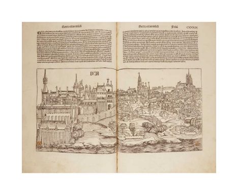
Nuremberg: Anton Koberger for Sebald Schreyer and Sebastian Kammermeister, 12th July 1493. Folio (456 x 309mm.), illustrated with over 1800 woodblock prints by Michael Wolgemut and Wilhelm Pleydenwurff, rebound in 18th or 19th century calf over ?original wooden boards, the binding worn; lacking 6 leaves including 1 Contents leaf ("El-Jula - Fredericus tercius"), folios 189, 259, 260 (259 & 260 mostly blank apart from page numeral and running title), 264 and 1 blank leaf at end, title-page trimmed and laid-down, 14 leaves with new lower margin and repaired in inner margin (folio 230 with some loss of woodcut), c. 17 additional leaves repaired in inner margin (folio 87 split with some loss of woodcut), c. 15 further leaves repaired in lower margin (folio 207 with tear extending into image, 226 verso affecting a few letters); folio 299 (map) repaired in inner margin and with corner supplied in manuscript facsimile; some light internal dampstaining and discolouration, a few minor wormholes not affecting text, neat repairs occasionally with slight loss to text, a few closed tears, a small amount of paint applied to a few images, folio 169 with one paragraph of text and image of a Pope erased by an early hand, some neat marginalia in an early hand, covers rubbed, joints split [USTC 748763; Goff S-307; HC *14508; Klebs 889.1; Oates 1026; Proctor 2084; BMC II, 437]Footnote: Provenance: Bookplate of S. Leigh Taylor [d.1891], bequeathed to him by his aunt Joanna Holdsworth [d.1869]; bequeathed by Samuel Leigh Taylor to his nephew, Russell Leigh Taylor; and thence by descentNote: One of the most important German incunables, The Nuremberg Chronicle (as this work is commonly known) is the most richly illustrated printed book produced in the fifteenth century. The text is a universal history of the Christian world from the beginning of times to the early 1490s, written in Latin by the Nuremberg physician and humanist Hartmann Schedel (1440-1514) on commission from the Nuremberg merchants, Sebald Schreyer (1446-1520) and Sebastian Kammermeister (1446-1503). Drawn by the author from multiple medieval and Renaissance sources, such as Bede, Vincent of Beauvais, Martin of Tropau, Bartolomeo Platina, Flavius Blondus, and Philippus de Bergamo, the Chronicle also provides detailed information on the history and topography of European countries and towns. The narrative is divided into 11 parts, the so-called "world ages", and is profusely illustrated with images of biblical and historical events, alongside topographical views of towns and countries in Europe and the Middle East, including Jerusalem (and its destruction) and Byzantium.
Lot 51
Ronaldshay, The Earl of Sport and Politics under an Eastern Sky. Edinburgh and London: William Blackwood and Sons, 1902. First edition, 8vo, 2 folding colour maps, 14 plates, black and white photographs through text, original green pictorial cloth; Gubbins, Martin Richard An Account of the Mutinies in Oudh and of the Siege of the Lucknow Residency. London: Richard Bentley, 1858. First edition, 8vo, 4 folding maps, 4 plates, contemporary red cloth with decorative blindstamping; Thurston, Edgar Ethnographic Notes in Southern India. Madras: Government Press, 1906. First edition, 8vo, 40 plates, original light blue gilt pictorial morocco; Coomaraswamy, Ananda K. (translator) Thirty Songs from the Panjab and Kashmir. London: Old Bourne Press, 1913. Edition of 405, 4to, 2 plates, music and lyrics, owner's ink stamp to free endpaper, polychrome cloth; Holmes, R.B. (photographer) The North-West Frontier of India in Picture. Bombay: The Times Press, 1919. 25 x 32cm, black and white photographs through text, 2 colour illustrations, original grey card pictorial binding; Hayden, H.H. Memoirs of The Geological Survey of India, Volume 36. Calcutta: Government of India Central Printing Office, 1904 and 1907. 8vo, folding map and 2 folding geology surveys, 14 plates, contemporary brown cloth; Edwardes, S.M. and L.G. Fraser Ruling Princes of India. Junagadh: Being a Historical, Archaeological, Political and Statistical Account of The Premier State of Kathiawar. Bombay: Times of India Press, 1907. Colour plate of Map of the Junagadh State, 6 plates with coloured photographs of princes and views on blue paper, photographs through text, original red morocco binding with gilt art nouveau-style decoration. White, Lieutenant George Francis Views in India, chiefly among the Himalaya Mountains. London & Paris: Fisher, Son, And Co., 1838. 38 illustrated plates including several by JMW Turner, contemporary quarter green morocco and green gilt moir (8) Footnote:
![The Scots Magazine...Volume VIII. Edinburgh: W. Sands, A. Murray, and J. Cochran, [1746]. 8vo, contemporary calf, upper cover](https://cdn.globalauctionplatform.com/aaab4a07-72a1-4a32-90e4-ad9000bb169f/5efb5c1a-23a3-4de6-bf35-ad9b00ad20b8/468x382.jpg)
Lot 62
The Scots Magazine...Volume VIII. Edinburgh: W. Sands, A. Murray, and J. Cochran, [1746]. 8vo, contemporary calf, upper cover detached; Stewart, David Sketches of the Character, Manners and Present State of the Highlanders of Scotland. Edinburgh: Archibald Constable & Co., 1822. 2 volumes, 8vo, hand-coloured folding map with some repairs, contemporary boards with later cloth spines; [Idem] Sketches of the Character, Manners and Present State of the Highlanders of Scotland. Edinburgh: Archibald Constable & Co., 1822. 2 volumes, 8vo, hand-coloured folding map, contemporary half calf, annotations to flyleaf in an early hand; The History of the Rise, Progress, and Extinction of the Rebellion in Scotland in the Years 1745 and 1746. London: R. Thomson et. al., [n.d.] Second edition, 8vo, frontispiece, portrait, contemporary half calf, ownership inscription of Emily Forbes; Bacon, Sir Francis The Compleat Parish-Officer...to which is added the Office of Constables. The Savoy: Bernard Lintot, 1734. Seventh edition, 12mo, contemporary calf, covers very worn, a large amount of internal marking; Munro, James A Gaelic Primer containing Rules for Pronouncing the Language. Glasgow: John Wylie & Co., 1828. 12mo, contemporary calf, hole to front free-endpaper; History of the Siege of Blair Castle in 1746. Privately printed, 1874. 8vo, inscribed to Duncan Forbes of Culloden from the Duke of Atholl, 1882; Description of the Regalia of Scotland. Edinburgh: James Ballantyne and Company, 1819. 12mo, lacking covers; MacLeod, R.C. The MacLeods of Dunvegan. The Clan MacLeod Society, 1927. 8vo, original red cloth gilt, signed by the author; Beresford, M. Standing Orders of the Seventy-Second Highlanders. Peshawar, 1873. 12mo, contemporary red calf; A History and Description of the Town of Inverness... Inverness: Kenneth Douglas, James Smith and Donald Fraser, 1847. 12mo, original green cloth gilt; sold not subject to return (13)
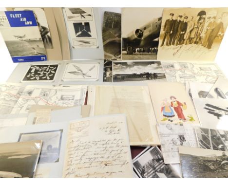
Lot 98
Aeronautical interest; press photographs and ephemera, particularly relating to Australia, including a letter from Flight Lieutenant Arthur Long AFC, the first pilot to cross the Bass Straight, signed photograph of a pilot, sea planes at Darwin, Junkers D-1925 in flight, Quantas material and a map of the London to Melbourne (MacRobertson) Centenary Air Race 1934, bearing facsimile signatures of Tom Campbell Black and Charles William Anderson Scott. (a quantity)


Lot 449
A LARGE SCROLL MAP OF ENGLAND AND WALES BY JOHN CARY hand-coloured engraving, composed of seventy-eight individual plates laid down, titled 'Cary's New Map of England and Wales with part of Scotland on which are carefully laid down all the direct and principal cross roads, the course of the rivers and navigable canals..', 'Published June 11th 1794 by J. Cary, Engraver & Map-Seller, No. 181 Strand' 225 x 177.5cm

Lot 451
A MAP OF SAINT HELENA BY LIEUTENANT R. P. READ a hand-coloured engraving, 'This Geographical Plan of the Island & Forts of Saint Helena is Dedicated by permission to Field Marshall His Royal Highness The Duke of Kent and Strathearn', 'Published for the Proprietor June 4th 1817 by J & M. Rippin, No. 21 Theobald's Road' 46 x 60cm


Lot 732
A printed silk scarf, 19th century, titled 'THE RAILWAYS IN GREAT BRITAIN ALSO THE LINE OF NAVIGATION FROM THE PRINCIPAL SEA PORTS TO BOTH HOME AND FOREIGN STATIONS', the red printed map with railway lines and navigation routes picked out in black, within a red floral bordered, illustrated title block to top right corner, 55cm x 60cm (at fault) CONDITION REPORT:The piece shows staining in several areas, particularly around the title panel, over Northern Ireland and north of the Cornish peninsular. There are three small tears to the lower edge, the largest 15mm long. There is a further small tear in the top left hand corner.

Lot 357
THE SCRIPTURE ATLAS, OR A SERIES OF MAPS, TO ILLUSTRATE THE OLD AND NEW TESTAMENT, full red leather, gilt embossed decoration to cover and spine, engraved title page, twenty hand-coloured engraved maps including five double-page, tissue-guards, bound with A COMPLETE INDEX TO THE SCRIPTURE ATLAS, with advertisement and list of Patrons, Matthews And Leigh, London 1812 and 1813, with Farrar (F.W.), THE LIFE OF CHRIST, full leather, gilt title and decoration to spine, marbled endpapers, gilt edges to block, inscribed to front free endpaper and dated '1882', coloured Palestine map frontispiece, engraved title page, engraved illustrations throughout, Cassell Petter & Galpin, London, and LEONARD'S CHRONOLOGICAL AND GEOGRAPHICAL FAMILY GUIDE TO THE HOLY BIBLE, fold out coloured map engraved by John Dower, paper panels on linen, embossed leather boards, 64cm x 76cm, C.W. Leonard, circa 1860 (3)

Lot 11
The Regality of Kirriemuir by Alan Reid with a map of the district and 140 illustrations from original photographs and drawings, published John Grant 1909 - 1st edition, 650 copies of this book were printed, 600 were for sale, list of subscribers at rear. Bound in maroon gilt cloth with top edge gilt, very good clean condition.

Lot 3
5 Biggles and Gimlet by Captain W. E. Johns inc. Biggles Takes a Holiday pub. Hodder & Stoughton 1st Ed. June 1949 small tear top and bottom of dust jacket on spine and some wear on front flap, and Biggles in the Jungle, pub. the OUP 1947 reprint, jacket torn on spine, and The Murder at Castle Deeping revised and reset 1951 pub. Latimer House in dj tear to rear, and Gimlet Bores In pub. Brockhampton Press 1950 1st Ed. lower portion of jacket missing on spine, and Jimlet Off the Map, pub. Brockhampton Press 1st Ed. 1951, has inscription otherwise nice clean copy, together with Boys Will Be Boys by E. S. Turner: 'The Story of Sweeney Todd,' 'Deadwood Dick,' 'Sexton Blake,' 'Billy Bunter,' 'Dick Barton,' et. al. pub. Michael Joseph 1948 3rd Impression.
Lot 76
Quantity of cigarette cards, both loose and in several albums, approx 40 in total, makers include W.D & H.O Wills, Players, Park Drive, Mobil cigarette cards, History of Naval Dress, National Flags, Railway Equipment, Wild Flowers, Association Footballers, Regimental Badges, Military Uniforms, Coronation of H.M King George VI and H.M Queen Elizabeth, Sea Fishes, Tennis, Cricketers, Aeroplanes including a Philips Ten-Sheet Road Map of England and Wales cloth edition and collection of Lyon tea cards Australia, Gallagher's Wild Animals, Will's Garden Flowers and Wild Animals, Do You Know?, Craven Black Cat Military Uniforms, amongst many others.
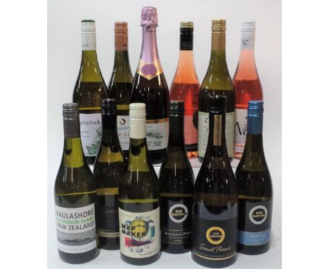
Lot 123
12 BOTTLES NEW ZEALAND WHITE AND ROSE WINEHaulashore Sauvignon Blanc 2020; Anchorage Reserve Sauvignon Blanc 2020; Map Maker Sauvignon Blanc 2019; Kim Crawford Sauvignon Blanc 2020; Kim Crawford Small Parcels Sauvignon Blanc 2019; Kim Crawford Pinot Gris 2019; Spinyback Pinot Gris 2020; Blind River Sauvignon Blanc 2019; Oyster Bay Sparkling Rosé; Freeman's Bay Rosé 2019; Lansdowne Pinot Gris 2015; The Ned Rosé 2020


Lot 143
County maps etc. A collection of 19th Century maps including Cary, John. A New Map of Hampshire, 1811; A New Map of Warwickshire, 1818; A New Map of Derbyshire, 1823 - Bettison's Map of the Country Twenty Miles Round Cheltenham, n.d. All folding hand coloured, in board slipcases. With 14 others and a pamphlet on Buxton (19)/Provenance: Spetchley Park


Lot 170
Kirwan, Richard. Elements of Mineralogy, 1784, Orig. boards (worn) - Buckland, Rev. William. Geology and Mineralogy, 2 vols., 1837 - Mossman, Samuel. The Origin of the Seasons Considered from a Geological Point of View, Edinburgh and London 1819. Engraved map and diagrams - Burr, Frederick. Introduction to the Study of Geology, 1836. Hand coloured frontispiece. With 2 other volumes. 8vo., orig. cloth (7)/Provenance: Spetchley Park


Lot 233
Wright (Andrew) Court-Hand Restored or, The Student's Assistant in Reading Old Deeds, Contracts, Records etc., London 1879, two photographic souvenir booklets, The Beauty of Argyll and Memories of Skye, various ephemera including small hotel adverts, one with maps of Jersey, another with panoramic map of the Rhine, a silk bullfighting poster, 1871, a hand written diary of a trip with Sir Walter Currie 'Through Kaffir Land and No-Man's-Land Jany-April 1862'


Lot 749
Frederick De Wit - Nova Orbis Tabula, in Lucem Edita, late 17th century hand coloured engraved map of the world, with figural vignettes, total size 52 x 62cmCondition report: Some staining/discolouration. Tear on the left. Central vertical fold has torn in places and been reinforced on the back - please see photos.


Lot 125
A pair of vintage A Bulzoni snakeskin shoes, size 38, with similar handbag; a black and purple Radley handbag, shoulder strap; another handbag; and a quantity of vintage scarves, to include 'The "Fairest Cape of All"' hand-painted map of South Africa by Monica Wilson, signed and dated 1953, plus Pierre Cardin, Chanel, Kreier, Christian Lacroix, Guy Laroche, Norma Legge, Paloma Picasso, Schiaparelli, mainly silk.


-
108737 item(s)/page