We found 108737 price guide item(s) matching your search

Refine your search

Year

Filter by Price Range
  • List
  • Grid
  • 108737 item(s)
    /page

Lot 399

Canariae I. A charming miniature map of the Canary Islands, off the coast of Morocco. The map is handsomely adorned with a strapwork cartouche, a galleon, and two sea monsters. The majority of the maps for Bertius` geographical treatise were engraved by Jodocus Hondius Jr. after Mercator. French text on verso. A nice impression on watermarked paper with attractive color and one small spot to the left of the ship. 3.8 W x 5.3 H Hondius/Bertius, 1618

Lot 400

Carte des Isles Canaries, avec l`Isle de Madere, et Celle de Porto Santo This copper engraved map of the Canary Islands includes the islands of Porto Santo, de Madere, Tenerife, Palme, de Fer, de Canarie and Fortaventure. There are three distance scales including French leagues, marine leagues, and Spanish leagues. Issued folding on sturdy paper with a few faint spots. 12.6 W x 8.3 H Bonne, Rigobert 1787

Lot 401

Sancta Helena A handsome map of Saint Helena Island in the south Atlantic Ocean. The mountainous topography is depicted, along with a forested area and one dwelling. The map is handsomely embellished with a sea monster, ship, and an ominous title cartouche. The majority of the maps for Bertius` geographical treatise were engraved by Jodocus Hondius Jr. after Mercator. French text on verso. A dark impression with attractive color. 3.8 W x 5.3 H Hondius/Bertius, 1618

Lot 403

Islands in the Atlantic Beautiful steel engraved map consisting of four maps with six vignette views. Maps include the island groups of Cape Verde, Canary, Azores, Bermuda, and Madeira. Vignettes include Fayal, Villa Franca, and Pico (Azores), Chapel in the Rock St. Vicente (Cape Verde), Teneriffe (Canary Islands), and Funchal (Madeira). All surrounded in a delicately engraved border. Map drawn and engraved by J. Rapkin, illustrations drawn and engraved by H. Winkles. Original outline color with later color in the vignettes, a couple of insignificant spots in the image, and faint toning along the sheet`s edges. 13.9 W x 9.8 H Tallis, John 1850

Lot 404

Mappa Aestivarum Insularum, Alias Barmudas Dictarum, ad Ostia Mexicani Aestuary Jacetium... A striking map based on the famous survey by Richard Norwood of the Bermuda Company, also known as the Somers Isles Company, in 1618. The map shows the division into the original Tribes, which were a short-lived name for what became administrative parishes, and were names of major shareholders in the company. Also shown are the various landowners, with their names in a table below the map. There are many tiny houses shown on the map, locating settlements, as well as minute cannons marking the defensible points. The map is superimposed over a chart of the Atlantic with the coastlines of Britain, North America and Hispaniola showing the location of Bermuda. Decorated with an exquisite strapwork cartouche, a coat of arms, a medallion and a compass rose. Jansson reissued Hondius` plate with his imprint between 1647 and 1666. Spanish text on verso, published between 1653-66. A nice impression with wide margins and professionally repaired centerfold separations that enter into map 1"" at top and 2"" at bottom. There is minor soiling and a faint damp stain at left. 15.5 W x 20.4 H Hondius/Jansson, 1653

Lot 408

Islanda This wonderful little map of Iceland shows the island prior to when any actual surveys were completed. It reflects very sketchy knowledge of the island, which is shown surrounded by many smaller islands. The minutely engraved map features delightful depictions of topography and elaborate cities. Mount Hecla is shown as a flaming mountain and named Mons Helafiel. Several icebergs are shown floating off the coast. The map is oriented by a simple compass and adorned with a deftly engraved cartouche. Engraved by Girolamo Porro and printed on a full sheet (8.3 x 11.6"") of Italian text. A dark impression with marginal soiling and foxing, well away from image. 4.1 W x 5.8 H Porcacchi, Tomaso 1586

Lot 409

Tabula Islandiae Auctore Georgio Carolo Flandro This handsome copper engraved map of Iceland was based on information from a Dutch navigator named Joris Carolus in about 1620. The map shows the influence of both versions of Bishop Gudbrandur`s previous maps, a coastline resembling the Ortelius version, and Mercator`s selection and spelling of many place names. The island`s topography is dominated by huge mountains and volcanoes and its shoreline is a rugged labyrinth of fiords. It is richly embellished with title and distance scale cartouches, compass roses, rhumb lines, a sailing ship and two sea monsters. The cartouche features two winged sprites, an important symbol in Icelandic and Norse mythology. Along with elves and dwarves, sprites were magical beings who aided the gods. The map was first issued by Jodocus Hondius and then re-issued by Willem Blaeu with his imprint. It became the prototype for the mapping of Iceland and its influence did not wane until the mid-18th century. French text on verso, published between 1643-50. A fine impression with original color that has been partially refreshed and minor damp stains in the bottom blank margin. 15 W x 19.5 H Hondius/Blaeu, 1644

Lot 410

Carte de l`Islande pour Servir a la Continuation de l`Histoire Generale des Voyages. Dressee sur celle de M. Horrebows In 1752 the Danish scholar, Niels Horrebow, published an important book and map about Iceland. His map, based on the previously unpublished Knoff survey, was a major departure from previous maps based on Bishop Gudbrandur Thorlaksson`s map of more than 150 years earlier. Thus, it marked a turning point in the cartography of Iceland. This is Bellin`s version for Prevost`s important work on voyages of exploration. The map locates villages and churches and graphically delineates the mountains, rivers, lakes and forests. A note at bottom left explains that there are only two Episcopalian villages on the island, which are so marked, and that the term ""village"" on this map simply identifies a location where commerce occurs when ""the Danish negotiators arrive on the island."" Issued folding on watermarked paper with minor offsetting. The right margin has been extended with old paper to accommodate framing. 11.8 W x 14.9 H Bellin, Jacques Nicolas 1758

Lot 411

[Lot of 3] Groenland [and] Novae Zemlae Delineatio [and] Delineatio Freti Vaigats This matched set of 3 miniature maps are from Bertius` geographical treatise. Each map is beautifully engraved with a strapwork title cartouche and fully engraved seas. The majority of the maps for Bertius` geographical treatise were engraved by Jodocus Hondius Jr. after Mercator. French text on verso. Size varies slightly.A. Groenland. This handsome miniature map is one of the first maps to focus on Greenland. The island is shown as a narrow island with a central mountain range. Across the Fretum Davis is C. Bedford. Iceland is also shown with an erupting volcano.B. Novae Zemlae Delineatio. This charming miniature map shows the parts of Novaya Zemlya that had been discovered by western Europeans during their search for a northern passage to Asia. The first visit was by Hugh Willoughby in 1553. Then in 1596, Willem Barents rounded the north point of Novaya Zemlya, and wintered on the east coast near the northern tip. The map shows the western coast and northern tip of Novaya Zemlya according to Barent`s reports, and is decorated with two sailing ships and a raft of penguins in the sea, with a decorative title cartouche and compass rose.C. Delineatio Freti Vaigats. This miniature map shows the straits between mainland Russia and Vaygach Island, an area that was discovered by western Europeans during their search for a northern passage to Asia. The first visit was by Hugh Willoughby in 1553. Then in 1596, Willem Barents rounded the north point of Novaya Zemlya, and wintered on the east coast near the northern tip. At the time Vaygach Island was thought to be a part of Novaya Zemlya. The map is decorated with a sailing ship, compass rose, spouting whale, and a nice title cartouche. Very light toning and marginal soiling. 3.8 W x 5.3 H Hondius/Bertius, 1616

Lot 412

Europa Recens Descripta This classic map of Europe is presented in the carte-de-figures style with vignettes on three sides. The upper frieze has nine bird`s-eye views of Amsterdam, Prague, Constantinople, Venice, Rome, Paris, London, Toledo and Lisbon. The side borders contain the costumes of the noblemen and women of ten European nations. The map is embellished with sailing ships, sea monsters, bears and Neptune riding a dolphin and holding his trident. A beautiful map produced at the height of the Golden Age of Dutch mapmaking; it was included in the first volume of Blaeu`s magnificent atlas. French text on verso, published between 1643-50. A dark impression with original color that has been partially refreshed, light printer`s ink residue at left, and an expertly repaired centerfold separation that enters 2"" into map at bottom. The right and left margins have been extended to accommodate framing. 16.3 W x 22.1 H Blaeu, Willem 1643

Lot 413

Status Religionis Catholicae in Europa per Mappam Geographicam Proposit. This map of Europe shows the spread of Catholicism throughout the continent. A legend on a stone plinth at bottom left identifies cities based on their Catholic affiliation, including those that are part non-Catholic, and those where Catholicism has been introduced but is in decline. The magnificent title cartouche features a vignette of the Crucifixion, and the map is further embellished by sailing ships and sea monsters. A dark impression on a clean, bright sheet with attractive color. 9.1 W x 13.8 H Scherer, Heinrich 1702

Lot 414

Nouvelle Carte pour Servir a l`Histoire de l`Empire d`Occident Depuis les Premiers Empereurs Romains Jusques Apres les Successeurs de l`Empereur Theodose avec des Tables et des Remarques Trens Instructives This interesting map reflects the extent of the Roman Empire in Europe and northern Africa. The map features good topographical detail, and provinces, client states, cities, and rivers are named. There is an extensive key to important locations at bottom and a legend at upper left providing information on the governing hierarchy. A few historical and geographical notes in Latin appear within the map. A fine impression issued folding with a few extraneous creases, minor offsetting, and a hint of toning that is most noticeable in the blank margins. 19.9 W x 22.9 H Chatelain, Henry Abraham 1719

Lot 415

L`Europe Dressee sur les Observations de Mrs. de l`Academie Royale des Sciences et Quelques Autres; & sur les Memoires les Plus Recens Large, attractive map of Europe, including Iceland and the Mediterranean, based on the geography of Guillaume Delisle. The German Empire dominates all of central Europe, Poland takes in all of northeastern Europe, and the Turkish Empire occupies all of southeastern Europe. Fine decorative title cartouche. Alternative title above neatline at top: ""Nova Europe Descriptio in Regna & Regiones Praecipuas Divisae, ad Usum Serenissimi Burgundiae Ducis."" Original color on watermarked paper with minor soiling, a crease adjacent to centerfold at bottom, and a professionally repaired tear that just enters neatline at bottom. 18.9 W x 22.9 H Delisle/Covens & Mortier, 1730

Lot 416

Europa Secundum Legitimas Projectionis Stereographicae Regulas et Juxta Recentissimas Observationes Aeque ac Relationes... Decorative map of Europe with good detail throughout. It is based upon Haas` stereographic horizontal projection, which was featured in his book on cartographic methodology. Large decorative cartouche features Europa, crowns, horse heads, putti and the figure of Fame with her trumpet. A handsome chart that extends to include Iceland, the Mediterranean, and part of Northern Africa. French title L`Europe dessinee Suivant les Regles... is in top margin. Light soiling with a few very minor repairs and creases along the centerfold. 18.7 W x 21.8 H Haas/Homann Heirs, 1743

Lot 418

Das Under Buch Beschreibung Engellandts und Schottlandts This charming woodblock map of Britain is based on the Mercator-Ortelius outline and focuses primarily on England and Wales as the northern part of Scotland and the western part of Ireland are cut off by the borders. The map shows an unusual eastward slant to the mainland of Scotland. Only major cities are located and the topography is simplified. A small ship sails in the North Sea. German text on verso. A nice example with a faint stain along bottom neatline. 9.8 W x 6.8 H Munster, Sebastian 1578

Lot 419

Magna Britannia While the majority of the maps for Bertius` geographical treatise were engraved by Jodocus Hondius Jr. after Mercator, the individual maps of England, Scotland and Ireland were engraved by Salomon Rogiers after John Speed. This map depicts England, Wales, Scotland and a portion of Ireland, with great detail of towns and rivers throughout. French text on verso. A fine impression on watermarked paper with minor show-through of text on verso. 3.9 W x 5.4 H Hondius/Bertius, 1618

Lot 420

Britannia Prout Divisa fuit Temporibus Anglo-Saxonum, Praesertim Durante Illorum Heptarchia Elaborate vignettes depicting kings and scenes from Saxon history flank this magnificent map of Britain. The scenes are identical in subject matter to those used by John Speed. However they are presented in the dramatic, Dutch miniature style. The left border contains portraits of the earliest kings, while the right one depicts later kings in the process of conversion to Christianity. Included is a scene of Ethelbert receiving instruction from Saint Augustine and another of Sebert re-consecrating the temples of Diana and Apollo, now St. Paul`s, London and St. Peters, Westminster. The map shows England, Scotland and Wales divided into the various Saxon kingdoms, each decorated with its coat-of-arms. A superb example of Dutch cartographic design and engraving. French text on verso, published between 1645-48. A fine impression with full original color, light even toning, and professional repairs to a few small holes confined to blank margins. There is a printer`s crease in the bottom right vignette. 16.3 W x 20.3 H Blaeu, Johannes 1645

Lot 422

Britannia Romana This handsome map shows the British Isles during the era of Roman rule. Iron Age tribes are located, as are numerous towns. Hadrian`s Wall is depicted and various associated forts are named. The title cartouche is emblazoned onto a shield. On watermarked paper with light offsetting and remnants of cello tape on verso and along the edges on recto. There is moderate toning that is mostly confined to the blank margins. 13.9 W x 16.9 H Morden, Robert 1695

Lot 426

The North & East Riding of Yorkshire Copper engraved sheet with a map of Yorkshire, the largest county in England, occupying the lower two-thirds of the page. The top third of the sheet contains a mileage chart with the title The Road from Carlisle to Rarwick, enclosed in a beautifully engraved cartouche. Text along the bottom by John Owen describes the county`s layout, weather, and soil. An Ogilby-style strip map showing Northamptonshire and Warwickshire appears on verso, along with Northamptonshire`s coat-of-arms and descriptive text. A crisp impression on an unevenly toned sheet with a hint of offsetting from an opposing page. 7.3 W x 4.7 H Owen & Bowen, 1720

Lot 427

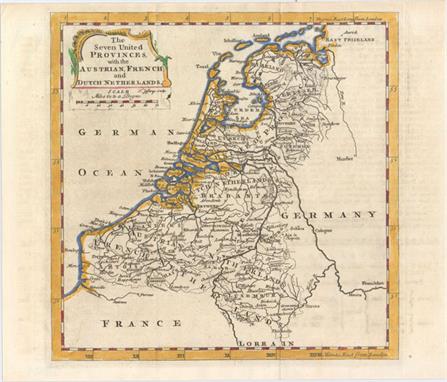
[Lot of 4] London to Birmingham by Buckingham and Banbury [and] [Untitled - Road map from Wendover to Caughton] [and] A Map of Buckinghamshire North West from London [and] Buckinghamshire A. London to Birmingham by Buckingham and Banbury, by Carrington Bowles, from Paterson`s Itinerary, dated 1785, black and white (3.5 x 6.5""). The recto of this sheet contains a strip map from Tring through Aylesbury to Bicester. The verso shows a strip map from Chalfont St. Peter through Amersham and Aylesbury to Padbury, just a few miles south of Buckingham. In the bottom margin on both sides are keys identifying the proprietors of various locations on the maps. Condition: A fine impression on watermarked paper. (A+)B. [Untitled - Road map from Wendover to Caughton], by Owen & Bowen, from Britannica Depicta or Ogilby Improved, circa 1720, black and white (4 x 6.2""). This strip map depicts the road from Wendover through Alesbury, Buckingham, Banbury, and Stratford upon Avon, to Caughton. Notes regarding each of the towns along the map are included, and on verso is the coat of arms of Banbury. Condition: Watermarked paper with very light toning. (B+)C. A Map of Buckinghamshire North West from London, by Thomas Badeslade, from Chorographia Britanniae, dated 1742, hand color (5.9 x 5.8""). This miniature map depicts Buckinghamshire showing roads, towns, rivers, and topography. At left is information for each of the towns regarding the number of members they send to Parliament and days on which there are markets and fairs. Condition: Light toning with remnants of cello tape along edges of sheet on verso. (B+)D. Buckinghamshire, by Anonymous, circa 1720, hand color (4.1x 4.1""). This tiny map of Buckinghamshire shows towns and includes a triangular distance table. Condition: A few spots of foxing. (B+) See description above. 1720-85

Lot 428

Map of the County of Middlesex, from an Actual Survey Made in the Years 1819 & 1820 This large and decorative map of Middlesex was published by the famous Greenwood firm. It depicts the region from London west to Uxbridge and north to Waltham Abbey. Large vignettes of Westminster Abbey and St. Paul`s Cathedral are illustrated in the lower portion of the sheet with a large compass rose above the map image. On watermarked paper with moderate soiling, two extraneous vertical creases to the left of the centerfold, and an edge tear confined to the right blank margin. 21.2 W x 25.6 H Greenwood Firm, 1829

Lot 429

Warwicum, Northhamtonia, Huntingdonia, Cantabrigia, Suffolcia, Oxonium, Buckinghamia, Bedfordia, Hartfordia, Essexia... Mercator`s great map of the southeast region of England including the British Channel and London. The map includes London, Kent, Oxford and Cambridge, as it covers the region between Norwich in the north and west to beyond the Isle of Wight. The sea is engraved in a moire pattern and the title is included in a fine strapwork cartouche. French text on verso, published between 1613-16. A nice impression on watermarked paper with very minor soiling and a few tiny wormholes confined to the blank margins. 14.4 W x 18.3 H Mercator, Gerard 1613

Lot 436

Anglia Regnum This fine map of England and Wales was copied from Willem Blaeu`s map and its decorations are nearly identical except that Jansson has added heraldic shields in Scotland and Ireland. It is decorated with four ships, a scale of miles flanked by sheep and a cherub, and two finely engraved coats of arms, of Great Britain and of England, surmounting the title cartouche. French text on the verso, published between 1645-46. A bright example with a fine impression, minor show-through of text on verso, and a professionally repaired 1"" tear in Glamorganshire. 15.3 W x 19.8 H Jansson, Jan 1645

Lot 441

A New & Accurate Map of North Wales, Drawn from a Late Survey This detailed map details six historic counties in northern Wales, from Anglesey down to Montgomeryshire. Roads, castles, rivers, and bays are identified, and cities, rectories, vicarages, fairs, and borough and market towns are indicated by symbols explained in a key at top right. A decorative title cartouche adorns the bottom left corner. Issued folding on a slightly toned sheet with light offsetting and some soiling mostly concentrated just outside the neatline at left. 7.2 W x 9.3 H Anon., 1766

Lot 442

Scotia This is one of the earliest printed maps of Scotland, with north oriented to the right of the page. The map is adorned with sailing ships, sea monsters, a compass rose, a stippled sea, and a title cartouche flanked by putti. Engraved by Girolamo Porro and printed on a full sheet (8.3 x 11.6"") of Italian text. Minor soiling in the blank margins. 4.1 W x 5.6 H Porcacchi, Tomaso 1586

Lot 445

Scotland This impressive map of Scotland features excellent detail of the counties, towns and cities, and topography. An inset in the upper right corner zeroes in on the Shetland Islands. Six vignettes drawn and engraved by J. Rogers surround the map, depicting the city of Edinburgh, men in the midst of deer stalking, an intense game of shinty, Holyrood House, and monuments to two of the nation`s most important writers, the poet Robert Burns and man of letters Sir Walter Scott. Enclosed in an elegant border. The map itself was drawn and engraved by J. Rapkin. On a clean, bright sheet with faint offsetting. 13.9 W x 9.9 H Tallis, John 1850

Lot 446

[Lot of 2] Perth Kinross [and] Argyle This appealing pair of miniature maps focuses on Perth Kinross and Argyle, regions and former counties of Scotland. The Perth Kinross map is embedded in an elaborate illustration featuring a bolt of cloth, bird, waterfall, and fish (the area is known for its salmon and trout fishing). Within the map itself, towns, rivers, mountains, and a lake are identified. Engraved by Thierry. The Argyle map is surrounded by depictions of a waterfall, mallet, fishing net, sheep`s head, and bolts of cloth, and shows the string of islands that make up the region. Engraved by Migneret. Maps by Perrot are described by King as ""the most decorative miniature maps of the nineteenth century."" Size varies slightly. Each map has light scattered foxing. There are remnants of hinge tape on the verso of the Perth Kinross map. 4.3 W x 2.8 H Perrot, Aristide Michel 1823

Lot 448

Irlanda A charming small map of Ireland with north oriented to the right. The shape and geography of the country is quite rudimentary, with cities focused primarily along the coastline. The map is adorned with fantastical sea monsters, a compass rose, and a decorative title cartouche. Engraved by Girolamo Porro and printed on a full sheet (8.3 x 11.6"") of Italian text. On watermarked paper with minor show-through of engraving on verso. An ink notation and some scattered foxing appear along the sheet`s edges, well away from image. 4.1 W x 5.6 H Porcacchi, Tomaso 1586

Lot 449

L`Irlande Divisee par Provinces Civiles et Ecclesiastiques Decorative map with rococo-style cartouche and two distance scales. Good detail throughout the island particularly with towns, rivers and coastlines. Enclosed with an ornate picture-frame border. A strong impression with original color, some faint color offsetting, and a small rust stain confined to the lower blank margin. 10.8 W x 12.3 H Brion de la Tour/Desnos, 1766

Lot 450

Ireland This is a delicately engraved map of Ireland showing excellent detail of the provinces, towns, and cities as well as topography. The map is surrounded by lovely vignettes of St. Patrick`s Cathedral in Dublin, Limerick Castle, one of Ireland`s Holy Wells, Ross Castle on the Lake of Killarney, and the Round Tower in Wicklow. The beautifully engraved border is comprised of shamrocks, with a harp entwined in shamrocks at the bottom. Original outline color with light scattered foxing, faint soiling, and marginal toning. 13.7 W x 9.4 H Tallis, John 1850

Lot 452

A Plan of the River Lagon, and of the Intended Navigable Canal from Belfast to Loughneagh... This appealing map centers on the River Lagan and stretches from Lough Neagh to just northeast of Belfast. Various towns and cities, mills, bridges, and roads are shown. A chart at bottom right indicates the distance between various destinations in the area depicted. A compass rose orients the map with the north to the upper right hand corner. Issued folding with light offsetting. 6.8 W x 12.4 H Bowen, Emanuel 1778

Lot 455

[Lot of 3] Suecia et Norvegia ect. [and] Gotia [and] Thietmarsia This matched set of 3 miniature maps are from Bertius` geographical treatise. Each map is beautifully engraved with a strapwork title cartouche and distance scale. The majority of the maps for Bertius` geographical treatise were engraved by Jodocus Hondius Jr. after Mercator. French text on verso. Size varies slightly.A. Suecia et Norvegia ect. This map depicts Scandinavia, extending east to include parts of present-day Russia and the Baltic states.B. Gotia. A lovely miniature map of southern Sweden delineating Gotland, Oland and the mainland from Stockholm south to below Vaxjo.C. Thietmarsia. This map shows the Holstein region in northern Germany, between the Eider and Elbe Rivers. The map is oriented with north to the left and features a moire-patterned sea. Very light toning, minor show-through of text on verso, and marginal soiling. 3.8 W x 5.3 H Hondius/Bertius, 1616

Lot 457

Suecia, Dania, et Norvegia, Regna Europae Septentrionalia... This fine map depicts the kingdoms of Sweden, Denmark and Norway, whose coats of arms are featured within the title cartouche. The map is attributed to Anders Bure (1571-1646), a Swedish cartographer and mathematician. Bure, also known as Andreas Bureus, is best known for his 6-sheet map of Scandinavia and for serving as the first director of the Swedish land survey. The Kingdom of Sweden is shown at its largest extent. The map extends to present day Finland and the Baltic states, and is filled with details of towns, political boundaries, rivers, and topography. This is the first state with French text on verso, published between 1643-50. A nice impression with original color that has been partially refreshed and faint damp stains in bottom blank margin that just enter map border in a few spots. 16.7 W x 20.9 H Blaeu, (Family) 1643

Lot 458

Scandinavia Complectens Sueciae Daniae & Norvegiae Regna ex Tabulis Beautiful folio map of Scandinavia, including the Baltic States with a portion of northeastern Russia, locates Moscow, S. Michael Archangel, Konigsberg, and more. Elaborate figurative cartouche features a herald, putti, angels, a lion, and royal coat-of-arms. Four distance scales at upper right. A nice impression with moderate toning along the centerfold, faint offsetting, and several small damp stains confined to the blank margins. 19 W x 22 H Homann, Johann Baptist 1720

Lot 460

La Suede, et la Norwege avec l`Islande... This attractive and nicely engraved map of Scandinavia presents the political divisions of each country with an inset of Iceland. The map is flanked by French text describing the area. The map, text and border were all printed from separate plates with the text adhered to the sheet by the publisher. The sheet with text measures 18.8 x 11"". A nice impression printed on bluish paper with very light toning along centerfold and edges of sheet. 9.2 W x 10.2 H Brion de la Tour, Louis 1786

Lot 463

Sweden & Norway This finely and precisely engraved map of Sweden and Norway shows many towns and cities, political divisions, canals, lakes, and rivers. A table at right gives the districts and prefectures for Norway and Sweden. Features decorative borders. Original color with wide margins and a light damp stain along the sheet`s edges, well away from the map. 11.9 W x 9.8 H Thomas, Cowperthwait & Co., 1850

Lot 464

Gothia This map of the southern part of Sweden depicts the forested topography, lakes and numerous place names. The large cartouches have a military theme with Mars and his fierce hounds atop the title. The map is further embellished with several sailing ships and coats of arms. This is the first state with a scales cartouche at lower left. French text on verso, published between 1643-50. A fine impression on watermarked paper with original color that has been partially refreshed. There is very light toning and faint damp stains in bottom blank margin that just enter map border in a few spots. 16.4 W x 20.8 H Blaeu, (Family) 1643

Lot 465

Ducatus Uplandia A decorative map of the area around Stockholm with well-engraved detail of the interconnected waterways from the Baltic through to Lake Malaren and its tributaries. The map is embellished with a number of coats of arms with the heraldry for Uppsala being the most prominent. The map is dedicated to Jacob de la Gardie in the lower left, while farmers and allegorical figures flank the title cartouche on the right. This is the first state with French text on verso. A nice impression on watermarked paper with old color that has been partially refreshed. There are a few spots of foxing in the image and faint damp stains confined to bottom blank margin. 15.1 W x 19.6 H Blaeu, (Family) 1643

Lot 467

Dioecesis Stavangriensis, & Partes Aliquot Vicinae, Opera L. Scavenii, S.S. This fine map shows the Bishopric of Stavanger and the adjacent regions from the work of Laurids Clausen Scavenius, the bishop of Stavanger from 1605 to 1626. The map locates the major villages and towns and presents reasonable coastal detail. However, the interior topography is not very accurate with Opslo Tellemarck shown as a large empty region, save for a large lake and a notation describing the road from Stavanger to Hallengdal as ""very hard due to the steepness of the mountains."" The map is beautifully embellished with two coats of arms, four sailing ships and two fine cartouches. Latin text on verso, published between 1640-43. A fine impression on watermarked paper with minor soiling. Professionally remargined at top with a portion of neatline skillfully replaced in facsimile. 16.4 W x 19.8 H Blaeu, (Family) 1640

Lot 469

Livonia, Vulgo Lyefland This handsome map covers the area of present-day Estonia, Latvia and Lithuania, with the Baltic Sea, as well as the neighboring coastlines of Sweden and Finland. The map is embellished with sailing ships, a title cartouche, and the coats of arms for Sweden, Finland, Estonia, Courland (Latvia), Lithuania, Moscovia and Ingria. French text on verso, published between 1643-50. A nice impression with original color that has been partially refreshed, a crease adjacent to centerfold, and minor damp stains confined to bottom blank margin. 15.1 W x 19.5 H Blaeu, (Family) 1643

Lot 471

Magn. Ducatus Lituaniae in Suos Palatinatus et Districtus Divisus... A detailed map of Lithuania and parts of Latvia, Kaliningrad, and Belarus. Numerous towns are noted, including Riga, Kaliningrad (Konigsberg), Vilnius, and Minsk. The map extends south to Pinsk and Mazyr, and east to Smolensk, Russia. Political boundaries, rivers, forests, and marshes are also shown. At top right is an inset with text describing the region. A French title above the map reads: ""Carte du Grand Duche de LituaniaeÂ…"" A nice impression with original color that has been partially refreshed and an abrasion above title cartouche. 18.6 W x 21.3 H Homann Heirs, 1749

Lot 473

Dania This miniature map of Denmark extends to include southern Sweden and parts of northern Germany. Tiny towns, river, and islands are shown. The majority of the maps for Bertius` geographical treatise were engraved by Jodocus Hondius Jr. after Mercator. French text on verso. A fine impression on watermarked paper with attractive color and one small spot below title cartouche. 3.8 W x 5.3 H Hondius/Bertius, 1618

Lot 476

Fionia Vulgo Funen Fine map of Fyn, Langeland and Als decorated with two distinctive cartouches, fancy scroll calligraphy and sailing ships. A large coat of arms is at upper left and the title cartouche featuring farmers and cows is at lower left. At right is a second cartouche containing a distance scale in an unusual vertical format. French text on verso, published between 1643-50. A nice impression on watermarked paper with original color that has been partially refreshed. There is light toning and minor damp stains confined to the bottom blank margin. 15 W x 19.6 H Blaeu, (Family) 1643

Lot 477

[Lot of 2] Hollanda [and] Isole Selandie Two very fine copper-engraved charts in the Italian style with fully stippled seas, depicting the Netherlands with the islands of Zeeland, and part of Flanders to the south. Cities are illustrated with miniature castles and include Rotterdam, Breda, Polder, and Brussels. Each map is adorned with a strapwork title cartouche and a compass rose. Engraved by Girolamo Porro and printed on full sheets (7 x 10.3"") of Italian text. Lovely color and minor soiling with manuscript writing in blank margins. Hollanda also has a couple of small manuscript marks in the map image. 4 W x 5.5 H Porcacchi, Tomaso 1590

Lot 478

Carte de la Hollande Prise en General Contenant les Sept Provinces Unies des Pays Bas This handsome map of Holland shows the area from the islands off the coast of Friesland and Embden in the north to Ostende and Dusseldorf in the south. Provinces, rivers, and towns are identified, including major cities such as Amsterdam, Rotterdam, the Hague, and Haarlem. Includes three distance scales. Engraved by Andre. A crisp impression with two tiny wormholes and a hint of offsetting. 9 W x 12.8 H Bonne/Raynal, 1780

Lot 479

Groningae et Omlandiae Dominium Vulgo de Pronvincie van Stadt en Lande... This detailed map of the northern Dutch region of Groningen extends to Emden. It is filled with meticulously engraved detail of the towns, roads, landmarks and topography. The scale of miles in the lower left is graced with coats of arms, allegorical figures and a putto bearing a lyre. The map is dedicated to D. Ludolpho Tjardae of Starkenburg. Lovely original color that has been partially refreshed, light soiling, and faint damp stains that enter 1"" to 2"" into map at right and left. 18.4 W x 22.4 H Visscher, Nicolas 1680

Lot 483

Flandria This is the rare, first of three plates of Flanders that Ortelius published in his monumental Theatrum Orbis Terrarum. The map extends from Zeeland and Antwerp in the north to Calais in the south, and as far east as Douai and Brussels. Rivers, forests, political boundaries, and hundreds of towns are shown, with the largest cities marked with miniature bird`s eye views. The map is embellished with galleons engaged in battle, a sea monster, and an allegorical female figure holding a bundle of grains and the coat of arms of Flanders. The map is enclosed in an elegantly engraved egg-shaped border. Latin text on verso. Van den Broecke estimates that fewer than 75 copies of this map were printed for the 1573 edition. Nice impression and color on watermarked paper with one tiny hole in image, a few small abrasions, and a professionally repaired centerfold separation. Expertly remargined all around with repairs to a few tears and chips entering border of map with excellent facsimile work of neatline in a few spots and decorative border at top and bottom left. 15.2 W x 19.6 H Ortelius, Abraham 1573

Lot 486

The Seven United Provinces, with the Austrian, French, and Dutch Netherlands This excellent small map of the Low Countries extends to show parts of Germany and France, which are left largely unengraved. Many cities are shown, including Amsterdam, Utrecht, the Hague, Antwerp, and Brussels, as are several provinces, rivers, and roads. A decorative title cartouche and enclosed distance scale adorn the top left corner of the map. Issued folding with some minor offsetting from an opposing page of text. 7.2 W x 7.1 H Jefferys, Thomas 1760

Lot 487

A Correct Chart of the Bay of Biscay This lovely small chart of the Bay of Biscay features soundings as well as notes indicating the type of sand or the presence of rocks at various points on the ocean floor. A note off the northern coast of Spain states, ""The depth of Water on the N. Coast of Spain is from 150 to 200 Fathoms generally Coral and Rocky Ground but even near the Land there is often no Ground at that Depth."" There is good detail along the French and Spanish coastlines. A compass rose capped with a fleur-de-lis radiates rhumb lines at the map`s center. This chart was engraved by Rollinson for Rev. John Malham (1747-1821), a writer and teacher of navigation, for the first American edition of Malham`s The Naval Gazetteer; or, Seaman`s Complete Guide. Minor soiling with a tiny repaired hole in an unengraved area at top right. 9.3 W x 7.3 H Malham, John (Rev.) 1797

Lot 490

Duche et Gouvernement de Normandie This map of Normandy extends east to Paris and includes the southern coast of Britain. There is good detail of towns, political divisions, rivers, and forested areas. The map is adorned with a rococo cartouche. Engraved by Robert Cordier. Watermarked paper with light toning at top and a few minor creases. The margins at top right and left have been professionally extended with old paper to accommodate framing. 15.1 W x 20.1 H Sanson, Nicolas 1650

Lot 492

[Lot of 2] Les Environs de la Rochelle et de l`Isle de Re [and] L`Isle de Narmoustier A. Les Environs de la Rochelle et de l`Isle de Re, by Nicolas de Fer, from L`Atlas Curieux, dated 1715 (12.9 x 8.9""). Ref: Pastoureau, FER ID. This lovely chart shows the French seaport La Rochelle, its surroundings, and the Ile de Re in the Bay of Biscay. Several towns and cities are marked by small depictions of fortresses or structures. Salt evaporation ponds appear on the outskirts of La Rochelle, and various ports, canals, marshlands, and rock formations and flats are noted. A compass rose topped with a fleur-de-lis adorns the center of the chart. With an accompanying sheet of text titled Description de la Rochelle et de l`Isle de Re. Condition: On watermarked paper with a few small spots. (A)B. L`Isle de Narmoustier, by Nicholas Tassin, from Cartes Generales des Provinces de France et d`Espagne..., circa 1633 (5.9 x 4.1""). Ref: Pastoureau, TASSIN III [28]. This small decorative map provides a bird`s-eye view of Noirmoutier-en-l`Ile in the Bay of Biscay. Small depictions of plots of land, a windmill, churches, and other structures appear all over the island. Also included are a decorative title cartouche, a compass rose topped with a fleur-de-lis, and several sailing ships. Condition: The sheet has been remargined at top and there is a 3"" diagonal tear running from the neatline at top to the center of the island that has been closed on verso with archival materials. A notation in pink ink appears in the bottom blank margin. (B+) See description above. 1633-1715

Lot 497

Hispaniae Nova et Exacta Descriptio This very rare map of Spain and Portugal was published only in the first edition of Paulus Merula`s Cosmographiae Generalis, which included 5 larger maps engraved by Johannes and Baptista van Doetecum and 38 maps from Petrus Bertius` Tabularum Geographicarum. The map extends to the Balearic Islands and the northern tip of Africa, and is filled with details of towns, rivers, mountains, and political boundaries. Elegantly engraved by Baptista van Doetecum, the map is embellished with a compass rose, sailing ship, and delicately patterned sea. The strapwork title cartouche encompasses the distance scale and is topped with the Royal coat of arms of Spain, ruled by the House of Habsburg.Merula, a Dutch jurist, was appointed to the chair of history at the University of Leyden in 1592. In addition to this geography he also published folio editions, wrote many treatises on laws and history, and is also known for his geological studies. A fine impression with attractive color on watermarked paper. Issued folding, now pressed, with minor offsetting and a binding trim at left that has been professionally repaired. 9.2 W x 12.8 H Merula, Paulus G. 1605

Lot 498

Les Royaumes d`Espagne et de Portugal This sharply engraved map of the Iberian Peninsula is filled with detail of towns, roads, and topography. The islands of Ibiza, Majorca and Minorca are included as well. The symbols used to indicate roads, rivers, monasteries, convents, Inquisition locations and other interesting places are noted in a key to the left of the cartouche. A band of text at the bottom notes the range of the Spanish and Portuguese colonial possessions in the New and Old Worlds. Original color on bluish, watermarked paper with good margins. There is light toning along the centerfold and the impression is faint in lower left corner. 19.8 W x 22.9 H Elwe, Jan Barend 1792

Lot 499

Castilia Vetus et Nova This miniature map shows the majority of the Iberian Peninsula, centered approximately on Salamanca. Northern Portugal is shown from Lisbon to Braga, and the map extends east past Cuenca. Numerous other towns are shown, including Madrid, Valladolid, Toledo, and Ciudad Real. Adorned with two strapwork cartouches and stippled sea. The majority of the maps for Bertius` geographical treatise were engraved by Jodocus Hondius Jr. after Mercator. French text on verso. Nice impression and color on watermarked paper with a hint of toning. 3.9 W x 5.5 H Hondius/Bertius, 1618

Lot 500

[On 2 Sheets] Partie Meridionale des Costes d` Espagne ou sont les Royaumes de Granade et d`Andalousie... [and] Parte Meridional de las Costas d`Espanas con los Reynos de Granada y AndaluciaÂ… This two-sheet map depicts southern Spain, covering the Mediterranean coast from Ayamonte to Vera, and extending north to Badajoz in the west and the Sierra de Segura mountains in the east. The map was issued during the War of Spanish Succession, which was caused by the succession of the Frenchman Philippe of Anjou to the Spanish throne, thereby uniting France and Spain under the House of Bourbon. This upset the balance of power in Europe and was opposed by the British, Dutch and Germans. During the conflict, the southern part of Spain was the main theater of war. The maps include the Bay of Cadiz and Gibraltar and the major cities of Merida, Seville, Corduba, Granada, and Almeria. Each sheet has a large title cartouche, one in French and one in Spanish, both dedicated to Philip V. The cartouche on the western sheet is surrounded by grape vines, and the cartouche on the eastern sheet includes allegorical figures and the royal arms and heralds of Cordova, Andalucia and Granada. Size varies slightly. Excellent, dark impressions on watermarked paper with attractive color. There is just a hint of toning along centerfolds and a professionally repaired tear confined to right blank margin on eastern sheet. These are very bright, clean examples. 21.6 W x 17 H Nolin, Jean Batiste 1762

Lot 504

L`Andalousie avec les Royaumes de Grenade et de Murcie This handsome map of Andalusia spans from the Strait of Gibraltar up to the border of the now-defunct New Castile region of Spain. It shows the area`s many mountains in addition to several towns and cities in the region, such as Seville, Granada, Malaga, Murcia, Cordoba, and Ciudad Real. Includes six distance scales. Engraved by Andre. There are a few faint damp stains in the image and minor offsetting especially evident along the centerfold. 9.2 W x 14 H Bonne, Rigobert 1780

Lot 505

Valentia Regnum; Contestani, Ptol. Edentani, Plin. A handsome map of Valencia detailing the area from the Cenia River to St. Gines and inland to Murcia and Teruel. The map has numerous place names with pictorial depictions of cities and towns. The sea is filled with galleons, a sea monster and a fine compass rose. The decorative cartouche is topped with the coat of arms of the region, featuring a miniature view of the city of Valencia. French text on verso. A fine impression with generous margins, and original outline color in map with later coloring in cartouche and decorative elements. There are faint damp stains in corners of sheet, a couple of creases just above title cartouche, and a tear confined to bottom blank margin that has been closed on verso with archival tape. Otherwise a bright, clean example. 15.1 W x 19.4 H Blaeu, Willem 1635

Lot 507

Description des Gades A charming miniature map of Cadiz, showing several castles and the mountainous topography. Adorned with a sailing ship and a sea monster. The majority of the maps for Bertius` geographical treatise were engraved by Jodocus Hondius Jr. after Mercator. French text on verso. A good impression with very light toning and several printer`s creases confined to blank margins. 3.8 W x 5.1 H Hondius/Bertius, 1618

Lot 508

Portugallia A handsome miniature map of Portugal, with north oriented to the right. There is good detail of the towns and rivers in the region. Adorned with two strapwork cartouches. Latin text on verso. A nice impression with even overall toning and a printer`s crease. 3.7 W x 5.3 H Hondius/Bertius, 1618

Lot 510

Nova Totius Germaniae Descriptio This map of the German Empire covers present-day Germany, Poland, Netherlands, Belgium, Switzerland, Austria, Czech Republic and parts of Poland and Hungary. The map is densely engraved with information and decorated with the imperial double-headed eagle of the German Empire. French text on verso, published between 1643-50. A nice impression with original color that has been partially refreshed. There are two professionally repaired tears adjacent to centerfold that enter map 3"" at bottom and 2"" at top. 15.5 W x 19.6 H Blaeu, (Family) 1643

Loading...Loading...
  • 108737 item(s)
    /page

Recently Viewed Lots