We found 108737 price guide item(s) matching your search
There are 108737 lots that match your search criteria. Subscribe now to get instant access to the full price guide service.
Click here to subscribe- List
- Grid
-
108737 item(s)/page


Lot 356
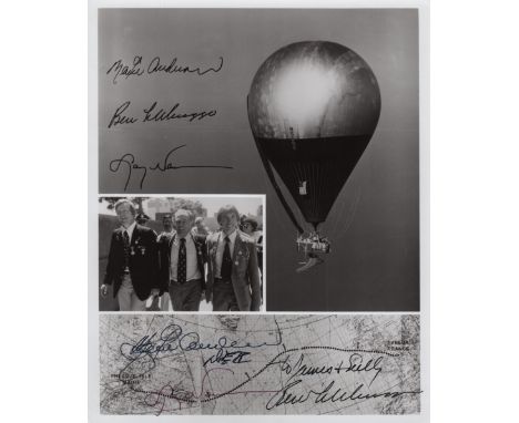
DOUBLE EAGLE II: Signed and inscribed 8 x 10 photograph by all three crew members of Double Eagle II individually, comprising Ben Abruzzo, Maxie Anderson and Larry Newman, being the pilots of the first balloon to cross the Atlantic Ocean, 1978. The composite image depicts the balloon in flight, a map charting the route of the historic flight and an image of the three crew members in three quarter length poses together. Signed by each in black inks to the base of the image, Abruzzo adding an inscription in his hand and Anderson adding DEII in his hand beneath his signature. The image also features facsimile signatures of each of the crew. Autographs of Abruzzo are scarce following his untimely death in an airplane crash. VG
Lot 366
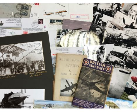
AVIATION: Selection of various air force and space flight ephemera and collectables, including printed R.A.F. flight documentation, a Fleet Air Arm Meteorologist Sleeve Badge, commemorative postal covers celebrating various aviation anniversaries, postcards and photographs depicting aircraft, pilots and astronauts, reproduction photographs of German Luftwaffe personnel of World War II, printed aviation newsletters and programmes, a selection of metal and plastic toy aircraft (some damaged), part of the original main spar from the Avro Lancaster PA 474 (limited edition of 1000 pieces), Air Training Corps Gazette, February 1943, The Aeroplane Spotter, January 1945, Flight, October & November 1909, The Aeroplane, November 1911, a boxed video history of the R.A.F. presented by Richard Todd, an unconstructed Revell 1:72 model of the Avro Lancaster "Dam Buster", an unidentified Aeroplane Log Book, a souvenir ticket made of metal from one of the crashed gliders which carried the British 1st Airborne Division into battle at Arnhem, a facsimile hardback edition of the Flying Log Book of Wing Commander Robert Stanford Tuck (limited edition 445/2500), a set of Churchman cigarette cards, The R.A.F. at Work, a map of Great Britain displaying aeronautical information, September 1948 etc. Generally G to VG, 161


Lot 352
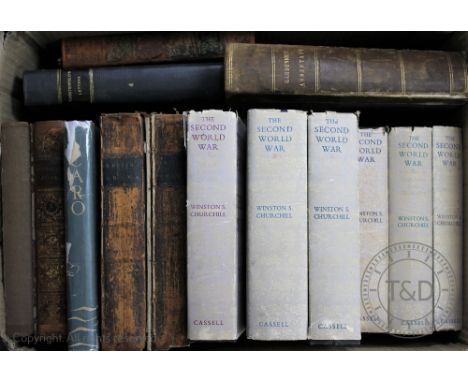
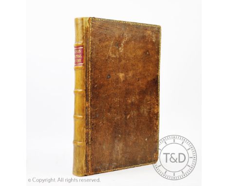
RAYMOND (G), THE NEW UNIVERSAL AND IMMPARTIAL HISTORY OF ENGLAND, engraved plates, poor condition map by Bowen, London, Cooke, THOMPSON (R), THE GARDENERS ASSISTANT, with hand coloured plates, London, Blackie, c1858; CRANE (W), illus, PAN-PIPES, pictorial boards; ASPLAND (A), THE GOLDEN LEGEND, Holbein Society, 1878; CHURCHILL (W), THE SECOND WORLD WAR, 1948-1954; LAURO DE BOISIS, ICARO, translated and signed by Ruth Draper to Anthony Pearce, dated Cape Town Dec 18th 1933; and other bindings (Qty)


Lot 408
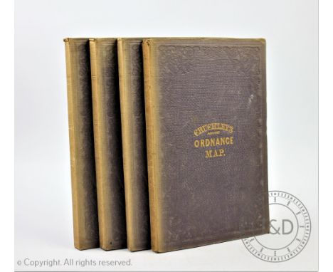
CRUCHLEYS REDUCED ORDNANCE MAP OF ENGLAND AND WALES, four large folding linen backed maps comprising Shropshire and surrounding counties(30, 31, 36, 37,), another centred around Huntingdonshire (32, 33, 38, 39), one entered round London (19, 20, 26, 27) and a map centred around Bristol (17, 18, 24, 25)


Lot 433
LEIGH (C), THE NATURAL HISTORY OF LANCASHIRE, CHESHIRE AND THE PEAK IN DERBYSHIRE, engraved portrait frontis, folding map with hand coloured detailing and twenty four engraved plates, three parts in one, re-backed calf with original tan boards, frontis and title cut and re-laid, Oxford, 1700 (1)

Lot 434
MOGG (E), PATTERSONS ROADS, being an entirely original and accurate description of all the direct and principle cross roads in England and Wales, 7th edition, folding frontis map, map of London to Hollyhead and seven folding maps at rear, later 1/2 calf with original boards, and brass clasp, London, 1824 (1)


Lot 673
A 1950's Philips 10 inch Challenge Globe, on square base, 31cm high CONDITION REPORT: Crazed throughout with some browning down the join lines of the map and some losses to the paper at the joins - heaviest to the equator in South America - slight gapping to the equator at the Atlantic. A couple of odd blemishes. Meridian lightly grubby. Overall fair.


Lot 2036
SPEKE, John Hanning, Journal of the Discovery of the Source of the Nile, London 1863, 1st edition, 8vo original cloth, cloth worn and discoloured, content detached from case, lacks map of Eastern Equatorial Africa which should be in rear pocket, all illustrations and the other map are present (1)

Lot 123
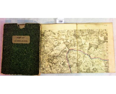
An unframed map of the Parish of St Mary, Whitechapel, two unframed maps showing allied progress on the Western Front, an Ogilby 1698 route map, together with a large quantity of unframed maps relating to Hertfordshire. Condition Report: We believe this to be original 1698, with later colour added. Overall good condition. Evidence of crease top to bottom centre.

Lot 293
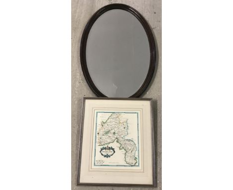
A framed and glazed map of the Parish of St John's, Wapping and the Parish of St Paul's, Shadwell, together with two framed and glazed maps of Hertfordshire, various sizes. Condition Report: There are two county maps and a parish map of both St John, Wapping and St Paul Shadwell in one frame (see image).


Lot 964
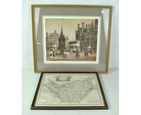
ARTHUR DELANEY (1927-1987); limited edition signed print 'Albert Square', signed in pencil lower right, 361/400, 35.5 x 44cm, framed and glazed, and a map of Chester after Robert Morden (2). (D) CONDITION REPORT: This lot qualifies for Artist Resale Rights. For further information, please visit http://www.dacs.org.uk

Lot 893
ROBERT MORDEN; a 17th century hand coloured engraved map 'The Smaller Islands In The British Ocean', 38 x 33.5cm, framed and glazed, a further example 'The County Palatine of Chester' and a reproduction example (3). CONDITION REPORT: Period map with faint outline to margin, small area of staining top centre, two 6cm creases top left and top right, otherwise ok, the other two are reproductions.

Lot 148
An early to mid-20th century hand drawn and coloured map of the Verbania area of North West Italy, possibly used in escape by a prisoner of war, approx 21.5 x 17cm. CONDITION REPORT: Some holes, some tears and losses to the edges and corners, staining, some pencil annotations, used for escape is a suggestion only by purport of vendor.


Lot 78
Steamship testing in New York.- Hutchings (John, publisher) Origin of Steam Navigation. A View of Collect Pond and its Vicinity in the City of New York in 1793, broadside with map of Collect Pond in New York City and illustrations and text describing early steamship tests by John Fitch, lithograph on wove paper, 370 x 470 mm. (14 1/2 x 18 1/2 in), under glass with light folds and handling creases, framed and glazed, 1846.
-
108737 item(s)/page