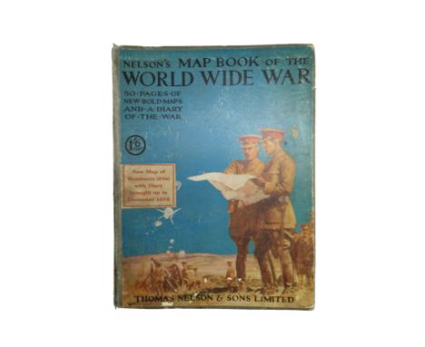
We found 109198 price guide item(s) matching your search

Refine your search

Year

Filter by Price Range
  • List
  • Grid
  • 109198 item(s)
    /page

Lot 243

1953 (10/53) London Underground Metropolitan Line CAR DIAGRAM from compartment stock, mounted behind acrylic in original-style wooden frame. Size: 25.5" x 9.5" (65cm x 24cm) with frame. Map has vertical creases and a little damp ingress at the lower edge but is otherwise in very good, ex-use condition. [1]

Lot 468

Selection (4) of 1930s panel POSTERS for London Coastal Coaches from the "Travel the King's Highway" series. Each features a route map and colourful illustration of the constituent companies' coaches on a country road. This set is for North Western/Standerwick's/Bracewells/John Bull/Majestic Express, Orange Bros/SMT/United/Majestic, West Yorkshire/Yorkshire Electric/Yorkshire Traction/East Yorkshire/East Midland & Eastern Counties/Westcliff-on-Sea/Eastern National. Size: 9.75" x 14.75" (25cm x 37cm). All are in excellent condition with only very minor storage marks. [4]

Lot 383

1933 London Underground H C Beck diagrammatic, card POCKET MAP from the first-year series titled 'Underground Railways of London'. Issued c.December 1933 and has print reference 33-3636. Shows the escalator connection between Bank and Monument stations. An excellent example with only minor signs of use. [1]

Lot 382

1934 London Underground 'Underground Railways of London' POCKET MAP. A second-year H C Beck diagrammatic card map with print reference 34-1945 and showing the escalator connection between Bank and Monument stations. An excellent example in near-mint condition. [1]

Lot 17

1928 London Underground MAP of the Electric Railways of London "What to see and how to travel". December (12/1928) edition designed by E G Perman with elaborate calligraphy of station names and border etc. In good, lightly-used condition with foxing spots on the cover and a short, inward fold parting. [1]

Lot 478

Robert Hancock (1730 - 1817), A New and Accurate Plan of the City of Bath to the Present Year 1793, published by W. Taylor and W. Meyler, 1793, hand-coloured engraving, 47 x 53cm, framed and glazed, Bath from the Ordnance Survey, engraved by J. Henshall, coloured engraving, label verso from The Antique Map Shop, Bath, 'Guaranteed to be a genuine antique map, by Henshall, Date c1837', 31.5 x 19cm, framed and glazed, City of Bath, engraving, label verso from Antique Maps, Earley Maps c.1540 - 1900, Certificate of Authenticity, 'Earley Maps guaranteed this to be a genuine Antique Map as dated, by T. Moule, printed in c.1840', 27 x 20cm, framed and glazed, J. Newman, A view from the Railway Arch over Pulteney Road, coloured lithograph, 22 x 31cm, unframed, General Motors Limited advert, colour print, 26 x 9cm, unframed and The Rover Co. Ltd 1948 advert, colour print, 20.5 x 15.5cm, unframed

Lot 228

A late 19th century Eastern Telegraph Company page turner with map decoration and 1897 calendar to the handle.

Lot 526

Large 19th Century framed map of Wiltshire by C & I Greenwood, published by Greenwood & Co, Regent Street Pall Mall London. Map with hand coloured details. Measures 82 x 101cm.

Lot 510

Five maps, to include, A New Map of the County Palatine of Lancaster, printed for C Smith No 172, Strand, January 6th 1804, 50.5 x 45.5cm, A New Map of Yorkshire, printed for C Smith No 172, Strand, January 6th 1804, 45.5 x 53.5cm, a map of North Riding, West Riding & East Riding, published by C Smith 1804, 45.5 x 53.5cm and two other maps, all framed and glazed

Lot 133

'Saxton's Survey of England and Wales, R.A. Skelton, together with 'Ogilby's Road Map of England and Wales' and 'Britannia Depicta Road Atlas' (3)

Lot 134

'A Map of The World Designed by Gio. Matteo Contarini, Engraved by Fran Roselli', together with 'Sir Francis Drake's Voyage Round The World 1577 - 1580 Two Contemporary Maps', both printed by order of the trustees and sold at the British Museum 1924 & 1931(2)

Lot 151

Three maps to include Map of the Scenery of the Grampian Mountains,41 x 42cm, an Accurate map of Italy, Paas, circa 1800 and Argyle Bute and Dumbarton, (3)

Lot 864

A collection twenty lighters including novelty pen and one with Atlantic map

Lot 318

A reproduction John Speede map of "The Countie of Nottingham"

Lot 279

FREIHERR VON TETTAU: 18 MONATE MIT RUSSLANDS HEEREN IN DER MANDSCHUREI, 2 BDE Bd. 1: Von Beginn des Krieges bis zum Rückzug nach Mukden: Bd 2.: Nach Lioyan bis zum Friedensschluss. Berlin, Mittler, 1907-1908. Mit 3 Falttabellen, 16 Karten u. Kartenskizzen (davon 15 lose in Kartentaschen am Schluss beider Bände) sowie zahlr. s/w Abbildungen nach photographischen Aufnahmen v. Tettaus. V S., 1 Bl. 398 S., 1 Bl.; XI, 483 S. Orig.-Leinenbände mit roter Deckel- u. Rückenprägung.24,5 x 17 x 3,7 (4,3) cmFREIHERR VON TETTAU: 18 MONATE MIT RUSSLANDS HEEREN IN DER MANDSCHUREI, 2 VOL.Vol. 1: From the beginning of the war to the retreat to Mukden: Vol. 2: To Lioyan until the conclusion of peace. Berlin, Mittler, 1907-1908. With 3 folding tables, 16 cards and map sketches (of which 15 loosely in map pockets at the end of both volumes) as well as many b/w illustrations after photographic recordings by Tettaus. V p., 1 Bl. 398 p., 1 Bl. ; XI, 483 pp. Orig. -linen covers.24,5 x 17 x 3,7 (4,3) cm

Lot 469

STAMPS FALKLAND IS DEPENDENCIES, 1944 to 1985 mint collection with all four GVI overprinted sets, GVI thin & thick map sets, QEII 1954 set to £1, South Georgia 1963 set U/M with both £1 stamps, 1971 surcharge set U/M etc. A clean lot!

Lot 247

A framed facsimile world map with two other pictures

Lot 359

A antique framed map showing fortifications of Paris, shipping unavailable

Lot 93

A large vintage wall hanging map of South America Shipping unavailable

Lot 456

A Second World War British Army webbing map case

Lot 464

A Great War poster "The Great German Plot", comprising "Points to Remember. By the Earl of Denbigh" and a related map, printed by Roberts & Leete, 31 cm x 25 cm

Lot 511

A Great War publication, "Nelson's Map-Book of the World-Wide War containing an entirely new series of 35 clear maps with A Diary of the War and Sketch Maps illustrating Military Operations", Thomas Nelson and Sons Limited, London, circa 1916

Lot 1321

After Thomas Kitchin (1719 - 1784) "A New Map of Cumberland", watercolour tinted engraving, from Thomas Kitchin, "England Illustrated", London, J. Dodsley, 1764, in card mount, gilt slip and moulded frame under glass, 35 cm x 41 cm overall

Lot 1305

After George Cole (early 19th Century) A map of Cumberland, watercolour tinted engraving, engraved by John Roper, circa 1835, in card mount, gilt slip and moulded wooden frame under glass, 32.5 cm x 38.5 cm overall

Lot 462

A 1916 trench map of Hazebrouck, Belgium

Lot 1566

Map of the Endcliffe Hall Estate, Sheffield 1899. Peter Owen Jones print, Midland Station, other prints in a portfolio, Brck Carter print.

Lot 1155

Vintage Advertising - Perrier Motor Map of England and Wales, on fabric, featuring Perrier 'The Champagne of Table Waters', cartouche above Anglesey 144 x 155cm.

Lot 516

A 17th century hand coloured map of Dorsetshire by Rob Morden sold by Abel Swale Awnsham and John Churchil with certificate of age

Lot 557

A large framed map of Dorset by C & J Greenwood: from an actual survey made in the years 1825 & 1826, with a vignette of St Mary's Church, Sherborne lower left

Lot 240

A collection of nine boxed Waddington's Shaped Jig-Map puzzles including South Europe, New Zealand, Australia, Scandinavia, South America etc

Lot 138

A vintage Elgin American compact inset with compass surrounded by map of the world decoration

Lot 364

An antique hand coloured map of "Middlesex olima trinobantibus habitata" by John Norden

Lot 283

Pulman, George P.R - The Book of the Axe, large folding map and 11 tinted lithograph plates, pub. 1854 in half leather

Lot 588

An early 19th century map of France in Provinces engraved by E Jones and published by C Smith, Mapseller in 1808

Lot 755

A framed watercolour "The Slipway" by Karen Charman along with two local interest items. An unframed limited edition 132/250 reproduction print of an antiquarian engraving of the "North View of Lyme Cobb" engraved for the history of Lyme Regis and a framed Ordnance Survey map of Whitford 1887 - 1903 featuring Whitford, Maidenhayne, Hampton, Seaton Branch Line and Seaton Junction etc

Lot 265

A series of 5 scarce WW2 era ‘ABCA’ map review posters by Fosh & Cross. Dating from January 1946 through to April 1946. Numbered from 85 through to 89. Condition: each poster appears to have had little to no use, and each is still folded as originally supplied. Poster No.85 is a little ‘dog eared’ at the corners. The printed colours remain bright and strong. Approximate size: 101.5cm x 76cm.

Lot 338

A scarce Mahdist War era souvenir printed handkerchief, entitled ‘Heroes of the Sudan’ Dating from circa 1885, the item is finely printed with portraits of notable British military commanders from the Sudan War. Including among others, Colonel Burnaby, who was killed at the Battle of Abu Klea in 1885, General Gordon, who was killed at Khartoum in 1885, plus Major-General Stewart who was mortally wounded at the Battle of Metammeh in 1885. The centre of the handkerchief shows a map of the area, with notable battle dates. The item is hemmed to each edge, with the figures being printed in black and the floral border being a purple / grey colour. Approximately 52cm x 56cm. Condition: very good for its age. Minor yellowing to the cotton fabric, but the printed colours are still quite strong. The top hemmed edge has some old pin holes from where it has been pinned to wall previously.

Lot 264

A further series of 5 scarce WW2 era ‘ABCA’ map review posters by Fosh & Cross. Dating from December 1945 through to January 1946. Numbered from 80 through to 84. Condition: each poster appears to have had little to no use, and each is still folded as originally supplied. Some of the fold lines are a little grubby from storage. The printed colours remain bright and strong. Approximate size: 101.5cm x 76cm.

Lot 288

A WW2 era framed and glazed world map, by William Bromage. Entitled ‘News Chronicle All Fronts War Map’, and dated 1940. Approximately 98cm x 65cm. Condition: fold lines to the map plus some splitting along the fold lines in places. Small amount of fading to the colours, but still a nice display pieces. Plus, a limited edition concord print 129/400, signed by the artist, Stephen Brown, and presumably 3 of its former pilots. Framed and glazed, approximately 78cm x 58cm. Condition: good. And, a post WW2 / 1950’s snapshot photograph album. Containing approximately 110 images, the many appearing to be relate to the Parachute Regiment. Condition: some loose images, but mostly good condition. 3 items.

Lot 195

WWI Princess Mary Christmas tin and Original Daily Mail War Map. In polished condition, with a couple brown corrosion spots to the lid.

Lot 254

A series of 5 WW2 era ‘ABCA’ map review posters by Fosh & Cross. Dating from April 1945 through to July 1945. Numbered from 65 through to 69. Condition: each poster appears to have had little to no use, and each are still folded as originally supplied. The printed colours remain bright and strong. Approximate size: 101.5cm x 76cm.

Lot 228

A selection of WW2 dated military maps, mostly showing locations in the European Theatre of war, plus a East Anglia Map. One example is designated a ‘composite’ map for Operation Veritable, and marked ‘Secret’. The map locations cover the areas; Amiens-Mons, Trier, Lille-Ghent, Hamburg, Osnabruck, Walcheren-Amsterdam, Dresden, Harve-Amiens, Schwerin, Namur-Luxembourg, Koln, East Anglia, Oldenburg, Folkestone-Boulogne, Kassel, Wessel (with pencil inscription saying ‘Daddy crossed the Rhine on March 8th 1945’, Rouen-Paris, Halle, and the aforementioned secret Operation Verity composite map. 19 maps in total. Sizes vary between 107cm width to 63cm width. Condition varies between pieces, some examples are clean, with just the usual fold lines. Others have splits to the paper along the folds, or small holes from service wear. Several have folded / creased corners from use in the field.

Lot 251

A series of 5 WW2 era ‘ABCA’ map review posters by Fosh & Cross. Dating from February 1945 through to April 1945. Numbered from 60 through to 64. Condition: each poster appears to have had little to no use, and each are still folded as originally supplied. Poster No.64 has a small V shaped tear to the top edge. The printed colours remain bright and strong. Approximate size: 101.5cm x 76cm.

Lot 332

A very scarce Anglo-Egyptian War souvenir handkerchief, dating from circa 1882. Monochrome printed onto cotton, showing a map of Egypt, specifically Alexandria when under British bombardment from the Royal Navy. Several British warships are illustrated off the coast, such as H.M.S. Alexandra, H.M.S. Sultan, and H.M.S.Inflexible. In the right hand margin of the handkerchief there appears to be a small pencil sketch of a hot air balloon drawn directly onto the fabric. Approximately 55.5cm x 55.5cm. Condition: generally very good. It’s possible that the item may have been a ‘second’ on account of the fact that the printing is slightly disrupted by a fault to the weave of the cotton across the word ‘Alexandria’. The cotton has yellowed a little with age, but it is free from large holes or other kinds of damage. It appears to have been tacked on to a wall in the past, as evidenced by several small pinholes along the top edge.

Lot 258

A series of 5 WW2 era ‘ABCA’ map review posters by Fosh & Cross. Dating from September 1945 through to November 1945. Numbered from 75 through to 79. Condition: each poster appears to have had little to no use, and each is still folded as originally supplied. A couple of the posters have slightly yellowed in places, and some of the fold lines are a little grubby. Poster No.79 has a small hold where the fold lines intersect. Any of the above flaws would likely of occurred during storage. The printed colours remain bright and strong. Approximate size: 101.5cm x 76cm.

Lot 257

A further series of 5 WW2 era ‘ABCA’ map review posters by Fosh & Cross. Dating from July 1945 through to September 1945. Numbered from 70 through to 74. Condition: each poster appears to have had little to no use, and each is still folded as originally supplied. Poster No.70 has a small tear and and crumpling to the left side, plus some very small holes where the fold lines intersect. Poster No. 72 has some foxing along a fold line. The printed colours remain bright and strong. Approximate size: 101.5cm x 76cm.

Lot 250

A series of 5 scarce WW2 era ‘ABCA’ map review posters by Fosh & Cross. Dating from December 1944 through to February 1945. Numbered from 55 through to 59. Condition: each poster appears to have had little to no use, and each are still folded as originally supplied. There is some browning to the fold lines in places, likely caused by storage. The printed colours are bright and strong. Approximate size: 101.5cm x 76cm.

Lot 1779

Terry Pratchett Discworld "Unseen University" by Bernard Pearson, Limited Edition Number 11 of 250 released worldwide, taken from Bernard Pearsons' original mould by Vincent Cowdrey, Cast by James Cy and hand painted by Karen King, this set is complete with all parts numbered 11 to the underside, with original certificate of authenticity signed by Bernard Pearson dated September 1998, with original Ye Mappe or Cunning Plan Map detailing parts, together with an A4 page detailing the parts in more depth, the height of Tower of Art 53cm

Lot 333

Middlesex.- Rocque (John) A Map of the County of Middlesex Reduced from an Actual Survey in four sheets, engraving with hand-colouring, sheet 550 x 725 mm (21 3/4 x 28 1/2 in), central vertical fold, minor surface dirt, unframed, 1757; together with a slightly compromised set of Rocque's Carte Topographique de . .. Middlesex, on four sheets, engravings, each sheet approx. 500 x 680 mm (19 3/4 x 26 3/4 in), two sheets laid down back-to-back, trimmed, some surface dirt and browning, old nicks and tears, all unframed, 1754; together with an additional two sheets from another set, 1754 (7)

Lot 88

Australia.- Wills (William John) A Successful Exploration through the interior of Australia, half-title, frontispiece, engraved portrait, folding map at end, short tears to foldline and gutter with neat repairs verso, ex-library with usual ink-stamps, scattered faint spotting, new endpapers, contemporary half-calf, rebacked, slight bumping to corners and extremities, 1863 § Lee (Ida) Early Explorers in Australia, first edition, frontispiece, plates, folding map in pocket at end, previous owner's ink-stamp to half-title, original cloth, slight bumping to corners and extremities, dust-jacket, small hole affecting text to bottom flap, chipping and small loss to edges, 1925; and another on Australia, 8vo (3).

Lot 306

NO RESERVE World.- Reid (G. H.) An Essay on New South Wales, the Mother Colony of the Australias, one folding hand-coloured panorama, split to fold with partial tape repair, one folding table, one folding map, ex-Amherst Town Library with label, original cloth, gilt, slight bumping to corners and extremities, Sydney, 1876 § Hibben & Co's Souvenir of British Columbia Views, folding panorama, concertina binding, original embossed cloth, slightly rubbed, n.d. § Vues du Canal de Suez, Views of the Suez Canal, plates and panoramas, concertina binding, original embossed cloth, gilt, a little rubbed, n.d.; and others similar, including several panoramas, v.s. (22).

Lot 309

Britain.- Greenwood (C. & J.) Six large-scale county maps of Nottinghamshire, Lancashire, Leicestershire, Warwickshire, and Westmorland, including a large-scale county map of Nottingham by Sanderson, engravings, all with early hand-colouring, full sheets, each map over approx. 1100 x 1400 mm (43 1/4 x 55 in), all dissected and mounted on linen, folding with endpapers into book-style slipcase, the majority slightly rubbed and scuffed, 1820s to 1836 (6)

Lot 178

Middle East.- Nicohosoff (Alexander) Palestine, pre-War map of Palestine with inset map of the Sinai Peninsula, lithograph printed in colours, 840 x 630 mm (33 x 24 3/4 in), folding into original blue paper wrappers, scuffed, 8vo, [c.1942]; together with 4 folding maps of the region, including Nicohosoff's 'General Map of Egypt', Philips' 'Authentic Imperial Maps for Tourists and Travellers 'Egypt', Bartholomew's 'Map of the Middle East and Near East', a mid-20th century map of the 'Middle East' also by Bartholomew, and another, maps printed in colours, all folding, mainly early to mid-20th century (6)

Lot 112

Europe.- World War II.- Vlaanderen (André) L'Europe en Sept 1939, serio-comic map of Europe, lithograph with full original hand-colouring, no. 20 from an edition of 150, signed by the artist, sheet 610 x 860 mm (24 x 33 3/4 in), under glass, minor cockling, minor surface dirt, framed, Leon Burghgraeve, Bruges, 1939; together with an explanatory letterpress text sheet in English, framed (2)⁂ Scarce at auction. Britain is shown depicted as a woman with battleships on leads; France as Marianne, leading her troops into battle; Germany, with a swastika sash, stabbing a female Poland; and Russia as a Cossack holding a hammer and sickle, his arm around a large brown bear.

Lot 318

Europe.- Arrowsmith (Aaron) Map of France, Belgium, and part of Switzerland. From Cassini, National Atlas, Ferrari, Weiss, &c., large six sheet map, engraving with hand-colouring, each sheet 775 x 1000 mm (30 1/2 x 39 1/2 in), dissected and mounted on linen, some offsetting and surface dirt, each folding with publisher's key label to endpanel, presented in marbled slipcase, worn, 4to, James Wyld, 1817; together with four other folding maps, including James Wyld's 'Post Map of Europe...', Stockdale's 'New Map of Spain and Portugal', and Auguste Logerot's 'Carte Itinéraire Complete de La France', 8vo, 19th century (5)

Lot 4

Persia.- Browne (Edward G.) A Year Amongst the Persians, first edition, half-title, remnants of map frontispiece only, advertisements at end, cracked hinges, front free endpaper becoming detached, bookplate, previous owner's ink signature, cracked hinges, original cloth, slight bumping to corners and spine extremities, 1893 § Resor i Asien, innehållande: Lady Grahams Resa i Begalen - Lord Amhersts Ambassad till Kina. - Hr Golownins Resa och Fångenskap i Japan. - Hr Moriers första Resa i Persien ..., lacking preliminary blank, scattered spotting, disbound, loosely inserted into later marbled paper, Stockholm, 1828 § Fraser (David) Persia and Turkey in Revolt, frontispiece, plates, scattered faint spotting, bookplate, original cloth, a little rubbed, slight bumping to corners and extremities, 1910 § Wills (C. J.) In the Land of the Lion and Sun or Modern Persia, first edition, frontispiece, advertisements at end, scattered spotting, bookplate, previous owner's ink signature, original cloth, lightly sunned spine, slight bumping to corners and extremities, 1883; and others on Persia, 8vo (c.40)

Lot 185

Middle East.- Warren (Charles) Underground Jerusalem: An Account of some of the Principal Difficulties Encountered in its Exploration and the Results Obtained, first edition, half-title, 3 woodburytype plates, 6 plates and plans, one folding map, illustrations, previous owner's ink name-stamp to half-title, scattered spotting, broken upper hinge, original pictorial cloth, rubbed, bumping to corners and extremities, 8vo, 1876.

Lot 58

NO RESERVE Africa.- River Nile.- Forbes (Rosita) From Red Sea to Blue Nile: Abyssinian Adventure, first edition, half-title, frontispiece, plates, folding map, spotting at beginning and end, corrections inserted by hand, original cloth, small water-stain to upper cover, slight bumping to corners and spine extremities, 1925 § Rey (C. F.) In the Country of the Blue Nile, first edition, half-title, frontispiece, plates, scattered spotting, bookplate, original cloth, slight bumping to corners and spine extremities, 1927 § Sykes (Captain C. A.) Service and Sport on the Tropical Nile, half-title, frontispiece, plates, folding map at end, original cloth, slight bumping to corners and spine extremities, 1903; 8vo (3)

Lot 255

NO RESERVE Thailand.- Graham (W. A.) Siam, 2 vol., frontispieces, plates, folding map, one or two faint spots, ex-Wigan Library with usual labels and ink-stamps to endpapers, occasional discreet blind-stamps, original pictorial cloth, fractional bumping to spine extremities, 8vo, 1924.

Loading...Loading...
  • 109198 item(s)
    /page

Recently Viewed Lots