

A quantity of books; Miguel De Cervantes Saavedra, `The History and Adventures of the Renowned Don Quixote`, to which is prefixed some accounts of the Authors Life by T Smollett MD, the fourth edition corrected in four volumes, London 1770, calf spine and cover with Findlay bookplate, WM Thackeray, `The Virginians, Tales of the Last Century` Vol I & II, London; Bradbury & Evans, Bauverie Street 1859, faded red calf spine and marbled cover with Findlay bookplate, King Lake, Alexander William, `The Invasion of the Crimea: It`s Origin and an Account of its Progress`, Volumes I, II & III, second edition, William Blackwood & Sons, Edinburgh and London 1863, calf spine and corners, marbled cover with Findlay bookplate, Lever, Charles `The Dodd Family Abroad` with illustrations by Phiz, London, Chapman and Hall, 193 Piccadilly 1854, calf spine and corners with marbled cover, and another by Lever, Charles and Roland Cashel, illustrations by Phiz, London, Chapman and Hall, 1850, calf spine and corners, marbled cover with Findlay book plates, Le General Comte de Segur, M Histoire De Napoleon et De la Grande Armee, Pendant L`annee 1812, Vol I & II, seizieme edition, Vol I including pull out map, calf spine and corners, marbled cover with Findlay bookplate, Don Antonio De Solis, `History De La Conquista De Mejico, De la America Septentrional De Nueva Espana, Paris, Baudry, Liberia, Europea, calf spine and cover, and Por Don Quintana, Manuel Josef Tesoro del Parnaso Espanol, Paesias Selectas, Castellonas, Paris, En la Liberia, Europea De Baudry 1838, calf spine and cover (15) Footnote: Lots 334-336 are all books formally belonging to the library of the Findlay Family from the Boturich Estate, Dunbartonshire
We found 109182 price guide item(s) matching your search
There are 109182 lots that match your search criteria. Subscribe now to get instant access to the full price guide service.
Click here to subscribe- List
- Grid
-
109182 item(s)/page


Teesdale H. : New British Atlas. Containing a Complete Set of County Maps, on which are delineated all the principal cross roads, cities, towns & considerable villages, parks, rivers, navigable canals & railways. Preceded by general maps of England, Scotland, North & South Wales, the whole carefully revised and corrected to the year 1830. Folio. Engraved title page. 46 engraved maps hand-coloured in outline and by area. CONDITION REPORT: Condition : The Atlas is complete but the original binding is very worn and the map pages disbound and subject to some crude repairs in places. The volume will require extensive repair and conservation although the condition of the maps varies considerably. Contact for further detailed information.

Huish R. : The Last Voyage of Capt. Sir John Ross R.N. for the Discovery of a North West Passage, Performed in the Years 1829, 30, 31, 32 & 33. by an Officer attached to the Expedition, 1835. 8vo. Contemp. qtr. binding, maroon gilt label, marbled boards. Engraved frontis and tp. Map/Chart of the voyage,seven engraved plates, folding chart recording 'Observations on the dip of the magnetic needle' , a four page dictionary of the Esquimaux Language. ( Scarce edition ). CONDITION REPORT: Generally vg. Spine needs repair, lower section detached but present. Some foxing throughout. A second tp. bound later in the book but as published. One plate not opposite page indicated in index. The book has not been rebound.

World Atlas ( Lacks Title Page ) C.1850. Large square folio. Engraved h/c plate delineating principal mountains and rivers in the world followed by 40 engraved maps ( all present ) starting with eastern and western hemispheres together with others featuring continents and countries. Hand coloured in outline. CONDITION REPORT: Lacks spine and upper board. No title page or other prelims. Contents page loose. Remaining block of maps reasonably tight and generally quite clean and bright. Map 35 West India Islands mis-paginated but all maps present.

Casualty Department. a) Kirby W. : European Butterflies and Moths 1882. Vols. 1 & 2. Qto. Hand coloured plates. b) 16th.C. Spanish Legal/Theological Commentary 1565. Vol 2. only. Folio, contemporary binding, Lacks title page, engraved heraldic design featured on each sub-section introductory page, engraved initial letters, engraved double-page plate. c) Thoyras R. ( Trans. Tindal N. ) History of England 1732, Vol. I only. Folio, contemp. binding. Engraved vignette on tp; engraved maps of Roman and Saxon England, folding map of France. Genealogical tables, engraved pictorial headings to chapters & initial letters. d) Knight C. : Old England, Vol.I. only. Nd. C.1860. Folio, col.plates, engraved illustrations. Together with other miscellaneous titles. CONDITION REPORT: All volumes needing repair/restoration. Enquire for details. All plates present


Strip road map featuring Bedfordshire, Buckinghamshire,Cambridgeshire and Oxfordshire, nd. C.1730. Roads and other details hand coloured. Also featuring muncipal heraldic devices and those of local families together with brief topographical annotations. Mounted, framed and glazed. CONDITION REPORT: Vg.


Oarsman's and Angler's Map of the River Thames from its source to London Bridge, nd. C.1900. Folding linen backed strip map, coloured in outline,within a cloth-bound 12mo binding together with textual commentary. Length of map approx. 2.36m! x 16cm. Printed by Edward Stanford. Together with : Ordnance Survey Map of S.W. Environs of London, 1906. Folding, linen-backed map with marbled end papers. CONDITION REPORT: Angler's map showing some signs of use and wear at extremities but basically sound. London map with small stain in trhc o/w sound; lacks slip case.

Cruchley's Railway and Telegraphic Map of Bedford Showing all the Railways and names of Stations, also Telegraph Lines and Stations. Nd. C.1870. Engraved title, county blocked in printed colour, h/c in outline. Originally a folding pocket map. Mounted and glazed. CONDITION REPORT: Small repair to one folding corner. One very small stain.

Speed J. Bedfordshire and the Situation of Bedford Described. Map dated 1610. Elaborate strap-work and heraldic titular Cartouche, engraved vignette Plan of the town of Bedford with an annotated table of street names; also incorporating heraldic devices of local nobility together with an engraved and decorated mileage scale. Additonal vignettes h/c and the map h/c in outline. Mounted, framed and glazed with original textual commentary text visible on verso. CONDITION REPORT: Some light browning and very minor repairs to closed tears. Blank margin cropped to decorated map margin along at least one side


World Map : Eastern and Western Hemispheres, nd. C.1845 ( Post Wilkes' sighting of Antarctic Coast - no further detail on this map). Double folio (from an unidentified atlas). Two hemispherical engraved maps which also include dual vignettes on the lower margins featuring major rivers and mountains. All hand coloured. Both mounted, framed and glazed CONDITION REPORT: Some discolouration o/ vg.

Johnston's Railway Map of England & Wales ( 'Revised by various companies' ) Also showing Canals, nd. C 1920 ( 11th.Ed. ). Large rolled map with baton supports ( one missing ) for wall hanging. Railway and canal routes colour coded. Linen backed with glazed surface. CONDITION REPORT: Upper baton missing with some fraying and cracking of top 6" and minor loss; remainder clean and bright.

Map of the German Empire divided into its circles to which is added the Kingdom of Prussia. The whole laid down from the most accurate surveys and chiefly from the map of Marshall de Schmettau. Printed for Carrington Bowles, London. Nd. C.1790. 120cm. x 54cm. Engraved 'military' cartouche, h/c mainly in outline and originally folded into four large folio sized panels. Together with: Suite De La Carte Du Suyder-Zee depuis L'Isle D'Urck Jusquesa, Amsterdam. Chez.P. Mortier. 90cm x 65cm, originally folded into two large elephant folio panels. Mainly h/c in outline. Both mounted, framed and glazed. CONDITION REPORT: Vg.

Hertfordshire Miscellany : Morden R. Map of Hertfordshire nd. C.1750. Minor detail and outlines h/c. Framed and glazed. Drapentier J. : St. Mary's Hitchin, nd. h/c print & The Town of Hitchin, 1826. h/c plan in perspective. Plan of the Houses & Lands in Hitchin and of Lands near Tatmare Hill in the Parishes of Hitchin & Ippollitts belonging to Rbt. Tristram, 1774. MF&G.

London Passenger Transport Map : Watford, 1933. Bound in a maroon hb., red cloth A4 folder with marbled eps. Map linen-backed and folded into 8 panels. Together with a selection of early 20th.C Ordnance Survey and other maps. ( List available ). CONDITION REPORT: Passenger map vg; others in a range of conditions - please enquire.


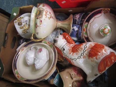
A parcel lot of ceramics to include Alfred Meakin Caledonia pattern dinner service to include twelve dinner plates, nine side plates and twelve cake plates, eleven soup bowls, two sauce boats and stands, two serving dishes, two oval serving platters, and one oblong serving plate with lustre wares, moustache cup and another similar, Staffordshire dogs A/F, grotesque jug, map of Birmingham with a framed print of Queen Victoria.


[GEOGRAPHICAL GAME] Wallers Tour through England and Wales. A New Pastime, hand-coloured engraved map, flanked by printed rules, divided into sections and linen-backed, printed advert for William Darton on the verso, marbled paper-covered slipcase with printed labels front & back, London, Printed for the Author by W. & T.D.Darton, January 2nd, 1809.


-
109182 item(s)/page