We found 109182 price guide item(s) matching your search

Refine your search

Year

Filter by Price Range
  • List
  • Grid
  • 109182 item(s)
    /page

Lot 274

History Of Whitby 1779 by Lionel Charlton (frontage piece map missing)

Lot 577

A framed county map of Derbyshire and a framed and engraved new map of the county of Chester (2)

Lot 100

Kelly's Post Office map of London, 1972; and others

Lot 36

A Greenwood & Co. map of Nottinghamshire, framed

Lot 796

A Robert Morden map of Norfolk - 38 cm x 58 cm - in a modern frame - visible folds and some spotting and a Thomas Dix New Map of Suffolk - 36 cm x 44 cm in a modern frame - Condition report: Some discolouring to centre fold

Lot 824

A large World Map circa 1967 - 180 cm x 120 cm - on fabric re-inforced paper by George Philips and Son - includes Air Miles and Sea Distances

Lot 843

A framed hand coloured Map of Huntingdonshire by Richard Blome - map size 23 cm x 27 cm

Lot 1500

A leather bound volume `The Natural History of Lancashire, Cheshire and the Peak in Derbyshire` by Charles Leigh, Doctor of Physick Oxford 1700, with a hand coloured map of the counties Condition report: spine missing and general wear

Lot 55

Unsigned early hand done map of Australia, 33cm x 43cm

Lot 98

John Speed, Hand coloured engraved map, "Cornwall", inset showing Launceston Castle, Coat of Arms, heraldic devices etc., double framed and glazed with English text, Sudbury 7 Humble, 41cm x 54 1/2cm, Hondius 1630

Lot 116

A VICTORIAN MAP BY GALL & INGLIS, a jigsaw map of England and Wales, "Superior and Dissected", comprising the map and original box container, made up 36cm x 29cm

Lot 276

WITH THE FLAG TO PRETORIA, with folding map, Eyre and Spottiswoode, 1 green cloth bound volume, together with; A SHORT HISTORY OF THE SOUTH WALES BORDERERS 24th Foot and the Monmouthshire Regiment, compiled by direction of the Regimental Committee

Lot 429

Map book J Cary 1794, no title page

Lot 13

A collection of kitchenalia, etc, to include an enamelled bread bin, enamelled flour bin, two vintage Kenwood mixers, etc, two dog baskets, a leather suitcase, etc, together with a strapwork decorated canvas covered travel trunk, canvas camp beds, screen, rolled map, Bridge game, hanging coat rack, sewing box

Lot 578

Homannianos Heredes (18th Century) A geographic map of Regni Poloniae, published for the Heritiers de Homann, double page hand coloured engraving, 47cm x 52cm

Lot 133

A reproduced early map of East Lancashire from Slaidburn in the North to Bury in the South with explanations, folded and later framed, 58cm by 49cm

Lot 529

A framed and glazed partially coloured Richard Blome map of Shropshire; approximately 31cm x 27cm, together with another smaller map of Shropshire and two maps of similar form of Worcestershire and Shropshire (4)

Lot 263

Robert Morden Antique Map a hand coloured map of Herefordshire, sold by Able Swale Awnsham and John Churchil. 43 x 37 cms.

Lot 355

Jaillot, Alexis Hubert and Mortier, Pierre A map depicting the English channel, "La manche ou le canal entre la France et l`angleterre" colour overlay, pub. Amsterdam circa 1700, in unframed mount 24 x 20½ in. (61 x 52.1 cm) See Illustration.

Lot 354

Poland, modern bronze medals (7), including Poland 1918-1929, 55mm., and Poland 1944-47, 70mm., both with map of Poland, others 60mm., 70mm (3), and octagonal, 85mm., and a plaque 71mm. x 71mm., extremely fine (8) VAT Status: Margin Scheme View Terms & Conditions

Lot 721

Battle of Ramillies, 1706, AE Medal by J. Croker, bust of Queen Anne left, rev. galli. ad. ramellies. victis. xii. maii. mdccvi., two Fames flying supporting map, in ex. flandr. et. brabant. recept, 34 mm. (MI ii, 384/92; Eimer 419), lustrous, extremely fine VAT Status: Margin Scheme View Terms & Conditions

Lot 722

Citadel of Lille taken, 1708, AE Medal by J. Croker, crowned bust of Anne left, rev. insvlae. captae. mdccvii., Victory holding shield of Lille above map of fortifications, 44 mm. (MI ii, 338/169), extremely fine VAT Status: Margin Scheme View Terms & Conditions

Lot 2099

Travel, Early 1960s London Transport Underground map by Waterlow & Sons. of London, designed by Paul. E Garbutt, on fibre glass This was on display in the underground 40 x 50in. (102 x 127cm)

Lot 1216

A large collection of signed menus, cards and photos (20) and other aviation material. Signed by members of the RAF and US airforce Including signed pictures of US Astronaut Thomas P.Stafford. A commemorative Marshall Islands five dollar coin signed by members of the RAF. Signatures include Major General Philip J. Conley, Wing Commander Geoffrey Page, Richard Branson. A collection of Aviation magazines and Service of Dedication booklets. Thirty three mid to late 20th century postcards and a topographical map of the South East of England. PROVENANCE: Air Vice Marshall Bird-Wilson (1919-2000) who was known as "Birdy" was a spitfire pilot in WW2 and a member of the "Guinea pig club". This lot is sent in for sale by one of his descendants.

Lot 1608

Guiljelmus and Johannes Blaeu, 17th/18th century hand-coloured map of China, 16 x 19½in. (41 x 48cm)

Lot 1609

18th century French map of England by S.Robert, 1778, 19"x 20"

Lot 1610

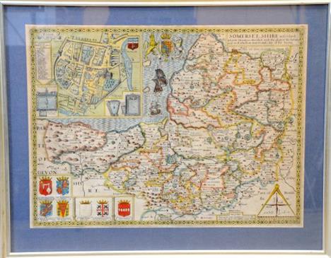
17th century John Speed map of Somersetshire, 15 x 20in. (38 x 51cm)

Lot 1611

18th century French map of Senegal, 19 x 13in. (48 x 33cm)

Lot 1612

17th/18th century John Speed hand coloured map of Yorkshire

Lot 1613

18th century map of Sussex by Robert Morden 16 x 19in. (41 x 48cm)

Lot 1614

18th century map of Cornwall by Robert Morden 16 x 18in. (41 x 46cm)

Lot 1615

18th century map of Huntingtonshire by Robert Morden 15 x 18in. (38 x 46cm)

Lot 1616

18th century map of Middlesex by Robert Morden 16 x 19in. (41 x 48cm)

Lot 1617

18th century map of Dorsetshire by Robert Morden 15 x 16in. (38 x 41cm)

Lot 1618

18th century map of Shropshire by Robert Morden 15 x 18in. (38 x 46cm)

Lot 1619

18th century map of Buckinghamshire by John Speed 16 x 21in. (41 x 53cm)

Lot 1620

Maris Pacifici , 19th C map of the Pacific region , after Ortelius Abrahamus. PROVENANCE: Francis de Sales McHugh Collection. 13 x 19in. (33 x 48cm)

Lot 92

Mixed Lead Figures and Signs, including Britains Gnome, Britains Map of the World Cow, Madame Tussauds figures, Britains Milling Set, Segal Footballers, Timpo Knights, road signs etc

Lot 192

Falkland Islands (and Dependencies). 1938-52 primarily mint stock in black stockbook. 7 x 1938 sets with numerous extras, such as 16 x 5/-s including an ‘indigo’, which is fine, and 3 x second 10/-s mint. This section alone conservatively catalogues £10482. Then 3 x unmounted 1952 sets and quite a range of duplicated Dependencies sets including 5 mint Thin Map sets, well worth viewing

Lot 200

Falkland Island Dependencies. 1946 Thick Map 2d, 3d, 9d and 1/- on airmail piece with Graham Land CDS of 22 FEB 1947, the 9d with Plate 2 R6/8 ‘SOUTH POKE’. SG G7c (£250)/CW 39D

Lot 44

A framed and glazed 17th century style map of Roman Britain: `Britannia Romana` (later frame), after Morden, 1695.

Lot 45

A framed and glazed 18th century style map of Northumbria (Northumberland), (later frame).

Lot 83

John Speed: a framed and glazed map of Wiltshire.

Lot 105

John Speed: framed and glazed map of Devonshire.

Lot 123

A reproduction framed and glazed map of Hertfordshire by Johan Blaeu.

Lot 56

Ebenezer Le Page a fictitious map of the Island of Guernsey 23 x 33in (58.5 x 54cm).

Lot 189

William Berry The History of the Island of Guernsey, lacking title page and map, with hand coloured plates and marbled boards, published London 1815.

Lot 47

A reproduction Saxton`s map of Derbyshire, framed

Lot 65

A map of Ireland and an Irish print, titled A Soldier`s Song, Irish National Anthem, both framed

Lot 1397

A Map of the Thames and Medway

Lot 1683

Young (George), A History of Whitby, 1817, 2 vols., folding map, plates, morocco (bindings well worn); Bell (James), A System of Geography, 1840, 2 vols, folding maps, half sheep (bindings well worn); Robertson (William), Middlesbrough`s Effort in the Great War, nd, original cloth; with a quantity of others (2 boxes)

Lot 1366

A Fox Hunting Map of Great Britain, framed.

Lot 1099

A printed map of the British Isles.

Lot 326

A late 17th century John Speed map of Herefordshire 38 x 50cm

Lot 351

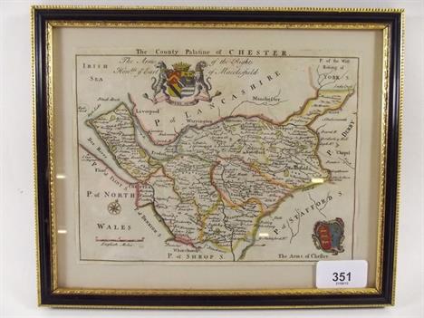
An 18th century map of Cheshire dedicated to the Earl of Macclesfield, 15 x 20cm

Lot 30

A WWII DOUBLE SIDED SILK MAP OF NORWAY, SWEDEN, FINLAND AND USSR, 76 cm x 86 cm

Lot 94

TRAVELS OF ANACHARSIS THE YOUNGER IN GREECE by The Abbe Barthelemy in seven volumes, second edition, 1790s, including map/plate volume (7)

Lot 97

A COMMENTARY ON ANTONINUS HIS ITINERARY, or Journies of the Roman Empire, so far as it concerneth Britain by William Burton, with folding map, 1658

Lot 118

A SMALL COLLECTION OF UNFRAMED MIDLAND MAPS including Moule of Shropshire, Kitchin of Staffordshire, Fullarton etc together with a Hughes map of The Lake District late 18th Century (6)

Loading...Loading...
  • 109182 item(s)
    /page

Recently Viewed Lots