We found 109182 price guide item(s) matching your search

Refine your search

Year

Filter by Price Range
  • List
  • Grid
  • 109182 item(s)
    /page

Lot 6193

Thoresby, Ralph - 'Ducatus Leodiensis or the Topography of the ancient and populous town and parish of Leedes and parts adjacent in the West Riding of the County of York' printed for Maurice Atkins 1715 engraved frontispiece, folding map and plan, full calf, ribbed and gilt spine, bookplates of Wilfred Lanson and William Cole

Lot 76

John Speede, Map of Flintshire. Flintshire. Speed (John), sold by John Sudbury and George Humbell, [1627], engraved map, inset town plans of Saint Asaph and Flint, and an inset picture of St Winifred's Well, strapwork cartouche and mileage scale, with an alphabetical table of all the towns and description of Flintshire in English on verso, framed and glazed to both sides.38.5 x 51.5cm (framed 54.5 x 67cm)

Lot 6

Braun (Georg) and (Hogenberg) Franz Gent (Ghent) Late 16th century from Civitates Orbis Terrarum, engraved city plan map of Gent (Ghent) with contemporary hand-colouring, Latin text to the reverse. Unframed.plate 48cm x 33.5cmTranslation of cartouche text: Ghent, the most splendid city in Flanders, was founded by Julius Caesar and called Gaius after his forename, as the Brabant chroniclers relate. The city is distinguished by its rivers, altogether delightful, magnificent, spacious, never confined, nowhere stifling. The houses are innumerable and well-kept, the men richly talented, the customs venerable. A double wall amplifies the beautiful appearance of the place, which - like Louvain - also has quiet corners for reflection and study. Ghent also possesses famous schools and magnificent churches; the climate is excellent. The people, it can be said, are more frugal than parsimonious. Ghent is embellished by the relics of several saints and two famous monasteries dedicated to St Peter, Prince of the Apostles, and St Bavo; each has an abbot and a sizeable annual rental income.

Lot 237

British Empire 1924 Official Guide booklet, British Empire Exhibition 1924 Wembley map and Lipton Tea caddy for the British Empire Exhibition

Lot 484

Ashburton, Charles Alfred - 'A New and Complete History of England: From the First Settlement of Brutus, Upwards of One Thousand Years Before Julius Caesar, to the year 1793', printed and sold by W. and J. Stratford,1793, with engravings throughout, large folding map present, in quarter leather binding (a/f, title page missing)

Lot 532

Robert Morden - Early 18th century hand coloured map of Sussex, including the English Channel, sold by Abel Swale and Awnfham and John Churchill, 38.5cm x 44.5cm, framed under glass

Lot 91

Vinyl - Queen The Complete Works (EMI – QB 1) 14 album limited edition numbered box set. Complete with booklet, Tour itinerary 1971 to 1985 and Queen Map of the World. Ex

Lot 85

Two tapestry pictures, horse and coach and cottage, and vintage map of Cumberland

Lot 628

A later 20th Century Lundberg Studios glass paperweight, of spherical form, in the Worldweight Classic Petite pattern, internally decorated with a map of the world and cased in clear crystal, scratch signed and dated 1999 to the base, height 8cm.

Lot 636

A collection of 20th Century and later assorted glass paperweights, to include a facet cut example, a stylised apple with controlled air bubbles, an engraved example depicting a map of the world, a weight of egg form with a blue core cased in clear with alternating gilt and frosted panel decoration etc, two resin paperweights with internal flowers, a bottle modelled as a boot and a small scent bottle in blue, tallest height 22cm. (10)

Lot 212

Johannes Blaeu, Wallia, hand coloured map, circa 1645, 51cm x 60cm, framed and double glazed (Please note condition is not noted. We strongly advise viewing to satsify yourself as to condition. If you are unable to view please request a condition report, which will be provided in writing).

Lot 214

Abraham Ortelius (Dutch, 1527-98), Bohemiae from the Theatrum Orbis Terrarum 1588, published by Christopher Plantia, hand coloured map, 36.5cm x 49cm; also Les Environs de L'Estang de Longpendu by Jean Van Damme, hand tinted map, 44cm x 57cm (2) (Please note condition is not noted. We strongly advise viewing to satsify yourself as to condition. If you are unable to view please request a condition report, which will be provided in writing).

Lot 215

William Kip/Christopher Saxton, Denbigh Comitatus Pars Olim Ordovicum, hand coloured map, published circa 1610-30, 27cm x 33cm; also another Saxton/Kip map, Mongomery (sic) Comitatus Qui Olim Pars Ordovicum, 28cm x 33cm (2) (Please note condition is not noted. We strongly advise viewing to satsify yourself as to condition. If you are unable to view please request a condition report, which will be provided in writing).

Lot 78

Polar Exploration.Ross (Sir John), Narrative Of A Second Voyage In Search Of A North-West Passage, and of a Residence in the Arctic Regions During the Years 1829, 1830, 1831, 1832, 1833. [with] Appendix to the Narrative …A. W. Webster, 1835, two large quarto volumes, possibly large paper copies, Narrative volume: large folding map (torn), twenty-seven (of thirty) plates, six coloured or tinted, Appendix volume: twenty plates, twelve coloured or tinted. Foxing, re-backed cloth bindings with original spine labels laid down;Another copy, two quarto volumes (smaller than the first set), the Narrative volume with large folding map (torn), thirty plates as called for, three coloured or tinted (which are three of the four plates missing from the first set, none of the plates coloured in the first set are coloured in this one, frontis detached but present), Appendix volume: twenty plates, twelve coloured or tinted. Foxing, original cloth, joints of Narrative volume splitting. Abbey Travel 636.

Lot 26

Twentieth Century Pictorial Maps.Taylor (A.E.), Pratt's High Test Plan of Ireland.No date (33 after name), colour map, 760mm x 506mm, framed and glazed;Pratts High Test Plan of Wales with Neighbouring Counties.Anglo American Oil, no date, colour map, 663mm x 475mm visible, mounted, framed, glazed front and rear.Pratts High Test Plan of the Eastern Counties and the Midlands.no date, colour map, 507mm x 760mm, framed and glazed (out of position);Jones (Denis M.), Leeds from A.D. 1626 ....Pictorial Maps, no date, colour map, sheet approx 560mm x 670mm, framed and glazed;with ten other pictorial maps, eight framed and glazed, two folded. (14)

Lot 28

Saxton, (Christopher).[Yorkshire] - Eboracensis Comitatus (cuius Incolae olim Brigantes appellabantur) Longitudine Latitudine hominumque numero reliquis illustrior.Ano. Dni, 1577. Christopherus Saxton descripsit, Augustinus Ryther Anglus Sculpsit. Ano Dni 1577.[1579], hand-coloured engraved map on two joined sheets, 530mm x 730mm visible, some closed tears, not examined out of frame but appears to be laid down, mounted framed and glazed.[Whitaker 1, The first printed county map of Yorkshire].Several closed tears, some vertical creasing, possibly earlier folds, section around scale has horizontal and vertical repaired tear, colours a little faded, right hand sheet is darker than left hand sheet, white colouring around title and armorial appears crude. Not examined out of frame but appears to be laid down.

Lot 84

‘Agricola’.Description of The Barossa Range and its Neighbourhood, in South Australia. Illustrated with Maps and Coloured Plates, from Original Drawings Made on the Spot by George French Angas.Smith Elder, 1849, folio, 20 pages, six hand-coloured litho plates, lacking map and plan, marbled endpapers, worn half half binding, lacking back-strip, upper board detached. [Abbey Travel 580]

Lot 71

Talbert (Richard J. A.)Barrington Atlas of the Greek and Roman World.Princeton Universiy Press, 2000, three volumes, the large folio atlas (with worn and torn dust jacket) and two quarto Map-by Map Directories, in original cloth;Eames (Wilberforce); Adventures in Americana 1492-1897 .... Being a Selection of Books from the Library of Herscel V. Jones ...N.Y.: Cooper Square, 1964, three quarto volumes, original cloth; Al-Hijji (Ya'qub Yusuf), The Art of Dhow-building in Kuwait.LCAS, 2001, quarto, signed presentation copy from the author to Fred Gettings, dust jacket.[Provenance - The Fred Gettings Library]. (7)

Lot 38

Ireland (Samuel).Picturesque Views on the Upper, or Warwickshire Avon …R. Faulder and T. Egerton, 1795, iii-xviii, 284 pages (lacks half title, one preliminary leaf out of sequence), engraved map (stained), thirty sepia aquatint plates, two portraits, additional portrait bound in, half calf (spine faded, leather a little stained);[Johnstone (Charles)], Chrysal; or the Adventures of a Guinea: By an Adept. Hector M’Lean, 1821, three volumes, large paper copy with fifteen hand-coloured plates, eight monochrome plates replicating colour plate scenes and three additional engraved titles with vignettes replicating colour plate scenes, all edges gilt, contemporary calf (re-backed retaining original back-strips). [Provenance - The Fred Gettings Library]. (4)

Lot 79

Whales and Whaling.Markham (Albert Hastings), A Whaling Cruise to Baffin’s Bay and the Gulf of Boothia and an Account of the Rescue of the Crew of the ‘Polaris’.Sampson Low, Marston …, 1875, second edition, plates as called for, original cloth gilt;Bullen (Frank T.), The Cruise of the ‘Cachalot’, Round the World After Sperm Whales.Smith Elder, 1898, first edition, folding map and plates as called for, original cloth gilt;Struthers (John), Memoir on the Anatomy of the Humpback Whale ...Edinburgh: MacLachlan and Stewart, 1889, reprint from the ‘Journal of Anatomy and Physiology’, six lithographic plates, presentation slip ‘From the author’, original cloth;Beale (Thomas), The Natural History of the Sperm Whale …. To which is added, A Sketch of a South-Sea Whaling Voyage …Holland Press, 1973, facsimile edition, dust jacket;Elliott (Gerald), A Whaling Enterprise, Salvesen in the Antarctic.Michael Russell, 1998, first edition, dust jacket;With Fifteen Others. [not collated]. (20)

Lot 75

Polar Exploration.A large quantity of books on exploration, predominantly polar exploration, including;Rymill (John), Southern Lights, The Official Account of the British Graham Land Expedition 1934-1937.Chatto and Windus, 1938, first edition, plates, folding map, torn and price-clipped dust jacket;Nansen (Fridtjof), 'Farthest North' Being the Record of a Voyage of Exploration of the Ship Fram 1893-96 ....Archibald Constable, 1897, first edition, two volumes, plates and maps, original cloth (worn);Bagshawe (Thomas Wyatt), Two Men in the Antarctic, An Expedition to Graham Land, 1920-1922.Cambridge University Press, 1939, first edition, plates, folding panoramas, original cloth;Scoresby (Rev. W.), Journal of a Voyage to Australia and Round the World for Magnetical Research.Longman Green ... 1859, first edition, portrait frontis, publisher's presentation stamps, orginal cloth;Anon., Cook's Voyages Round the World, for Making Discoveries towards the North and South Poles.Manchester: Sowler and Russell, 1799, portrait frontis in facsimile, five plates as called for, modern quarter calf; Thomson (C. Wyville), The Depths of the Sea. An Account of the General Results of the Dredging Cruises of H.M.SS 'Porcupine' and 'Lightning' ...Macmillan, 1874, second edition, maps and plates, original cloth;Scott (Capt. Robert F.), The Voyage of the 'Discovery'.Macmillan, 1905, two volumes, maps and plates, original cloth.[not collated]. (qty)

Lot 70

Fielding (Xan).The Stronghold, An Account of the Four Seasons in The White Mountains of Crete.Secker & Warburg, 1953, first edition, frontis and plates as called for, map endpapers, dust jacket (priced 21s.);idem, Hide and Seek, The Story of a War-time Agent.Secker & Warburg, 1954, first edition, signed presentation inscription from the author on half title, additionally signed on the title page, plates as called for, map endpapers, dust jacket (priced 15s.).[Major Xan Fielding, DSO, CdeG., was a Special Operations Executive agent in WWII, serving in Crete (with Patrick Leigh Fermor), France and the Far East.]

Lot 352

Blaeu's map of Berkshire, uncoloured and unmounted, and a 19th century coloured map of Berkshire, by C and J Greenwood, unmounted

Lot 349

A Speed 17th century black and white map of "Breknoke", in double-sided glass mount

Lot 348

A Saxton 17th century coloured map of Brecknock, in strip frame

Lot 346

Antonio Zatta: a late 18th century map of the "Stato Del Mogol", in gilt strip frame

Lot 350

A Cary's hand-coloured map of Middlesex

Lot 351

A well reproduced Tombleson's map of the Thames, in strip frame

Lot 178

A Hand-coloured Map of Nottinghamshire, engraved by John Cary, published 1789, 54cm x 36.5cm; a small map of Durham, (2).

Lot 98

The Shooter’s Guide or Complete Sportsman’s Companion by B. Thomas 1826 with engraved plates. An Illustrated Treatise on The Art of Shooting by Charles Lancaster 1889 illustrated. Shots from A Lawyer’s Gun 1927. Mr. Punch with Rod and Gun. Sporting Days by John Colquhoun 1866. Sketches of the Wild Sports & Natural History of The Highlands by Charles St. John illustrated 1878. Field Sports of Scotland 1936. The Complete Sportsman 1914 illustrated Lewis Baumer. Sportsman’s Bedside Book by B.B. 1937. Moonraking illustrated Lionel Edwards 1936. Lives of the Hunted and Wild Animals I Have Known by Ernest Seton. Mountaineering with 130 illustrations, Hounds & Dogs Their Care, Training & Working illustrated 1932 and Steeplechasing (Lonsdale Library). Linen backed map of Gloucestershire / Wiltshire labelled 'Duke of Beaufort' (16)  

Lot 245

Stroud canal map dated 1775, showing the route from Stroud to the River Severn at Framilode, 17 x 30cm, in gilt frame

Lot 277

Military and social history including 1910 roll call 'God Save The King' coronation, 1st Queen's Dragoons Guard beer mats, QEII silk, lots of Army and Navy WW1 and WW2 photographs, battlefield tour programme, shipping postcards, Salonica army Christmas greetings and hand drawn map

Lot 114

The Despatches & Letters of Vice Admiral Lord Viscount Nelson with Notes by Sir Nicholas Harris Nicolas, published Henry Colburn 1844-1846 in 7 volumes with several folding plates, portrait, map, facsimile handwriting, etc bound in half leather with gilt lettered leather labels (one boards detached)

Lot 1580

A hand tinted map of Lancashire, 40 x 52cm, and six futher maps including Prussia, Japan, and Corea (Korea), etc. (7)

Lot 1591

ROBERT MORDEN; an 18th century map of Chester, 37 x 42cm, framed and glazed.

Lot 1592

ROBERT VAUGHAN; an 18th century map of Warwickshire, 31 x 26cm, together with five further maps, each framed and glazed (6).

Lot 1747

FORD (W), A DESCRIPTION OF SCENERY IN THE LAKE DISTRICT, with folding frontis map, London, Groombridge, 1845; HOWITT (W&M), THE WYE, photographic plate, 1863; PLUES (M), RAMBLES IN SEARCH OF WILD FLOWERS, hand coloured plates, 1863; EUSTACHE (L), THE FRENCH COOK; engraved frontis, 1829; and five other books (9)

Lot 297

A folding map on cloth of England, Wales and Scotland, dated 1801, W Faden Geographer to His Majesty and His Royal Highness The Prince of Wales, N.5 Charing Cross Road

Lot 521

Pont (Timothy) Glottiana Praefectura Superior; The Upper Ward of Clyds-Dayl 17th century engraved map, framed under glass and measuring approx. 71cm x 62cm externally Glottiana Praefectura Inferior cum Baronia Glascuensi; The Nether Ward of Clyds-Dayl and Baronie of Glasgow and Levinia Uice Commitatus; The Province of Lennox, called the Shyre of Dun-Britton As above (3) Condition Report:Available upon request

Lot 523A

Par M, Bonne M'tre De Mathe'matiq 1771, Carte du Royaume D'Ecosse Framed map of Scotland under glass measuring approximately 40cm high x 52cm wide externally J, Bartholomew Junr Edinburgh, Upper Estuary of the Clyde and adjoining country Framed map of ports and harbours on the west coast of Scotland under glass measuring approximately 59cm high x 41cm wide externally La Citta di Venezia  Framed map of the city of Venice under glass measuring approximately 37cm high x 60cm wide externally Avril Paton "Snow Fall" signed framed print under glass measuring approximately 44cm high x 51cm wide and a framed etching of Sauchiehall St, Glasgow under glass measuring 35cm high x 28cm wide (5) Condition Report:Available upon request

Lot 520

Taylor (George) & Skinner (Andrew) Two hand-coloured road maps from the Survey and Maps of the Roads of North Britain or Scotland, showing respectively the routes from Glasgow to Longtown and Edinburgh to Glasgow, framed under glass and measuring approx. 56cm x 25cm; two smaller county maps (Perth and Linlithgowshire) by Thomas Kitchin; a map of Argyle & Bute by Sayer Bennet; and a later Dumbartonshire county map, all being framed (6) Condition Report:Available upon request

Lot 523

Pont (Timothy) Annandiae Praefectura; Vulgo the Stewartrie of Annandale 17th century engraved map, framed under glass, measuring approx. 64cm x 55cm externally Buthe Insula; The Yle of Boot (Isle of Bute) Arania, Insula in aestuario Glottae; The Yle of Arren in the Fyrth of Clyd (Isle of Arran in the Firth of Clyde) (3) Condition Report:Available upon request

Lot 522

Pont (Timothy) Iura Insula; The Yle of Iura (Isle of Jura), 17th century engraved map, framed under glass and measuring approx. 72cm x 62cm externally Knapdalia Provincia, que sub Argathelia censetur; The Province of Knapdale which is accounted a member of Argyll And Lorna, cum insulis vicinis et provinciis eidem conterminis; Lorn wt. the Yles and provinces bordering there-upon As above (3) Condition Report:Available upon request

Lot 521A

John Thomas, Edinburgh 1828  Framed map of Annan under glass measuring approximately 56cm high x 69cm externally Scotia Ta BVLA Framed hand coloured map of Scotland under glass measuring approximately 60cm high x 71cm wide externally Geographical and Statistical map of Scotland c1813 Framed 19th century hand coloured map of Scotland under glass measuring approximately 58cm high x 68cm wide  August Stifler 1804, Charte vod Scotland Early 19th century map of Scotland under glass measuring approximately 56cm high x 68cm wide (4) Condition Report:Available upon request

Lot 520A

Venezia 1779 Prello Antonio Zatta, La Scozia Settentrionale Divisa Nelle Sue Contre Particolari  18th century framed map of Scotland framed under glass and measuring approximately externally 50cm high x 60cm wide  De l'inte Scozia c1720 18th century framed map of Scotland framed under glass and measuring approximately externally 59cm high x 50cm wide (2) Condition Report:Available upon request

Lot 524

Guicciardini (Lodovico) Brugh View of Bruges, printed circa-1613, framed under glass, measuring 36cm x 29.5cm externally, with dealer's label to reverse Ortelius (Abraham) Agrege Du Theatre D'Ortelius Johannes Baptista Vrients, 1602, four pages, framed together in a double-sided frame, measuring approx. 62.5 x 31cm externally, featuring a map of Scotland Together with a framed "Nuremburg Chronicle" view of Florence (3) Condition Report:Available upon request

Lot 376D

A George V silver cigarette case, by H Bros, Birmingham 1937, the body with engine-turned decoration, and another smaller by W. T. Toghill & Co, Birmingham 1934, an a Japanese 950 silver zippo lighter, engraved with a map of Korea, weighable silver 241gms (3) Condition Report:Available upon request

Lot 505

Relics of Ancient Architecture and Other Picturesque in Glasgow  Published and Lithographed in Colours by Miller & Buchanan from Water Colour Drawings by Thomas Fairnbairn  Glasgow, 1849, large folio half-bound in gilt ruled Morocco with gilt-titled upper cover Together with a linen-backed folding Map of the City of Glasgow as Divided into Municipal Wards (2) Condition Report:Available upon request

Lot 560

Collectables : Clarecraft Discworld - Tube containing various posters, 5 x jigsaws. Discworld Map in tube, Collectors Guide in folder.

Lot 83

Calcutta. Plan of the City of Calcutta, published under the direction of Colonel St. G. C. Gore, R. E. Surveyor General of India, Calcutta: May 1901, large colour lithographic map, sectionalised and laid on linen, inset lists of streets and lanes, slight staining to the margins, 1240 x 1025 mm, marbled endpapers which are frayed, contained in a near contemporary green cloth slipcase, the slipcase worn and frayed, together with Allen (W. H. & Co. publishers). Map of India from the most recent Authorities, 1859, map engraved by J & C Walker with contemporary wash colouring, sectionalised and laid on linen, table of explanation, slight staining, 930 x 830 mm, advertisement endpapersQTY: (2)

Lot 235

Camden (William). Britannia siue Florentissimorum Regnorum, Angliæ, Scotiæ, Hiberniæ et Insularum adiacentium ex intima antiquiate Chorographica dsescriptio, Authore Guilielmo Camdeno, Nunc postremo recognita, & magna accessione post Germanicam aeditionem adaucta, 5th edition and 1st with maps, London: George Bishop, 1600, additional engraved title by William Rogers (repaired closed tear to lower left of image plus minor paper residue in the same area) letterpress title with large woodcut royal coat-of-arms bound in after dedication, additional title page for Hiberniæ et Insularum Briitanniæ Adiacentium descriptio..., 3 engraved maps by William Rogers; Britannia Provincia Romanorum, Englalond Anglia Anglosaxonum Heptarchia and Hibernia Antiqua (the latter printed to recto of Bbb8), full-page engraving of Stonehenge to P6, several full-page engraved illustrations of coins and antiquities, woodcut head-pieces, decorative initials, etc., contemporary ink marginal annotations to a few leaves including index and additional title page for Hiberniæ et Insularum, some water staining to margins, wormhole to top inner margin from first additional title to D1, tear with loss to outer top margin to Q3, later endpapers, contemporary blind stamped calf rebacked, lacking title label, boards rubbed, spine and corners worn & showing, upper board detached, small 4to QTY: (1)NOTE:STC 4507; Shirley 230.Bonar-Law pre-1612 P235 (for Hibernia Antiqua).Includes Rogers's map of Ireland copied from the 1595 Mercator map but showing Ireland in ancient times.

Lot 115

Shropshire. Speed (John), Shropshyre described. The Sittuation of Shrowesbury shewed with the Armes of those Earles and other memorable things observed, George Humble, circa 1627, hand-coloured engraved map, an inset town plan of Shrewsbury, large strapwork cartouche and mileage scale, slight creasing and spotting, several repaired marginal closed tears, central fold partially strengthened on verso, 385 x 515 mm, English text on verso, together with Schenk (Petrus & Valk Gerard). Comitatis Cantabrigiensis vernacule Cambridgeshire, Amsterdam, circa 1700, engraved reticulated map with contemporary wash colouring, decorative cartouche and mileage scale, large margins, central fold strengthened on verso, 405 x 510 mm, with Ruscelli (G.). Tabula Europae III, Venice, circa 1599, hand-coloured engraved map of France, 135 x 175 mm, Latin text on verso, plus, Bertius (Petrus & Langenes Barent). France, circa 1602, hand-coloured engraved map, slight overall toning, 90 x 125 mm, French text on verso, and Van den Keere (Pieter). Bolonia, circa 1630, hand-coloured engraved map, 130 x 165 mm, Latin text on verso, with an uncoloured engraved strip road map by Owen and Bowen, running through Buckinghamshire, Northampton, Warwickshire and Oxfordshire, printed on both sides, 200 x 120 mmQTY: (6)

Lot 117

Surrey. Greenwood (C & J), A Map of the County of Surrey from an actual survey made in the years 1822 and 1823, George Pringle Jnr. 1st September 1823, large scale engraved map with contemporary hand colouring, sectionalised and laid on linen, uncoloured vignette of Kew Palace, compass rose, table of explanation, calligraphic cartouche and dedication, the whole edged in blue silk (some loss), minor offsetting, faint pencil markings to lower right, blind scratches to scale, 1000 x 1200 mm, contained within contemporary marbled calf book box (rubbed and slightly worn)QTY: (1)

Lot 52

Sopwith (T). An Account of the Mining Districts of Alston Moor, Weardale, and Teesdale, in Cumberland and Durham; comprising Descriptive Sketches of the Scenery, Antiquities, Geology, and Mining Operations, in the Upper Dales of the Rivers Tyne, Wear, and Tees, Alnwick: Printed by and for W. Davison, 1833, hand-coloured engraved map frontispiece (lightly offset to title), scattered spotting, three previous handwritten ownership inscriptions and one later ink stamp to front pastedown and endpaper, ownership stamp in blue ink to verso of map, original green cloth, printed label to spine, 8vo, together withDana (James). Manual of Mineralogy, including observations on mines, rocks, reduction of ores..., 4th edition, New Haven: Durrie & Peck, 1851, numerous illustrations throughout, some spotting, previous ownership inscription to front pastedown, hinges reinforced with archival tape to front pastedown and front fly leaf, original speckled calf, toned and rubbed with some loss, lower board partially detached, gilt spine, cracked and rubbed with some loss at head and tail of spine, 8voQTY: (2)

Lot 97

Ireland. Camocio (Giovanni Francesco), Irlanda, published by Fernando Bertelli, Venice, circa 1575, uncoloured engraved map oriented to the east, large margins, slight spotting, 135 x 190 mmQTY: (1)NOTE:Andrew & Charlotte Bonar Law. The Printed Maps of Ireland to 1612, page 11.Rare. Camocio is believed to have died in Venice in the early 1570s, probably during an outbreak of the plague. His plates passed to Bertelli who re-issued Camocio's Isole Famosa Porti Fortezzi..., about 1575. The maps are unchanged apart from the addition of a page number to the lower right corner of the map.

Lot 219

* Gillray (James). Phaeton alarm'd! H. Humphrey March 22nd 1808, etching with contemporary hand-colouring, large margins, borders a little toned and dust soiled, some marginal closed tears, later ink marginalia and some ink linear marks affecting the printed image, 340 x 375 mmQTY: (1)NOTE:BM satires 10972.A somewhat sycophantic caricature by Gillray depicts Canning as Phaeton driving a chariot across the sky in a semi-heroic composition. Gillray is gentle with the Foreign Secretary depicting him travelling across a celestial panorama, filled with malevolent opponents. Below the panorama is a map of Europe set ablaze by the Napoleonic wars.

Lot 268

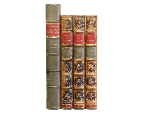
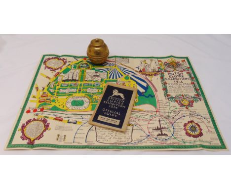
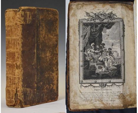
Popery. Popish Cruelty Display'd, Being a short, but impartial history of some of the assassinations, murders, and inhumane slaughters, committed by papists upon protestants ..., [London?], 1718, guarded-in title edge-frayed and with early ink manuscript name Willm Hodgson, bound with: Nottingham (Daniel Finch, Earl of), The Answer of the Earl of Nottingham to Mr. Whiston's Letter to Him, concerning the Eternity of the Son of God, and of the Holy Ghost ..., eighth edition, London: for Edward Valentine, 1721, 3pp. advertisements at end, bound with: [Randolph, Herbert], Some Plain and Short Arguments from Scripture proving the Lord Jesus Christ to be the supreme God ..., sixth edition, London: for John Clark, 1719, bound with: Popping (S., publisher), The Lay-Mens Humble Representation of their Just Grievances, London, 1720, bound with: Calamy (Edmund), A Letter to Mr. Archdeacon Echard, upon occasion of his History of England, third edition, London: for John Clark, 1718, woodcut head- and tail-pieces and initials, generally toned, occasional minor marks or stains, some dust-soiling, hinges cracked, mid-18th century blind-tooled calf, rubbed, one corner showing, minor worming to spine ends, 8vo, together with: [Zacharie de Lisieux, pe?re], A Rela[tion] of [the] Cou[ntry of] Ja[nsenia, Ne[ver Till Now Described, Wherein] is [... composed in French by Lewis Fountaine, Esq; and newly translated into English by P.B.], [1668], majority of title lacking and torn away (with an additional usual version of the title bound-in at the rear), without folding map, some toning, dust- and finger-soiling mainly at front and rear, few leaves lightly edge-frayed or with minor losses to blank margins, without front endpapers, contemporary calf, worn, small 8vo, plus: Gunter (W.), Gunter's Confectioner's Oracle, London: Alfred Miller, 1830, 4 plans (one folding), without portrait frontispiece, lightly toned, scarce minor spotting, hinges cracked, contemporary maroon half calf, worn, front joint cracked and board loose, spine covering defective, 8vo, with 4 other antiquarian titles (one in 2 volumes), some defectiveQTY: (8)NOTE:First item: ESTC T180090, T21975, T49335, T171246 & T38157 respectively.Second item: ESTC R38878; Wing F1410 for the usual edition. This copy appears to have remnants of a rare version of the title with the additional phrase 'Never till now described'. This version is not in ESTC, Wing or Library Hub. We have only found one mention of this version: in the catalogue of the first portion of the ... library of the late James Crossley, sold by auction by Sotheby, Wilkinson & Hodge 21-28 July 1884 (lot 896).

Lot 100

Ireland. Philippe (Pierre), L'Irlande conforme aux Itinéraires et assujettie aux observations astronomiques..., circa 1787, uncoloured engraved map, three lines of scale to the right-hand vertical margin, 270 x 405 mm, together with Van der Aa (Pieter). Lagenie où Leinster, Leiden, circa 1710, hand-coloured engraved map presented in a 'picture frame' border, 235 x 400 mm, with Seale (R. W.). Plans of the Principal Towns, Forts and Harbours in Ireland; For Mr Tindal's Continuation of Mr Rapin's History, circa 1760, sixteen uncoloured engraved plans on one sheet (as published), old folds, 405 x 500 mm, plus Turrel (E.). Dublin [and] the Environs of Dublin, published under the Superintendance (sic) of the Society for the Diffusion of Useful Knowledge, 1833, two engraved city plans, both with contemporary outline colouring, slight mount staining to the plan of Dublin, each approximately 320 x 400 mm, with another copy similar of the plan of Dublin, and Walker (J & C). Ireland, published under the Superintendence of the Society for the Diffusion of Useful Knowledge, circa 1833, engraved map with contemporary outline colouring, 390 x 330 mm, with Chatelain (Henri). Carte du Gouvernement Civil et Militaire avec L'Etat des Officiers du Royaume D'Irlande, circa 1719, two uncoloured engraved maps of Ireland, two heraldic shields and two interior views of the Irish parliament, all set within descriptive French text, 365 x 465 mm QTY: (8)NOTE:Andrew Bonar Law. The Printed Maps of Ireland 1612 - 1850, number 134 ii (Philippe).

Lot 407

Malcolm (John). The Political History of India from 1784 to 1823, 2 volumes, 1st edition, London: John Murray, 1826, errata leaf at end of vol. I, light spotting front and rear, irst volume with ownership signature John Stracey 1827 to pastedown, edges untrimmed, original cloth-backed boards, printed paper title label to spines of each volume, spines and joints worn, 8vo, together with: Barrow (George). Ceylon: Past and Present, London: John Murray, 1857, folding engraved map, 32 pp. publisher's adverts at rear, original cloth gilt, extremities lightly rubbed, 8vo, plus Radclyffe (Charles W.). Memorials of Eton College, 1st edition, Eton: T. Ingalton & Son, 1844, tinted lithograph title and 23 plates, foxing and some damp staining, contemporary red half morocco, gilt decorated spine, some wear and marks, folio, plus Peel (Lawrence). Horæ Nauseæ, London: Printed by Bradbury and Evans, 1841, contemporary manuscript note to verso of front free endpaper; 'Edwards Anson, From the Author, Laurence Peel, Jun 12, 1879(?)', light spotting, publisher's original cloth binding, 4to, plus 14 other volumes and 3 folding maps (Switzerland, India, The North of England and part of Scotland), various sizes and condition QTY: (22)

Lot 5

Bower (Hamilton). Diary of a Journey Across Tibet, 1st edition, London: Rivington, Percival and Co, 1894, ownership inscription of John Bower (the author's brother) to half-title, frontispiece, folding map (frayed with small loss), 29 full-page and smaller illustrations, hinges cracked, sewing loosened with text block separated in places, original green pictorial cloth, rubbed with some wear to extremities, 8voQTY: (1)NOTE:Yakushi B533. In 1891 Hamilton Bower and Dr. W. G. Thorold, at the instigation of the British Indian intelligence service, travelled 1200 miles across the Tibetan plateau through unknown country, at an average elevation of 19000 feet, despite being deserted by their guides, their food supplies giving out and almost all their transport animals dying. The Indian sub-surveyor Atma Ram accompanied Bower and Thorold and made an important map of the region which is reproduced in the book. Bower was the first European to cross the Tibetan plateau, for which he was awarded the Founder's Medal of the Royal Geographical Society.

Loading...Loading...
  • 109182 item(s)
    /page

Recently Viewed Lots