We found 109182 price guide item(s) matching your search
There are 109182 lots that match your search criteria. Subscribe now to get instant access to the full price guide service.
Click here to subscribe- List
- Grid
-
109182 item(s)/page


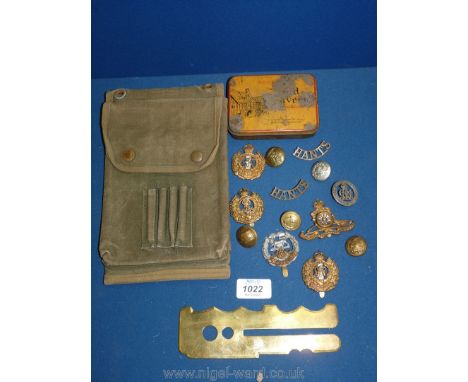
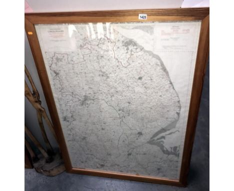
Lot 1022
A WWII British army small folding map case in jungle green, marked to the interior 'FLW1945 OAT VC8262', and 'Keep Mosquito Repellent Off Celluloid' to the flap; a brass button polishing guard marked 'Patent No 116972/17 and WHB'; and a tin of 13 cap badges and buttons for Royal Artillery, Royal Engineers Hampshire regt. Inniskilling etc.


Lot 1225
A quantity of pamphlets for Hawaii, a S.O Book for a Major B.O Bown, Royal Engineers, envelope with a wax seal for H.M Commissioner Anguilla addressed to Force Commander land Force Anguilla,, photograph of a nuclear explosion, map of The Christmas island showing camps, water holes, helicopter pads etc and a photograph of Force Commander Lt. Col. B.O Bown M.B.E R.E.


Lot 247
Cigarette cards selection of sets and part sets to include large cards, Players, Wills, Churchmans, better items noted include Churchman Army Badges of Rank, Sectional cycling map, Boy Scouts, Wills recruiting posters, Godfrey Phillips famous boys, Gallaher The Great War VC Heroes, Wills billiards, Lambert & Butler interesting musical instruments, hints & tips for motorists and others condition mixed

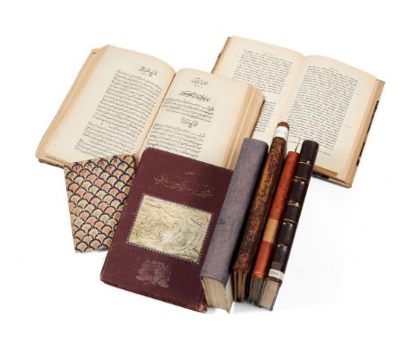
Lot 605
A Collection of printed books relating to the Middle East, in German, Syriac, Russian, Farsi and Arabic [mostly nineteenth or early twentieth century] comprising: (i) Rubayat Hakim Omar Khayyam, dated 1304 AH, numerous ink inscriptions to preliminary leaves, two plates of manuscript facsimiles of the work at the back, 160 x 120mm., boards covered with contemporary dutch-pastepaper; (ii) Hermann Gotz, Eine Orientreise, Leipzig, 1901, adnuchromolithographic frontispiece, numerous illustrations in the text, lightly foxed, 235 x 160mm., morocco-backed boards, spine gilt with raised bands; (iii) Philoxeni Mabbugensis, Scriptores Syri (Latin edition), Paris, 1907 AD, ex-libris stamps, 235 x 160mm., half vellum over marbled boards; (iv) Grey's Elegy, illuminated by Owen Jones, London, 1846, lightly foxed, 255 x 180mm., gothic-style binding; (v) A Qajar work on medical pathology, Tehran, dated 1300 AH, first leaf loose, 250 x 170mm., contemporary morocco binding; (vi) Ganjiyeh Qur'an, Tehran, dated 1328, plates and a folding table, 215 x 150mm., morocco-backed cloth boards; (vii) A history of the Russo-Japanese war, Istanbul, dated 1321, illustrations throughout, some gatherings loose, 240 x 170mm., original cloth with chromolithographic map pasted to upper cover, spine worn; (viii) Tuhfat al-Ayan bi-sira ahl'Uman, dated 1330 AH, 245 x 150mm., original printed cloth-backed boards All from the Mohamed Makiya collection


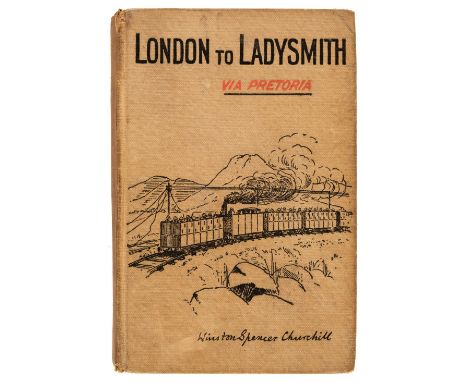
Lot 343
Churchill (Winston S.) London to Ladysmith via Pretoria, 1st edition, London: Longmans, Green and Co., 1900, 3 folding maps and plans (frontispiece map with closed marginal tear and outer margin frayed), 2 pp. advertisement and 32 pp. catalogue at rear, a little light spotting, front endpaper browned with contemporary previous owner inscription, front hinge a little tender, original pictorial cloth, spine lightly toned with small tears at ends, light marks to lower cover, slight lean, 8vo (Woods A4a), together with Ian Hamilton's March, 2nd edition, London: Longmans, Green and Co., 1900, portrait frontispiece, folding map, advertisements and catalogue at end, endpapers toned, contemporary presentation inscription at front, original cloth, spine a little faded and rubbed at ends, 8vo, with 3 others: The Story of the Malakand Field Force, new edition, 1899, G.W. Steevens' From Capetown to Ladysmith, 3rd impression, 1900 and John Black Atkin's The Relief of Ladysmith, 1st edition, 1900 (lacking front endpaper)Qty: (5)
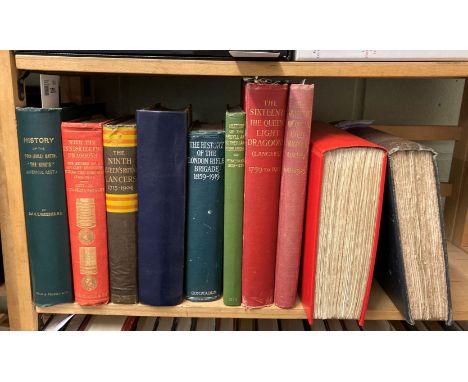
Lot 359
Wurtzburg (C.E.) The History of the 2/6th (Rifle) Battalion "The King's" (Liverpool Regiment), 1914-1919, Aldershot: Gale & Polden, 1920 portrait frontispiece, folding maps contained in rear pocket, maps and illustrations, original green cloth gilt, covers slightly bowed, 4to, together with Yardley (J. Watkins). With the Inniskilling Dragoons. The Record of a Cavalry Regiment during the Boer War, 1899-1902, 1st edition, London: Longmans, Green and Co., 1904, portrait frontispiece, folding map, illustrations, 40 pp. catalogue at end, inscribed "From the Officers Inniskilling Dragoons, June 6th 1904" to title verso, endpapers toned, top edge gilt, original polychrome cloth gilt, corners a little bumped, 8vo, plus Graham (Henry). History of the Sixteenth, the Queen's Light Dragoons (Lancers) 1912 to 1925, Devizes: privately printed by George Simpson, 1926, illustrations, folding maps contained in rear pocket, top edge gilt, original cloth, spine faded, 4to, with others related including Walter Willcox's The Historical Records of the Fifth (Royal Irish) Lancers, 1908, Frank Reynard's The Ninth (Queen's Royal) Lancers 1715-1903, 1904 and Godfrey Williams's The Historical Records of the Eleventh Hussars Prince Albert's Own, 1908 (rebound)Qty: (10)
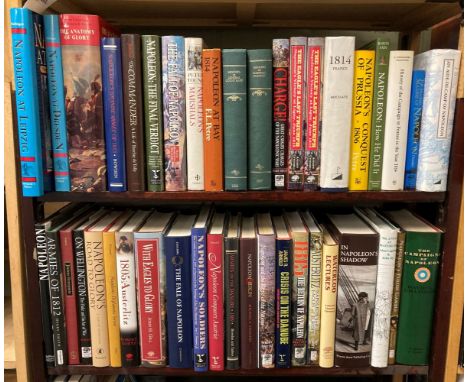
Lot 360
Nafziger (George). Napoleon at Leipzig. The Battle of Nations 1813, Chicago: Emperor's Press, 1996, maps and illustrations, original boards, dust jacket, 8vo, together with Napoleon's Dresden Campaign. The Battles of August 1813, Emperor's Press, 1994, maps and illustrations, original boards, dust jacket, 8vo, plus Chandler (David G.) The Campaigns of Napoleon, London: Weidenfeld and Nicolson, 1966, folding map, illustrations, original cloth, price-clipped dust jacket, 8vo, with others related including In Napoleon's Shadow. Being the first English language edition of the Complete Memoirs of Louis-Joseph Marchand, valet and friend of the Emperor 1811-1821, Proctor Jones, 1998, The Anatomy of Glory, adapted from the French of Henry Lachouque by Anne S.K. Brown, Arms and Armour Press, 1978 and Scott Bowden's Napoleon's Grande Armee of 1813, Emperor's Press, 1990Qty: (45)
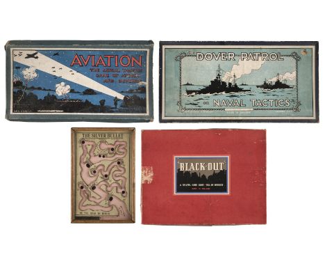
Lot 367
* Games. The Silver Bullet or the Road to Berlin, manufactured by R.Farmer and Son, circa 1916, a British wartime dexterity puzzle in the form of a stylised map charting the Allied advance on Berlin, manufacturer's instructions printed on a label to verso of frame, 24 x 16.5cm, together with 2 other WWI period board games comprising Aviation The Aerial Tactics Game of Attack and Defence by H.P.Gibson & Sons Ltd, with 40 blue cards and 39 red (lacking 1), folding board and instructions, boxed, Dover Patrol or Naval Tactics by H.P. Gibsons & Sons Ltd, 40 blue cards and 40 red cards, folding board, instructions, boxed plus a WWII game ARP "Black-Out" A Skilful Card Game - Full of Interest, with 51 cards , 4 vehicles and folding board, boxedQty: (4)

Lot 491
* Air Vice-Marshal Harold Bird-Wilson. Spitfire MJ845 presentation model, the composite model with personal registration HBW and fitted with a gauntlet rudder (the symbol of 17 Squadron), presented on a mahogany base with aluminum plaque stamped 'Aircraft No MJ845 Serial No- CBAF-1X 1-8-43', 23cm wingspan, together with another desktop model of a Hurricane Mk1, the aluminum model made by D.P. Carter to commemorate the 50th Anniversary of the Battle of Britain (1940-1990), stamped on the undercarriage, mounted on a circular base, 17.5cm wingspan, plus some related ephemera from the same estate comprising two photographs of Bird-Wilson (1 signed), Automobile Association and Royal Aero Club General Flying Map (1936), some annotations, Spitfire and Hurricane aircraft identification cards and Some of the Few by John P.M. Reid, together with a First Day Cover signed by Bird-WilsonQty: (8)NOTESProvenance: From the estate of Air Marshal Harold Arthur Bird-Wilson, CBE, DSO & Bar, AFC & Bar (1919-2000) Harold Arthur Cooper Bird-Wilson was born at Prestatyn (1919-2000), he was educated at Liverpool College and joined the RAF in 1937. After completing training he joined 17 Squadron at Kenley. He crashed in bad weather his passenger killed and he himself suffering from severe facial injuries, resulting in four operations making him one of the original guinea pigs. Bird-Wilson returned to service on 28 December and after converting to Hurricanes he rejoined 17 Squadron on 24 February 1940. He went to France on 17 May 1940 and the following day shared in the destruction of Do17, and on the 19th damaged a Me109 and on 21st shared a Hs126. He took part in the operations over Dunkirk and damaged a Ju87 and a Ju88 soon after he shot down a Me110 on 29 July 1940 and shared a Ju88 on 21 August going to claim further aerial victories. Bird-Wilson was awarded the DFC (London Gazette, 24 September 1940), he was shot down by Adolf Galland on 24 September and baled out, burned and was rescued from the sea by an MTB. Bird-Wilson had a long and successful career in the RAF, and post-war service him hold many different position and he retired from service in 1974.

Lot 814
HENNEPIN, L. A New Discovery of a Vast Country in America 1698, with A Continuation of the New Discovery? 1699, lacks the 2 fldng. maps (present in facsimile with part of orig. map in part II present), 6 orig. engrvd. fldng. plts. (2 with professional old edge repair, 1 with old corner repair) 1st. part lacks engrvd. t/p & all before A3, recased with cont. fl. panelled cf. & later cf. sp.


Lot 114
Patrick Moore signed 18x12 signature piece Albedo map of Mars from Observations by Patrick Moore. Sir Patrick Alfred Caldwell-Moore CBE HonFRS FRAS 4 March 1923 - 9 December 2012) was an English amateur astronomer who attained prominence in that field as a writer, researcher, radio commentator and television presenter. Good condition. All autographs come with a Certificate of Authenticity. We combine postage on multiple winning lots and can ship worldwide. UK postage from £4.99, EU from £6.99, Rest of World from £8.99
Lot 257
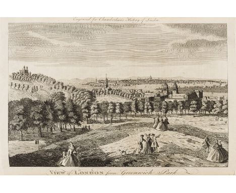
Architecture.- Chamberlain (Henry, editor) A New and Compleat History and Survey of the Cities of London and Westminster...By a Society of Gentlemen, first edition, engraved frontispiece, 2 folding maps and 64 engraved plates, list of subscribers, some light spotting and offsetting, map of environs of London with tear to fold, Pp2 torn without loss, pencil inscription of Kerry Downes, contemporary calf, spine gilt with red morocco label, a little worn, joints split, folio, for J. Cooke, [?1770].


-
109182 item(s)/page