We found 108737 price guide item(s) matching your search

Refine your search

Year

Filter by Price Range
  • List
  • Grid
  • 108737 item(s)
    /page

Lot 345

England & Wales. Walker (J & C), A New Map of England and Wales, with part of Scotland showing the Mail Coach, Turnpike & Railroads, Canals &c. 1839, large engraved map with bright contemporary hand colouring, sectionalised and laid on linen, the map surrounded by numerous distance tables, green endpapers, 1450 x 1030 mm, contained in a contemporary cloth slipcase with contrasting red morocco gilt label to upper cover, slight wear to extremities of slipcaseQty: (1)

Lot 346

Essex. Greenwood (C & J), Map of the County of Essex, from an actual survey made in the year 1824..., Greenwood, Pringle & Co. July 1st 1825, large scale uncoloured engraved map, sectionalised and laid on modern linen on three sheets, calligraphic cartouche, table of explanation, compass rose and a vignette view of Audley End House, later marbled endpapers, modern paper chemise, contained in a modern morocco book-box with contrasting morocco gilt labels to spine, each sheet approximately 1320 x 535 mmQty: (1)

Lot 347

Essex. Speed (John), Essex devided into Hundreds, with the most Antient and fayre Towne Colchester Described and other memorable Monuments observed, G. Humble, circa 1627, engraved map with early hand-colouring, an inset town plan of Colchester, trimmed to neatline and laid on near-contemporary paper, central fold repaired on verso, 380 x 510 mm, no text on versoQty: (1)NOTESThe trimming and re-backing of the map with near-contemporary laid paper, coupled with the early colouring would suggest that this map came from a privately commissioned atlas, whose purchaser requested these particular specifications.

Lot 348

Frankfurt. Munster (Sebastian). Frankfurt an der Oder..., circa 1568, uncoloured woodblock city plan, additional French title above map, slight marginal soiling, French text below and on verso of map, image size 245 x 300 mm, together with Francfurt an der Oder, circa 1790, unattributed uncoloured engraving, originally published in the "Sächsischer Postillion", slight overall toning, 180 x 300 mm, with Bertius (Petrus). Franckfurt an der Oder, circa 1620, uncoloured city panorama, 150 x 195 mm, Dutch text on verso, plus Merian (Mathäus). Gruntrib der belägerung und Statt Franckfurt..., circa 1634, uncoloured engraved city plan showing the fortifications, two short repaired marginal closed tears, 275 x 350 mm, and Gürcsh (C. F.). Schlacht bey Cunersdorf den 12. August 1759, engraved battle plan with contemporary outline colouring, slight overall toning, old folds, 405 x 480 mm, with another six 17th & 18th-century maps and plans of Frankfurt, including examples by Saur, Merian and Romano, various sizes and conditionQty: (11)

Lot 349

Gloucestershire. Saxton (Christopher), Glocestriae sive Claudiocestriae Comitat (Claudy Caesaris Nomine ad huc Celebrat) Verus Tipus atq Effigies. No. Dni. 1577, circa 1579, engraved map with contemporary hand colouring and some later enhancement, engraved by Augustine Ryner, large strapwork cartouche surmounted by the royal crest, mileage scale by dividers, with the coat of arms of Thomas Seckford, slight creasing, central fold strengthened and repaired on verso, a few pin-holes, one repaired small hole, 385 x 495 mmQty: (1)

Lot 351

Hampshire. Speed (John), Hantshire described and devided, Thomas Bassett & Richard Chiswell [1676], hand-coloured engraved map, an inset town plan of Winchester, long repaired closed tear along central fold, slight dust soiling, 380 x 510 mm, English text on versoQty: (1)

Lot 352

Hertfordshire. Speed (John), Hartfordshire Described, The Sittuations of Hartford and the most ancient Towne St. Albons with such memorable actions as have happened, 1st edition, John Sudbury & George Humble, [1611], hand-coloured engraved map, inset town plans of Hertford and Verolanium (St Albans), central fold strengthened and repaired on verso, slight overall toning and mount staining, 385 x 515 mm, English text on versoQty: (1)

Lot 354

* Hungary. (Munster (Sebastian), Landtafel des Ungerlands, Polands, Reussen, Littaw, Walachen und Bulgaren, Basel [1550 or later], hand-coloured woodcut map, slight marginal toning, 320 x 360 mm, mounted, framed and glazed, together with [Schlesia nach Aller Gelegenheit in Stetten...,] circa 1558, hand-coloured woodcut map, mounted to obscure title, 320 x 360 mm, mounted, framed and glazedQty: (2)

Lot 355

Huntingdonshire. Speed (John), Huntingdon both Shire and Shire Towne with the Ancient Citie Ely Described, 1st edition, George Humble [1611], hand-coloured engraved map, inset town plans of Huntingdon and Ely, central fold repaired on verso, slight toning to central fold, slight text 'show through', 385 x 510 mm, English text on versoQty: (1)

Lot 356

Indian Ocean. De Bruyn (Cornelius) Route Exacte de Gamron à Batavia et de Batavia à Gamron, originally published in "Travels into Muscovy, Persia, and part of the East-Indies…", 1737, an uncoloured engraved map showing De Bruyn's route from Gamron (Bandar Abas) to Batavia (Jakarta), compass rise and numerous rhumb lines, large margins, 235 x 305 mmQty: (1)

Lot 357

Isle of Wight. A collection of thirty maps, 18th & 19th century, engraved and lithographic maps, including De Fer (Nicolas). L'Isle de Wight..., circa 1700, hand-coloured engraved map, inset maps of Torbay and the Scilly Isles, one repaired closed tear affecting image, 355 x 320mm, with another copy, laid on later card, together with Brannon (A.). The Map of the Isle of Wight with every information for the Tourist & Pleasure Visitor..., 1862, engraved decorative map, inset maps of Newport, Ryde and Ventnor, old folds, repaired closed tear affecting image, laid on later card, 345 x 440 mm, with Von Reilly (Franz J. J.). Die Insel Wight, engraved map with contemporary outline colouring, circa 1799, 215 x 280 mm, plus Collins (H. G.). Isle of Wight, circa 1852, uncoloured lithographic map, one repaired closed tear affecting image, old folds, slight staining, old ink library stamp to lower margin, 460 x 720 mm, with another 24 maps including examples by Philip & Son, Bacon, Illustrated London News, Laurie & Whittle, Dawson, Rocque, Brannon, Kelly, Moll, Bartholomew and J & C Walker, several duplicates, various sizes and conditionQty: (30)

Lot 358

Isle of Wight. Speed (John), Wight Island, Thomas Bassett & Richard Chiswell, [1676 or later], engraved map with sparse contemporary outline colouring, large margins, slight spotting to margins, near contemporary manuscript title to margin on verso, 385 x 510 mm, no text to versoQty: (1)

Lot 360

Kent. Speed (John), Kent with her Cities and Earles Described and Observed, Thomas Bassett & Richard Chiswell, [1676], hand-coloured engraved map, inset town plans of Canterbury and Rochester, good margins, 385 x 515 mm, English text on versoQty: (1)

Lot 362

Lancashire. Hennet (G.), A Map of the County Palatine of Lancaster Divided into Hundreds and Parishes from an accurate survey made in the years 1828 and 1829, Henry Teesdale and Co. May 1st. 1830, large scale engraved map with contemporary outline colouring, sectionalised and laid on linen, calligraphic cartouche, compass rose, table of explanation, uncoloured vignette of the New Custom House Liverpool, some offsetting and staining, marbled endpapers, edged in green silk, 1615 x 1130 mm, marbled endpapers, contained in a contemporary calf book-box with contrasting modern morocco gilt label to spine, box worn and rubbedQty: (1)

Lot 363

Leicestershire. Speed (John), Leicester both Countye and Citie described, The Honorable Famylies that have had the titles of Earls thereof with other accidents therein observed, Thomas Bassett & Richard Chiswell, 1676, hand-coloured engraved map, inset town plan of Leicester, 380 x 510 mm, English text on versoQty: (1)

Lot 364

Lewis (Samuel). A Topographical Dictionary of Scotland..., with Historical and Statistical Descriptions: Embellished with a Large Map of Scotland..., (supplementary volume only), 1846, title page and contents list, six large engraved folding map sheets with contemporary outline colouring, which if conjoined form a monumental map of Scotland, the map is titled "A Map of Scotland Divided into Counties shewing the Principal Roads, Railways, Rivers, Canals, Lochs, Mountains, Islands &c. on a scale of Five Miles to an Inch", slight offsetting, occasional short closed tears where old folds cross, some repaired on verso, each sheet approximately 650 x 640 mm, contemporary cloth gilt boards, frayed and some wear to spine, slim 4toQty: (1)

Lot 365

Lincolnshire. Speed (John), The Countie and Citie of Lincolne Described with the Armes of them that have bene Earles thereof since the conquest, Thomas Bassett & Richard Chiswell, [1676], hand-coloured engraved map, an inset town plan of Lincoln, wide margins, two small repaired closed teras385 x 510 mm, English text on versoQty: (1)

Lot 366

London. Philip (George & Son, publisher), Philips New Library Map of London and its Environs, circa 1895, large lithographic map, sectionalised and laid on linen with contemporary outline colouring, slight staining, marbled endpapers, 1130 x 1480 mm, contained in a contemporary cloth gilt slipcase, worn and frayedQty: (1)

Lot 367

* Manchester. Dean (R. & W. publishers), A Plan of Manchester and Salford, 1809, hand-coloured engraved map, compass rose and decorative cartouche, 455 x 655 mm, mounted, framed and glazed, together with Baines (Edward). Manchester and its Environs engraved from an actual survey..., by William Swire, Leeds, 1824, hand-coloured engraved map, inset plan of Manchester in 1650, decorated with topographical vignettes and coats of arms, old folds, some spotting, 415 x 520 mm, mounted, framed and glazed, with Hall (Sidney). Bolton, 1824, uncoloured engraved city plan, slight staining, 175 x 250 mm, mounted, framed and glazed plus Morton (W.). A Plan of Manchester and Salford taken in about 1650, circa 1840, hand-coloured engraved plan, toned overall, unobtrusive blind stamp to the upper right corner, 130 x 180 mm, mounted, framed and glazedQty: (4)

Lot 368

Manchester. Laurent (C.). A Topographical Plan of Manchester and Salford with the adjacent parts; shewing also the different allotments of land proposed to be built on as communicated to the Surveyor by the respective Proprietors..., Dec. 9th 1793, large uncoloured folding map, inset strip road map of the route from Manchester to London, inset plan of Manchester and Salford and an inset map of the Country around Manchester, old folds with occasional short splits along the fold, slight spotting and toning, 990 x 920 mmQty: (1)NOTESThe map was used to illustrate Aikin's 'Description of the Country from Thirty to Forty Miles Round Manchester'.

Lot 369

Maps. A collection of 38 British county, regional and country maps, town plans and charts, 17th - 19th century, including Bowen (Emanuel). An Accurate Map of the County of Kent devided into its Lathes and subdivided into Hundreds..., Robert Sayer & Carington Bowles, circa 1765, engraved map with contemporary outline colouring and some later enhancement, trimmed to neat line re-margined, some wear and closed tears, torn with slight loss and replaced in facsimile, 520 x 700 mm, with Ogilby (John). The Road from the City of Salisbury com. Wilts to Campden..., [and] The Road from London to Southampton, circa 1676, one coloured and one uncoloured engraved strip road map, The road from Salisbury to Campden worn and frayed with some loss to the printed surface, laid on later thin card, the road from London to Southampton trimmed to neatline on vertical margins with slight loss to the printed surface, margins extended, each approximately 315 x 465 mm, plus Blaeu (Johannes). Hantonia sive Southantonensis comitatus vulgo Hantshire [and] Vectis Insula, Anglice The Isle of Wight, Amsterdam, circa 1645, two engraved maps with contemporary hand-colouring, worn and frayed with some loss to the printed surface, crudely repaired on verso, 415 x 505 mm, French text on verso with another 34 maps, including examples by Cary, Lodge, Moule, Bowen, Bartholomew, Kitchin, Rocque, Baker, Archer, Weller, Seller/Grose, Henshall, Morden, Munster and Murdoch Mackenzie, various sizes and conditionQty: (38)

Lot 370

Moule (Thomas). Moule's English Counties, 30 parts (only), G. Virtue, 1831, descriptive text and 30 engraved county maps and town plans, some maps with sparse later colouring to the heraldic shields, maps stained and dust-soiled with some marginal fraying, Wiltshire torn with slight loss, lacking some pages of descriptive text, publishers paper wrappers, torn and some covers missing, soiled and frayed, each part 290 x 225 mm, together with Pinnock (William). The Guide to Knowledge, 1832, a disbound periodical containing 53 (only) wood-engraved 'white on black' maps of British counties, foreign countries and celestial maps, each approximately 170 x 235 mmQty: (approx. 83)NOTESThe Thomas Moule maps comprise of - Surrey, Essex, Shropshire, Cambridgeshire, Devon, Norfolk, Gloucestershire, Herefordshire, Buckinghamshire, Nottinghamshire, Boston, Lincolnshire, Rutland, Derbyshire, Durham, Isle of Man, Environs of Plymouth, Northumberland, Bedfordshire, Monmouthshire, Wiltshire, Middlesex, Berkshire, Warwickshire, Northamptonshire, Leicestershire, Worcestershire, Cumberland, Huntingdonshire and a four-sheet map of England & Wales.

Lot 371

Newsmaps. US Government (publisher), prepared and distributed by Army Orientation Course, War department, 102 periodicals, a broken run, 1942 - 46, monotone and colour broadsheets, printed on both sides, many with maps and posters, showing the progress of the war, including Geisel (Theodore, 'Dr Seuss'). This is Ann..., she drinks blood! Her full name is Anopheles Mosquito and she is dying to meet you!...., November 8th, 1943, colour printed photolithographic educational map, with additional maps and photographs on verso, old folds, University of California (Military Department) ink library stamp and red crayon signature to image, 870 x 1190 mm, together with, Heavy Tanks and Self-propelled Artillery, Learn to recognize these vehicles, January 11th, 1943, colour printed photolithographic propaganda and educational poster of tank silhouettes, with additional maps and photographs to verso, four 'punch holes' to margins, old folds, 870 x 1190 mm, with Manning (F.E.), Target Berlin, 'Newsmap', Prepared and Distributed by the Army Orientation Course. Special Service Division Army Service Forces, War Dept., 2E581 Pentagon Bldg., Washington D.C. U.S. Government, October 25, 1943, large photolithographic poster with detachable scale at the base of the map, old folds, 870 x 1190 mm with another 95 Newsmap posters, all with maps and photographs from various theatres of World war II, occasional duplicates, all approximately 870 x 1190 mm, various conditionQty: (102)NOTESNewsmaps were published by the Special Service Division, Army Service Forces, War Department. The issues were prepared and distributed by the Army Orientation Course. One standard feature that appears on all maps is a short textual summary of key events titled The War Fronts, which included descriptions of war-related events, mostly by geographic area, such as China, Russia, Tunisia, South Pacific, Aleutians, Wake, etc. Newsmaps were produced each Monday from 1942-1946 and usually featured a map of the current war fronts on one side and a poster about a war-related topic on the other. They were distributed by the Army and Navy to primarily military installations and government & civilian groups working on War Department projects.

Lot 372

Norfolk. Saxton (Christopher & Lea Philip), Norfolk described by C. Saxton, Corrected and Amended with many Additions of Roads &c. by P. Lea, circa 1693, uncoloured engraved map, an inset town plan of Norwich, old folds, narrow margins on three borders, 335 x 495 mmQty: (1)

Lot 373

Norfolk. Saxton (Christopher), Norfolciae comitatus continens in se Oppida Mercatoria 26, Pagos et Villas625, Una cum singulis Hundredis et Fluminibus in eodem vera descriptio, 1574, [1579], map engraved by Cornelius Hogius with contemporary hand-colouring and some later enhancement, strapwork cartouche and key plate, central fold strengthened and restored on verso, slight toning to central fold, some marginal dust and finger soiling, 330 x 490 mmQty: (1)NOTESThe first engraved county map of Norfolk.

Lot 375

Ogilby (John). The Road from Bristoll to Worcester, [1675 or later], uncoloured engraved road map (complete on one sheet), 310 x 445 mm,Qty: (1)NOTESSheet number 59. The road Commences at Bristol and passes through Dursley, Gloucester, Tewkesbury and Severn Stoke, ending at Worcester.

Lot 381

Ogilby (John). The Road from London to St. Davids in com Pembroke, [1675 or later], uncoloured engraved strip road map, slight marginal water staining, 300 x 440 mmQty: (1)NOTESThe road commences in London and passes through Brentford, Hounslow, Stowe, Maidenhead, Henly-on-Thames, Nettlebed and Dorchester and ends at Abingdon. Sheet 24.

Lot 382

Ogilby (John). The Road from St Davids com Pembroke to Holywell com Flint [and] The Continuation of the Road from St Davids to Holywell, [1675 or later], two consecutive uncoloured engraved strip road maps, narrow margins, slight staining, slight juvenile pencil scribbling to the verso of one map, each approximately 350 x 450 mmQty: (2)NOTESTwo consecutive road maps completing the road from South Wales to Anglesey. Sheet numbers 66 & 67.

Lot 383

* Oxfordshire. Speed (John), Oxfordshire described with ye Citie and the Armes of the Colledges of ye famous University, Thomas Bassett & Richard Chiswell, [1676], hand-coloured engraved map, inset town plan of Oxford, the vertical margins decorated with 18 heraldic shields of university colleges, printers fold to lower right corner, 385 x 530 mm, mounted, framed and double-glazed, English text on versoQty: (1)

Lot 385

* Poland. Chatelain (Henri Abraham), Carte de Pologne avec la Chronologie des Rois et des Ducs de Lithuanie..., circa 1714, hand-coloured engraved reticulated map, with historical and geographical tables, 500 x 595 mm, mounted, framed and glazed, together with Nouvelle Carte Genealogique des Soverains et des Familles Illustres aliez a la Maison quaux decendans de la Famille Roialle de Piaste Roi de Pologne avec le Blason de Leurs Armes [and] Carte Genealogique des Princes et Rois de Pologne...., circa 1714, two large hand-coloured engraved genealogical charts of the Royal families of Poland, old folds, slight toning, each approximately 390 x 925 mm, mounted, framed and glazed, with Carte des Trois ordres qui Composent l'Etat de la Republique de Pologne..., circa 1714, hand-coloured engraved panorama of Cracow with two additional vignette views and descriptive text below images, 355 x 466, plus Nouvell Carte du Royaume de Pologne..., 1714, hand-coloured engraved reticulated map, 505 x 585 mm, and Carte Genealogique de Pologne..., hand coloured genealogical chart, 355 x 450 mm, with two others similarQty: (8)

Lot 386

* Poland. Merian (Matthaus), Polonia Regnum et Silesia Ducatus, circa 1640, hand-coloured engraved map, 275 x 355 mm, mounted, framed and glazed, together with Bowen (Emanuel). A New and Accurate Map of Poland, Lithuania &c. Divided into its Palatinats..., [1744], hand-coloured engraved map, some creasing, left-hand vertical margin trimmed to neatline and re-margined, mounted with another copy similar, each map 350 x 425 mm, framed and glazed, with Van der Aa (Pieter). La Pologne suivant les Nouvelles Observations..., circa 1700, hand-coloured engraved map with an ornate engraved 'picture frame' border, trimmed to the image on the lower border and re-margined, 255 x 380 mm, mounted with another slightly later copy which lacks the picture frame border, framed and glazed, plus Nolin (Jean Baptiste). Carte des Etats de Pologne..., circa 1753, hand-coloured engraved map, old folds, 215 x 300 mm, mounted with another copy similar, framed and glazed and De Vaugondy (Robert). Royaume de Pologne, circa 1795, engraved map with sparse contemporary hand -colouring, mounted with another slightly later edition, each 245 x 285 mm, framed and glazedQty: (5)

Lot 39

Ellis (John). Ellis's English Atlas: or, a compleat chorography of England and Wales: in fifty-four maps. Containing more particulars than any other collection of the same kind. The whole calculated for the use of travellers, academies, and of all those who desire to improve in the knowledge of their country. From the last surveys of the several counties ... Engraved by, and under the direction of, J. Ellis, London: Carrington Bowles, [1768], title with vertical fold and torn with loss of right third (with loss to map index list to verso), 50 engraved maps of 54 each hand-coloured in outline (including 48 double-page & 2 folding, lacking folding general map & 3 others), few marks, occasional spotting and light toning, endpapers renewed preserving early 19th century inscription, contemporary half calf, marbled sides, morocco reback, some wear, 8voQty: (1)NOTESChubb CCXXVIII. Sold as a collection of maps, not subject to return.

Lot 390

Propaganda Map. Manning (F.E.), Target Berlin, 'Newsmap', Prepared and Distributed by the Army Orientation Course. Special Service Division Army Service Forces, War Dept., 2E581 Pentagon Bldg., Washington D.C. U.S. Government, October 25, 1943, large photolithographic poster with detachable scale at the base of the map, old folds, some folds strengthened and repaired on verso, slight dust soiling, 1190 x 890 mmQty: (1)NOTESUncommon.

Lot 391

Propaganda map. Nazi War Aims, Grab! Grab! Grab!!!, That's the Nazi Policy, circa 1940, colour photolithographic British propaganda map based upon a map of Europe showing Germany's expansionist ambitions, old folds, pinholes to each corner, 370 x 495 mmQty: (1)

Lot 393

Railways. Cheffin (Charles Frederick, publisher), London & Birmingham Railway. Plan of the Line and Adjacent Country, Robert Stephenson Engineer, 10th September 1835, large engraved map with contemporary wash colouring, sectionalised and laid on linen, inset maps of Birmingham and the London Depots, panoramic cross-section at the base of the map showing the railways inclination, slight offsetting and dust soiling, slight wear where old folds cross, a few folds crudely strengthened with tape in the margins on the recto, green endpapers, 715 x 1550 mm, contained in a modern marbled card slipcase with morocco gilt label to upper coverQty: (1)

Lot 394

River Thames. Heather (William), To the Right Honorable the Master, Wardens & Elder Brethren of Trinity House, This Chart of the Entrances to the River Thames is most respectfully dedicated, November 5th 1791, sea chart engraved by J. Stephenson with contemporary outline colouring, inset map of the River Thames showing the course of the river to London, slight fraying to margins, slight creasing, one small repaired closed tear, additional horizontal fold, 640 x 785 mmQty: (1)

Lot 395

River Thames. Jaillot (Alexis Hubert), Carte de Entrée de la Tamise avec les Bancs, Passes, Isles et Costes Comprise entre Sandwich et Clay, Depot de la Marine, Paris [1693 or later], hand-coloured engraved map orientated to the east, inset map of the River Thames, compass rose and numerous rhumb lines, slight marginal creasing, and one repaired marginal closed tear, one small hole in the margin but not affecting image, central fold strengthened on verso, 460 x 900 mm, together with Wells (J. B. publisher). A New Map from the Mouth River Thames to the Severn, shewing a great space of Country on each side of the River Thames with the Mail and other Stage Roads from London..., 1798, uncoloured engraved map decorative cartouche, some spotting and staining, old folds strengthened on verso, 340 x 925 mmQty: (2)NOTESThe first described chart is a later 18th-century impression because the north 'point' on the compass rose has had the fleur-de-lys replaced with a revolutionary bonnet.

Lot 396

Russia. Geological map Geologichevskaya karta Rossi i khrebtov Uralskago i Kavkazskago, sostavlena ... Gelmersenom [title in Russian], [St Petersburg: H. Schmitzdorff], 1863 [i.e. 1865], colour lithographic map by P. Gundrizera after Gregor von Helmersen, toned, a little spotting and dust-soiling to margins, a few repaired nicks to edges, 66.7 x 69 cm, contemporary ticket of the Geografichesky Magazin, Nevsky Prospekt (incorporating Romanov eagle) to verso, together with a copy of Helmersen's explanatory pamphlet, Explications de la carte géologique de la Russie (St Petersburg: H. Schmitzdorff, 1865; 19 pp., spine secured with blue tape, 8vo)Qty: (2)NOTESRare and important map by Baltic German geologist Gregor von Helmersen (1803-1885), one copy traced in libraries, at the University of Freiburg. In the accompanying pamphlet Helmersen explains that the first geological map of Russia was produced by William Fox-Strangways in 1829. Helmersen then produced his own 'petite carte géologique' in 1841. A geological map of northern Russia only appeared in A. N. Demidoff's Voyage dans la Russie méridionale (1842), followed by the map included in Geology of Russia and the Ural Mountains (1845) by Murchison, Verneuil and Keyserling. Helmersen's second map, completed in 1863 but not published until 1865, is based on that of Murchison et al. but with significant additions based on intervening discoveries, in particular in the Caucasus and the Urals.

Lot 40

Fisher, Son & Co. Fisher's County Atlas of England and Wales. Compiled from authentic surveys, and corrected to the present time. With a topographical and statistical description of each county, 1st edition, London: Fisher, Son, & Co., [1842-45], folding engraved map frontispiece of England & Wales (partly repaired closed tear to fold) and 47 other maps (including double-page map of Lincolnshire & Devonshire), each map hand-coloured in outline, title-page with vertical crease, upper hinge split, contemporary half calf, joints cracked mostly at head & foot, 20th century paper label to upper board, binding rubbed, folio (30 x 37 cm)Qty: (1)NOTESBeresiner p.101; Chubb 504; Smith pp.136-137.

Lot 402

* Silesia. Homann (Johann Baptist, heirs of), Principatus Silesiae Rattiboriensis..., 1736, engraved map with contemporary outline colouring and some later enhancement to the cartouche, key plate and mileage scale, very large decorative cartouche, mounted with another slightly later copy of the same map but with an uncoloured cartouche and key plate, slight staining to the second map, 555 x 810 mm, double-aperture mount, framed and glazedQty: (1)NOTESA large and detailed map of Gleiwitz and Ostrau in Poland - part of Silesia - and published in the 'Atlas Silesiae Id Est Ducatus Silesiae Generaliter Quatuor Mappis nec non Specialiter...,'. The atlas had four general maps and sixteen large scale detailed maps of Poland and Silesia, all with extraordinary and highly decorative cartouches.

Lot 403

* Silesia. Homann (Johann Baptist), Principatus Silesiae Teschinensis..., 1736, engraved map with contemporary outline colouring and some later enhancement to the cartouche, key plate and mileage scale, very large decorative cartouche, slight creasing, mounted with another slightly later copy of the same map but with an uncoloured cartouche and key plate, 555 x 820 mm, double-aperture mount, framed and glazedQty: (1)NOTESA large and detailed map of the Duchy ofTeschen in Austrian Silesia - and published in the 'Atlas Silesiae Id Est Ducatus Silesiae Generaliter Quatuor Mappis nec non Specialiter...,'. The atlas had four general maps and sixteen large scale detailed maps of Poland and Silesia, all with extraordinary and highly decorative cartouches.

Lot 405

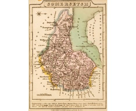
Southern England. A collection of sixteen regional maps, 17th - 19th century, including Mercator (G. & Hondius J.). Warwicum, Northamtonia, Huntingdonia, Cantabrigia, Suffolcia, Oxonium, Buckinghamia, Bedfordia, Hartfordia, Essexia, Berceria, Middelsexia, Southhatonia, Surria, Cantiu. & Southsexia, circa 1610, uncoloured engraved map, ornate strapwork cartouche, some worming to lower margin, a few repaired wormholes affecting image, 370 x 460 mm, German text on verso, together with another later edition (circa 1635) with French text on the verso, with Du Sauzet (Henri). Warwicum, Northhantonia, Huntigdonia, Cantabrigia, Suffolcia, Oxonium, Buckinghamia..., circa 1734. hand-coloured engraved map (based on Mercator), 185 x 260 mm, with another uncoloured copy, plus Borghi (A. B.). Le Provincie che sono al Sud Est Dell Inghilterra, Florence, 1816, engraved map with contemporary outline colouring, some staining, 240 x 320 mm, and Von Reilly (Franz Johann Joseph). Des Konigreichs England Sudlicher Theil oder Cornwall, Devon Shire, Dorset S., Somerset S., Bristol, Wilt S., Hamp S., Berk S., Buckingham S., Oxford S., Gloucester S. und Monmouth S. circa 1789, engraved map with contemporary wash colouring, 205 x 280 mm, with another ten maps similar, including examples by Marmocchi, Cloppenburgh (publisher), Moll, Von Reilly, J & C Walker, Hogg, Borghi and Edwards, various sizes and conditionQty: (16 )

Lot 406

Staffordshire. Speed (John), Stafford Countie and Towne with the ancient Citie Lichfeild described, Thomas Bassett & Richard Chiswell [1676], hand-coloured engraved map, inset town plans of Stafford and Lichfield, central fold very lightly toned, slight creasing, 390 x 515 mm, English text on versoQty: (1)

Lot 407

Surrey. A collection of nine maps, 18th & 19th century, including Luffman (John). Surrey, [1803], engraved circular miniature map with contemporary hand-colouring, descriptive text below the map, overall size 150 x 75 mm, together with Bickham (George). Surrey, Laurie & Whittle, [1796], hand-coloured engraved pictorial 'bird's-eye' map, mount stained, 235 x 155 mm, with Gibson (John). A Correct Map of Surrey from the best Authorities, J. Payne, The Universal Magazine, [1769], uncoloured engraved map old folds, some staining along one fold, contemporary descriptive text fixed to verso of map, the whole backed with archival tissue, 175 x 200 mm, plus Ramble (Reuben). Surrey, [1845], uncoloured engraved map surrounded by lithographic vignettes with contemporary hand-colouring, laid on linen, 165 x 195 mm, and Moll (Herman). Surrey, [1724], uncoloured engraved map with the vertical margins decorated with antiquities and a view of London Bridge, 195 x 315 mm, together with Pigot (James). Surrey, [1828], engraved map with contemporary outline colouring and some later enhancement to the topographical vignette, 240 x 370 mm, with another slightly later edition published by J. Slater from circa 1844, plus Cary (John). Surrey, 1809, engraved map with contemporary outline colouring, 225 x 270 mm, with another slightly later edition, circa 1820Qty: (9)

Lot 408

Switzerland. Fries (Lorenz), Tabula Nova Helvetiae, Lyon circa 1541, uncoloured woodblock map, central fold strengthened on the verso, small area of loss to the printed title in upper margin, very slight spotting, 310 x 420 mm, mountedQty: (1)

Lot 410

Warwickshire. Speed (John), The Counti of Warwick The Shire Towne and Citie of Coventre described, John Sudbury & George Humble, circa 1627, hand-coloured engraved map, inset town plans of Warwick and Coventry, trimmed to strapwork margin and laid on later thick paper, one hole affecting image, loss to printed image appears to have been replaced with a piece from another copy, 380 x 500 mmQty: (1)

Lot 42

Grose (Francis). The Antiquities of England and Wales, 8 vols., London: Hooper & Wigstead, circa 1797, engraved frontispiece and title to each, 56 engraved maps, including one large folding general map and 55 maps of the counties & islands dispersed within the text, numerous engraved plates & plans, some spotting throughout mostly to titles and margins, contemporary diced calf, each volume rebacked, some joints cracked, occasional light wear to extremities, 4toQty: (8)

Lot 44

Hodgson (John). A History of Northumberland, in three Parts, (comprising Part I, Part II volumes 1-3 & Part III volumes 1-3), Newcastle 1820-40, 58 engraved plates (one with image to both sides) and wood engraved vignettes, occasional spotting & some browning, contemporary uniform half morocco (except part I in original sheep-backed boards, joints cracked & slight wear; part II vol 3 in original cloth-backed boards), 4to, together with: Ibid, A Topographical and Historical Description of the County of Northumberland; containing an Account of its Towns, Seats, Antiquities, Churches, Public Edifices, Scenery, the Residences of the Nobility, Genry, &c., London: Sherwood, Neely, & Jones, 1813, extra-illustrated containing a totle of 90 plates (mostly engraved and few lithographed plates, 8 double-page, 1 folding, many mounted), one folding map and one double-page plan, front endpaper with presentation bookplate and bookplate of David Ian Moor, top edge gilt, remainder untrimmed, 20th century calf, gilt decorated spine, fading to spine and boards, 8vo, Tate (George), The History of the Borough, Castle, and Barony of Alnwick, 2 volumes, Alnwick: Henry Hunter Blair, 1866, 21 lithograph plates & plans (including frontispieces), woodcut illustrations, bookplates of Richard Laurence Pembarton and David Ian Moor to front endpapers, contemporary calf, gilt decorated spines, slightly rubbed to extremities, 8voQty: (10)

Lot 45

Lewis (Samuel). [An Atlas comprising Maps of the Several Counties, divided into Unions and of the Islands of Guernsey, Jersey and Man; with a Map of England and Wales, and a Plan of London and its Environs, S. Lewis & Co.] circa 1842, lacking printed title and preliminaries, folding engraved map of England and Wales, folding plan of London and 42 (only, lacking Durham) uncoloured engraved maps, 12 folding, some spotting and staining throughout, bookplate of Heytesbury House, contemporary cloth, gilt title to spine, worn, bumped and rubbed, 4toQty: (1)NOTESSold as a collection of maps, not subject to return.

Lot 48

Ormerod (George). The History of the County Palatine and City of Chester, 2nd edition, revised and enlarged by Thomas Helsby, 3 volumes in 6, London: George Routledge, 1882, portrait frontispiece to volume I, colour map, numerous engraved plates, occasional light spotting, top edge gilt, contemporary red morocco-backed boards, joints and edges rubbed, some fading, folioQty: (6)

Lot 5

Browne (Edward G.) A Year Amongst the Persians. Impressions as to the life, character, and thought of the people of Persia, received during Twelve months' residence in that country in the Years 1887-8, 1st edition, London: Adam and Charles Black, 1893, folding colour map (with closed tears), advertisement leaf, a few minor spots, bookplate, original blue cloth, spine a little darkened and rubbed at ends, joints and edges rubbed, slight lean, 8voQty: (1)

Lot 50

Pigot (James). Composite British Atlas, London: James Pigot, circa 1832, 42 engraved maps, hand-coloured in outline, including folding map titled Pigot & Cos. New Map of England & Wales with part of Scotland, 1830 and Pigot & Cos. New Map of Wales from the Latest Survey, and folding map of Yorkshire, single-page map of Leicestershire & Rutland duplicated, also with an uncoloured folding engraved map of the West Riding and Ainsty of the County of York, Leeds: Edward Baines, 1822, and uncoloured folding map of East & North Ridings of the County of York, Leeds: Edward Baines, 1822, all folding maps linen backed, modern half calf, marbled sides, folioQty: (1)

Lot 51

Pilkington (James). A View of the Present State of Derbyshire; with an account of its most remarkable antiquities, 2 volumes, 2nd edition, Derby & London, 1803, folding map with outline and colouring, 3 engraved plates including one folding, some spotting, armorial bookplates of Edward Nicholas Hurt, contemporary calf gilt with leather spine labels, rubbed, slightly cracked on joints, together with: [Bray, William], Sketch of a Tour into Derbyshire and Yorkshire, including part of Buckingham, Warwick, Leicester, Nottingham, Northampton, Bedford, and Hertford-shires, 1st edition, B. White, 1778, some spotting throughout, a few neat ink marginalia and contemporary dated ownership inscription of 'Wolley' to title, armorial bookplate of Adam Wolley, contemporary calf backed marbled boards with vellum tips, rubbed and slightly cracked at head of joints, small 8vo, plus: Farington (John), Britannia Depicta... Part VI. Containing thirty-one views in Derbyshire, 1818, 31 engraved plates, some heavy spotting, contemporary quarter calf gilt with vellum tips, rubbed and some spotting to boards, oblong folioQty: (4)

Lot 52

Russell (P. & Owen Price). England Displayed. Being a New, Complete, and Accurate Survey and Description of the Kingdom of England, and Principality of Wales, 2 volumes, London: For the authors by Aslard and Browne, 1769, engraved frontispiece to volume I, 54 engraved maps by T. Kitchin, T. Bowen, G. Rollos and others, 54 engraved plates only (of 80), folding general map with archival tissue repair, folding London map with imprint shaved at foot, small wormtrack affecting a few letters of first few leaves, occasional spotting and water stains, a few chips and tears, contemporary calf, rebacked and repaired with original spines relaid, a little rubbed, folioQty: (2)NOTESChubb CCXXXV.

Lot 536

* Print racks. 3 four-legged modern oak print or map stands, stained wooden racks, each with 2 brass retaining buttons, 720 mm high, 550 mm, long and 280 mm wide, together with one larger example with four brass retaining buttons, 850 mm high, 765 mm long and 280 mm wideQty: (4)

Lot 56

Walker (J. & C.) British Atlas, Comprising separate Maps of every County in England, each Riding in Yorkshire and North & South Wales, showing the roads, railways, canals, parks, boundaries of boroughs &c., London: Longman, Rees & Co., 1863, double-page engraved title, 49 hand-coloured engraved maps, a few small repairs along folds, Lancashire map with repaired tear to verso, occasional light spotting and small marginal stains ,later half calf, original calf label pasted to upper cover, spine faded, a little rubbed, folioQty: (1)

Lot 57

Wallis (James). Wallis's New British Atlas containing a Complete Set of County Maps, divided into hundreds in which are carefully delineated all the direct and cross roads, cities, towns, villages, parks, seats, rivers, and navigable canals & a general map of England & Wales, London: S.A. Oddy, 1812, engraved title, 43 hand-coloured engraved plates, occasional light marginal soiling and stains (mainly to Dorset and Sussex), small stain to Rutlandshire, later cloth, spine titled in gilt, small splits to joints, folioQty: (1)NOTESChubb CCCL.

Lot 58

Wallis (James). Wallis's New Pocket Edition of the English Counties or Travellers Companion in which are carefully laid down all the Direct & Cross Roads, Cities, Townes, Villages, Parks, Seats, and Rivers, with a General Map of England & Wales, London: J. Wallis, circa 1812-[14], engraved title, Address to the Public, 44 engarved maps including general map of England & Wales (comprising 40 county maps, separate maps of North & South Wales and smaller map of Isle of Wight not called for in contents, all single page except double page map of Yorkshire), early wash hand-colouring, 20th century bookplate to front blank, 20th century half calf, preserving earlier morocco title label to upper board, 12mo (14.3 x 10.0 cm), together with: Lewis (William), Lewis's New Traveller's Guide, and Panorama of England and Wales. Containing Forty-Four Superior Maps, with all the direct and cross-roads, and objects of interest, and the distance of each principal place from London, including much information useful to all Travellers, London: William Lewis, 1835, engraved map frontispiece of England & Wales and 42 engraved maps (as called for, including maps of North & South Wales, map of Yorkshire folding), letterpress title toned, hinges split, original cloth with printed title label to upper cover, joints and extremities frayed, small 8vo (14.7 x 11.3 cm)Qty: (2)NOTESChubb 344 (Wallis) and Chubb 365 (Lewis. Despite the title calling for 44 maps as originally published by Wallis, there are only 43).

Lot 59

Wallis (James). Wallis's New Pocket Edition of the English Counties or Travellers Companion in which are carefully laid down all the Direct & Cross Roads, Cities, Townes, Villages, Parks. Seats and Rivers with a General Map of England & Wales, published J. Wallis and sold by Davies & Eldridge, Exeter, 1810, letterpress title and contents list, forty-three (complete) engraved maps with contemporary hand colouring, including 1 double-page (Yorkshire), plus a small map of the Isle of Wight (not called for by Chubb but usually present), slight dust and finger soiling, later endpapers, bookplate of R. H. Johnstone contemporary marbled boards with gilt morocco label to upper cover, re-backed in modern red morocco, bumped, rubbed and worn at extremities, 12moQty: (1)NOTESChubb. CCCXLIV.

Lot 8

Cunynghame (Sir Arthur Augustus Thurlow). A Glimpse at the Great Western Republic, 1st edition, London: Richard Bentley, 1851, [6] 337 pp., half-title, contemporary bookseller's ticket (J. Rodwell) to front pastedown, original pink wavy-grain cloth stamped in blind, spine and section of front board sunned, lower fore corner of front board bumped, 8vo, together with: Lowe (Willoughy P.). The Trail that is Always New, 1st edition, London: Gurney and Jackson, 1932, 22 halftone plates from photographs and from drawings by H. Gronvold or J. P. Lowe, map, occasional spotting, damp-stain to lower fore corner of frontispiece, signed by the author on the title-page, autograph letter signed from the author to one Lady Waller (18 August 1940) tipped to front pastedown, original cloth, dust jacket (chipped and damp-stained), 8vo, and 2 others (not collated): Boynton, The History of the Navy during the Rebellion, 2 volumes, New York, 1868 (original green pictorial cloth gilt), and Kane, Arctic Explorations, Hartford, 1881 (original maroon cloth gilt)Qty: (5)NOTESHowes C958 (Cunynghame); cf. Sabin 17979 (Cunynghame, 1863 edition). Cunynghame's account of a 5000-mile tour across North America commencing in Montreal is uncommon, with no other copy traced in auction records. It includes a lengthy passage on slavery, which concludes that 'the increased value of labour, the increased price of slaves, and the daily increasing cultivation of the sugar-cane together with the large amount of mortgaged property, are the principal causes which will prevent its abolition'.

Loading...Loading...
  • 108737 item(s)
    /page

Recently Viewed Lots