We found 109182 price guide item(s) matching your search

Refine your search

Year

Filter by Price Range
  • List
  • Grid
  • 109182 item(s)
    /page

Lot 90

A Saxton coloured map of Staffordshire, 16ins x 21ins together with a map of Herefordshire and a tapestry sampler

Lot 945

STEPNIAK, S. King Stork and King Log. A Study of Modern Russia 2 vols. 1896, London, 8vo orig. cl. plus MICHELL, T. Russian Pictures 1889, London, 4to orig. gt. dec. cl. plus LATHAM, R.G. The Native Races of the Russian Empire 1854, London, 8vo orig. cl. fldng. map & cold. litho. frontis. plus 5 others (9)

Lot 946

SPOTTISWOODE, W. A Tarantasse Journey Through Eastern Russia… 1857, London, 8vo orig. cl. fldng. map & plts. plus MUNRO-BUTLER-JOHNSTONE, H.A. A Trip Up the Volga… 1875, Oxford & London, 8vo orig. gt. dec. cl. map & 12 plts. plus 7 others (9)

Lot 953

UK TRAVEL WARNER, W. Albion’s England 1612, London, disbnd. lacks all before B2 (supplied in photocopy), plus MOGG, E. Paterson’s Roads 16th. ed. 1822, orig. hf. L. v. loose with casing det. 10 engrvd. maps. plus Owen’s New Book of Roads bnd. with Owen’s New Book of Fairs 1799, London, sm.8vo cont. fl. cf. fr. bd. det. lacks map, plus 4 others (7)

Lot 964

CREAKE, B. …Miscellaneous History From the Creation to William the Conqueror 1754, London, 8vo cont. fl. cf. fr. bd. det. engrvd. frontis & 2 plts. plus ROBINSON, J. Ancient History… 1807, London, 8vo cont. fl. cf. fldng. map (2)

Lot 975

KEPPEL, G. Narrative of a Journey Across The Balcan Vol. I. 1831, London, 8vo cont. fl. cf. cold. frontis, 1 map, 1 engrvd. plt. plus TIELKE, J.G. An Account of Some of the Most Remarkable Events of the War Between Prussians, Austrians, and Russians… Vol. I. 1787, London, 6 fldng. maps & plans, 8vo cont. fl. cf. bds. det. plus 3 others incl. 2 odd vols. bds. det. or lacking (5)
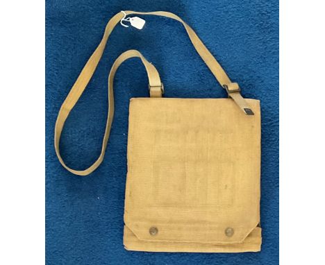
Lot 258A

Local interest, a coloured map of Bridport c.1801, 34x21.5cm; together with Municipal Corporation Boundaries, several pages relating to Bridport; and three reproduction prints of the town of Bridport in the 19th century (5)

Lot 304

Large gilt framed bevelled edge mirror together with framed dutham map, tapestry etc

Lot 290

Africa. Speed (John), Africae. A framed and glazed 17th century map of Africae engraved by Abraham Goos. Text verso.

Lot 417

A framed and glazed 18th century antique map of Denmark. Titled 'Il Regno di Danimarca, con il Ducato di Sleswik di nuova projezione' by Antonio Zatta. 53x43cm.

Lot 419

A framed and glazed antique hand coloured map of Shropshire. Comitatus Salopiensis, Shropshire. By Jan Blaeu. 64x51cm.

Lot 422

A framed and glazed vintage map of Jersey by the Jersey Transport Company. With illustrated details. Published by New Centurion publishing and publicity Ltd. 69x57cm

Lot 187

A John Ogilby map of Monmouth to Llanbedr

Lot 406

After John Rowland. The Royal Troon Golf Club, coloured print, and after T G Grey; map of Bourne, In The County of Lincolnshire, ltd ed. 100. (2)

Lot 476A

Eighteen Millenium five pounds crowns, obverse bust portrait of HM Queen Ellizabeth II and dated 1999, verso a map of Great Britain and midnight time new millenium.

Lot 553

A collection of military items, to include goggles, leather map case, water bottles, etc. (a quantity)

Lot 499

A box of ephemera containing maps including a 1941 war map of Europe, theatre programmes, magazines, William Harrison Ainsworth Lancashire Witches, a 1930s expandable ledger etc.

Lot 13

WW2 Map case. A superb near mint-example of a World War Two British Army Officers37 pattern D-Day era webbing map case, made by Waring & Gillow Co and stamped AC 1944, also bearing a stamped War Dept Arrow. Good condition, well sought after item. Good condition. All autographs come with a Certificate of Authenticity. We combine postage on multiple winning lots and can ship worldwide. UK postage from £4.99, EU from £6.99, Rest of World from £8.99.

Lot 144

A group of four maps including framed map of Northumberland After Robert Morden, map of Scotland After Blaeu and two others

Lot 469

A FRAMED VINTAGE SAXTONS MAP OF CHESHIRE 1577

Lot 176

Thomas Kitchen, original map of Glamorganshire with vignette, 36 x 52cm approx, Hogarth frame. (B.P. 21% + VAT)

Lot 29

MIXED LOT COMPRISING CARRINGTON BOWLES HAND COLOURED ROAD MAP - MELTON MOWBRAY TO BARNSLEY, PUBLISHED 1782, FRAMED AND GLAZED, TOGETHER WITH MOUNTED BOTANICAL PRINTS, UNFRAMED, AND A VINTAGE "HOW TO PLAY LAWN TENNIS" MAGAZINE

Lot 25

Australia 2000 silver proof dollar kangaroo/map

Lot 38

Australia 2002 Silver dollar kookaburra in flight/map KM 691.1.

Lot 432

British Military Map of Catterick Training Centre, produced by Ordnance Survey for the Ministry of Defence 1971.

Lot 433

British Military Map of Beckingham Ranges and WETC Sheet SK85 produced by Ordnance Survey for the Ministry of Defence

Lot 434

British Military Map of Carlisle War Office Edition produced by Ordnance Survey for the Ministry of Defence, The national Grid (Provisional Edition) printed Chessington 1947

Lot 435

British Military Otterburn/Redesdale Small Arms Training Area Map, printed for D. Survey, Ministry of Defence 1965, a scarce Cold War era map for the famous Training area which now has mostly been turned into National Park.

Lot 436

British Military Map of Catterick and Warcop Training Centre, produced by Ordnance Survey for the Ministry of Defence 1970. Edition I-GSGS. An excellent map with all the areas of the Training area marked. Scarce

Lot 437

British Military Map of Hexham War Office Edition produced by Ordnance Survey for the Ministry of Defence, The national Grid (Provisional Edition) printed Chessington 1947 Sheet 77.

Lot 438

British Military Map of Teesdale War Office Edition produced by Ordnance Survey for the Ministry of Defence, printed 1964 Sheet 84.

Lot 439

British Military Map of Wensleydale War Office Edition produced by Ordnance Survey for the Ministry of Defence, printed 1961 Sheet 90.

Lot 440

British Military Map of Penrith War Office Edition produced, printed for D. Survey (WO & AM) 1961 Sheet 83. The top right has been torn but the map is complete.

Lot 441

British Military Map of Penrith War Office Edition produced by Ordnance Survey for the Ministry of Defence, The national Grid (Provisional Edition) printed Chessington 1949 Sheet 83. It appears to be two maps fixed together.

Lot 449

British Military Map of Glasgow and the Middle West War Office Edition Fourth Edition produced by Ordnance Survey for the Ministry of Defence, G.S.G.S., No. 4650 Published by the War Office 1948. Scotland Sheet No.4

Lot 450

British Military Map of Ripon War Office Seventh Edition produced by Ordnance Survey for the Ministry of Defence, printed 1966 Sheet 91.

Lot 451

British Military Otterburn/Redesdale all Arms Training Area Map, printed for D. Survey, Ministry of Defence 1965, a scarce Cold War era map for the famous Training area which now has mostly been turned into National Park.

Lot 452

British Military Map of The Fourth Clyde and Tay War Office Fourth Edition produced by Ordnance Survey for the Ministry of Defence, printed 1948, Scotland Sheet 3 .

Lot 453

British Military Map Scotland south West War Office Fourth Edition produced by Ordnance Survey for the Ministry of Defence, printed 1948. Somewhat worn condition with parts of the edges torn.

Lot 454

British Military Map Frome second Edition produced by Ordnance Survey for the Ministry of Defence/War Office, printed 1947. Sheet 166

Lot 455

British Military Map Lancaster and Kendal Seventh Series produced by Ordnance Survey for the Ministry of Defence/War Office, printed SP RE (BAOR) 1966. Sheet 89

Lot 89

A mid-20th century “Motoring And Touring Map” (Section CG); & an album of mixed cigarette & food cards.

Lot 298

9ct quatrefoil blue spinel brooch, 2.2g, 9ct Australia map brooch set with garnets (one stone vacant) and a yellow metal amethyst bar brooch (3)

Lot 468

J H Steward military compass etched P.F.M. Michelli, Eton College 1905 in leather case, cased pocket barometer, a further pocket prism and a map tracking set (4)

Lot 518

Administrative map of the British Railways by John Bartholomew, framed 85 x 73cm (af)

Lot 751

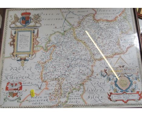
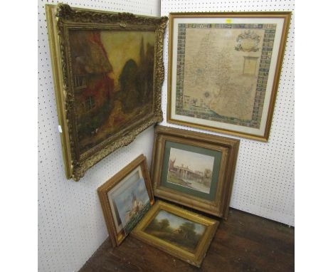
CM Holland (Late 19th century British school) - River scene with figures, watercolour and bodycolour on paper, signed and dated 1892 and inscribed Part Copied, 22 x 27cm, together with a late 19th century oil painting on canvas of a garden scene with water pump and cat, signed Alfred Parsons, 45 x 59.5cm approx, also together with further oil on board of a landscape with cottage, an oil on board of an 18th century style marine battle scene and an 18th century map of Oxfordshire dedicated to the Bishop of Oxford by RP, 50 x 48cm approx, various sizes, all framed (5)
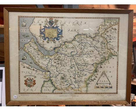
Lot 813

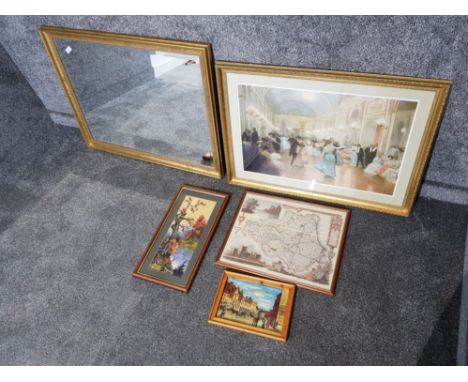
A 19th century map of the county of Gloucester by C & J Greenwood, published 1851, 60 x 68.5 cm approximately, together with a Cruchley's road and railway map of the county of Middlesex, 46 x 54.4 cm, framed set of Wills cigarette cards from the Old Inns Series together with a John Player Derby & Grand National Winners Series cigarette card set, one other reproduction set of cricketing cards, etc, all framed (7)

Lot 815

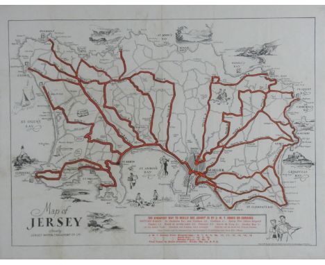
A collection of 19th century and later pictures including a map of Warwickshire published by Henry Teesdale, small collection of 19th century botanical engravings and topographical views including two engravings of Badminton, signed black and white etching by Anthony Hill - Babbicombe (sic), a 19th century framed invoice from Dauncey & Turner - Wickwar, dated 1880, etc, together with a mahogany framed mirror in the Georgian manner and a reproduction Thames Nauticalia brass cased clock/barometer/thermometer, on a wooden plaque (collection)

Lot 1802

Including old colored, including 7 Provencie, largest map is 65 x 50 cm.

Lot 1805

Including Grolla, largest map is 63 x 53 cm.

Lot 1808

Including old colored and Brabant map, largest map is 52 x 62 cm.

Lot 1817

Including old colored maps, including map of Antwerp, largest map is 67 x 65 cm.

Lot 1820

Including old colored maps, including map of Brabantia, largest map is 51 x 60 cm.

Lot 1823

Including old colored maps, including map of Biesbos, largest map is 97 x 56 cm.

Lot 1826

Including old colored maps, including map of Brabant, largest map is 80 x 50 cm.

Lot 1832

Including old colored maps, including map of Belgie, largest map is 55 x 48 cm.

Lot 1835

Including old colored maps, including map of Brabantia, largest map is 93 x 59 cm.

Lot 1838

Including old colored maps, including map of Gelderland, largest map is 93 x 61 cm.

Lot 1841

Including old colored maps, including map of Brabant, largest map is 53 x 64 cm.

Lot 1847

Including old colored, including map of Brabant, largest map is 80 x 50 cm.

Loading...Loading...
  • 109182 item(s)
    /page

Recently Viewed Lots