

Five individual parts of Cassell's Universal Atlas to include; Part I - containing six, single issue maps with two covering the top of England and Wales; a England South West sheet; a England South West Sheet; a part of Wales covering Cardigan Bay and Canarvon Bay and Wales North East; Part II - a double page map covering Lancashire; Part III - containing four single maps of Yorkshire North East, North West, South East & South West; Part IV - containing four large folding double page maps of the Great Britain showing all the Railways, & Railway Stations, the Canals, Navigable Rivers & Principal Roads, Steam Packet Routes & Distances covering the North East, North West, South East and South West; Part X - containing six maps covering Wales - South East & South West, Scotland - North East, North West, South West & South East together with three bound Atlas' to include The People's Atlas; Diercke Schul-Atlas and The New Reference Atlas of the World (8)
We found 109198 price guide item(s) matching your search
There are 109198 lots that match your search criteria. Subscribe now to get instant access to the full price guide service.
Click here to subscribe- List
- Grid
-
109198 item(s)/page

![Robert Morden (c. 1650-1703), a two-page map, Darbyshire (Derbyshire), [1722], hand-coloured engraving, 36cm x 42cm](https://cdn.globalauctionplatform.com/cad49de9-6db1-48fa-aec7-a678008ce726/0cd4e427-a77a-4683-b7d7-e6face71a360/468x382.jpg)

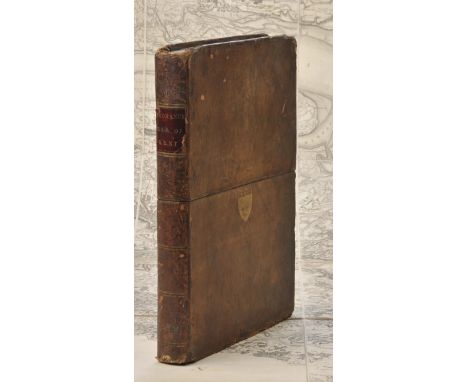
Local Interest - Davies (the Rev. D.P.), A New Historical and Descriptive View of Derbyshire, From The Remotest Period To The Present Time, S.Mason, Belper 1811, viii + 717pp + index [14], title-page with John Cary's map of Derbyshire, illustrative engravings throughout, later half-leather and buckram binding, 8vo


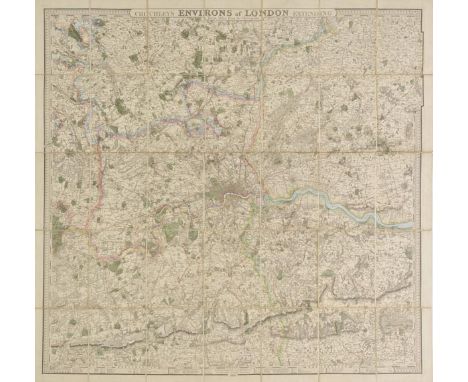
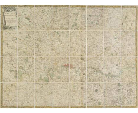
London. Cruchley (G.F.), Cruchley's Environs of London extending thirty miles from the Metropolis, 1828, engraved map with contemporary outline colouring, sectionalised and laid on linen, 890 x 920 mm, marbled endpapers and publisher's printed label to upper board, together with Faden (William), The Country Twenty-five miles round London, planned from a scale of one mile to an inch, 1815, engraved map with contemporary hand colouring, sectionalised and laid on linen, 1025 x 1270 mm The first map described; J.Howgego, The Printed Maps of London, no.299 state 4, the second map no.188 state 7. (2)

*World. Homann (Johann Baptist), Planiglobii Terrestris cum utroq Hemisphaerio Caelesti Generalis Repraesentatio..., published Nuremberg, circa 1730, engraved hemispheral map with contemporary hand colouring, two additional hemispheres showing northern and southern celestial projections, 495 x 550 mm, mounted, framed and glazed (1)

Asia. Hondius (Jodocus), Asia recens summa cura demeata Auctore Iud. Hondio, originally published Amsterdam, but this example is a pirated Italian edition, possibly printed in Venice, circa 1642, uncoloured engraved carte-a-figure map on two conjoined sheets, ten costumed figures to the vertical margins, twelve oval vignettes of principal cities to the horizontal margins, old folds, sparse near contemporary ink marginalia, 440 x 560 mm, no text on verso An unrecorded Italian pirated copy of Hondius's map, probably engraved in Venice, perhaps by the little known publisher Stefano Scolari. The paper used in the printing bears the water mark of an anchor in a circle, surmounted by a six pointed star (Heawood 8?) which indicates the paper to be Italian and of the period. The map appeared together with six other similar examples at a Sothebys auction, several of which bore the date 1642, and had numerous vignette views to the borders reversed. On the map of Europe, the Tower of London appears on the left rather than the right of the image, however, this error is not present on the views of Venice, Rome and Constantinople. The map is based on an earlier work by Jodocus Hondius published in 1623.The 1623 printing formed part of a set of maps of the four continents of which Africa and Asia are dated 1623. The title of the Asia map appears in the upper left in a cartouche which is a mirror image of that on Jodocus Hondiuss 1619 map. The imprint is in the cartouche in the upper right. Later states of the map bear the imprint of Johannes Janssonius - as in the present example. (1)

London. Willdey (George), A New & Correct Map of Thirty Miles Round London Shewing all the Towns, Villages Roads &c. with the Seats of the Nobility & Gentry and whatever else is remarkable. Done from the best Surveys, Together with an Alphabetical Table for ye ready finding of all the places contain'd in the Map, sold by G.Willday at ye Corner House in Ludgate Street, circa 1720, engraved circular map on two conjoined sheets, contemporary outline colouring, laid on later linen, tables to either side of map, circular vignette of London and of allegorical figures in the upper cusps, lower left has a display of maufactured items and lower right an advertisement for George Willdey's toy and print shop, old folds, slight staining, slight cracking along old folds, 645 x 970 mm J.Howgego. Printed Maps of London, no.69 state 1. (1)

Hoskyn (E.L.). Stories of Old..., containing twelve full-page illustrations in colour by L.Tennant, published Adam and Charles Black, 1912, twelve (complete as list), colour printed allegorical maps by Lillian Tennant, each showing a historical or mythological character set within a map of the country of the story's origin, publisher's decorative boards with colour printed panel to upper cover, boards detached, lacking spine, text block partially disbound, 4to Sold as a collection of maps, not subject to return. (1)

Thornton (William). The New, Complete, and Universal History, Description, and Survey of the Cities of London and Westminster, The Borough of Southwark, and the Parts Adjacent..., by a Society of Gentlemen, the whole revised, corrected & improved..., printed for Alex. Hogg, 1784, engraved frontispiece, folding engraved plan of London, and 103 full-page engraved plates, including views, buildings, some portraits, etc., without the map of the counties 20 miles round London, one plate bound upside down, some minor marks, and small worm track to extreme fore-margin of first few leaves (not affecting text), contemporary engraved bookplate of Reverend Benjamin Lawrence to front pastedown, contemporary full tree calf, worn with joints cracked and upper cover detached, folio (1)
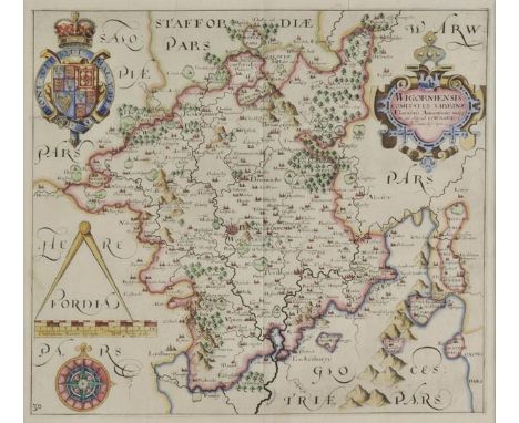
*Worcestershire. Saxton (Christopher & Hole William), Wigorniensis comitatus Sabrinae Fluminis Amenitate insignis qui oilm ad Cornauios spectant description, circa. 1637, hand coloured engraved map, strapwork cartouche, compass rose and mileage scale, 285 x 315 mm, mounted, framed and glazed, together with Walker (J & C),Gloucestershire, published Longman, Rees, Orme & Co., 1835, engraved map with bright contemporary hand colouring, 400 x 335 mm, mounted, framed and glazed (2)

World. Teesdale (Henry), A New Chart of the World on Mercator's Projection, with the Tracks of the most Celebrated & Recent Navigators, 1845, large engraved map with contemporary hand colouring, sectionalised and laid on linen and displayed on two sheets, marbled endpapers, 1270 x 2000 mm, bound in contemporary maroon morocco gilt boards, slight wear at extremities A fine example of one of the first world maps to show Texas as an independent Republic. English and American claims to the Oregon territory are noted. (1)
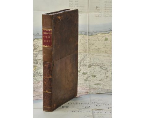
Kent. Faden (William, publisher), General Survey of England and Wales. An entirely new and accurate Survey of the County of Kent with part of the County of Essex, Done by the Surveying Draughtsmen ofHis Majesty's Board of Ordnance..., under the Direction of Capt. W. Mudge of the Royal Artillery F.R.S., 1801, large map, engraved by Thomas Foot, sparse near contemporary colouring highlighting the roads, sectionalised and laid on linen, slight dust soiling and staining, 1185 x 1765 mm, publisher's label to rear of upper siding, contained in a contemporary morocco book box with the gilt arms of Ordnance Survey, scuffed and worn The first map published by Ordnance Survey. (1)
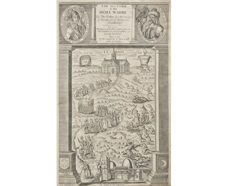
Fuller (Thomas). The Historie of the Holy Warre, 2nd edition, printed for R. Daniel for Thomas Buck, Cambridge, 1640, additional engraved title (close-trimmed at foot), folding engraved map (backed onto linen), bound with The Holy State, by Thomas Fuller, 1st edition, printed by Roger Daniel for John Williams, Cambridge, 1642, additional engraved title, 20 engraved illustrations, lacking front blank, occasional light soiling and annotations, contemporary reverse calf, some wear at spine ends, rubbed with stains, folio STC 11465 and Wing F2443. (1)
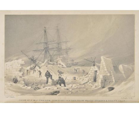
Back (Sir George). Narrative of an Expedition in H.M.S. Terror, Undertaken with a View to Geographical Discovery on the Arctic Shores, in the Years 1836-7, 1st edition, John Murray, 1838, twelve tinted lithographed plates, some spotting, frontispiece with small water-stain to lower outer corner, folding engraved map at rear, one or two short closed tears and some offsetting, contemporary tan diced calf, some minor rubbing and marks, new gilt lettered spine label, 8vo Sabin 2617. A scarce Arctic travel book. George Back was sent by the Admiralty to gain knowledge of the coastline between Prince Regent Inlet and Turnagain Point. However, HMS Terror became stuck in the ice near Frozen Strait, suffering considerable structural damage, and eventually limping back to Ireland. Although failing in his main aim, Back was able to make many detailed observations on conditions and surroundings, including ice floes, the terrain of Southampton Island, trading with Baffin Island Eskimos, the weather and privations endured. (1)
![Bible [English]. [The Holy Bible, containing the Old Testament and the New: newly translated out of the originall tongues...,](https://cdn.globalauctionplatform.com/97730585-3d9d-4238-afe7-a67500ac3e34/f75f5b70-5ede-4b68-d2bd-f093f6876786/468x382.jpg)
Bible [English]. [The Holy Bible, containing the Old Testament and the New: newly translated out of the originall tongues..., Imprinted at London: by Bonham Norton and John Bill, 1628], general title not present, New Testament title within decorative woodcut border (with 17th century manuscript genealogical entries to verso), Apocrypha present, black letter text throughout, 18th century manuscript ownership & date of Thomas Pacey March 1st 1766 to verso of final leaf, bound at front with The Genealogies by John Speed (without map), some dust-soiling and few marks, 18th/19th century blind panelled calf gilt, joints cracked, worn at head & foot of spine and to extremities, 4to Herbert 411. (1)
*Ogilby (John). The Road from Bristol to Worcester, circa 1678, hand coloured engraved strip road map, toned overall, 315 x 450 mm, framed and glazed, together with Morden (Robert), The Kingdom of Ireland [1695 or later], uncoloured engraved map, 420 x 350 mm, framed and glazed (glass cracked), with Van den Keere (Pieter), Oxfordshire, Chester [and] Shropshire, circa 1637, three hand coloured engraved maps, some overall toning, each approximately 85 x 120 mm, mounted, framed and glazed, with another five county maps by Kitchin, Cary, Cole & Roper, Hinton and Morden, various sizes and condition (10)
[Swift, Jonathan]. Travels into several remote nations of the world, volume 1 only (of 2), 1726, 2 part-titles, each part with separate pagination and a map, lacks portrait frontispiece, some heavy spotting and occasional browning, 19th-century ownership inscription and note of Seth B. Watson to title, contemporary panelled calf, lower cover with later neat reback and matching upper cover, 8vo Teerink 290: 'AA' (second octavo edition). (1)
Scotland. Bowles (Carington), Bowles's New Pocket Map of Scotland, laid down from the original survey of James Dorret..., 1791, engraved map with contemporary outline colouring, some fraying and closed tears to margins, 560 x 515 mm, together with, Jansson (Jan & Pont Timothy), Extimae Scotiae pars septentrionalis in qua Provinciae Rossia, Sutherlandia Cathenesia et Strat-Naverniae, [1659 or later], engraved map with contemporary outline colouring, ornate uncoloured cartouche and mileage scale, 450 x 530 mm, with Murray (T.I.), Scotland, published 1830, engraved map with contemporary outline colouring, slight creasing, short split to central fold, one marginal closed tear just affecting image, 690 x 460 mm, plus Jansson (Jan & Pont Timothy), Cathenesia, Caithness, [1659 or later], engraved map with contemporary hand colouring, creased and with repaired marginal closed tears, laid on later paper, 390 x 530 mm (4)
Dufy (Raoul). Mon Docteur le Vin, aquarelles de Raoul Dufy, published Draeger FrŠres, Paris, 1936, nineteen colour illustrations after Dufy, publisher's limp card boards with glassine wrapper, 4to, together with King (Moses, publisher), Kings Views, New York 1908 - 1909, numerous illustrations of New York including several double page panoramas, publisher's decorative cloth, slight wear to extremities, tall 4to, with Morgan (William), Ogilby's and Morgan's Pocket-Book of the Roads with their Computed and Measured Distances and the Distinction of Market and Post-Towns..., 7th edition, 1732, title with near contemporary ownership signature, advertisement, explanation and tables of roads, lacking map, hinges and joints weak and cracked, contemporary calf, rubbed and worn, 16mo, plus Hassall (John, illustrator), Ye Berlyn Tapestrie: Wilhelm's Invasion of Flanders, printed Edmund Evans, circa 1916, colour printed caricature of the German aggression of the First World War published 'concertina style' on thirty pages, publisher's printed paper wrappers, a little frayed at extremities, oblong 8vo, with Morand (Paul), Route de Paris a la M‚diterran‚e, published Paris, 1931, numerous black & white illustrations, publisher's printed card boards, a little chipped and worn, 8vo, with two other volumes similar (7)
Cheshire. Kelly & Co. (publisher), Post Office Directory of Cheshire with Map engraved expressly for the work and corrected to the time of publication, 1857, title and preface, folding engraved map of Cheshire, advertisements bound in at rear, later endpapers, modern cloth gilt, 8vo, together with, Hall (James), A History of the Town and Parish of Nantwich or Wich-Malbank in the County Palatine of Chester, published Nantwich, 1883, engraved frontispiece with a newspaper cutting of the obituary of the author stuck to verso, illustrations throughout, later endpapers, publisher's cloth gilt boards with later reback retaining original labels, 4to, plus Johnson (Miss E.A.), A Short History of Nantwich and Neighbourhood, The first portion to the end of the civil war by Miss E.A.Johnson..., the whole revised and completed by Roger Russel, published Nantwich, 1902, printed topographical frontispiece, numerous illustrations throughout, upper hinge cracked, contemporary cloth gilt, stained and wrinkled, 8vo, plus, Astle (William, editor), "Stockport Advertiser" Centenary History of Stockport, published Stockport, 1922, topographical frontispiece, illustrations throughout, contemporary cloth gilt, faded, 8vo (4)

United States. Faden (William), The United States of North America with the British Territories and those of Spain, according to the Treaty of 1794, Engraved by Wm. Faden, 1796, engraved map with contemporary outline colouring, decorative uncoloured cartouche, five colour references, 540 x 640 mm R.V.Tooley. The Mapping of America, no.80 state (f). (1)

*Lancashire. Speed (John), The Countie Palatine of Lancaster described and divided into Hundreds, published Thomas Bassett & Richard Chiswell, [1676], hand coloured engraved map, inset town plan of Lancaster, slight creasing, central fold partially strengthened on verso, closed tear to lower left corner, skillfully repaired on verso, occasional repaired marginal closed tears, 385 x 510 mm, mounted, framed and double glazed, English text on verso (1)
Kent. Greenwood (C. & G.), Map of the County of Kent, from an actual survey made in the years 1819 & 1820, published G.Pringle junr., 1821, large engraved map, sectionalised and laid on linen, bright contemporary hand colouring, calligraphic cartouche, table of explanation and reference to the hundreds, slight dust soiling and off-setting, 1140 x 1750 mm, marbled endpapers, contained in a contemporary calf book box, spine partially re-backed with later red gilt morocco label, worn at extremities (1)

Cary (John). Cary's Traveller's Companion or a Delineation of the Turnpike Roads of England and Wales; shewing the immediate Route to every Market and Borough Town throughout the Kingdom..., 1806, calligraphic title, advertisement and index, forty-three (complete) engraved maps with contemporary outline colouring, one map (Yorkshire), sectionalised and laid on linen and stored in pocket, list of towns, index and publisher's advertisement bound at rear, secondary marble endpapers and then seventeen blank notes pages bound at rear, marbled endpapers, all edges gilt, contemporary 'envelope style' straight grained red morocco binding with gilt title to spine, a little rubbed at extremities, small 4toA Chubb CCCLV. (1)
![*Cornwall. Saxton (Christopher & Kip William), Cornwall olim pars Danmoniorum, [1637], uncoloured engraved map, inset vignett](https://cdn.globalauctionplatform.com/97730585-3d9d-4238-afe7-a67500ac3e34/4ebf8253-8991-4ec2-b27e-f1410134015b/468x382.jpg)

Africa. Hondius (Jodocus), Africae nova Tabula Auct. Jud. Hundio, published Amsterdam but an unrecorded pirated Italian edition, probably published in Venice, circa 1642, uncoloured engraved carte-a-figure map on two conjoined sheets, sparse near contemporary ink marginalia, old folds, slight staining, 445 x 560 mm, no text on verso These highly decorative examples of Dutch cartography combined with the advances in geographical knowledge made these maps a valued commodity on both the domestic and international market.That many of these maps were sold as separate sheets, and/or were inserted into composite-style atlases of the period, accounts for their rarity today. This example was probably engraved in Venice, perhaps by the little known publisher Stefano Scolari. The map is based upon Jodocus Hondius's map initially published in 1623. (1)
*Flintshire. Speed (John), Flint-shire, published Thomas Bassett & Richard Chiswell, [1676], hand coloured engraved map, inset town plans of St.Asaph and Flint, inset view of St. Winifred's Well, central fold partially strengthened on verso, 395 x 515 mm, framed and double glazed, English text on verso (1)
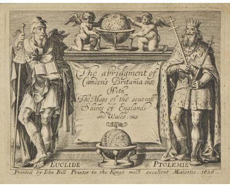
Bill (John). The Abridgment of Camden's Britannia with the Maps of the severall Shires of England and Wales, 1626, decorative title page with early 19th century manuscript marginalia, dedcation to the King, 'To the reader', 'A Delineation of the Univerall Notions of Geographie', a secondary half title, a table of the Spanish Armada, 'Especiall Notes', list of religous houses and index of the counties all present, general map of England & Wales and fifty (of fifty-one) uncoloured engraved maps, lacking Lincolnshire, small ink library stamp (Selbourne Library) to verso of title and below the map of Flintshire, a few text headlines shaved, slight text showthrough, slight staining, later endpapers, 20th century calf gilt with red morocco gilt label to upper board, small oblong 4to Rare. It is believed that only two hundred copies of this atlas were ever published. Chubb XLI. (1)

Ireland. Wyld (James), Ireland, circa 1840, large engraved map with contemporary outline colouring, sectionalised and laid on linen, on six sheets, two uncoloured engraved vignettes, slight spotting, overall size 1900 x 1400 mm, marbled endpapers This monumental map of Ireland by Wyld is uncommon. (1)
![World. Ortelius (Abraham), Typus Orbis Terrarum, published Antwerp, [1592], hand coloured engraved map with ornate strapwork](https://cdn.globalauctionplatform.com/97730585-3d9d-4238-afe7-a67500ac3e34/dfcb0d7b-cd8b-4198-9e53-9684f04f00cf/468x382.jpg)

South Pacific. Imray (James & Son, publisher), South Pacific Ocean, 1869, large uncoloured 'blue backed' chart stretching from Papua New Guinea and Eastern Australia to Western South America, numerous inset maps of islands and important ports and harbours, map seller's ink stamp, slight creasing, 1020 x 1870 mm (1)
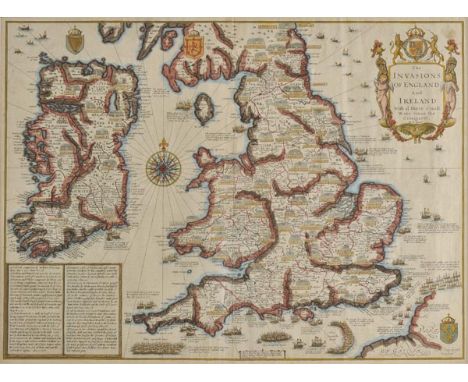
*England & Ireland. Speed (John), The Invasions of England and Ireland with al their civill wars since the conquest, published Thomas Bassett & Richard Chiswell, [1676], hand coloured engraved map, decorative cartouche, compass rose and numerous rhumb lines, 385 x 520 mm, mounted, framed and double glazed, English text on verso (1)
![Martin (R. Montgomery, editor). [Tallis's Illustrated Atlas..., circa 1851], lacking title and preliminaries, fifty-seven (on](https://cdn.globalauctionplatform.com/97730585-3d9d-4238-afe7-a67500ac3e34/9fd8476b-828d-4c44-e7c4-12cedcd93df3/468x382.jpg)
Martin (R. Montgomery, editor). [Tallis's Illustrated Atlas..., circa 1851], lacking title and preliminaries, fifty-seven (only) engraved maps with contemporary outline colouring, each map with a printed number to upper right corner, some fraying and chipping to margins, 'Russia in Asia' with long closed tear, occasional spotting and staining, text block loose, contemporary half calf, crudely rebacked, rubbed and worn, folio Sold as a collection of maps, not subject to return. (1)
![Europe. Blaeu (G.), Europa recens descripta, published Amsterdam [1621 - 1630], uncoloured engraved carte-a-figure map of Eur](https://cdn.globalauctionplatform.com/97730585-3d9d-4238-afe7-a67500ac3e34/37575609-0a7c-4acb-d307-d758292d16b8/468x382.jpg)
Europe. Blaeu (G.), Europa recens descripta, published Amsterdam [1621 - 1630], uncoloured engraved carte-a-figure map of Europe, slight worming, some water staining, one rust mark, 410 x 550 mm, no text on verso The map is a reduction of Blaeu's wall map of 1608, with the majority of the coastal cartography based on Blaeu's sea charts. A decorative border surrounds three sides: above are nine birds-eye views of the principal European cities including Paris, London, Amsterdam, and Istanbul; flanking the map are ten costumed figures representing the national dress of various European inhabitants.This is the third state with the name changed in the cartouche from Guil:Janssonio to Guiljelmo Blaeu, and no text on the verso. The map would be incorporated into Blaeu's first atlas the Appendix in 1630. Later states with text on the verso would appear in all Blaeu's subsequent atlases. (1)
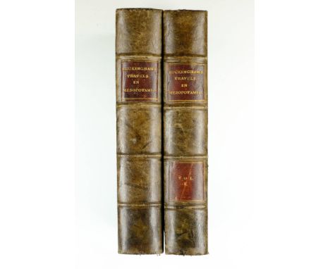
Buckingham (James Silk). Travels in Mesopotamia including a journey from Aleppo to Bagdad by the route of Beer, Orfah, Diarbekr, Mardin & Mousul; with researches on the Ruins of Nineveh, Babylon and other ancient cities, 2 volumes, 1st. edition, published Henry Colburn, 1827, lacking half title, numerous wood engraved illustrations to text, one folding engraved map (with slight spotting), and two folding lithographic plates (all complete as lists), ink library stamp to title pages, book plates to front pastedowns and front endpaper, later endpapers, early 20th century quarter calf (bound in Baghdad), gilt morocco labels to spines, lacking 'vol.2' label, 8vo Atabey 163. (2)
![*England & Wales. Coronelli (Vincenzo Maria), Parte settentrionale de Regno d'Inghilterra..., [together with] Parte meridiona](https://cdn.globalauctionplatform.com/97730585-3d9d-4238-afe7-a67500ac3e34/71f30b06-07f0-4079-a723-d795be459a3e/468x382.jpg)
*England & Wales. Coronelli (Vincenzo Maria), Parte settentrionale de Regno d'Inghilterra..., [together with] Parte meridionale del regno d'Inghilterra..., circa 1697, two hand coloured engraved maps, a large cartouche on each map, inset map of the British Isles displayed on 'a curtain', slight creasing, each approximately 465 x 615 mm, each map mounted, framed and glazed (2)
![Persia & Afghanistan. Wyld (James), Wyld's Military Map of Central Asia and Afghanistan, [1878], lithographic map with contem](https://cdn.globalauctionplatform.com/97730585-3d9d-4238-afe7-a67500ac3e34/8e09a68c-b359-402e-fc99-2e8ae4f2e168/468x382.jpg)
Persia & Afghanistan. Wyld (James), Wyld's Military Map of Central Asia and Afghanistan, [1878], lithographic map with contemporary outline colouring, sectionalised and laid on linen, 880 x 1190 mm, marbled endpaper, contemporary cloth board with printed label to upper cover, upper board detached (1)
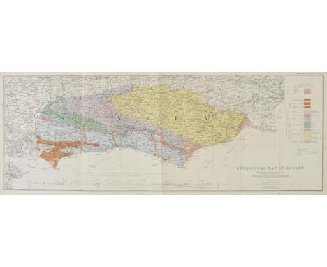
Dixon (Frederick). The Geology of Sussex; or The Geology & Fossils of the Tertiary and Cretaceous Formations of Sussex, new edition, revised and augmented by T. Rupert Jones, 2nd edition, Brighton, William J. Smith, 1878, colour lithograph frontispiece, folding coloured geological map of Sussex, 63 uncoloured photolithographed plates (numbered 1-64, including frontispiece) at end, some light spotting to map, final leaf of text and first plate, original yellow chalk-glazed endpapers, original quarter plum morocco gilt, rubbed and scuffed, 4to, together with Geological Map of Sussex by W. Topley, [1878], folding colour lithographic map with table of explanation and cross section of the geology of the English Channel from Seaford to the Isle of Sheppy, 260 x 715 mm, bound in original green cloth with gilt title to upper cover, rubbed and slight wear to spine, slim 4to The geological map was first drawn by Frederick Dixon, a surgeon who practised in Worthing and died in the cholera epidemic of 1849. William Topley was a geologist by profession, who surveyed the Weald between 1863 and 1873 and was Superintendent of the publication of the Ordnance Geological Survey from 1880. (2)
*Caernarvonshire. Speed (John), Caernarvon both Shyre and Shire-towne with the ancient Citie Bangor described, published Thomas Bassett & Richard Chiswell, [1676], hand coloured engraved map, inset town plans of Caernarvon and Bangor, small sellotape stain along central fold, central fold partially strengthened on verso, 395 x 515 mm, framed and double glazed, English text on verso, together with The Countie of Radnor described and the Shyre townes sittuatione, published John Sudbury & George Humble, circa 1627,hand coloured engraved map, inset town plan of Radnor, small hole to central fold, repaired on verso, slight staining, 385 x 505 mm, framed and double glazed, English text on verso (2)

*Caricatures. A mixed collection of thirty-five etched cartoons and caricatures, mostly late 18th & early 19th century, caricatures with contemporary hand colouring after Rowlandson, Gillray, Cruickshank, Woodward and Newton, all plagiarised editions published in Ireland by William MaCleary, including:- 'State Physicians Bleeding John Bull to Death', 'A Long headed Minuet!!', 'English Fire Side [and] French Fire Side', 'The Last Shift', 'A Cake in Danger', 'A Sailor's Marriage', 'The Four Seasons of Love', 'The Cholic' [and] 'A Divine in Glory', each approximately 275 x 240 mm, mostly in good condition Ireland had a lucrative export trade based around the wholesale supply of retailers in the Irish provinces, Scotland and England. The trade with Britain seems to have been particularly important and was largely based upon the sale of pirate versions of books and prints that were originally published in London. This was possible because home rule meant that Irish publishers were exempt from legislation governing copyright over printed material in England, while lower labour costs and taxes on paper, allowed Irish publishers to offer goods at a fraction of their London competitors. William MaCleary was one of the foremost print dealers, based in Dublin and with premises on the fashionable Nassau street, he produced a great many caricatures which had the original artist and publisher's names removed and were issued with just MaCleary's name below the image. This advantageous trading position made Dublin a thriving centre for print making and publishing and by 1801 Dublin was home to a substantial number of businesses dealing in the production and and sale of printed goods. Wilson's Dublin Directory for 1801 contains entries for 59 printers, publishers and engravers, 39 booksellers, 9 map and printsellers, as well as 9 other businesses that sold products such as inks, paint, copperplates and paper which could be used in the printing process.List of titles included : View onboard a Packet; Patience on a Monument smiling at Grief or The Royal Laundress washing Boney's Court Dresses; Tit for Tat or Every dog has his day (*); Aryl Visit to a Foreign Capital or The Ambassador not at home; Fashionables of 1821; Les Invisibles; Traveling in France or Le Depart du Diligence; Leap Frog !!; A Halfpay Agents Levee; Giving up the Ghost or One Too Many; A Long Headed Minuet !!; State Physicians Bleeding John Bull to Death !!; An Early Lesson of Dancing !; The Mischief of Methodicism, Agoing ! Agoing !; Fashionables of 1820; Everyone his Hobby; Fashionable Waltzing (Favourite Hobbies); John Doe and Richard Roe; Brothers in Law !; Oh! that is too too solid flesh would melt; Pigmy Revels; Pigmy Revels, Plate 2; Dandies as they are; French Fire Sides; English Fire Sides; The Last Shift; Ease, Comfort & Recreation or A Sixpenny Trip to the Rock; Ah! Sure such a pain was never seen so justly formd to meet by nature; The Four Seasons of Love; A Sailor's Marriage; A Cake in Danger; A Divne in his Glory; The Cholic; Pictures of Prejudice or Roscius Dissected by Thomas Rowlandson (after Woodward) (*); Three Opinions on the Pay of Young Roscius by Thomas Rowlandson (after Woodward) (*).(35)
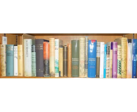
Ransome (Arthur). The Picts and Martyrs: Or, Not Welcome at all, 1st edition, 1943, black and white illustrations, map endpapers, original green cloth, dust jacket, spine a little toned with closed tear at head, 8vo, signed by the author to half title, together with Fowles (John), Daniel Martin, 1st edition, 1977, original cloth, dust jacket (spine a little faded), 8vo, inscribed to Menina Russell-King from the author, plus a loose inscribed blank card addressed to the same, plus Peniakoff (Lieutenant-Colonel Vladimir, 'Popski'), Private Army, 1st edition, 1950, maps and illustrations, original cloth, dust jacket (spine lightly toned), 8vo, inscribed by the author to Menina Mesquita (Russell-King), with some autograph and typescript letters, cuttings etc between the two, with other signed or inscribed books by William Plomer, T.H. White, Len Deighton, Sergei Chepik, Elizabeth Bowen, Marcel Junod, Yehudi Menuhin et al, plus Charles Doughty's Travels in Arabia Deserta, new edition, 1921 (with his clipped signature), A.E. Popham's The Drawings of Leonardo Da Vinci, Cape, 1949 reprint, inscribed to Menina from the Cape staff and The Drawings of Leonardo Da Vinci, 1946 Menina Mesquita was secretary to publisher Jonathan Cape, 1950's-60's. (3 shelves)

England & Wales. Greenough (George Bellas), Geological Map of England and Wales, Reduced by Permission from the Map in 6 Sheets Published by the Geological Society, published J.Gardner, 1826. engraved map with contemporary hand colouring, sectionalised and laid on linen, inset list of geological group, slight toning, 675 x 540 mm, contained in contemporary slipcase The first reduced reprint of Greenough's large geological map of 1819. There are at least three other issues of this map: there is an extremely rare earlier issue with the same imprint as the present lot, but dated 1st June and two others with the same date as the present lot but carrying the names of either C. Smith, 172 Strand, or G.F. Cruchley, 81 Fleet St., on printed slips pasted over the Gardner imprint. The printed label on the slipcase on this example has the legend 'Sold by C.Smith'. (1)
Ogilby (John). [The Works of Publius Virgilius Maro. Translated, adorn'd with sculpture, and illustrated with annotations... by John Ogilby, printed by Thomas Warren for the Author, 1654], 3 preliminary leaves only (of 8), lacking the portrait, frontispiece, and title page, 81 (of 101) full-page engraved and etched plates after Franz Cleyn by Wenceslaus Hollar and Pierre Lombart, engraved map not present, lacking several leaves at end (text ends on Cccc4, page 577), a few closed tears repaired, some soiling, near-contemporary blind-panelled calf, rubbed and some wear, modern reback, large folio (398 x 250 mm) Wing V610. The impressions of the plates are generally good. Sold with all faults, not subject to return. (1)

Neele (Samuel & George ). Neeles General Atlas Consisting of a Complete set of Maps compiled from the best Authorities and Including all the new Discoveries, 1814, calligraphic title with allegorical vignette, dedication, advertisement and index, sixty-two engraved maps with contemporary hand colouring (including thirteen double page), index calls for sixty, some near contemporary ink and pencil marginalia, some dust soiling and marginal staining, three additional tipped in maps (World, India and the Great Lakes), additional map of south east Wales loosely inserted, gutter joint splitting , some maps with sellotape strengthening along gutter, hinges crudely strengthened with tape, contemporary half morocco, heavily worn and rubbed with spine partially lacking Sold as a collection of maps, not subject to return. (1)

Mathison (Gilbert Farquhar). Narrative of a Visit to Brazil, Chile, Peru, and the Sandwich Islands, During the Years 1821 and 1822. With Miscellaneous Remarks on the Past and Present State, and Political Prospects of those Countries, 1st edition, 1825, four hand-coloured aquatint plates, folding map of the Sandwich Islands (i.e. Hawaii), 2 page catalogue at end (toned), some light offsetting and spotting, contemporary calf-backed boards, spine a little rubbed, 8vo Abbey Travel 700; Hill p.194; Sabin 46858. (1)
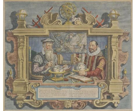
*Title page. Hondius (Coletta), Gerardus Mercator Natus Rupelmundiae ..., Judocus Hondius Natus in Pago Flandriae dicto Wackene..., published Amsterdam, [1613 or later]. hand coloured engraved double portrait, 390 x 455 mm, mounted, framed and glazrd Famous double-portrait of two of the most important map makers Gerardus Mercator and Jodocus Hondius, seated in front of a wall map of Europe surrounded by atlases, globes and measuring instruments. The portrait was published in several of the Mercator-Hondius Atlas. (1)
Ireland. Morden (Robert), The Kingdom of Ireland, [1695 or later], uncoloured engraved map, 415 x 350 mm, together with The East Riding of Yorkshire [and] Cambridgeshire, [1695 or later], two uncoloured engraved maps, Cambridgeshire with two long closed tears affecting image, repaired with sellotape, each approximately 365 x 425 mm (3)
![Bible [English]. The Bible: Translated according to the Hebrew and Greeke, and conferred with the best Translations in divers](https://cdn.globalauctionplatform.com/97730585-3d9d-4238-afe7-a67500ac3e34/cbbbaf22-b873-4bdb-bef5-25d921e53e3e/468x382.jpg)
Bible [English]. The Bible: Translated according to the Hebrew and Greeke, and conferred with the best Translations in divers languages..., Imprinted at London by Robert Barker, 1615, general and New Testament titles within decorative woodcut borders, Apocrypha present, double-column black letter text, lacking leaves *3 & *4, bound with The Genealogies by John Speed (without map) at front, and Two right profitable and fruitfull Concordances..., Imprinted at London by Robert Barker, 1615, and The Whole Booke of Psalmes, London: Printed for the Company of Stationers, 1617 at rear of volume, final leaf reguarded, occasional close trimming at head of one or two leaves, light dust-soiling & minor toning, all edges gilt, 19th century blind panelled calf by J. Wright, boards detached, rubbed, 4to Herbert 341; Darlow & Moule 265. Apparently the last black-letter quarto edition of this version printed by Barker, (Herbert). (1)
London. Bowles (Carington), Bowles's Environs of London taken from actual surveys exhibiting all the new Roads, Parks, Seats of the Nobility &c., to the present year, 1775, engraved map with contemporary outline colouring, sectionalised and laid on new linen, 645 x 860 mm, together with Betts (John), The Excursionist's Map of the Environs of London, circa 1850, lithographic map with contemporary outline colouring, folded and laid on linen, 330 x 420 mm, publisher's cloth boards with printed label to upper board, with Davies (B.R.), London and its Environs, 1847, engraved map with contemporary outline colouring, sectionalised and laid on linen, one small repair to lower right corner, 555 x 700 mm, marbled endpapers, publisher's cloth gilt boards, plus Stanford (Edward), Stanford's Map of Central London, 1897, colour lithographic map, sectionalised and laid on linen, 650 x 970 mm, publisher's printed boards J.Howgego. The Printed Maps of London. The first map described no.154, state 2, the second, no.403, the third, no.372 state 6. (4)

London. Wyld (James), A New Map of the Country Twenty-Five Miles round London, 1830, published James Wyld (successor to Mr Faden), 1830, engraved map with bright contemporary hand colouring, sectionalised and laid on linen, 1050 x 1275 mm A later issue of a map originally published by W.Faden in 1788. J.Howgego. Printed Maps of London, no. 188, state 10. (1)
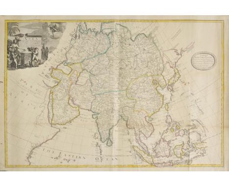
Asia. Price (Charles), Asia according to ye Newest Observations..., sold by T. Brandreth and G. Willdey at ye Archimedes and Globe in Ludgate street and at ye same sign over against ye Royal Exchange in Cornhill where are made and sold all sorts of globes, [1713], engraved map on two conjoined sheets with contemporary outline colouring, large uncoloured cartouche, slight creasing, old folds, slight staining, one small hole in margin not affecting image, 660 x 975 mm Uncommon two-sheet map originally prepared by Price for the unsuccessful partnership of Price, John Senex and John Maxwell (1708-1711). After the partnership broke up, each member took the plates that they engraved with them, the majority of which were engraved by Senex, and were re-issued in his English Atlas from 1714. In 1713, Wildey acquired the remainder of Price's stock and began to issue them with his own imprint and in a further ill-fated partnership with Timothy Brandreth. The partnership was not a commercial success and later the same year, Willdey was advertising the remaining stock of the maps at a heavily discounted price.This particular example bears a dedication by Charles Price to Earl John Poulett, who was Lord Steward between 1711-1714. We have been unable to trace another example which bears the dedication. (1)
London. Bowen (M.), A Topographical Survey of the Country, from Thirty-five to Forty miles round London, published R.Sayer & J.Bennet, 1775, engraved map with contemporary outline colouring, sectionalised and laid on linen, small holes in linen folds, 510 x 550 mm, contained in contemporary marbled slipcase, worn and rubbed, together with Cary (J.), Cary's Actual Survey of the Country Fifteen Miles round London, 1800, engraved map with contemporary outline colouring, sectionalised and laid on linen, slight spotting and toning, trimmed to neatline, 760 x 880 mm, contained in contemporary marbled card slipcase with printed label to upper board, slipcase strengthened with clear tape, with Weale (John), Weale's Map of London and its Vicinity, 1851, uncoloured engraved map, old folds, occasional marginal closed tears, 520 x 915 mm, plus Stockdale (John), A New Map of the Country round London, 1796, engraved map with contemporary hand colouring, sectionalised and laid on linen, partial disintegration of linen resulting in several splits along old folds, toned overall, 815 x 950 mm, with two others similar J.Howgego. Printed Maps of London, the first map described, no.161, second map no. 183 state 2, fourth map no.210. (6)
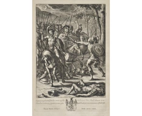
Rowe (Nicholas). Lucan's Pharsalia, Translated into English Verse, printed for Jacob Tonson, 1718, engraved frontispiece, title with engraved vignette, double-page engraved map, engraved initials and illustrations, a little light spotting, armorial bookplate of Viscount Downe, contemporary speckled calf, joints cracking, chipped at ends, folio, together with The Works of Virgil: Containing his Pastorals Georgicus and Aeneis, Translated into English verse; by Mr. Dryden, 2nd edition, 1698, title printed in red and black (laid down), numerous engraved plates by Wenceslas Hollar, final leaf repaired with some loss of text, some spotting and soiling, hinges reinforced, contemporary blindstamped calf, rebacked, rubbed, folio, plus The Satires of Decimus Junius Juvenalis. Translated into English Verse. By Mr. Dryden and several other eminent hands, together with the Satires of Aulus Persius Flaccus, 1st Dryden translation, 1693, occasional minor spotting, library blindstamp to lower margin of title, endpapers renewed, contemporary half calf, rebacked and recornered, folio, with three others including Sir Bulstrode Whitlocke's Memorials of the English Affairs, from the Suppos'd Expedition of Brute to this Island, to the end of the Reign of King James the First, 1709 and The Iliad of Homer, Translated by Mr. Pope, 1715 (defective) (6)
-
109198 item(s)/page