We found 109182 price guide item(s) matching your search
There are 109182 lots that match your search criteria. Subscribe now to get instant access to the full price guide service.
Click here to subscribe- List
- Grid
-
109182 item(s)/page


Lot 729
ARTHUR GEORGE HILL: ARCHITECTURAL AND HISTORICAL NOTICES OF THE CHURCHES OF CAMBRIDGESHIRE, L, 1880, 1st edn, old cl gt worn + REV EDWARD CONYBEARE: A HISTORY OF CAMBRIDGESHIRE, L, 1897 1st edn, fdg map, orig qtr cf gt worn, teg + J F GREENWOOD: TWENTY-FOUR WOODCUTS OF CAMBRIDGE, L, John Lane, The Bodley Head Limited, 1926, limited edn (850) numbered, 24 woodcuts compl, orig cl bkd bds, ptd paper label to top bd and to spine, d/w + "URBS CAMBORITUM" PSEUDONYM WILLIAM ROBERT BROWN: LEAFLETS OF LOCAL LORE, circa 1895, [32pp] of "Cambridgeshire Cameos", rebnd cl (not recent) by Wilson & Son Binders, Cambridge (4)
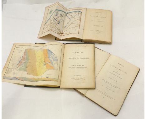
![[JOHN CHAMBERS]: A GENERAL HISTORY OF THE COUNTY OF NORFOLK INTENDED TO CONVEY ALL THE INFORMATION OF A NORFOLK TOUR, Norwich](https://cdn.globalauctionplatform.com/3c6586db-51ea-4d98-ab95-a51300d48e53/0c0025ab-431c-4c8e-dd3e-bb4869659770/468x382.jpg)
![[JOHN CHAMBERS]: A GENERAL HISTORY OF THE COUNTY OF NORFOLK INTENDED TO CONVEY ALL THE INFORMATION OF A NORFOLK TOUR, Norwich](https://cdn.globalauctionplatform.com/3c6586db-51ea-4d98-ab95-a51300d48e53/41ef1388-ca70-4590-b630-d1e6ef535a5c/468x382.jpg)
![[THOMAS KITSON CROMWELL]: EXCURSIONS IN THE COUNTY OF NORFOLK, 1818-19, 1st edn, 2 vols, added engrd ttls, engrd fdg map + en](https://cdn.globalauctionplatform.com/3c6586db-51ea-4d98-ab95-a51300d48e53/f34ac5bb-d294-4d16-aa6f-70ab8ca34c2f/468x382.jpg)

Lot 753
OLIVER G REDDY: LIFE AND SPORT ON THE NORFOLK BROADS IN THE GOLDEN DAYS, L, T Werner Laurie, circa 1910, orig cl gt worn + IAN C HANNAH: THE HEART OF EAST ANGLIA, THE STORY OF NORWICH FROM EARLIEST TO LATEST TIMES, ill E B Hannah, L, [1915], 1st edn, orig dec cl gt + THE REV RICHARD LUBBOCK: OBSERVATIONS ON THE FAUNA OF NORFOLK AND MORE PARTICULARLY ON THE DISTRICT OF THE BROADS, Norwich 1879, new edn, fdg frontis map, orig cl gt + WILLIAM ANDREWS (ed): BYGONE NORFOLK, L, 1898, 1st edn, orig cl gt + DONALD MAXWELL: UNKNOWN NORFOLK, 1925, 1st edn, col'd frontis + 11 col'd plts + 8 tinted plts and many illustrations in text, complete, orig cl gt (5)

Lot 754
AUGUSTUS JESSOPP: DIOCESAN HISTORIES - NORWICH, L, 1884, fdg frontis map, orig dec cl gt + A GREAT GOTHIC FANE, THE CATHOLIC CHURCH OF ST JOHN THE BAPTIST NORWICH WITH HISTORICAL RETROSPECT OF CATHOLICITY IN NORWICH, Brighton, W T Pyke & Co, and L, Heath, Cranton & Ouseley, 1913, 1st edn, orig dec cl gt + HISTORY AND DESCRIPTION OF THE CATHEDRAL CHURCH OF NORWICH, Norwich, Charles Muskett, 1842, 7 engrd plts complete, from the sheets of Benjamin Winkles: ARCHITECTURAL AND PICTURESQUE ILLUSTRATIONS OF THE CATHEDRAL CHURCHES OF ENGLAND AND WALES, old cl gt (3)

Lot 757
WALTER RYE: 8ttls: TOURISTS GUIDE TO THE COUNTY OF NORFOLK..., L, Edward Stanford 1889, 4th edn, engrd fdg map frontis + engrd fdg plan complete, orig cl gt: SOME EARLY ENGLISH INSCRIPTIONS IN NORFOLK BEFORE 1600..., L, Jarrolds, [1923], ltd edn (375), signed and numbered, orig cl: AN INDEX RERUM TO NORFOLK ANTIQUITIES - PUBLISHED FOR SUBSCRIBERS, Norwich, Agas H Goose, 1899, orig cl bkd bds, printed paper label to spine: A HISTORY OF NORFOLK, L, 1885, 1st edn, rebnd hf cf marb bds: SOME HISTORICAL ESSAYS CHIEFLY RELATING TO NORFOLK - PART 2, Norwich, 1926, orig cl bkd printed bds: AN INDEX TO NORFOLK TOPOGRAPHY, L, 1881, orig cl gt: THE VISITATION OF NORFFOLK, MADE AND TAKEN BY WILLIAM HARVEY..., ed Walter Rye, L, 1891, orig cl gt, bk plt of Hugh Gurney Barclay: THE HISTORY OF THE BETHEL HOSPITAL AT NORWICH BUILT BY MRS MARY CHAPMAN IN THE YEAR 1713, Norwich, Gibbs & Waller 1906, contemporary hf cf gt (8)

![[THOMAS KITSON CROMWELL]: EXCURSIONS IN THE COUNTY OF NORFOLK, L, 1818-19, 1st edn, 2 vols in 1, lge paper, added engrd ttls,](https://cdn.globalauctionplatform.com/3c6586db-51ea-4d98-ab95-a51300d48e53/8cd43ec2-2d56-4526-c591-8af6973f5cba/468x382.jpg)
![HARRY BRITTAIN: RAMBLES IN EAST ANGLIA ..., L, [1898], 17 plts as list, 8pp advts at end, orig pict cl gt + ERNEST RICHARD SU](https://cdn.globalauctionplatform.com/3c6586db-51ea-4d98-ab95-a51300d48e53/d9b01258-0799-41f7-94f7-a806285f9bf1/468x382.jpg)
Lot 775
HARRY BRITTAIN: RAMBLES IN EAST ANGLIA ..., L, [1898], 17 plts as list, 8pp advts at end, orig pict cl gt + ERNEST RICHARD SUFFLING: THE LAND OF THE BROADS, Stratford, Benjamin Perry, [1895], fdg frontis map, qty advts at end, orig pict cl gt + ANNA BOWMAN DODD: ON THE BROADS, ill Joseph Pennell, L, MacMillan, 1896, 1st edn, orig decor cl gt, spine browned (3)
![GEORGE CHARLES HAITE: AFLOAT ON THE NORFOLK BROADS, L and Manchester, Ayr, S Hildesheimer [1888], 1st edn, orig cl bkd pict b](https://cdn.globalauctionplatform.com/3c6586db-51ea-4d98-ab95-a51300d48e53/e71f9bea-c452-4f28-dc58-2d8504832360/468x382.jpg)
Lot 776
GEORGE CHARLES HAITE: AFLOAT ON THE NORFOLK BROADS, L and Manchester, Ayr, S Hildesheimer [1888], 1st edn, orig cl bkd pict bds soiled + [ALAN GARDYNE]: THE LOG OF THE LALAGE BEING A DESCRIPTION OF A CRUISE ON THE NORFOLK BROADS, Stratford 1892, reprinted from Tinsley's Magazine (new series) August and September 1889, orig ptd wraps + WALTER RYE: A MONTH ON THE NORFOLK BROADS ON BOARD THE WHERRY "ZOE" AND ITS TENDER, THE TUB "LOTUS", ill Wilfrid Ball, L, Norwich and Yarmouth [1887], 1st edn, 4 fdg maps, orig pict bds + ERNEST RICHARD SUFFLING: THE LAND OF THE BROADS ..., L, L Upcott Gill, 1885, 1st edn, fdg frontis map (some tears and splits, no losses), ttl pge and frontis reinforced with tape, 6pp advts at end, orig pict cl gt near disbnd (4)

Lot 796
T CHUBB: A DESCRIPTIVE LIST OF THE PRINTED MAPS OF NORFOLK 1574 -1916, 1928 1st edn, orig cl gt, + RONALD RUSSELL: GUIDE TO BRITISH TOPOGRAPHICAL PRINTS, 1979, 1st edn, orig cl gt d/w + R V TOOLEY: MAPS AND MAP MAKERS, 1949, 1st edn, orig cl, + R V TOOLEY: SOME ENGLISH BOOKS WITH COLOURED PLATES..., L, 1935 1st edn, orig cl gt (4)
![[HILL MUSSENDEN LEATHES]: ROUGH NOTES ON NATURAL HISTORY IN NORFOLK AND THE EASTERN COUNTIES, L, Jarrold & Sons [1890], 1st e](https://cdn.globalauctionplatform.com/3c6586db-51ea-4d98-ab95-a51300d48e53/e3ec3315-3355-4bc9-ce7d-29c5234a55bc/468x382.jpg)
Lot 799
[HILL MUSSENDEN LEATHES]: ROUGH NOTES ON NATURAL HISTORY IN NORFOLK AND THE EASTERN COUNTIES, L, Jarrold & Sons [1890], 1st edn, 3pp adverts at end, orig pict wraps worn + RICHARD LUBBOCK: OBSERVATIONS ON THE FAUNA OF NORFOLK AND MORE PARTICULARLY ON THE DISTRICT OF THE BROADS, Norwich, Henry W Stacy, 1848, fdg frontis map, 2 plts, orig cl bkd prtd wraps, (2)
Lot 802
CHARLES JOHN AND JAMES PAGET: SKETCH OF THE NATURAL HISTORY OF YARMOUTH AND ITS NEIGHBOURHOOD..., L, 1834, 1st edn, orig bds worn, lacks most of backstrip, + SAMUEL WOODWARD: AN OUTLINE AND GEOLOGY OF NORFOLK, Norwich, John Stacy 1833 1st end, hand col'd litho fdg frontis map + 7 litho plts including one hand col'd fdg, contemporary cl, inner joints split + THE REV RICHARD LUBBOCK: OBSERVATIONS ON THE FAUNA OF NORFOLK AND MORE PARTICULARLY ON THE DISTRICT OF THE BROADS, Norwich, Charles Musket 1845, 1st edn, hand col'd litho fdg frontis map + 2 plts, Alan Hunter's copy with his signature on ffep and some marginal MS annotations, some leaves loose, inner joints reinforced, contemporary cl worn, (3)

Lot 803
THE REV KIRBY TRIMMER: FLORA OF NORFOLK, A CATALOGUE OF PLANTS FOUND IN THE COUNTY OF NORFOLK, L and Norwich, 1866, 1st edn, 12 mo, orig dec cl gt + FRANCIS WILLIAM GALPIN: AN ACCOUNT OF THE FLOWERING PLANTS, FERNS AND ALLIES OF HARLESTON..., TO WHICH ARE ADDED OBSERVATIONS ON THE BIRDS OF THE DISTRICT BY CHARLES CANDLER, L, and Harleston, 1888 1st edn, hf ttle frontis, orig cl gt + RICHARD LUBBOCK: OBSERVATIONS OF THE FAUNA OF NORFOLK AND MORE PARTICULARLY ON THE DISTRICT OF THE BROADS, Norwich 1879, new edn, fdg frontis map + 2 plts, orig cl (3)

Lot 806
MARK KNIGHTS: JARROLDS GUIDE TO NORWICH BASED ON THE ANCIENT HISTORIC DIVISIONS OF THE CITY, circa 1905, 16th edn, revised and enlarged, fdg map, orig pict wraps + W H JUNGS: A QUAINT CORNER IN OLD NORWICH, SAMSON AND HERCULES AND AUGUSTINE STEWARD'S HOUSES, INTERESTING ANNALS AND REMINISCENCES FROM THE 15TH TO THE 19TH CENTURIES, Norwich, 1900 1st edn, Cubitt & Sons content, 30pp, old hf cf marb bds, orig top wrap bnd in, + THE HANDBOOK TO THE CITY OF NORWICH, A COMPLETE GUIDE TO ITS ANTIQUITIES, CATHEDRAL, PUBLIC INSTITUTIONS AND INDUSTRIES, Norwich, Jarrold & Sons, 1883, hf ttle, small part loss, old cl gt + "A MEMBER OF THE BUILDING COMMITTEE": BIRTH AND PARENTAGE OF THE NEW NORFOLK AND NORFOLK HOSPITAL, Norwich, Fletcher & Sons [1883], 1st edn, frontis, six fdg plans, orig wraps + M KNIGHTS' NORFOLK AND NORWICH ANNUAL AND EAST ANGLIAN GLEANER, Norwich, The Norfolk News Company Ltd 1886, orig prtd wraps, (5)


Lot 1476
R. Morden map of England, Bishoprick of Durham, Hertfordshire and Worcestershire, Carte de l'ocean occidental, plans of the principal towns, forts and harbours in Ireland, for Mr Tindals continuation of Mr Rapins History. Roberto Gordonio a'straloch, Aberdene and Banf, a new map of Sarmatia Europaea Pannonia and Dacia, Hugh S White A Tripoli Well, 2nd state c1/6 Etching, W.L. Walton, engraving of the first carriage the Ariel. The Arial Transit Company. Pub 1843.


Lot 1478
Blome Map of Norfolk, Moule Map of Durham, another, the Road from London to Southampton showing the Smaller Islands in the British Ocean,Tallis John, Later edition, Mexico, California and Texas, Greenwood map of the County of Huntingdon together with four framed topographical engravings, (9),

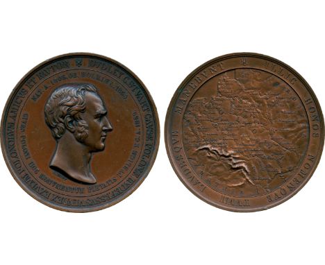
Lot 2633
COMMEMORATIVE MEDALS, British Historical Medals, Poland / Great Britain, Lord Dudley Stuart, Bronze Memorial Medal, 1859, by J F A Bovy, bust of Stuart right, rev map of Poland in relief, 63mm (BHM 2659; E 1530; C-P 126/81). Good very fine. Lord Dudley Coutts Stuart (1803-1854), Liberal politician and advocate of Polish independence. He married a scion of the Bonaparte family.


Lot 418
Ninety-one copies of 'Britain in Pictures', to include 'British Clocks and Clockmakers' by Kenneth Ullyett, 'British Polar Explorers' by Admiral Sir Edward Evans, 'English Glass' by W B Honey, 'British Cartoonists' by David Low, 'British Maps, Map Makers' by Edward Lynam, mostly with dust jackets with some doubles


Lot 71
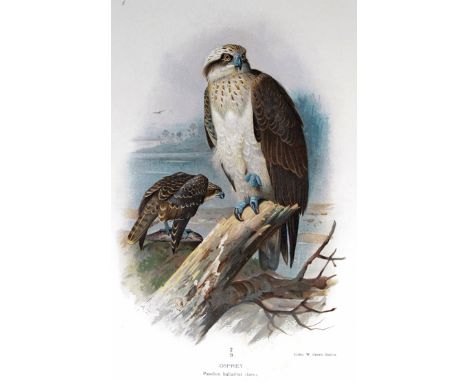
Lilford (Thomas L. Powys, 4th Baron). Coloured Figures of the Birds of the British Isles, London 1885-97, 7 vols., 8vo, contemporary half morocco, with photogravure portrait and 421 plates, bookplate of Robert Hargreaves, some foxing but plates generally in excellent condition and numbered in pencil, minor scuffing to the spines, plate 62 in vol. VI (Bulmers Petrel) is absent with a repeat of Sooty Shearwater in its place; and Notes on the Birds of Northamptonshire, London 1895, 2 vols., 8vo, contemporary half morocco, folding map and 37 (of 67) plates, bookplate of Robert Hargreaves, some foxing but plates generally in excellent condition and numbered in pencil, minor scuffing to the spines. (9)
![After John Speed, 'Pembrokshyre', [sic], original uncoloured map, being a Bassett and Chiswell edition with English text vers](https://cdn.globalauctionplatform.com/fe90ba62-45b6-4ab5-aafa-a51500a8b884/27db6917-9f77-411f-e0b4-2040077cd86e/468x382.jpg)
Lot 568
After John Speed, 'Pembrokshyre', [sic], original uncoloured map, being a Bassett and Chiswell edition with English text verso. Hogarth framed and glazed. CONDITION REPORT: Badly torn through fold 6" vertically from bottom, overall browned with age - good margin. No other obvious serious issues, frame has losses.
Lot 181
NEWFOUNDLAND - Small unused selection incl 1897 400th Anniversary 1c to 60c (SG 66/79), 1897-1918 ½c olive to 5c blue, 1908 2c Map, 1911 recess, perf 14 6c to 9c and 15c, 1911-16 Coronation 1c to 15c incl listed shades of 1c, 2c and 8c, 1919 Newfoundland Contingent 1c to 36c, 1919 $1 on 15c Air, 1920 surchs (excl 3c on 15c type A) and 1923-24 1c green to 24c sepia, a few faults but generally above average, part to large part o.g. (72)
Lot 210
CANADA - Selection on five cards incl, 1897 Jubilee short set to 50c, 1897-98 set to 10c, 1898 (Map) set, 1899 surch set, 1903-12 vals to 20c, 1908 'Quebec' set (excl 10c), 1911-2 perf 12 set to 50c incl shades, 1922-31 set to $1 with perf vars, 1927 Confed set to 12c and Historical set, 1928 Air, 1932 Ottawa set, 1932-3 perf 11 set to 13c, imperf x 8½ set, 1933-4 commems, 1935 Jubilee set, 1935 set to $1, 1935 Air and 1935 coil set (3), Special Delivery 1898-1935 all issues, very mixed cond incl unused without gum , gum toning small faults etc, cat £4000+ (136)


Lot 687
A Queen Anne walnut cabinet on chest, circa 1700, with moulded cornice above two cupboard doors concealing an arrangement of ten small drawers, on a chest of two short and two long graduated drawers on bun feet, 167.5cm x 109cm/see illustration Condition Report: Colour and patina good, small area of beading missing from interior, each door has split vertically through the centre, feet old but probably replacements. Small dent in centre of left hand door, carcass split to both sides of top, later lock to map drawer .Handles, locks and escutcheon would appear to be original. Slight damage to veneer by hinges and on upper right door. For its age in good condition


Lot 1130
An 18th century Irish hand-drawn book of maps of the Estate of Samuel Ahmuty Esq., in the County of Longford, surveyed in 1790 by John Jonston, full calf (disbound) 53 x 38 cm, to/w a linen-backed folding map of County Longford by William Edgeworth, 1813 (2) Please note: The surname is now known as 'Auchmuty') Condition Report Full calf, 27 maps, some loose, seems to have names of neighbours, not sure about individual tenants Longford map - 129.5 x 117.5 cm


Lot 145
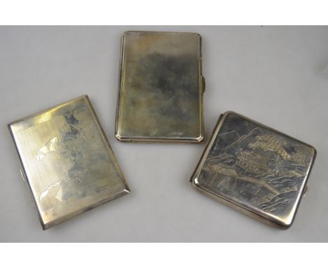
A heavy quality silver cigarette case with engine-turned decoration, Smith & Bartlam, Birmingham 1943, to/w a sterling cigarette case engraved with a map of India and Burma (pre-Partition) and a Japanese example engraved with buildings in a landscape, stamped 'Sterling Silver 950' (3) 15.3 oz


Lot 1007
AN EARLY 20TH CENTURY DE DION-BOUTON ADVERTISING MAP which centres around Châlons-sur-Marne showing surrounding towns and connecting roads within a border advertising 'De Dion-Bouton Moteurs', published by De Dion-Bouton and seemingly printed with a list of various garages selling De Dion-Bouton motor cars and various motor cars, buses and lorries, originally a folding map but now framed and glazed to the front and back, 89cm wide x 79cm high

Lot 425
Iran, Mohammad Reza Pahlavi, proof gold medal for the coronation, SH 1347 (1967), conjoined busts l. of the Shah, Empress and Crown Prince eva, legend around, rev. Imperial Crown and medal placed on map of Iran, within wreath, 38mm., wt. 25.02gms., stamped 900 fine, the images matt against a brilliant surface, minor handling marks and hairlines, virtually as struck

Lot 547
Romania, The Buzau to Marasesti Railway, 60th anniversary, 1941, by Constantin Iotzu (1884-1962), rectangular bronze plaquette with arched top, framed winged figure of speed, legend below, 1881 OCTOMBRIE 1941 - ANI 60 - DE LA PRIMA CALE FERATA BUZAU MARASESTI REALIZATA DE INGINERI ROMANI, rev. railway motif and legend above a map in relief of the railway line, 105 x 56.5mm., in case of issue by the Monetaria Nationala, virtually as struck, rare
-
109182 item(s)/page