We found 109182 price guide item(s) matching your search
There are 109182 lots that match your search criteria. Subscribe now to get instant access to the full price guide service.
Click here to subscribe- List
- Grid
-
109182 item(s)/page


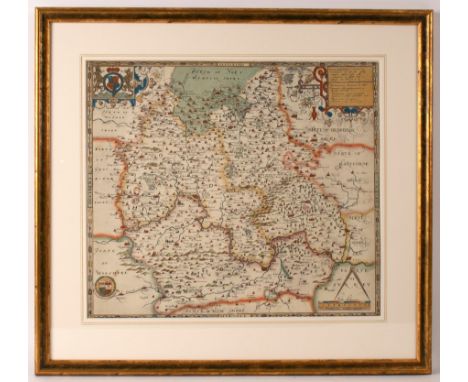
![[LONDON] The Picture of London, for 1819, 12mo folding frontis, add. pict. engr. title, folding 'Panorama' map, 1 of 2 large](https://cdn.globalauctionplatform.com/7e61c0c4-4f4c-488f-9e39-ac3000af2982/5d9203b2-bd30-4862-a850-ac3000d1430d/468x382.jpg)


Lot 366
GENTLEMAN'S MAGAZINE, vol. 10, 1740, with folding maps of Russian /Turkish border & Vera Cruz; vol. 10, 1740, containing "A New Map of the Western Atlantic", & "Castle of San Lorenzo" & 1 plate; 2 vols. for 1738 with no plates; CHESTERTON, Napoleon of Notting Hill, 1st, 1904; & 4 other vols. (9).
![[JAVA] RAFFLES (Sophia) Memoirs of the Life...of Sir Thomas Stamford Raffles, 4to, portrait frontis, 3 plates only & fold](https://cdn.globalauctionplatform.com/7e61c0c4-4f4c-488f-9e39-ac3000af2982/45ed655c-971a-4740-9130-ac3000d1505d/468x382.jpg)


![[MAPS] "The Pacific Islands" folding linen-backed map (splits/repairs) cloth boards, L., Stanford, n.d. & 5 others, vario](https://cdn.globalauctionplatform.com/7e61c0c4-4f4c-488f-9e39-ac3000af2982/4f2ffb76-123a-4c30-85aa-ac3000d0bcbc/468x382.jpg)
![[MAPS] ROCHFORT SCOTT (Capt. C.) Map of a portion of the South of Spain folding litho map, boards, L., n.d.; 2 maps of India,](https://cdn.globalauctionplatform.com/7e61c0c4-4f4c-488f-9e39-ac3000af2982/2d1d528a-0ea2-4d04-8eb0-ac3000d0bde9/468x382.jpg)
![[MAP] "W. & A. K. Johnston's Series of History Maps, Canada and the United States..." school map, lacquered, rollers, Edi](https://cdn.globalauctionplatform.com/7e61c0c4-4f4c-488f-9e39-ac3000af2982/c21c7050-e6b5-4e75-a0ce-ac3000d171dd/468x382.jpg)


Lot 836
John Speed (1552-1629)/Britain as it was Devided in the Tyme of the Englishe Saxons especially during their Heptarchy/coloured engraved map/with text verso, 39cm x 51cm CONDITION REPORT: This is glazed to each side so the reverse is visible. Overall the colours appear fresh and the map is in good condition. Label for Magna Gallery to reverse.


Lot 183
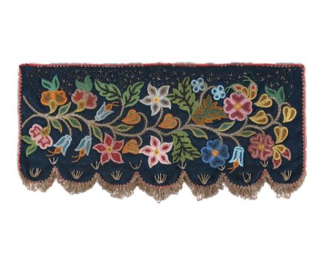
A Cree beaded shelf valence Prince Albert area, Saskatchewan, Canada cloth, velveteen, coloured glass and cut steel beads, the front with a floral and leaf spray with a series of steel bead crosses and interspersed lines to the top, the scalloped base with hooped tassels, with a metal rim tag inscribed N. Amer. Indian (Sioux) Battleford, Sioux or Blackfoot Indn, circa 1890, 60cm wide, 28.5cm deep. Provenance Colin F. Taylor Collection, Hastings. Michael G. Johnson Collection. Exhibited Sacred Circles, Two Thousand Years of North American Indian Art, Hayward Gallery, London, 7 Oct 1976 - 16 Jan 1977 and Nelson Gallery of Art, Atkins Gallery of Fine Arts, Kansas City, Missouri, 1977 Published Sacred Circles, Two Thousand Years of North American Indian Art, Arts Council 1976, p.177, no.448. Described as a Santee/Sioux Drum Cover. Lent by C. F. Taylor Collection, Hastings. These shelf valences were used in trappers' cabins or traders' houses and made in the style similar to the drum covers of earlier times. It has been suggested that the cut steel work along the top could represent stars or a map of hunting sites and trails. Battleford is a small town in Saskatchewan close to the Alberta border.
Lot 227
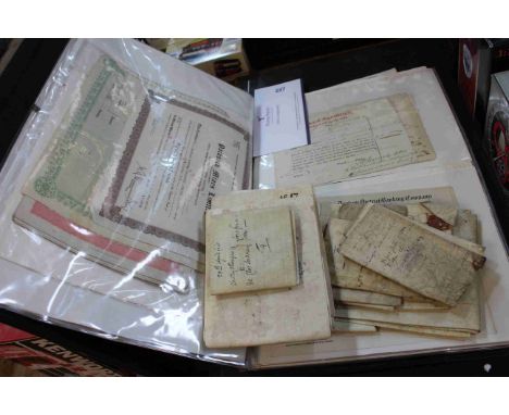
Folder of c1830's to 1950's stock and share certificates including 1832 Gravesend and Milton Steam Boat Co, 1809 Newcastle Banking Co, 1923 Derby Dome Wyoming Oil Co, Interest Warrant US Car Co, East India Annuities, Dunford Steamship Co, Bagnall Sheet Metal Co, Kent Coal Concessions Ltd, Northumberland Shipbuilding Co; Together with eleven parchment topographical Britain indentures (1609 to 1772), various family names (family tree interest) and Robert Morden Durham map 1722.


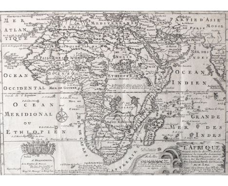
Lot 237
Nicholas de Fer L'AFRIQUE Paris: Chez L’Auteur, (1700) 1717 Copperplate engraving, three vertical folds, one horizontal fold, repaired 3cm tear at original map hinge; verso: paint show through, centre top and bottom corners taped to window mount, pencil note on back, framed,from de Fer's L'Atlas Curieux ou le Monde,22,8 by 31,7cm
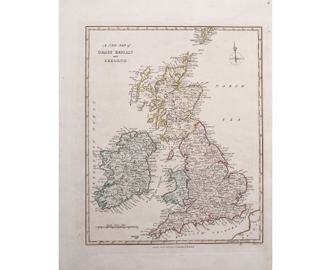
Lot 239
R Wilkinson THREE MAPS OF THE BRITISH ISLES London: R Wilkinson, 1794 A New Map of Great Britain and Ireland:Copper engraving, coloured; verso: pencil note, Top right corner "4", E Bourne sculp, 28 by 22,6cm,and A New Accurate Map of England & Wales:Copper engraving, coloured; verso: pencil note, Top right corner "5", M Morrison sculp, 27,3 by 22,2 cm,and A New Accurate Map of Scotland:Copper engraving, coloured; verso: pencil note; top right corner "6", 28,7 by 21,9 cm,from Robert Wilkinson's General Atlas


Lot 1350
Mixed lot of costume jewellery to include a silver hinged bangle with engraved decoration, a silver curb link charm bracelet hung with charms to include a totem pole, hinged tepee, 'British Columbia' map, 'Canada' beaver, hinged piano, Concorde, snail, etc, together with a contemporary silver bracelet with diamond set heart, further silver pieces, a continental turquoise and blister pearl brooch, etc


Lot 2828
A collection of mainly 19th century mixed legal documents, including a framed testimony by George Isaac, possibly the Bishop of Gloucester, various signed Oaths, letters, etc, a bound copy of A Map of Prestbury Fields and Hill, with hand drawn maps, details of the enclosure at Prestbury dated 1731, together with a well presented early 19th century arithmetic book, handwritten


![Ornithology: Blackburn, Mrs [Jemima] Hugh - Birds Drawn from Nature, folio, half calf, with 40 only lithograph plates, Glasgo](https://cdn.globalauctionplatform.com/62b2ce84-ae9c-4ddd-bf78-ac1d0139e9b9/25d093cd-9d98-4854-8616-ac3a009be3ee/468x382.jpg)
Lot 228
Ornithology: Blackburn, Mrs [Jemima] Hugh - Birds Drawn from Nature, folio, half calf, with 40 only lithograph plates, Glasgow 1868; Ticehurst, Norman F - A History of the Birds of Kent, 8vo, cloth, 24 photographs and coloured folding map at rear, London 1909 and Witherby H.F. et al - The Handbook of British Birds, 5 vols, 8vo, cloth, London 1945 (7)
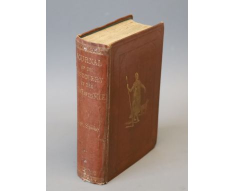
Lot 251
Speke, John Hanning - Journals of the Discovery of the Source of the Nile, 1st edition, 8vo, original cloth, with folding map in rear cover pocket, 2 engraved portraits and 24 plates, title page browned and with repair to top right, light spotting throughout, minor joints reinforced in green tape, William Blackwood & Sons, Edinburgh and London, 1863

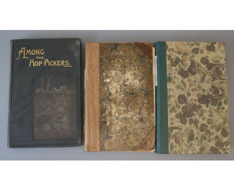
Lot 270
Fussell, L.A. - Journey Round the Coast of Kent, 8vo, rebound, facsimile folding map, Baldwin, Craddock and Joy, London 1818 and Shindler; Rev. R - Mission Work among The Hop-Pickers in the Weald of Kent, London [circa 1895]; Oulton, W.C - Picture of Margate, and its Vicinity, 8vo, rebacked, lacking early text and some plates, other plates trimmed, remounted and bound in, London 1820 (3)
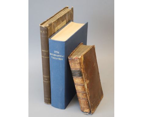
Lot 274
Hensall, Samuel and Wilkinson, John - Domesday ... This the Counties of Kent, Sussex and Surrey, qto, rebound half cloth, with double page map of Kent, London 1799; Scraggs, Sir William - The Practice of Courts-Leet, 8vo, calf, front cover detached, London 1728 and Ecton, John - Thesaurus Rerum Ecclesiasticarum, 2nd edition, qto, rebound cloth, London 1754 (3)
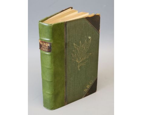
Lot 324
Jackson, Albert Bruce - Catalogue of the Trees and Shrubs (Excluding Rhododendrons) at Borde Hill, Sussex, in December 1932, with a foreword and notes by Colonel Stephenson Robert Clarke, C.B., portrait frontis, 8 photo plates and a folded sketch map, original half calf and gilt pictorial cloth, Oxford: printed at the University Press ... 1935, possibly one of a few copies bound for presentation (? with the map added); this one interleaved throughout - with some notes and a few loose inserts; the Colonel's initials ('S.R.C.') gilt stamped on upper cover, and his presentation inscription at front (recipients name crossed through); another copy, in a somewhat similar format had been gifted to the Du Cane Godmans (of South Lodge, near Horsham). This now famous collection had been built up by Colonel Clarke (1862-1948) from where the Estate had been acquired in 1893)CONDITION: Leather corners with some wear, the volume amateurishly rebacked, frontis with marginal spotting and guard torn, final 2 index leaves with unsightly cellotape repairs.
Lot 325
Brocklehurst, Capt. H.C. - Game Animals of the Sudan; their habits and distribution ..., 12 coloured plates by W.H. Riddell, numerous text illustrations and a folded map, gilt pictorial cloth, 1931; Wolhuter, Harry - Memories of a Game-Ranger, 6th edition, portrait frontis and 16 plates, numerous text illustrations, map on endpapers, gilt pictorial cloth, (Johannesburg 1958); together with 13 others on foreign travel and natural historyCONDITION: Brocklehurst-v.sl. wear/marks on cloth, spotting on half and title pages and slightly elsewhere; Wolhuter - sl. 'knocked' on spine, otherwise good copy; Others include Younghusband's Kashmir/Black's Colour Books, repr. 1911, 70 col. plts and folded map, good condition, Seton Thompson's Chinese Lanterns (N.Y. 1924), many photo plts, Very good copy, Roosevelts The Wilderness Hunter (Ist trade edition, 1883), 24 plts, 'edition-de-luxe' notice tipped in, reddish-brown chapter heads (? denotes first issue), gilt pictorial cloth (some wear and marks), few marks etc. inside-with 'used' feel

Lot 326
Bindings - Hissey, James John - On Southern English Road, 16 plates and folded map, earlier 20th century, royal blue gilt ruled levant, half morocco and cloth, gilt pictorial and panelled spine, gilt top and marbled endpapers, by Riviere, 1896; Roberts, Lord - Forty One Years in India ...., 14th edition, 2 vols, 29 plates including folded plans and maps, some coloured, gilt ruled red half calf and cloth, gilt decorated and panelled spines, marbled endpapers (by Bickers) 1897; Stephens, James - Collected Poems, limited edition, publisher's vellum backed blue paper boards, gilt lettered spine, fore and lower edges uncut, 1926, one of 500 large paper copies, signed by author, together with 5 other leather bound booksCONDITION: Hissey- some inside spotting, with 2/3 plate margins also, overall very good copy, original gilt pictorial cloth spine and upper cover bound-in at end, 1st edition. Roberts-title and other foxing, bindings very good, reprinted month following original issue


Lot 337
Sussex Interest: Shoberl, Frederick - A Topographical and Historical Description of the County of Sussex, 8vo, rebound quarter calf, folding engraved map, 9 plates, London [c.1813]; Chambers, George - Tourist's Guide to the County of Sussex, 12mo, cloth, with folding map, London 1883; A Guide to all the Watering and Sea Bathing Places, 12mo, rebound calf, with folding engraving of Brighton Pavilion, London [c.1823] and Paterson, Daniel - Paterson, Daniel - Paterson's Roads, 18th edition, with folding maps, London 1826 (4)

Lot 339
Brassey, Annie Allnutt - A Voyage in the Sunbeam, 6th edition, 8vo, cloth, with folding world map, London 1878; Gleichen, Count - With the Camel Corp Up The Nile, 8vo, cloth, London 1888; Waterton, Charles - Wanderings in South America, 8vo, rebound quarter calf, London 1879; Stevenson, Robert Louis - Treasure Island, illustrated by Rowland Hilder, qto, cloth with dj; Humphrey Milford, Oxford, 1929; Williamson, Henry - Tarka, 8vo, cloth, London 1932; Wilkins, W.H. - Mrs Elizabeth and George IV, 2 vols, 8vo, rebound half red morocco, London 1905, in slip case (7)


Lot 356
Allen, Thomas - The Picturesque Beauties of Great Britain- A Series of Views from original drawings, 8vo, half calf with marbled boards, with fold out map, frontis of Canterbury Cathedral (foxed) and 52 plates, George Virtue, London, 1833; Greenwood, C - An Epitome of County History - Vol 1 - Kent, (all published), folio, blind stamped green cloth with gilt titling, with double-page hand -coloured map of Kent and 82 litho plates, London, !838 (2)


-
109182 item(s)/page