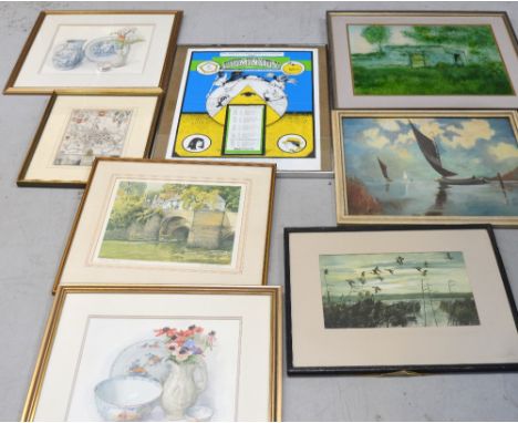
We found 109198 price guide item(s) matching your search

Refine your search

Year

Filter by Price Range
  • List
  • Grid
  • 109198 item(s)
    /page

Lot 484

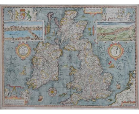
A poster for 'The Science Fiction Theatre Liverpool Presents Illuminatus! at the Liverpool School of Language, Mathew Street Liverpool', 63 x 50cm, a print after Geoff Rhind depicting a dwelling, a signed print after Roland Spencer Ford depicting Ludford Bridge in Ludlow, a pair of prints after John Davison, a map of the city and university of Oxford etc (8).

Lot 492

A large quantity of decorative pictures and prints including an engraving of the bay and island of Hong Kong, limited edition print of ducks, etching of London, reproduction map etc. *Provenance: Professor B. Lofts.

Lot 500

Edward Wells; a rare c.1700 map of China, 'A New Map of Great Tartary, and China, with the adjoining parts of Asia, taken from Mr DE Fer's map of Asia, dedicated to his Highness William Duke of Gloucester', hand coloured, 36 x 50.5cm, framed and glazed. *Provenance: Professor B. Lofts.

Lot 501

Robert Sayer; an 18th century colour map depicting Falmouth and Carreg Road 50 x 35cm, plus a larger map depicting Valetta in the Island of Malta 64 x 49cm, both framed and glazed (2). CONDITION REPORT Falmouth map has extensive visible foxing and the Valetta map also has foxing to a lesser extent

Lot 345

Insert from William Camden's 'Britannia', 17th Century Penbrokeshire, to include fold outs, sparsely coloured map and text.

Lot 529

John Ogilby, uncoloured original strip road map, Carmarthen to Cardigan together with framed map of Pembrokeshire with associated road map. (2)

Lot 570

Venitiis 1785 map of Southern Europe, Imperium Caroli Magni H. 38cm, W. 47cm, together with Antionia Zatta's 1784 map of Mare di Guinea, La Guinea Occidentale,H. 41cm, W.33cm

Lot 252

HOUSEHOLD SUNDRIES VARIOUS INCLUDING LAWN GREEN BOWLS, IN CARRYING CASES, BYGONE TENNIS BALLS AND BOXES, GLASSWARES, PAIR OF SMALL CHINA CABINET CUPS AND SAUCERS, MODEL RAILWAYS MAGAZINES AND A REPRODUCTION OF A JOHN SPEED MAP OF CHESTER

Lot 222

A framed and glazed map (County of Surrey) by C & I Greenworld (1829)

Lot 155

A John Speede map of Bedfordshire, from his 17th century work 'The Theatre of the Empire of Great Britaine', framed and glazed to both sides, 52 x 41cm AF

Lot 64

Military articles and effects relating to William Parker of the Cheshire Yeomanry, including his machete and canvas map-case, along with a mounted bronze relief plaque, a sabre in scabbard, an album of wartime postcards and a photograph of William Parker.

Lot 137

A mahogany oblong coffee table with red leather inset top and a square top coffee table inset with a map of the world

Lot 182

A box of collectables to include novelty items, road map, etc.

Lot 208

Militaria - military caps and berets, army football trophy, two military related prints and a Battle of Britain map, and other militaria in one box

Lot 235

Military edition cloth map 'England North East', Bartholomew's 'Railway History Map of Britain', other Bartholomew's, Horlick's and other vintage maps, children's books and annuals, collection of horse brasses and other brassware, photographs and postcards etc in one box

Lot 150

JAMES BOND 1:8 SCALE ASTON MARTIN; A large and heavy quality 1:8 scale Eaglemoss diecast precision model of James Bond's Aston Martin DB5. Highly detailed, the original spec for the model includes; working rear and front lights, working horn, ejector seat, accelerator sound effects, brake lights, light up map to interior, machine guns in lights, movable bullet proof rear screen, key ignition, rubber tyres etc. This particular model is well made. All features working. In fantastic condition. Approx 8.5kg. (NOTE: Spring from ejector seat has been removed for ease of transport, but can just be slipped back on for use) CAN BE POSTED WORLDWIDE CONTACT US FOR A QUOTE, OR VIEW www.eastbristol.co.uk.

Lot 201

A old school map of the UK on canvas together with collection of 1980s annuals and a collection of mixed pottery (2 trays)

Lot 147

A framed map, together with 2 limited edition prints Beverley and Princes Quay, Hull and a picture of the old Royal Observatory, Greenwich (5)

Lot 160

An 18th century hand coloured Robert Morden map of Kent

Lot 545

Collection of 30 vintage Timpo metal USA WWII soldiers including Kneeling with Field Radio, sitting with map, sitting with radio, standing with binoculars, military policeman, Motorcycle despatch rider (af), West point cadet with cymbols, West point cadet at the salute and many more

Lot 386

A MID 19TH CENTURY BLACK AND WHITE MAP SHOWING "THE BASIN OF THE TAY", from a survey by James Knox circa 1831, published by John Anderson of Edinburgh, 60cm x 77cm image size, in slender Hogarth glazed frame

Lot 1252

Of local interest: an early 19th century lithograph of 'A View of Bognor from the Hotel', I.11.5 x 19.5cm; together with a 17th century Sussex distance chart map by Jacob Van Langeren, (lacking margins); and another antique map of Chichester.

Lot 1459

An antique hand-coloured map of Sussex by Robert Morden, pl.35 x 42cm.

Lot 1680

A pair of antique hand-coloured road maps by John Ogilby, comprising 'London to Arundel' and 'London to Portsmouth', 33 x 44cm. Condition Report: The London - Arundel Map Showing foxing and discolouration overall with a clear centre - possible tape to rear. Minor creasing seen along the central crease. Has been re-framed in recent times. The London - Portsmouth Map In good clean condition. Some minor creasing seen as well as central crease. No sign of plate number (possibly under mount). Has been re-framed in recent times.

Lot 1682

An antique French hand-coloured map of 'D'Angleterre Qui Comprend L'ilse de Wight', pl.61 x 87cm.

Lot 303

A 19th Century map of Leicestershire by Fullerton

Lot 347

BIBLE IN ENGLISH: 'The Holy Bible, containing the Olde Testament, and the New...newly translated out of the originall tongues...' London, Robert Barker, 1614: 8vo, later panelled calf boards more recently rebacked, general title page within ornate woodcut surround, nt title page dated 1615, rubricated and printed in double column throughout, woodcut genealogies and double page map, lower joint sprung else a good copy. (1)

Lot 401

MILITARY ACHIVE: a collection of ephemera and several albums compiled by a Major Stanley Rolls covering the period circa 1900-1950, the earliest album covering the subjects time in India and in training at Portsmouth, leading onto his service in the first World War, the second album to include a seized German trench map of the front at Thiepval 1917, programmes, menus and periodicals for various staff and company events, personal photographs etc, a third album with cuttings and ephemera relating to his wife's time as British Vice-Consul to America. (Large carton)

Lot 383

A superb early gilt framed embroidered silk map of England, 54 x 65cm.

Lot 113

Quantity of commercial airways memorabilia to include: mounted map, ephemera, cutlery, freebies, cards etc from BEA, BOAC, Aquila, New Zealand, Indian, Eastern, Eagle, Malayan, Delta, Japan airways etc plus branded travel bags

Lot 88

Three Shell publications to comprise: The Modern Motorcycle, Motor Car and Commercial Vehicle, all incorporating flip-flap coloured diagrams showing the internals of vehicles, engines etc together with a motor racing enthusiasts scrap book and the Geographia road map of England and Wales

Lot 197

Cigarette Cards, Ireland, complete set of Player's Sectional Map of Ireland, together with the 'Joker' card (full map)(gd)

Lot 335

A Robert Morden Coloured County Map Of Kent

Lot 155

Robert Morden, Shropshire, a hand coloured Antiquarian Map, circa 1695, sold by Abel Swale, Awnsham and John Churchill, framed and glazed, 37cm by 43cm

Lot 156

Robert Morden, Shropshire, a hand coloured Antiquarian Map, circa 1695, sold by Abel Swale, Awnsham and John Churchill, framed and glazed, 37cm by 43cm

Lot 157

Robert Morden, Nottinghamshire, a hand coloured Antiquarian Map, circa 1710, sold by Abel Swale, Awnsham and John Churchill, framed and glazed, 37cm by 43cm

Lot 158

Robert Morden, Westmorland, a hand coloured Antiquarian Map, circa 1700, sold by Abel Swale, Awnsham and John Churchill, framed and glazed, 38cm by 44cm

Lot 159

Lidalia, hand coloured map engraved by Timotheo Pont, one inch to one mile scale, titled Lidalia/v el/Lididalia Regio/Lidisdail/Auct. Timotheo Pont, framed, 48cm by 55cm, together with a small 19th century map of Shropshire (2)

Lot 268

Pierre Fourdrinier (1698-1758), engraving, Classical column, 13.5" x 9", together with an 18th century hand coloured map of the Netherlands, 1748, and an embroidered woolwork picture, framed, (3).

Lot 57

John Speed (1552-1629), Map of the Kingdome of Great Britaine and Ireland, inset plans of the capital cities of London and Edinburgh, surmounted with the royal crest and decorated with sea monsters, sailing ships and an elaborate compass rose, sold by Thomas Bassett in Fleet Street & Richard Chiswell in St. Paul's Churchyard, 1676, with later hand colouring, English text on verso, engraving, 40 x 53cm.; 15.75 x 21in.

Lot 1518

GLENKEITH 1965 CONNOISSEURS CHOICE Speyside Single Malt Whisky. Bottled by Gordon & MacPhail with old map label. 75cl, 40% volume, in carton. CONDITION REPORT: Very good

Lot 1522

BANFF 1974 CONNOISSEURS CHOICE Highland Single Malt Whisky. Bottled by Gordon & MacPhail in 1992 with old map label. 75cl, 40% volume, in carton. CONDITION REPORT: Very good.

Lot 1523

GLENKINCHIE 1974 CONNOISSEURS CHOICE Lowland Single Malt Whisky. Bottled by Gordon & MacPhail with old map label. 75cl. 40% volume, in carton. CONDITION REPORT: Very good. Fill just in the neck.

Lot 1524

GLENCADAM 1974 CONNOISSEURS CHOICE Highland Single Malt Whisky. Bottled by Gordon & MacPhail with old map label. 75cl, 40% volume, in carton. CONDITION REPORT: Very good. Fill in the neck

Lot 113

A map by Robert Morden 'The Smaller Islands in the British Ocean' 37cm x 42cm

Lot 204

19th Century map, The Prospect of Oxford, 32cm x 46cm

Lot 1300

An Eastern Telegraph Company Limited, The Eastern Extension 1890 calendar page turner, with double sided map blade; playing cards, silver ARP badge; ration books; miniature Teddy bear etc

Lot 1341

Local Interest - a coloured map of Derbyshire, 26.5cm x 20cm; Derbyshire, a monochrome map, printed by W. & A.K. Johnson, London [c. 1889], 25cm x 15cm (2)

Lot 131

Robert Morden, a map of Nottinghamshire, hand coloured engraving

Lot 351

A Philips Railway Map of the British Isles. Fold out linen.

Lot 396

Vintage map measuring tool - 'Jakar'. Map Measurer 101, made in W Germany. With original instructions and plastic wallet.

Lot 328

WWI Pocket Compass with 1915 pocket book map reading book and WWI Company Drill book.

Lot 459

Australia - "Roo and Map Series" Published by Australia P.O. 1971

Lot 1011

GUILLAUME DE L'ISLE (17TH/18TH CENTURY), AN HISTORICAL MAP OF THE ROMAN EMPIRE AND THE NEIGHBOURING BARBAROUS NATIONS (THEATRUM HISTORICUM) hand-coloured engraved map, faded 57.5cm x 124.5cm Framed and under glass

Lot 1191

WOODSTOCK EXPERIENCE: THE FESTIVAL'S OFFICAL SIGNED BOOK & MULTIMEDIA SET DELUXE EDITION deluxe edition no. 029/1000, signed by Michael Lang and Arlo Guthrie, Genesis Publications Ltd; two cloth-bound volumes with gold and silver coloured edging, contained in a hand-made folding case, silk-screened with art by Shepard Fairey; includes original Woodstock Music and Art Fair ticket, lithograph by Peter Max, five new essays in a facsimile Woodstock press pack, facsimile of Lang's hand-drawn map, special 7" vinyl pressing of Santana's 'Savor' and Jefferson Airplane's 'White Rabbit'

Lot 764

A Tiffany & Co. circular china pot and lid decorated in the Peony pattern together with another decorated with a Map of the World.

Lot 12

Gibbon (Edward), The History of the Decline and Fall of the Roman Empire, 8 vols, frontis, folding map, hf mor gt, 8vo, Paris, 1840; Alison (Archibald), History of Europe, 3rd Edition, 10 vols, hf mor gt, 8vo, London, 1839 and other volumes, (bindings a/f, not subject to return).

Lot 40

Wentworth (William Charles), A Statistical, Historical and Political Description of the Colony of New South Wales, 2nd Edn, engr frontis, fldg map, hf cf gt, 8vo, 1820.

Lot 41

Laborde (M Leon de), Journey Through Arabia Petraea to Mount Sinai and the Excavated City of Petra, 1st edn, litho frontis, fldg map, 24 plts (of 26), cl gt, 8vo, 1836.

Loading...Loading...
  • 109198 item(s)
    /page

Recently Viewed Lots