We found 109182 price guide item(s) matching your search

Refine your search

Year

Filter by Price Range
  • List
  • Grid
  • 109182 item(s)
    /page

Lot 534

Josephus (Flavius). Alle de Werken..., van Flavius Josephus, Amsterdam, Pieter Mortier, 1704, printed title in red and black, additional engraved allegorical title, twelve double-page engravings, including two plans (one of Jerusalem), two folding engraved maps (Holy Land, and Mediterranean & Middle East), the first map with closed tear to fold, without loss, over 200 engraved illustrations to text, engraved title with 8 cm closed tear repaired, without loss, generally in good clean condition, contemporary full calf, rubbed and some wear with joints cracked, thick folio First edition of Josephus in Dutch, with illustrations by the brothers Jan and Kaspar Luyken. (1)

Lot 538

Lalande (Jerome). Exposition du calcul astronomique, 1st edition, Paris: De l'Imprimerie Royale, 1762, title within decorative typographic border, 3 folding engraved plates, occasional minor spotting or browning, recent quarter calf gilt over marbled boards, 12mo, together with Leadbetter (Charles), A Treatise of the Eclipses of the Sun and Moon, for Thirty-Five Years, Commencing Anno 1715, 2nd edition, 1731, woodcut illustrations to text, advert leaf bound at end of preliminaries, some spotting and a few closed tear repairs, small old owner's name stamp to title, contemporary sheep, rubbed and some edge wear, rebacked, 8vo, plus West (William), Mathematics, with Eleven Copper-Plates, Revised by John Rowe, 1st edition, 1762, 4pp. subscribers, 11 folding engraved plates at rear, manuscript footnote initialled by Rowe to page 77, light browning to preliminaries, recent boards, 8vo 1) Rare first edition of Lalande's second publication which contains tables of the movements of planets and an engraved map of the moon. Houzeau-Lancaster I, 11802. 2) Leadbetter gained fame for his accurate prediction of the 1715 total solar eclipse. 3) Little is known of William West of Exeter, this rare and posthumously published text being his only known work. (3)

Lot 542

Mitchell (Joseph). Practical Suggestions for Relieving the Over-Crowded Thoroughfares of London; securing improved means of locomotion; diverting the sewage from the Thames and appropriating it to agricultural use; with estimate of cost and probable revenue..., in a letter addressed to Sir Benjamin Hall, Bart., Chief Commissioner to the Board of Works. 1st edition, 1857, 26pp., four tinted lithographed plates including large folding frontispiece (light dampstain to lower margin, splits to two folds) and one other folding, large folding engraved map of London at rear (marginal closed tear), some minor soiling, author's signed presentation inscription to William Paterson at head of title, original cloth, slightly rubbed and faded on spine, slim tall 8vo Uncommon work by the noted Scotsman who was one of the first members of the Institute for Civil Engineers. The proposed scheme outlined here centred on a magnificent street 'to form one grand vista, in almost a straight line, from Kensington Gardens Palace to the extreme East of London'. (1)

Lot 571

Skelton (Joseph). Skelton's Engraved Illustrations of the Principal Antiquities of Oxfordshire, 1823, engraved title-page, county map and 49 engraved plates, engraved vignettes to text, a little spotting and soiling, recent antique-style half calf over marbled boards with engraved armorial bookplate retained to front pastedown, 4to, together with Culpeper (Nicholas), The Complete Herbal..., new edition, published Thomas Kelly, 1835, engraved portrait frontispiece, 20 plates at rear, each with 9 hand-coloured engravings of plants, some soiling, modern half calf over marbled boards, 4to, plus [Defoe, Daniel], The Secrets of the Invisible World Disclos'd: or, An Universal History of Apparitions Sacred and Prophane, under all Denominations..., by Andrew Moreton, 1729, 5 engraved plates, lacks frontispiece, heavy browning and some old damp-staining throughout, title-page heavily soiled and with lower outer corner loss affecting imprint, a few leaves frayed with corner loss, contemporary calf, rebacked and corners restored, 8vo, plus other miscellaneous mostly antiquarian including leather-bound sets of Shakespeare and Macaulay (46)

Lot 583

Bailey (John). General View of the Agriculture of the County of Durham; with Observations on the Means of its Improvement. Drawn up for the Consideration of the Board of Agriculture and Internal Improvement, 1813, folding hand-coloured engraved map, nine engraved plates at end, a few folding including the Durham Ox and Mr Mason's Cow, some browning and spotting, original paper-backed boards, printed label to spine (chips and losses), together with General View of the Agriculture of the County of Leicester, by William Pitt, of Wolverhampton, to which is Annexed a Survey of the County of Rutland, by Richard Parkinson, 1813, folding engraved map, 24 engraved plates at end (with water stain), light toning, original paper-backed boards, printed label to spine (with tear and stain), plus General View of the Agriculture of the County of Northampton, by William Pitt, 1813, folding hand-coloured map, publisher's catalogue and Thomas Gibbs 2 page Agricultural Seeds catalogue at end, scattered light spotting, uncut, original boards, paper label to spine, a little soiled with tears, 8vo, with three others: H.E. Strickland's A General View of the Agriculture of the East-Riding of Yorkshire, 1812, Adam Murray's General View of the Agriculture of the County of Warwick, 1815 and William Pitt's General View of the Agriculture of the County of Stafford, 2nd edition, 1813 (6)

Lot 584

Bailey (John & Culley, George). General View of the Agriculture of the County of Cumberland, with Observations on the Means of Improvement, 1st edition, 1794, bound with General View of the Agriculture of the County of Derby..., by Thomas Brown, 1st edition, 1794, folding map of rivers, without county map, bound with General View of the County of Devon..., by Robert Fraser, 1st edition, 1794, folding engraved map, bound with General View of the Agriculture in the County of Dorset..., by John Claridge, 1st edition, 1793, lacks half-title, bound with 6 further items from the same series, all 1st editions, 1794, including Durham (hand-coloured map, 2 folding tables (one split) and 2 folding plates; lacks half-title, small hole to blank area of main title), Essex (lacks half-title), Gloucester, Hants (including Isle of Wight), Hereford and Huntingdon (1793), a little scattered spotting and marginal dust-soiling, contemporary paper-backed stiff blue grey wrappers, soiled and worn, covers detached and manuscript spine largely perished, 4to (1)

Lot 585

Batchelor (Thomas). General View of the Agriculture of the County of Bedford, 1813, folding hand-coloured engraved map, engraved portrait of the Duke of Bedford, seven engraved plates, publisher's list at end, some light toning, original boards, printed paper label to spine (tears and splits), together with A General View of the Agriculture of Berkshire, by William Mavor, 1813, folding hand-coloured map, folding map of the Rivers Thames and Isis (with outline colour), folding map of Inland Navigation between London and Bristol, 26 engraved plates, light spotting and soiling, original paper-backed boards, some wear, 8vo, plus General View of the Agriculture of Buckinghamshire, by the Rev. St. John Priest, 1813, folding engraved map, 13 engraved plates, light spotting, original paper-backed boards, chips and losses to spine, 8vo, with five other General View of Agricultures: Middlesex, by John Middleton, 2nd edition, 1813, Hertfordshire, by the Secretary of the Board, 1813, Sussex, by the Rev. Arthur Young, 1808, Kent, by John Boys, 2nd edition, 1813 and Surrey, by William Stevenson, 1813 (8)

Lot 587

Davies (Walter). General View of the Agriculture and Domestic Economy of South Wales, Containing the Counties of Brecon, Caermarthen, Cardigan, Glamorgan, Pembroke, Radnor..., 2 volumes, 1st edition, 1814, hand-coloured folding map, 2 plates including 1 folding and hand coloured, printed list of publications of the Board of Agriculture and a catalogue of Agricultural Seeds, etc., sold by Thomas Gibbs at rear of volume 2, occasional spotting or light browning, uncut, original boards, rubbed and spines worn, printed paper label to volume 2 only, together with General View of the Agriculture and Domestic Economy of North Wales..., by Walter Davies, 1810, hand-coloured folding map, 2 engraved plates at rear (1 folding), some spotting or browning throughout, uncut, disbound, original lower board detached but present, plus General View of the Agriculture of the County of Monmouth..., by Charles Hassall, 1815, half-title, hand-coloured folding map frontispiece, 2 engraved plates at rear, some spotting and occasional heavy browning, uncut, original boards with printed paper label to spine, rubbed and soiled, all 8vo (4)

Lot 589

Holt (John). General View of the Agriculture in the County of Lancaster...., 1st edition, 1794, lacks half-title, folding hand-coloured engraved map, 1 engraved plate, lacks frontispiece, some spotting and browning, together with Wedge (Thomas), General View of the Agriculture of the County Palatine of Chester.., 1st edition, 1794, half-title, 2 engraved plates, additional errata slip tipped in at foot of final page, some marginal spotting throughout, plus Bailey (John & Culley, George), General View of the Agriculture in the County of Northumberland..., 1st edition, 1794, some light browning, lacks half-title, plus Lowe (Robert), General View of the Agriculture of the County of Nottingham..., 1st edition, 1794, half-title, hand-coloured map of the soil of Nottingham, all contemporary plain wrappers, dust-soiled and browned on spines, 4to, plus later editions for the same counties from the same series: Cheshire by Henry Holland (1813), Lancashire by R.W. Dickson & W. Stevenson (1815), Lincolnshire [by Arthur Young], 2nd edition (1813), Northumberland by J. Bailey and G. Culley, 3rd edition (1813), and Nottingham, by Robert Lowe (1813), each with folding map frontispiece, all but that for Northumberland hand coloured, all uncut, original boards with printed paper labels for Lancashire, Lincolnshire and Nottinghamshire, some soiling and wear, 8vo (10)

Lot 590

Marshall (William). General View of the Agriculture of the Central Highlands of Scotland, with Observations on the Means of their Improvement, 1st edition, 1794, half-title, bound with General View of the Natural Circumstances of those Isles, Adjacent to the North-West Coast of Scotland, which are Distinguished by the Common Name of Hebudae or Hebrides..., by Robert Heron, 1st edition, Edinburgh, 1794, bound with General View of the Agriculture of the County of Mid Lothian..., by George Robertson, 1st edition, Edinburgh, 1793, half-title, hand-coloured county map, bound with General View of the Agriculture of the Isle of Man..., by Basil Quayle, 1st edition, 1794, half-title, engraved map, early leaves heavily foxed, some old marginal damp-staining at rear, bound with 7 further Scottish items from the same series, all 1st editions, 1794, including West-Lothian (lacks half-title), Nairn (marginal damp-staining), Perth, Renfrew (engraved plate, lacks half-title and final blank), Roxburgh, Selkirk (engraved plate) and Tweedale (lacks final blank), contemporary paper-backed stiff blue grey wrappers, soiled and worn, spine somewhat perished and covers near-detached, 4to (1)

Lot 591

Robertson (George). General View of the Agriculture of the County of Mid-Lothian: With Observations on the Means of its Improvement; Drawn up for the Consideration of the Board of Agriculture and Internal Improvement, from the Communications of George Robertson Farmer, at Granton, near Edinburgh, with Additional Remarks of several respectable Gentlemen and Farmers in the County, Edinburgh, 1795, folding hand-coloured engraved map, 11 engraved plates, scattered light spotting, top corner of front endpaper torn away, original paper-backed boards, manuscript title to spine, a few tears, 8vo, together with General View of the Agriculture, State of Property, and Improvements, in the County of Dumfries, by Dr Singer, Edinburgh, 1812, folding hand-coloured map, eight engraved plates and plans, a few folding, including four hand-coloured plates of bulls and cows, occasional light waterstain and a few spots, original paper-backed boards, a few tears and stains, 8vo, plus General View of the Agriculture of the County of Inverness, by James Robertson, 1813, two folding engraved maps of the Soil of Invernessshire and Intended Caledonian Canal (detached), a few spots, original boards, joints splitting, losses at spine ends, 8vo, with 12 other Scottish General View of Agricultures, including Perth, 1799, Roxburgh and Selkirk, 1813, Nairn and Moray, 1813, Argyle, 1813, Clydesdale, 1813, East Lothian, 1813, Kincardineshire, or the Mearns, 1813 and Peebles, 1814 (15)

Lot 593

Rudge (Thomas). General View of the Agriculture of the County of Gloucester, 1813, folding hand-coloured engraved map, two engraved plans with outline colour at end, two engraved plates, a little light spotting, original paper-backed boards, some wear to spine, 8vo, together with General View of the Agriculture of the County of Hereford, by John Duncumb, 1813, folding hand-coloured map (a little toned), four engraved plans and plates at end, including three folding (one torn without loss), light spotting, original paper-backed boards, small splits to spine, 8vo, plus General View of the Agriculture of the County of Worcester, by William Pitt, 1813, folding engraved map, six engraved plates at end (with water stain and light spotting), 6 page Thomas Gibbs Agricultural Seeds catalogue at end, some light spotting and marginal water stain, original boards, some wear, 8vo, with five other mostly General View of Agriculture: Shropshire, by Joseph Plymley, 1813, Wiltshire, by Thomas Davis, 1813, Oxfordshire, by the Secretary of the Board, 1813 and The Islands on the Coast of Normandy, Subject to the Crown of Great Britain, by Thomas Quayle, 1815, plus Arthur Young's Farmer's Calendar, new edition, 1804 (disbound) (8)

Lot 595

Wedge (John). General View of the Agriculture of the County of Warwick, with Observations on the Means of its Improvement, 1st edition, 1794, half-title, 4 engraved plans with a little hand colouring (old damp stain to margins), bound with General View of the Agriculture of the County of Westmorland..., by Andrew Pringle, 1st edition, Edinburgh, 1794, without half-title (correct?), bound with General View of the Agriculture of the County of Wilts..., by Thomas Davis, 1st edition, 1794, half-title, folding hand-coloured engraved county map, bound with 4 other items from the same series, all 1st editions, 1794, including Worcester, East Riding of Yorkshire (hand-coloured map and 7 plates), North Riding of Yorkshire (hand-coloured map), and West Riding of Yorkshire (hand-coloured engraved sketch map), contemporary paper-backed blue grey wrappers, soiled and worn, broken on spine with some leaves detached, 4to (1)

Lot 596

Worgan (George B.). General View of the Agriculture of the County of Cornwall, 1815, folding map frontispiece, folding table, 15 engraved plates, publisher's adverts at rear, occasional spotting, uncut, original boards, soiled, spine worn and covers near-detached, together with Vancouver (Charles), General View of the Agriculture of the County of Devon..., 1813, 29 plates including hand-coloured map frontispiece, some folding and 2 others hand coloured, several detached, folding tables, some occasional light browning, uncut, original boards, corners bruised and some soiling and loss to spine, plus Stevenson (William), General View of the Agriculture of the County of Dorset..., 1812, folding hand-coloured map frontispiece, occasional spotting, uncut, original boards with printed paper label to spine, rubbed and soiled, some loss to foot of spine, plus Hampshire including the Isle of Wight (1813), Somerset (Bath, 1798), and Sussex (1808), all with hand-coloured folding map frontispieces, uncut, original boards, soiled and worn, all 8vo (6)

Lot 597

[Young, Arthur]. General View of the Agriculture of the County of Essex..., by the Secretary of the Board, 2 volumes, 1813, hand-coloured folding map frontispiece, 58 engraved plates (complete), a little spotting, uncut, original boards with printed paper labels to spines, rubbed and soiled, spine torn with loss to head of volume 1, together with General View of the Agriculture of the County of Norfolk..., by the Secretary of the Board, 1813, hand-coloured map frontispiece, 6 engraved plates, 8 folding tables, printed list of Publications of the Board of Agriculture at rear, some occasional spotting, uncut, original boards with printed paper label to spine, rubbed and soiled, cracked on joints and some wear to spine, plus 3 others from the same series including another edition of Norfolk by Nathaniel Kent (1813), Huntingdon by R. Parkinson (1813) and Suffolk [by Arthur Young], (1813), each with folding map frontispiece, last 2 hand coloured, all uncut in original boards, somewhat worn, all 8vo (6)

Lot 602

Dening (C.F.W.). The Eighteenth-Century Architecture of Bristol..., with preface by Sir Lawrence Weaver and an Introduction by J.E.Barton, 1st edition, published J.W.Arrowsmith, Bristol, 1923, additional half title decorated with a vignette of a sedan chair, numerous tipped in black and white illustrations, presentation copy by the author dated 1929, top edge gilt, remainder untrimmed, quarter cloth, rubbed and frayed at extremities, boards a little stained, 4to, together with Green (David),Blenheim Palace, 1st edition, published Country Life Limited, 1951,additional half title, numerous black and white illustrations throughout, slight spotting to preliminaries, publisher's cloth gilt, dust jacket a little spotted and frayed, 4to, with His Majesty's Stationery Office, (publishers),Royal Commission on Historical Monuments England. An Inventory of the Historical Monuments in the City of Oxford, 2nd edition 1949, numerous black and white illustrations and folding plans throughout, folding map contained in pocket at rear, slight spotting to preliminaries, publisher's cloth gilt, dust jacket a little stained with spine faded, 4to, plus Her Majesty's Stationery Office (publisher),Royal Commission on Historical Monuments England. An Inventory of the Historical Monuments in the City of Cambridge, 2 volumes, 1st edition, 1959, numerous black and white illustrations and folding plans throughout, erratum to rear pastedowns, publisher's cloth gilt, dust jackets, 4to, with another ten volumes similar (15)

Lot 644

Acerbi (Joseph). Travels Through Sweden, Finland, and Lapland to the North Cape, in the years 1798 and 1799, volume 1 (of 2) only, 1802, 18 black and white engravings including portrait frontispiece, later inscription to modern front endpaper, period inscription to head of title-page, some minor toning, rebound in modern gilt-decorated brown half morocco, spine slightly rubbed to head and foot, 4to, together with Manning (Francis), The Life of Our Emperour Theodosius the Great, London, printed by F.L., 1693, some marks, front endpaper partially detached, contemporary full calf, front board detached, boards and spine rubbed with loss, 8vo, plus Salignac (Francois De), Les Aventures De Telemaque, Fils D'Ulysse, 2 volumes bound in 1, nouvelle edition, Rotterdam, 1717, 10 black and white engraved plates plus engraved half-title and folding map, some toning and light spotting, contemporary gilt-decorated full calf, boards and spine rubbed with loss, 8vo, plus other 18th and 19th-century literature and reference, including A Description of England and Wales..., volumes 1-3, 5-8, 10, 1769-70, all leather bindings, some decorative, some odd volumes, condition is generally good/very good, 8vo/4to (3 cartons)

Lot 646

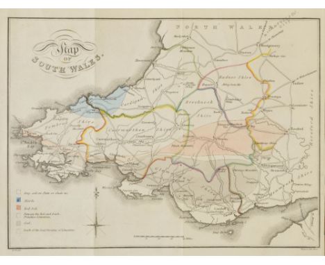
Elzevir Press. C. Julii Caesaris quae extant ex emendatione Jos. Scaligeri, Leiden: Ex officina Elzeviriana, 1635, engraved title and two folding engraved maps (with ink stamp to verso of each), few woodcut illustrations including some full-page, ink stamp to verso of final leaf, old library bookplate, all edges gilt, near contemporary gilt decorated red morocco, loss to title label, adhesive tape residue to boards, 12mo, together with Bird (George W.), Wanderings in Burma, 1st edition, Bournemouth & London, 1897, frontispiece not present, numerous black & white plates from photos, folding maps & plans, including large folding map in rear pocket and additional folding plan of Mandalay Palace, one plan with long closed tear, top edge gilt, remainder untrimmed, original gilt blocked dark green cloth, frayed & torn at head & foot of spine, few marks, large 8vo, with Harte (Rev. Walter), The History of the Life of Gustavus Adolphus, King of Sweden, Sirnamed, The Great, 2 volumes, 1759, engraved portrait frontispiece, eight maps & plans (five folding), one folding table (torn), occasional spotting, bookplate of Lord Craven, Benham Place to upper pastedowns, contemporary speckled calf, joints cracked, worn, 4to, with [Barthelemy, Jean Jacques & Barbie du Bocage, Jean Denis], Recueil de Cartes Geographiques, plans, vues et Medailles de l'Ancienne Grace, relatifs au Voyage du jeune Anacharsis..., Paris, 1788, thirty-one folding and double-page engraved maps, plans & plates, some with worm damage and loss, original boards, worn, 4to, plus other miscellaneous antiquarian volumes, mostly early 19th century (a carton)
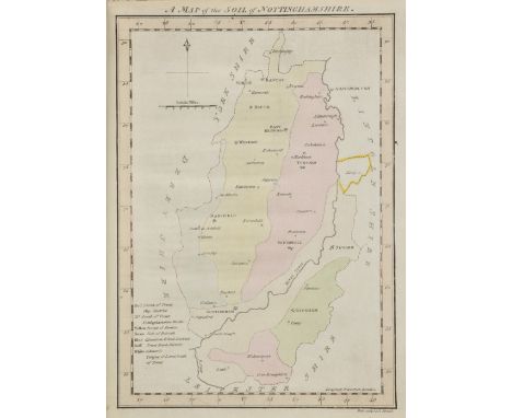
Lot 647

Flaxman (John). The Classical Compositions of John Flaxmn R.A. Sculptor, comprising the Iliad and Odyssey of Homer and the Tragedies of Aeschylus, engraved at Rome by Piroli; and the Theogony and works and days of Hesiod, engraved by WIlliam Blake, published Bell and Daldy, 1870, title and contents list, 140 uncoloured engraved plates in outline, occasional scattered spotting, top edge gilt, contemporary half morocco with gilt decorated spine, rubbed and worn, folio, together with Illustrations of the Divine Poem of Dante Alighieri by John Flaxman, Sculptor R.A., with descriptions from the Translation of the Rev. Henry Francis Cary, published Bell and Daldy, 1867, additional half title and frontispiece and 109 uncoloured engraved plates in outline with lines of verse below image, gutta percha perished, contents shaken and loose, top edge gilt, publisher's gilt decorated cloth, a little stained, folio, with Crichton-Browne (Sir James, Broadbent Sir William, Schofield Alfred T. and others, editors), The Standard Physician, 3 volumes, 1908, portrait frontispiece,. additional half titles, numerous uncoloured illustrations to text and throughout, folding and moveable chromolithographic anatomical diagram at rear of volume 1, contemporary half morocoo gilt, heavily rubbed and worn, large 8vo, plus Troup (R.S.),The Silviculture of Indian Trees, 3 volumes, published Oxford at the Clarendon Press, 1921, additional half titles. folding lithographic map to volume 1, numerous colour and black and white illustrations throughout, some scattered spotting, upper hinges in volumes 2 & 3 cracked and weak, some staining to endpapers and pastedowns, publisher's cloth gilt with some worming to boards, stained, 4to (a carton)

Lot 648

Fosbrooke (Thomas Dudley). An Original History of the City of Gloucester..., 1819, monochrome engraved plates and plans including half title, bookplate to modern front endpapers, ex-libris with associated stamps, some spotting, contemporary half calf rebound to modern brown calf spine retaining original labels, boards rubbed with minor loss, folio, together with Bibliotheca Gloucestrensis: A Collection of Scarce and Curious Tracts..., Washbourn and Son Publishers, volumes 1-3, 1823-25, 3 monochrome frontispiece, bookplates to front pastedowns, some minor spotting, uniform contemporary gilt decorated half calf, boards rubbed, volume 1 front board partially detached and spine missing, 4to, and Scott (Walter), The Border Antiquities of England and Scotland..., volumes 1 & 2, 1814-17, numerous monochrome engravings with tissue gurads, some light spotting, uniform contemporary gilt decorated full calf, boards slightly rubbed and partially detached, spines rubbed with minor loss, 4to, plus other 19th century and modern UK topographical reference and related, including O.S. maps, Adams Syn Chronological Chart or Map of History, Walker Brothers, London, some leather bindings, many original cloth, condition generally good/very good, 8vo/folio (5 cartons)

Lot 658

Wyatt (William). Life in the Southern Isles; or, Scenes and Incidents in the South Pacific and New Guinea, circa 1870, numerous black and white illustrations, including frontispiece and ma, some light marks, rebound with modern endpapers, partial original boards and spine retained to modern red cloth, 8vo, together with Cheesman (Evelyn), Camping Adventures in New Guinea, 1st edition, 1948, Six-Legged Snakes In New Guinea, 1st edition, 1949, both numerous black and white illustrations, both original cloth in dust jackets, covers slightly rubbed with minor loss to head and foot, 8vo, and Lett (Lewis), Knights Errant of Papua, black and white frontispiece, map to front endpaper, some minor marks, original blue cloth in dust jacket, covers slightly marked with minor loss to head of spine, 8vo, plus other early 20th century and modern Papua New Guinea and South Pacific reference, including Balus, The Aeroplane in Papua New Guinea, volumes 1-3, by James Sinclair, all 1st editions, 1986-90, mostly hardback publications, many in dust jackets, G/VG, 8vo/folio (3 shelves & cartons)

Lot 665

Daumas (Maurice). Scientific Instruments of the Seventeenth and Eighteenth Centuries and their Makers, 1989, numerous black and white illustrations, original green cloth in dust jacket, 8vo, together with Leistikow (Dankwort), Ten Centuries of European Hospital Architecture, 1st edition, 1967, numerous black and white plates, original grey cloth in dust jacket, covers slightly rubbed to head and foot, 8vo, and Wiseman (Richard), Of Wounds of Gun-Shot Wounds, Of Fractures and Luxations, facsimile edition, 1977, 6 black and white illustrations, including frontispiece, and map, original boards in dust jacket, 8vo, plus other modern historical and medical history reference and related, including publications by Scholar Press, Minerva Press, Oxford, Cambridge, all original cloth in dust jackets, G/VG, 8vo/4to (6 shelves)

Lot 666

Du Pin (L.E.). The Evangelical History: Or, The Life of our Beloved Saviour Jesus Christ, Comprehensively and Plainly Related... in Four Books, printed for Abel Swall & T. Child, 1695, 6 black and white engraved plates, including frontispiece, bound with The Lives of The Apostles, circa 1695, 14 black and white engraved plates, plus folding map, some minor spotting, period inscription to rear endpaper, contemporary embossed full calf, boards and spine slightly rubbed to head and foot, 8vo, together with Busby (Richard), Grammatica Busbeiana, Auctior & Emendatior, i.e. Rubimentum Grammaticae Graeco-Latinae Metricum, 1702, period inscription to pastedowns and title page, lacking front endpapers, some light marks, contemporary full calf, spine slightly rubbed, hinges cracked, 8vo, and Church of England, La Liturgie, C'est a dire, Le Formulaire des Prieres Publiques..., 1695, period inscriptions to endpapers, some light marks, all edges gilt, contemporary gilt decorated blue calf, boards and spine slightly rubbed with minor loss to head, 12mo, plus other 18th and 19th century literature and reference, including Letters Written by Philip Dormer Stanhope..., volumes 1-4, 8th edition, 1778, Boswell's Life of Johnson, edited by George Birkbeck Hill, volumes 1-6, 1887, mostly leather bindings, condition generally good, 8vo/4to (3 shelves)

Lot 688

Volwiler (Albert T.). George Croghan and the Westward Movement 1741-1782, 1st edition, USA, 1926, 4 black and white illustrations including frontispiece map, some minor toning, original blue cloth, spine slightly rubbed to head and foot, 8vo, together with Coel (Margaret), Chief Left Hand, Southern Arapaho, 2nd printing, 1982, black and white illustrations, some minor spotting, original black cloth in dust jacket, 8vo, plus Galloway (Patricia), Choctaw Genesis, 1500-1700, 1995, black and white illustrations, original brown cloth in dust jacket, 4to, plus other Native American & North America reference, mostly original cloth in dust jackets, some ex-library with associated marks, G/VG, 8vo/4to (3 shelves)

Lot 146

GIOVANNI BATTISTA CARPANETTO 1863-1928 Guida di Torino 1899 Lit. Salussolia, Torino. Litografia a colori. Telato, strappi restaurati lungo i margini. Qualità B. 164 x 97 cm Una donna eterea e bellissima, alata messaggera di cultura, quasi comparendo dalle nubi incede portando in mano un libro aperto mentre con l’altra mano tiene una pianta della città di Torino. Color lithograph. Backed on linen, restored tears among the margins. Condition B. 68,90 x 38,18 in. An ethereal beauty, winged messenger of culture, almost enveloped by great clouds, proceed solemnly bearing an open book while with the other hand she holds a map of Torino. Bibliografia / Literature Catalogo Bolaffi del Manifesto Italiano, Torino, 1995, pp. 48-49. 500

Lot 92

Hand tinted map of Yorkshire by Peter van den Keere, 17th Century12x16cm, hand tinted map of a plan of Bell-Isle divided into parishes engraved for the Universal magazine by J Hinton c.1800, 29x17cm, framed and glazed.

Lot 93

Hand tinted map of Cheshire by Christopher Saxton 17th Century26x30cm, 19th Century map of Cheshire showing the various boundaries and electoral divisions, 18x25cm, both framed and glazed. (2) CONDITION REPORT: Old map, central crease, can see text behind

Lot 396

An interesting woodblock Map of Japan,late 19th century, the islands with numerous marked cities, some highlighted in red, the rivers, seas and mountains in blue, the three sheets mounted on linen,34.5 x 140cm

Lot 397

A rare engraved and coloured Map of Omi Province, Japan,1872, the land enclosing Lake Biwa and showing the hills, rivers and towns, coloured green, red and blue, the paper in four sections, two detached,48.5 x 72cm

Lot 351

Linda Chambers, signed artist limited edition coloured print, 35/250, 'Medbourne Village'; I. Trickett, signed limited edition coloured print, 'Under and Over', 701/850; a reproduction map of Northamptonshire, and two other prints, (5).

Lot 365

After Robert Morden, 'Leicestershire', a handcoloured map from Camden's Britannia, 36cm x 42cm

Lot 366

Hand-coloured county boundary map, Hartfordshire, 1798, published J. Stockdale, Piccadilly, and St Albans 'The Ancient Borough', 1826, (2).

Lot 516

George Bickham (1684-1758) - 'A map of Yorkshire - North from London', 1754, from Bickham's The British Monarchy, plate 43, 26 x 15.5 cm

Lot 392

TWO BOXES OF MISCELLANEOUS CHINA, GLASS, METALWARE, BOOKS ETC to include The Cotswolds - an Ordnance Survey half inch scale map 1931

Lot 579

A ROYAL COPENHAGEN VASE and a dish, a Limoges dressing table set, Canadian soapstone figures, a carriage clock, martingales, a baluster shaped brass mounted lantern etc. and an antiquarian style map of Yorkshire

Lot 649

AN OLD HAND COLOURED MAP of Cambridgeshire, after John Speed, originally sold by Thomas Bassett and Richard Chiswell 39cm x 53cm

Lot 551

John Speed (British cartographer, 1552-1629): Hondius 1610, Lincolnshire, a hand coloured map, with cartouche of Lincoln streets, and coats of arms, double sided with list of hundreds verso, 53 by 39cm, in a Hogarth frame.

Lot 552

Christopher Saxton and William Kip: a 17th century map of Lincolnshire, 'Lincolniae Comitatus ubi olim infederunt Cotitani', hand coloured, 35 by 30cm.

Lot 568

A collection of vintage Post Office posters, including twenty eight near mint First Class Delivery Map posters of the UK, with three more similar used, a poster of the Post Office Tower prior to its erection, 'Use Your Correct Address' posters for Betws Y Coed, Gillingham, Dorset, and Ashford in Middlesex, a Goonhilly space dish, and H.M.Telegraph Ship Monarch. (37)

Lot 632

A collection of training manuals 1929 to 1952 including Small Arms Training, Application of Fire 1937, Field Service book 1941, Manual of Map Reading, Photo Reading and Field Sketching 1929, plus three volumes of The Naval History of Great Britain by William James.

Lot 305

A mid 19th century framed map of China, 43 x 56cm

Lot 152

Five Children's Educational Posters, circa 1950/60'sEach roll down poster in the form of a Continent with Victorial images of local wildlife, subjects to include South America, North America, Asia, Europe, Australia, New Zealand and Oceania, each map produced by Westermanns Victorial Maps

Lot 247

Hand tinted map of Cheshire produced by John SpeedeShowing various villages and parks, sold by Thomas Bassett in Fleet Street and Richard Chiseell in St Paul's Churchyard, signed engraving of a liner next to the Liver building, marked in pencil No: 04 signed Walter Richards (2)

Lot 398

An 18th century hand coloured engraved map of Armenia, 38 x 50cm, together with a collection of three various framed maps (4)

Lot 489

Michael Coulter, Ipswich High School for girls, signed limited edition print, 29 x 38cm, together with a map of England, framed

Lot 677

P. Hardy, 20th century, scenes, signed watercolours, a pair, together with another watercolour and a map of Suffolk

Lot 92

World War Two (WWII) - a waterproof / weatherproof plastic German map, scale 1:100000 km with area of detail to one side Portsmouth to Bournemouth (east to west) and Isle of Wight to Stockbridge and Alton (south to north) marked 'stand vom 7 Juli 1941', and verso Bognor Regis to Southampton (east to right) and Isle of Wight to Petersfield and Winchester (south to north) marked 'stand vom 6 Sept 1941, sheet size approx 67 cm (h) x 65 cm (w) - Est £400 - £500

Lot 549

Baily's Hunting Directory 1939 -1949. 8vo. Hb. Original red cloth, gilt. Two fold-out maps. The 43rd. vol. of Baily's Hunting Directory resumes the Annual Record of Hunting at home and abroad after publication had to be cancelled in 1939, owing to the outbreak of WW2. Where possible,the new volume links up with the last edition (1938-1939), and continues the history of each hunt during the war years. most packs were semi-dormant during this period, but have now been re-organized, many with the increased practical interest of the farmers, who are contributing so much to the life, wealth, and sport of the country today. The aftermath of War brought many casualties to hunts abroad, particularly in Europe and in India, but the details of those which have survived make most interesting reading. For some the 'swan-song', as in the case of the Ramle Vale, Palestine, is a worthy record of sporting schievement. Vg copy of a less common Directory. CONDITION REPORT: Boards faded on spine. Pull out map very tatty. Please see additional images. We are unable to offer a phone line on this particular lot.

Lot 590

Local History Miscellany : Munby G. & Wright T. : Turvey and the Mordaunts, 1893. 12mo Hb; Munby G. : Former Days at Turvey, 1908. 8vo. Hb. Scarce; Wright T. : The Town of Cowper, 1886. 1st.Ed. 8vo Hb; Scullard H. : John Howard, 1899. 8vo. Fine binding; Suffling E. : The Land of the Broads, 1887. 8vo Hb. Fldg. map; Hutton E. : Book of the Wye, 1911. Together with four other similar volumes. CONDITION REPORT: Generally vg.

Lot 600

Post Office Directory of Lincolnshire, 1876. Tall qto. Hb. Original maroon cloth, gilt. Engraved fldg. map. Scarce. CONDITION REPORT: Binding quite worn with minor loss at head and tail but basically sound and complete. Folding map is present but torn into two large segments ( closed tears ) - virtually complete and capable of restoration.

Lot 625

Training Manuals and Handbooks : A collection of WWI War Office Handbooks featuring regulations and guidance for various units within the UK armed forces including :Signalling, Field Service Regulations, Manouvres, Rifle, Map Reading, Expeditionary Force, etc. All designated 'Not to be Published', 'Not to fall into enemy hands' or 'Restricted' CONDITION REPORT: This Lot is part of a substantial collection of books and ephemera consigned to auction by the Imperial War Museum which represent duplicates of items already in their collection. The material covers the 1st. & 2nd. World Wars, other areas of 20th.C. Military History and more general, related subjects. It will therefore bear evidence of this fact to varying degrees in the form of library stamps, booking sheets etc. Evidence of this provenance varies considerably. A number of books have a standard library binding. A substantial number retain the original binding. In the context of its status as an ex-library collection the condition of individual Lots varies - some might be considered 'poor' (though scarce), most are 'good' to 'very good'. Interested buyers/bidders are advised to make their own physical checks on Lots prior to submitting or making bids well before the day of the sale.

Lot 662

30 Corps in Germany. 8vo Landscape, illustrated card. Foward by Horrocks to all the ( multi- national ) divisions under the command of 30 Corps 1941-45.Information for every soldier about the formation in which he is now serving and about the country it is occupying. It also sets out what is being done for the soldier's well-being, recreation and preparation for discharge. Folding map at rear. ( 2 copies ). CONDITION REPORT: This Lot is part of a substantial collection of books and ephemera consigned to auction by the Imperial War Museum which represent duplicates of items already in their collection. The material covers the 1st. & 2nd. World Wars, other areas of 20th.C. Military History and more general, related subjects. It will therefore bear evidence of this fact to varying degrees in the form of library stamps, booking sheets etc. Evidence of this provenance varies considerably. A number of books have a standard library binding. A substantial number retain the original binding. In the context of its status as an ex-library collection the condition of individual Lots varies - some might be considered 'poor' (though scarce), most are 'good' to 'very good'. Interested buyers/bidders are advised to make their own physical checks on Lots prior to submitting or making bids well before the day of the sale.

Lot 663

19th. Field Survey Company - Royal Engineers : Overseas Service, 1939 - 1946. Nd. Reproduced and printed by 19th. Field Survey Coy., R.E. C. ( 1946? ). Large folding poster-sized sheet featuring coloured map of Europe, Middle East & Africa surrounded by engraved type illustrative vignettes with a textual commentary at the base. CONDITION REPORT: This Lot is part of a substantial collection of books and ephemera consigned to auction by the Imperial War Museum which represent duplicates of items already in their collection. The material covers the 1st. & 2nd. World Wars, other areas of 20th.C. Military History and more general, related subjects. It will therefore bear evidence of this fact to varying degrees in the form of library stamps, booking sheets etc. Evidence of this provenance varies considerably. A number of books have a standard library binding. A substantial number retain the original binding. In the context of its status as an ex-library collection the condition of individual Lots varies - some might be considered 'poor' (though scarce), most are 'good' to 'very good'. Interested buyers/bidders are advised to make their own physical checks on Lots prior to submitting or making bids well before the day of the sale.2

Lot 713

Michelin wall-mounted, enamelled and coloured sheet metal map of England Wales, C.1960s. CONDITION REPORT: Slight corrosion at corner holes for screw fitting o/w vg.

Lot 777

George Philip : The Allies Map -Western Front - A Detailed Reference Map of Paris to the Rhine. Armistice Terms. Nd. C.1919. Folding,coloured, shaded and annotated map housed within original card covers. CONDITION REPORT: Small tears with slight loss to margins and hinge of cover o/w vg.

Lot 832

Railwayana ,Omnibuses,The London Underground & The Highway Code : Railway Signalling and Communications, 1940; The A B C of Southern Locomotives, 1942; Two Underground Maps, 1950s; Map of General Bus Routes ( London) 1931; The Highway Code, 1930. Together with other related booklets.

Lot 840

Wyld J. : Military Sketch of of Zulu Land, The Transvaal and Adjoining Territories, 1879. A linen-backed, folding, 24 panelled coloured map housed within the original folding hb binding with the original label stating ' Wyld's Large Scale Military Sketch Map - Zulu Land' etc. The map itself has a heading at the top - ' Wyld's Military Staff Map'; there is an inset panel indicating the location of the territory featured on the African continent and other details featured are Mail Steamers & Telegraph Lines. The map was used during the Anglo-Zulu War in 1879. Very scarce. CONDITION REPORT: The cloth folder binding is beginning to deteriorate with small tears in the spine and the label is faded although clearly legible but is still basically sound. The map is in vg+ condition.

Lot 841

Speed J. : Bedford Shire and Situation of Bedford pub George Humbell, printed date of 1610, hand coloured engraved map, inset town plan of Bedford, decorative cartouche, heraldic emblems, textual notes and mileage scale. Text to verso. Framed and glazed. CONDITION REPORT: Vg. Not stuck down. Both sides glazed. Colours still bright. Some minor damage to the base of fold which has been repaired, another further small repair.

Loading...Loading...
  • 109182 item(s)
    /page

Recently Viewed Lots