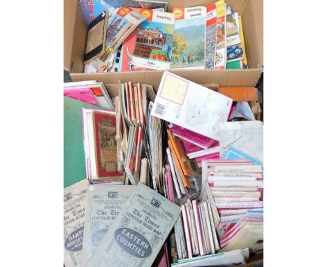
We found 109198 price guide item(s) matching your search
There are 109198 lots that match your search criteria. Subscribe now to get instant access to the full price guide service.
Click here to subscribe- List
- Grid
-
109198 item(s)/page


Lot 299
MAP OF AFRICA: 'To the Right Honourable Charles Earl of Peterborow, and Monmouth &c, this map of Africa, according to ye newest and most exact observations is most humbly dedicated by your lordship's most humble servant H Moll geographer..', London, Bowles, circa 1720: large copper engraved map with contemporary hand colour, inset cartouche illustrations of African cities and James Fort, approx 60 x 98cm, framed and glazed in window mount. (1)
Lot 300
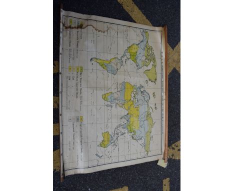
WORLD MAP: JOHNSTON (W & A K, publisher): 'W & A K Johnston's Effective Maps of the World - Climate': printed in Great Britain by W & A K Johnston & G W Bacon Ltd, (mid-20thc): large col. litho world map, rolled on two wooden staves with string hanger to upper, waterstain to left edge, some tears and chips to perimeters, approx 116 x 86cm. (1)


Lot 627
Abraham Ortelius after Gerard Mercator 1573 (?), ‘Scotia Regnum’, Hnd-cold. Engr. Map of the Kingdom of Scotland, With margins, bears signature & date, Plate size 15 ¾ x 16 ins (34.5 x 40.5 cms)(CONDITION REPORT: Profuse foxing)This is Hogarth framed and glazed. There is a reasonable amount of foxing and spotting on it around the edges and into the map although the main central map section doesn’t look too bad. See images on the website.


Lot 633
After Jacobus Hondius - 1630 - ‘Map of Cornwall’. Hand coloured engraving. 14 ¾ x 20 ins (37.5 x 51 cms). Hogarth framed and glazed.(CONDITION REPORT: Lacking margins, acidic discolouration, several tears)The Hogarth frame goes right to the edge of the item and the plate impression mark is not visible but there is a vertical central fold clearly visible.

Lot 635
PLEASE NOTE, MAP IS 19TH CENTURY FACSIMILIE A hand-coloured map engraving by S. Parker, 'A New Map of London - a Plan of the Citys of London, Westminster and Borough of Southwark with the new Additional Buildings, Anno, 1721'. (map size 50.5cm x 66.5cm). Glazed parcel-gilt frame (later). Provenance: The Map House, Beauchamp Place, London SW3.


Lot 2278
FADEN, William(1749 London - 1836) Landkarte des Heiligen Römischen Reiches Kolorierter Kupferstich. 1788. Framed & behind glass 71,5 x 84 cm. Detailreiche Postroutenkarte des Heiligen Römischen Reiches (deutscher Nation) und angrenzender Staaten am Vorabend der Französischen Revolution 1789, bezeichnet "A new Map of the German Empire and the Neighbouring States" Mehrfach gefaltet, etwas stockfleckig, Lichtschaden. Englischer Kupferstecher, Verleger, Kartograf und königlicher Geograf von König Georg III. ("geographer to the king").


Lot 475
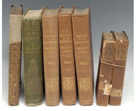
Antiquarian Books - Travel and Exploration - Egypt, Lane (Edward William), An Account of the Manners and Customs of the Modern Egyptians [...], first edition thus, two-volume set, London: Charles Knight and Co., 1836-1837, b/w plates and in-text illustrations, some music, contemporary cloth, 8vo, 19th century church and seminary stamps, 8vo, (2); Prescott (William H.), History of the Conquest of Mexico, three-volume set, second edition, London: Richard Bentley, 1844, titles printed in red and black, portrait frontispieces, maps and plates, contemporary cloth, 8vo, (3); The Continental Tourist; Belgium & Nassau, London: Parry & Co., [n.d., c. 1845], illustrated with 32 steel engravings and a fold-out map, contemporary green cloth (chipped spine), 8vo, (1); Wood (Charles W.), In the Valley of the Rhone, London: 1899, green cloth gilt, 8vo, (1), [7]
Lot 480
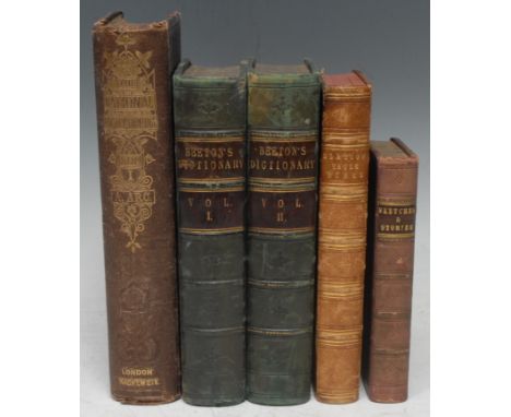
Antiquarian Books - Scotland - Hydraulic Engineering, Glasgow Water Works, a Victorian sammelband of four monographs &/or tracts: Gale (James M.), The Glasgow Water Works: Papers Read During the Session 1863-64 [...], Glasgow: Printed by Bell & Bain, 1864, 56pp, additional lithograph title-page, 1 fold-out map and 3 fold-out charts; Glasgow Loch Katrine Waterworks, Banquet to Mr. Bateman [...], Westminster: Vacher & Sons, 1860, 47pp; a further sequence of six connected papers from a periodical, lacking title-page and a contents, paginated from [121]-266 and illustrated with 52 full-page engineering plates; Gale (Mr. James, C.E.), On the Port-Glasgow Water Works [...], Glasgow: William Munro, 1868, 8pp and 4 fold-out plates, contemporary half-morocco over moiré boards, red-stained edges, 8vo, (1); Sinclair (Catherine), Sketches and Stories of Scotland and the Scotch, With Corrections and Additions, London: Simpkin, Marshall, and Co., [n.d. 1868], contemporary three-quarter calf, marbled edges, 12mo, (1); Beeton's Dictionary of Useful Information [...], two-volume set, London: S.O. Beeton, [1859], volume I with fold-out chromolithograph chart, further b/w fold-out charts and plates, in-text illustrations, contemporary green quarter-calf, marbled edges and endpapers, 8vo, (2); The National Encyclopædia [...], volume I only, London: [n.d.], 8vo, (1), [5]


Lot 365
AFTER JOHN OGILBY "The Continuation of the Extended Road from Buckingham to Bridgenorth, hand-coloured engraving, size including frame 57 cm x 64.5 cm, together with AFTER RICHARD BLOME "A general map of the county of Oxford", hand-coloured engraving, size including frame 64 cm x 56 cm, AFTER T KITCHIN "Oxfordshire", later hand-coloured engraving, together with AFTER W H TOMS "A chart showing the sea coast of England and Wales with the Fortifications, Royal Docks, Harbours, Sands and C", hand-coloured engraving, together with another mounted as one and another similar
![6 framed maps and 1 volume comprising Blaeu, Joan The Westerne Iles of Scotland. [Amsterdam, c. 1654], engraved map hand-colo](https://cdn.globalauctionplatform.com/7585ab16-9d02-401a-8ea4-ad4000cd8dfd/ad64fb63-87f8-434d-8bf4-ad4000fa5ed4/468x382.jpg)
Lot 21
6 framed maps and 1 volume comprising Blaeu, Joan The Westerne Iles of Scotland. [Amsterdam, c. 1654], engraved map hand-coloured in outline, 425 x 575mm, framed and glazed; Blaeu, Joan. Lewis and Harray. [Amsterdam, c. 1650]. hand-coloured engraved map, 415 x 555mm., slightly spotted, framed and glazed; Blaeu, Joan. The Yle of Skie. [Amsterdam, c. 1654], engraved map, faintly hand-coloured in outline, 455 x 570mm, framed and glazed; Blaeu, Joan. Some of the Smaller Westerne Yles lying betweene the Iyles of Mull and Skye. [Amsterdam, c. 1654], engraved map, hand-coloured in outline, 410 x 540mm, French text on verso, small note in faint ink just below the island of Egg, framed and glazed; Moll, H. A Map of the North West Part of the Western Islands. [1725], later hand-colouring, slight darkening above centre fold, framed and glazed; Mallet, A.M. Is. de Fero de Scheland. Orknay et Hebrides. [c. Paris, 1683], hand-coloured engraved map, 155 x 117mm, framed and glazed; Lewis, Samuel. Topographical Dictionary... supplementary volume: Map of Scotland. 1849, 4to, map on 6 folding sheets, original cloth (6 maps and 1 volume)
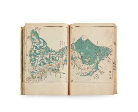
Lot 22
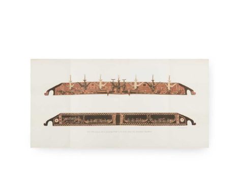
Aou Tōkei Kokugun Zenzu - Atlas of the Provinces of Japan Osaka & Edo, 1837. One volume only, 20 x 28cm, with 41 coloured woodblock maps (on 82 pages) (the full 2 volumes contain 75 maps), original yellow wrappers without label, some rubbing to covers, a little internal spotting, ownership inscription in red pencil to one text leaf, English place names and compass in manuscript to initial map
![[Various Authors] General View of Agriculture 12 volumes, 8vo, contemporary calf, most with maps and many hand-coloured, comp](https://cdn.globalauctionplatform.com/7585ab16-9d02-401a-8ea4-ad4000cd8dfd/9171c30f-f328-401d-a33c-ad4000fa8aa3/468x382.jpg)
Lot 237
[Various Authors] General View of Agriculture 12 volumes, 8vo, contemporary calf, most with maps and many hand-coloured, comprising: General View of Agriculture of the West Riding of Yorkshire, 1799, without map; General View of Agriculture of the County of Durham, 1810; General View of Agriculture of the Hebrides, or Western Isles of Scotland, 1811, with frontispiece; General View of Agriculture of Buckinghamshire, 1813; General View of Agriculture of the County of Bedford, 1813; General View of Agriculture of the County of Cambridge, 1813; General View of Agriculture of the County of Northampton, 1813; General View of Agriculture of Northumberland, 1813, folding map torn with slight loss to engraved area; General View of the Agriculture of Shropshire, 1813; General View of Agriculture of the County of Nottingham, 1813; General View of Agriculture of the County of Hereford, 1813; General View of Agriculture of the County of Huntingdon, 1813 (12)
![Braun, Georg & Franz Hogenberg Cairo, Egypt Cairus quae olim Babylon; Aegypti maxima urbs. [Cologne, after 1574], hand-co](https://cdn.globalauctionplatform.com/7585ab16-9d02-401a-8ea4-ad4000cd8dfd/a2d53b35-33d0-4521-88df-ad4000fa951f/468x382.jpg)
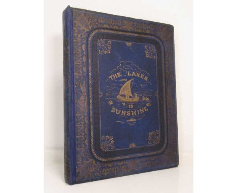
Lot 26
Cary, John Cary's New Map of England and Wales with part of Scotland London: J. Cary, 1794. 4to, hand-coloured single-page map of England and Wales, diagram to illustrate scale and 76 map sections, hand-coloured, contemporary tree calf, neatly rebacked [ESTC N48119]; Payn, James. The Lakes in Sunshine. Photographic and other Pictures of the Lake District. London: Simpkin, Marshall, 1868. 4to, 16 mounted albumen plates, text engravings, folding map in end pocket (not called for), original blue cloth, neatly rebacked retaining most of spine (2)
![Cary, John [New and Correct English Atlas] [London, 1787], 4to, engraved title and 46 engraved county maps hand-coloured in o](https://cdn.globalauctionplatform.com/7585ab16-9d02-401a-8ea4-ad4000cd8dfd/f6974ed8-2b72-4d20-a29f-ad4000fad3bc/468x382.jpg)
Lot 27
Cary, John [New and Correct English Atlas] [London, 1787], 4to, engraved title and 46 engraved county maps hand-coloured in outline, modern quarter calf retaining original boards, lacks the title-page and general map, 6pp. list of Subscribers, a few maps with very small marginal stain, slightly rubbed at foot of spine
Lot 273
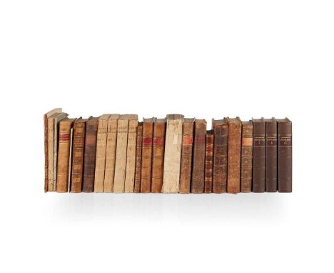
Agriculture in Scotland 21 volumes, comprising Wight, Andrew. Present State of Husbandry in Scotland. Edinburgh: W. Strahan [&c.], 1778-1784, 4 volumes in 6, 8vo, volumes 1-2 contemporary calf gilt, volumes 3-6 original boards, uncut, those in boards lightly rubbed; Maxwell, Robert. Select transactions of the Honourable The Society of Improvers in the Knowledge of Agriculture in Scotland. Edinburgh: Paton &c., 1743. First edition, 8vo, folding plate, signed by Maxwell beneath authenticity statement on title page verso, contemporary calf, gilt; Robertson, James. General View of the Agriculture in the County of Perth. Perth, 1799. First edition, 8vo, folding map, original wrappers, uncut; Young, David. Agriculture the Primary Interest of Great Britain. Edinburgh, 1788. 8vo, contemporary quarter calf, dampstained at beginning, rubbed; [Lindsay, Patrick] The Interest of Scotland Considered... Agriculture. Edinburgh, 1733, 8vo, contemporary calf, neatly rebacked, spine gilt; [Linen Manufacture] A Collection of the Acts in Parliament... relating to the Linen Manufacture. Edinburgh, 1751, 8vo, contemporary calf, lacks front free endpaper; Young, David. National Improvements upon Agriculture. Edinburgh, 1785. 8vo, Geo Dempster's copy, contemporary calf gilt, red morocco label; Mackenzie, Henry. Prize Essays and Transactions of the Highland Society of Scotland. Edinburgh, 1799, volume 1 only, 8vo, contemporary calf gilt; Naismith, John. General View of the Agriculture of the County of Clydesdale. Glasgow, 1798, 8vo, folding map, original boards, uncut; Anderson, James. Essays relating to Agriculture and Rural Affairs. Edinburgh, 1784-96, Third edition, 3 volumes, 8vo, modern quarter calf, morocco labels; Sinclair, Sir John. Address to the Society for the Improvement of British Wool, constituted at Edinburgh. Edinburgh, 1791. 8vo, original wrappers, slightly rubbed; Robinson, John. Letter to Sir John Sinclair, Bart. London, 1794. 4to, disbound; Douglas, Robert. General View of the Agriculture in the Counties of Roxburgh and Selkirk. Edinburgh, 1787, 8vo, folding maps, 1 folding plate, contemporary half calf, joints split; Kames, Lord. The Gentleman Farmer. Edinburgh, 1798, 8vo, engraved frontispiece and 3 plates, title slightly torn and spotted, contemporary calf, rubbed; [Clerk-Maxwell, George] Observations on the Method of growing of Wool in Scotland. Edinburgh, 1756, 8vo, marbled wrappers, some spotting; and 2 odd vol. on agriculture (21)
![[Chambers, John] A General History of the County of Norfolk Norwich: John Stacy, 1829. 2 volumes, 8vo, folding map hand-colou](https://cdn.globalauctionplatform.com/7585ab16-9d02-401a-8ea4-ad4000cd8dfd/c02e7537-29bd-4923-8114-ad4000fb3cd4/468x382.jpg)

Lot 333
Beveridge, Erskine North Uist, its Archaeology and Topography Edinburgh: William Brown, 1911. 4to, number 16 of 315 copies, signed and inscribed from Erskine Beveridge to his sister, frontispiece map, 149 plates and a folding map in the rear pocket, original black quarter morocco over green gilt boards, with several items of ephemera included
Lot 336
Brenchley, Julius S. Jottings during the Cruise of H.M.S. Curaçoa among the South Sea Islands in London: Longmans, Green & Co., 1873. First edition, "Presented by the Publishers" blindstamp to title margin, 8vo, folding double-page chromolithograph frontispiece, 50 lithograph plates (all but 9 in colour), 1 chromolithograph & 8 wood-engraved plates & folding map with hand-colouring, original green pictorial cloth, small gilt stamp of C.L.A. on upper cover, head of spine worn, joints repaired

Lot 344
Garnett, T. Observations on a Tour through the Highlands and Part of the Western Isles of Scotland London: T. Cadell, Junior, & W. Davies, 1800. 2 volumes, 4to, folding map, 52 plates, contemporary half calf neatly rebacked retaining contemporary spines, a little browning, a couple of small closed tears to plates; Hall, Rev. James Travels in Scotland by an Unusual Route. London: J. Johnson, 1807. 2 volumes, 8vo, frontispiece, map, 28 plates, contemporary half calf neatly rebacked; Beith, Alex A Highland Tour. Edinburgh: Adam and Charles Black, 1874. 8vo, original blue cloth gilt; Campbell, M.S. The Flora of Uig (Lewis). Arbroath: T. Buncle & Co. Ltd., 1945. 8vo, blue cloth; Knight, G.A. Frank A Visit to the Outer Hebrides in Search of Mollusca, 1902. 8vo, original wrappers; MacRury, Ewen A Hebridean Parish. Inverness: Northern Chronicle Office, 1950. 8vo, blue cloth gilt (7)
Lot 347
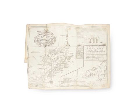
Heath, Robert A Natural and Historical Account of the Islands of Scilly London: R. Manby and H.S. Cox, 1750. 8vo, folding map, folding table, lacking the advertisement leaf and portrait, contemporary calf, upper cover detached, lower cover lacking, a little internal dampstaining and light spotting [ESTC T132199]
Lot 348
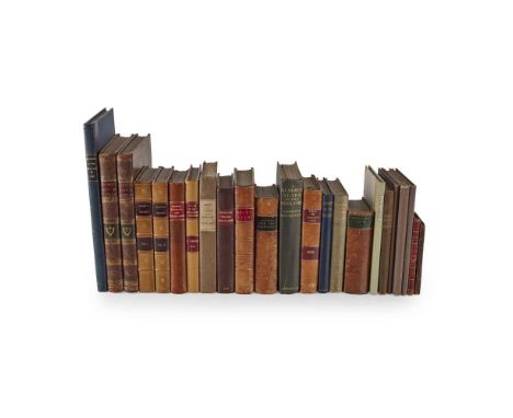
Highland Tours 23 volumes, comprising Garnett, T. Observations on a Tour through the Highlands and Part of the Western Isles of Scotland. London: T. Cadell, Junior, & W. Davies, 1800. 2 volumes, 4to, hand-coloured folding map, 52 hand-coloured aquatints, contemporary tree calf, some toning and offsetting; [Larkin, Philip] Sketch of a Tour in the Highlands of Scotland. London: Baldwin, Cradock, and Joy, 1819. 8vo, original boards; [Macky, John] A Journey through Scotland. London: J. Pemberton, 1732. Second edition, 8vo, modern quarter calf; Johnson, James The Recess, or Autumnal Relaxation in the Highlands and Lowlands... London: Longman, Rees, Orme, Brown, & Co., 1834. 8vo, modern quarter calf, a little dampstaining to title-page; Mawman, J. An Excursion to the Highlands of Scotland and the English Lakes. London: J. Mawman, 1805. 8vo, folding map neatly repaired with tape, plates; [Simond, Louis] Journal of a Tour and Residence in Great Britain... Edinburgh: George Ramsay and Company, 1815. 2 volumes, 8vo, 21 tinted plates, contemporary calf neatly rebacked; [Grant, Anne] Letters from the Mountains. London: Longman, et al., 1806. 8vo, 3 volumes bound as one, contemporary half calf; Knox, John A Tour through the Highlands of Scotland and the Hebride Isles... London: J. Walter et al., 1787. 8vo, contemporary half calf; Bede, Cuthbert A Tour in Tartan-Land. London: Richard Bentley, 1863. 8vo, contemporary half calf rebacked with a later spine; Nicolson, Alexander Report on the State of Education in the Hebrides. Edinburgh: Thomas Constable, 1866. 4to, modern blue quarter morocco; MacKenzie, Osgood Hanbury A Hundred Years in the Highlands. London: Edward Arnold, 1921. 8vo, original green cloth gilt, neat gift inscription to free-endpaper; and 10 others (23)
-
109198 item(s)/page