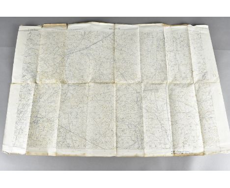
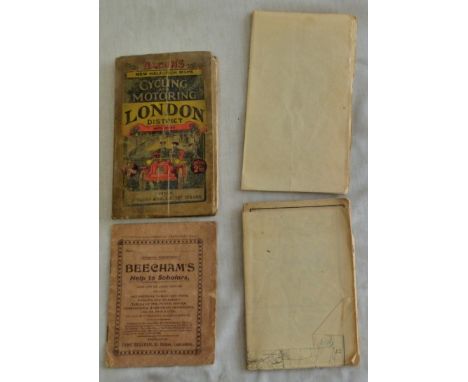
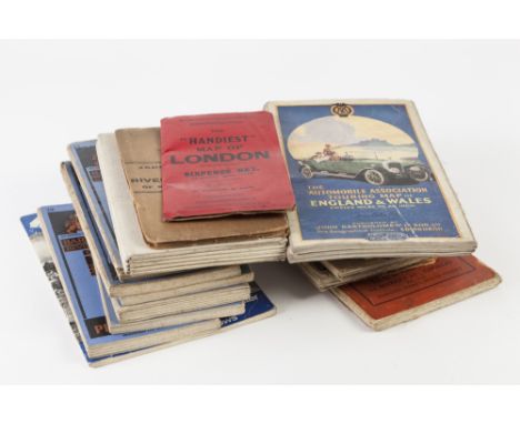
We found 109182 price guide item(s) matching your search
There are 109182 lots that match your search criteria. Subscribe now to get instant access to the full price guide service.
Click here to subscribe- List
- Grid
-
109182 item(s)/page
A brown leather satchel, together with a cigarette card album, a 1944 Michelin map of Germany and with map of Devon verso, an Übersichtskarte von Nordost-Afrika 1:5,000,000, with pencil inscriptions, together with various postcards including humorous postcards, framed and glazed Victorian photographs and a Victorian black and white photograph album, white metal car mascot in the form of an eagle, tuning fork, scales, various other metal ware and ephemera, etc
Malta, Government of Malta, First Issue, 5/-, 13 August 1914, series aa no. 010498, printed in black over green map of the island, with Royal arms at top and embossed seal at centre (Pick 2), folded and has been backed with cloth, a little frail at upper right corner but generally fine, rare
Cinderella: 1907 Lady Minto's Fete 'set' of three commemorative labels comprising 4a red depicting Lady Minto, 4a blue depicting The Earl of Minto (Viceroy of India) and 1r black, grey and red depicting a map of India, a few faults but uncommon, these accompanied by ppcs. depicting King Edward VII, Queen Alexandria, The Earl of Minto and several native Indian rulers, also two postcards, one franked QV ¼ on ½a blue-green, the other by KEVII 3p grey, each tied by 'MINTO FETE/CALCUTTA' red cross special cancels, former also with Howrah arrival cds alongside for 2 FE 07
A mid 18th century plan, coloured engravings, for the Langborn Ward and Candlewick Ward, London, with their divisions into Parishes according to a new survey inscribed to Sir Joseph Hankey and to Sir Charles Asgil, Knight, later framed and an 19th century map of the Parish of St Martin's in the Fields, framed
1946-49 'Thick Map' ½d black and green, 1d black and violet, 2d black and carmine, 3d black and blue and 6d black and orange, each showing "Missing 'I' in 'Is' " variety (SG G1b/G4b, G6b), the 1d and 2d in horizontal pairs with normal, all fine lightly used (3d and 6d on pieces) with variety clearly visible, a scarce assembly and each with RPS cert issued between 2000 and 2015
Maps: c1780 Map of the Falkland Islands, South Sandwich Islands and South Georgia, entitled (in French) "ISLES MAIDENLAND/DES HAWKINS/ET LE DETROIT/DE FAKLAND/Ces Isles sont nommees/MALOUINES/PAR LES FRANCOIS", taken from Pelleret Atlas published in Geneva, folded down centre and a few light tones but fine for this
Atkinson (Thomas Witlam). Travels in the Regions of the Upper and Lower Amoor and the Russian Acquisitions on the Confines of India and China. With Adventures among the Mountain Kirghis; and the Manjours, Manyargs, Toungouz, Touzemtz, Goldi, and Gelyaks: The Hunting and Pastoral Tribes, 1st edition, 1860, colour lithograph frontispiece, folding map at end, wood engraved illustrations, publisher's catalogue at end, some light spotting, endpapers renewed, small booklabel, original blindstamped cloth, rebacked with original spine relaid, faded, 8vo, together with Travels in Russia, and a Residence at St. Petersburg and Odessa, in the Years 1827-1829; Intended to give some account of Russia as it is, and not as it is Represented to be, by Edward Morton, 1st edition, 1830, 16 pp. publisher's catalogue at front, library stamps, original boards with later calf spine, crease marks to covers, 8vo, with three others: S.G.W. Benjamin's Persia and the Persians, 1887, D. Mackenzie Wallace's Russia, 2 volumes, 4th edition 1877 (ex-libris) and John Bell's Travels from St. Petersburgh in Russia to Various Parts of Asia, volume I only (of 2), Edinburgh, 1788 (6)
Hobson (William Colling). This Map of Yorkshire is most respectfully dedicated to the Nobility, Clergy, Gentry, Landowners and Manufacturers of the County, pub. William Colling Hobson, York, 1st ed., July 1843, fine engraved map with original outline colouring, sectionalised and laid on linen, on two sheets, calligraphic title, compass rose and table of explanation, each sheet approximately 1255 x 760 mm, original cloth with gilt decorated upper board and spine, steel clasp, bumped to extremities (1)
Hunter (Rev. Joseph). South Yorkshire. The History and Topography of the Deanery of Doncaster in the Diocese and County of York, 2 volumes, published J.B.Nichols and Son, 1828 - 1831, engraved portrait frontispiece with some spotting, list of subscribers, two double page engraved maps with contemporary hand colouring, one uncoloured engraved town plan of Doncaster and fifteen engraved plates, some spotting, top edge gilt, joints strengthened, later quarter morocco gilt, spine a little worn and frayed, folio, together with Miller (Edward), The History and Antiquities of Doncaster and its Vicinity, published Doncaster, [1804], folding engraved map frontispiece (laid on linen), dedication, list of subscribers and errata, eleven (complete) uncoloured engraved plates, some spotting and staining throughout, later endpapers, late 19th century half cloth with printed paper label to spine, worn at extremities, 4to, with Whitaker (Thomas Dunham), The History and Antiquities of the Deanery of Craven in the County of York..., edited by A. W. Morant, 3rd edition, published Joseph Dodgson, Leeds and Cassell Petter & Galpin, London, 1878, additional decorative lithographic title and printed half title, portrait frontispiece, numerous plates, maps and folding tables, marbled endpapers, top edge gilt, contemporary blind and gilt stamped morocco, heavily worn, folio (4)
Overton (Philip & Bowles Thomas, publishers), A new map of the county of York laid down from an actual survey wherein is included not only all Towns, Villages, Churches, Roads, Rivers, Mountains, Rapes, Hundreds &c. but also all Gentlemens Houses & whatever else is remarkable therin, 1728, large engraved map with contemporary hand colouring, large decorative cartouche and table of explanation, old folds, occasional strengthening on verso, 565 x 945 mm A close copy of the John Warburton large scale map of Yorkshire. Sold separately but the folds on this example suggest that the map was bound in Jean Covens & Corneille Mortier's 'Atlas Nouveau contenant Toutes les Parties du Monde...,'. A scarce map of Yorkshire, with the last copy appearing in auction in 2005. (1)
Saxton (Christopher & Webb William), [Yorkshire, circa 1642], untitled hand coloured map engraved by Augustus Ryther, on two conjoined sheets, inset town plan of York (replacing the coat of arms on the 1579 edition) and a vignette panorama of Hull (replacing the title cartouche of the 1579 edition), trimmed to neatline with margins replaced, small repair to upper right corner,one horizontal fold as well as the vertical, the right hand sheet appears a little darker (possibly dust soiling) than the left, backed with archival tissue, 530 x 740 mm Published in 'The Maps of all the Shires of England and Wales'. Scarce. (1)
-
109182 item(s)/page