We found 109198 price guide item(s) matching your search
There are 109198 lots that match your search criteria. Subscribe now to get instant access to the full price guide service.
Click here to subscribe- List
- Grid
-
109198 item(s)/page


Lot 295
DAVID L. KENINGALE (LEPIDOPTERIST) WILDLIFE LICENCE TAXIDERMY SALES (Butterflies) Ref: CL07/2015/0003 IN EXCESS OF 100 BUTTERFLIES; ex. France, to include Swallowtails, mixed Fritillaries, Map Butterfly, Nettle Tree butterflies, various Blues etc. Pair of Short-tailed Blue, pair of large Copper, L.dispar rutilus (Italian race) ex. coll. M. Harvey. Specimens for the most part in fine condition, full data. Ex. coll. D.L. Keningale. Well presented in large wooden entomological store case with br ass fittings, internal lift-out camphor cell, labels ex. Hope Dept. Oxford


Lot 1
Africa.- Du Chaillu (Paul B.) A Journey to Ashango-Land, vignette title, folding map at end, ink signature to front pastedown, original cloth, rubbed, bumping and chipping to spine extremities, [Hosken p.63], 1867 § Speke (John Hanning) Journal of the Discovery of the Source of the Nile, illustrations, 1 map only (of 2), lacking folding map, contemporary half calf, defective spine, rubbed, [Hosken p.188], 1863, first editions, frontispieces, plates, spotting, cracked hinges; 8vo (2)
Lot 16
Holy Land.- Egerton (Lady Francis) Journal of a Tour in the Holy Land, first edition, 4 tinted lithograph plates, illustrations, occasional faint spotting, original cloth, slight splitting to spine extremities, [Abbey Travel, 384], For Private Circulation only, 1841 § Bartlett (W. H.) Jerusalem Revisited, engraved frontispiece, engraved additional title and 20 plates (1 folding), illustrations, occasional spotting, publisher's advertisements at end, cracked upper hinge, original cloth, gilt, slight bumping to corners and extremities, 1855 § Tristram (H. B.) The Topography of the Holy Land, folding colour map frontispiece, illustrations, occasional faint spotting, contemporary half calf, n.d., 8vo (3)
Lot 22
New Guinea.- D'Albertis (L. M.) New Guinea: What I Did and What I Saw, 2 vol., first edition, portrait frontispiece, plates (4 chromolithographed) and illustrations, colour folding map, trimmed and loosely inserted, one or two plates misbound, 2 sections loose (pp.113-128, vol. 1 & pp.241-256, vol. 2), cracked hinges, original pictorial boards, rubbed, slight bumping to corners and extremities, 1880 § Pratt (A. E.) Two Years Among the New Guinea Cannibals, first edition, frontispiece, folding map (large tear), full-page illustrations, occasional spotting, original cloth, a little rubbed, slight bumping to extremities, 1906; and 2 others, New Guinea, 8vo (5)
Lot 25
World.- Cumming (C. F. Gordon) Fire Fountains. The Kingdom of Hawaii, 2 vol., first edition, frontispieces, 6 plates (1 loose), 2 maps (1 folding), original decorative cloth, a little rubbed, bumping to spine extremities, 1883 § Moseley (H. N.) Notes by a Naturalist on the "Challenger", first edition, colour frontispiece, plate and folding map at end, spotting, original cloth, rubbed and worn, slight bumping to extremities, 1879 § Lankester (E. Ray) Extinct Animals, portrait frontispiece, illustrations, cracked hinges, original cloth, slight bumping to extremities, 1905; and 3 others, similar, 8vo (7)
Lot 30
Ireland.- Leland (Thomas) The History of Ireland, 3 vol., third edition, half-titles, occasional spotting, bookplate, contemporary calf, cracked joints, rubbed and worn, Dublin, R. Marchbank for R. Moncrieffe, 1774 § Doherty (William James) Innis-Owen and Tirconnell, first edition, presentation copy inscribed and signed by the author, original cloth, slight bumping to corners, lightly browned spine, Dublin, 1891 § The Treble Almakack for the Year 1827, engraved frontispiece, lacking folding map, spotting, occasional marginal damp-staining and soiling, ex-Custom House Derry with occasional stamps throughout, ink inscription to front pastedown, contemporary calf, rubbed and worn, split to spine head, Dublin, n.d.; and others, Ireland, v.s. (35)
Lot 31
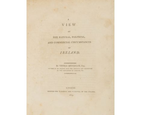
Ireland.- Newenham (Thomas) A View of The Natural, Political and Commercial Circumstances of Ireland, first edition, folding engraved map of Ireland (hand-coloured in outline), half-title, slightly foxed and browned, very small tear in upper margin of title, bookplate on front pastedown, later endpapers, contemporary half calf, gilt spine, 4to, T. Cadell and W. Davies, 1809.
Lot 32
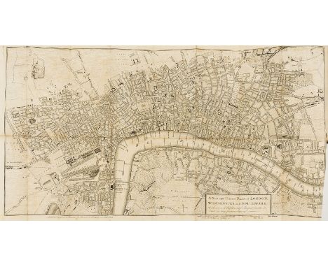
London.- London and its Environs Described, 6 vol., first edition, engraved frontispiece and 78 plates and plans only (of 79), 3 folding (1 with tear), lacking folding map of London and environs, 4 leaves and 1 plate detached (vol. 2), occasional spotting, damp-staining, contemporary calf, rebacked, upper cover detached (vol. 3), lower cover detached (vol. 6), broken binding (vol. 2), cracked hinges, very rubbed and worn, bumping to corners and extremities, 8vo, for R. and J. Dodsley, 1761.

Lot 42
Geology.- France.- Carez (L.) La Géologie des Pyrénées Françaises, 6 vol., plates and illustrations, Paris, 1903-09 § Dufény (Pierre Armand) and Jean Baptiste Élie de Beaumont, Explication de la Carte Géologique de la France, 2 vol., illustrations, lacking folding map, Paris, 1841-48, ex-Geological Society Library with usual labels and stamps, modern cloth, a little rubbed; and 3 others, also publications from Mémoires pour Servir à l'explication de la Carte Géologique Détaillée de la France, 4to (11)
Lot 8
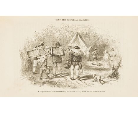
Australia.- New Zealand.- Sherer (John) The Gold-Finder of Australia, first edition, additional vignette title (small hole), plates, spotting, original cloth, rubbed, bumping to corners and extremities, [1853] § Butler (Samuel) A First Year in Canterbury Settlement, first edition, folding hand-coloured engraved map, cracked hinges, original cloth, rubbed, 1863 § He Maramataka; ara, He Pukapuka ... [Church Almanac for 1850], damp-stained and soiled throughout, original paper wrappers, lower cover defective, No te kareti, 1850 § Goodridge (Charles Medyett) Narrative of a Voyage to the South Seas, and the Shipwreck of the Princess of Wales Cutter ..., engraved portrait frontispiece and 2 plates, subscribers list, occasional faint spotting, original cloth, rebacked with original spine laid down, bumping to corners and extremities, Exeter, 1843; and 5 others, Australia or New Zealand, 8vo (9).
Lot 88
Bindings.- Franklin (Benjamin) The Complete Works, in Philosophy, Politics and Morals, of the Late ..., 3 vol., engraved portrait frontispiece, additional engraved titles, ink signatures to vol. 2 and 3, 12 engraved plates (8 folding, 1 double-page), 1 engraved folding map, 1 folding table, occasional faint spotting, occasional marginal damp-staining, bookplates, contemporary half-calf, rebacked, a little rubbed, 1806 § Josephus (Flavius) The Works of ..., 6 vol., translated by William Whiston, ink inscription to front free endpaper (vol. 1), spotting, contemporary half calf, faded spines, slight bumping to corners and extremities, Edinburgh, 1815; and others, 8vo (sm. qty)


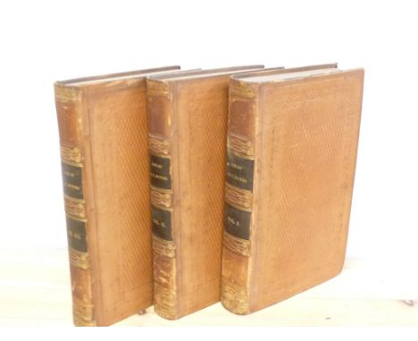
Lot 294
GLEIG G. R. The Life of Major General Sir Thomas Munro. 3 vols. Eng. port. frontis & fldg. eng. map of India, hand col. in outline (some tears). Diced calf, internal dust mkg. etc. 1830. Condition Report. As images, some browning/foxing but cleans up in text.Map has some tears. Slight splitting to inside Vol 1 but all gen o.k.


Lot 134
BAINES EDWARD. The History of the County Palatine of Lancaster. 4 vols. 121 engs. & 3 maps incl. large col. map of Manchester & District, these bound in at the end of the vols. Large paper quarto. Rebound half calf, a nice set. With inscription "This set was Edward Baines' own copy purchased from the library of Doctor Baines of Whitby". 1831-1835.


-
109198 item(s)/page