We found 109198 price guide item(s) matching your search
There are 109198 lots that match your search criteria. Subscribe now to get instant access to the full price guide service.
Click here to subscribe- List
- Grid
-
109198 item(s)/page


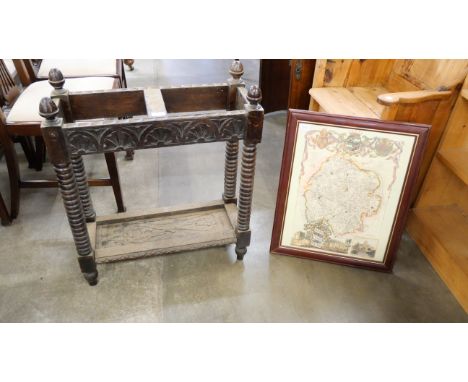

Lot 7219
"MAP OF THE EMPIRE OF GERMANY.. by "L. Delarochelle... London 1794" - teilkolorierte, 4 seitige Kupferstichkarte des 18. Jhdt., hinter Glas in massivem Mahagonirahmen mit Messing - Eckrosetten gerahmt. Platte ca. 51,5 x 119,5 cm. Rahmen beigegeben, max. Außenmaß ca. 60 x 125 cm. Geringe Erhaltungsmängel.


Lot 258
Collection of Engraved Maps of CumbriaIncluding: Smith (C.), A New Map of the County of Westmoreland: Divided into Wards, 1801, hand-coloured engraved map; Duncan (J.), Map of the County of Westmoreland: Divided into Wards, Containing the District Divisions and other Local Arrangements effected by the Reform Bill, no date, hand-coloured engraved map; Cary (J.), Westmoreland, outline hand-colouring, engraved map; and others.Various dimensions, all unframed, mostly 19th century.

Lot 265
Lewis (Samuel)Atlas to the Topographical Dictionary of England, Comprising A General Map of London, a General Map of England, a Plan of England, and Maps of the Counties of..., London: S. Lewis and Co., 1845, engraved maps as called for, including some folding, tears to some, including large repaired tear to map of England and Wales, some foxing, contemporary blind-stamped cloth.
Lot 269
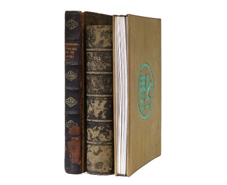
McLeod (John) Narrative of a Voyage, in His Majesty's Late Ship Alceste to The Yellow Sea, along the Coast of Corea .... to the Island of Lewchew; with an account of her Shipwreck in the Straits of Gaspar. John Murray, 1817, first edition, [8], 288 pages (the first leaf a blank so may lack a half title), portrait frontis, four colour plates, errata slip, ornate ownership inscription to blank leaf, bookseller's slip causing offsetting to pages 154 and 155, [one reference source mentions a folded map but no other sources mention one], worn calf binding (front board detached); Anon., The Twenty four cases of Filial Piety, no date, English and Chinese text, colour illustrations, concertina pages, original boards; Burton (John Hill), The Book-Hunter, etc., William Blackwood & Sons, 1862, burgundy crushed morocco binding gilt by Bradstreet's, top edge gilt, housed in a book-form case.(3)

Lot 271
NorfolkA Good Collection of Books on Norfolk, including: A Compleat History of Norfolk..., In the Savoy: Printed by E. and R. Butt; and Sold by T. Cox, at the Lamb under the Royal Exchange, Cornhill, 1730, with an engraved map of Norfolk by Robert Morden tipped-in before the title-page, full calf binding (re-backed); Knowlitte (John, (Arthur H Patterson)), Through Broadland in a Breydon Punt, Norwich: H. J. Vince, 1920, signed "John Knowlittle" to the dedication, original green cloth, gilt; Browne (P.), the History of Norwich, from the Earliest Records to the Present Time., Norwich: Printed by Bacon, Kinnebrook, and Co. and Sold by and for R. Chipperfield, 1814, frontis, plates, later dark green cloth; Cooke (George Alexander), Topographical and Statistical Description of Norfolk., London: Printed for C. Cook, no date, folding engraved map of Norfolk, recent full leather binding; with 33 others and a small framed picture. (38)

Lot 273
Photographs Assorted Photographs and Artwork, including: three Ottomar Anschütz photographs of a man training a horse, two dated 1884, one 1883, one blind-stamped "Spooner & Co., 379 Strand. W. C,"; three photographs mounted on paper of the River Wharfe, pencil notes to verso attibute them to Fenton (Roger) and printed by Frith (F.), circa 1860/70; a monochrome photograph of a river scene; further photographs mounted on paper/card, including Alpine landscapes, Scottish landscpapes, cathedrals etc.; with pencil sketches; watercolours; a Robert Morden map of Leicestershire; various sizes. (qty)

Lot 277
Saxton (Christopher) and Speed (John).Norfolk, A Countie Florishing & Populous Described and Devided with the Armes of such noble families as have borne the titles therof.J[ohn] S[udbury] and G[eorge] H[umble], no date [early seventeenth century], engraved by R. Elstrack, hand-coloured engraved map with inset battlescene, framed and glazed.
![Speed (John)York Shire. Sudbury and Humble, 1610 [1611], hand-coloured engraved map, plate mark 385mm x 512mm, English text t](https://cdn.globalauctionplatform.com/9469cd87-0ab5-4cbf-a3fe-b0d500a7a035/f7c6527d-8117-4ee1-9c32-b0f300ee68e7/468x382.jpg)
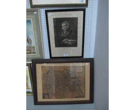
Lot 278
Speed (John)York Shire. Sudbury and Humble, 1610 [1611], hand-coloured engraved map, plate mark 385mm x 512mm, English text to reverse, pages 77/78, signature Vv, wear to central fold, mounted, framed, glazed front and rear. [Whitaker 20];Wear to central fold. Several small tears to margins, particularly upper margin. Two small stains to upper right and left corners (see images). Not examined out of frame.


Lot 200
Africa.- Pearce (Major F. B.) Zanzibar: the Island Metropolis of Eastern Africa, first edition, frontispiece, plates, one with blind-stamp at foot (not affecting image), one folding map at end, short tear to gutter, new endpapers, original cloth, expert repairs to spine extremities, slight bumping to corners, 8vo, 1920.


Lot 21
Strahlenberg (Philip Johan von) and others. Large collection of over 50 maps of Sweden, Scandinavia, and other maps of Europe, from Värnanäs Manor, Sweden, including 'Charta ofver Stockholms och Upsala Hofdingedomen...', Homann's 'Insulae Danicae in Mari Balthico Sitae', a slightly compromised impression of Homann's 'Plan der Belagerung von Fridrichshall', Strahlenberg's scarce map of Russia, 'Nova Descriptio Geographica Tattariae Magnae . . . Imperii Russici', and many other maps of Sweden and its environs, including several plans of European cities, including Geneva, Lille, and 'Plan Routier de la Ville et Faubourgs de Paris 1784', and others, engravings, some hand-colouring, various sizes, largest 740 x 1050 mm (29 1/8 x 41 1/4 in), handling creases, surface dirt and browning, some nicks and losses, all unframed, loose, in oversized portfolio, [17th to 19th century] (c. 50)Provenance:Värnanäs Manor, Sweden; then by descent.

Lot 213
Britain.- Roscoe (Thomas) Wanderings and Excursions in North Wales, ?first edition, previous owner's ink inscription, original cloth, rebacked retaining original backstrip, slight bumping to corners and extremities, [1836]; Wanderings and Excursions in South Wales, broken upper hinge, contemporary half-morocco, gilt, a little rubbed, slight bumping to corners and extremities, [1837], half-titles, additional engraved titles, engraved plates, tissue-guards, one folding map, scattered faint spotting, bookplate, § Hall (Mr. & Mrs. S. C.) The Book of South Wales, the Wye, and the Coast, half-title, vignette title, engraved map, illustrations, advertisements at end, bookplate, original cloth, rebacked retaining original backstrip, recornered, a little rubbed, 1861; and others on Britain, 8vo (14)

Lot 214
Hampshire & Isle of Wight.- White (William) History, Gazetteer, and Directory of Hampshire and the Isle of Wight, lacks folding lithographed county map, contemporary blind-stamped cloth, re-cased, gilt spine, slightly dulled, Sheffield, 1859 § Whitehead (J.L.) The Climate of the Undercliff, Isle of Wight, original cloth, 1881 § Fuller (Hester Thackeray) Three Freshwater Friends: Tennyson, Watts and Mrs. Cameron, original printed wrappers, bound in modern cloth, 1933; and 5 others, Isle of Wight, 8vo, v.d. (8).
Lot 215
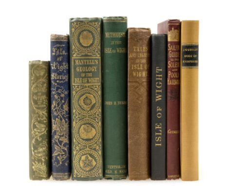
Hampshire & Isle of Wight.- Journey-Book (The) of England. Hampshire including the Isle of Wight, folding map and illustrations, tears repaired with paper tape, browned, new endpapers, modern cloth, 1841 § Elder (Abraham) Tales and Legends of the Isle of Wight, second edition, plates by Robert Cruikshank, 1843 § Dyson (John B.) Methodism in the Isle of Wight, frontispiece map, Ventnor, 1865 § Black's Guide to the Isle of Wight, twelfth edition, frontispiece, 4 plates and a folding map, half-title, advertisements at end, ink signature on title and preliminary ff., 1891, all but the first original cloth; and 4 others, Isle of Wight, 8vo (8).

Lot 217
London.- Lloyd (John H.) The History, Topography, and Antiquities of Highgate, one of a few large paper copies for presentation (unnumbered), portrait frontispiece of Coleridge, map, illustrations, gilt-stamped red calf label "Presented by the Author to R.Hammond, Esq." on front pastedown, old ink signature on front free endpaper, original pictorial cloth with Highgate Archway in gilt on upper cover, g.e., rebacked and cornered in morocco, rubbed, Highgate, printed by Subscription on behalf of the Library Fund, 1888 § Price (J.E.) A Descriptive Account of the Guildhall of the City of London, plates & plans including facsimiles and 3 double-page chromolithographs, some folding, blind-stamp to title, original pictorial cloth, gilt, rubbed, hinges a little worn, 1886; and another, 4to (3)
Lot 23
World.- Breton de la Martinière (Jean-Baptiste) China: Its Costume, Arts, Manufactures, etc.,..., 4 vol., first edition in English, 80 engraved plates, some light off-setting, original boards and paper labels to spines, a little chipped and worn, uncut, [Abbey, Travel 535], J.J. Stockdale, 1812 § Tombe (Charles Francois) Voyage aux Indes Orientales, 2 vol. only (of 3; lacking atlas volume), first edition, half-titles, a little browning and spotting, contemporary half calf, spines gilt, board corners a little stained, Paris, Arthus Bertrand, 1810 § Perouse (J.F.G. de la) Relation abregée du voyage de La Perouse, engraved folding map and plates, near contemporary calf-backed boards, spine gilt, Leipzig, 1799; and 10 others world, v.s. (17)
Lot 195
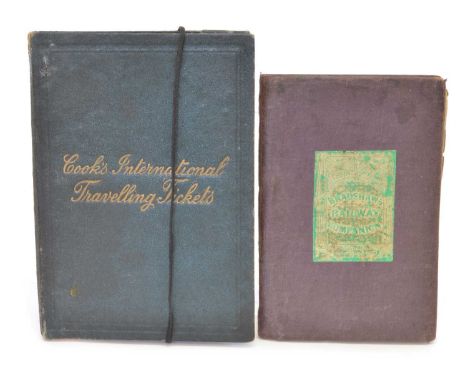
Bradshaw's Railway Companion, Manchester, 1840 Bradshaw (George) Bradshaw (George) Bradshaw's Railway Companion, Manchester, 1840, folding glazed map of London, six partially hand-coloured double-page maps, four double-page city plans of Birmingham, Liverpool, Manchester and Leeds, folding plate of elevations of railways plus a folding map of England & Wales. Also included is a 'Cook's International Travelling Tickets' ticket wallet with a Kur-Karte for Locarno and return ticket from London to Basel '(Bale)

Lot 50
Blaeu, Joan. Map of Cheshire. Cheshire. Blaeu (Joan), Cestria Comitatus Palatinus, 1662, ornamental title cartouche and armorials, hand-coloured engraved map.50 x 59.5cm (framed 55 x 64.5cm)The map is in good, original condition. The paper has browned universally across the sheet and there are some minor spots of foxing. There is some pencil graffiti in the lower right-hand corner of the sheet and some other minor surface marks. The map is ornately reframed and glazed. The frame has some knocks and losses.


Lot 318
A George III oval silk needlework map of the world. The central hemisphere hung from ribbon drapes flanked by two hairwork figures, with carnations, roses and forget me nots embroidered below, 38X30.5cm, in a gilt gesso frame.The needlework is behind glass and has not been examined out of the frame.There is no apparent damage or repair, there is a rectangular 'shadow' visible towards the bottom of the globe, and some 'time' staining towards the top.The frame is good, with slight rubbing and a couple of cracks visible in the gesso. There is glue visible on the top edge of the glass, where it meets the frame, the purpose of this is unclear.


Lot 524
COLLECTION OF BOOKS AND OS MAPS, including The Ever Green Being a Collection of Scot's Poems, two volumes pub.1724, both rebound, also Lectures on the Mountains or, The Highlands and Highlanders as they were and as they are, pub.1860 first series and second series (2 vols), along with various Bartholomew's OS maps and a War Office edition map of the Outer Hebrides


Lot 166
Northern Britain Distance Tables etc. Collection of thirteen printed items, mostly 18th century, with distance tables (4) for Cumberland and Westmorland each with a small early version alongside hand-coloured miniature maps, then larger armorial versions again hand-coloured; itineraries (6, of which 4 framed) incl. Cumbria, Scottish, etc.; Yorkshire County map of 1724 'with the Post Roads &c.' by Herman Moll (framed); and two matching town plans c.1850 for Bradford and York (framed). An excellent group in most attractive condition and with matching traditional frames.

Lot 200
A Further Brown Album Containing Approx. 250 postcards, a mix of subject cards and foreign topography with British Topography also. Subjects include North American Wild Indians, a good selection of Advertisements; Mermaid Milk, O. O. Whisky from Stromness (Orkney Isles), Erasmic Soap, South Eastern Railway & Chatham Railway Map Card, Napier Six Cylinder Motor Carriages. 14 New Burlington Street, London, The National Telephone Company, G. P. Government Tea, International Horse Show, Olympia, London 1908 and 1912, Camp Coffee, Tit Bits, Dickin’s & Jones – Regent Street, Marmite and Hartley’s Fruit Farm. Asti girls, a large selection of topographical cards of Copenhagen followed by some of Ireland and England with better of Billingshurst, Hastings and a range of Tullamore. Further better cards of Wetheral, Launceston etc, all in good order


Lot 5479
Boxes and Objects - a 19th century carte de visite album, containing various cabinet cards, etc; another album, no contents; a collection of early to mid 20th century postcards; an oval hat tin/box; plated wick trimmer and stand; razors; an early 20th century wooden jigsaw, Map of England, unchecked; Chinese cork dioramas; etc, qty
![Histoire De L’Academie Royale Des Sciences [Royal Academy of Sciences] Année M. 1714 Avec les Memoires de Mathem](https://cdn.globalauctionplatform.com/e2975df3-9273-450b-8001-b0ab00a0a1be/5461360f-7e05-437c-9d8d-b0dd00e5c9ce/468x382.jpg)
Lot 1204
Histoire De L’Academie Royale Des Sciences [Royal Academy of Sciences] Année M. 1714 Avec les Memoires de Mathematique & de Physique, pour la meme Année, published A Amsterdam chez Pierre De Coup 1719 with chapters on Anatomy, Geometry, Astronomy, Geography, Mechanical etc with numerous folding engraved plates including map, charts, diagrams, figure studies etc, bound in full leather with raised bands and gilt spine

-
109198 item(s)/page