

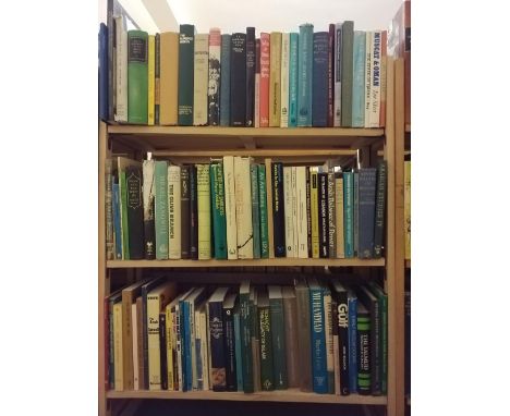
Bartlett (W.H.). Scenery and Antiquities of Ireland, Illustrated from Drawings by W. H. Bartlett; The Literary Portion of the Work by J. Stirling Coyne, Esq, 2 volumes, London: George Virtue, 1841, 2 engraved titles, folding map, 120 plates, spotting (mostly marginal), endpapers replaced, tissue guards, later red half morocco, boards & extremities rubbed, corners bumped, 4to, together with Roscoe (Thomas). Wanderings in South Wales, including the River Wye, 1st edition, 2 volumes, London: Tilt and Vogue, 1836, engraved frontispieces & vignettes, 93 engraved plates, some marginal spotting, modern full red morocco gilt, all edges gilt, boards marked, extremities rubbed, 8vo, plus two others: John Britton, The History and Antiquities of the Abbey and Cathedral Church of Gloucester, 1829 and Holyhead Road, Reports of Mr Telford, 1820Qty: (6)
We found 109182 price guide item(s) matching your search
There are 109182 lots that match your search criteria. Subscribe now to get instant access to the full price guide service.
Click here to subscribe- List
- Grid
-
109182 item(s)/page
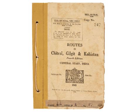
North-West Frontier. Routes in Chitral, Gilgit & Kohistan, 4th edition, General Staff, India, 1941. printed by the manager, Government of India Press, Simla, copy no. 247, 1942, 485 pp., large folding route map contained in rear pocket, original cord-bound cloth-backed printed boards, shelf number pasted at foot, a little light spotting, some edge wear, 8voQty: (1)NOTESRare. Issued by the Intelligence Department for official use only by the Government of India as a practical military and political handbook of this region of the North-West Frontier and Afghanistan. Sources were officers in the field and their clandestinely-employed local tribesmen. The work, along with other tribal monographs, route books and military reports were classified and subject to strict rules of custody. It was also ordered that when a new edition of a particular work appeared all previous editions had to be destroyed. As a result these works survive in very few locations. (Finding Aid. British Intelligence Files on Afghanistan and its Frontiers, c. 1888-1946, IDC Publishers, 2003).
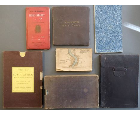
Folding Maps. Seven Folding Maps, late 19th & early 20th century, including, Juta (J. C.). Juta's Map of South Africa from the Cape to the Zambesi compiled from the best available Colonial and Imperial Information..., J. C. Juta & Co. Cape Town and Edward Stanford, London, 1903, large colour lithographic map, sectionalised and laid on linen, 900 x 1220 mm, contained in a contemporary cloth slipcase with printed title label to upper cover, together with Grosvenor (Gilbert, Editor). North America prepared especially for The National Geographic Magazine, Edward Stanford, circa 1930, colour photolithographic map, sectionalised and laid on linen, 970 x 690 mm, contained in contemporary diced calf slipcase with an 'envelope style' lid, with Canal Map. Manchester Ship Canal General Plan, Henry Blacklock & Co. Manchester, 1890, colour lithographic map, sectionalised and laid on linen, 455 x 910 mm, marbled endpapers, publisher's gilt cloth boards, plus Ordnance Survey. Four maps of parts of South -East England on a scale of 1 inch to the mile, circa 1825, four uncoloured engraved maps (part of Middlesex and Berkshire, part of Surrey, part of Sussex & part of Kent), numbered 7, 8, 9 & 6 respectively, each sectionalised and laid on linen, marbled endpapers, each approximately 635 x 950 mm, contained in a contemporary cloth slipcase, and Reynolds (James). The Oarsman's and Angler's Map of the River Thames from its Source to London Bridge, 1891, colour lithographic map, laid on linen and folded 'concertina' style', some staining, lacking rear board and spine, upper board stained, 2650 x145 mm, with 2 others similar and one early 20th-century map of China displayed on turned wooden battens, and another of a historical time chart of world history, the letter lacking its lower batten, both creased and stainedQty: (9)
![Bible [Latin]. Biblia Sacra vulgatae editionis, 7 volumes, Paris: Fredericum Leonard, 1705, engraved title to volume 7 with i](https://cdn.globalauctionplatform.com/27b5cdfc-fc3c-49b1-9e32-ada600c31087/02117c11-1a9f-49f9-a35c-ada600fe15d8/468x382.jpg)
Bible [Latin]. Biblia Sacra vulgatae editionis, 7 volumes, Paris: Fredericum Leonard, 1705, engraved title to volume 7 with imprint date of 1697, one folding engraved map, light toning, bookplates of D. de Sambucy and Robert J. Hayhurst to front endpaper of first volume, all edges gilt, contemporary red crushed morocco, elaborate gilt-decorated spines and gilt-ruled borders to boards, joints and extremities slightly rubbed, 16mo in 8sQty: (7)

Kent. Symonson (Philip), A New Description of Kent ... the tractes of Ryuers, Rylles and creeks, with the trendinge of the sea-shore be more naturally described then heretofore it hath ben done, printed and sold by Peter Stent 1659, engraved map on two conjoined sheets, inset views of Rye and Dover Castle, ornate strapwork cartouche, old folds, slight wear where old folds cross, slight overall toning, backed with archival paper, 515 x 780 mmQty: (1)
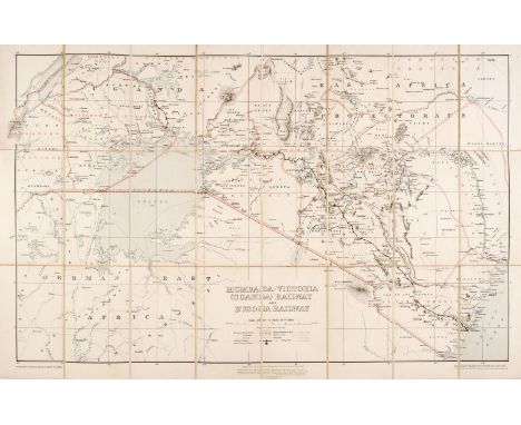
Africa. Stanford (Edward publisher). Mombasa-Victoria (Uganda) Railway and Busoga Railway, Printed by the Ordnance Survey office for the War Office, 1913, colour photolithographic map, sectionalised and laid on linen, 540 x 810 mm, bound in the publisher's cloth boards with printed label to upper cover, spine and boards fadedQty: (1)NOTESThe Uganda Railway was a metre-gauge railway system and former British state-owned railway company. The line linked the interiors of Uganda and Kenya with the Indian Ocean port of Mombasa in Kenya. The map is indicative of the period preceding WWI in the 'scramble for Africa' when various European powers struggled to grasp, maintain and exploit various parts of Africa.
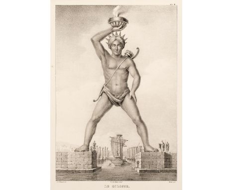
Rottiers (Bernard Eugene Antoine). Monumens de Rhodes, Atlas only, Brussels, 1828, lithograph title, map and 74 engraved and lithographed plates only (of 75, lacking plate 5), a few hand-coloured, one or two short closed marginal tears, a few light spots, modern cloth with original title mounted to upper cover (title a little soiled with repaired tears), oblong folioQty: (1)NOTESBlackmer 1450.
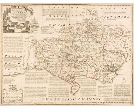
Hampshire & Dorset. Kitchin (Thomas & Bowen Emanuel). A New Improved Map of Hampshire from the best Surveys & Intelligences, Divided into its Hundreds..., [and] An Accurate Map of Dorset Divided into its Hundreds, Drawn from the best Authorities..., Robert Sayer and C. & J. Bowles [and] Robert Wilkinson Carington Bowles & Robert Sayer, 1764 & 1785 respectively, two engraved maps with contemporary outline colouring, Hampshire with some later enhancement to the cartouche, toned overall and with some staining, Dorset with some abrasion to the printed surface and some mount staining, each approximately 545 x 700 mmQty: (2)NOTESOriginally published in 'The Large English Atlas'.

Williams (David). The History of Monmouthshire, 1st edition, subscribers copy, London: H Baldwin, 1796, 35 aquatint plates (lacking plate XXX of Llanwerne), half-title, map, 2 folding tables, list of subscribers to rear, errata, bound without p117/118 as usual, map and half-title detached and loosely inserted, tissue guards (some missing, some detached), untrimmed, spotting (mostly marginal), front hinge broken, later quarter calf, boards rubbed, corners bumped, spine extremities rubbed with loss of head and tail cap, joints rubbed, spine creased with sticker to base, 4toQty: (1)NOTESAbbey, Scenery 537; Upcott II, page 931. One of 32 rare coloured copies, from an edition of 168 copies printed for subscribers.

Surrey & Kent. Bowen (Emanuel), An Accurate Map of the County of Surrey Divided into its Hundreds..., Carington Bowles & Robert Sayer, circa 1765 [and] An Accurate Map of the County of Kent divided into its Lathes..., Robert Sayer, T & J Bowles, circa 1764, two engraved maps with contemporary outline colouring and some later enhancement, both toned overall, Surrey with slight mount staining and a short split at the base of the central fold, each approximately 535 x 715 mmQty: (2)NOTESOriginally published in 'The Large English Atlas'.

* Bedfordshire. Speed (John), Bedford Shire and the Situation of Bedford described with the armes of those Honorable Familyes that have borne ye titles of Dukes and Earls thereof, H. Overton, circa 1710, hand-coloured engraved map, inset town plan of Bedford, large strapwork cartouche and mileage scale, 380 x 505 mm, mounted, framed and glazedQty: (1)

Scilly Isles. Collins (Capt. Greenville), The Islands of Scilly..., circa 1700, hand-coloured engraved sea chart, large decorative cartouche, compass rose and numerous rhumb lines, with the separately printed descriptive text tipped on to the lower margin (as published), map size 450 x 565 mm, together with Untitled sea chart of the Western tip of Cornwall and the Scilly Isles, circa 1700, hand-coloured engraved sea chart, large decorative cartouche, compass rose and numerous rhumb lines, 450 x 565 mm, with A New and exact Survey of the River Dee or Chester-Water..., circa 1700, hand-coloured engraved sea chart, large decorative cartouche, compass rose and numerous rhumb lines, 445 x 565 mmQty: (3)

Middlesex. Speed (John), Midle-Sex described with the most famous Cities of London and Westminster, 1st edition, George Humble, 1611, hand-coloured engraved map, inset town plans of Westminster and London, inset views of Saint Peters and Saint Pauls, small split at the head of the central fold, 385 x 515 mm, English text on versoQty: (1)
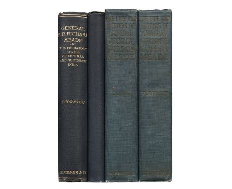
Thornton (Thomas Henry). General Sir Richard Meade and the Feudatory States of Central and Southern India. A Record of forty-three years' service as soldier, political officer and administrator, 2 volumes, including Supplement, London: Longmans, Green and Co., 1898, portrait frontispiece, folding colour map, half-tone illustrations, publisher's catalogue at end, a little light spotting, endpapers toned, original cloth, spine ends and corners a little rubbed, 8vo, together with: Meade (George). The Life and Letters of George Gordon Meade, Major-General United States Army, edited by George Gordon Meade, 2 volumes, 1st edition, New York: Charles Scribner's Sons, 1913, maps and illustrations, endpapers renewed, original cloth, some fading to spine lettering, a little rubbed at ends, 8voQty: (4)NOTESGeneral Sir Richard Meade (1821-1894) was a British Indian Army officer and administrator. George Gordon Meade (1815-1872) was a United States Army officer, best known for defeating the Confederate Army of General Robert Lee at the Battle of Gettysburg during the American Civil War.

Allegorical Maps. Le Charivari (publisher), Carte de la Fraternité Européene, circa 1880, uncoloured allegorical map of Europe by Draner, very slight spotting, slight text show through, descriptive key below the image, 290 x 390 mm, French text on verso, together with L'Eclipse (publisher). La Carte de Tendre en 1869, wood-engraved allegorical map, near-contemporary wash colouring, in a bi-folium format with French text and illustrations throughout, small holes to central fold, overall size 480 x 330 mm, with La Lune (Publisher). Carte du Théatre de la Guerre, 1866, uncoloured wood-engraved allegorical map in a bi-folium format with French text and illustrations throughout, slight spotting, slight fraying to the central fold, overall size 490 x 335 mm, plus Le Gonne (Petrus). Plan Humoristique de la Ville de Lyon, 1910, uncoloured lithographic plan, two long repaired closed tears, toned overall, slight staining, 590 x 400 mmQty: (4)

Salmon (Thomas). Modern History: or, the Present State of all Nations, describing their respective situations, persons, habits, buildings, manners, laws and customs, religion and policy, arts and sciences, trades, manufactures and husbandry, plants, animals and minerals. Being the most complete and correct system of geography and modern history extant in any language, 3 volumes, 1st quarto London edition, London: Betterworth and Hitch, 1739, 43 (of 46) folding engraved maps by Herman Moll only (lacking the Map of India beyond the Ganges, Map of United Provinces or Netherlands, and Map of Upper Italy), America map showing California as an island, plus 58 engraved plates, occasional light water stain, previous owner signature of D.L. Cumming, bookplates, all edges red, contemporary sprinkled calf gilt, some stains to spines, one or two wormtracks head and foot, 4toQty: (3)NOTESSabin 75826.
Chesney (Francis Rawdon). The Expedition for the Survey of the Rivers Euphrates and Tigris, carried on by order of the British Government in the years 1835, 1836, and 1837; preceded by geographical and historical notices of the regions situated between the rivers Nile and Indus, in four volumes, 2 volumes [all published], 1st edition, London: Longman, Brown, Green and Longmans, 1850, half titles, 49 lithograph plates, most tinted, loose folding map (formerly contained in front pocket), folding tables, lacking the 13 additional maps in slipcases (as often), final index leaf of volume I repaired, some light spotting, toning and offsetting, bookplate of Stephen Tudsbery-Turner, contemporary half morocco, volume I upper cover detached, upper joint split, rubbed and scuffed, 4to,Qty: (2)NOTESAtabey 234; Blackmer 337. Originally intended to be published in four volumes, "Chesney was sent to China before he finished writing the history of the expedition and half of the manuscript was lost... In 1829 he set out for Constantinople intending to take part in the Russo-Turkish war; instead he made a tour of inspection in Syria and Egypt which had two results - the overland route to India and the Suez Canal (De Lesseps was led to attempt the enterprise after reading Chesney's report). In 1831 Chesney carried out his preliminary survey of the Euphrates alone, floating down the river on a raft. A parliamentary committee recommended a full-scale expedition, and two steamships were assembled near Bir in 1835, near the property of John Barker (q.v.). During the voyage the S.S. Tigris sank and after many difficulties the S.S. Euphrates finally reached Basra." (Blackmer).
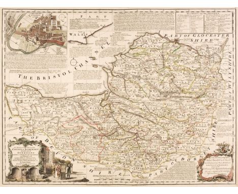
Somerset & Gloucestershire. Bowen (Emanuel), An Improved Map of the County of Somerset Divided into its Hundreds..., [and] An Accurate Map of the Counties of Gloucester and Monmouth Divided into their Respective Hundreds, Carington Bowles & Robert Sayer [and] T. Bowles, Robert Sayer, John Tinney & John Bowles & Son, 1764 & 1760 respectively, two engraved maps with contemporary outline colouring, Somerset with an inset town plan of Bath and some later enhancement to the hand colouring, Gloucester & Monmouth with light overall toning and some staining to the central fold, each approximately 545 x 690 mmQty: (2)NOTESOriginally published in 'The Large English Atlas'.
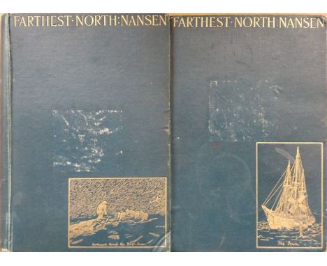
Nansen (Fridtjof). Farthest North. Being the Record of a Voyage of Exploration of the Ship Fram 1893-96, 2 volumes, 1st English edition, London: Archibald Constable & Co., 1897, colour and monochrome illustrations, one folding colour map only (of 4), some light spotting, volume 2 lacking free endpapers, original cloth gilt, labels removed from upper boards, 8vo, together with: Wallace (D. Mackenzie), Russia, 2 volumes, 4th edition, London, Paris & New York: Cassell Petter & Galpin, 1877, two folding maps (one strengthened to folds), ink stamps to front endpapers, original cloth, rebacked, preserving original spines, rubbed, 8vo, Price (Julius M.), The Land of Gold, the narrative of a journey through the West Australian Goldfields in the Autumn of 1895, 2nd edition, London: Sampson Low, Marston & Co., 1896, portrait frontispiece and monochrome plates & illustrations, folding map at rear, publisher's ink stamp to title, hinges split, original pictorial cloth, 8vo, plus other travel, including Russia related etc.Qty: (a carton)
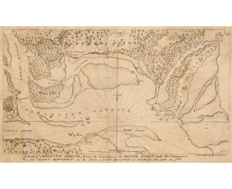
Abernethie (Thomas). A Sketch of Charleston Harbour shewing the disposition of the British Fleet under the Command of Vice Adml. Mariot Arbuthnot in the Attack on Fort Moultrie on Sulivan Island in 1780, Charleston circa 1785, uncoloured engraved map, old folds, small repaired holes where old folds cross, folds strengthened and repaired on the verso, a few small holes along old folds, slight spotting and staining, early 19th-century manuscript annotations to the verso, 180 x 305 mmQty: (1)NOTESA scarce map of Charleston which was originally published in David Ramsay's 'History of the Revolution of South Carolina'. Ramsay's book has the distinction of being the first work granted a copyright in the United States and the map is one of the earliest battle plans of the Revolution to be engraved in America.
Seymour (Robert). A Survey of the Cities of London and Westminster, Borough of Southwark, and parts adjacent, 2 volumes, London: J. Read, 1734-35, titles in red & black, folding engraved plan (with closed tear repaired with adhesive tape to verso), eight engraved plates (two folding), engraved illustrations, some light toning and offsetting, upper pastedown with bookplate of John Jeffreys Pratt, 2nd Earl Camden, contemporary panelled calf, rebacked, morocco labels to spines, folio, together with: Thornton (William), The New, Complete, and Universal History, Description, and Survey of the Cities of London and Westminster, The Borough of Southwark, and parts adjacent..., by a Society of Gentlemen, revised, corrected, and improved, London: Alex Hogg, [1793?], engraved frontispiece, engraved folding plan (strengthened & repaired with adhesive tape to verso), 104 engraved plates& plans (including folding map), short closed tear to title and following leaf at gutter, initial few leaves a little creased, contemporary marbled calf, neatly rebacked, red morocco title label to spine, folio, Chamberlain (Henry), A New and Compleat History and Survey of the Cities of London and Westminster, the Borough of Southwark, and parts adjacent; from the earliest accounts, to the beginning of the year 1770..., by a Society Gentleman, revised, corrected & improved, London: J. Cooke, [1770], engraved frontispiece (lined to verso), 65 engraved plates & plans (including two folding maps, one repaired to verso with adhesive tape, two single-page plates strengthened to verso), closed tear to C2, some damps staining mostly round margins, occasional marks & soot marks to margins, contemporary sheep, rebacked, red morocco title label retained, folioQty: (4)
Hillyard (Susan). Before The Oil, a personal memoir of Abu Dhabi 1954-1958, 1st edition, Bakewell: Ashridge Press, 2002, numerous black & white illustrations, original cloth in dust jacket, 8vo, together with: Rice (Michael), The Archaeology of the Arabian Gulf, c. 500-323 BC, 1st edition, London: Routledge, 1994, black &white illustrations, original cloth in dust jacket, covers lightly rubbed to head & foot, 8vo Stookey (Robert W.), Yemen, the politics of the Yemen Arab Republic [Westvuew Special Studies on the Middle East], 1st edition, Boulder: Westview Press, 1978, black & white frontispiece map, publishers original cloth, 8vo Huygelen (Paul), Equator Crossings, Travelogue Extraordinary, 1st edition, Dubai: Motivate Publishing, 2008, colour & monochrome illustrations, original cloth in dust jacket, 8vo, plus other modern Middle East history & reference, mostly original cloth in dust jackets, some paperbacks, G/VG, 8vo/4toQty: (6 shelves )NOTESFrom the library of Edward Henderson (1917-1995), British diplomat and Ambassador to Qatar.
Dodsley (Robert & John Cowley). The Geography of England: Done in the Manner of Gordon's Geographical Grammar, 1st edition, London: Printed for R. Dodsley, 1744, printed title, dedication, preface and introduction, 55 uncoloured engraved maps only (of 56, lacking the plan of London, as often), small repaired tear to the verso of the final map, occasional light offsetting and a few spots, endpapers renewed, contemporary calf, rebacked, a little rubbed, 8voQty: (1)NOTESChubb CLXXXI.
Watkins (John). Life, Poetry, and Letters of Ebenezer Elliott, the Corn-Law Rhymer. With an abstract of his politics, 1st edition, London: John Mortimer, 1850, original publisher's blind-stamped cloth, spine lettered in gilt, rubbed and some soiling, with a little fraying to head and foot of spine, ownership signature of Edgell Rickword, dated 31.3.39 to front endpaper, 8vo, together with: Walton (Izaak, and Charles Cotton). The Complete Angler, extensively embellished with engravings on copper and wood, from original paintings and drawings, by first-rate artists. To which are added, an introductory essay... and illustrative notes, 3rd edition, London, J. Major, 1835, monochrome engraved plates (one re-hinged), all edges gilt, contemporary gilt decorated morocco, worn, with upper cover detached, and some loss to head of spine, 8vo Pocock (Noel). Below zero, A Travesty of Winter Sport, with verses adapted to the occasion by A. E. Johnson, London: Hodder & Stoughton, circa 1910, tipped-in colour plates, original pictorial cloth, rubbed and soiled, a little fraying to spine, 4to, and other antiquarian and illustrated books, some leather-bound, including Adam's Sinchronological Chart or Map of History, circa 1870, T. E. Lawrence, A Brief Record of the advance of the Egyptian Expeditionary Force, 1919, & Seven Pillars of Wisdom, 11th impression, 1938 (in worn dustwrapper), John Lovell, The Swiss Family Robinson, Cassell Petter and Galpin, circa 1860s (very good copy in publisher's gilt decorated green cloth), Hans Christian Andersen, Fairy Tales, illustrated by Harry Clarke, London, George C. Harrap, re-printed 1931, original green cloth, spine somewhat faded and near-detached, 2 early to mid 19th-century scrap albums, containing drawings, watercolours, engravings and a few photographs with manuscript verse, The Duenna: A Comic Opera, London, printed for E. Johnson, 1776, etc.Qty: (3 or 4 cartons)

Norfolk. & Suffolk. Bowen (Emanuel), An Accurate Map of the County of Norfolk Divided into Hundreds and drawn from Surveys..., 1st edition, J. Tinney, 1753 [and] An Accurate Map of the County of Suffolk Divided into its Hundreds..., T & J Bowles & Robert Sayer, circa 1764, Norfolk is an engraved map with contemporary outline colouring and some later enhancement, slight spotting to the margins, 540 x 715 mm, Suffolk, an engraved map with sparse contemporary outline colouring (the map shows evidence of washing and cleaning), one long vertical crease, occasional marginal closed tears and chipping, several small holes affecting the printed surface, 525 x 700 mmQty: (2)NOTESOriginally published in 'The Large English Atlas'.
Morier (James Justinian). The Adventures of Hajji Baba, of Ispahan, 3 volumes, 2nd edition, London: John Murray, 1824, half-titles to volume 2 only, occasional scattered spotting, light toning to margins, original cloth-backed boards, remnants of paper labels to spines, board edges worn, covers rubbed, small 8vo, together with: Robertson (George S.), Chitral, the story of a minor siege, 2nd edition, London: Methuen & Co., 1899, monochrome frontispiece, plates & plans, folding map at rear, original cloth, extremities worn, 8vo, plus other travel etc., including two odd volumes of A Voyage Round the World, including Travels in Africa, Asia, Australasia, America etc..., volumes 2 & 3 only (mixed set), 1834-35, volume 2 lacking plates, and Travels in Siberia by Adolph Erman, volume 2 only (of 2), Philadelphia, 1850, and German Official Account of the Russo-Japanese War, The Scha-Ho (Maps), Hugh Rees Ltd, [1910], containing nine folding maps, plus other travel including Persia & Asia related etc.Qty: (2 cartons)
![[Ruskin, John]. A Protest Against the Extension of Railways in the Lake District, by Robert Somervell, with Articles thereon](https://cdn.globalauctionplatform.com/27b5cdfc-fc3c-49b1-9e32-ada600c31087/db6ac481-b573-4b51-8b2f-ada600fdb527/468x382.jpg)
[Ruskin, John]. A Protest Against the Extension of Railways in the Lake District, by Robert Somervell, with Articles thereon reprinted from the 'Saturday Review,' &c. and a Preface by John Ruskin, 1st edition, Windermere: J. Garnett & London: Simpkin, Marshall & Co., [1876], some markings to title-page and final leaf browned, disbound, remains of upper wrapper loosely inserted, 8vo, together with Osborne's Guide to the Grand Junction, or Birmingham, Liverpool, and Manchester Railway, with the Topography of the Country, 2nd edition, Birmingham: E.C. & W. Osborne, 1838, numerous wood engravings including adverts at rear, one folding chart, lacks folding map, a little spotting and soiling, small ink library stamp to title verso and exhibition ticket tipped in at front, hinges near broken, original cloth, some soiling and wear, 8vo, plus The London and Birmingham Railway Guide and Birmingham and London Railway Companion…, by J.W.W., Published [by the author] James Wyld, 1838, folding map of London attractions, 4 pages publisher’s adverts at rear, lacks folding railway map frontispiece, original gilt-stamped cloth, upper cover detached and spine defective, small 8voQty: (3)

Sri Lanka. MacDonald Gill (Leslie), Map of Ceylon showing her Tea and other Industries, Ceylon Tea Propaganda Board, 1933, colour lithographic pictorial map, some creasing and staining, trimmed with slight loss to the publishing line below the image, slight chipping to the margins, several marginal closed tears and small holes, all repaired on the verso, slightly toned overall, 750 x 465 mmQty: (1)NOTESThis highly decorative map of Ceylon was produced in two sizes, this being the smaller of the two editions.

Calthrop (Dion Clayton). Traveller's Joy, A Device, 1st edition, William Heinemann Ltd. 1924, additional half-title, eight imaginary colour lithographic pictorial maps after Gilbert Pownall, each with a page of descriptive text, publisher's decorative cloth, dust-soiled and scuffed, slim folio, together with Hader (Berta and Elmer). Berta and Elmer Hader's Picture Book of the States, Harper & Brothers, New York & London, 1932, 27 (of 28) pictorial photolithographic maps of various states, one map with a long closed tear, crudely repaired with tape, contents disbound, shaken and loose, publisher's cloth boards, worn and rubbed, oblong 4to, with Cobb (W. H.). Atlas of Fairyland, Hutchinson's Books for Young People [1948], 11 (complete as list), colour lithographic pictorial map plates, each with a page of descriptive text, publisher's colour pictorial card wrappers, slight wear to extremities, slim 4toQty: (3)NOTESSold as a collection of maps, not subject to return.
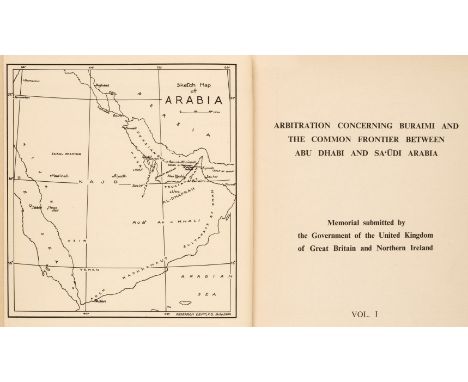
Abu Dhabi and Sa‘udi Arabia. Arbitration concerning Buraimi and the Common Frontier between Abu Dhabi and Sa‘udi Arabia, Memorial submitted by the Government of the United Kingdom of Great Britain and Northern Ireland, 2 volumes, 1st edition, 1955, frontispiece map of Arabia, lacking the 10 maps and 'Gazetteer of Place Names', corrigenda leaf tipped in, original cloth-backed boards, copy number stickers to front boards, pencilled notation to front boards, spine extremities bumped & marked, 8voQty: (2)NOTESScarce. From the library of Edward Henderson, British diplomat who headed the British response to the crisis. "Between 1952 and 1955 Henderson also played a role in the Buraimi dispute which arose following the arrival in the Buraimi Oasis of armed Saudi Arabians. His famous sang-froid and skill at avoiding confrontation were demonstrated in October 1955, when he is said to have sent the driver of an exceptionally belligerent British officer on an errand in order to prevent him from awakening the officer before his planned offensive. By the time he awoke, it was too late. The Saudis having moved off after a severe warning and guarantees of safe passage, the British objective had been achieved without loss of life or serious casualties." (Independent Obituary). From the library of Edward Henderson (1917-1995), British diplomat and Ambassador to Qatar.
Battle of Waterloo. Manuscript Map, circa 1815, pen and watercolour battle plan, martial cartouche, key plan in pencil, some spotting and staining, 380 x 470 mm, together with Gibraltar. North Front of Gibralter (sic), circa 1815, pen and watercolour plan of the fortifications, key plan, title below the image, some staining, 230 x 335 mmQty: (2)

Polar Menus. A group of 19 menus for the Arctic Club, 1933/59, comprising printed menus for dinner celebrations in 1933, 1934, 1936, 1937, 1938 (2), 1946-54 & 1956-59, most with pictorial or map designs, a few pencil notes of names, occasional soiling and markings, folded, various sizesQty: (19)

Political postcards. A collection of political 'map postcards', early-mid 20th century, French, German, American and British colour lithographic and photolithographic political and propaganda map postcards, including Nazi propaganda map postcards (one with the original envelope sent to the USA from Danzig) all relating to the Free City of Danzig and the Polish Corridor question, ten mounted, each approximately 90 x 130 mmQty: (18)

Paris. Picquet (Charles), Plan Routier de la Ville de Paris Divisé en XII Arrondissements ou Mairies et en 48 Quartiers..., Paris, 1814, large scale engraved city plan with contemporary hand colouring, sectionalised and laid on linen, with identifying text to the vertical margins, booksellers label to the verso, 825 x 1380 mm, contained in a marbled card and morocco gilt chemise and then in a contemporary green morocco gilt slipcase, some wear to the slipcaseQty: (1)NOTESThe second state of this decorative and detailed map of Paris. It shows at the beginning of the re-design of the City during the Reign of Napoleon and is dedicated to Count Frochot, the second Prefect of the Department of the Seine - a position created by Napoleon Bonaparte - which replaced the Mayor of Paris.
London. Cole (B.), A collection of 6 ward plans, circa 1760, engraved maps, 3 with later hand-colouring, 2 trimmed to plate mark and laid on later paper, various sizes and condition, together with Norden (John & Kip J.). Middlesex olima Trinobantibus habitat, circa 1610, hand-coloured engraved map, large strapwork cartouche and mileage scale, toned overall, some creasing, 280 x 340 mm, Ordnance Survey (Publishers). Three maps of parts of Middlesex, Wiltshire and Somerset on a 1 inch to the mile scale, 1809 - 22, three uncoloured engraved maps, slight marginal fraying, each approximately 630 x 930 mm, with facsimile maps of John Rocques Large Scale Map of Surrey (2 copies), Rocques Map of London and Westminster and Wenceslaus Hollar's Prospect of London and two others similar, various sizes, good condition, with Collins (Captain Greenville). Rye Harbour, circa 1790, uncoloured engraved sea chart, 445 x 290 mm, and Skelton (J. publisher). Skelton's Reduced Engraving of the Original Plan of Oxford, Taken by Ralph Agas in the Year 1578, Jany. 1st 1823, hand-coloured engraved city plan, old folds, slight mount staining, 335 x 485 mmQty: (16)

* Staffordshire. Speed (John), Stafford Countie and Towne with the ancient Citie Lichfeild described, Thomas Bassett & Richard Chiswell [1676], uncoloured engraved map, inset town plans of Lichfield and Stafford, slight creasing, additional horizontal fold, short splits alongside the central fold, one small rust hole, 385 x 510 mm, mounted, framed and glazedQty: (1)
![Worcestershire. Speed (John), Worcestershire Described, John Sudbury & George Humble [1627 - 32], hand-coloured engraved](https://cdn.globalauctionplatform.com/27b5cdfc-fc3c-49b1-9e32-ada600c31087/49ebd320-417e-45bb-8c0e-ada600fddeba/468x382.jpg)
Worcestershire. Speed (John), Worcestershire Described, John Sudbury & George Humble [1627 - 32], hand-coloured engraved map, an inset town plan of Worcester, large strapwork cartouche, mileage scale and compass rose, slight fraying to the margins, 385 x 510 mm, English text on versoQty: (1)
Goujon (Jacques). Histoire et Voyage de la Terre-Sainte, ou tout ce qu'ily a de plus remarquable dans les saints lieux, est tres-exactement descrit, 2nd edition, Lyon: Pierre Compagnon & Robert Taillandier, 1671, title with woodcut device, 16 folding engraved plates and plans, lacking the engraved map of the Holy Land, some light spotting and a few annotations, near contemporary calf gilt, a little rubbed, 4toQty: (1)NOTESDescription of the Christian holy places in the Holy Land by Franciscan missionary Goujon.

English Channel. De Hooghe (R.), Carte Maritime de L'Angleterre depuis les Sorlingues jusques a Portland..., Pierre Mortier, Amsterdam, 1693, large engraved sea chart on two conjoined sheets with contemporary outline colouring, showing Cornwall, Devon and the Western Approaches, inset map of the Scilly Isles, inset vignette views of Portland, Lands End and Truro, compass rose and numerous rhumb lines, slight creasing and dust soiling, laid on later linen, 595 x 945 mmQty: (1)NOTESKOEMAN: vol 4. p. 423-4, M.Mor 5. These charts were judged by Koeman to be the 'most spectacular type of maritime cartography ever produced'.

Denmark. Schenk (Petrus), Dania Regnum Ducatus Holsatia. et Slesvicum Insulae Danicae et Provinciae Jutia Scania etc. Amsterdam, 1706, engraved reticulated map with contemporary hand-colouring, 490 x 590 mm, together with Russell (J. C.). Denmark. Divided into Dioceses and Prefectures compiled from the best Authorities, 1790, hand-coloured engraved map, 410 x 320 mmQty: (2)


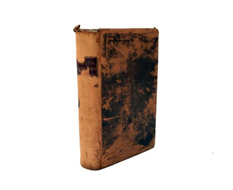
BOWDLER, Thomas. The Family Shakespeare, 1861. Full red morocco gilt, out of its covers. With RUSKIN, John, Roadside Songs of Tuscany, 4to, George Allen, Orpington, 1885. With 20 pasted-in plates. Black morocco gilt. With the Ordnance Survey map of Scotland, folio, 1924, on the scale of a quarter of an inch to the mile. With other books (box)

BOWEN, Emanuel, A New and Accurate Map of All The Known World, c1764, 315mm x 540mm; KITCHEN, Thomas, A Chart of The Globe, 285mm x 440mm, and a Map of Scandinavia, 265mm x 345mm; Norden & Kip, Surrey, 285mm x 375mm, hand-coloured; and a 19th century strip map from London to Truro, 185mm x 440mm, hand-coloured (5)


SPEED, John, Map of Shropshire. Bassett & Chiswell, 1676, 350mm x 510mm. Hand-coloured, English text to verso, glazed both sides. With Shropshire from the Dispatch Atlas, 1863, unframed. With a reproduction Speed Map of Shropshire, framed and glazed, and a framed certificate awarded to Violet Aitken concerning women's suffrage (4)


RICHARD BLOME, Map of the Holy land 1687; a French map of the Holy Land by Nicolas de Fer, 1705; Kitchen's map of the Roads of England and Wales 1796, dissected on linen, John Ogilvy's strip map of the road from Islip in Oxford to Bramyard in Hereford, circa 1675; a map of Cumberland by Henry Teesdale 1831; Turkey and Hungary by Thomas Kitchen 1783; and a French map of Martinoque. All framed and glazed (7)

MORSE, Jedidiah, The American Geography; or a view of the Present Situation of the United States of America, Elizabeth Town, New Jersey, first editon 1789. With 2 folding maps. Light offsetting to maps, small tear at gutter on map of Northern and Middle States, no repairs. Rubbed contemporary sheep


in the years 1797 and 1798. London: T. Cadell & W. Davies, 1801-04. First edition, 2 volumes, 4to, 1 folding map, bookplate of James Graham, contemporary diced russia gilt, map with tiny hole at centre fold and strengthened on verso, joints rubbed, vol. 2 joints splitting, a very few pages spotted
![London: Richard Phillips, [1807], First edition, 4to, folding map, contemporary half calf, spine gilt, map slightly spotted,](https://cdn.globalauctionplatform.com/6a0f2529-0111-4c5e-8615-ad9b010384a8/63df5b48-0817-4769-a0ad-ada2011db9c6/468x382.jpg)

Travels of Anacharsis the Younger in Greece. 1806, 8 volumes including 4to atlas of maps, contemporary half calf gilt; Anson, George A Voyage round the World. 1780. 15th edition, 8vo, 3 folding charts, contemporary calf, rubbed; Davy, C. & F. A Relation of a Journey to the Glaciers in the Dutchy of Savoy. 1776, 8vo, contemporary calf, rubbed; Johnson, Samuel A Journey of the Western Islands of Scotland, 1775, 8vo, calf, worn, covers detached; Withington, Nicholas The Travels... a factor in the East Indies. 1746. 8vo, folding map torn without loss, contemporary calf, slightly rubbed; Pennant, Thomas A Tour in Scotland, 1790; A Tour in Scotland and Voyage to the Hebrides. 1890, 2 parts in 2 volumes, plates, uniform calf, slightly rubbed; Eustace, J.C. A Classical Tour in Italy. 1814. 2 volumes, 4to, plates, maps, contemporary calf gilt; and 10 others, sold not subject to return


Redding, Cyrus An Illustrated Itinerary of the County of Cornwall. 1842, 4to, engraved plates, contemporary quarter morocco gilt; Leighton, John Select Views on the River Clyde. 1830; Leighton, John Select views of Glasgow and its environs. 1828, 4to, uniform embossed blue calf gilt, plates on india paper, one spine worn; Dugdale, William Warwickshire. Coventry, 1817. 8vo, engraved plates, folding coloured map, contemporary tree calf gilt, joints cracking; Burke, Edmund The Speeches. 1816, 4 volumes, 8vo, contemporary calf gilt; Lewis, Samuel Topographical Dictionary of England. 1831. 4 volumes, 4to, maps, contemporary half calf; Pinkerton, John Modern Geography. 1807, 3 volumes, 4to, plates and maps, some folding, contemporary half calf, spines gilt; Report from the Committee on the Commercial State of the West India Colonies 1807, folio, contemporary calf; [Congress of Vienna] Translation of the General Treaty, signed in Congress, at Vienna, June 9, 1815. 1816, folio, half calf; sold not subject to return (quantity)
Scott, Sir Walter The Border Antiquities of England and Scotland. 1814, 2 volumes, 4to, engraved titles and plates, contemporary red morocco gilt, g.e.; John Tweed, publishers The History of Glasgow... by writers of eminence. Glasgow, 1872. 2 volumes, contemporary blue half calf gilt; Nimmo, William A General History of Stirlingshire. Edinburgh, 1777. 8vo, large folding map, contemporary reversed calf; M'Ure, John A View of the City of Glasgow. Glasgow, 1736, 8vo, engraved portrait, 1 folding view, contemporary calf, view torn without loss, rubbed; Robertson, William [Works]. 1794. 10 volumes, 8vo, contemporary tree calf gilt; Laing, Malcolm The History of Scotland. 1804, 4 volumes, 8vo, contemporary calf gilt; Spalding, John History of the Troubles and Memorable Transactions in Scotland. Aberdeen, 1792. 2 volumes, 12mo, contemporary tree calf gilt; Tytler, Patrick F. History of Scotland. 1841. 9 volumes, 8vo, contemporary calf, lacking labels, slightly rubbed; Rollin, C. The Ancient History. 1795, 10 volumes, 12mo, contemporary calf, spines gilt; sold not subject to return (quantity)
![or a Complete Collection of Voyages and Travels. London, 1744-48, 2 volume folio, 61 maps and plates (15 folding) [complete],](https://cdn.globalauctionplatform.com/6a0f2529-0111-4c5e-8615-ad9b010384a8/260872e3-0c75-4a10-80e1-adb70106892b/468x382.jpg)
or a Complete Collection of Voyages and Travels. London, 1744-48, 2 volume folio, 61 maps and plates (15 folding) [complete], contemporary calf, volume 2 title frayed and ragged with textual loss, frontispiece cut down & pasted to front endpaper, one plate stained (p.183), occasional small stains and spots, 1 plate with marginal tear, final leaf vol. 2 frayed without loss, vol. 1 world map repaired crudely and glue stained, folding Circumnavigator map lacking right-hand section, folding map of Australia torn without loss, folding plate mounted on guards, vol. 2 lacks front free endpaper, worn, upper cover detached
-
109182 item(s)/page