We found 109198 price guide item(s) matching your search
There are 109198 lots that match your search criteria. Subscribe now to get instant access to the full price guide service.
Click here to subscribe- List
- Grid
-
109198 item(s)/page


Lot 1012
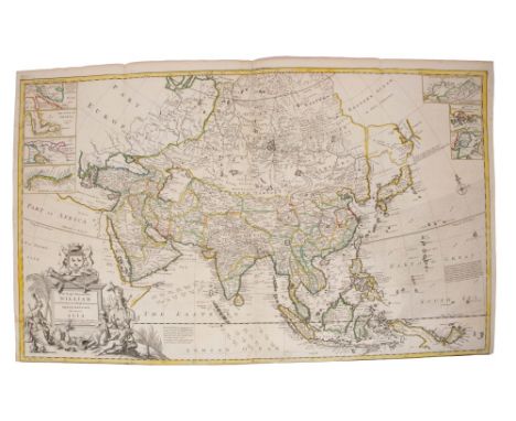
Herman Moll (d. 1732), large hand-coloured map - ‘A map of East Indies.... to Ye Directors of Ye Hon.ble United East- India Company’, 1717, 62cm x 101cm.Condition report: A couple of tears from margins, tape repairs to margins arresting other tears, otherwise minor disrepair commensurate with age


Lot 1057
John Speed (1552-1629), hand-coloured map - ‘Stafford Countie and Towne’, sold by Thomas Bassett in Fleet Street and Ric. Chiswell in St. Paul’s Churchyard, 39cm x 51cm, framed.Condition report: Glazed frame, not examined out of frame, very little margin showing, colour is faded, some time staining and grubbiness o central crease, otherwise condition is good


Lot 1055
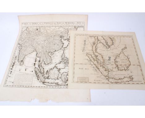
Johannes Van Keulen (1654-1715), engraved map - Sumatra, Malacca, Sincapoera, Banda en Sunda (1753). Plate 50cm x 112cm.Condition report: large patches to left hand side, with water damage, holes and staining in area of title and surround, elsewhere creases, losses to margins and small hole to crease, upper left


Lot 999
Thomas Kitchin (1718-1784), engraved map - ‘A general map of the East Indies and that part of China where the Europeans have any settlements or commonly any trade’, engraved for the London Magazine, 1747-1760, trimmed to beyond plate edge on left side, 31cm x 41cm.Condition report: tape repair to diagonal tear from left edge, otherwise minor creases, discolouration


Lot 1041
John Speed (British 1552-1629)/Rutlandshire with Oakham and Stanford/with the arms of the Duke of Rutland/hand coloured engraved map, 38cm x 51cm/Joan Blaeu (Dutch 1596-1673)/Lincolnia Comitatus/hand coloured engraved map, 43cm x 51cm and/Le Cercle de la Basse-Saxe subdivise en tolls Les Estates et Principau tes, 52cm x 82cm

-
109198 item(s)/page