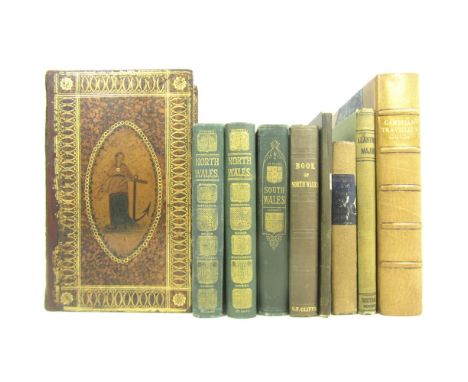

Wales, a collection, including a fine binding: Boothroyd, B. the History of the Ancient Borough of Pontefract. Pontefract, 1807. 8vo, list of subscribers, 6 plates and plans (1 folding), contemporary "Etruscan" binding gilt, rebacked retaining spine, rubbed; [Wales] The Cambrian Traveller's Guide. Stourport, 1813, Second edition, 8vo, hand-coloured folding map, tan half morocco by Sangorski & Sutcliffe; Smith, J. A Guide to Bangor, Beaumaris, Snowdonia. Liverpool, 1833, 12mo, folding map, original cloth, slightly rubbed; Cliffe, C.F. The Book of North Wales. 1851, original cloth; Black, A. & C. Black's Picturesque Guide to North Wales. 1869, 2 copies, original cloth; to South Wales. 1874, original cloth; Hemingway, J. Panorama of the Beauties, Curiosities and Antiquities of North Wales. 1834. 12mo, folding map, original cloth; and 1 other (Trevelyan: Llantwit Major) (9)
We found 109182 price guide item(s) matching your search
There are 109182 lots that match your search criteria. Subscribe now to get instant access to the full price guide service.
Click here to subscribe- List
- Grid
-
109182 item(s)/page
![Yorkshire, a large collection, including [Gent, Thomas] The Antient and Modern History of the famous City of York. York: T.](https://cdn.globalauctionplatform.com/f7ecc0c4-f95b-425e-aa5a-a75201035f2b/f863ae32-0a0e-4b91-c159-f06cee4610b5/468x382.jpg)
Yorkshire, a large collection, including [Gent, Thomas] The Antient and Modern History of the famous City of York. York: T. Hammond, 1730. 8vo, folding plan, folding plate, list of subscribers at end, contemporary panelled calf, rubbed; [Langdale, Thomas] The History of Northallerton. Northallerton: J. Langdale, 1791. 8vo, later quarter calf; [Farrer, W., printer] The History of Ripon. Ripon, 1806. Second edition, 8vo, frontispiece, original boards, uncut; Ainsworth, J., publisher The Scarborough Guide (sixth edition). Scarborough, [c.1820]. 12mo, 2 maps, 5 plates, contemporary half calf; Peat, Robert, printer The History of Thirsk. Thirsk, 1821, bound with Castellum Huttonicum. Some Account of Sheriff-Huytton Castle. York, 1824, plates, contemporary half calf gilt; Thompson, J. Historical Sketches of Bridlington. Bridlington, 1821. 12mo, frontispiece, manuscript corrections to text, contemporary half calf gilt; Cole, John, printer. Picture of Scarborough for the year 1824. Scarborough, 1824. 12mo, frontispiece, 1 plate, illustrations, original printed boards, uncut; [Wilson, J., printer] A Guide to Croft, Dinsdale, Middleton, Darlington etc. Darlington, 1834. 8vo, frontispiece & 3 plates, original cloth; Hinderwell, Thomas The History and Antiquities of Scarborough. Scarborough, 1832. Third edition, 12mo, frontispiece & 2 plates, original cloth; Walbran, Mr. A Guide to Ripon and Fountains Abbey. Ripon, 1861; Walbran, J.R. The Pictorial Pocket Guide to Ripon and Harrogate. Ripon, 1850; Walbran, J.R. The Visitor's Guide to Redcar. Ripon, 1848; Walbran, J.R. A Summer's Day at Bolton Priory. 1847, 4 works in one volume, contemporary half calf; Allison, J., printer Allison's Picturesque Pocket Companion... Whitby and its Neighbourhood. Whitby, 1850. 12mo, frontispiece, original printed wrappers; Phillips, John The Rivers, Mountains and Sea-Coast of Yorkshire. 1853. 8vo, 35 plates, original cloth, spine faded; Wilkinson of Barnsley, Mr. Stainborough & Rockley. London, 1853. 12mo, one of very few copies printed on fine paper, presentation copy to Thomas Bell from the publisher, frontispiece & 3 plates, original cloth, g.e.; [Hunton, James] York and its Vicinity. York, 1864. 8vo, 5 plates, 1 plan, 1 map, original cloth gilt; Reed, S., publisher Reed's Illustrated Guide to Whitby. Whitby, 1855. 12mo, original wrappers; Myrtle, A.S. Practical Observations on the Harrogate Mineral Waters. 1869. 8vo, photographic frontispiece, recent quarter calf; Page, W.G.B. The Hull and East Riding Portfolio. Hull, 1887. 4to., original upper wrappers bound in, cloth; Turner, J.H. The History of Brighouse, Rastrick and Hipperholme. Bingley, 1893, original cloth; and 6 more recent volumes ; sold as a collection not subject to return (24)
![Two maps of Scotland, comprising Blaeu, Willem Scotia Regnum. [Amsterdam : Willem Blaeu, 1635], 40 x 52cm., hand-coloured ma](https://cdn.globalauctionplatform.com/f7ecc0c4-f95b-425e-aa5a-a75201035f2b/27ba8d11-b986-4529-fb22-13e7c383e8e7/468x382.jpg)
Two maps of Scotland, comprising Blaeu, Willem Scotia Regnum. [Amsterdam : Willem Blaeu, 1635], 40 x 52cm., hand-coloured map, French text on verso, framed and glazed, slight discolouration at extreme of margins; de Vaugndy, Gilles Robert Le Royaume d'Ecosse divisé en shires ou comtés. Paris, 1751, engraved map, hand-coloured in outline, 51 x 59cms., framed and glazed, slight uniform discolouration (2)


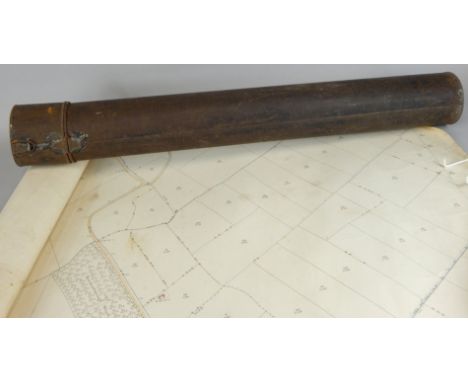
Yorkshire - Teesdale, Henry and C. Stocking Yorkshire, this map of the County constructed from a Survey commenced in 1817, & Corrected in the Years 1827 & 1828. London: Teasdale & Stocking, 1828. Large engraved map on 3 sheets, each sheet 184 x 75cm., dissected and backed on linen, hand-coloured, edged in green silk, contemporary calf slip-off case, unusually clean
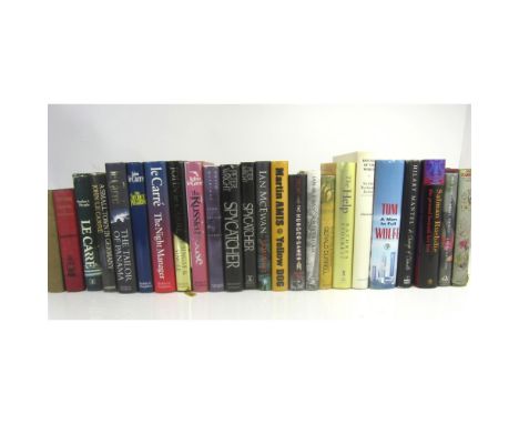
A collection of literature and modern first editions, including Stevenson, R.L. Treasure Island. Cassell, 1886, 13th thousand, First Illustrated edition, pictorial title, map, and 24 plates, original red pictorial cloth; Hardy, Thomas The Dynasts. 1903. Part 1 only, later cloth (one of c.100 copies with the 1903 dated title-page); Le Carré, J. Smiley's People. 1980, dustwrapper frayed; Small Town in Germany. 1968, library labels removed from front endpapers; The Russia House. 1989; The Tailor of Panama. 1996; The Secret Pilgrim. 1991; The Night Manager. 1993; The Single and Single. 1999; Guterson, D. Snow Falling on Cedars. New York, 1994; Wright, Peter Spycatcher. Heinemann Australia, 1987, owner's inscription on endpaper; another copy, 1987 (but printed in Dublin); McEwan, I. Saturday. 2005; Amsterdam. 1998; Amis, M. Yellow Dog. 2003; Collins, S. The Hunger Games. New York, 2008; Durrell, G. Birds, Beasts and Relatives. 1969, dustwrapper somewhat soiled; Durrell, G. My family and other animals. Hart-Davis & The Book Society, 1956, dustwrapper worn, and 6 others (24)


MIXED, complete & part sets, inc. part sets (trimmed to images), Cohen Weenen Football Captains (31) & Ogdens Sectional Cycling Map (39), Wix Henry 3rd (47) & ERB (16); complete (7), Wills (6), Famous Inventions, Lucky Charms, Dogs, Players AC&DS etc., in period albums & loose, FR to VG, Qty.
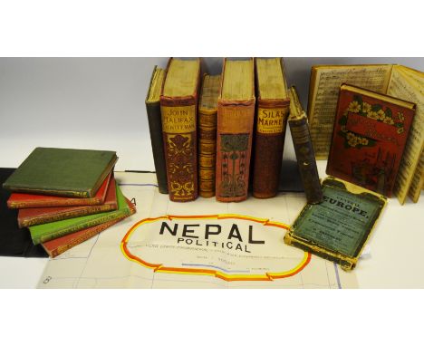
Books and Maps - a 19th century calf bound book Industrial Biography by Samuel Smiles; various Art Nouveau examples of children's stories; a government of India map of Nepal published by Vidya Chitr Prakashan, c.1970; an early 20th century map of Europe; Moxon's Miniature Poets, by Alfred Tennyson c.1865; etc


Various furnishing pictures including an etching of St. Peter's Church, Carmarthen, after M.A. Jones, similar etching of St. David's Cathedral, map of Glamorganshire after Archer, another map of Essex, sketch of a steam paddle wheeler and an etched on copper study of a galleon, all framed.(B.P. 24% incl. VAT)


BULLER (REV. JOHN). "A Statistical Account of the Parish of Saint Just in Penwith ..." 1st edn folding map & litho plts comp, orig cl crudely taped, 1842g; plus "A Short History of Penzance ... Land's End District." by Rev. W.S. Lach-Szyrma, plts, map etc comp, orig cl gt, aeg 1878 vg; plus 1 other.


John Ogilvy & William Morgan, The Travellers Pocket Book of the Roads, 22nd edition, corrected and considerably improved, pub. Buckland, Rivington, Law etc..... London 1785, small square edition, 178 pages, cloth bound boards c/w folding map Condition Report intact, original but signs of much use commensurate with age and type of publication

Three George III leather bound volumes - Kent, Nathaniel, General View of the Agriculture of the County of Norfolk, With Observations For The Means of its Improvement, pub London 1796 (c/w folding map and engravings) to/with Lowe, Robert, General View of the Agriculture of the County of Nottingham, London 1798 (c/w folding hand coloured maps and engravings) and General View of the County of Norfolk, London 1804 (coloured folding map, illustrations) all with library bookplate John McDouell of Logan, two ink signed Col. McDouall 1799 (3)
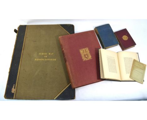
Survey Map of Haddingtonshire, folio edition, surveyed in 1853 by Capt James RE, pub Colonel Hall RE, Superintendent, 9th August 1854, part leather and cloth bound, gilt titled to/with numerous associated titles on Haddington and The Survey Atlas Of Scotland, folio, pub Royal Scottish Geographical Society 1912 (6)


-
109182 item(s)/page