We found 109198 price guide item(s) matching your search
There are 109198 lots that match your search criteria. Subscribe now to get instant access to the full price guide service.
Click here to subscribe- List
- Grid
-
109198 item(s)/page


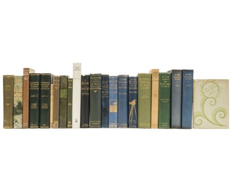
Lot 522
MURRAY, John, Fisher, A Pictureque Tour of The River Thames in Its Western Course. Bohn, 1845. 4to. Frontis. map. glt. cl. worn & repaired. tog.with PENNELL, Joseph & Elizabeth Robin, The Stream of Pleasure being a month on the Thames. Fisher Unwin, 1891. 4to. Illus with tissue guard. full cf. bd. Plus MITTON, G.E. The Thames illus. by MORIMER Menpes, A&C Black, 1906. cold. plts. pict. cl. Plus other related interest inc. Abingdon.


Lot 513
LYSON, Rev. Daniel & Samuel. Magna Britannia. Being A Concise Topographical Account of Several Counties of Great Britain. Vol. 1 parts 1 & 11. containing Bedfordshire, Berkshire and Buckinghamshire. Cadell, 1806. lge. 4to. plates as listed. with extra illus. Lacking map of Buckinghamshire. full cf. rebacked. Tog.with Topographical and Historical Account of Buckinghamshire by same. Cadell, get. 4to. Map of Buckinghamshire present. plates as listed. 1/2 bds. 3


Lot 148
Africa.- Dutton (E. A. T.) Kenya Mountain, signed and inscribed by author, frontispiece, plates, folding map at end, original cloth, faded spine, 1930 § Hobley (C. W.) Kenya: From Chartered Company to Crown Colony, first edition, frontispiece, plates, original cloth, lightly faded spine, 1929 § Foran (W. Robert) A Cuckoo in Kenya, frontispiece, plates, new endpapers, original cloth, a little rubbed, 1936; and 12 others, Kenya, 8vo (15)
Lot 214
Atlases.- .English Pilot (The). The Fourth Book. Describing The West-Indian Navigation, from Hudson's Bay to the River Amazones..., 10 double-page engraved maps and charts only of 22 and 4 single maps only of 6, after Captain Southicke, Mark Tiddeman and others, 3 engraved maps in text (St Peter's Island, Barbados and Antigua) and numerous woodcuts in the text, 1 map with rust marks, another map small piece of corner torn away, another map clipped at tail partially repaired with small loss, another map loose with small chip in corner and slight rust marks, title with small tear at tail repaired, small rust marks on title and first f. of text, N1 & 2 small holes in margins, F2 torn and repaired at tail with some loss of text, some creasing and soiling to maps, browned, early 19th century ink signature of Samuel Smiley of Larne on title, remains of 4 engraved maps from another work loosely inserted at end, new endpapers, contemporary calf, rubbed, some surface wear, rebacked in modern calf, [Tooley, p. 61], folio, Dublin, Published by Boulter Grierson, 1767; sold not subject to return. ⁂The very rare Dublin edition.
![[Simond (Louis)] Journal of a Tour and Residence in Great Britain...by a French Traveller, 2 vol., first English edition, 21](https://cdn.globalauctionplatform.com/8766109f-1deb-4a16-a9ea-a7e0012ad58f/d5992aa5-2dd1-4c00-fe85-0ce30a6542ac/468x382.jpg)
Lot 72
[Simond (Louis)] Journal of a Tour and Residence in Great Britain...by a French Traveller, 2 vol., first English edition, 21 hand-tinted aquatint plates by J. Clark after the author, 2 folding tables, engraved illustrations in text, 8pp. advertisements at end of vol.2, light cockling to beginning of vol.1 from damp but faint staining only affecting front endpapers, contemporary half calf, rubbed, rebacked, corners repaired, Edinburgh, George Ramsay, 1815 § Butcher (Rev. Edmund) An Excursion from Sidmouth to Chester, 2 vol., first edition, half-titles, engraved frontispiece, advertisement leaf at end of vol.2, contemporary half calf, red roan labels, 1805 § [Goldsmith (Oliver)] the Life of Richard Nash, of Bath, Esq., first edition, engraved portrait, 2 advertisement leaves at end, contemporary calf, joints split, 1762 § Gostling (W.) A Walk in and about the City of Canterbury, third edition, title in red and black, signature at head, folding engraved map (lightly foxed), N gathering bound in preliminaries, modern cloth-backed boards, uncut, old paper label preserved on upper cover, Canterbury, 1799, slightly rubbed; and 3 others, topography, 8vo et infra (9)
Lot 241
Ireland.- Petty (William) Hiberniae Delineatio..., first edition of the first atlas of Ireland, engraved portrait frontispiece of Petty by Edwin Sandys, double-page engraved frontispiece and contents leaf (the second state, with the wording "Cum Privilegio Regis" added), and 37 engraved maps on 36 double-page or folding sheets, frontispiece laid down, some maps folds strengthened, Mayo County map with slight stain, a few maps with slight creasing to edges, slightly foxed and browned in places, book-ticket of Dupplin Castle on front pastedown, new endpapers, modern half calf, [Shirley, British Library T.PETTY-1b], folio, [Dublin], [1685]. ⁂ Produced by William Petty after his "Down" Survey of the 1650s.SALEROOM NOTICES: This is not the first edition of 1685 but the c.1732 edition.
Lot 92
Yorkshire.- Whitaker (Thomas Dunham) An History of Richmondshire..., 2 vol., 45 engraved portraits, plates and plans including some after Turner, 4 hand-coloured, tissue guards, genealogical tables, some double-page, with publisher's lithographed note to subscribers loosely inserted at beginning, extra-illustrated with 4 original watercolour views, 7 engraved portraits and one view, most tipped into blank leaves, watercolours captioned in pencil, foxing to plates, contemporary half calf, rubbed, rebacked preserving old spines, corners repaired, London & Leeds, 1823; An History of the Original Parish of Whalley..., engraved plates, 2 folding, and folding engraved map, light browning, contemporary mottled calf, red roan label, repairs to lower joint, Blackburn, 1801; The History and Antiquities of the Deanery of Craven..., engraved portrait and plates, folding genealogical tables, some foxing, modern half calf, spine gilt with red morocco label, uncut, 1805, first editions, folio & 4to (4) ⁂ The watercolours in the first depict Redmire Chapel, Redmire, Low Bolton Farm and Thornton Rust; the additional engravings include a rare folio broadside of 1752 about Henry Jenkins "who lived to the surprizing Age of 169" with an etched portrait by Thomas Worlidge.
Lot 184
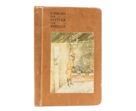
Africa.- Stigand (Capt. and Mrs. C.H.) Cooking for Settler and Trekker, illustrations, pencil annotations, occasional faint spotting, original cloth, a little rubbed, slight bumping to extremities, [1920] § Cranworth (Lord) A Colony in the Making, first edition, frontispiece, plates, large folding map, occasional light spotting, original cloth, slight bumping to extremities, 1912; Kenya Chronicles, uncorrected proof copy, occasional spotting, original paper wrapper with printed label to upper cover, rubbed, a little spotted, slight chipping to extremities, 1939; and 12 others, similar, 8vo (15) ⁂ The first is scarce with only 5 copies on COPAC.
Lot 250
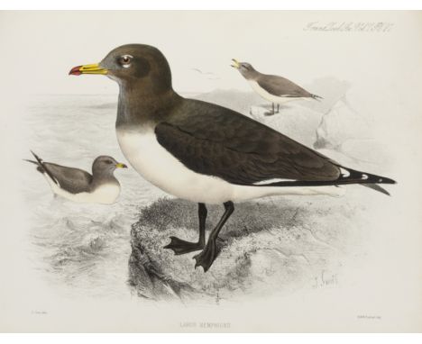
Dwight (Jonathan) The Gulls (Laridae) of the World, Bulletin of the American Museum of Natural History, vol. 52, part. 3, pp.63-401, plates, some colour, library cloth, original printed wrappers bound in, New York, 1925 § Wilkinson (E.S.) Shanghai Birds, colour plates, original pictorial cloth, gilt, Shanghai, 1929 § Finsch (Otto) On a collection of Birds from North-Eastern Abyssinia and the Bogos Country, extract from Transactions of the Zoological Society, vol. 7, part 4, pp..197-331, folding map and 4 hand-coloured lithographed plates by and after J. Smit, 1870; and 9 others, birds of the world, 8vo & folio (12)
Lot 154
Africa.- Gregory (J.W.) The Great Rift Valley, first edition, colour frontispiece, 20 plates, 2 folding maps, illustrations, advertisement leaf at end, ink inscription, original decorative cloth, rebacked, abrasion mark to upper cover, slight bumping to corners and extremities, [Hosken pp.87-88], 1896 § White (Stewart Edward) The Rediscovered Country, frontispiece, plates, folding map at end, with small tear, original cloth, slight bumping to extremities, c.1915 § Wilson (Lady Sarah) South African Memories, portrait frontispiece, portraits, cracked hinge, occasional light spotting, 16pp. advertisements at end, original cloth, bumping and splitting to spine (repaired), bumping to extremities, 1909; and 8 others, similar, 8vo (11)

Lot 65
Piozzi (Hester Lynch) Observations and Reflections made in the course of a Journey through France, Italy, and Germany, 2 vol., first edition, 6pp. advertisements at end of vol.2, old ink signatures at head of titles, old book-label of C.D.Barret, handsome contemporary tree calf, spines gilt with red and green roan labels, a little rubbed and scuffed, A.Strahan and T.Cadell, 1789 § Boswell (James) An Account of Corsica, the Journal of a Tour to that Island..., second edition, half-title, engraved title-vignette, folding engraved map, lightly browned, modern calf-backed marbled boards preserving old morocco label on spine, E. & C.Dilly, 1768, 8vo (3)
Lot 180
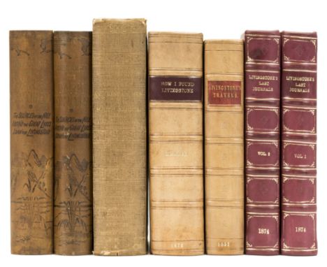
Africa.- Stanley (Henry Morton) How I Found Livingstone, second edition, half-title (3 holes, repaired), photographic frontispiece (ink stamp to verso, water-stain to corner), 3 folding maps and plans only (of 5), 2 with small tear, some tender edges, occasional light finger soiling, 1872 § Livingstone (David) Missionary Travels and Researches in South Africa, first edition, folding frontispiece (tear, repaired), final plate torn and repaired, 1 folding map (small tear), occasional light spotting, 1857; The Last Journals of David Livingstone, in Central Africa, 2 vol., first edition, frontispieces, 2 folding maps, marginal water-staining throughout, pencil annotations, 1874; plates and illustrations, later half-calf, [Hosken p.126]; and 3 others, by Livingstone or Stanley, 8vo (7)
![Lancashire.- [West (Thomas)] The Antiquities of Furness..., first edition, list of subscribers, folding engraved plan, 2 engr](https://cdn.globalauctionplatform.com/8766109f-1deb-4a16-a9ea-a7e0012ad58f/6882efaf-002e-4204-b323-2edb7620ee1d/468x382.jpg)
Lot 60
Lancashire.- [West (Thomas)] The Antiquities of Furness..., first edition, list of subscribers, folding engraved plan, 2 engraved plates, one folding, some spotting, contemporary calf, rebacked preserving old spine, corners repaired, for the Author, 1774; A Guide to the Lakes, in Cumberland, Westmorland, and Lancashire, fifth edition, half-title, engraved frontispiece and plate, 3pp. advertisements at end, with the additional suite of 16 aquatint plates separately issued but sometimes bound in), some hand-coloured, a few trimmed with loss to imprint, lacking folding engraved map, contemporary tree calf, spine gilt with red and blue labels, repairs to joints, 1793 § Aikin (J.) A Description of the Country...round Manchester, 2 vol. including portfolio of maps, engraved frontispiece, additional vignette title, plates and maps, rather soiled and foxed, text modern half calf, 3 large folding maps detached and loose in cloth portfolio (some tears repaired), 1795, the first two a little rubbed; and 2 others on Tim Bobbin and an 18th conveyance on vellum from Sir William Farrington of Shaw Hall, Leyland concerning the sale of church pews, 4to & 8vo (7)

Lot 257
Lloyd (Llewellyn) The Game Birds and Wild Fowl of Sweden and Norway, second edition, 48 chromolithographed plates, folding map mounted on linen and bound in at rear, green morocco gilt by Bayntun Rivière, original cloth bound in at rear, t.e.g., [Nissen IVB 569; Anker 312; Zimmer, p.403], 1867 § Cronau (C.) Der Jagdfasan: seine Anverwandten und Kreuzungen; Naturgeschichte und Aufzucht des Jagdfasans, 6 colour plates, bookplate of S.Dillon Ripley, original cloth-backed boards with paper label to upper cover, [Not in Nissen or Zimmer], Berlin, 1902 § Horsbrugh (Boyd Robert) The Gamebirds and Waterfowl of South Africa, facsimile edition, number 41 of 100 de luxe copies, colour plates, original green half morocco, slip-case, Winchester Press, [1978] § Delacour (Jean) The Pheasants of the World, 32 plates after J.C. Harrison, publisher's cloth, dust-jacket, Country Life, 1951; and 4 others, pheasants, 8vo & 4to (8)
Lot 190
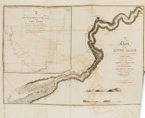
Africa.- Tuckey (Captain J. K.) Narrative of an Expedition to Explore the River Zaire, Usually Called the Congo, in South Africa in 1816, first edition, folding engraved map, 13 plates, illustrations, lacking half-title, a little off-setting, occasional spotting, heavier to plates, modern half crushed morocco, [Hosken p.203], 4to, 1818.
Lot 157
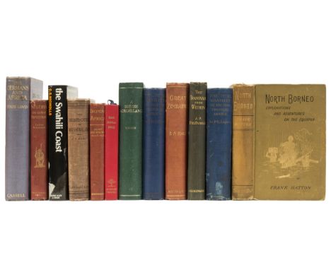
Africa.- Hatton (Frank) North Borneo Explorations and Adventures on the Equator, frontispiece, plates, illustrations, large folding map (1 tear), 32pp. advertisements at end, ink inscription, occasional light spotting, a little rubbed, 1885 § Hall (R. N.) Great Zimbabwe Mashonaland, Rhodesia, frontispiece, plates, illustrations, folding colour map, ink inscription, occasional light spotting, 1905 § Lugard (Sir F. D.) The Dual Mandate in British Tropical Africa, occasional light foxing, light soiling to upper cover, 1922; first editions, original cloth, slight bumping to extremities; and 9 others, similar, 8vo (12)
Lot 244
Archer (Sir Geoffrey) and Eva M. Godman. The Birds of British Somaliland and the Gulf of Aden, 4 vol., 28 colour plates after Archibald Thorburn, folding maps, bookplate of Peter Tate, original cloth, dust-jackets, light fading to spines, otherwise a fine set, 1937-61 § Chapin (James P.) The Birds of the Belgian Congo, 4 vol., Bulletin of the American Museum of Natural History vol.LXV, LXXV, 75a & 75b, vol.2 with colour frontispiece after G.E.Lodge, plates and illustrations, folding map, occasional ink notes to margins, titles a little browned and spotting, modern red crushed half morocco, spine gilt with bird motifs, New York, 1932-54 § Jackson (Sir Frederick John) The Birds of Kenya Colony and The Uganda Protectorate, 3 vol., portrait frontispiece, folding colour map and 24 colour plates after G.E.Lodge, captioned tissue-guards, original cloth, 1938; and 5 others, birds of Africa, 8vo (16)
Lot 203
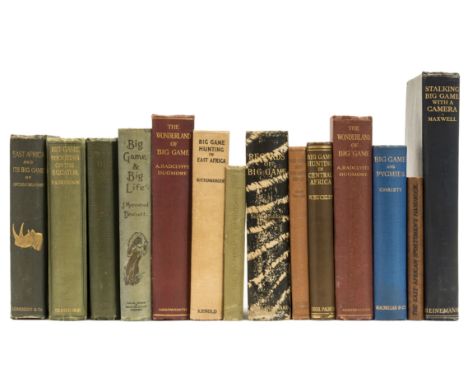
Big Game.- Willoughby (Captain Sir John C.) East Africa and its Big Game, first edition, plates (3 loose), folding map (short tear), occasional light spotting, 1889 § Dickinson (Captain F. A.) Big Game Shooting on the Equator, first edition, plates, cracked hinges, slight shelf-lean, 1908 § Maxwell (Marius) Stalking Big Game with a Camera in Equatorial Africa, first English edition, limited to 500 copies, plates, folding map, 1925; frontispieces, original cloth, slight bumping to spine extremities, [Czech p.175, p.48, p.109]; and 11 others, Big Game, v.s. (14)
Lot 186
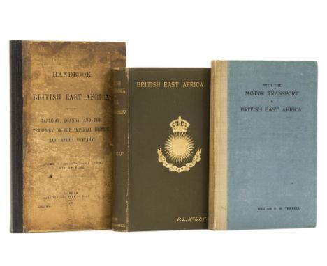
Africa.- Terrell (William E.W.) With the Motor Transport in British East Africa, frontispiece, ink inscription, original cloth backed boards, c.1919 § Handbook of British East Africa Including Zanzibar, Uganda, and the Territory of the Imperial British East Africa Company, 2 folding maps in pocket at end, small ink stamps on verso of maps, new endpaper, original boards, rubbed, 1893 § McDermott (P. L.) British East Africa or Ibea, first edition, frontispiece, folding map, new endpapers, original cloth, spine a little rubbed, slight bumping to extremities, 1893 and 12 others, East Africa, v.s. (15)
![Japan.- [Meiji Period Traveller's Map of Japan], folding colour woodcut map, on six conjoined sheets, overall c.710 x 1430mm.](https://cdn.globalauctionplatform.com/8766109f-1deb-4a16-a9ea-a7e0012ad58f/3a70f024-886b-4c57-94e7-355beefbb673/468x382.jpg)
Lot 225
Japan.- [Meiji Period Traveller's Map of Japan], folding colour woodcut map, on six conjoined sheets, overall c.710 x 1430mm., title and text in Japanese, some very light soiling and slight wear to folds, original wrappers with printed paper label, a little spotted and rubbed, folding to 4to, [late 1860s]. ⁂ Including a table with distances of towns from Tokyo and the services available to travellers, but not showing Hokkaido. The use of lines of latitude and longitude, a Western concept, suggest the map was made following the establishment of relations with the United States in the mid-1850s, while the depiction of Japan as a whole country is unlikely to have been created until after the Meiji Revolution in 1868 when the country was unified under the rule of the Emperor Meiji.
Lot 153
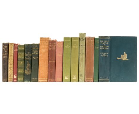
Africa.- Gouldsbury (Cullen) and Hubert Sheane, The Great Plateau of Northern Rhodesia, first edition, frontispiece, plates, folding map at end (small marginal tear), original cloth, slight bumping to extremities, [Czech p.65] 1911 § Rowley (Rev. Henry) Twenty Years in Central Africa, folding map (small tear), occasional light spotting, original pictorial cloth, rubbed, slight shelf-lean, n.d.; and 13 others, 8vo (15)
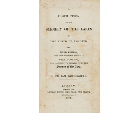
Lot 91
Wordsworth (William) A Description of the Scenery of the Lakes, Third Edition, first separate edition, folding engraved map (linen-backed), rather foxed, later morocco-backed boards, by W.H.Smith & Sons (?Douglas Cockerell), spine darkened and with small chip at head, fading to boards, 1822 § Byron (G.G.N., Lord) The Corsair, sixth edition, half-title, contemporary mottled calf, gilt, spine gilt with blue roan label, 1814 § [Smith (James & Horatio)] Rejected Addresses: or the New Theatrum Poetarum, first edition, half-title, lacking advertisement leaf at end, occasional foxing, modern brown morocco, gilt, by Bayntun, spine gilt, g.e., spotted, 1812, the first two rubbed; and another, Wordsworth, 8vo & 12mo (4) ⁂ Some new material appears in the first item including a sonnet on p.42; the last contains parodies of the Romantic poets.
Lot 146
Africa.- Drake-Brockman (Ralph E.) British Somaliland, plates and illustrations, folding map at end, occasional faint spotting, 1912 § Saville (Frank) River of the Giraffe, 10 plates (2 loose), lacking frontispiece and map, ink inscription, occasional light spotting, 1925; first editions, original cloth, slight bumping to extremities; and 6 others, similar, 8vo (8)
Lot 213
America.- Warre (Captain Henry) Sketches in North America and the Oregon Territory, first edition, 12 hand-coloured lithograph views on 10 sheets only of 20 on 16, plate guards, and map of Warre's route, untitled, title browned, without the printed note concerning binding options and the dedication leaf (called for by Abbey), 1 plate guard with small tear, some slight finger soiling in a few margins of plates, inner hinges strengthened, original cloth boards, gilt, faded, modern half morocco, gilt, [Abbey, Travel 656; Howes W114; Sabin 101455], folio, Dickinson & Co., [1848]. ⁂ Plates in good clean condition. "The only western color-plates comparable in beauty to those by Bodmer." - Howes.
Lot 224
Italy.- Rome.- Monaldini (Venanzio) Pianta della Citta di Roma, con la Indicazione di tutte le Antichitata e nuovi Abbellimente, engraved plan by Pietro Ruga, 750 x 1130 mm. (29 ½ x 44 ½ in.), side panels with 16 views of buildings, extensive key, dissected and linen-backed, a few minor finger marks but a very good example, contemporary marbled slip-case with engraved and manuscript labels, Rome, Monaldini, 1829; Monaldini (Venanzio) Pianta delle Vestigia di Roma, engraved plan of ancient Rome by Gio. Acquaroni, 635 x 845 mm. (25 x 33 ¼ in.), dissected and linen-backed, contemporary marbled slip-case with engraved and manuscript labels, Rome, Monaldini, 1826; Sickler (F.C.L.) Plan Topographique de la Campagne de Rome, engraved map of the Roman Campagna by Pietro Ruga, 570 x 880 mm. (22 ½ x 34 ½ in.), dissected and linen-backed, with Pantogramma des Environs de Rome, outline engraved panorama, folding sheet 215 x 1620 mm. (9 ¾ x 63 ¾ in.), contemporary marbled slip-case with engraved and manuscript labels, Rome, Monaldini, 1832, (3).
![[Fisher (Jonathan)] A Picturesque Tour of Killarney, Described in Twenty Views,.. Together with A Map of the Lake and its Env](https://cdn.globalauctionplatform.com/8766109f-1deb-4a16-a9ea-a7e0012ad58f/f4a1645e-ace3-4339-e51d-d393197412e8/468x382.jpg)
Lot 238
[Fisher (Jonathan)] A Picturesque Tour of Killarney, Described in Twenty Views,.. Together with A Map of the Lake and its Environs, sepia aquatint full-page map and 20 full page plates, inner hinges strengthened, contemporary half calf, gilt, rubbed, t.e.g., [Abbey, Scenery 479], a fine copy, large oblong folio, 1789.
Lot 204
Mountaineering.- Fitzgerald (E. A.) Climbs in the New Zealand Alps, second edition, one of only 500 copies, frontispiece, plates and illustrations, folding map in pocket at end, some small tears to folds, occasional spotting, abrasion mark to front pastedown, original cloth, morocco spine labels, slight bumping to extremities, 1896 § Tilman (H. W.) Snow on the Equator, first edition, plates, maps, pencil inscription, occasional light foxing, original cloth, dust-jacket, slight chipping to top edge, 1937; and 6 others, mountaineering, [Neate F36 & T47], 8vo, (8)
Lot 43
Gilpin (Rev. William) Observations on the River Wye..., second edition, large paper copy, 17 hand-tinted aquatint plates, light staining to one or two leaves, contemporary calf, gilt, spine gilt with red roan label, [cf.Abbey, Scenery 546, 1800 edition], 1789; another edition, first edition, half-title, 15 hand-tinted aquatint plates, contemporary calf, rebacked with gilt spine preserving old label, 1782; Observations, relative chiefly to Picturesque Beauty...particularly the Mountains, and Lakes of Cumberland, and Westmoreland, 2 vol., second edition, half-titles, 3 hand-coloured engraved maps and 27 hand-tinted aquatint plates, contemporary calf, rebacked preserving old gilt spines with red roan labels, [Abbey, Scenery 183], 1788; Remarks on Forest Scenery..., 2 vol., second edition, half-titles, hand-coloured double-page engraved map and 30 hand-tinted plates only (of 31, vol.2 lacking view of Beaulieu river), signatures cut away from front free endpapers, contemporary half red roan, spines faded, 1794, some foxing and offsetting, a little rubbed; and another by Gilpin, 4to & 8vo (7)
Lot 149
Africa.- Eggeling (William J.) The Indigenous Trees of the Uganda Protectorate, plates and illustrations, folding colour map, original cloth, rubbed, 1940 § O'Shea (T. J.) Farming & Planting in British East Africa, first edition, frontispiece, plates and illustrations, cracked hinge, original pictorial boards, a little rubbed, slight bumping to extremities, Nairobi, 1917 § Morrison (C. R.) Mixed Farming in East Africa, occasional spotting, original cloth, dust-jacket, slightly rubbed, 1935; and 10 others, similar, 8vo (13)
Lot 137
Africa.- Cameron (Verney Lovett) Across Africa, 2 vol., first edition, frontispieces, water-damage to edge of frontispiece and title (vol. 2, repaired), plates, illustrations, 3 folding facsimiles, folding map in pocket at end, original decorative cloth, [Hosken p.38] 1877 § Akeley (Mary L. Jobe) Carl Akeley's Africa, frontispiece, plates, 4 maps only (of 5), ink inscription, original cloth, 1931; and 11 others, similar, 8vo (14)
Lot 139
Africa.- Carpenter (G. D. Hale) A Naturalist on Lake Victoria, first edition, 3 ALs by the author, colour frontispiece, folding map at end, plates and illustrations, heavily annotated, occasional foxing, original cloth, rubbed, bumping to corners and extremities, [Hosken p.42], 8vo, 1920. ⁂ With loosely inserted slip noting this as an 'Advance Copy.'

Lot 342
Broadside.- Cochin (Nicolas) The Map of the Kingdom of Heaven, or 'La carte du royaume des cieux, avec le chemin pour y aller', after Stefano della Bella (1610-1664), etching and engraving, published by Nicolas Jean Baptiste de Poilly, [circa 1650, but a later impression from circa 1740], on laid paper with watermark of large rosary encircling a Maltese cross, two plates printed on two sheets, total platemark (incl. lettered title above) approximately 875 x 570 mm. (34 1/2 x 22 1/2 in), total sheet 1150 x 745 mm. (45 1/4 x 29 3/8 in), unframed. Literature: De Vesme/Massar 1056 ⁂ Religious broadside after a programme devised by Hierosme Chastelain presenting the division between Heaven, Purgatory, and Hell. The walled celestial city of Jerusalem, presided over by the Holy Trinity from a mountain summit, is featured at the top; the souls of Purgatory are shown below outside the gates of Heaven; and finally, the fiery rivers of hell are at the bottom presided over by Lucifer.
Lot 189
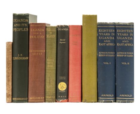
Africa.- Tucker (Alfred R.) Eighteen Years in Uganda, 2 vol., plates, folding colour map, occasional light spotting, cracked hinges (vol. 2), slight rubbing to corners and joints, 1908 § Cunningham (J. M.) Uganda and its Peoples, illustrations, map, cracked hinge, bumping to spine extremities, 1905; first editions, frontispieces, ink inscriptions, original cloth; and 6 others, Uganda, 8vo & 4to (9)
Lot 279
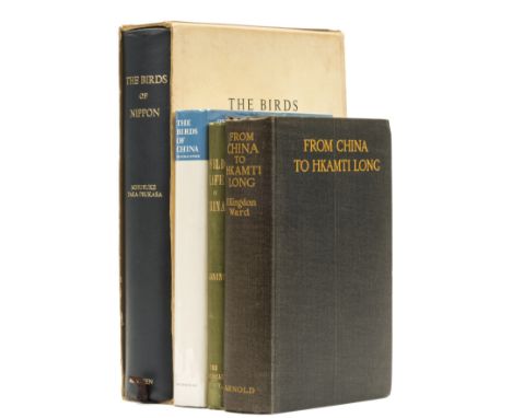
Ward (F. Kingdon) From China to Hkamti Long, first edition, plates, folding map, some light foxing, 1924 § Lanning (George) Wild Life in China, bookplate, Shanghai, 1911 § Taka-Tsukasa (Dr Nobusuke) The Birds of Nippon, 3 colour plates, illustrations, original slip-case (rubbed and surface soiled, ink inscription to cover), Tokyo, 1967, original cloth; and another, China, 8vo & 4to (4)
Lot 144
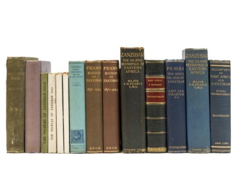
Africa.- Craster (Capt. J.E.E.) Pemba, the Spice Island of Zanzibar, first edition, folding map, original cloth, slight bumping to spine extremities, [Hosken o.52] 1913 § Younghusband (Ethel) Glimpses of East Africa and Zanzibar, folding map, later half calf, 1910 § Pearse (Major F. B.) Zanzibar, first edition, occasional light spotting, original cloth, browned spine, rubbed, slight bumping to extremities, 1920; frontispieces, plates; and 12 others, Zanzibar, 8vo (15)

Lot 447
Bible, English. The Holy Bible, Conteyning the Old Testament and the New, 2 parts in 1, double column, black letter, 72 lines, titles with elaborate woodcut borders, woodcut initials, John Speed's Genealogies without double-page engraved map before text, Kalendar printed in red and black, OT laid down, edges chipped, A2-4 lower margins repaired, X1-2 torn with some loss X1 crudely repaired, 3U3-4 lower margins torn and repaired, last f. creased, some slight staining and a few small tears mostly to edges, browned, 18th century panelled reverse calf, rubbed, [Herbert 322 STC 2226], folio, Robert Barker, 1613. ⁂ "The true 1613 folio edition of King James' Bible; easily distinguishable from the other large folio editions by its smaller type... with 72 instead of 59 lines to the full column." - Herbert.

Lot 237
Britain.- Teesdale (Henry) New British Atlas, Containing a Complete set of County Maps, on which are Delineated all the Principal Cross Roads, Cities, Towns & most Considerable Villages, Parks, Rivers, Navigable Canals & Railways Preceded by General Maps of England, Ireland, Scotland, North & South Wales... to 1840, double-page engraved title by T. Barnett, 3 folding general maps and 47 double-page county maps (Yorkshire on 4 sheets), all fully hand-coloured, 1 extra double-page hand-coloured map of England and Wales by James Wyld, 2 maps with small tears (1 with small loss affecting map), some slight foxing, contemporary morocco, gilt, slightly faded and rubbed, gilt spine rubbed, g.e., folio, Henry Teesdale & Co., 1840.
Lot 182
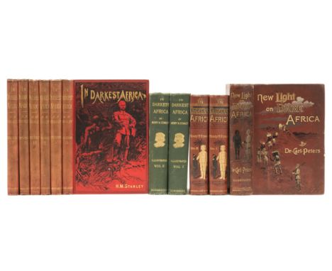
Africa.- Stanley (Henry Morton) In Darkest Africa, 2 vol., first edition, ink inscriptions, illustrated endpapers, frontispieces, 4 maps (3 folding, 2 with a small tear), spotting, 1890; In Darkest Africa, 6 vol., subscribers edition, 3 folding maps (2 with small tears), occasional light spotting, faded spines, slight bumping to extremities, 1890 § Peters (Dr. Carl) New Light on Dark Africa, first English edition, frontispiece (discreetly strengthened), lacking map, occasional light finger soiling, rebacked with original spine laid down, rubbing to extremities, 1891; plates and illustrations, original pictorial cloth, [Hosken p.189; Czech p.128]; and another, by Stanley, 8vo (11)
Lot 174
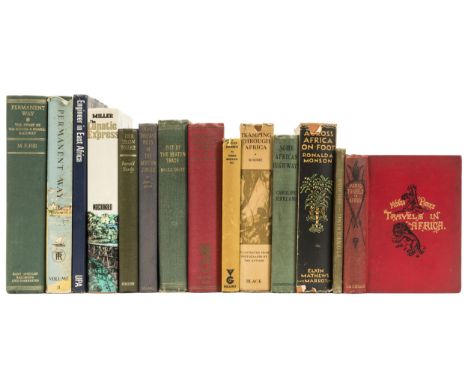
Africa.- Park (Mungo) Travels in the Interior of Africa, occasional light spotting, prize-label, spine a little faded, 1893 § Monson (Ronald A.) Across Africa on Foot, dust-jacket, small tears and chipping, small loss to extremities, 1936 § Kirkland (Caroline) Some African Highways, ink inscription, [Hosken p.116], 1908 § Roome (W. J. W.) Tramping Through Africa, occasional light spotting, folding map, dust-jacket, a little rubbed, small tears and chipping to extremities, 1930; all but the first, first editions, frontispieces, plates, original cloth, slight bumping to extremities; and 10 others, similar, 8vo & 4to (14)
Lot 138
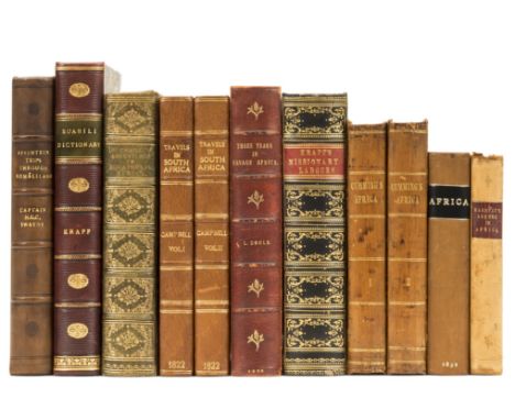
Africa.- Campbell (John) Travels in South Africa, 2 vol., first edition, hand-coloured aquatint frontispieces, 9 plates only (of 10), lacking map, occasional light off-setting, modern half morocco, [Abbey Travel 328] 1822 § Murray (Hugh) Narrative of Discovery and Adventure in Africa, engraved folding map, additional engraved title, illustrations, bookplate, occasional light spotting, contemporary calf, rebacked, Edinburgh, 1832; and 9 others, similar, 8vo (11)
Lot 230
South America.- Mawe (John) Travels in the Interior of Brazil, first edition , engraved frontispiece, 7 plates (1 hand-coloured) and 1 map, title and some other ff. offsetting, some foxing, new endpapers, later Longmans catalogue bound in at end, modern half calf, gilt spine, edges uncut, [Sabin 46991], 4to, 1812.

Lot 418
Brown (Ford Madox, painter and designer, 1821-93) Autograph Letter signed "F Madox B" to Charles Rowley, philanthropist, businessman and art dealer, 4pp., 8vo, [London] 37 Fitzroy Square, 4th September 1877, current news relating to members of the Rossetti family, "My wife returns to day from Gorleston [Marine House] where she has been these 4 weeks with Mrs. Rossetti - I was only one day with her being anxious to be here at work, but I had soon after getting back to my work to go off with [W.M.] Rossetti who was in great want of change & refused to go without some company that he liked", and concerning his painting of Cromwell in Conversation with Milton dictating a letter to Andrew Marvell protesting at the Piedmont Easter Massacre 1655, "The Milton-Cromwell picture is making progress... however, & as I usually do in such case I am elaborating certain points... my chief labour is with an old map of Savoy of the time - as made to look like such - which was a somewhat troublesome problem...", folds.
Lot 271
Hickson (Sidney J.) A Naturalist in North Celebes, first edition, colour frontispiece, folding map, plates and illustrations, upper hinge starting, bookplate of Robert and Maria Travis, original cloth, gilt, chip to head of spine, 1889 § Verner (Colonel Willoughby) My Life Among the Wild Birds in Spain, plates and illustrations, endpapers browned, original cloth, gilt, 1909 § Mary Duchess of Bedford, Edited by John Gore, 2 vol, vol.1 lacking front free endpaper, original half calf, light wear to extremities, 1938; and 18 others, birds and other natural history and biography, 8vo (22)
Lot 168
Africa.- Livingstone (David) Missionary Travels and Researches in South Africa, first edition, folding lithographed frontispiece, plates (1 folding), 1 folding map only (of 2), occasional marginal water-staining, pencil annotations, modern half calf, [Hosken p.126] 1857 § The Life and Explorations of David Livingstone, chromolithographed frontispiece, additional title and 19 plates, occasional light spotting, original decorative morocco, gilt, slight bumping to corners and extremities, Reading and Bath, n.d.; and 14 others, Livingstone, 8vo & 4to (16)
Lot 223
Italy.- Brenna (Gio.) and C. Pinchetti. Carta Geografica e Postate del Regno Lombardo-Veneto, engraved map by Giuseppe Pezze, 860 x 1310 mm. (33 ¾ x 51 ½ in.), from Lake Maggiore east to Trieste, 17 town plans at foot, dissected and linen-backed, contemporary marbled slip-case with manuscript label, one edge rubbed, Milan, Gio. Cogliati, 1848; Brenna (Gio.) Carta Topografica dei Contorni di Milano, engraved map by Vittorio Angeli, original outline hand-colouring, 700 x 850 mm. (27 ½ x 33 ½ in.), dissected and linen-backed, contemporary marbled slip-case with engraved title, Milan, Fratelli Bettalli, 1833; and six engraved regional maps of the area north of Milan by Brenna, dissected and linen-backed, in two contemporary slip-cases, Milan, 1836-1845, (4).
Lot 109
Potatoes.- Kirkpatrick (Hezekiah) An Account of the Manner in which Potatoes are cultivated and preserved, and the uses to which they are applied in the counties of Lancaster and Chester, together with a description of a new variety of the Potatoe, peculiarly convenient for forcing in Hot-Houses and Frames, mounted errata slip at foot of final verso, final f. blank, [Henrey 899; Perkins 935], Warrington, Printed by W. Eyres, 1796 bound with Ringsted (Josiah) The Farmer. Comprehending the several most interesting objects and beneficial practices in the culture of wheat, rye, Barley, Oats, Buckwheat, Peas, Beans...Together with the Cultivation of Hops, Vines, Forest Trees, Fruit Trees, Kitchen and Flower Garden Productions. Likewise, directions in the breeding and improvement of Horses, Oxen, Cows, Calves, Sheep, Lambs, and Hogs...Also, rules for the treatment and rearing of Poultry,viz. Pheasants, Turkeys, Geese, Fowl, Tame Rabbits, Pigeons, &c. And the ordering of bees, and their Labors...third edition, [British Bee Books 128 and cf. 134, Samuel Cooke's The Farmers Wife, 'the wording of the 12 pages on bees is identical with that in The Farmer by Ringsted'], Printed for J. Smeeton, n.d. [?c.1790] and Fordyce (George) Elements of Agriculture and Vegetation...To which is added, an appendix, for the use of Practical Farmers, fifth edition, 3 engraved plates, for J. Johnson, 1796 and Holt (John) General view of the Agriculture of the County of Lancaster: with observations on the means of its improvement. Drawn up for the Consideration of the Board of Agriculture and Internal Improvement, first edition, engraved folding frontispiece map and 5 plates, 2 folding letter-press tables, [Perkins 815], for G. Nicol, 1795, together 4 works in 1 vol., some spotting or mostly light foxing, offsetting, occasional staining, contemporary half calf, spine gilt and with red morroco label, corners worn, rubbed, 8vo ⁂ The Kirkpatrick is rare at auction, as is the third edition of Ringsted, which is not recorded in ESTC.
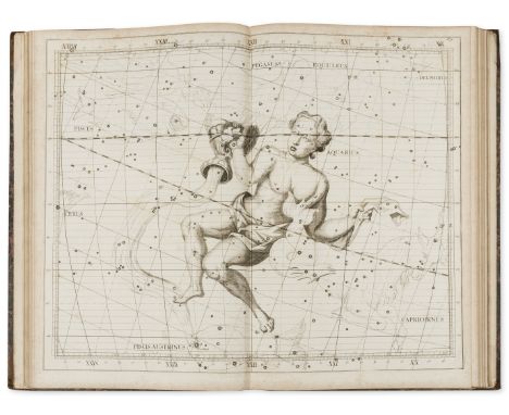
Lot 289
Flamsteed (John) Atlas Coelestis, engraved portrait by George Vertue after T. Gibson, engraved vignette on title, headpiece, tail-piece and initial, and 27 double-page engraved star maps (on 28 sheets, map 14 in 2 sheets), without the list of subscribers, some slight foxing to edges, Warren de la Rue's copy with his bookplate on front pastedown, contemporary half calf, corners bumped, rebacked in modern calf, [cf. Warner pp.80-82], folio, Printed for C. Nourse, 1781. ⁂ The most important star atlas of the eighteenth century. "John Flamsteed, our astronomer royal, was the author of the most important star-atlas published during the period covered by this chapter (1675-1800), and one which satisfied the needs of astronomers generally for almost a century." - Brown. Astronomical Atlases, p. 47. Warren de la Rue (1815-89), chemist and astronomer.
![Scotland.- [Gower (Elizabeth Leveson, Duchess of Sutherland)] Views in Orkney and on the North-Eastern Coast of Scotland, [on](https://cdn.globalauctionplatform.com/8766109f-1deb-4a16-a9ea-a7e0012ad58f/ab7c28b1-e1a6-4e98-f5eb-48268ebeab21/468x382.jpg)
Lot 110
Scotland.- [Gower (Elizabeth Leveson, Duchess of Sutherland)] Views in Orkney and on the North-Eastern Coast of Scotland, [one of 120 copies for presentation to friends] , etched title with vignette map, 12 vignettes and 31 plates on 28 sheets, mostly views, occasional spotting, a few plates of other subjects loosely inserted, contemporary green morocco, gilt, g.e., rubbed, folio, [privately printed], 1807.

Lot 145
Africa.- Dracopoli (Ignatius Nicolas) Through Jubaland to the Lorian Swamp, 1 folding map, spotting, cracked hinges, slight bumping to spine extremities, 1914 § Haywood (Captain C. Wightwick) To the Mysterious Lorian Swamp, 1 folding map, scattered faint foxing, 1927; first English editions, frontispieces, plates, original cloth, [Czech p.51 & 73], 8vo (2)
-
109198 item(s)/page