We found 109198 price guide item(s) matching your search

Refine your search

Year

Filter by Price Range
  • List
  • Grid
  • 109198 item(s)
    /page

Lot 218

Netherlands. Senex (John), The VII United Provinces corrected from the observations communicated to the Royal Society at London & ye Royal Academy at Paris, 1709 [or later], large engraved map with contemporary hand colouring, on two conjoined sheets, 645 x 940 mm, together with Moll (Herman), Les Provinces des Pays-Bas Catholiques ou A most exact map of Flanders or Austrian Netherlands &c..., published D. Midwinter & T. Bowles, circa 1720, large engraved map with contemporary outline colouring, on two conjoined sheets, inset maps of Luxembourg, Isle de France and a plan of 'fortifications', old folds, very slight toning to folds, 610 x 1005 mm (2)

Lot 219

Northamptonshire. Eyre (Thomas & Jefferys Thomas), The county of Northampton as surveyed and planned..., 2nd edition, published William Faden, 1791, uncoloured large scale map, engraved by William Faden on four sheets (conjoined into two), two engraved vignettes of Queen's and Geddington Cross, slight offsetting, slight marginal dust soiling and fraying, overall size 1240 x 1300 mm, contained in a modern purpose made marbled card portfolio (1)

Lot 220

Northamptonshire. Speed (John), Northampton, published Thomas Bassett & Richard Chiswell, [1676], hand coloured engraved map, inset town plans of Northampton and Peterborough, slight creasing, occasional marginal closed tears, 390 x 515 mm, English text on verso, mounted (1)

Lot 222

Northern England. Lamberti (Aniello), Carta II. per L'Inghilterra, published Florence, [1779], engraved playing card map of the northern half of England & Wales, (nine of cups), contemporary hand colouring, a list of the counties and rivers below map, 100 x 60 mm Geoffrey King. Miniature Antique Maps (2nd. edition), page 180.A tarot suit card from a pack known as the 'Minchiate', which comprised of ninety-seven cards with seven relating to the British Isles. Rare. (1)

Lot 225

*Oxfordshire. Speed (John), Oxfordshire described with ye citie and the armes of the colledges of ye famous university, published Thomas Bassett & Richard Chiswell, [1676], hand coloured engraved map, inset town plan of Oxford, eighteen coats of arms to the vertical margins, central fold split and repaired on verso, one repaired closed tear affecting image, some browning to lower right corner, 390 x 530 mm, framed and double glazed, English text on verso (1)

Lot 226

*Oxfordshire. Plot (Robert), The Map of Oxfordshire, [1677], hand coloured engraved map, decorative cartouche, mileage scale, table of explanation and compass rose, old folds, small closed tears with slight loss affecting image, repaired with facsimile, one long closed tear affecting image, 500 x 480 mm, mounted, framed and glazed, together with Plot (Robert), The Natural History of Oxford-shire, being an essay toward the natural history of England, printed at the Theatre in Oxford..., 1677, decorative title, dedication to Charles II, sixteen uncoloured engraved plates, index bound at rear, bookplates of Effingham and Simon Nowell-Smith, later endpapers, 19th century half calf gilt, worn at extremities, 4to Created by the first keeper of the Ashmolean Museum of Oxford, the map is decorated with 172 coats of arms of the county's gentry, Oxford colleges, the city and the four county towns. One of the most decorative maps of Oxfordshire ever produced. (2)

Lot 227

Persia. Ortelius (Abraham), Persici sive sophorum regni Typus, [1595], hand coloured engraved map, slight fraying to margins but not affecting image, 350 x 500 mm, Latin text on verso, together with Kitchin (Thomas), New map of Persia divided into its provinces from the latest authorities, circa 1790, engraved map with contemporary outline colouring and some later enhancement, old folds, 385 x 345 mm The first map described:- Marcel van den Broecke. Ortelius Atlas Maps, no. 167. (2)

Lot 228

*Scotland. Scobie (Mathew), A map of Roxburgh Shire of Tiviotdale, circa 1770, large scale map with contemporary outline colouring, engraved by John Bayley, on four conjoined sheets, inset map of East Point and Chivot Hill, table of remarks and a list of the principal seats, table of explanation, ornate cartouche and compass rose, slight overall toning and some dust soiling, 1050 x 950 mm, framed and glazed (1)

Lot 23

Mandelslo (Johann Albrecht von). Voyages celebres et remarquables, faits de Perse aux Indes orientales ... contenant unde description nouvelle et trŠs-curieuse de l'Indostan, de l'Empire du Grand-Mogol, des Œles et presqu'Œles de l'Orient, des royaumes de Siam, du Japon, de la Chine, du Congo, etc. ... mis en ordre et publiez ... par Adam Olearius, traduits de l'original par A. de Wicquefort ... nouvelle edition rev–e et corrig‚e exactement, augment‚e considerablement, Amsterdam: Michel Charles Le CŠne, 1727, half-title to volume 1, title pages printed in red and black, engraved arms to dedication, portrait 20 maps and plans (most of them folding), 16 folding views including panorama of Tokyo, 1 folding plate depicting Hottentots, 7 further plates not mentioned in the 'avis au relieur', 19 vignettes in the text, final privilege leaf, additional engraved title and volume 2 half-title lacking, occasional spotting and browning, later hand-colouring to folding map 'Royaume de Perse' and the views of Gamron (i.e. Bandar Abbas) and Anvers, plan of Goa with small rupture to intersection of folds, map of the Congo with short split along one fold, short closed tear to 'La rade de Batavia' plate not affecting image, mild damp-staining towards rear, near-contemporary calf, gilt spine, joints cracking superficially at ends, folio (31 x 19 cm) Atabey 884 (accompanied by a copy of Olearius's Voyages ... faits en Moscovie, Tartarie, et Perse), Cordier Indosinica 883, Japonica 367-8, Sinica 2077, Cox I pp. 271-2 for other editions. Re-issue of Van der Aa's 1719 Leiden edition, the preferred edition of a work first published in German in 1647. Mandelslo travelled to Persia in 1633 as part of an embassy sent by the Duke of Holstein; the other ambassadors remained in Persia but Mandelslo obtained permission to continue to India, sailing from Hormuz on the Persian Gulf in 1638 and landing at Surat, thence travelling throughout India and returning to London via Ceylon and Madagascar. In addition to the regions visited, the plates and maps depict China, Japan, and various locations in the Dutch East Indies. (1)

Lot 231

Shropshire. Greenwood (C. & J.), Map of the county of Salop from an actual survey made in the years 1826 & 1827, published July 2nd. 1827, large scale engraved map with contemporary hand colouring, sectionalised and laid on linen, calligraphic title, compass rose, table of explanation and a vignette of the south west prospect of Shrewsbury, inset map of part of Shropshire, slight staining and offsetting, library stamp below cartouche, edged in green silk, several library stamps to verso, library label to endpaper and inside lid of book box, 1485 x 1230 mm, contained in a contemporary green morocco gilt book box, rubbed and worn at extremities (1)

Lot 232

Society for the Diffusion of Useful Knowledge. A collection of eighteen city plans, circa 1840, engraved city plans with contemporary hand colouring, some with later additional watercolour, one map with mount staining, slight spotting, occasional marginal closed tears, one duplicate, each approximately 330 x 395 mm The plans consist of:- Amsterdam, Oporto, Lisbon, Pompeii, Naples, Florence, St. Petersburg (2), Turin, Milan, Genoa, Bordeaux, Marseille, Edinburgh, Vienna, Plan of Ancient Rome, Plan of modern Rome [and] Paris [on two sheets]. (18)

Lot 235

*Turkish Empire. Speed (John), The Turkish Empire, published George Humble, [1627], hand coloured engraved 'carte-a-figures' map, ten costumed figures to the vertical margins, eight oval vignettes of principal cities to upper horizontal margin, 395 x 515 mm, mounted, framed and double glazed, English text on verso A clean bright example in very good condition of one of the most decorative maps of the region issued in the 17th Century and the first map of the region to be published in England. (1)

Lot 236

Underground map. Beck (Henry C.), London Underground Transport, 1937, colour photolithographic on card, an example of Beck's iconic map of the London Underground four years after its first appearance, slight spotting, the verso shows a detail of the interchange stations in the central area with the names of the stations within diamonds, some staining to verso, two folds, 155 x 225 mm, together with a London Transport 1935 untitled folding map of the bus routes in the central area of London, old folds, 430 x 565 mm (2)

Lot 237

Vienna. De Hooghe (Romain), Untitled engraving of the siege of Vienna, published Amsterdam, Nicolas Visscher, circa 1685, uncoloured engraving, faded manuscript title above map, vertical margins extended, 460 x 575 mm A view of Vienna as it was when besieged by the Turks in 1683. (1) Now supplied with a modern reproduction of the print, together with a key plate to the engraving produced by Historisches Museum der Stadt Wien

Lot 238

Wales. Jansson (Jan), Ceretica sive Cardiganensis comitatus Anglis Cardigan Shire, published Amsterdam, circa 1648, engraved map with contemporary outline colouring, 385 x 505 mm, Latin text on verso, mounted, together with Van den Keere (Pieter), Wales, circa 1627, hand coloured engraved map, 85 x 125 mm, English text on verso, mounted, with Mercator (Gerard & Cloppenburg H. Jan Evertsz), Cambriae typus auctore Humeredo Lhuydo, Denbigiense Cambrobritanno, circa 1630, hand coloured engraved map, 185 x 255 mm, mounted, plus Bertius (Pieter), Cambria, [1618], uncoloured engraved map, 100 x 130 mm, Latin text on verso, mounted, and Luffman (John), Caerdiganshire, [1803], circular miniature map with contemporary hand colouring, English text below map, map size (to plate mark) 80 x 70 mm, mounted, with another four county maps of Cardiganshire and three strip road maps of north west Wales, including examples by Van den Keere, Miller, Cowley, Osborne, Owen & Bowen and Senex, various size and condition, mounted, with a 1901 lithographic folding map of the Great Western Railway, sectionalised and laid on linen, 750 x 820 mm (13)

Lot 240

*Wiltshire. Saxton (Christopher & Kip William), Wiltoniae comitatus herbida..., 1st edition, [1607], engraved map with contemporary outline colouring, 280 x 355 mm, mounted, framed and glazed (1)

Lot 242

*World. Magini (Giovanni Antonio), Universi orbis descriptio ad usum navigantium, published Venice, [1596], hand coloured map, engraved by G. Porro, 135 x 175 mm, mounted, framed and glazed R. W. Shirley. The Mapping of the World, no. 196. First published in Magini's edition of Ptolemy's Geographia. This 'mariner's map' is a reduced version of Gerard Mercator's large world map of 1569. Note the speculative addition of a mountain range in the Southern Continent, a clear 'North-West passage' and the absence of the Great Lakes. (1)

Lot 243

*World. Porro (Girolamo & Magini Giovanni), Universi orbis descriptio, published Venice, [1596], hand coloured map of the world on an oval projection with six wind heads, 135 x 175 mm, mounted, framed and glazed R. W. Shirley, The Mapping of the World, no.195. The map was re-printed a year later in Cologne with an abbreviated 'Terra incognita' above the North American continent. (1)

Lot 244

*World. Quad (Matthais), Typus orbis terrarum ad imitationem universalis gerhardi Mercatoris..., published Johann Bussemacher, Cologne, [1600], hand coloured engraved map, inset portrait of Christ in an oval frame and a quotation from Cicero below the map, 220 x 310 mm, mounted, framed and glazed R. W. Shirley, The Mapping of the World, no. 197. Note the mythical islands of Groclant, Thule, Frischlant and S. Brandam which appear near Greenland. (1)

Lot 245

Yorkshire. Saxton (Christopher & Hole William), Eboracensis comitatus pars septentrionalis vulgo North Riding, Eboracensis comitatis pars occidentalis vulgo West Riding [and] Eboracensis comitaus..., pars orientalis vulgo East Riding, [1607, 1637 & 1610 respectively], together three hand coloured engraved maps, the West Riding toned overall, the North Riding with some text 'showthrough' and slight staining to margins, the East Riding with slight mount staining, each approximately 210 x 250 mm, together with another coloured copy of the East Riding, with Morden (Robert), The North Riding of Yorkshire [and] The East Riding of Yorkshire, [1695 or later], two hand coloured engraved maps, slight toning to the North Riding, each approximately 360 x 420 mm, plus Kitchin (Thomas), The East Riding of Yorkshire, published in 'The London Magazine', [1749], uncoloured engraved map, old folds, 190 x 200 mm, and Morden (Robert), The West Riding of Yorkshire [and The North & East Riding of Yorkshire, circa 1731, two hand coloured engraved maps, old folds, each approximately 170 x 225 mm, with another uncoloured copy of the North & East Riding (10)

Lot 246

Yorkshire. Saxton (Christopher & Lea Philip), York-shire described cy Ch. Saxton. Many additions and corrections as ye roads, wapontakes &c., [published Thomas Jefferys, 1749], uncoloured engraved map, old folds, slight creasing, 535 x 735 mm A very scarce late edition of Saxton's map, with the Willdey attribution removed. The British Library has two copies of this map, but no others have been recorded. (1)

Lot 247

Yorkshire Jansson (Jan), Provincia Eboracensis Yorke-shire, Ducatus Eboracensis pars Occidentalis. The West Riding of Yorke Shire [and] Ducatus Eboracensis pars Borealis. The North Riding of Yorkeshire, circa 1650, together three engraved maps with contemporary outline colouring, slight spotting and toning, each approximately 390 x 500 mm, German & French text on verso The map of the whole of Yorkshire is from the 1636 'pre-atlas' state without the decorative cartouche and mileage scale. (3)

Lot 248

*Yorkshire. Speed (John), York Shire, published John Sudbury & George Humble, circa 1627, hand coloured engraved map, near contemporary manuscript annotation of the rivers, 385 x 510 mm, framed and glazed, together with Saxton (Christopher & Hole G.), Cestriae comitatus Romanis legionibus et coloniis olim insignis vera et absoluta descriptio, circa 1610, hand coloured engraved map, 'open book' cartouche, compass rose and mileage scale, 260 x 305 mm, framed and glazed, with Morden (Robert), The county Palatine of Chester [and] Buckinghamshire [1695 or later], two hand coloured engraved maps, some spotting to Cheshire, 350 x 415 mm and 420 x 350 mm respectively, both framed and glazed (4)

Lot 28

Robertson (John). Six Years on the Road: or, Reminiscences of Colonial Life, Scenes, and Incidents, 1st edition, Cape Town: for the author, 1856, errata slip, bookplate of South African bibliographers Ida and F. W. Hosken, contemporary cloth, label to front board, spine sunned, covers marked, 12mo (19.2 x 10.8 cm), together with: Du Chaillu (Paul B.), A Journey to Ashango-Land: and Further Penetration into Equatorial Africa, 1st edition, John Murray, 1867, wood-engraved frontispiece and plates, folding map to rear (slightly spotted), Hosken bookplate, inner hinges slightly tender, original pictorial cloth gilt, rubbed, fraying to spine ends, tips bumped and worn, 8vo, Ball (Benjamin Lincoln), Rambles in Eastern Asia, including China and Manilla, 1st edition, Boston: James French and Company, 1855, lithographic map, mild spotting, original cloth, wear to spine-ends, pale marks to covers, 8vo, Scott (James George), France and Tongking, a Narrative of the Campaign of 1884 and the Occupation of Further India, 1st edition, T. Fisher Unwin, 1885, folding map frontispiece (with tear to one fold), 2 folding plans, original red cloth (secondary binding without the Chinese characters gilt to the front board), spine sunned, 8vo, and approximately 30 others, all travel, East Asia and elsewhere, 19th and 20th century, original cloth, 8vo Mendelssohn II p. 234 for Robertson (rare Cape Town imprint: Copac traces copies at the British Library, Cambridge and Oxford only). (approx. 40)

Lot 299

Bible [English]. The Holy Bible: containing the Old Testament and the New. Newly Translated out of the Originall Tongues: and with the former Translations diligently compared and revised: by his Maiesties speciall commandement, printed at London by Robert Barker, 1636, original woodcut title ruled in red present, woodcut New Testament title also present, Booke of Common Prayer dated 1635 bound in at front, and Whole Book of Psalmes, printed by GM for the Companie of Stationers, dated 1636 bound in at rear, ruled in red throughout, all edges gilt, contemporary gilt-decorated red full morocco, rubbed and some wear to joints and edges, with upper cover detached, thick 8vo Herbert 503. Genealogies and double-page map present. (1)

Lot 302

Bible [English]. The Holy Bible, containing the Old Testament and the New: Newly translated out of the Originall Tongues: and with the former Translations diligently compared and revised, by his Maiesties speciall commandement..., Imprinted at London by Robert Barker and John Bill, 1630, general and New Testament titles within decorative woodcut border, general title with manuscript date beneath imprint and inscriptions to verso with slight show-through, Apocrypha present, double column black letter text with occasional very slight close-trimming to running titles and marginal notes, bound with at front the Genealogies by John Speed, including double-page woodcut map of the Canaan, Genealogies title strengthened to inner margin and initial leaves frayed to outer margins, bound with at rear A Briefe Concordance..., London: Printed by the Assignes of Clemment Cotton, 1630, with woodcut device to title, also bound with an incomplete Whole Booke of Psalmes. Collected into English Meeter, by Thomas Sternhold, John Hopkins, and others..., London: Printed by W.S. for the Company of Stationers, 1631, volume contains early ownership inscriptions and genealogical entries for Robert Imbleton dated Jan 2nd 1647, William Story (undated), and John Foster dated 1758 & 1780, occasional light dust-soiling and dampstains mostly to first & last few leaves, contemporary gilt panelled maroon morocco, second compartment of spine with gilt initials WM and date 1710, upper joint split at head & foot, spine worn with loss at head & foot, upper board dust-soiled, extremities worn, 4to, (leaf size 212 x 160mm) Herbert 430, Darlow & Moule 329 & STC 2290. Apocrypha with Wisd. xix. 22: 'neither diddest thou...'. (1)

Lot 312

Croker (John Wilson). The Battle of Talavera, 10th edition, 1816, period inscription by the author to head of half-title, bookplates to front pastedowns, some minor spotting, all edges gilt, contemporary gilt decorated green full morocco, spine slightly faded and rubbed, 8vo, together with Hay (Andrew Leith), A Narrative of The Peninsular War, 4th edition, 1850, 20 monochrome illustrations and folding map, period inscription and minor loss to front endpaper, some light toning and offsetting, all edges gilt, contemporary gilt decorated black morocco, spine lightly rubbed, 8vo, and Chesney (Charles C.), Waterloo Lectures: A Study of the Campaign of 1815, 1868, later tipped-in inscription to front endpaper, monochrome folding map, minor spotting, contemporary gilt decorated full calf bound by Riviere, spine lightly rubbed with minor loss to head and foot, 8vo, plus 6 further volumes of 19th century Waterloo reference, all contemporary gilt decorated leather, 8vo (9)

Lot 314

[Defoe, Daniel]. Memoirs of a Cavalier: Or a Military Journal of the Wars in Germany and the Wars in England; From the Year 1632, to the Year 1648, 1st edition, [1720], a little minor spotting, bookplates, including Ralph Edward Gathorne-Hardy (1901-1978, antiquary and socialite), contemporary calf, rebacked, a little rubbed, 8vo, together with The History of the Helvetic Confederacy, by Joseph Planta, 2 volumes, 1st edition, 1800, engraved titles, folding engraved map, a litte light offsetting and spotting, contemporary half calf, a little rubbed, small wormtracks and stains to spines, 4to, with two others: The Ecclesiastical History of the English Nation... written in Latin by Venerable Bede and now translated into English from Dr. Smith's edition..., 1723, and Select Fables of Aesop and other Fabulists in three books, by R. Dodsley, new edition, circa 1770 (5)

Lot 32

Shackleton (Sir Ernest). South, The Story of Shackleton's Last Expedition 1914-1917, new impression, December 1919, colour frontispiece, monochrome plates after photographs, folding map at rear, with closed tear to left margin (partly repaired with clear tape), some light marks to margins and a little spotting to endpapers, contemporary ownership inscription dated Xmas 1919 to front endpaper, original blue cloth, decorated in silver, rubbed and upper joint with short split at foot, 8vo, together with Bartlett (W.H. and Beattie, William), Switzerland Illustrated, 1835, engraved title and 43 engraved views, bound with Allom (Thomas and Beattie, William), Scotland Illustrated, 1835, engraved title and 22 steel engraved views only, some marginal staining, generally soiled throughout, contemporary black half morocco, rubbed and some wear with joints cracked at head of spine, 4to, plus Churchill (Winston Spencer), The World Crisis, The Eastern Front, 1st edition, 1931, monochrome plates, folding maps, etc., original dark blue cloth gilt, a few minor marks (generally a good copy), 8vo (3)

Lot 322

Forsyth (William). History of the Captivity of Napoleon at St. Helena..., 3 volumes, 1853, 3 monochrome frontispieces, monochrome folding map to rear of volume 1, period inscription to volume 1 front endpaper, minor marginal toning, uniform contemporary gilt decorated full calf bound by Nutt & Son, spines lightly rubbed to head and foot, 8vo, and A General Officer (Anon), An Analysis of the Talents and Character of Napoleon Bonaparte, printed by William Sams, 1821, monochrome portrait frontispiece, bookplate to front pastedown, some minor spotting, modern gilt decorated calf spine retaining contemporary full calf boards, boards lightly marked, 8vo, and Defauconpret (A.J.B.), Anecdotes of the Court and Family of Napoleon Bonaparte, 2nd edition, printed for Henry Colburn, 1818, period and later inscriptions to front endpaper, some light spotting, modern endpapers, modern half calf, 8vo, plus 15 further volumes of 19th century Napoleon reference, all leather bindings, G/VG, 8vo/4to (20)

Lot 326

Gibbon (Edward). The History of the Decline and Fall of the Roman Empire, A new edition, 12 volumes, published T. Cadell Jun. and W. Davies, 1802, engraved portrait frontispiece to volume 1, printed titles, folding engraved map by Thomas Kitchin to volume 1, occasional spotting and staining, bookplate of Francis Hale Rigby to front pastedown and additional bookplate of Henry Ernest Gascoyne Bulwer to front endpaper, uniform contemporary speckled calf with gilt decorated spines with contrasting morocco title and volume number labels, volumes 1, 2 & 3 with joints repaired and re-backed but retaining original spines, bumped with slight wear to extremities, 8vo Francis Hale Rigby (1758 - 1827) was an MP of Mistley estate in Essex (demolished in 1844). Henry Ernest G. Bulwer was a diplomat and colonial governor and High Commissioner of Cyprus from 1886 to 1892. (12)

Lot 338

Kelly (Christopher). A Full and Circumstantial Account of the Memorable Battle of Waterloo..., 1817, numerous monochrome folding maps and engravings, some spotting, and light water damage, contemporary gilt decorated full tree calf, boards and spine lightly rubbed, 4to, together with Tregortha (John, publisher), Britain Triumphant on the Plains of Waterloo..., Burslem, 1816, hand coloured folding map frontispiece and 6 monochrome plates including map, modern endpapers, spotting throughout, modern brown half calf, 8vo, and Tucker (John Montmorency), The Life of Field-Marshal the Duke of Wellington..., circa 1850, 2 folding maps plus monochrome illustrations, modern endpapers, minor toning, all edges gilt, modern gilt decorated half calf, 8vo, plus 25 further volumes of 19th century Wellington and Waterloo history and reference, mostly leather bindings, G/VG, 8vo/4to (28)

Lot 39

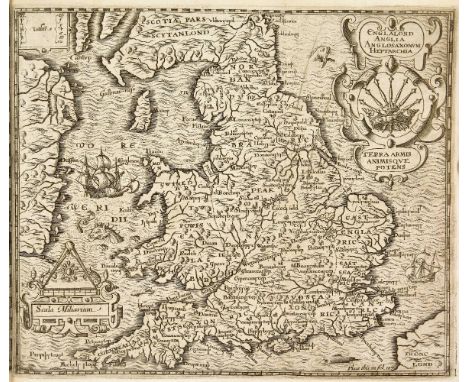
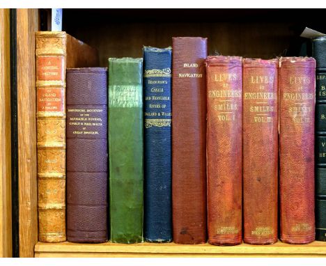
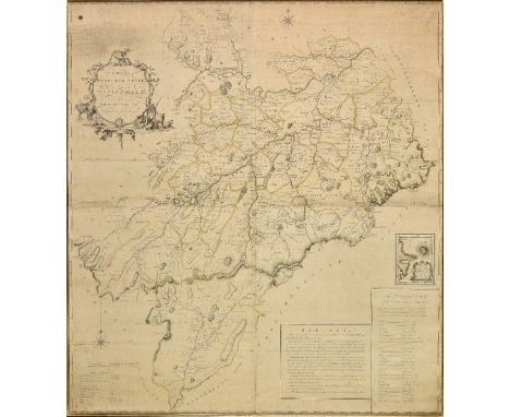
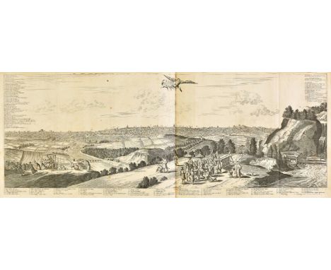
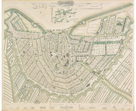
Aikin (John). A Description of the Country from thirty to forty Miles round Manchester, 1st edition, for John Stockdale, 1795, engraved frontispiece, additional vignette title, 69 engraved maps and views on 61 sheets, large folding hand-coloured map (80 x 88 cm) and large folding plan of Manchester (110 x 95 cm) to rear, frontispiece and vignette title spotted and browned, marginal spotting to other plates, light offsetting and small hole to folding plan, contemporary inscription ('This is decidedly the finest copy of the work I have ever had ...' signed W. H. Ford) to initial blank, above pencil inscription 'Fanshawe Sale', engraved bookplate of Barron Field (see note), contemporary half russia by C. Ambery of Manchester, rebacked, rubbed, 4to (29.4 x 22.6 cm), together with: Warner (Richard, editor), Collections for the History of Hampshire and the Bishopric of Winchester: including the Isles of Wight, Jersey, Guernsey, and Sarke, 5 volumes in 3, 1st edition, for the authour [sic], 1795, volume 1 in 2 sections, 62 engraved plates, some hand-coloured, lacking the 'Plan of the Form of Jersey' as usual ('not to be found in any of the copies' examined by Upcott), spotting and browning, mended tear in plate facing p. 264 volume 1 section 2, engraved bookplate of George Macartney, 1st Earl Macartney (see note), contemporary diced russia, worn, covers detached, 4to, ibid., Hampshire extracted from the Domes-Day Book, 1st edition, Faulder [and others], 1789, lacking half-title, title page spotted and marked, edges untrimmed, 20th-century half cloth, wear to spine, 4to (28.5 x 22 cm), Duthy (John), Sketches of Hampshire, 1st edition, Winchester: Jacob and Johnson, 1839, lithographic map frontispiece, 7 lithographic plates (2 hand-coloured),light spotting, bookplate, front inner hinge tender, edges untrimmed, original cloth, spine faded and rolled, large 8vo, and approximately 10 others, 18th- and 19th-century Hampshire topography, various formats Upcott pp. 462-5 (Aikin), pp. 276-81 (Warner, Collections). Warner's Collections is one of 225 small-paper copies, in addition to 25 copies on large paper. Provenance, Aikin: Barron Field (1786-1846), Australian judge and poet (bookplate); Warner, Collections: George Macartney, 1st Earl Macartney (1737-1806), British ambassador to China (bookplate). (approximately 15)

Lot 4

Boer War. The Work of the Ninth Division, by Major-General Sir H.E. Colvile, 1st edition, 1901, folding maps, advertisements at end, endpapers spotted with clear tape marks, previous owner signature, original cloth, spine toned and a little rubbed, 8vo, together with The Story of the 34th Company (Middlesex) Imperial Yeomanry. From the point of view of Private No. 6243, by William Corner, 1st edition, 1902, folding maps, half-tone illustrations, a few minor spots, top edge gilt, original blue cloth gilt, a few small faded and stained patches, 8vo, plus War Record of the York & Lancaster Regiment 1900-1902. From Regimental and Prive Sources, by A.H.C. Kearsey, 1st edition, 1903, folding map (with tears along folds), illustrations, some spotting, library blindstamp to front endpaper, original cloth, spine a little rubbed and faded, 8vo (3)

Lot 405

Luce (Gordon H.). Old Burma-Early Pagan, 3 volumes, New York: J.J. Augustin, 1969, colour frontispiece, black & white plates, folding colour map, original cloth gilt, 4to, together with Stanley (Henry), Through the Dark Continent or the Sources of the Nile around the Great Lakes of Equatorial Africa and Down the Livingstone River to the Atlantic Ocean, 2 volumes, new edition, 1899, folding map, wood engraved plates and illustrations, near contemporary half morocco, 4to in 8s (5)

Lot 41

Atkyns (Sir Robert). The Ancient and Present State of Glocestershire, 2nd edition, 1768, eight single-page engraved armorial plates, sixty-five double-page engraved plates (complete) including county map, birds-eye plan of Gloucester, view of the West Prospect of Gloucester, Gloucester Cathedral and sixty-one birds-eye views of country seats by Kip, occasional light spotting and minor toning, marbled endpapers with bookplate to upper pastedown of Christopher Turnor (1809-1886) of Stoke Rochford and bookplate monogrammed VPSS, all edges gilt, mid 19th century calf, elaborate gilt decorated spine, joints and extremities rubbed & scuffed, folio, Upcott p.250. A wide margin example in very good condition. (1)

Lot 43

Blake (Malachi). A brief account of the destructive fire at Blandford Forum in the county of Dorset which happened on June 4, 1731, reprinted from the edition published in 1735, published A. C. Hailes, Blandford & John Russell Smith, London, 1860, printed title, uncoloured map of the town with two vignette views of the town to verso, ten leaves of printed descriptive text, some marginal closed tears, endpapers detached, publisher's stitching weak and loose, contemporary gilt blind stamped boards, stained, slim 4to (1)

Lot 44

Camden (William). Britannia siue Florentissimorum regnorum, Angliae, Scotiae, Hiberniae, et insularum adiacentium ex intima antiquitate chorographica descriptio...., Nunc postrem• recognita, & magna accessione post Germanicam aeditionem adaucta, London: George Bishop, 1600, additional engraved title by William Rogers with early inscription to upper blank margin, letterpress title with woodcut Royal arms bound after dedication, two folding engraved maps by William Rogers, ten full-page engraved illustrations including map of Ireland, several woodcut illustrations and decorative initials, with final blank 3N4 present, front free endpapers with ink ownership stamps and inscriptions, contemporary calf, rebacked, black morocco title label to spine, boards rubbed and corners worn & showing, small 4to, together with [Garth, Samuel], The Dispensary. A Poem. In six cantos, 6th edition, 1706, engraved frontispiece, adhesive tape residue to gutter of frontispiece, title, final leaf, 20th century decorative endpapers, contemporary blind panelled calf, rebacked, 8vo STC 4507 (Camden). The fifth edition and the first with maps. "Hiberniae, et insularum Britanniae adiacentium descriptio" has separate dated title page; pagination and register are continuous. (2)

Lot 46

Chaplin (S. E.). Geography of England & Wales (title on upper cover), 1853, forty-seven manuscript pen and watercolour maps of England and Wales, English & Welsh counties, each with descriptive text surrounding the map, each sheet, very slight spotting, 245 x 315 mm, loose in a contemporary black morocco gilt portfolio, remains of silk ties, oblong 4to The very neat script describes the history and commercial attributes of each county as well as the principal county towns and cities and surrounds a small ink and watercolour map. (1)

Lot 496

West (William). Picturesque Views and Description of Cities, Towns, Castles, Mansions, and other objects of interesting feature, in Shropshire, Birmingham: William Emans, 1834, 16 engraved plates only, some spotting and dampstaining, margins frayed, contemporary cloth-backed marbled boards, publisher's printed title label (calling for 18 plates), some wear, 4to, together with Leighton (Stanley), Shropshire Houses Past & Present illustrated from drawings, 1901, portrait frontispiece and numerous plates, title in red & black, top edge gilt, remainder untrimmed, original Japanese vellum-backed boards, some wear and soiling, 4to, with Gazetteer, The Shropshire Gazetteer, with an Appendix, including a Survey of the County..., Wem: Printed & published by T. Gregory, 1824, folding engraved map frontispiece by John Cary, numerous lithograph plates, some dampstaining and spotting, modern half cloth, large 8vo, plus other 19th and 20th century Shropshire, history and topographical reference and related Provenance: Plaish Hall, Shropshire. (3 shelves)

Lot 50

Home (John). The History of the Rebellion in the Year 1745, London: Printed by A. Strahan for T. Cadell, Jun. and W. Davies, 1802, folding engraved mapped, 3 folding battle plans and single-page portrait plate, Westport House bookplate to upper pastedown, contemporary red half morocco gilt, 4to, together with [Graham, John Viscount Dundee], Memoirs of the Lord Viscount Dundee and the Highland Clans, &c. Together with an Account of the Massacre of Glenco, 2 parts in one, Edinburgh: D. Webster, 1818, original cloth-backed boards, spine torn with loss, 8vo, with Saint Fond (B. Faujas de), A Journey through England and Scotland to the Hebrides in 1784, a revised edition of the English translation edited, with notes and a memoir of the author by Sir Archibald Geikie, 2 volumes, Glasgow: Hugh Hopkins, 1907, black & white frontispieces and plates, scattered spotting, top edge gilt, remainder untrimmed, contemporary half morocco gilt by Ramage, 8vo (limited edition of 450 copies printed), plus Anderson (Peter), Guide to Culloden Moor and Story of the Battle with Description of the Stone Circles and Cairns at Clava, 2nd edition, Edinburgh: John Menzies, 1874, folding lithograph map frontispiece, few plates and plans, contemporary cloth, small 8vo (5)

Lot 504

Langford (John Alfred). Staffordshire and Warwickshire, Past and Present: 4 volumes, Birmingham, circa 1880, monochrome plates, all edges gilt, some minor spotting, publisher's uniform original gilt decorated plum cloth, spines slightly faded and rubbed to head and foot, large 4to, together with Lewis (Samuel), A Topographical Dictionary of England..., 4 volumes, 1835, numerous monochrome maps, some light spotting, uniform modern calf spines retaining contemporary half calf boards, boards slightly rubbed, 4to, and Smith (William), A New & Compendious History of the County of Warwick..., Birmingham, 1830, 62 monochrome plates including map frontispiece, some plates hand coloured, some spotting, later endpapers, contemporary gilt decorated half calf, boards and spine lightly rubbed, 4to, plus other 19th century and modern Warwickshire, Bristol, London & UK history and topographical reference, including Northamptonshire Notes & Queries, 6 volumes, 1886-97, by Christopher A. Markham, some leather bindings, some original cloth, some in dust jackets, condition is generally good/very good, 8vo/4to (4 shelves)

Lot 507

Pye (Charles). A Description of Modern Birmingham..., Birmingham, 1819, some spotting, contemporary half calf boards retaining original gilt decorated calf spine bound by Goodman, boards lightly rubbed, 8vo, together with Roscoe (Thomas), The London and Birmingham Railway..., 1839, colour folding map frontispiece, monochrome plates, all edges gilt, modern endpapers, some light spotting, modern brown half calf, 8vo, and Kelly & Co (publisher), Kelly's Directory of Birmingham, with its suburbs for 1882, monochrome advertisements to front and rear, some minor toning, and spotting, front guttering cracked, publisher's original gilt decorated red cloth, boards marked, spine lightly rubbed to head and foot, 8vo, plus other 19th century and modern Birmingham history and reference, including Birmingham Faces and Places, an illustrated local magazine, 6 volumes, circa 1888, some leather bindings, some original cloth in dust jackets, G/VG, 8vo/folio (2 shelves)

Lot 521

Beattie (William). Switzerland, illustrated in a series of views..., 2 volumes, 1838, numerous monochrome plates, some light spotting and marks, uniform contemporary gilt decorated red morocco, boards and spines rubbed, 4to, together with Baker (Samuel White), The Albert N'Yanza Great Basin of the Nile..., 2 volumes, 1886, monochrome folding map frontispiece to volume 1, plus other illustrations, some tears, watermarks and light spotting, uniform original gilt decorated green cloth, boards and spines slightly rubbed to head and foot, 8vo, and Moryson (Fynes), An Itinerary..., 4 volumes, Glasgow, 1907, monochrome facsimile illustrations, top edge gilt, some minor toning, uniform original gilt decorated red cloth, spines slightly rubbed to head and foot, 8vo, plus other late 19th and 20th century European and African travel and history reference, including publications by A. & C. Black, Cambridge, Harvard, some leather bindings, mostly original cloth, G/VG, 8vo/4to (6 shelves)

Lot 56

Nash (Treadway Russell). Collections for the History of Worcestershire, 2 volumes, 1st edition, 1781-1782, folding engraved map frontispiece to volume 1, engraved vignette title to each volume, 77 engraved plates & plans, 13 leaves of Domesday Book printed in red & black, engraved illustrations to text, 19 folding pedigrees, offsetting to text from plates, some browning and spotting, modern half calf gilt, maroon morocco title labels, brown buckram sides to boards, spines faded, folio Upcott p.1330. (2)

Lot 57

[Owen, Hugh & John Brickdale Blakeway]. A History of Shrewsbury, 2 volumes, 1st edition, 1825, additional engraved title to each, numerous engraved and lithograph plates and plans, some light offsetting and scattered spotting, marbled endpapers with contemporary booksellers label of W. & J. Eddowes of Shrewsbury and modern bookplate of Roy & Nina Merley pf Plaish Hall, contemporary calf, gilt decorated spines and board borders, upper joint of volume 1 split and other joints cracked, 4to, together with [Acton, Frances Stackhouse], The Castles & Old Mansions of Shropshire, Shrewsbury: Leake and Evans, 1868, lithograph frontispiece and plates, title in red & black, endpapers renewed, original cloth gilt, modern rebacked spine and corners in navy morocco, 4to, with Leighton (Stanley), Shropshire Houses Past & Present Illustrated from Drawings, 1901, half-title, portrait frontispiece and numerous plates, Plaish Hall bookplate, top edge gilt, remainder untrimmed, modern half morocco, 4to, with Kelly's Directory, Shropshire, 1909, folding hand-coloured map, scattered spotting, Plaish Hall bookplate, original red cloth gilt, frayed at head & foot, large 8vo, plus two others, A History of Shrewsbury School... illustrated by Alfred Rimmer, 1889, and The Natural History of Stafford-Shire by Robert Plott, facsimile edition, 1973 (7)

Lot 6

Churchill (Winston S.). Ian Hamilton's March, 1st edition, Longmans, Green, and Co., 1900, half-tone frontispiece, folding colour map, sketch-maps in text, 4 + 32 pp. advertisements to rear, map slightly spotted, bookplate of the earls of Northesk, ownership inscription 'Northesk, Dec 1st 1900' to initial blank, original red cloth, spine sunned, headcaps slightly frayed, damp-stain to rear board, corners slightly rubbed, 8vo, together with Savrola, a Tale of the Revolution in Laurania, 1st UK edition, 1st issue, Longmans, Green, and Co., 1900, publisher's imprint to title page verso dated 1899, 2 pp. publisher's advertisements to rear, browning to endpapers and blanks, ink-stamp of the Kyrle Society, Manchester to initial blank, original green cloth, spine relined, slightly nicked at foot, a few pale marks to boards, lower outer corner of front board bumped and worn, 8vo Woods A5, A3(b). Provenance (Ian Hamilton's March): David Carnegie, 10th Earl of Northesk (1865-1921). (2)

Lot 60

[Pennant, Thomas]. A Tour in Scotland, and Voyage to the Hebrides; MDCCLXXII, parts I & II, London: Benjamin White, 1790, engraved titles with vignette illustration (referred to as frontispieces in plate list. Volume 2 title with repaired closed tears and partly lined to recto), 89 engraved plates and plans (some folding), together with A Tour in Scotland; MDCCLXIX, 5th edition, London: Benjamin White, 1790, engraved title with vignette, folding engraved map, detached and with few closed tears, 42 engraved plates (including 1 folding plan), some offsetting, light dust-soiling and occasional spotting to each volume, endpapers renewed, contemporary uniform marbled calf, modern rebacks and title labels to each volume (numbered I-III), board edges worn, 4to (3)

Lot 61

Phillips (John). A General History of Inland Navigation, Foreign and Domestic: Containing a Complete Account of the Canals already Executed in England, with Considerations on those Projected. To which are added, Practical Observations, 1st edition, 1792, folding hand-coloured engraved map frontispiece, four folding engraved plates at rear, 20th century sheep gilt, morocco title labels, 4to, together with Priestley (Joseph), Historical Account of the Navigable Rivers, Canals, and Railways, of Great Britain, as a reference to Nichols, Priestley & Walker's New Map of Inland Navigation, 1831, folding engraved map frontispiece offset to title, folding hand-coloured plate at rear, late 19th/early 20th century cloth gilt, 8vo, with Phillips (John), A General History of Inland Navigation, Foreign and Domestic: containing a complete account of the canals already executed in England, with considerations on those projected , 5th edition, [1805], half-title, one folding engraved plate, occasional toning, edges untrimmed, contemporary green half vellum, early 19th century book label to upper board for the Uttoxeter Book Society, 8vo, and De Salis (Henry Rodolph), Bradshaw's Canals and Navigable Rivers of England and Wales..., 1904, folding colour lithograph map in rear pocket, original green cloth gilt, 8vo, and Smiles (Samuel), Lives of the Engineers, with an Account of their Principal Works; comprising also a History of Inland Communication in Britain, 3 volumes, 1861-1862, engraved portrait frontispiece to each volume and numerous wood engraved vignette illustrations, scattered spotting, original cloth, 8vo, plus a defective copy of A General History of Inland Navigation, Foreign and Domestic, by J. Phillips, 1795, four engraved plates, lacking folding map, title torn and damp soiled (lined to verso) & following leaves damp soiled, modern cloth, 4to (8)

Lot 63

Rudder (Samuel). A New History of Gloucestershire, 1st edition, Cirencester: Samuel Rudder, 1779, double-page engraved map, sixteen engraved plates (including 13 double-page & 3 single-page plans), one engraving in letterpress, double-page plate of Sanywell Park with short paper fault flaw hole to image, occasional offsetting and spotting, marbled endpapers with split hinges, contemporary diced calf with gilt decorated board borders, rebacked and board corners repaired, folio Upcott pp.251-253. (1)

Lot 64

Shaw (Rev. Stebbing). The History and Antiquities of Staffordshire, Compiled from the Manuscripts of Huntbach, Loxdale, Bishop Lyttelton and other Collections of Dr. Wilkes, The Rev. T. Feilde &c. &c....., 2 volumes, [volume 1 and volume 2 part 1 (all published)], 1798-1801, half-title to volume 1 lacking (not called for in volume 2), folding engraved county map to volume 1, eighty-two engraved and aquatint plates (one folding, plate of Soho Manufactory with very small holt to image), folding engraved plan of the town of Wolverhampton, engraved illustrations to text, 426 hand-coloured armorial shields to fore-margins (finished with gum arabic), 3 folding pedigrees, titles spotted (particularly volume 1 title) and both with vertical crease, occasional toning, spotting and occasional light offsetting, marbled endpapers with cloth hinges, all edges gilt, 20th century red morocco, elaborate gilt decorated spines and board borders, folio, 48.5 x 28.5cm Upcott pp.1176-1185. Large paper copy. A handsome set. (2)

Lot 644

*Embroidered map. Europe by Mary Ann Wheeler, 1818, embroidered map of Europe, decorative cartouche and compass rose, some water staining, toned overall, one small tear affecting image, 450 x 555 mm, mounted, framed and glazed (1)

Lot 679

Jigsaw map. The Traveller's Companion or the Post Roads of England and Wales, with the Distances in Measured Miles, by the Late [John] Rocque, Chorographer to the King, circa 1760s, engraved map pasted onto wood and dissected along county boundaries, hand-coloured in outline, approximately 53 pieces, three counties (Oxfordshire, Radnor, and Rutland), and four other small portions or tabs, all replaced in facsimile (except one blank tab), somewhat faded and dusty, top edge of Northumberland a little rubbed, tiny chip off Warwickshire, 50 x 48cm (20 x 19ins), contained in original wooden box, with printed paper label (darkened and some marks) on sliding lid, label with chip to lower edge and lacking lower left corner John Rocque was one of the most important and prolific map-makers of the 18th century, until he died in 1762. (1)

Lot 859

Hardy (Thomas). Tess of the d'Urbevilles, Macmillan and Co., Limited, 1926, woodcut frontispiece, plates and headpieces by Vivien Gribble, folding map of Wessex to rear, contents entirely unopened, original quarter vellum, lower outer corners of boards minutely rubbed and bumped, folio Purdy p. 77. First edition illustrated by Vivien Gribble, large-paper issue, one of 325 copies signed by Thomas Hardy. There were also 1500 unsigned copies in octavo. Provenance: Robert ('Robin') Charles Meadows White (1904-1939), Lieutenant-Commander, Royal Navy (pencilled ownership inscription 'Robin White, January 1938' to front free endpaper); thence by descent. White died in one of the first British naval disasters of the Second World War when his destroyer HMS Duchess was accidentally rammed by HMS Barham off the Mull of Kintyre. (1)

Lot 871

Baden-Powell (Robert, 1857-1941). A group of three scrap albums compiled by Leila Evelyn Landon, relating to the events of the Second Boer War, with some references to her husband Major Kenneth McLaren's involvement in the War, and a revealing telegram from Baden-Powell, 1899-1901, largely comprising hundreds of cuttings from newspapers and magazines of the day, one cutting [Daily Mail, 17 April 1900] giving the first news of McLaren's capture, 'he was now lying dangerously wounded in a laager two miles from the town. Owing to this officer being a Freemason, and to his meeting brother masons among the Boers, he is receiving every attention, and their anxiety on his account is quite remarkable. They send daily bulletins, and the last accounts were favourable. Sarah Wilson'; plus occasional further pencil corrections and notes to cuttings; a few scattered related ink signatures of officers involved including R.S.S. Baden-Powell, H. Plumer, W.P. Symons, Fred. Hammersley, A. Wormald, D.E. Wood, E.D. Miller; a pencil sketch map of Camp Junction, Limpopo; two menu invitations to Private W.H.F. Landon (Leila's brother); plus various telegrams sent to Mrs McLaren, mostly by her husband, messages reading: 'Buller has relieved Ladysmith', 1 March 1900; 'Cronje has surrendered', 27 February 1900; handwritten copy of a telegram sent by Lord Roberts to Colonel Plumer after the Relief of Mafeking; 'Roberts has taken Pretoria after twelve hours fighting' (date stamp indistinct); 'Splendid victory by Hunter 500 Boers captured' (30 July 1900); plus an interesting telegram sent by Baden-Powell to McLaren, received by the Eastern Telegraph Company from Funchal via Eastern, 23 July 1901, to McLaren, S.A. Constabulary, Colonial Office, London, 'Could you put me up Friday night incognito Bloater'; plus a few items loosely inserted including a short autograph note initialled in Kenneth McLaren's hand, Shashi Patrol, December 1899, concerning reconnaissance, a total of approximately 110 stiff card leaves, some leaves detached, contemporary red half roan, worn, covers detached and backstrips deficient, folio Kenneth McLaren was a Major in the 13th Hussars Regiment of the British army. After his military service he assisted with the growth of the Scouting movement, founded by his friend Robert Baden-Powell. In 1898 McLaren married Leila Evelyn Landon, who died in 1904. During the Second Boer War in South Africa McLaren was gravely wounded at the siege of Mafeking in March 1900, falling prisoner to the Boers. McLaren first met Baden-Powell (also a 13th Hussars officer) in 1881. Although McLaren was 20 at the time, Baden-Powell nicknamed him 'The Boy', on account of his young appearance. In turn, McLaren's nickname for Baden-Powell was 'Bloater'. The two became good friends, their relationship being one of the most important friendships in Baden-Powell's life. McLaren was one of the staff at Baden-Powell's Brownsea Island Scout Camp in 1907 and Baden-Powell convinced McLaren to be his first manager at the C. Arthur Pearson Ltd office of The Scout magazine but McLaren resigned that position in March 1908. Relations between the two ceased upon McLaren's second marriage in 1910 to Ethyl Mary Wilson (his nurse). Baden-Powell considered Ethyl below McLaren's station and advised against the marriage. There has been much speculation about Baden-Powell's sexuality, much of this attention following in the decades since Tim Jeal's exhaustive biography Baden-Powell (Hutchinson, 1989), wherein he closely scrutinised the relationship between 'Bloater' and 'Boy'. Jeal stopped short of concluding that the relationship was in any sense sexual or romantic, but reveals a very close bond which, had it been made public, would have scandalised Edwardian social attitudes. Tim Jeal wrote that 'The available evidence points inexorably to the conclusion that Baden-Powell was a repressed homosexual'; but the telegram from Bloater to McLaren included in these albums hints that the relationship may have been more than just platonic. Certainly, the fact that McLaren's wife Leila, who compiled these albums, saw fit to include this telegram, the meaning of which must have been clear to her, suggests that she privately accepted the relationship or affair, whatever her true feelings about it were. (3)

Lot 913

Adams (Richard). Watership Down, 1st edition, 1972, folding map, with short closed handling tear, front free endpaper with ink inscription 'Aidan & Nancy Chambers Amberley -S.T.- Nov 1972', pastedowns lightly toned, original cloth, minor pale mottling to tail edges, dust jacket, a few closed tears, head of spine a little frayed, 8vo, together with the Rex Collings Press Release loosely inserted, printed on rectos of two leaves folded, plus a newspaper cutting of Aidan Chambers' review of Watership Down, from The Sunday Times, 3rd December 1972, and a related piece of paper with his pencilled notes Aidan Chambers was sent this copy of Watership Down to produce a review of the book for The Sunday Times. The review notes that, to his own astonishment, Watership Down 'is stunning, compulsive reading', and is both minutely detailed and inventive. It is interesting to read his jotted notes, where he asks questions such as 'allegory or not?' and 'for children or not?'. He also points out that because the rabbits are frequently in danger, and yet can fight and inflict damage if needed, this brings to the story 'the possibility of courage (or cowardice) and heroism'. (2)

Lot 937

Chatwin (Bruce). In Patagonia, 1st edition, 1977, illustrations, map endpapers, original cloth, dust jacket, 8vo With a presentation inscription from the author Patrick White to one of the actors in his play 'Netherwood', which premiered in Adelaide in 1983 to half title; "Stuart the Cop, "Netherwood", 1983, from Patrick". (1)

Lot 946

Fermor (Patrick Leigh). The Traveller's Tree. A Journey through the Caribbean Islands, illustrated by A. Costa, 1st edition, John Murray, 1950, frontispiece, double-page sketch-map, photographic plates, text-block toned, spotting to endpapers and preliminaries, a few small spots to margins, contemporary ownership inscription to front pastedown, original green cloth, dust jacket chipped and toned, rear panel spotted, 8vo The author's first book. (1)

Lot 995

Waugh (Evelyn). Black Mischief, 1st edition, 1932, map frontispiece, some light spotting, review for the book pasted to front endpaper, bookplate of W & M Preston and bookseller sticker to front pastedown, original cloth, spine faded, 8vo, with a presentation inscription from the author on notepaper pasted to front endpaper verso: "To Margaret Preston, with all good wishes for Xmas from Sydney the Saint", together with Scoop, 1st edition, 1st issue, 1938, 1st issue with 'as' in last line of page 88, a little light toning and a few spots, bookplate to half title, original cloth, spine faded, 8vo, plus Officers and Gentlemen, 1955 and Unconditional Surrender, 1959, 1st editions (4)

Lot 801

Victorian and Later Railway Ephemera, various documents, pamphlets and other paper work, including an 1894 L&NWR Blackpool day trip flyer, 1917 L&SWR pamphlet for the Special Arrangements in Connection with the Movement of Troops and a 1925 programme LNER Centenary of Railways, together with a 1938 LT pocket railway map and various other earlier items including a number of way bills, F-G, (Qty)

Loading...Loading...
  • 109198 item(s)
    /page

Recently Viewed Lots