We found 109198 price guide item(s) matching your search
There are 109198 lots that match your search criteria. Subscribe now to get instant access to the full price guide service.
Click here to subscribe- List
- Grid
-
109198 item(s)/page


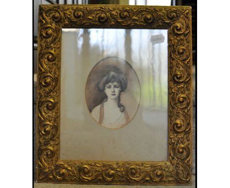
Lot 187
THOMAS PROBERT (land surveyor), published by Boyer, Faden Carey and Wilkinson, 'A plan of the part of the County of Pembroke called Pen-caer and the sea coast adjacent, where between 1200 and 1400 French troops under the command of General Tate made a descent on a point of land called Garn or Cerrig Gwastad on the 22nd day of February 1797, and the place of their encampment, also the place of their surrender on the 24th ditto to his Britanick Majesty's forces under the command of the right honourable Lord Cawdor.' An uncoloured map published 1798. 66 x 77cm approximately. CONDITION REPORT: Creased with marks and stains but basically in good condition commensurate with age. Now in modern glazed frame.

Lot 188
BAPTISTE HOMANNO, 'Insulae A Principartus Rugiae', sparsely coloured. 49 x 58cm and a map of the China Sea (Mers de Chine) from 'The Atlas du Voyage de la Perouse', sparsely coloured, 51 x 69cm approx. (2) CONDITION REPORT: Both have minor foxing spots and discolouring but are basically good.

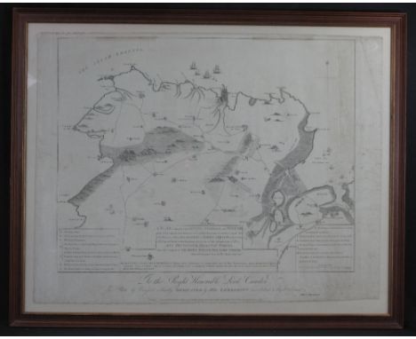
Lot 190
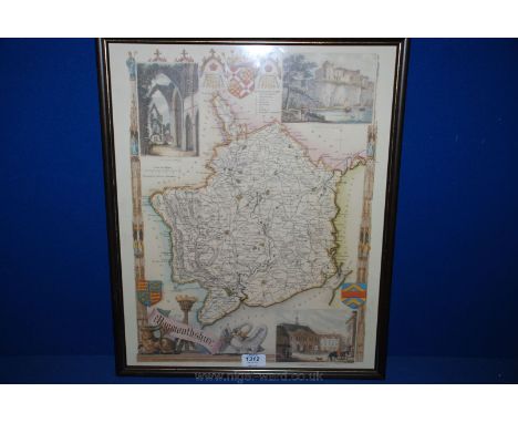
GERALD MERCATOR, (1607-1633), 'Cornubia, Devonia, Somersetus, Dorchestria, Wiltonia, Gloucestria, Monumetha, Glammorgan, Caermarden, Pembrok, Cardigan, Radnor, Brecnoke, Herefordia and Wigornia.', [sic], a map of the South West of England and South Wales, coloured. 37.5 x 46.5cm approx. CONDITION REPORT: Good condition overall only very minor discolouring, visible plate mark. Framed and glazed.


Lot 447
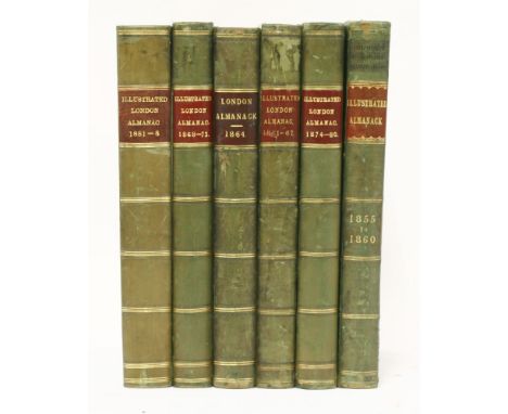
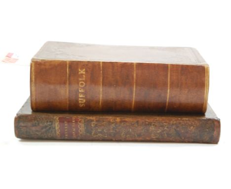
1. The Illustrated London Almanack: Six volumes: 1855-60; 1861-67; 1868-73; 1874-80; 1881-88; and 1864-71. Bound without general title, but all the coloured chromolithograph plates present. 4to.; half leather. VG; 2. Robinson, P F: History of Hatfield House. For author, Arch, 1833. Complete with engraved dedication leaf, vignette, seven plates, and two plans. Folio, half leather. Rebacked; occasional foxing; 3. Great Northern Railway Distance Map, 1897. Large folding linen backed map in original leather covers. G+ (8)


Lot 1365
ELPHINSTONE (Hon. Mountstuart) An Account of the Kingdom of Cabul, and its Dependencies . . . comprising a view of the Afghan nation . . . new & revised edition. 3 plates (2 coloured) & folded map, half titles; contemp. gilt calf with panelled spines, marbled e/ps. & edges. 1842. * with enveloped note from author inserted.
![[SLAVE TRADE] An Abstract of the Evidence (to) a Select Committee of the House of Commons . . . on the part of the petitio](https://cdn.globalauctionplatform.com/beea3b6d-f344-4b0a-a062-a602009ea7be/64235729-1d4c-4846-b41f-2918a8c12965/468x382.jpg)

Lot 130
OLYMPICS, selection, inc. softback editions of Oylmpische Rundschau (7), annual reports of the International Olympic Institute, July 1938-April 1943; German c/c, Olympia 1936 Vols I & II (with map), with duplicates laid down in scrap album; IOC Poster postcards (42), Impel US Olympic Hall of Fame (set of 90) etc., G to EX, 143*


Lot 74
1921 (March). 'A Graphic Presentation of the Government of Ireland Act, 1920'. Map of proposed constituencies. Issued by The Irish Constituent Assembly, Dublin. Printed by Kenny Press, price one shilling. Map of Ireland showing proposed constituencies for the proposed Parliaments of Northern and Southern Ireland. 30 x 25in. (76.20 x 63½cm) P


Lot 386
A collection of original GWR Memorabilia mainly from the 1920's - a GWR Puzzle 'Caerphilly Castle' (complete in a Fair Box), a GWR illustrated pamphlet to celebrate the Silver Anniversary of the 'Cornish Riviera Express' 1904 to 1929, The GWR with Map 1926 for the use of Company Officials only, a Red GWR Stewards Armband, papers relating to the GWR Lecture and debating Society, a GWR Publication 'A Corner of Wales', 4 x GWR Operatic Society Concert Programmes from the 1920's, 'The War Record of the GWR by E A Pratt published in 1922, a folder 'Visit of the Institute of Transport to Swindon' May 30th 1924 and a Menu for the Congress at Bristol in May 1924, 2 copies of the GWR Magazine dated December 1922 and September 1930 and other GWR related items.

Lot 58
A carton of assorted 18th and 19th Century hard backed books to include; The lives of the most eminent British Painters, Sculptures and Architects by Allan Cunningham vol. III London 1830, the Rambler by Dr Samuel Johnson vols II and III, London 1796 , Moral Tales for Young People by Maria Edgeworth vol III, London 1802, A Voyage to the South Seas and to many other parts of the World performed from Sept 1740 to June 1744 by Commodore Anson (missing title page and rear map) etc.


-
109198 item(s)/page