We found 109182 price guide item(s) matching your search

Refine your search

Year

Filter by Price Range
  • List
  • Grid
  • 109182 item(s)
    /page

Lot 379

1933 first-edition of the Harry Beck London Underground POCKET DIAGRAMMATIC MAP with the famous cover slogan 'A new design for an old map'. This is the less-common paper version. Apart from some slight scuffing to the top of the centre (cover) panel, this is in excellent condition, a superb example. [1]

Lot 386

1913 London Underground POCKET MAP 'What to See and How to See it, Stations Everywhere'. Issued at Electric Railway House on 5-4-13. This is the scarce version with red bullseye roundel and red outlining on cover. Opens out to 14" x 11" (35cm x 28cm) and shows the extensions of the Hampstead Tube to Edgware and the Bakerloo to Queens Park. Minor scuffing at one edge, slight stains to cover, otherwise in very good condition. [1]

Lot 389

1935 DIAGRAMMATIC MAP by H C Beck of 'The Routes of Imperial Airways'. Drawn by Harry Beck, it shows the airline's global network with distances from London and a key to service frequency. Measuring 16.5" x 10.5" (42cm x 26cm) and linen-backed, it is not known whether this was a personal initiative, seeking a commission, or an official publication. It is known that the airline published a poster in 1936 which incorporated some of this work. Slightly aged, otherwise good. [1]

Lot 398

1962 London Underground quad-royal POSTER MAP designed by Harold Hutchison. Shows the Victoria Line under construction from Victoria to Walthamstow (Hoe Street). Folded. A 9" (23cm) fold parting, a few small edge tears, fold-corner partings and some old tape residue marks at the edges but still displays well. [1]

Lot 4

London Underground items comprising c1932 Metropolitan Railway MAP OF LONDON (The Met's own version of the Underground map) with print ref M.1795/50M (some staining to cover but otherwise very good), diagrammatic CARD MAP by Harry Beck, issue No 1, 1937 (used condition) and 1946 FOLD-OUT LEAFLET for the Central Line extension to Stratford (used condition). [3]

Lot 40

London area double-royal POSTER MAPS comprising 'London Rail System' (BR) dated 1970 (facsimile copy), 'London's Railways' (LT & BR) dated 1973 and LT 'Bus Routes' dated 1973 plus a slightly smaller BR internal MAP 'Western Region' dated 1981. All with varying degrees of wear and some small tears. [4]

Lot 42

1924 Metropolitan Railway small POCKET CARD MAP "How to get to and from the British Empire Exhibition". Illustration of a new electric locomotive on the cover. Opens out to three panels. This is the orange cover version. In very good condition, still crisp and firm. [1]

Lot 50

London Underground linen-card POCKET MAP from the Stingemore-designed series of 1925-32. This is a special edition of the c1928-9 issue with pale green cover, with cover over-print 'With the compliments of the Cunard Steam Ship Co Ltd'. In excellent, unmarked condition. [1]

Lot 57

1924/5 Metropolitan Railway FOLD-OUT CARD 'How to get to London's Football Grounds'. Opens out with a pop-up footballer and shows the location of the various football grounds against a map of the Underground system. Undated but shows British Empire Exhibition at Wembley. In excellent condition. [1]

Lot 58

1924 Metropolitan Railway FOLD-OUT CARD 'Fast Trains to and from the British Empire Exhibition'. Opens out to a timetable with illustration of latest electric locomotive and has an Underground system map on the reverse. Small number annotated on cover, otherwise in excellent condition. [1]

Lot 63

Midland Red & Railways Joint Motor Services, Birmingham Area official TIMETABLE BOOKLET dated May to September 1936, in very good condition, complete with fold-out map and wonderful pictorial covers, plus Midland Red official TIMETABLE BOOKLET for the Worcester Area dated May 1953 and complete with fold-out map, some cover stains but generally good. [2]

Lot 66

London Transport TIMETABLE BOOKLET of Buses, Coaches, Trolleybuses, Tramways & Underground Rlys for the London Area dated August 1934. In very good condition, fold-out map is present. [1]

Lot 77

1880 District Railway 'IMPROVED MAP OF LONDON', 2nd edition of a series that ran from 1879-1885. A linen-backed map inside hard covers bound in leathercloth, folds out to 42" x 26" (107cm x 66cm). Shows the completion of the Inner Circle between Mansion House and Aldgate as under construction, equally the extension to Whitechapel. In very good condition, just lightly used. [1]

Lot 84

1909 London Underground STREET & RAILWAY MAP. A 54-page booklet featuring prominent use of the then recently-introduced UndergrounD logo and incorporating a coloured system map, a monochrome illustration of the 'No need to ask a p'liceman' poster, sectional street plans with the Underground lines superimposed and a street index. In well-used condition with wear. [1]

Lot 87

1921 London Underground 'Inner Area MAP of the Electric Railways of London', a pocket-sized linen-card issue designed by MacDonald Gill using his own personalised style of calligraphy for the station names and key box text. Very minor wear to the covers and a very good example overall. [1]

Lot 94

April 1915 LCC Tramways MAP & GUIDE TO CAR SERVICES with the cover picture of Abbot's Pew, Westminster Abbey. Lightly-used with a small stain on the cover and very small partings at some of the fold-corners but overall a very good copy. [1]

Lot 97

c1870s 'Wyld's MAP of the Superficial Geology of London and Environs', a fold-out, canvas-backed map inside hard covers. Shows railway lines including the first sections of the Metropolitan & District Railways. In good , lightly-used condition. Plus fold-out MAP 'Reynold's Cyclists' Map of the Environs of London', undated but early 20C (no cover, well used) plus a 1950s/60s 'Chichester's Map & Guide to London' (well used). [3]

Lot 98

North Riding of Yorkshire Parliamentary Boundary Map, 19th century engraving 25cm x 20cm and five other prints depicting local York scenes (6) Condition Report Click here for further images, condition, auction times & delivery costs

Lot 100

'A Mapp of the Estates of the Great Duke of Russia Blanch or Moscovia', Richard Bloom 17th century uncoloured map 29cm x 41cm Condition Report Click here for further images, condition, auction times & delivery costs

Lot 574

Box containing cigarette cards in album, mixed paperwork, a signed letter from author Robert Neill, old editions of Goblin Ill, A Rackham Wind In The Willows print (Washerman Toad with Gypsy), plus a vintage railway map

Lot 280

ROBERT MORDEN "Warwickshire" an engraved Map, hand coloured details and cartouche, 36cm x 42cm in hogarth glazed frame

Lot 281

JANSSONIUS, JOANNES, 'SURRIA' A 17th century engraved map of Surrey, Hogarth framed, mounted and glazed, 30cm x 50cm together with one other MAP OF SURREY, partially hand coloured in gilt frame, 38cm x 52cm

Lot 282

ROBERT MORDEN An 18th century engraved map of 'Bark Shire' (Berkshire), first published in 1695, which appeared in Camdens Britannia, hand coloured detail mounted in the base of a polished wood tray frame with pierced handles, 35cm x 41cm

Lot 16

LOT OF DECORATIVE PRINTSincluding a 'Blaeu' wall map

Lot 1720

A World War I period folding trench map for St Julien, Edition 3.D, trenches correct 25-06-16, 68 x 92.5cm.

Lot 1403

A J Norden antique coloured map of Surrey, 30.5 x 39cm.

Lot 4

AFTER JOHN SPEEDE (1552-1629) "Oxfordshire decribed with Ye Cite and the Arms of the Colleges of Ty Famous VNIUERSITY AO 1605", a black and white engraved map, later coloured, with details of the hundreds verso, 40 cm x 53 cm CONDITION REPORTS Fold to the centre. Small black dots all over. Some other creases, dark mark round the figures' clothes. Down the figure on the right of the globe and possible rip damaged to the paper to his right. Back shows evidence of various repairs throughout - some of these repairs are visible to the front, round the villages "Wightam", "Kidlington" down the top half of the centre, the figure to the left of the globe's robes and the village of "Dichley" etc. Various signs of wear and tear throughout. Will need attention to get rid of bugs etc.

Lot 5

AFTER GIROLAMO ALBRIZZI (fl. 1673-1697) "Carta Geografica della America Meridionale" a black and white engraved map, later coloured, 34 cm x 44 cm, together with AFTER MATTHEW SEUTTER (1678-1757) "Nova Totius Italiae", black and white engraved map, later coloured, 20 cm x 26 cm

Lot 2

AFTER THOMAS FULLER (18th Century) "Benjamin" from Fuller's Pisgah "Sight of Palestine" of Palestine, black and white engraved map circa 1750, later coloured, 27 cm x 34 cm CONDITION REPORTS Deep fold to the centre and various other creases to the paper and some more creases emanating from the bottom edge and from the top edge. Dark brown speckles along the lower edge, mainly around the lower left hand corner. the whole paper appears to be slightly browned. some other marks throughout, General signs of wear and tear through age throughout. Frame scratched, some chips ad losses

Lot 160

SIR ROBERT ATKYNS "The Ancient and Present State of Glostershire", W. Bowyer for Robert Gosling 1712, first edition: engraved frontispiece of Robert Atkyns by M Van DE GUCHT, title page with woodcut printer's device, Author's Epitaph, engraved coat of arms, double page folding map of Gloucestershire, double page folding plan Gloster City, double page folding engraving West Prospect of Gloster, double page folding engraving Gloster Cathedral, double page engraved bird's eye views drawn and engraved by Johannes Kip; brown leather covered boards, leather spine with gilt tooling and lettering(Provenance: the property of the Raymond Barker family late of Fairford Park Gloucestershire)

Lot 285

A globe published by G. F. Crutchley, London, circa 1850, marked "Crutchley's New Terrestrial Globe showing the latest discoveries towards The North Pole, Equatorial Africa, Australia, New Zealand & C London G F Crutchley Map Seller, Globe Maker and Publisher, 81 Fleet Street", raised on a stand with turned oak base, 23 cm diameter CONDITION REPORTS Various losses to the paper of the globe in various sections. Various scratches throughout also, the whole appears crazed. Black dots around the Arctic Circle and wooden base with various chips and pock marks, dark marks, the whole with various general signs of wear and tear throughout

Lot 1

AFTER HERMAN MOLL (1654-1732) "Terra Firma - Guiana and the Antilles Islands", black and white engraving, map later coloured, 18 cm x 25 cm, together with another "Die Insel Guanahani Oder St Salvador - Fig 22", a black and white engraved map, later coloured early 18th Century, 15 cm x 10 cm(Provenance: the property of the Raymond Barker family late of Fairford Park Gloucestershire)

Lot 370

A framed early Robert Morden map of Essex, together with a C&I Greenwood framed map of Essex.

Lot 162

[ARMSTRONG (Mostyn John)] History and Antiquities of the County of Norfolk, volumes I to X, Norwich 1781, 8vo, folding map and city plan, plates (including folding), slight offsetting to some titles, occasional foxing or dust staining, armorial bookplates of Sir William Jerningham Bart., Cossey, to first paste downs, original calf with gilt spines, some cracking to few joints; also - A General History of the County of Norfolk, two vols, 1829, 8vo, folding map, damaged bindings (12)

Lot 163

BLOMEFIELD (Francis) and Charles PARKIN. An Essay towards a Topographical History of the County of Norfolk, first edition, in five volumes, Fersfield and Lynn 1739-75, folio, with portrait of the author, 35 plates (including folding), folding plans of Norwich and Lynn, folding map, 4 pen and ink seal illustrations inserted on 3 leaves, 10 leaves of tables, and 3 tables within the pagination at end of Vol. I., added leaves in manuscript inserted at the front, later full morocco gilt (5) Note: According to Lowndes Bibliographer's Manual collation, this copy does not have the scarce dedication leaf in vol. II, nor the 'folded sheet of references' that accompanies the plan of Norwich which is present.  

Lot 170

KENT. Various histories and others, including Kelly's Directory, 1938; JAMES (W R), Charters of Maidstone, 1825, boards, 8vo; DEARN (T D W), An Historical, Topographical and Descriptive Account of the Weald of Kent, 1814, 8vo, map and illustrations, later half morocco; The County of Kent and Many of its Family Records, subscribers copy, 1896; various others (23)

Lot 171

KENT. A Complete History of Kent, 1730, 4to, folding map by Robert Morden, rebacked panel calf; FUSSELL (L), A Journey Round the Coast of Kent, 1818, 8vo, folding map, dust staining, rebacked; MURRAY (John), Handbook for Kent and Sussex, 1858, folding map in pocket, modern quarter calf; BRENT (J), Canterbury in the Olden Time, 1879, plates, worn cloth; CREASY (E), Illustrations of Stone Church, Kent, 1840, folio, plates, foxing, binding detached; SHEPHERD (G) et al. Virtue's Picturesque Beauties of Great Britain, Kent, 4to, plates, staining; also French Revolution. Tableaux Historiques de la Revolution Francaise, circa 1800, folio, lacking title, 24 engraved plates after Prieur, worn binding. etc. Sold not subject to return (12)

Lot 172

SOMNER (William), A Treatise of Gavelkind, London 1726, 4to, title in red and black, frontispiece, occasional stains, recased half morocco; DUGDALE (W), A Topographical Description of the County of Warwick, 1817, 8vo, extra illustrated, folding map, all rather toned, binding worn; WARDLE (G L), Charges Against the Duke of York, Albion Press Edition, 1809, 8vo, portraits, browning and foxing, binding worn (3)

Lot 180

ALDIN (C), Pickles, twenty-four colour plates, n.d. [c. 1909], publisher's cloth (worn), some age toning throughout; with Mac, c. 1912, original pictorial boards, corners bumped; RACKHAM (A, illust.), The Ingoldsby Legends, 1912, tipped-in colour plates, armorial bookplate, original cloth, spine sunned; JENKINS (Lady Minna), Sport and Travel in Both Tibets, map and twenty-five colour plates after watercolours by Lady Jenkins, n.d. [1909], original cloth gilt; light spotting to front cover; Dress and Decoration, a Liberty & Co catalogue, c. 1910, thirteen tipped-in fashion colour plates by H E Howarth, original board covers, front and back covers torn, internally clean (5)

Lot 2

Thomas Bowles (1712-1767) 'A View of Covent Garden', hand-coloured engraving, pub. 12th May 1794 by Laurie & Whittle, 26 x 40 cm; 'View of New Bridge Street, Black Friars with the Albion Fire Office & c.', hand-coloured engraving, pub. 22nd Feb 1810 by Laurie & Whittle, 30 x 45 cm, some foxing to mount, James Moxon, Milford-Haven, hand-coloured engraved map, framed, 50 x 61.5 cm, some staining; The Road from Chester to Cardiff, hand-coloured engraved road map, 34 x 45 cm, (stained and discoloured) (4)

Lot 241

VALERY (pseud., A. C. Pasquin), Historical, Literary and Artistical Travels in Italy, translated C. E. Clifton, Paris: Baudry, 1839, 8vo, vignette title, folding map, cloth, foxing throughout; BLESSINGTON (Countess of), The Idler in Italy, two vols bound in one, Paris: Galignani, 1839 and 1841, 8vo, decorative boards, spine gilt, some pages soiled; GOURNERIE (Eugène de la), Rome Chrétienne ou Tableau historique des souvenirs et des monuments chrétiens de Rome, Paris: Debécourt, 1843, two volumes in one, 8vo, spine gilt, marginal foxing throughout; REICHARD Guide des voyageurs en Europe, two volumes, eleventh edition, Paris: Hyacinthe Langlois, 1827, small 8vo, folding maps (edges worn), full calf (scratched), spine gilt (cracked). (4)

Lot 329

KEATE (George), An Account of the Pelew Islands, London: G. Nicol, 1788, second edition, 4to, engraved portrait frontispiece, folding map, fifteen plates, book plate of George W. Galloway to front pastedown, full calf (worn), head of spine damaged, front board loose.

Lot 363

Topography. KNIGHT (Charles), London, vols I-VI, 1841-44, 8vo, morocco; JONES (T) A History of the County of Brecknock, two vols, 1805-1809, 4to, plates as required, half calf, a.e.g.; and another copy of vol. II; FENTON (R), A Historical Tour Through Pembrokeshire, London: 1810, 4to, engraved portrait frontispiece, vignette title, folding map and 30 plates, full calf (worn) (7)

Lot 368

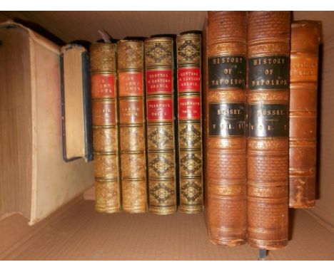
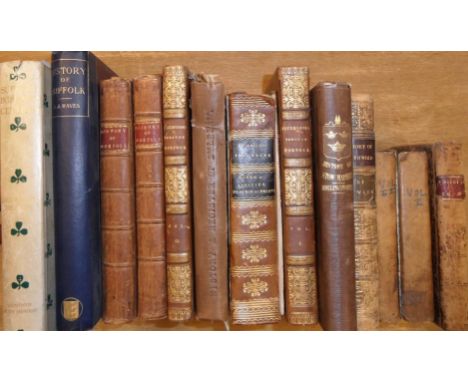
BAKER (Samuel W), The Albert N'Yanza, Great Basin of the Nile, in 2 vols., London: Macmillan 1866, 8vo, folding map and illustrations as called for, some age staining to first and least leaves, half calf lightly rubbed;PALGRAVE (William Gifford), Narrative of a year's journey through Central and Eastern Arabia, London: Macmillan, 1865, in two vols., 8vo, portrait, folding map hand-coloured in outline and 4 folding plans (one of which damaged and incomplete), foxing to first and last leaves otherwise good, half calf; DU CHAILLU (P) Explorations and Adventures in Equatorial Africa, London: John Murray 1861, 8vo, folding map (loss to one corner), frontispiece, illustrations, half calf; MacMUNN ( Major G F) The Armies of India, painted by Major A C Lovett, A & C Black 1911, 4to, signed edition de luxe (500), tipped in colour plates, covers stained; BUSSEY G M) History of Napoleon, in 2 vols., London 1840, illustrated by Vernet, frontispiece stained, rubbed calf; 3 others (11)

Lot 370

GADSBY (John), My Wanderings, Being Travels In The East In 1846-47, 1850-51, 1852-53, London 1855, folding map, illustrations, half calf. SHAW (Samuel, ed.), An Interesting Narrative of the Travels of James Bruce Esq. into Abyssinia, third edition, London, n.d. [c. 1790], lacking a map, 6 engraved plates as required, full calf (2)

Lot 374

SUFFOLK and NORFOLK. MARSHALL, The Rural Economy of Norfolk, two vols, 1787, folding map, sporadic staining, calf; [CROMWELL, T. K.], Excursions in the County of Norfolk, in 2 vols, 1818, folding map and plan, plates, calf gilt; Lives of Eminent and Remarkable Characters, 1820, engraved portraits, calf; and nine others (condition varies) (14)

Lot 375

JENKINS (Lady Minna). Sport and Travel in Both Tibets, London, n.d. [c. 1909], title inscribed by the author, double page engraved map and coloured plates, gilt lettered original cloth with mounted illustration on upper board.

Lot 381

McCLINTOCK (Captain), A Narrative of the Discovery of the Fate of Sir John Franklin & his Companions, London 1859, 8vo, folding map at end torn, last gathering loose, title a little foxed, contemporary half calf, rubbed.

Lot 382

SEEMANN (Berthold), Viti: An Account of a Government Mission to the Vitian or Fijian Islands in the Years 1860-61, Cambridge 1862, lithographic plates and folding map at end, later half calf binding.

Lot 384

LAURIE (R.), Survey of the County around London, To the Distance of Thirty-Two Miles from St. Paul's, London: R. Laurie, 1838, engraved map by Alexander Findlay, hand-coloured in outline, 640 x 820mm.

Lot 44

18th century Canadian interest. Giuseppe Maria Terreni (1739-1811), Caduta di Niagara, etching and engraving on laid paper, c. 1763, Park Gallery label to verso of the mount, mounted, 26 x 19.6 cm; Chesham after Chartres, The Siege of Quebec, hand-coloured engraving, published in Russel's New and Authentic History of England ..., 1781, mounted, 29 x 15 cm; M. A. Rooker, A View of Quebec from the Bason, mounted; with A map shewing the communication of the lakes and the rivers between Lake Superior and Slave Lake in North America, 1790, mounted (4)

Lot 49

John Speed (1552-1629) A map of Derbyshire, 'Darbieshire described', published by Thomas Bassett & Richard Chiswell, c.1676, hand-coloured engraved map, text on verso, framed and double glazed. 38½ x 51cm (15 x 20in) Condition: Hand colouring subtly faded. Light stain left of centre to the lower margin.  Both lower corners repaired.

Lot 50

John Cary (c.1754 – 1835) Map of Cambridgeshire from the best authorities, hand coloured engraving 1805, maple framed, 68 x 57cm overall; District of Colombia, coloured engraved map from the Carey & Lea atlas 1823, 30cm x 30cm (plate; unframed) (2)

Lot 51

Robert de Vaugondy after Thomas Kitchin. Carte des Isles Britanniques, hand coloured engraved map published Delamarche 1780, 55 x 73cm.

Lot 52

A manuscript "Carte du départment de L'Eure". A hand-coloured pen and ink map by ''Legaud'', 1852, 56 x 83 cm (some loss and damaged); together with "Plan de Dieppe", engraving, 1786, (previously folded), 62 x 87 cm; and one other smaller town plan (3)

Lot 53

Joan Blaeu. Huntingdonensis comitatus, Huntingdonshire, hand coloured engraved 17th century map, good margins, 54 x 63cm (sheet), unframed, reinforced to outer margins at top and foot of centre fold; and two other loose Huntingdonshire maps by Emanuel Bowen and C. Smith (3)

Lot 56

W. Hole. Scotia Regnum, hand coloured engraving c.1610, 30 x 36cm (toned); A. Johnston, A New Map of the North Part and South Part of Scotland, two engravings hand coloured in outline, 38 x 46cm (one left margin trimmed) (3)

Lot 57

William Kip and John Norden. Sussexia, hand coloured engraved map of Sussex, 1610, 32 x 39cm (trimmed to side margins), within the bound portion on Sussex from Camden's Britannia, cloth covers.

Lot 59

John Lennox. Map of 40 Miles Round Leeds, Leeds: John Lennox, n.d. [c.1865], hand-coloured engraved map, dissected into 32 sections laid on linen, with pasted-on printed title at top, folding into original morocco boards, gilt lettering on upper cover, overall 980 x 1240mm.

Lot 60

Joan Blaeu. North Riding of Yorkshire, hand coloured engraved map, 17th century.

Loading...Loading...
  • 109182 item(s)
    /page

Recently Viewed Lots