We found 109198 price guide item(s) matching your search

Refine your search

Year

Filter by Price Range
  • List
  • Grid
  • 109198 item(s)
    /page

Lot 1159

General books, to include an English Greek Lexicon by Edwards (G.M.), published 1930, a book relating to Xenophontis, quarter edition published in London by Hutchinson (Thomas A.M.), 1747 with map to front, leather bound, Cambridge University Press editions mainly relating to Sophocles, etc. Provenance: The library of the late Colonel D. Walton, CBE MCTD, 230 Battery, 58th Suffolk Medium Regiment, Royal Artillery in North Africa, Italy and Austria 1941-45. Accepted the surrender of ten thousand German POW, and surrender of General Dieter Von Arnim.

Lot 536

coloured lithographs: The Gift of Tongues; Unholy Alliance; The Last of his Race; The Sign of the Red Lion; A Scene from "John Jones"; and A Will O'the Wisp; also a map of Suffolk by Lewis, a French map and a pen and ink cartoon (9)

Lot 583

Cary, A Map of East Riding, Yorkshire 1805, Another Map of Middlesex 1787 (2)

Lot 47

A map of Bristol and Somerset from early 20th century. Four separate maps combined. Printed and published by the Ordnance Office, Southampton. Printed 1920

Lot 480

A WOODBLOCK PRINT POCKET MAP OF KYOTO Japan, 19th century A woodblock print map detailing Kyoto area, including illustrated streets, rivers, temples, other public sites and mountains in the background. The names of individual streets, etc. are listed. Framed. SIZE 37 x 49.5 cm Condition: Good age-related condition, modest staining and worm holes, creases and damages to fold intersections. Provenance: Austrian private estate.

Lot 170

A William & Mary olive-wood oyster-veneered, fruitwood and walnut cabinet-on-stand, circa 1690 and laterHaving a moulded cornice and a full-width cushion-moulded 'map' drawer, atop two cupboard doors, each with four glass-panes, and enclosing a single shelf, the stand with two frieze drawers, on five spiral-turned and elongated-ball centred legs, joined by pointed-ogee platform stretchers, on bun feet, 114cm wide x 47.5cm deep x 178.5cm high, (44 1/2in wide x 18 1/2in deep x 70in high)For further information on this lot please visit Bonhams.com

Lot 286

A George III needlework map of England and wales, circa 1800Worked mainly in black silk thread, and using coloured silk for the various county borders, on a linen ground, Hogarth-style frame, glazed, 42.5cm x 39cmFor further information on this lot please visit Bonhams.com

Lot 622

A Regency needlework map of England and Wales, circa 1820Of oval form, worked in coloured silks on a linen ground, designed with the counties of England and Wales, within a naturalistic trailing floral border, verre eglomise glass and gilt-wood frame, 62.5cm x 54cmFor further information on this lot please visit Bonhams.com

Lot 652

A Regency needlework: 'A Map of the World', dated 1810Worked in silk on a partly-printed silk ground, with longitude and latitude coordinates in black and the Continents and regional boundaries in shades of blue, brown, green and red threads, entitled 'A Map of the World with its latest discoveries, worked by Mary Thompson, at York School, 1810', within a laurel wreath, a compass below, verre eglomise glazed and ebonized frame, 52.5cm x 87cmFor further information on this lot please visit Bonhams.com

Lot 36

After Sir Thomas Lawrence, 'the Countess of Wilton', and a later copy of Saxtons map of Kent, Sussex, Surrey and Middlesex, 18" x 24".

Lot 1482

A LARGE FRAMED IMAGE OF A HISTORIC MAP OF STAFFORDSHIRE

Lot 2158

A RETRO COFFEE TABLE WITH ANCIENT MAP DESIGN AND BRASS SURROUNDS

Lot 101

Davis (Thomas). General View of the Agriculture of the County of Wilts. With observations on the means of its improvement. Drawn up for the consideration of the Board of Agriculture and Internal Improvement, by Thomas Davis, of Longleat, Wilts, Steward to the most noble the Marquess of Bath, London: Printed in the Year 1794, folding hand-coloured engraved county map by John Cary, bound with Billingsley (John), General View of the Agriculture in the County of Somerset; with observations on the means of its improvement ... drawn up for the consideration of the Board of Agriculture and Internal Improvement, London: Printed by W. Smith, 1794, folding hand-coloured engraved county map, occasional spotting and offsetting, contemporary half calf, upper joint and spine split, without title label, spine worn, 4to, together with: Billingsley (John), General View of the Agriculture of the County of Somerset, with observations on the means of its improvement. Drawn up in the year 1795, for the consideration of the Board of Agriculture and Internal Improvement, reprinted with considerable additions and amendments, Bath: Printed by R. Cruttwell, for the Author, 1797, half-title with ownership inscription at head, folding engraved county map, folding plan and one plate, edges untrimmed, 20th half calf, contrasting roan labels to spine, 8vo, Vancouver (Charles), General View of the Agriculture of the County of Devon ... Drawn up for the consideration of the Board of Agriculture, and Internal Improvement, London: Richard Phillips, 1808, folding hand-coloured engraved county map, signature to title, seven folding tables, 27 engraved plates (2 hand-coloured and 6 folding), contemporary half calf, gilt decorated spine, lower joint split, upper joint split at head, 8vo, and five others similar relating to agriculture in Cornwall, Dorset & HampshireQty: (8)

Lot 11

Conway (William Martin). Climbing and Exploration in the Karakoram-Himalayas, 1st edition, London: T. Fisher Unwin, 1894, half-title (newspaper cutting tipped to verso), monochrome frontispiece, first leaf of preface with signature W. Phillips to upper blank margin, monochrome folding map and plates, armorial bookplate of William Phillips to upper pastedown, top edge gilt remainder untrimmed, original pictorial cloth, 8voQty: (1)

Lot 13

Coxe (William). Sketches of the Natural, Civil, and Political State of Swisserland; in a Series of Letters to WIlliam Melmoth, 1st edition, London: J. Dodsley, 1779, light spotting and browning, closed tear in N7, bookplate of the Honourable Lionel Damer (1748-1807), British politician, contemporary speckled calf, rebacked retaining original spine, label renewed, Damer's arms gilt to top compartment, 8vo (22.4 x 13.5 cm), together with: ibid. Travels in Switzerland. In a Series of Letters to William Melmoth, 3 volumes, 3rd edition, London: T. Cadell, 1789, vi [4] iv 428, [6] iv 422 [1], viii iv 456 pp., 2 engraved folding maps (including general map and 'Mont Blanc and the Adjacent Alps', 5 plates (some folding), errata leaf to rear of volume 2, first folding map with extensive closed tear, bookplates of Sir Richard Bempde Johnstone, 1st Baronet (1732-1807), British politician, edges sprinkled blue, contemporary marbled calf, 8vo (21.1 x 12.6 cm), Burnet (Gilbert). Some Letters, containing an Account of what seemed most Remarkable in Travelling through Switzerland, Italy, some Parts of Germany, etc. In the Years 1684 and 1686, 2nd edition ('corrected'), Rotterdam: Abraham Acher, 1687, bound with: ibid. Three Letters concerning the Present State of Italy ... Being a Supplement to Dr. Burnet's Letters, [London: no printer], 1688, 2 works in 1 volume, first work retainining initial blank, burn-hole in A2, contemporary panelled calf, rebacked to style, 8vo (17.2 x 10.5 cm), Moore (John). A Journal during a Residence in France, from the beginning of August, to the Middle of December, 1792 ... A new edition, corrected, 2 volumes, London: G. G. and J. Robinson, 1794, [2] 502, [2] 617 [3], engraved folding map hand-coloured in outline, 'Explanation of the Map' leaf to rear, light browning, spotting to title-pages and elsewhere, without half-titles (unknown if issued), engraved rococo-style bookplates of Harry Calvert (possibly Lieutenant-General Sir Harry Calvert, 1763-1826), contemporary sprinkled calf, rebacked with original spines laid down, extremities refurbished, 8vo (21 x 12 cm)Qty: (7)NOTESESTC T86683 (Coxe, 1779 edition), T134278 (Coxe, 1789 edition), R25315 (Burnet, Some Letters), R20842 (Burnet, Three Letters), T121419 (Moore: seven copies in UK libraries). The third edition of Coxe's work was the first to be illustrated, with the exception of a 1781 French translation which contained a map, and of which ESTC traces one copy only.

Lot 131

Atkyns (Robert). The Ancient and Present State of Glocestershire, 2nd edition, London: Reprinted by T. Spilsbury for W. Herbert, 1768, eight single-page engraved armorial plates, 65 folding engraved plates including county map, birds-eye plan of Gloucester, view of the West Prospect of Gloucester, Gloucester Cathedral and 60 birds-eye views of country seats by Kip (complete), later endpapers, contemporary speckled calf, morocco reback with gilt decorated spine, board corners repaired, board edges lightly rubbed, folioQty: (1)NOTESUpcott p.246-249.

Lot 133

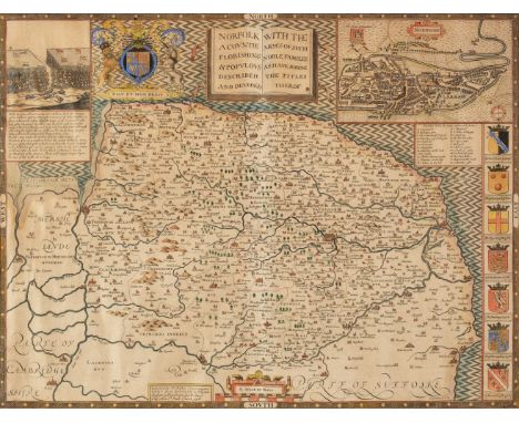
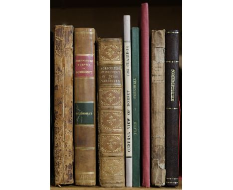
Bristol. The New Bristol Directory, for the Year, 1792..., by John Reed, Bristol: Wm. Browne, Wm. Bulgin, et al., [1792], pp. [4],84, scattered spotting, top edge gilt, remainder untrimmed, bookplate of Edward Greenfield Dogget & Hugh Greenfield Doggett to upper pastedown, late 19th century calf, spine lightly rubbed, 8vo, together with: Bristol Directories, Five directories for Bristol, including, Mathews's Annual Bristol Directory, and Commercial List, 29th edition, Bristol: Joseph Mathews, 1827, original boards, rebacked, 12mo; Mathews's Annual Bristol Directory..., 38th edition, Bristol: M. Mathews & Son, 1836, modern cloth-backed boards, 12mo; Mathews's Annual Bristol Directory, and Almanack, 44th edition, Bristol: M. Mathews & Son, 1842, original cloth, 12mo; Hunt & Co.'s City of Bristol, Clifton and Hotwells Directory, London: E. Hunt & Co., 1848, original cloth, 12mo; Mathews's Annual Bristol and Clifton Directory, and Almanack, 55th edition, Bristol: Mathew Mathews, 1853, double-page lithograph map, original cloth, joints split, 12mo, Mathews (Joseph), The Bristol Guide; being a complete Ancient and Modern History of the City of Bristol, 6th edition, Bristol: J. Mathews, 1825, engraved frontispiece, engraved map with closed tear, original cloth-backed boards, marked and some wear, 8vo, Duffield (C., publisher), The Historical and Local New Bath Guide..., Bath: C. Duffield, [1835?], folding engraved map and plan, 13 engraved plates and 34 engraved plates of trade advertisements, original cloth-backed printed boards (covers separated from text-block), slight wear to extremities, 8vo, Taylor (Anna, publisher, bookseller & stationer), The New Bath Guide; or, Useful Pocket Companion..., new edition, Bath: printed by R. Cruttwell, for A. Taylor, bookseller & stationer, 1796, bookseller's advert leaf at front, engraved portrait frontispiece, folding plan, and four plates, two illustrations to text, modern cloth-backed marbled boards, small 8vo, and other 18th - 20th century publications mostly relating to BristolQty: (31)

Lot 135

Camden (William). Britannia: or a Chorographical Description of Great Britain and Ireland, together with the Adjacent islands..., 2 volumes, second edition, revised, digested and published with large additions by Edmund Gibson, London: Printed for Mary Matthews, for Awnsham Churchill, and sold by William Taylor, 1722, engraved portrait frontispiece to volume 1, titles printed in red & black, 51 uncoloured engraved double page maps by Robert Morden (including two folding, Herefordshire map bound upside down) and 10 plates of coins and antiquities, few ink spots to leaf U2 and horizontal tear to leaf 3Q2 in volume 1, occasional light dust-soiling and spotting, light dampstaining at foot of initial leaves in volume 1 and to contents leaves at rear of volume 2, edges untrimmed with some fraying, short closed tears to margins at mostly at rear of volume 1, modern half calf, marbled sides, folioQty: (2)

Lot 136

Cary (John). Cary's New and Correct English Atlas: Being a New Set of County Maps from Actual Surveys..., 1st edition, London: John Cary, Septr. 1st 1787, engraved title & dedication, letterpress advertisement and contents leaf (contents leaf with manuscript numbering to list of maps), 47 engraved maps (complete as list, with manuscript number to upper outer blank corners) with contemporary outline colouring, each map with a tissue guard and a page of descriptive text, slight spotting mostly to initial leaves and index at rear, bookplate of Brunsdon Yapp and manuscript ownership to front endpaper, contemporary marbled calf, recent neat reback and title label, large 4toQty: (1)NOTESChubb CCLX. First edition of Cary's earliest published atlas.

Lot 138

Lewis (Samuel). Atlas to the Topographical Dictionaries of England and Wales..., 1848 title with later pencil marginalia, folding engraved map of England and Wales with long closed tears, uncoloured folding engraved plan of London with two short closed tears, 54 engraved county maps, all with contemporary outline colouring, (including 14 folding), slight spotting (mostly to margins), slight toning, Yorkshire with handling tears, contemporary cloth, worn, faded and marked, rear joint cracked, spine partially lacking, 4toQty: (1)NOTESSold as a collection of maps, not subject to return.

Lot 139

Macaulay (Kenneth). The History of St. Kilda, London: T. Becket & P.A. De Hondt, 1764, half-title, folding engraved map frontispiece, endpapers renewed, contemporary calf, rebacked, preserving morocco title label, 8vo, together with: Ibid., A Voyage to, and History of St. Kilda, Dublin: printed by James Hoey, 1765, half-title, advert leaf present at rear, contemporary calf, rebacked preserving original spine, 12mo, Knox (John), A Tour through the Highlands of Scotland, and the Hebride Isles, in MDCCLXXXVI, London: printed for J. Walter, R. Faulder, W. Richardson, et al., 1787, early annotations to first & last leaves, dust-soiling and few marks, edges untrimmed, lacking free endpapers, contemporary sheep-backed boards, worn, 8vo Wallace (James), An Account of the Islands of Orkney, London: Jacob Tonson, 1700, folding engraved map and one folding plate, signature at head of title, damp-soiling and fraying mostly to inner margins and repaired with tissue, lacking free endpapers, bookplate of Patrick Graham to upper pastedown, contemporary half calf, morocco title label to spine, 8vo, and two others, Rona, A Poem in Seven Books, Illustrated with a Correct Map of the Hebrides and Elegant Engravings, by John Ogilvie, London: J. Murray, 1777, and A Description of the Western Islands of Scotland, by Martin Martin, 2nd edition, London: A. Bell, 1716 (lacking map)Qty: (6)NOTESProvenance: David R. Wilson (1926-2020), bookseller and secretary of the British Trust for Ornithology.

Lot 140

Macaulay (Kenneth). The History of St. Kilda, containing a Description of this remarkable Island; the Manners and Customs of the Inhabitants; the Religious and Pagan Antiquities there found; with many other curious and interesting particulars, London: T. Becket, 1764, half-title (torn to inner margin, repaired & reattached), folding engraved map frontispiece, publisher's advert list at rear, some dampstaining and mottling, endpapers renewed, contemporary calf, rebacked (faded), 8vo, together with: Knox (John), A Tour through the Highlands of Scotland, and the Hebride Isles, in MDCCLXXXVI, London: J. Walter, R. Faulder, W. Richardson, et al., 1787, some toning, dust-soiling and spotting, front endpaper replaced, contemporary sheep-backed marbled boards, recent skiver title label to spine, wear to board edges, 8vo, Nimmo (William), A General History of Stirlingshire ... with the Natural History of the Shire, Edinburgh: William Creech, 1777, folding engraved map frontispiece, signatures at head of title, light dust-soiling and mottling, bookplate of Russell of Aden to upper pastedown, contemporary calf, title label deficient, 8vo, [Heron, Robert], Scotland Delineated, or a Geographical Description of every Shire in Scotland, including the Northern and Western Isles..., for the use of Young Persons, Edinburgh: James Neill, 1791, folding engraved map frontispiece with contemporary hand-colouring, edges untrimmed, contemporary half calf, joints split and light wear, 8vo, and four others including Critical Dissertations on the Origin, Antiquities, Language ... of the Antient Caledonians ... the British and Irish Scots, by John Macpherson, Dublin: printed by Boulter Grierson, 1768; A Companion, and Useful Guide to the Beauties of Scotland, to the Lakes of Westmoreland, Cumberland, and Lancashire ... to which is added, a more particular Description of Scotland..., by Sarah Murray, London: printed for the author, 1799; Rona, A Poem, in Seven Books, Illustrated with a Correct Map of the Hebrides, by John Ogilvie, London: J. Murray, 1777; and Three Successive Tours in the North of England, and Great Part of Scotland, by Henry Skrine, London: printed by W. Bulmer & Co., 1795 (title inscribed "To the Bristol Library Society from the Author)Qty: (8)NOTESProvenance: David R. Wilson (1926-2020), bookseller and secretary of the British Trust for Ornithology.

Lot 141

Marshall (William). The Rural Economy of Gloucestershire; Including its Dairy: Together with the Dairy Management of North Wiltshire: and the Management of Orchards and Liquor in Herefordshire, 2 volumes, 1st edition, Gloucester: R. Raikes for G. Nicol, 1789, half-title to volume I, folding engraved map, vertical repaired closed tear to A3 in volume 1 and signature 'Belmore' to upper margin, a few light spots, contemporary calf, dark green morocco title labels to spines, joints slightly cracked and spines darkened, 8vo, together with: Rudge (Thomas), General View of the Agriculture of the County of Gloucester. Drawn up for the consideration of the Board of Agriculture and Internal Improvement, London: Richard Phillips, 1807, hand-coloured folding engraved map and plan, folding engraved map of the Thames & Severn Canal hand-coloured in outline, two engraved plates, near contemporary cloth with gilt blocked crest and monogram 'BW' to upper board, 8vo, Turner (George), General View of the Agriculture of the County of Gloucester, with Observations on the means of its improvements, London: Printed by J. Smeeton, 1794, 57[1]pp., half-title present, some damp mottling, modern boards, slim 4to, and other Gloucestershire related, 19th & 20th century publications, including The History of Thornbury Castle, Thornbury: Richard Ellis, 1839; An Act for repairing and widening the Roads from Chippenham Bridge, in the County of Wilts, to the Top of Togg Hill in the County of Gloucester..., 1752Qty: (18)

Lot 142

Moule (Thomas). The English Counties Delineated; or a Topographical Description of England. Illustrated by a Map of London and a complete series of County Maps, George Virtue, 1837 [half title dated 1838], additional decorative half-titles, the example in volume 1 with near-contemporary juvenile colouring, frontispiece of Canterbury Cathedral to volume 2, folding engraved map of England and Wales, four-sheet map of England & Wales, comparison plate of the hills and mountains of Great Britain, folding engraved map of London with a long closed tear, but skillfully repaired on verso, folding engraved map of the Metropolitan Boroughs of London and 53 uncoloured decorative engraved maps, a few maps trimmed with slight loss to the printed image, marbled endpapers, contemporary diced calf with decorative gilt spines and contrasting gilt morocco titles, slight wear to extremities, 4toQty: (2)

Lot 146

Rudder (Samuel). A New History of Gloucestershire, 1st edition, Cirencester: Printed by Samuel Rudder, 1779, 26 engraved plates (comprising 4 double-page, 9 folding, 3 single-page including 2 single-page plans), without county map, extra-illustrated containing a conjoined folding engraved plan 'A Plan of the Thames and Seven Canal Navigation by Robert Whitworth 1783' cropped and joined to 'A Plan and Profile of the proposed Navigable Canal from the Line of the Thames and Severn Canal ... surveyed in 1784 by Robt. Whitworth' (engraved by William Faden), some spotting and toning, 19th century half morocco, rebacked preserving original spine, slightly rubbed, folioQty: (1)

Lot 148

Shepherd (Thomas). Metropolitan Improvements; or London in the Nineteenth Century ... with Historical, Topographical, and Critical Illustrations by James Elmes, London: Jones & Co., 1829, engraved title, 162 engraved views on 81 plates (including frontispiece), full-page engraved plan of Regent's Park, initial leaves slightly frayed to margins & repaired, few short repaired closed tears to two leaves of dedication, toning, spotting & few marks mostly to margins, contemporary red half straight-grain morocco, elaborate gilt & blind decorated spine, extremities lightly rubbed, 4to, together with: Trotter (William Edward), Select Illustrated Topography of Thirty Miles Round London; comprising views of various places within this circuit, London: The Proprietor, [1839], engraved frontispiece, additional pictorial title, and 32 plates on India paper, bound without folding map, some dampstaining at gutter, light toning and occasional spotting, all edges gilt, original green cloth gilt in bright condition, with title to upper board 'Views in the Environs of London - Proofs', 4toQty: (2)

Lot 149

Thompson (Pishey). The History and Antiquities of Boston, and the Villages of Skirbeck, Fishtoft, Freiston, Butterwick, Benington, Leverton, Leake, and Wrangle; Comprising The Hundred of Skirbeck, in the County of Lincoln, Boston: John Noble, Jun., 1856, wood engraved frontispiece and six plates and numerous vignette illustrations, folding pedigree, Surveyors Institution bookplate to upper pastedown, all edges gilt, contemporary brown morocco by Bedford, gilt panelled boards, rebacked preserving original gilt decorated spine, light scuffing, folio, together with: [Kilner, Joseph], The Account of Pythagoras's School in Cambridge; as in Mr Grose's Antiquities of England and Wales, and other Notices, [Cambridge?], [1790?], title, pp. iii-v, 5-56, 2ff., 59-158, nine engraved plates (2 folding), bound with: Cooper (C.H.), Borough of Cambridge. Report of Borough-Rate Committee, 3 Oct. 1850, Cambridge: Printed by Metcalfe & Palmer, [1850], 58pp., single-page engraved map, original blue front wrapper with title inscribed by the author, bound with folding leaf Supplement to the Cambridge Chronicle, Cambridge, March 2, 1861, contemporary brown half morocco, neatly rebacked, folioQty: (2)

Lot 150

Thoresby (Ralph). Ducatus Leodiensis: Or, the Topography of the Ancient and Populous Town and Parish of Leedes, and Parts Adjacent in the West-Riding of the County of York, 2 parts in one, 1st edition, London: Maurice Atkins, 1715, engraved portrait frontispiece, folding engraved map with outline hand-colouring & light red paint smudge (early manuscript notes to verso), 11 engraved plates (7 folding, south view of St. John's Church Leeds cropped to caption at foot), numerous engraved armorials to text, small rust hole to 2H2, short closed tears to final leaf, two leaves of early manuscript notes at front of volume, later endpapers, contemporary blind panelled calf, rebacked, upper board detached, folioQty: (1)

Lot 151

Walker (J & C, publishers). Hobson's Fox-Hunting Atlas; containing separate Maps of every county in England and the three Ridings of Yorkshire..., circa 1870, printed title with two small holes to lower margin but not affecting text, 42 (complete as list) lithographic maps with contemporary outline colouring, map of Lancashire with some offsetting, slight spotting throughout, marbled endpapers, bookplate of Charles Stewart Hardy, contemporary half morocco gilt, with additional decorative gilt title to upper siding, worn and rubbed, rear board damp stained with deterioration to the cloth and board, folioQty: (1)

Lot 152

Wallis (James, publisher). Wallis's New Pocket Edition of the English Counties or Travellers Companion, London: J. Wallis, circa 1810, engraved title with signature & date at head, engraved 'address to the public' with hand-coloured border, 44 hand-coloured engraved maps (one double-page), light toning, map of Isle of Wight slightly dampstained to upper outer margin, modern calf-backed marbled boards, 24mo, together with: Laurie (Robert), Laurie's Traveller's Companion: Exhibiting a Complete and Correct Survey of all the Direct and Principal Cross Roads in England, Wales and Scotland: as far North as Edinburgh and Glasgow: together with the roads to Perth & Aberdeen..., 9th edition, corrected and greatly improved, London: R. H. Laurie, 1823, folding engraved map of England & Wales and 23 double-page maps, with original hand-colouring, light toning, modern calf-backed cloth, spine a little faded, tall slim 8vo, Hall (Sidney), A Travelling Atlas of the English Counties, with all the Railroads, London: Chapman & Hall, [1848], 46 engraved maps (comprising 42 double-page, and 4 folding, including Ireland, Scotland, Wales, and Yorkshire), hand-coloured in outline, gutta-percha perished with some maps detached, original limp roan wallet-style binding, extremities rubbed, 8vo, Barclay (James), The Universal English Dictionary, containing an Explanation of Difficult Words and Technical Terms..., London: J. & F. Tallis, circa 1848, frontispiece of Buckingham Palace, additional engraved title (imprint dated 1844), 58 hand-coloured engraved maps by J. Archer, one uncoloured engraved plate of portraits, occasional spotting, contemporary half calf, joints cracked and some wear to extremities, 4toQty: (4)

Lot 153

Asia. Homann (Johann Baptist), Asiae Recentissima Delineatio qua Status et Imperia Totius Orientis Unacum Orientalibus Indiis Exhibentur, Nuremberg, circa 1720, engraved map with contemporary hand colouring and some later enhancement to the cartouche, slight marginal fraying with occasional repaired marginal closed tears, central fold partially split and crudely strengthened on verso, 490 x 565 mmQty: (1)

Lot 154

* Baltic Sea. Jaillot (Alexis Hubert), Carte de la Mer Baltique Contenant les Bancs, Isles et Costes Comprises entre l'Isle de Zelande et l'Extremite du Golfe du Finlande, Pierre Mortier, Amsterdam, circa 1705, large uncoloured sea chart, engraved by Henrich Van Loon, inset map of the approaches to Danzig, compass rose and numerous rhumb lines, 600 x 885 mm, mounted, framed and glazedQty: (1)NOTESThis impressive sea chart was initially created for Jaillot's Neptune Francois and was subsequently incorporated into publications by Bellin for the Depot de la Marine and by Mortier.

Lot 155

Bath. Hancock (Robert, 1730/31-1817). A New and Accurate Plan of the City of Bath to the Present Year, Bath, A. Taylor and W. Meyler, 1795, hand-coloured engraved city plan, surveyed by T. Chantry, old folds, several repaired marginal closed tears, some mount staining, repaired area of loss to the upper left margin but not affecting printed image, 455 x 520 mm, together with Moule (Thomas). City of Bath, & Somersetshire, circa 1845, hand-coloured engraved town plan and county map, both with slight mount staining, each approximately 205 x 275 mmQty: (3)

Lot 156

Boucher (Lucien, 1889 - 1971). Air France. Sur les Ailes d'Air France Decouvrez le Monde a Votre Tour, printed by Perceval, Paris, circa 1950, colour photolithographic map of the world produced for Air France, 360 x 575 mm, together with Air France. "Nova et Vetera" sur La Vieille Terre des Chemins Nouveaux, printed by Perceval, Paris, circa 1939, colour photolithographic map, slight soiling and some creasing to margins, 380 x 605 mmQty: (2)NOTESLucien Boucher produced a series of promotional posters for Air France throughout the middle of the 20th century. The first described map shows the world on a hemispheral projection with an allegorical representation of the four continents in each corner. The second map is one of Boucher's earlier works showing the routes that Air France flew around the world. The map is decorated with 'old' methods of transport such as a coach and horses, a sedan chair and various ships.

Lot 157

Bowen (Emanuel). An Accurate Map of Dorsetshire divided into Hundreds. Drawn from the best authorities..., An Accurate Map of Cambridgeshire divided into Hundreds, drawn from surveys..., [and] An Accurate Map of Herefordshire divided into its Hundreds. Drawn from the best Maps and Surveys..., Robert Wilkinson, R. Sayer and C. Bowles, circa 1760, together three large engraved maps with contemporary outline colouring, some mount staining and marginal fraying and short closed tears, slight spotting, each approximately 545 x 705 mm, together with Vuillemin (A.). Carte Physique et Routiére der Pyrénées..., Paris, printed by Thomas Letts, circa 1870, engraved map with contemporary outline colouring, sectionalised and laid on linen, the whole tipped on to modern card and retaining the publisher's cloth gilt boards, 560 x 835 mm, with Chetwind (Philip). Asiae Descriptio Nova Impensis, 1666, uncoloured engraved map, old folds, stained and toned, marginal closed tears and some fraying, a few small holes affecting the printed surface, 340 x 430 mm, plus Montalembert (R.). A Plan of Country North of Beaconsfield, circa 1850, pen, ink and watercolour map (from a drawing in the Kings Library, British Museum), margins chipped and frayed with slight loss, tipped on to near-contemporary card, detached, 395 x 380 mm, and Rizzi-Zannoni (Giovanni Antonio). Mapa dos Reynos de Portugal E. Algarve... Paris, circa 1780, engraved map with contemporary outline colouring and some later enhancement, old folds, some spotting and toning, 610 x 435 mmQty: (7)NOTESThe first three described maps were all published in E. Bowen & T. Kitchin's 'Large English Atlas'.

Lot 159

China. Seutter (George Matthaus), Opulentissimum Sinarum Imperium..., Augsburg, circa 1740, engraved map with contemporary hand colouring and some later enhancement to the cartouche and mileage scale, slight creasing to margins, 495 x 580 mmQty: (1)

Lot 161

Epping Forest. Plan of Waste Lands in the Northern Portion of Epping Forest in the County of Essex [and] Plan of Waste Lands in the Southern Portion of Epping Forest in the County of Essex..., within the meaning of the Epping Forest Act 1871, as ascertained by the Epping Forest Commissioners and referred to in their Scheme dated 23rd day of February 1877, two colour lithographic maps, the Southern Portion on three sheets, the Northern portion on four sheets, facsimile signatures of the commissioners and surveyor, old folds, some dust soiling and slight spotting, one marginal stain, all laid on contemporary stiff paper with manuscript labels to verso, the overall size (if conjoined) of the Southern Portion, 935 x 845 mm, the overall size (if conjoined ) of the Northern Portion 1840 x 655 mm, contained in a later card folder, frayed and wornQty: (2)NOTESScarce. We can find no auction records for this map, but there appears to be a copy held in the National Archives at Kew and another in The British Library.

Lot 162

Ewing (Thomas). Ewing's New General Atlas; containing Distinct Maps of all the Principal States and Kingdoms throughout the World; A New edition including the most recent Geographical Discoveries.., Oliver & Boyd, Edinburgh, circa 1840, calligraphic title page, advertisement and 16 pages of descriptive text, one double-page hemispheral map of the world and 26 single-page maps (complete as list), all with contemporary outline colouring, marginal dust and finger soiling throughout, hinges broken, near-contemporary ownership signature to front endpaper, contemporary half morocco with gilt design to upper cover, spine crudely repaired with sellotape, heavily rubbed and worn, 4to, together with Gaultier (Abbé). A Complete Course of Geography, by means of Instructive Games..., Collated with the Author's last Paris Edition and Digested for Europe Conformably to the Territorial Arrangements at the pacification in 1815 by Jehosaphat Aspin..., John Harris, 1825, title page, dedication, rules and descriptive text, a table of general questions, 7 pairs (only) of engraved maps (one labelled and one blank) but including the hemispheral world map, some dust soiling throughout, text block broken and detached, contemporary half morocco, boards detached, lacking spine, heavily worn and frayed, slim upright folioQty: (2)NOTESSold as a collection of maps, not subject to return.

Lot 163

Folding Maps. A collection of fourteen maps, atlases and guide books, mostly 19th century, including Bowen (Emanuel). An Accurate Map of the County of Kent Divided into its Lathes and subdivided into Hundreds..., circa 1765, engraved map with contemporary outline colouring, sectionalised and laid on linen, inset map of 'A Correct Draught of the Downs', large uncoloured allegorical cartouche, worn with small holes where folds cross, 525 x 710 mm, contained in a 19th-century slipcase, together with Smith (Charles). Smith's New Map of America with the recent Explorations, 1825, engraved map with contemporary outline colouring, sectionalised and laid on linen, spotted and toned overall, 730 x 750 mm, cloth endpapers, contained in a contemporary cloth slipcase, heavily worn and frayed, with Stanford (Edward, publisher). The Oarsman's and Angler's Map of the River Thames from its source to London Bridge, 1912, colour lithographic linear map sectionalised and laid on linen and bound concertina style, 2680 x 145 mm, contemporary cloth gilt boards, plus Bartholomew (John). Yorkshire, circa 1890, engraved map with bright contemporary outline colouring, laid on linen, 605 x 755 mm, contemporary cloth boards with gilt title to upper siding, and Halenza (Joseph). Rhein-Panorama von Mainz bis Coln, Mainz, circa 1860, uncoloured engraved decorative linear panorama of the River Rhine, some spotting and staining, 2480 x 260 mm, contemporary printed boards with title in German and repeated on the verso in French and English, upper board detached, worn and frayed, with another nine maps, atlases and guides, various sizes and conditionQty: (14)

Lot 164

Forest of Dean. Atkinson (John), Plan of Her Majesty's Forest of Dean, in the County of Gloucestershire, with High Meadow and Great Doward Woods by John Atkinson, Mineral Surveyor, one of the Deputy Gavellers of Her Majesty's Forest of Dean,1842, large map, engraved by J & C Walker, with contemporary outline colouring, sectionalised and laid on linen, calligraphic cartouche, compass rose and table of explanation, heavily spotted, 1350 x 1060 mm, contained in a contemporary morocco gilt slipcase, worn and frayedQty: (1)NOTESScarce.

Lot 165

Gloucestershire. Taylor (Isaac), To the Subscribers in General and more Particularly to those Noblemen and Gentlemen who honoured me with their Assistance in the Survey. This Map of the County of Gloucester is humbly dedicated..., (2nd edition), William Faden Aug. 21st 1786, engraved map with contemporary outline colouring, sectionalised and laid on linen, large uncoloured allegorical cartouche, five inset vignettes of principal buildings and castles, compass rose and table of explanation, publication details overlaid with a contemporary printed label, very slight dust soiling and very occasional staining, 1355 x 1205 mm, contained in a contemporary speckled calf slipcase with a contrasting label to spine. worn at extremitiesQty: (1)

Lot 167

Leicestershire. Morden (Robert), Lecester Sh: Playing card map, circa 1676, uncoloured engraved 'playing card map' with the suit mark of clubs and a circular portrait of the 'knave', some staining, 90 x 60 mm, mounted with a modern printed description below the map in a separate aperture, together with Simmons (Matthew). Leicester & Rutland..., [1657 or later], uncoloured map with triangular mileage table, engraved by Jacob van Langeren, toned overall with some tape staining to upper margin, 105 x 105 mm, with Van den Keere (Pieter). Leicestershire, circa 1627, uncoloured engraved map, slight browning to upper margin, one small rust hole in the margin but not affecting image, 85 x 125 mm, English text on versoQty: (3)

Lot 168

* Leicestershire. Speed (John), Leicester both Countye and Citie described, The Honorable Famylies that have had the titles of Earls thereof. With other accidents therein observed, John Sudbury & George Humble, circa 1627, hand-coloured engraved map, an inset town plan of Leicester, old sellotape staining at base of central fold, one small hole in the lower margin but not affecting the printed image, 380 x 510 mm, English text on verso, framed and double glazed, together with a reproduction map of Essex by Christopher Saxton, 420 x 540 mm, framed and glazedQty: (2)

Lot 169

* Lithuania. Hondius (Henricus). Magni Ducatus Lithuaniae..., Amsterdam, circa 1640, engraved map with contemporary outline colouring, inset map of the course of the River Dneiper, 445 x 550 mm, mounted, framed and glazedQty: (1)

Lot 170

* Norfolk. Speed (John), Norfolk a Countie florishing & populous described and devided with the armes of such noble familes as have borne the titles thereof, Thomas Bassett & Richard Chiswell, [1676], engraved hand-coloured map, an inset town plan of Norwich, light overall toning, 380 x 500 mm, mounted, framed and glazedQty: (1)

Lot 171

Poland. A collection of ten maps, 18th century, ten hand-coloured engraved maps, including Weigel (Christopher). Poloniae & Lithuania accurante curatius, Nuremberg circa 1715, engraved map with contemporary hand-colouring, slight spotting to margins, 280 x 345 mm, together with Moll (Herman). Poland subdivided into its general Palatinates &c...., circa 1744, engraved map, coloured in outline, slight staining, one small hole affecting image, 205 x 265 mm, with Bodenehr (Gabriel). Geographische Vorstellung derer Königreiche Polen und Preussen mit deren incorporierten Landen, circa 1720, hand-coloured engraved map, 160 x 210 mm, plus Chiquet (Jacques, publisher). Les Estats de la Couronne de Pologne..., Paris, circa 1719, engraved map with contemporary outline colouring, 165 x 220 mm, supplied with a sheet of contemporary descriptive text, together with a later edition re-issued by Hendrik de Leth, with Muller (Johann Ulrich). Pohlen.., circa 1701, uncoloured engraved miniature map with German text below the map, overall size 160 x 85 mm, plus De Vaugondy (Robert). Etats de la Couronne de Pologne..., Paris, circa 1748, engraved map with contemporary outline colouring, 165 x 215 mm, with another three maps similar, various sizes and conditionQty: (10)

Lot 173

* Poland. Cluver (Philip), Prussiae Nova Tabula, Amsterdam, circa 1697 - 1729, hand coloured map, engraved by John Harris, with another five versions of the same map after M. Merian and Pieter Van der Aa, each 270 x 325 mm, displayed in a six aperture mount, framed and glazedQty: (1)

Lot 174

* Poland. D'Avignon (Francais Ferdinand), Plan des Environs de Kalisz levé sous les ordres du Capitaine en Second de l'Etat, Major Bergenstrole, Paris, circa 1835, engraved map with contemporary outline colouring, sectionalised and laid on linen, title repeated in Cyrillic, slight staining and dust soiling, 800 x 855 mm, framed and glazedQty: (1)NOTESRare. We have located only one other copy held in the library at ULB Saschen Anhalt.

Lot 175

* Poland. De Wit (Frederick), Reipublicae et Status Generalis Poloniae Nova Tabula, Comprehendens Maioris et Minoris Poloniae Regni, Magni Ducatus Lithvaniae, Ducatus Prussiae, Curlandiae, Russiae, Vcraniae, Massoviae, Volhydiae et Podoliae..., Amsterdam, circa 1695, engraved map with contemporary hand colouring, 485 x 560 mm, displayed in a double aperture mount with another hand-coloured later state (circa 1700) with an amended title cartouche 'Regni Poloniae et Ducatus Lithuaniae..., 485 x 560 mm, framed and glazedQty: (1)

Lot 176

* Poland. Gastaldi (G.), Il Disegno de Geografia Moderna del Regno di Polonia, e Parte del Ducado di Moscovia, con parte della Scandia, e parte de Suevia, con molte Regioni, in quelli. Et la Provincia de Ustinga e quella di Severa in sino al Mare Maggiore, Venice, 1562, large uncoloured map on two conjoined sheets, right-hand vertical border skillfully re-margined, overall size 750 x 525 mm, mounted, framed and glazedQty: (1)NOTESThe first edition (the 2nd published in 1568) of a rare and early map of Poland, including Ukraine, the Crimea and the Baltic. It is regarded as the earliest Lafreri map to illustrate the Kingdom of Poland.

Lot 177

* Poland. Homann (Johann Baptiste, heirs of), Comitatus Glaciensis tabula..., Nuremberg, 1747, engraved map with contemporary hand colouring and some later enhancement, title repeated above the map in French, displayed in a double aperture mount with another copy similar but with an uncoloured cartouche and table of explanation, each 485 x 550 mm, framed and glazed, together with Blaeu (Willem). Comitatus Glatz Authore Jona Sculteto, Amsterdam, circa 1650, engraved map with contemporary outline colouring, large decorative cartouche and mileage scale, 410 x 505 mm, mounted, framed and glazedQty: (2)

Lot 178

* Poland. Homann (Johann Baptist), Regnum Borussiae..., Nuremberg, circa 1710, engraved map with contemporary hand colouring and some later enhancement, some creasing, upper corner margins torn and repaired, mounted with another copy with an uncoloured cartouche, slight creasing, each approximately 490 x 570 mm, mounted, framed and glazedQty: (1)

Lot 179

Poland. Hondius (Jodocus & Purchas, Samuel), Polonia et Silesia, circa 1625, hand-coloured engraved map, English text below and on verso, additional uncoloured engraved map of Lithuania also on verso, map size 145 x 180 mm, together with Ortelius (Abraham). Poloniae descriptio (published in an Italian pirated copy of the 'Epitome', circa 1655, hand-coloured engraved miniature map, 80 x 105 mm, with another copy similar, with Ortelius (Abraham & Galle Philip), Poloniae Descriptio, Antwerp, circa 1595, hand-coloured engraved miniature map, 80 x 105 mm, Italian text on verso, plus Mercator (Gerard). Polonia, circa 1650, engraved map with contemporary outline colouring, slight overall toning, paper brittle with chipped margins, additional English title to left-hand vertical margin, 170 x 240 mm, English text on verso, with another uncoloured example from the Cloppenburgh edition, circa 1632, with Latin text on verso, and De Laporte (Joseph). Carte Générale de la Pologne avec tous les Etats qui y sont annexés, Paris, circa 1786, hand-coloured engraved map, 180 x 225 mm, together with Eichovius (Cyprianus). Polonia et Silesia, circa 1604, uncoloured engraved miniature map, 95 x 120 mm, with two others similar by Lattré and Hildburghausen (publisher)Qty: (10)

Lot 18

Heylyn (Peter). Cosmographie, in Four Books. Containing the Chorographie and Historie of the Whole World, and all the Principal Kingdoms, Provinces, Seas, and Isles thereof, London: Anne Seile, 1669, additional engraved title stating 3rd edition and imprint dated 1667 (short closed tear to upper blank margin), letterpress title in red & black, four folding engraved maps (Europe, Asia, Africa, and Americas), map of Europe with closed tears at foot, some toning and spotting mostly to text, endpapers renewed, contemporary calf, rebacked preserving morocco title label, corners repaired, folioQty: (1)NOTESWing H1692A.

Lot 180

* Poland. Jaillot (Alexis Hubert), Estats de Pologne Subdivisés suivant l'estendue des Palatinats par le Sr. Sanson...., Paris,1692, large engraved map with contemporary outline colouring, on two conjoined sheets, the additional title above map, large uncoloured decorative cartouche and mileage scale, very slight offsetting, 580 x 875 mm, framed and glazedQty: (1)

Lot 181

* Poland. Jaillot (Alexis Hubert), Le Duche de Pomeranie Divise en ses Principales Parties..., Paris, 1696, large engraved map on two conjoined sheets with contemporary outline colouring, with a second title above the map "Le Duche de Pomeranie, Compris sous le Cercle de Haute Saxe...," some creasing, slight staining, 540 x 870 mm, mounted, framed and glazedQty: (1)NOTESTaken from an earlier map by Nicolas Sanson.

Lot 183

* Poland. Tableau des Guerres de Frederic Le Grand, Berlin, 1788, engraved tableau showing 27 maps depicting the battles of Frederic the Great, each with contemporary outline colouring, old folds, 595 x 645 mm, mounted framed and glazedQty: (1)NOTESThe engraved map was originally published in 'Tableau des Guerres de Frederic le Grands ou Plan Figures' in 1788 which described the battles of Frederick the Great of Prussia, considered to be one of the greatest military geniuses of history.

Lot 184

* Poland. Von Reilly (Joseph). Karte von Polen nach Sotzmann, Wein, 1796, large engraved map with contemporary hand colouring, old folds, 575 x 715 mm, mounted, framed and glazedQty: (1)

Lot 185

* Prussia. Cantelli da Vignola (Giacomo), La Prussia Divisa in Reale che Appartiene al Re di Polonia et in Ducale che Spetta all'Elettore di Brandeburgo..., G. G. Rossi, Rome, 1689, engraved map with contemporary hand colouring, large decorative cartouche and mileage scale, one repaired hole in margin just affecting printed image, slight creasing, mounted with another copy similar, each 425 x 580 mm, displayed in a double aperture mount, framed and glazedQty: (1)

Lot 186

* Prussia. Ortelius (Abraham), Prussiae Regionis Sarmatiae Europae Nobiliss. Vera et Nova Descriptio, circa 1595, hand-coloured engraved map after C. Henneberger, large strapwork cartouche, displayed with another similar example in a double-aperture mount, each 360 x 430 mm, framed and glazedQty: (1)

Loading...Loading...
  • 109198 item(s)
    /page

Recently Viewed Lots