We found 109198 price guide item(s) matching your search
There are 109198 lots that match your search criteria. Subscribe now to get instant access to the full price guide service.
Click here to subscribe- List
- Grid
-
109198 item(s)/page


Lot 1585
The Koran: Commonly Called The Alcoran of Mohammed, 1st George Sale edition, 4to., half bound, including folding map of Arabia with wax sealed repair, fold-out Plan of the Temple of Mecca, two fold-out Genealogical tables and another before P.9, Printed by C. Akers, London 1734 - general discolouration, spine worn, boards warped and other wear

![A late 18th Century sampler depicting 'A map of Angland' [sic] mapped out as the counties of England, the surrounding seas an](https://cdn.globalauctionplatform.com/de706b06-fa9a-495a-8d44-afc601016075/ddbe352a-9581-4eb4-ae0e-afe20096ac65/468x382.jpg)

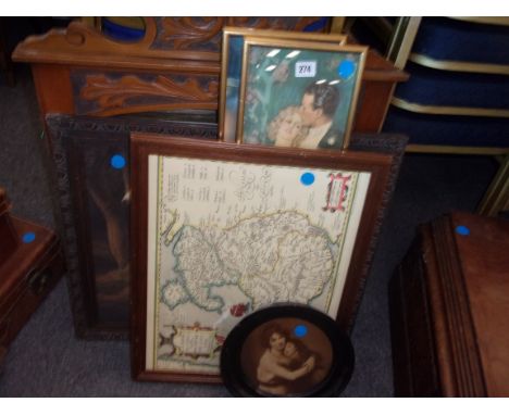
Lot 957
HENRY TEESDALE (CIRCA 1830) - 'Worcestershire', hand coloured engraving, framed, 34cm x 41cm, frame size 49cm x 55cm, also Teesdale 'Warwickshire', John Cary map of Lancashire published 1787 and an architectural drawing depicting a plan for Joseph Street Improvement, 1888, Middleton, Manchester. (4)


Lot 927
Various 19thC and other coins, low denomination world coins, etc., a rosewood jewellery box, St Christopher pendant, oak shield back plaque (AF) , black and white photographs, whistle, other bygones, collectables, etc., a Rone case containing plated cufflinks, gun sight, cloth map, cased Parker pen, dictionary, iron on AG badge, cricket medal, various other bygones, collectables, etc. (a quantity)


Lot 377
A chart of the Ethiopic or Southern Ocean and part of the Pacific Ocean from the parallel of 3 degrees N to 56 degrees 20' South Latitude drawn from the latest observations of the Spanish, Portuguese and Dutch astronomers by J. Foss Dessiou, Master of the Royal Navy, London, published by W. Faden, Geographer to His Highness the Prince of Wales, Charing Cross January 1st 1808, engraved map, framed, 59 x 89cm

Lot 378
John Thomas & William Denys, A New Chart of Mounts Bay in Cornwall, with the Adjacent Coast, from Cape Lizard to Cape Cornwall, printed for Robt Sayer & Jn. Bennett, Map & Chart-Sellers, No. 53 Fleet Street, as the Act Directs, 1st January 1780, later hand-coloured engraved map with title cartouche and seven profiles of headlands, framed and glazed, plate size 49 x 69.5cm, frame size 57 x 76.5cm

Lot 379
A modern printed map, 'Topographical Map of the City and County of New York and the adjacent Country: With Views in the border of the principal Buildings and interesting Scenery of the Island', 20th century, after the original published by J H Colton & Co., New York, 1836, framed, 51 x 114cm
Lot 381
Raleigh, Walter, The History of the World in Five Books, bound together with The Life of Walter Raleigh, full leather bound, with maps and illustrations throughout, London: c.1650; together with a selection of 18th century bindings to include: The Critical History of England, second edition, London: 1726; J. Whaley, A Collection of Poems, London: 1732; The Miscellaneous Works of Joseph Addison, ed. Tickell, vol. 2, London: 1777; and various others (lot) (AF)(VAT charged on the hammer price)Condition Report: The History of the World is overall in poor condition, the front board is loose, and many pages have tears, staining, water damage and creases or folds. The map of Arabia on pages 56-57 has a hole in the Persian sea; the map of Arabia and India is stained and has a hole in the Indian sea; some pages are mis-numbered, the chronological tables are intact to the end of the publication, all other illustrations appear to be intact. Other publications in the lot include: Mrs Le Noir, Village Anecdotes, or The Journal Of A Year, first two volumes only, London, 1804; Dr. Goldsmith, The Roman History, sixth edition, vol. 2 only, London, 1789; Herodotus, reprint from Schweighæuser, published in Greek, London, 1845; Homer, The Iliad, translated by Alexander Pope; Causes Celebres et Interessantes, avec Les Jugemens qui les ont décidées, vol. 19 only, Paris, 1743; Plutarch's Lives, vol. 2, London, 1716

Lot 43
Joan Blaeu - 'Herefordia Comitatus' (Map of the County of Herefordshire), 17th century engraving with later hand-colouring on laid paper, 40cm x 49cm, within a stained wood frame.Buyer’s Premium 29.4% (including VAT @ 20%) of the hammer price. Lots purchased online via the-saleroom.com will attract an additional premium of 6% (including VAT @ 20%) of the hammer price.

Lot 57
Jodicus Hondius - Warwicum, Northamtonia, Huntingdonia, Cantabrigia, Suffolcia, Oxonium, Buckinghamia, Bedfordia, Hartfordia, Essexia, Berceria, Middelsexia, Southhatonia, Surria, Cantiu & Southsexia' (Map of South East England), 17th century engraving with later hand-colouring on laid paper, 36.5cm x 46cm, within a Hogarth style frame.Buyer’s Premium 29.4% (including VAT @ 20%) of the hammer price. Lots purchased online via the-saleroom.com will attract an additional premium of 6% (including VAT @ 20%) of the hammer price.

Lot 47
Augustine Ryther, after Christopher Saxton - 'Anglia the Kingdome of England and Principality of Wales exactly Described' (Map of England and Wales), 17th century engraving on laid paper with later hand-colouring, 40.5cm x 52.5cm, within a Hogarth style frame.Buyer’s Premium 29.4% (including VAT @ 20%) of the hammer price. Lots purchased online via the-saleroom.com will attract an additional premium of 6% (including VAT @ 20%) of the hammer price.

Lot 60
Joan Blaeu - 'Surria Vernacule Surrey' (Map of the County), 17th century engraving with later hand-colouring on laid paper, 39cm x 50cm, within a gilt frame.Buyer’s Premium 29.4% (including VAT @ 20%) of the hammer price. Lots purchased online via the-saleroom.com will attract an additional premium of 6% (including VAT @ 20%) of the hammer price.

Lot 44
John Speed - 'Wight Island' (Map of the Isle of Wight), 17th century engraving with later hand-colouring on laid paper, 40cm x 52.5cm, within a Hogarth style frame.Buyer’s Premium 29.4% (including VAT @ 20%) of the hammer price. Lots purchased online via the-saleroom.com will attract an additional premium of 6% (including VAT @ 20%) of the hammer price.

Lot 48
John Speed - 'Bohemia, newly described' (Map of Western Czech Republic), 17th century engraving with later hand-colouring on laid paper, 43cm x 54cm, within a Hogarth style frame, together with two further engraved maps by different hands, 'Austria', and 'Picardie'.Buyer’s Premium 29.4% (including VAT @ 20%) of the hammer price. Lots purchased online via the-saleroom.com will attract an additional premium of 6% (including VAT @ 20%) of the hammer price.

Lot 46
Hubert Jaillot (publisher) - 'Le Royaume d'Escosse' (Map of Scotland), 17th century engraving with hand-colouring on laid paper, 90.5cm x 60.5cm, within a gilt frame.Buyer’s Premium 29.4% (including VAT @ 20%) of the hammer price. Lots purchased online via the-saleroom.com will attract an additional premium of 6% (including VAT @ 20%) of the hammer price.

Lot 50
Joan Blaeu - 'Cornubia Sive Cornwallia' (Map of the County of Cornwall), 17th century engraving with later hand-colouring, 40cm x 51cm, within a painted wood frame.Buyer’s Premium 29.4% (including VAT @ 20%) of the hammer price. Lots purchased online via the-saleroom.com will attract an additional premium of 6% (including VAT @ 20%) of the hammer price.

Lot 45
John Speed - 'Dorsetshyre with the shyre towne Dorchester described' (Map of the County of Dorset), 17th century engraving with later hand-colouring on laid paper, 39.5cm x 52.5cm, within a Hogarth style frame.Buyer’s Premium 29.4% (including VAT @ 20%) of the hammer price. Lots purchased online via the-saleroom.com will attract an additional premium of 6% (including VAT @ 20%) of the hammer price.

Lot 49
John Speed - 'Hantshire described and divided' (Map of the County of Hampshire), 17th century engraving with later hand-colouring, 38cm x 51cm, within a stained wood frame.Buyer’s Premium 29.4% (including VAT @ 20%) of the hammer price. Lots purchased online via the-saleroom.com will attract an additional premium of 6% (including VAT @ 20%) of the hammer price.

Lot 58
Joan Blaeu - 'Ceretica sive Cardiganensis comitatus; Anglis Cardigan Shire' (Map of the County of Cardiganshire), 17th century engraving with later hand-colouring on laid paper, 44.5cm x 56cm, within a Hogarth style frame, together with a similar map by the same hand, 'Fifae Pars Orientalis, The East Part of Fife'.Buyer’s Premium 29.4% (including VAT @ 20%) of the hammer price. Lots purchased online via the-saleroom.com will attract an additional premium of 6% (including VAT @ 20%) of the hammer price.

Lot 53
Gerard Mercator - 'Anglia Regnum' (Map of England and Wales), 17th century engraving with later hand-colouring on laid paper, 35cm x 47cm, within a painted and gilt wood frame.Buyer’s Premium 29.4% (including VAT @ 20%) of the hammer price. Lots purchased online via the-saleroom.com will attract an additional premium of 6% (including VAT @ 20%) of the hammer price.

Lot 549
Full title: Jan Barend Elwe (actief 1777-1815): 'Mappe monde ou description du globe terrestre & aquatique', hand-coloured engraving, Amsterdam, dated 1792Description: Work: 61 x 46 cm Paper: 65,5 x 55 cm Frame: 80,5 x 70,5 cm 'Mappe monde ou description du globe terrestre & aquatique suivant les dernieres & meilleures'. Elaborate double hemisphere world map embellished with allegorical representations of the continents based on Jaillot's world map. Ref.: - Koeman, Atlantes Neerlandici, II, p. 105.

Lot 550
Full title: Abraham ortelius (1527-1598): 'Romani Imperii Imago', hand-coloured copper engravingDescription: Work: 49,3 x 34,5 cm Paper: ca. 52 x 37 cm Frame: 65,2 x 52,2 cm original copper engraving, published 1612 in the famous historical atlas 'Parergon' (Latin text-edition) by Abraham ortelius. In the upper middlea title cartouche, in the upper right and left corners cartouches showing Roman kings. The bottom shows three cartouches, in the lower left corner and lower middle two text cartouches concerning Roman history, in the lower right corner a cartouche with a genealogical tree of Roman kings. Ref.: -Marcel van den Broecke, ortelius Atlas Maps, 187: the map was first published in the 'Parergon' between 1579 and 1587. The plate was altered for the next edition of 1592 with the addition of four lines by Vetruvius in the upper right corner.

Lot 551
Full title: Abraham ortelius (1527-1598): 'Presbiteri Johannis, sive, Abessinorum Imperii descriptio', hand-coloured copper engraving, [1598]Description: Work: ca. 44 x 37,2 cm Paper: ca. 45,5 x 38,7 cm Frame: 68,5 x 60,5 cm A 16th-C. map of the African continentdepicting the famous Kingdom of Prester John 'Pape Jan' along with much of eastern and central Africa, including the two Ptolemaic lakes, the supposed source for the Nile River. Ref.: - Van den Broecke, 175. - Norwich, 11. - Koeman III, map 8720:31. Prov.: - Ex-collection, The Parker Gallery, London.

Lot 552
Full title: Gerhard de Jode (1509-1591): Germania Inferior. Gallia Belgica dicta ... provincias septentrionales, hand-coloured copper engraving, [1593]Description: Work: 43,2 x 34,2 cm Paper: ca. 46 x 37 cm Frame: 59,5 x 52,2 cm 'Germania inferior. Gallia Belgica dicta, continens Hispaniarum Regis Provincias Septentrionales'.Formis Haredum Gerardi de Iode. An early map of The Netherlands, Belgium and Luxemburg, published by Gerard's son Cornelis de Jode in his ‘Speculum orbis Terrae', Antwerp, G. De Jode, 1593. (Van der Krogt 3, 2:02) Ref.: -Van der Krogt 3, 3000:32B. - Van der Heijden (Netherlands), #38.


Lot 514
Co. Wicklow Guides: Wright (G.N.) A Guide of the County Wicklow, 12mo Lond, 1827. Engd. frontis 4 engraved plts. & lg. fold. map, cont. full calf, gilt & blind tooled borders, v. good.; Guide to the County Wicklow, 12mo Dublin 1834. New Edn., fold. map, & 5 engraved plts. cloth; and, Fraser (James) Guide to the County of Wicklow, 12mo Dublin 1842, fold. map, & illustrations thro.-out, orig. cloth. (3)


Lot 187
Blaeu, Joan. 17th-century map of Worcestershire & Warwickshire & Coventry, hand-coloured copper engraving on laid/chain-lined paper, featuring decorative cartouche and heraldic shields, framed & glazed to recto and verso (both sides visible). ‘Wigorniensis Comitatus et Comitatus Warwicensis; nec non Coventrae Libertas. Worcester, Warwik Shire and The Liberty of Coventre.’ 54cm x 45.5cm.

Lot 395
A 17th/18th century detailed map of the home counties, hand coloured engraved map. ‘Warwicum, Northamptonia, Huntingdonia, Cantabrigia, Suffolcia, Oxonium, Buckinghamia, Bedfordia, Hartfordia, Essexia, Berceria, Midelsexia, Southatonia, Surria, Cantiu & Southsexia’. Framed and glazed. 48cm x 38.5cm.
Lot 476
John Speed, 17th Century map of Warwickshire, ‘The Counti of Warwick The Shire Towne and Citie of Coventre described’, Thomas Bassett & Richard Chiswell, hand coloured engraved map, inset city plans of Warwick and Coventry, large strapwork cartouche, compass rose and mileage scale. Framed and glazed. 50.5cm x 38.5cm.


Lot 1164
Miscellaneous pictures and prints, including Paul Bartlett - Life Painting Room at The Royal Academy Schools, London, 'Rachel,' signed, dated 1979 and numbered 7/200 by the artist in pencil, lithograph, 28 x 22cm, a Robert Morden county map of Nottinghamshire, n.d. [18th c], engraving, 35.5 x 42cm, modern decorative off-sets of earlier Japanese woodblock prints, portrait of Cardinal Newman, etc., (12) Mixed condition. Unexamined out of frames.

Lot 1053
Antiquarianism & Topography. Plot (Robert), The Natural History of Stafford-shire, first edition, Oxford: Printed at the Theater (sic), 1686, lacking map, 37 engraved plates as called for, of which 26 are double-page, one defective and repaired, ten or so plates discreetly repaired, infrequent minor stains and slightly tatty leaves, contemporary gilt-panelled calf, upper-cover detached, lower split and loosening but holding, bumped, chipped and rubbed, lacking endpapers, folio (36 x 24cm), [&] Faussett (Rev. Bryan) & Smith (Charles Roach), Inventorium Sepulchrale: an Account of Some Antiquities Dug up [...] in the County of Kent, from A.D. 1757 to A.D. 1773, London: Printed for the Subscribers Only, 1856, plates and in-text illustrations, some stains, original publisher's cloth by Bone & Son, London, ticket, disbound, ex-lib and with their markings, stamps, and implied condition, 4to, (2) Provenance: 1st: 1) My deare (sic) deare (sic) I was with thee poor Frank Brooke, verso pastedown with contemporary ink manuscript inscription; 2) Washington Sewallis Shirley, 9th Earl Ferrers (1822-1859), of Staunton Harold, Leicestershire, his large format armorial bookplate engraved by B. Warwick. 2nd: R.S. Ferguson, F.S.A., contemporary armorial bookplate.
-
109198 item(s)/page