We found 109198 price guide item(s) matching your search
There are 109198 lots that match your search criteria. Subscribe now to get instant access to the full price guide service.
Click here to subscribe- List
- Grid
-
109198 item(s)/page


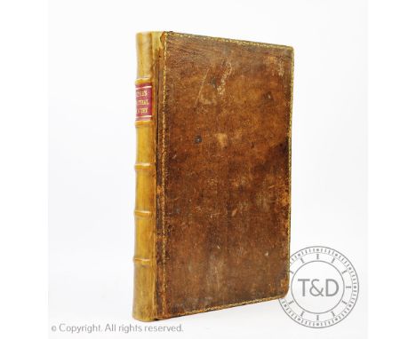
Lot 433
LEIGH (C), THE NATURAL HISTORY OF LANCASHIRE, CHESHIRE AND THE PEAK IN DERBYSHIRE, engraved portrait frontis, folding map with hand coloured detailing and twenty four engraved plates, three parts in one, re-backed calf with original tan boards, frontis and title cut and re-laid, Oxford, 1700 (1)

Lot 434
MOGG (E), PATTERSONS ROADS, being an entirely original and accurate description of all the direct and principle cross roads in England and Wales, 7th edition, folding frontis map, map of London to Hollyhead and seven folding maps at rear, later 1/2 calf with original boards, and brass clasp, London, 1824 (1)


Lot 673
A 1950's Philips 10 inch Challenge Globe, on square base, 31cm high CONDITION REPORT: Crazed throughout with some browning down the join lines of the map and some losses to the paper at the joins - heaviest to the equator in South America - slight gapping to the equator at the Atlantic. A couple of odd blemishes. Meridian lightly grubby. Overall fair.


Lot 2036
SPEKE, John Hanning, Journal of the Discovery of the Source of the Nile, London 1863, 1st edition, 8vo original cloth, cloth worn and discoloured, content detached from case, lacks map of Eastern Equatorial Africa which should be in rear pocket, all illustrations and the other map are present (1)

Lot 123
An unframed map of the Parish of St Mary, Whitechapel, two unframed maps showing allied progress on the Western Front, an Ogilby 1698 route map, together with a large quantity of unframed maps relating to Hertfordshire. Condition Report: We believe this to be original 1698, with later colour added. Overall good condition. Evidence of crease top to bottom centre.

Lot 293
A framed and glazed map of the Parish of St John's, Wapping and the Parish of St Paul's, Shadwell, together with two framed and glazed maps of Hertfordshire, various sizes. Condition Report: There are two county maps and a parish map of both St John, Wapping and St Paul Shadwell in one frame (see image).


Lot 964
ARTHUR DELANEY (1927-1987); limited edition signed print 'Albert Square', signed in pencil lower right, 361/400, 35.5 x 44cm, framed and glazed, and a map of Chester after Robert Morden (2). (D) CONDITION REPORT: This lot qualifies for Artist Resale Rights. For further information, please visit http://www.dacs.org.uk

Lot 893
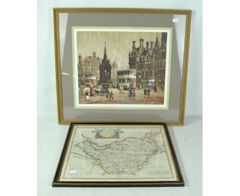
ROBERT MORDEN; a 17th century hand coloured engraved map 'The Smaller Islands In The British Ocean', 38 x 33.5cm, framed and glazed, a further example 'The County Palatine of Chester' and a reproduction example (3). CONDITION REPORT: Period map with faint outline to margin, small area of staining top centre, two 6cm creases top left and top right, otherwise ok, the other two are reproductions.

Lot 148
An early to mid-20th century hand drawn and coloured map of the Verbania area of North West Italy, possibly used in escape by a prisoner of war, approx 21.5 x 17cm. CONDITION REPORT: Some holes, some tears and losses to the edges and corners, staining, some pencil annotations, used for escape is a suggestion only by purport of vendor.


Lot 78
Steamship testing in New York.- Hutchings (John, publisher) Origin of Steam Navigation. A View of Collect Pond and its Vicinity in the City of New York in 1793, broadside with map of Collect Pond in New York City and illustrations and text describing early steamship tests by John Fitch, lithograph on wove paper, 370 x 470 mm. (14 1/2 x 18 1/2 in), under glass with light folds and handling creases, framed and glazed, 1846.


Lot 209
Three Early 20th Century Indian and Afghanistan Cloth-Mounted Military Maps, comprising Nawabshah District. Sind. 1934, 132 cm by 104 cm; another, similar, 1934 / 1936, and Punjab and Punjab States, 1921, 57.5 cm by 44.5 cm. Two larger maps with significant worm damage. Personal inspection recommended. Other map overall stained and worn.


Lot 88
Turkey, Arabia, and Persia. De Lisle (Guillelmo), Carte de la Turquie, de l'Arabia, de la Perse, with inset decorative title cartouche lower left, engraved by H. van Loon, Paris, [dated 1701], mounted, framed, and glazed, 64 x 78cm overall, together with Algeria. Shaw, Smyth, Rozet, Lapie, Garnier, Berard, North - Africa or Barbary, II, Algier, part coloured engraved map, engraved by J & C Walker, published by Baldwin & Cradock [bearing date Sept. 1st 1834], unframed, 35 x 42cm (2) Provenance: Property of a lady from a Normandy Manoir.

Lot 90
China. Schenk (Peter) & Valk (Gerard), Imperii Sinarum Nova Descriptio. Auctore Joh van Loon, decorative title cartouche lower left, part hand coloured engraved map, Amsterdam, [early 18th century], mounted, framed and glazed 66 x 72cm overall Provenance: Property of a lady from a Normandy Manoir.

Lot 91
China. Covens & Mortier, after Nieuhoff, Carte exacte de toutes les Provinces, Villes, Bourgs, Villages, et Rivieres du vaste ed puissant Empire de la Chine, with title cartouche above a scene with Westerns and Orientals, part hand coloured engraved map, Amsterdam, [18th century] mounted, framed and glazed, 66 x 72cm overall Provenance: Property of a lady from a Normandy Manoir.

Lot 92
East Indies. Moll (Herman), Map of the East-Indies and the adjacent Countries; with the Settlements, Factories and Territories, explaning [sic] what belongs to England, Spain, France, Holland, Denmark, Portugal &c. with many Remarks not extant in any other Map by H, Moll Geog., with title panel surmounted by coat-of-arms, inset views of Goa and Surat, inset plans of Bantam, Fort St. George and Madras, and Batavia, part hand coloured engraved map London [1715-20] hand coloured borders, mounted, framed and glazed, 80 x 120cm overall Provenance: Property of a lady from a Normandy Manoir.


-
109198 item(s)/page