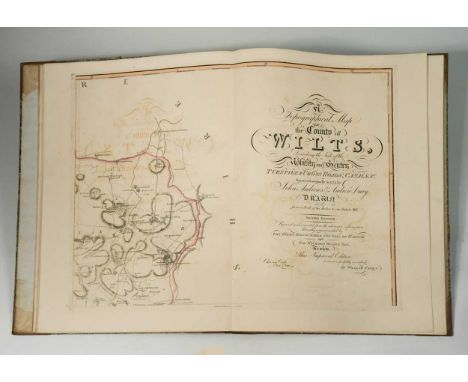
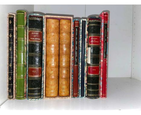
We found 109182 price guide item(s) matching your search

Refine your search

Year

Filter by Price Range
  • List
  • Grid
  • 109182 item(s)
    /page

Lot 248

NO RESERVE Spain.- Vaugondy (Gilles Robert de) and others. Collection of 7 maps and charts of Spain, including battle plans and fortifications, with 3 plans from 'Mr Tindal's Continuation of Mr Rapin's History of England', two charts by Jacques Ayrouard of 'La Baye de St. Philiou' and 'La Baye d'Alicant', and two double-page maps of the Iberian Peninsula, including Vaugondy's 'Carte des Royaumes d'Espagne et de Portugal', and Robert's map 'Royaumes d'Espagne et de Portugal', engravings, various sizes, largest 550 x 800 mm (21 1/2 x 31 1/2 in), occasional minor surface dirt and handling creases, all unframed, mainly 18th century (7)

Lot 250

NO RESERVE Spain & Portugal.- Visscher (Nicolas) Hispaniae et Portugalliae Regna..., map of the Iberian Peninsula, showing Mallorca and Minorca, decorative title cartouche in the lower right, engraving with full hand-colouring, platemark 450 x 550 mm (17 3/4 x 21 5/8 in), good margins, central vertical fold with splitting and repairs, handling crease to lower right quadrant, marginal nicks and tears, some spotting and surface dirt, unframed, [circa 1690]; together with 3 further maps of the Spain and Portugal, including De L'Isle's 'L'Espagne dressée sur la description qui en a été faite par Rodrigo Mendez Sylva', and two variant maps of 'Hispania Antiqua' by Sanson and Vaugondy, engravings, various sizes, occassional spotting and surface dirt, minor handling creases, unframed, 18th century (4)

Lot 266

Maw (George) A Monograph of the Genus Crocus, first edition, 81 hand-coloured lithographed plates, double-page colour map and two double-page tables, bookplate of Lawrence Austen Impey, endpapers and margins of title lightly browned, some foxing to peripheral ff., the odd spot elsewhere, original cloth, gilt, extremities lightly rubbed, t.e.g., [Nissen BBI, 1316; Stafleu & Cowan 5721], 4to, 1886.⁂ "George Maw (1839-1912) was the industrious author and illustrator of his great 'Monograph of the Genus Crocus' (1886)...His monograph, the result of ten years of inquiry, was the most complete work of its kind that has been published on any genus. The plates of this work are marvels of comprehensive detail and put to shame those of many more skilled draughtsmen. From a botanical point of view this work is a landmark."(Blunt & Stearn p. 277 & 279).

Lot 49

France.- Andrews (John) Letters to a Young Gentleman, on his setting out for France..., first edition, half-title, some light foxing, original boards, uncut and unopened, spine titled in manuscript, split to upper joint, J.Walter, 1784 § Vermont (Marquis de) & Sir Charles Darnley. London and Paris, or Comparative Sketches, only edition, 8pp. advertisements at beginning, original boards, uncut and unopened, spine ends worn, label chipped, 1823 § Shepard (J.S.) A Bicycle Ride in France, newspaper column mounted on 55 thick leaves (rectos only) with a decorative manuscript title in watercolour and 9 mounted actual photographs, modern cloth, 1894, the first two rubbed; and one part (Meuse) from Voyage dans les Départemens de la France of 1792 with a double-page hand-coloured engraved map and 4 engraved plates, 8vo (4)

Lot 155

A HAND-COLOURED ENGRAVED MAP "EUROPE" 22cm high x 28cm wide

Lot 1

David LogganArea Nova Nevellensis Colleg. Trin. Cant - Nevile's Court, Trinity College, Cambridge, engraving, 1690, 39 x 57.5cm; Together with, one book leaf of Huntingdonshire, a map of Essex and another of Hertfordshire

Lot 104

MORGAN (Dr.) Six Philosophical Dissertations, 1st English edition, Cambridge, 1770, small 4to, list of subscribers, 3 folding engraved plates, modern marbled wrappers, cloth drop-back box. Note: The subjects are: The Mechanical Powers, Elastic Bodies, Falling Bodies, The Parabola [Motion of Projectiles], The Cycloid, and The Rain-Bow; FORSTER (Thomas) Researches about Atmospheric Phaenomena, 1st ed., 1813, without half-title, library stamps, later plain cloth; FRISI (Paul) A Treatise on Rivers and Torrents, 1st edition in English, 1818, 4to, half-title, folding map, plan and a table, light foxing and dust staining, library stamp to half title and pastedown, recased preserving cloth spine strip (3)

Lot 107

HOMER. The Iliad and the Odyssey, by Alexander Pope, in 11 vols., London: C Rivington 1760, 8vo, engraved head and tail pieces, Iliad with two engraved portraits, two folding plates and a folding map, contemporary armorial bookplates of George Leycester with his signature, contemporary calf with good modern reback

Lot 111

CHAMBERLAIN (Henry) A New and Compleat History and Survey of the Cities of London and Westminster. London: for J. Cooke. no date [1770], folio, engraved frontispiece (offset on to title), 63 (of 64) plates, folding map and folding plan of London, calf with good reback

Lot 114

BELL (John) Travels from St. Petersburg in Russia, to Diverse Parts of Asia, in 2 vols., 1st edition, Glasgow: for the author by Robert and Andrew Foulis, 1763, small 4to, folding map 'of the Route between Mosco and Pekin.', slightly creased, with errata leaf and advertisement leaf, all printed on thick paper, generally fine, original calf with 20th century reback; WRIGHT (Edward) Some Observations made in travelling through France, Italy, &c. 2nd edition, 2 vols. in one, London 1764, 4to, with 42 plates (as required), occasional slight offsetting, worn rebacked calf (3)

Lot 129

Literature, various including TULLY (R) Narrative of a Ten Years Residence in Tripoli in Africa, second edition, London for Henry Colburn 1817, 4to, folding linen backed map and 7 coloured plates as required, an extra plate loosely inserted, some offsetting and spotting, half calf (rubbed), Pleydell Bouverie ownership slip pasted in; SYDENHAM (Thomas) Opera Universa, in quibus non solummodo Morborum Acutorum Historiae & Curationes Nova.., Editio Altera, London: R.N. for William Kettilby, 1685, 8vo, frontispiece portrait loose; bound with - Epistolae Responsoriae Duae, 2nd edition 1685; bound with - Podagra et Hydrope, 2nd edition 1685; bound with - Schedula Monitoria de Novae Febris Ingressu, 2nd edition 1688; all in worn calf with detached front board, some general age toning and slight marginal browning; also bindings and odd volumes, history and reference (quantity). Sold as seen.

Lot 149

GELL (William) The Geography and Antiquities of Ithaca, 1st edition, 1807, 4to, folding engraved map, single-page plan, 13 plates including 9 folding, some foxing and toning throughout, damaged plain cloth binding

Lot 159

Travel, memoirs and essays. ROBERTSON (J P & W P) Letters on Paraguay, 1838, small 8vo, folding map, 2 frontispieces, slight staining to titles, Fasque bookplates, modern half calf; ESTE (C) A Journey in the Year 1793 through Flanders .. to Switzerland, 1795, 8vo, half calf, rubbed; TWEEDIE (Mrs A) Mexico as I saw it, 1901, folding linen backed map at end, plates, half calf; FITZWILLIAMS (John K L) Letters from a Gunner 1914-18, 8vo, printed for private circulation, full morocco by Zaehnsdorf, Royal Artillery crest in gilt to upper board; PIKE (N) Sub-Tropical Rambles in the Land of the Aphanapteryx. New York 1873, 8vo, illustrations, cloth; WILSON (W R) Travels in the Holy Land, Egypt.., 2 vols, 1831, 8vo, interleaved with ink Biblical quotations to vol. I, half calf; others, all in varying condition with some staining and signs of use. Sold not subject to return (24)

Lot 17

N. Dupuis after Rembrandt, Portrait of Herman Doomer, engraving with etching, circa 1713, 27 x 21cm; After Gillray by W. Humphry, Judge Thumb, etching, 33.5 x 24cm; Saxton and Hole, map of Derbyshire, 17th century engraving, uncoloured, 30 x 33cm; another map by Morden, hand coloured; with 3 other prints (7)

Lot 173

ANDREWS (John) and Andrew DRURY. A Topographical Map of the County of Wilts, Describing the Seats of the Nobility and Gentry, Turnpike and Cross Roads, Canals, &c., Surveyed Originally in 1773..., 2nd edition, revised and corrected, London: W. Faden 1810, large folio, title slightly stained, table of the market towns and villages, folding Index, County Map of Wiltshire and complete with 18 double page sectional maps hand coloured in outline, Holland House armorial bookplate, later half calf over contemporary marbled boards

Lot 189

County histories, travel guides, etc. WYNDHAM (H P) Wiltshire extracted from Domesday Book, 1788, 8vo, calf; THROSBY (John) The Memoirs of the Town and County of Leicester, six vols. in 3, 1777, 12mo, lacks map and 2 plates, sporadic staining, calf; THOMPSON (J) The History of Leicester, 1876, square 12mo, calf; PHILLIPS (G) The Rutland Magazine, 5 vols., 1904-12, 8vo, cloth; DALE (T F) The History of the Belvoir Hunt, 1899, 8vo, cloth; MUSTERS (Mrs C) A Cavalier Stronghold, a Romance.., 1890, cloth gilt; DICKINSON (W) The History and Antiquities of Newark, 1816, 4to, boards; another copy, 1819, staining; COX (C) The Churches of Derbyshire, 4 vols., 1875-79, plates, cloth gilt; KING (R J) The Mineralogy of Leicestershire, 2 vols. 1973, 4to, doctoral thesis, cloth; with various others including few Baedeker and similar handbooks

Lot 196

Ireland, history and topography. THOMPSON (Mrs D P) A Brief Account of the Rise and Progress of the Change in Religious Opinion now taking place in Dingle, and the West of the County of Kerry, 2nd edition, 1847, 8vo, some staining, modern binding; The Irish Tourist, 3 vols. in one, no date, thick 12mo, plates, cloth, spine torn; Journal of a Tour in Ireland, 1806, 8vo, 36pp., map and plate, trimmed, modern boards; HUTTON (A W) Arthur Young's Tour in Ireland, 2 vols, Bohn's Library edition 1892, 8vo, folding map, cloth; others (condition varies; sold not subject to return)

Lot 197

Irish history and politics. Ireland as it is and as it should be under Home Rule, ... sixty two letters written between March and August 1893. Birmingham Daily Gazette, circa 1894, 8vo, map frontis, original green cloth gilt; Saorstat Eireann Irish Free State Official Handbook, Talbot Press 1932, folding map in pocket at end, colourful boards, cloth back; FOWLER (J H) Chapters in '98 History, 1938, 8vo, one of 500 signed numbered copies, original cloth; PRENDERGAST (J P) The Cromwellian Settlement of Ireland, 3rd edition 1922, dust jacket; SULLIVAN (A M) New Ireland, Political Sketches and Personal Reminiscences, 16th edition, 8vo, browned, paper wrapper (detached); few others, mainly general history

Lot 206

JEROME (J K) Three Men in a Boat, 1st edition 1889, 8vo, original cloth; PULMAN (G P R) The Book of the Axe, 4th edition, 1875, folding map, author's letter inserted, cloth gilt; ROBINSON (C E) A Royal Warren or Picturesque Rambles in the Isle of Purbeck, 1882, 4to, light spotting to title and frontis, uncut, cloth gilt; WHITE (Rev. G) The Natural History of Selborne, 1813, 4to, plates, rubbed calf, detached board; 5 others

Lot 251

American history. BANCROFT (Aaron) An Essay on the Life of George Washington, Commander in Chief of the American Army, through the Revolutionary War; and the First President of the United States. Worcester 1807, 8vo, portrait frontis, somewhat toned, calf, rubbed; SCHOULER (William) A History of Massachusetts in the Civil War, 2 vols. 1868, 8vo, folding map, original cloth; NASON (Elias) A Gazetteer of the State of Massachusetts. Boston 1876, 8vo, portrait frontis, folding hand coloured lithographic map by Russell, repaired calf; WASHBURN (Emory) Historical Sketches of the Town of Leicester, 1860, 8vo, frontis, folding map, portraits, cloth; PRINCE (Thomas) A Chronological History of New England, 1826, 8vo, new edition, library stamp to title, later cloth; BANCROFT (G) Memorial Address on the Life and Character of Abraham Lincoln, 1866, 8vo, portrait frontis, few ink spots, original cloth; HENSHAW (Col. W) The Orderly Book of --, with additions by Harriet Henshaw, 1881, 8vo, inscribed to head of title by Harriet Henshaw, cloth; 3 others (11)

Lot 257

New England, 9 vols. recent re-bindings in slip cases. LINCOLN (W) History of Worcester, Massachusetts, 1862, 8vo, portraits, recent morocco, slip case; SARGENT (Nathan) Men and Events, 2 vols., 1875, 8vo, inserted modern portrait plate, recent tree calf, slip case; WASHBURN (Emory) Sketches of the Town of Leicester, Massachusetts, 1826, 8vo, presentation inscription 'by the author' to head of title, Flint family inscriptions to first leaf, all rather browned and stained, brittle in places, recent red morocco; WASHBURN (Emory) An Address ... Inhabitants of the Town of Leicester, in the Events of the Revolution, 1849, 8vo, 48pp, original blue wrappers bound in, recent blue morocco, slip case; another copy, in yellow wrappers; HILL (Rev. T) The Centenary of Leicester Academy, 1884, 8vo, front wrapper bound in, recent green morocco, slip case; BURDETT (E W) History of the Old South Meeting-House in Boston, 1877, 8vo, original wrapper bound in at end, recent morocco, slip case; with one history of Leicester by Washburn, 1860, lacking title page; together with a reproduction map of Virginia and Maryland after R de Vaugondy (10)

Lot 261

Victorian shilling and other popular series books, mainly paperback 8vo and 12mo. SIMS (George R) How the Poor Live - Horrible London, 1889; The Siege of London, by 'Posteritas', 1885; SEN (Sun Yat) Kidnapped in London, 1897; STODDART (Jos) Sports and Pastimes, Men I have Met, 2 parts, 1889; PHILLIPS (W) The Wild Tribes of London, 1856, 3rd edition; MORELL (J R) Russia as it is, 1854, map; another copy, HORTON (T G) Turkey the People, Country and Government, 1854, illustrated; another similar for Russia, 1854; FISHER (F H) Cyprus Our New Colony, 1878, with maps, yellow boards; COOK'S Handbook to Venice, folding lithograph map, pictorial boards; DICKENS (C) Memoirs of Joseph Grimaldi, 1866, 12mo, yellow back pictorial boards; with others (34)

Lot 268

BACON (George W) New Large Scale Ordnance Atlas of the British Isles with Plans of Towns. With Descriptions, Alphabetical Indexes and Census Tables [of 1881], no date, circa 1885, 4to, with 100 double page colour lithographic maps and town plans, including 4 double sheets 'New Map of London divided into half mile squares & circles', complete as per contents list, title a little stained, maps generally clean with each numbered to upper right corner, original cloth, rebacked

Lot 270

STEVENSON (R L) Works, including 1st editions of: Kidnapped, 1886, with folding map; Catriona, 1893; The Merry Men, 1887; The Master of Balantrae, 1889; The Wrecker, 1892 (joints rubbed); The Black Arrow, 1888; The Wrong Box, 1889; St Ives, 1898; In the South Seas, 1900; others, all in uniform half red morocco gilt for Sotheran (18)

Lot 313

[NICOLOTTI (T), attributed to] An 18th Century manuscript map of the Bombardment of Toulon, 1707; pen, ink and watercolour on laid paper entitled ‘Bombardamento della Citta di Toulone… L’Anno 1707…’ with key and elaborate cartouche, image circa 26 x 20cm, glued down to old card backing.Note: a near identical map by Nicolotti, drawn as a trompe l’oeil and incorporated in a large map of the coast of France and Italy, circa 1707, is held by The Royal Collection Trust in its collection of military/naval maps/prints originally formed by the Duke of Cumberland (1721-1765)

Lot 34

Collection of framed prints and engravings. George Bickham, three plates of calligraphy with vignettes and decorations, 32 x 20cm (plate); After Sandby, Brocket Hall in Hertfordshire, small engraving, mounted with a pencil sketch of the Hall Stables below dated 1784, 16 x 24cm; a map of Hertfordshire by Robert Morden, 37 x 45cm; David Roberts, Craigmillar Castle, lithograph, 38 x 51cm; L. Beck, The Young King at the Butts, woodcut, Vienna edition 1775; others by Joseph Nash, etc (17)

Lot 363

Literature, various. WILLIAMS (Tennessee) Cat on a Hot Tin Roof. London 1956, 8vo, 1st reprint edition, dust jacket; STONE (C) Eton, 1909, 8vo, half vellum; LYTE (H C M) A History of Eton College, 1889, rebacked; BUTLER (S) An Atlas of Modern Geography, circa 1800, 8vo, lacking world map, finger soiling; The Spectator, 8 vols., small 8vo, no date, calf, worn; Album des Deutschen Rennsports, 6 vols. Berlin 1908-13, folio, illustrated, cloth; GLADSTONE (W E) The State in its Relations with the Church, 1838, 8vo, calf, rebacked; with a few other odd vols. (25)

Lot 383

CHURCHILL (Winston S) Ian Hamilton's March, London 1900, 1st edition, 8vo, folding map and adverts at end, title very lightly foxed, later half morocco, top edge giltNo Marks of previous ownership

Lot 44

John Speed, Italia, engraved hand coloured map of Italy, sold by George Humble 1626, with eight costume figures to vertical margins and six city vignettes to upper margin, English text verso, 40 x 52.5cm

Lot 45

World War One coloured folding map of Aleppo and region in the Ottoman Empire, linen backed, circa 81 x 63.5 cm, produced by the Arab Bureau [the British Intelligence organisation based in Cairo], scale 1: 500,000, (7.89 miles to one inch), and marked to lower left corner "GSGS 4011 (Aleppo)", published by the Survey of Egypt under authority from the War Office, for Arab Bureau.Note: The area in question is much of northern Syria and eastern Turkey. "Ottoman Empire" and "Aleppo" are printed in the top margin. The Arab Bureau was set up in 1916, its main role was the collection and dissemination of intelligence and propaganda about the Arab regions of the Middle East and North Africa. Map making was a key aspect of its work, and made use of both secret and open sources of intelligence to help in the struggle against the Allies' enemy, the Ottoman Empire. At the heart of the Arab Bureau mapping operation in 1915-16 was an unknown 2nd Lieutenant, T. E. Lawrence, who later achieved fame as Lawrence of Arabia.

Lot 50

Johann Walch Tabula Geographica maximae partis Americae Mediae sive Indiae Occidentalis, [map of the West Indies] Augsburg 1798, engraving with slight outline colour, 51 x 62cmsome toning and light creasing

Lot 52

The Authentic Map Directory of London and Suburbs, 4th edition, Geographia Limited, 4to, coloured maps, with supplement index booklet dated 1937 at end, original cloth

Lot 53

Atlases. JOHNSTON (W & A K) The Handy Royal Atlas, 1911, folio, coloured double page map sheets, rebound; BACON (G W) & Co. Ltd, Atlas of Great Britain and Ireland, c.1920s, 4to, coloured double page map sheets, repaired binding (2)

Lot 54

CARY (J) Cary's Reduction of his Six Sheet Map of the British Isles, 1836, 126 x 99cm, toned, wallet case; Cary's Six Sheet Map of England and Wales, with Part of Scotland, 1824, 135 x 105cm, wallet case; Smith's New Map of England and Wales, corrected to 1818, dissected and linen backed, somewhat toned, 116 x 96cm, in worn wallet case (3)

Lot 55

John Speed A map of Northumberland with inset armorials and plans of Newcastle and Berwick, published by John Sudbury and George Humble, coloured engraving circa 1610, 39 x 51cm44.5 x 58cm framedsmall paper loss to the lower right edge. Slight rippling visible to surface in places, perhaps indicating it is not laid (stuck) down. But not examined out of frame.

Lot 59

John SpeedA map of Italy with inset views of Verona, Naples, Venice, Rome, Genoa and Florence across the top and depictions of typical Italian fashions to the sides, from Bassett and Chiswell's Prospect of the Most Famous Parts of the World, coloured engraving 1676, 40 x 52cm51 x 63cm framed. Can be removed from frame. The lower margin has extended (see photo)

Lot 60

Railway maps. Mogg's Great Western Railway, 1842, 72 x 24cm, coloured folding map, linen backed; Cheffins's Map of the Railways, 3rd edition, 70 x 72cm; Cheffins's Map of the Grand Junction Railway, 109 x 43cm; WYLD (J) A New Map of Great Britain ... with the Railways Finished and in Progress, 1844, 75 x 57cm, cover detached; also - The Roads and Railroads, Vehicles and Modes of Travelling. London: John W Parker 1839, 8vo, cloth; Railroadiana, 1838, 8vo, folding coloured frontis (6)further images attached.

Lot 61

Folding maps. RENDEL (J M) Plan of Docks and Warehouses proposed to be made at Birkenhead, November 1844, hand coloured folding plan by J & C Walker, 62 x 75.5cm, cover detached and rubbed; BACON (G W) Map of England and Wales (North Sheet), circa 1920s, coloured, 64 x 101cm, wallet case; WHITE (W) Map of Suffolk, 1874, 44.5 x 57cm; Colchester district, 1838, cover marked 'Eastern Counties Railway', 64 x 50cm; three Guides to Portsmouth, 1825 (damp and brown stained), 1834, 1850 (toned); Ordnance Survey map of part of Devon between Bude Bay and Bideford Bay, hand coloured, 1813, 66 x 110cm; Ordnance Survey Index Map to England and Wales, 64 x 95cm (9)

Lot 62

Emanuel Bowen An Accurate Map of the County of Norfolk, 18th century hand coloured engraving, printed for Carington Bowles, Dickinson and Sayer, circa 1767, 54 x 72cmGenerally good condition. Colour is consistent across the map. Mounted close to the plate mark.

Lot 63

Sebastian Münster. Anglia II Nova Tabula, early wood engraved map circa 1550, with north oriented to the left, and the flags of Scotland and England, with part of Ireland, 29 x 37cm (visible); two others later: Antonia Zatta, Linguadoca di Foix e di Rossiglione con il Rouergue, hand coloured engraving, Venice 1777, 43 x 35cm; and an Italian map of Asia, 1778, 34.5 x 48cm (plate) (3)

Lot 64

John Speed.Kent with her cities and earles described and observed - A map of Kent with inset armorial designs and plans of Rochester and Canterbury, with a description of its cities and earls to the reverse, hand coloured engraving, 1627, 38 x 50cm53 x 66cm framed

Lot 64A

A folding map of London 1777, by J Ellis, for Carington Bowles, some trimming and pin holes to corners, linen backed, hand coloured engraving, 39 x 52cm; GWR folding paper map circa 1924, printed wrapper (2)

Lot 65

STEPHENSON (George) London & Birmingham Railway. Plan of the Line and Adjacent Country, Robert Stephenson Engineer. Large engraved folding coloured map published by Cheffins, 1835, linen backed, with inset plans of Birmingham Depot and London Depots, slight offsetting, 750 x 1575mm, with original wallet case

Lot 67

John Speed 'Cambridgshire Described', hand coloured engraved map of Cambridgeshire, published by Bassett and Chiswell, circa 1676, 40 x 53cm (visible), English text verso, in double glazed gilt frame

Lot 69

DONN (Benjamin) A Map of the County of Devon with the City and County of Exeter, Engraved by Thomas Jefferys. London: for the Author 1765, folio, hand coloured double page key map of the county and 12 section large scale map, the town plan single sheet uncoloured, light marginal staining and typical offsetting, in 19th century marbled boards and gilt lettered spine

Lot 7

Cambridge interest and others. Map of Cambridgeshire by Christopher Saxton and William Kip, loose uncoloured engraving, 17th century; Trinity College Great Court, engraving by Sparrow; British Railways Combined Excursion to Derby and Dovedale, lithographic poster printed by Stafford (unframed); two etchings by M. Oliver Rae; St Catharine's College, probably by Coronelli after Loggan c.1700; a hand coloured view towards King's College Chapel, 19th century, 13.5 x 22cm; together with various other prints, mostly framed (20)

Lot 70

TEESDALE (Henry, & Co) New Chart of the World on Mercator's Projection, with the Tracks of the Most Celebrated & Recent Navigators, engraved by John Dower, 1846, large hand coloured map in two folding sections, linen backed and dissected, with green fabric edging, both sections 131 x 99cm, in morocco gilt boards

Lot 71

[John Speed] A Map of Virginia and Maryland. London: Thomas Bassett and Richard Chiswell, [1676], engraved map with some outline colour, 39.5 x 53.5cm (sheet), English text verso, in double glazed gilt frame

Lot 72

C & J Greenwood. Map of London from an actual survey made in the years 1824, 1825 & 1826, published in 1827, 127 x 185cm, in tree calf caseA small pink wash smear to left side; tiny area (1cm ) oxidation to left side. A few small edge borders of paper sections folded in slightly and need flattening. Overall good original colour and universal tone. Please see images

Lot 86

[STRYPE (John)] Life of Sir Thomas Smith, 1698, 8vo, all rather browned, map at p.176, lacks portrait and Aa3 of appendix, rebacked calf; Historical Collections of the Life and Acts of the Rt. Rev. John Aylmer, Lord Bishop of London, 1st edition, 1701, 8vo, engraved portrait, panel calf, rebacked; Ecclesiastical Memorials, Relating Chiefly to Religion and its Reformation, under the Reign of King Henry VIII, King Edward VI, and Queen Mary the First..., 7 vols., 1816, 8vo, worn calf, rebacked (9)

Lot 89

[CHRISTYN, Jean-Baptiste] Histoire générale des Pais-Bas, contenant la description des XVII Provinces. Édition nouvelle. Brussells: Foppens, 1743, 4 vols. 8vo, folding map, plans and plates, frontispieces, internally clean, calf a little cracked; PUFENDORF (Samuel) Le Droit de la Nature et des Gens, ou Systeme General des Principes les plus importans de la Morale, de la Jurisprudence, et de la Politique. Translated from the Latin by Jean Barbeyrac, 2nd edition, 2 vols. Amsterdam: Chez Pierre de Coup, 1712, 4to, frontispiece portrait of Pufendorf, vignette titles in black and red, a little toned, contemporary calf (rubbed), chipped and missing labels (6)

Lot 189

RICHARD- YORKSHIRE-1722: REGISTRUM HONORIS DE RICHMOND- LONDON 1722, a rare and extensive large folio work on the early history of Richmondshire, its town and villages. Comprising over 450pp, in sections, appendices and indexes. Complete with all plates, mostly of coats and arms and armorial seals, including a folding map of Richmondshire and a folding view of the town with its castle and church.Printed by R. Gosling, Fleet Street 1722. Text in Latin Ownership signature on title page of Thomas Zouch (1737-1815) Divine and Antiquary (See extensive entry in DNB) Contemporary full leather binding, boards detached Ex. Lib

Lot 43

1904 Russo-Japanese war map 4th edition fold-out cloth map by W & A K Johnston - cover has slight water damage otherwise in virtually unused condition

Lot 44

1904 Russo-Japanese war map 9th edition fold-out paper map by W & A K Johnston - has some repairs t/w book The Russo-Japanese War 1904-1905 by Geoffrey Jukes

Lot 403

A Citizen Eco-Drive Whitehawk World Time gents wrist watch, ref. BJ9122-03A, cal. 6000 quartz movement, silver and white world map dial with rotating inner ring dial, gilt kite markers, lumed hands and date aperture at 4, 40mm. gold plated case, later black leather strap, no box or papers. * Condition: Not currently running - probably simply requires a new battery. Dial VG. Crystal has a tiny deep scratch at 4 o'clock. Light scratching to case from use and scratching to case back. Strap very worn.

Lot 7098

Palitoy Action Man Vintage a pair of British Military figures - both are flock head, Eagle Eye, gripping hands and dynamic body (1) Officer figure in Lancers uniform with field glasses and map; (2) Military Police with sub machine gun, pistol and baton - Fair to Good some powdery residue to caps may improve with cleaning, in white card display boxes. (2)

Lot 7114

Palitoy Action Man Vintage L348 Special Operations Tent "Can be Pitched Indoors or Out" - includes tent, poles, base, guy ropes, table, folding chair, map case and map, also includes instruction leaflet - contents appear generally Excellent in a Good original lift off lid box.

Lot 1485

A Commercial and Political Map of Southern Scotland and Adjacent English Counties, by Alexander Gross FRGS, dissected and laid on cotton, published produced by Geographia Ltd, London, 27.5 x 18 cm

Lot 1487

37 Ordinance Survey map copies relating to Whitley Bridge Exchange in North Yorkshire, including key plan

Lot 1491

A Victorian map of Westmoreland (Westmorland), watercolour tinted engraving, in Hogarth frame under glass, 29 cm x 23 cm overall

Loading...Loading...
  • 109182 item(s)
    /page

Recently Viewed Lots