We found 109182 price guide item(s) matching your search
There are 109182 lots that match your search criteria. Subscribe now to get instant access to the full price guide service.
Click here to subscribe- List
- Grid
-
109182 item(s)/page


Lot 636
A MALBY`S 12" TERRESTRIAL GLOBE, 19th century, the cartouche reading "Malby`s Terrestrial Globe, compiled from the latest and most authentic sources including all the recent geographical discoveries, Agents George Philip & Sons, Map and Atlas Publishers 32 Fleet Street, London 1866", and comprising twelve paper gores, with Analemma in the Pacific, brass hour ring, the ecliptic with zodiac and calendar months, supported on three turned and reeded wooden supports with turned feet and stretchers, 18 1/2" high (Illustrated)


Lot 210
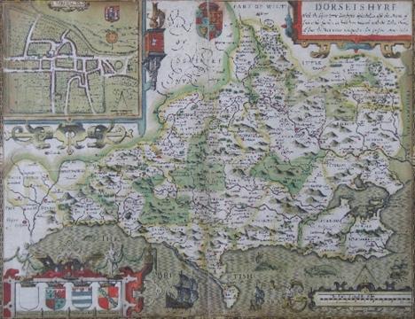
Edwin Hasted - “The History and Topographical Survey of the County of Kent”, printed for the author by Simmons & Kirkby, Canterbury, 1782-1799 (four volumes, folio size, bound in half morocco), bought by Baynton of Barth (mid 20th Century), containing hand coloured folding map of the County of Kent 1783 (with repairs and backed on to linen), and also containing thirty-five folding maps of the Hundreds and sixty full page engravings

Lot 250
John Cary - Two copies of “Cary’s Map of England” published London 1794 and 1816 respectively by J. Cary (two volumes with three quarters brown leather and full brown leather binding respectively - latter inset to front with six small watercolours of farm plans, including - Etchinghole Farm, Goudhurst, Kent - latter volume in poor condition)


Lot 254
Sidney Hall - Coloured engraving - Folding Map of “Isle of Wight”, 8ins x 10ins, published by Chapman & Hall, London (one folding map with blue cloth binding), and J.R. Jobbins - Two coloured engravings - Folding “Plan of the Town of Brighton and its Vicinity” and “London and Brighton Railway”, 12.5ins x 18.5ins, and 27ins x 8.5ins, both published by J.R. Jobbins, London 1842 (two folding maps in blue cloth binding)

Lot 220
`The Stapelieae` by Alain White and Boyd L Sloane with a map by William E Ruddolf being a first edition with presentation inscription for the award to H W Smith for a display of Esmpervivum at the Macclesfield Cactii exhibition in September 1960, which includes a letter from the author to a `Colonel Drake-Brockman` being a first edition printed by `Pasadena, California 1933` in black cloth with silver highlights

Lot 221
A collection of leather bound books comprising `The Pourtraicture Of His Sacred Majesty King Charles I In His Solitudes And Sufferings` re-printed for Edward Lloyd, Dublin 1706 (af), `Lucien De La Traduction Den Perrot` printed Paris 1674 in three volumes with full leather bindings with gilt highlights, `Plinys Epistles And Panegyrick The Life of Pliny` by Mr Henley volume one (originally in two volumes), printed by W Mears, London 1724, with full leather binding, `British Tourists Or Travellers Pocket Companion Through England, Wales, Scotland & Ireland` in six volumes, this being volume six, this edition deals with London including a fold-out map printed for Richard Phillips 1807 with full leather binding and `The Universal Etymological English Dictionary` volume two, third edition with many editions by N Bailey printed for Thomas Cox, London 1737 with full leather bindings (7)


Lot 242
A large coloured map of the area of around Knutsford Cheshire, printed for Stephens and Mackintosh by `George Gibbons & Co`, 1902, the central panel showing the areas of Knutsford, Wilmslow, Alderley Edge, Macclesfield and Bollington surrounded by adverts from local businesses, framed and glazed in a contemporary wooden frame with gilt slip, height 84cm, width 97cm


-
109182 item(s)/page