*Trench Map - The Somme. A linenised folding First World War trench map of [Beaumont, Albert Thiepval], France, Sheet 57D S.E., Edition 2B, corrected to 28 April 1916, showing towns of Albert, Grandcourt, etc., scale 1:20,000, printed in black with red and blue features, 65 x 90 cm, ownership name of Thomas S. Alston (1)
We found 109182 price guide item(s) matching your search
There are 109182 lots that match your search criteria. Subscribe now to get instant access to the full price guide service.
Click here to subscribe- List
- Grid
-
109182 item(s)/page
An Egyptian white metal cigarette case, mid 20th century, of oblong form the front pierced with a study of a building beneath a sunburst the back pierced with a map of Africa on a sunburst background inscribed 'Egypten 1946-47' opening to reveal a chased interior with two heart shaped photograph apertures and elasticated cigarette holder 13.5cm wide
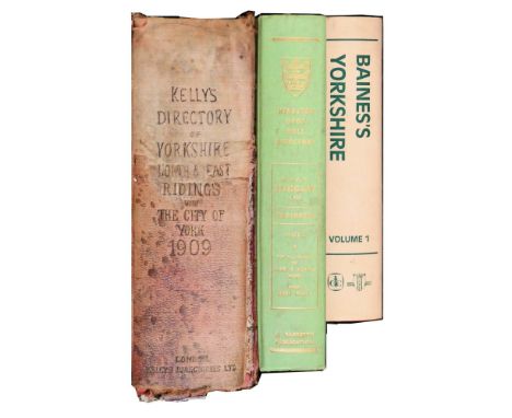
Home (Gordon). The Motor Routes of England, Western Section, A & C Black, 1911, folding map, colour illustrations, a few minor spots, top edge gilt, original cloth gilt in bright condition, 8vo, together with The Model T Ford Car, by Victor W. Page, 1915, numerous illustrations, original blue cloth, a little rubbed, 8vo, plus Railways of To-Day. Their Evolution, Equipment and Operation, by Cecil J. Allen, 1930 colour and black and white illustrations, original red cloth gilt, d.j., spine a little rubbed and faded, 8vo, with other transport and mechanical related including J.L. Nayler's Aviation of To-Day, c. 1933, Herbert Morris & Bastert, Empress Works, Loughborough, 1910, Chetwode Crawley's From Telegraphy to Television, 1931, and some Castrol Grand Prix publications, 1940's-60's (38)
World War One Burrowes (A.R.), The 1st Battalion The Faugh-A-Ballaghs in the Great War, nd., Gale & Polden, plates and maps as called for (one map torn without loss), original cloth (stained); Buchan (John), The History of The Royal Scots Fusiliers (1678-1918), 1925, Nelson, plates and maps as called for, original cloth (label scar); Murphy (C.C.R.), The History of the Suffolk Regiment, 1914-1927, nd., Hutchinson, plates and maps as called for, original printed paper boards (label scarred); with a quantity of others (label scars on spines, ownership bookplates) Multiple lot so detailed condition report not available. Generally good only. Previous owner's book plate (some in multiple locations, possibly hiding institution marks). All have evidence of a removed spine label
Tickell (R. Eustace) The Vale of Nantgwilt, A Submerged Valley, 1894, Virtue, oblong folio, map, plates as called for, original quarter vellum; Dukes (Thomas F.), Antiquities of Shropshire .., 1844, Shrewsbury; for the author, quarto, half cloth; Shrewsbury Journal, Salopian Shreds and Patches, Volumes I - V, 1875-83, Shrewsbury, five volumes, half calf (rubbed); Anderson (John Corbet), Shropshire, its Early History and Antiquities, 1864, Sotheran, plates, a.e.g., calf; with five others (13)
Thoresby (Ralph) Ducatus Leodiensis: or, The Topography of the Ancient and Populous Town and Parish of Leedes ..., 1715, Atlins & Clements, folio, portrait frontis (detached), folding map, 11 other plates as called for (1 plate title cropped), calf (well worn, boards detached) [Boyne p.71]; idem, The Diary of Ralph Thoresby .., 1830, Colburn & Bentley, two volumes, portrait frontis, [with] Letters of Eminent Men, addressed to Ralph Thoresby, 1832, Colburn & Bentley, two volumes, recent uniform cloth (5)
Clarkson (Christopher) The History and Antiquities of Richmond in the County of York, 1821, Bowman, folding map frontis, engraved title (with restored edge), plates and pedigrees as called for (Boyne p181), recent half calf; [idem], The History of Richmond, In the County of York ..., 1814, Bowman, plates as called for (Boyne p 181), half calf; with ten others (12)
Hutchinson (W.) An Excursion to the Lakes in Westmoreland and Cumberland; with a Tour through Part of the Northern Counties in the Years 1773 and 1774, 1776, Wilkie and Charnley, portrait frontis, eighteen folding plates (lacking plate list/errata), calf (re-backed); Wordsworth [William] et al, A Complete Guide to the Lakes, comprising Minute Directions for the Tourist, with Mr. Wordsworth's Description of the Scenery of the Country ..., 1842, Hudson and Nicholson .., hand-coloured folding map, eight plates, original cloth; with one other (3)
Whitaker (Thomas Dunham) An History of the Original Parish of Whalley, and Honor of Clitheroe ..., 1872-6, Routledge, fourth edition, revised and enlarged, two volumes, quarto, large paper subscriber's list, map, plates and pedigrees as called for, t.e.g., half morocco; idem, The History and Antiquities of the Deanery of Craven, in the West Riding of the County of York, 1878, Cassell ..., third edition, quarto, maps, plates and pedigrees as called for, t.e.g., uniform half morocco; with five others (8)
Chattock (R.S.) Wensleydale, Fourteen Etchings with Descriptive Text, 1872, Seeley ..., folio, fourteen plates, original cloth; Turner (J.M.W.), Richmondshire, 1891, Virtue, numbered India Paper edition limited to 500 copies, 20 engraved plates, unbound folio sheets in original quarter morocco book-form folder (edges worn); Hutton (W.), A Trip to Coatham, A Watering Place in the North Extremity of Yorkshire, 1810, John Nichols ..., portrait frontis, 3 plates, folding map, recent half calf; Phillips (John), Illustrations of the Geology of Yorkshire ... Part II, The Mountain Limestone District, 1836, Murray, 4to., 25 plates including folding geological map, original wraps; [Clarkson (Christopher)], The History of Richmond, in the County of York ..., 1814, Bowman, three plates, sheep; with eight others (13)
Thoresby (Ralph) Ducatus Leodiensis: or, The Topography of the Ancient and Populous Town and Parish of Leedes ..., 1715, Atlins & Clements, folio, portrait frontis, folding map and 11 plates as called for, calf (re-backed) [Boyne p.71]; Survey of an Estate Situate at Clotherholme, Studley Roger, North Stainley cum Sleningford and Ripon, in the Parish of Ripon ..., the Property of the Earl de Grey & Ripon, 1861, manuscript, title, contents and thirteen pages of survey, 'Robert Selford, Ripon' inscribed below title, limp morocco binding; with one other (3)
Griffith (Richard) A General Map of Ireland to Accompany the Report of the Railway Commissioners shewing the Principal Physical Features and Geological Structures of the Country, Constructed in 1836 and Engraved in 1837 - 8, The Geology Revised and Improved in 1855, Dublin; Hodges & Smith and London; Longman, large folding map, hand-coloured by county, ?facsimile signature of Griffith (1855), five (of six) parts (lacking large part of Connaught), each part approx 680mm x 820mm, each dissected into 28 sections, linen-backed, each sheet with corner initials to 1870's, cloth slipcase (slipcase joints split)
Conder (C.R.) & Kitchener (H.H.) Map of Western Palestine in 26 Sheets from Surveys Conducted for the Committee of the Palestine Exploration Fund ... During the Years 1872 - 1877, 1880, large folio, numbered subscriber's copy, signed by the Chairman, James Glaisher, title sheet, coloured key map and 26 colour maps, housed in original half roan folder (upper board detached)
The Gulf Jansson (J.), Arabiae Felicis Petraeae et Desertae nova et accurata delineatio, nd. [1650 or later], Amsterdam, hand-coloured map, 445mm x 525mm, framed and glazed [Al-Qasimi p.75] ; [Blaeu (W.J.)], Persia, Sive Sophorum Regnum, nd [c1634 or later], hand-coloured map, 380mm x 500mm, framed and glazed [Al-Qasimi p.63] (2)
Moll (Herman) Asia - To the Right Honourable William Lord Cowper, Lord High Chancellor of Great Britain, This Map of Asia According to ye Newest and Most Exact Observations is Most Humbly Dedicated, nd. [c1720], large engraved map, hand-coloured in outline, formed from two sheets, impression 582mm x 970mm, framed and glazed
Cary (J.) London, Westminster and Southwark, Accurately delineated from the latest Surveys to which is now first added a Correct List of upwards of 350 Hackney Coach Fares, laid down from actual Measurement ..., 1785, engraved folding map, 412mm x 547mm, some hand-colouring, dissected into 16 sections, linen-backed, framed and glazed. Worn slipcase entitled Wallis's New Pocket Map of London ..., loosely attached to rear. [Howgego #173 (4), Boyle #17]
Lodge (John) engraver Chart and Plan of the Harbour of New York and the Coun'y Adjacent from Sandy Hook to Kingsbridge Comprehending The Whole of New York and Staten Islands and Part of Long Island & the Jersey Shore: And Shewing the Defences of New York, Both by Land and Sea, Nov 30th, 1781, J. Bew, engraved map from the Political Magazine, 420mm x 240mm, uncoloured, together with magazine (disbound); idem, Cape Fear River with the Counties Adjacent and the Towns of Brunswick and Wilmington against which Lord Cornwallis detached a Part of his Army, the 17th of January last., March 31st 1781, J. Bew, engraved map from the Political Magazine 240mm x 180mm, uncoloured (stained) together with the magazine (disbound); both maps with original folds (2)
Keulen (Johannis Van) Pas Kaart Vande Noord Oost Kust Van Cuba en d' Oost Kust van Florida vervaatende de Canal van Bahama met de Bahaamse Eylanden, nd. [1687], Amsterdam, second state of Keulen's hand coloured engraved map or nautical chart of the north-east coast of Cuba, the south-east coast of Florida and the Bahamas, impression 522mm x 592mm, margins frayed, small area of loss to lower border [described as the first map to detail this part of Florida's coast, it was apparently popular with the pirates who patrolled the area]
Creighton (R.) A Map of England & Wales, Divided into Counties, Parliamentary Divisions and Dioceses, Shewing the Principal Roads, Railways, Rivers and Canals .... with the Distance of Each Town from the General Post Office, London, 1839, Lewis, large folding map in four parts, each quadrant approx 1060mm x 880mm, each dissected into 35 sections, hand coloured by county, engraved view of the General Post Office, linen-backed, each quadrant individually bound in morocco gilt covers
Hennet (G.) A Map of the County Palatine of Lancaster, Divided into Hundreds and Parishes from an accurate Survey Made in the Years 1828 and 1829, engraved by James Bingley, published May 1, 1830 by Henry Teesdale, large hand-coloured folding map, 1630mm x 1155mm, dissected into 48 sections mounted on linen, housed in leather book-form slipcase (slipcase well worn)
Eastern Europe - Military Map Schubert (General Major), Kriegstrassen Karte Eines Theiles von Russland ..., 1837, comprising sixteen folding maps, each with border, complete with folding 'squelette' or index map, linen backed, card slipcase with spine label [An uncommon military map covering European Russia, parts of Scandinavia, the Baltic States, Poland, Belarus, the Ukraine, etc.]
Bell (John Thomas William) Plan of the Hartlepool Coal District in the County of Durham including part of the Wear District in the Same County, being the First of a Series of Plans of the Great Northern Coal Field..., 1843, Castle Eden, large hand coloured map, linen-backed, (wear to lower edge); with four Ordnance Survey maps of Hartlepool, 1/2500 scale c.1859, coloured, rolled sheets (5)
Mutiny on the Bounty An Account of the Mutinous Seizure of the Bounty, 1987, Genesis, numbered limited edition of 150 copies, reprinting the Turner and Bently accounts, mounted colour photographs, half calf, slipcase; Fryer (John), The Voyage of the Bounty Launch, 1979, Genesis/Rigby, numbered limited edition of 500 copies, signed by Stephen Walters, author of the introduction, folding map, half calf, slipcase;
Africa Photographic Scenery of South Africa, 1880, Sam Alexander, portrait to title page, 100 mounted photographs, a.e.g., original morocco gilt (hinge breaking, preliminaries detached, significant foxing, binding rubbed); Shoberl (Frederic), The World in Miniature - Africa Volume I, Ackermann, eleven hand-coloured plates including title and folding map, cloth-backed boards (2)
Wright (G.N.) The Rhine, Italy, and Greece, 1841-2, Fisher, two volumes bound in one, quarto, 73 engraved plates including titles, a.e.g., later half morocco; Tombleson [William], Fearnside (W.G.) edit., Tombleson's Views of the Rhine, 1852, [and] Tombleson's Upper Rhine, nd., Tombleson, two volumes, 139 engraved plates (including titles) and a large folding panoramic map to rear of each volume, a.e.g., quarter leather bindings (non-uniform); with one other (4)
Newland (H.) The Erne, its Legends and its Fly Fishing, 1851, Chapman and Hall, additional engraved title, frontis (both hand-coloured), folding map (torn with significant loss), four uncoloured plates, original cloth (worn and faded); Matson (Walter J.), Salmon & Trout Fishing in Ireland .., 1910, Browne & Nolan, folding map, six mounted colour plates, original cloth gilt (2)
Mackintosh (Alexander) The Modern Fisher: or Driffield Angler ..., 1821, Derby; Mozley, frontis and title vignette, half roan (some wear); Williamson (John), The British Angler: or, A Pocket-Companion for Gentleman-Fishers ..., 1740, Hodges, frontis (facsimile), three folding plates, full morocco; Williamson (T.), The Complete Angler's Vade-Mecum, Bring A Perfect Code of Instruction on the Above Pleasing Science ..., 1808, Payne and Mackinlay et all, ten plates (one a facsimile), full sheep, card slipcase; Fosbrooke (T.D.), The Wye Tour, or Gilpin on the Wye ..., 1818, Ross; Farror, portrait frontis, map, boards (re-backed); with two others (6)
R.P. [Plot (Robert)] The Natural History of Oxford-Shire, 1677, Oxford, engraved title, large folding map (linen-backed), 15 (of 16) plates, calf (re-backed) Coker [John], A Survey of Dorsetshire. Containing the Antiquities and Natural History of that County .., 1732, Wilcox, large folding map (hand-coloured in outline), six plates, title page in reduced facsimile, Z1 torn, calf (re-backed) (2)
Laurence (Edward) The Duty of a Land Steward .., 1743, Knapton, folding frontis map, folding plate, diced calf (re-backed); Strype (John), Annals of the Reformation and Establishment of Religion .., 1709, Wyat, folio in fours, contemporary calf (re-backed); Watts (Victor), The Cambridge Dictionary of English Place Names ..., 2006, CUP, dust wrapper; with eight others (11)
-
109182 item(s)/page