We found 109182 price guide item(s) matching your search

Refine your search

Year

Filter by Price Range
  • List
  • Grid
  • 109182 item(s)
    /page

Lot 863

A George III terrestrial globe by Thomas Malby and Sons, later dated 1851, indistinctly marked January 1st, with brass meridian, supported on mahogany tripod stand with integral compass to the base (scratched and chipped map work), 104cm high, 59cm diameterFor condition information please see https://auctions.trevanionanddean.com/catalogue/3b1a953bcb35b74a9caddcda4dce852a/a7180bf4bbbb20d27ed1aac9c041a473/the-september-fine-art-antique-auction/

Lot 334

After John Speed, map of The Countie of Nottingham and a Robert Morden map of Lincolnshire

Lot 4072

A framed and glazed map of Spain and Portugal by Emmanuel Bowen, 36cm x 44cm

Lot 352

A library map - general map of Europe W and AK Johnston Limited, corrected to 1914 - 135cm x 112cm - some general wear, mainly to edges but colours good

Lot 367

Interesting group of items including a book - Story of 79th armoured division, a WWII period book, with restricted sticker inside, together with a document, 'The Bulls Head', dated 23rd May 1945, mentioning Churchill, Montgomery etc., and a map. Also included, a Wedgwood creamware cornucopia,oval basalt box & enamel patch box with plough horses.

Lot 427

A 17th Century coloured map of Derbyshire, framed along with a Bowen map of Derbyshire, framed

Lot 267

Cigarette cards - a Carreras slip in album with contents, two further albums  and a John Bartholomew Great Western Railway map showing routes, stations and junctions.(2)

Lot 431

John Charles Allcot Britain, Australia, 1888-1973 "HMS Endeavour entering botany bay" the ship that put New Zealand and Australia on the map, 1925 ,oil on board, signed lower left, 49.5cm X 59.5cm approx

Lot 79

Antique Australian 9ct rose gold Map brooch set with blue simulants and seed pearls marked 9ct Lion passant? RegD approx 3.2 grams

Lot 1081

Frank Sherwin 1930's Prints, I Anne Ellis "The Land Girl" print, Irish linen map of Bermuda, other pictures:- One Box

Lot 1145

A Lancashire Map, prints etc:- One Box

Lot 357

Map of the North Riding of Yorkshire, by Emanuel Bowen, hand-coloured, framed and glazed, c. 750 x 585 mm

Lot 857

Three books, Taking Bearings, Map & Compass Readings and The Oxford Military Note and Sketch Book with integral compass G

Lot 3251

19th century interior scene of three men looking at a map, unsigned, oil on canvas, 18cm x 23cm .

Lot 3096

John Speede 17th century map Dorsetshire dated 1662, 38cm x 50cm .

Lot 3097

John Speede 17th century map Derbieshire dated 1610, 39cm x 51cm .

Lot 3133

Coloured engraving of Roy de Perse, King of Persia, print , 15cm x 11cm, a coloured print of Russian Tartars, 14cm x 10cm, another Persian print of villagers conversing, 18.5cm x 26cm, and a copperplate scene of 'Hispahan', 16cm x 11.5cm. Also a 17th century map of the Red Sea labelled 'Mare Rubrum' and another of Persia, 9cm x 12.5cm. All in black frames. (6 in lot) .

Lot 843

In Excess of Twenty Early XX Century and Later Picture Postcards, photographs, receipt, debenture stock certificate, parcels way bill, map and other items, all with Sheffield 'transport' railway thematic's including, Sheffield loco drivers, Manchester, Sheffield and Lincolnshire railway parcels and waybill's dated 1873, 1872, map of the railways in the Sheffield area 1838-1975, G.N.R. 8ft single express.

Lot 89

Kentucky Straight Bourbon Whiskey, 4/5 quart, one ceramic decanter depicting Germany with map to reverse

Lot 360

SHELLEY (HENRY C), Majorca, 1926, folding map loose, COLES FINCH (WILLIAM), Watermills and and Windmills and three other works relating to Kent (5)

Lot 293

G.W Bacon, London, a leather case containing 30 folding maps of the British Isles, with tabs to the tops of the maps, together with a map measurer

Lot 152

Robert Morden, An Antique hand coloured map of Worcestershire, sold by Abel Swale Awnsham & John Churchill, 14ins x 16.5ins, together with another Antique hand coloured map, of Westmorland, 18ins x 23ins

Lot 142

Geoffrey Sparrow, etching, Crawley and Horsham in Newells Rough, signed, 8ins x 10.5ins, framed, together with an O.S. pocket map of the Pytchley Hunt

Lot 2080

17th Century copper-engraved map of the East Riding of Yorkshire by Richard Blome, framed and glazed.

Lot 4244

The Himalayan Journal, Vol.I, No.1, April 1929. Loosely inserted manuscript map of Sikkim, a printed map, and an original photograph showing the view during an expedition. Good, clean, bright; opening pages present but detached

Lot 4247

Collection of 14 indentures, mostly vellum, Elizabethan/Jacobean/Carolean/Commonwealth examples (1590s to 1650s), some later, predominantly relating to Lincolnshire, a couple of documents mentioning the Estate of Edlington (one dated 1595 between John Savill of York and Robert Cutt of London); one mortgage for the Treworgan Estate in Hereford, dated 1791, concerning Benjamin Biddulph ('an infant'), eldest son and heir of Benjamin Biddulph deceased; a 1651 document referring to John Tilson, Westminster and Lincoln; 1623 indenture concerning Edward Badby; a copy of Mr George Short's marriage settlement, East Keale; 1617 indenture between Stephen Phillips and Thomas Phillips of Lincoln; 1878 conveyance between Rev. Canon Marsden and John Cardinal (including manuscript estate plan/map); 1801 document mentioning James King and John Lowe, and others, signatures, wax seals, together with 20 scanned copies of the documents

Lot 1445

Colour printed map of Lincolnshire by Robert Morden (1650-1703).Gilt Frame - Measures 56 x 52cm.

Lot 3032

Automotive ephemera and maps, to include The Morris 10-4 Brochure, Ordnance Survey 1/4" map of Great Britain sheets 6 and 8, Boots Pure Drug Company Ltd, Motorist First Aid case, etc. (qty)

Lot 302

WW2 Silk Escape & Evasion Map Europe Details of Escape Routes France, Germany, etc.A very rare early war example, marked 'MOST SECRET', this shows routes across the frontier into Switzerland and gives text details of the routes etc. VGC.

Lot 295

WW2 RAF Aircrew Escape Map kit.A rare example, comprising: Colour printed double sided silk map Area C/D.... Miniature compass and escape Saw blade in original cover. Contained in original waterproof pouch.

Lot 300

WW2 Silk Escape Map 'Tie'An unusual souvenir made from a silk escape map of Europe. GC.

Lot 65

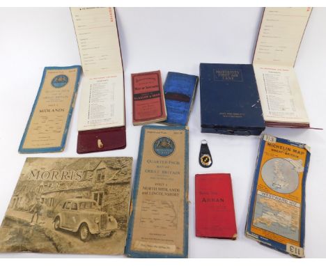
RAF Medal Group, Logbooks and Large Photographic Archive of Group Captain T.W.G. Eady.This remarkable archive records the interwar and WW2 career of Group Captain Thomas William George Eady who flying career began in 1928 and ended in 1950. Comprising: Medal Group India General Service Medal, clasp 'North West Frontier 1930-31', 'F/O T.W.G. EADY RAF', 1939/45 Star, Africa Star, Defence Medal, War Medal, King Faisals Medal. Mounted as originally worn. ... Corresponding miniature medal group. ... Four (3 RAF 1 Civilian) Pilot Log Books. These covering a period of 1928 to 1950 the 1931 period recording in detail bombing operations on the North West Frontier of India. ... An outstanding archive of 12 photograph albums recording mostly G/Capt Eady's interwar career in Egypt, India and Aden. Images show training, aircraft including large number of flying boats every day squadron life air to air shots, people etc..... Interwar Pilot wings badges... Plus other items etc. (A very large quantity)... Also the medal group of Group Captain Eady's father comprising: 1914/15 Star 'MID C.M. EADY RN', British War Medal, Victory Medal 'S.LT RN', 1939/45 Star, Pacific Star, Defence Medal, War Medal. Group Captain Thomas William George Eady began his pilot training in Egypt in 1928, qualifying as a pilot he was posted to 2 Squadron India. He took part in operations on the NWF near Peshawar one one flight his aircraft was struck by lightning. In 1930 he was posted to 84 Squadron and took part in bombing operations on one occasion his aircraft had 27 bullet holes in it. The log gives good detail of these operations. He later converted to seaplanes and it was this type that he would continue his RAF career. He served with 201 Squadron and in 1936 was posted to 203 in Aden. In 1937 he flew back to the UK a Singapore flying boat and was given command 201 Squadron. At the time of the outbreak of war he was serving at 8FTS at Montrose and was quickly sent to Rhodesia as part of the Empire Flying Training Programme. He took command of 230 Squadron before posting to Nakuru East Africa and in 1942 found himself Commanding RAF Helwan. By the end of 1943 he was serving as Map Overseer liaising between the aircraft factory at Speke and Bomber Command. In 1945 he was given command of No.1 Parachute Training School at Ringwood and oversaw the school move to RAF Upper Heyford. He commanded RAF Manston and his last posting was to RAF Credenhill. He retired from the RAF in 1953. Aircraft flown include Avro 504, DH9, Bristol Fighter, Hart, Southampton, Singapore, London, Wapiti, Sunderland, Gladiator, Hurricane, Kittyhawk, Mustang, Spitfire, Meteor. His log records no fewer than 50 different types or marks.

Lot 304

WW2 / Cold War Period RAF Silk Escape & Evasion Maps Far East. Maps 44A good and rare grouping of Silk Escape Maps covering the Far East, Taiwan, Korea, French Indo China etc. All the maps are the Map 44 series and comprise: A/B, C/D, E/F, G/H, J/K, L/M, N/O, R/S. Overall near VGC. (8 maps)

Lot 299

WW2 RAF / SOE Silk Escape Map J3/J4 Italy.A good scarce example, retaining part of original paper envelope. This example printed both sides, giving details of the Swiss Frontier. VGC Envelope A/F. ... Accompanied by a second silk map being a variation of the same area J3/J4. (2 items)

Lot 301

WW2 RAF Silk Escape Map (No. 43 Europe) & Waterproof Packet A good example of the silk Escape map 43/, 43/B. France Belgium Holland. Printed colour double sided. ... Complete with original waterproof packet of issue. This printed with 'F' and '43'. Map VGC Packet with age wear. (2 items)

Lot 306

WW2 RAF Silk Escape & Evasion Maps Europe Map 43 Series.A scarce grouping of maps from the map 43 series, these covering Holland, France, Belgium, Germany, Portugal, etc. Each colour double sided printed. Comprising: C/D, (4 maps)

Lot 3024

An LNER Lincolnshire panoramic map, set no 6, Bacon's British Isles rainfall and isobars wall atlas, etc., trench lighter, spirit level, etc. (qty)

Lot 822

A FRAMED MAP OF PLUMLEY IN THE COUNTY PALATINE OF CHESTER

Lot 245

Motor Racing, Isle of Man T.T. Programmes 1952, 1953, each with map, scorecard booklet and many photographs relating to the races, including signatures, Buchan, Jarman, King, Brown.

Lot 248

Motor Racing, Isle of Man T.T. Races Programmes 1954, 56 and 57, each with map and scorecard, 1951 Goodwood April 14th and 1958 Mallory Park Programmes.

Lot 12

GERARD MERCATOR (1512-1594). Hand coloured engraved map of Sicily, see Latin text verso, framed and glazed, 34 x 47 cm

Lot 183

Rhodes, E., Peak Scenery or Excursions in Derbyshire made chiefly for the purpose of picturesque observation, 1818, four parts in two volumes, brown calf spine, engravings, marbled boards 36 x 27cm and three other volumes namely Nightingale, Topographical and Historical Description of Staffordshire, map, paper covered boards and Leyland, J., The Peak of Derbyshire, 1891 and Calvert, F., Picturesque Views... in Staffordshire, 1830, half leather, marbled boards (5).

Lot 179

Roscoe, T., Wanderings in South Wales including River Wye and Wanderings in North Wales, 1836 both volumes by Tilt & Simpkin, some foxing, full leather, engravings, aeg. and Bingley, Rev. W., North Wales including it's Scenery, Antiquities & Customs, 1804 (2 volumes), full leather map (4).

Lot 448

Jan Jansson: "Cumberland & Westmorland", hand coloured 18th century map, 17" x 21.5", framed and glazed

Lot 447

Jan Jansson: "The Countie of Leinster", hand coloured 18th century map, 15" x 19", framed and glazed

Lot 129

EPHEMERA, selection, inc. WWII cinema poster for Rosie L'Endiablee (Sweet Rosie O'Grady), with Betty Grable & Robert Young, with part map of Epsom area printed to reverse (1940), by Papeteries de Genval, Belgian tax stamp to front (12 x 16.5); cinema photos, inc. FoH stills, horror films (17), Brennende Betten, with Ian Dury (7, with 25 reproduction copies); sixteen 8 x 10 production stills from a Coulembier film (with Terry Thomas); When The Wind Blows (10+2, with ten reproduction copies), G to EX, 50+

Lot 306

FOOTBALL, selection, inc. Donaldson Sports Favourites (footballers), sheet of twelve cards, signed by the artist Barr (inscribed to Timperley Card Collection); part sets, yellow newspaper cut-outs (115), insert of Newcastle United team to South Africa 1952, The Sun 3-D cards (13 premium), Guinness Football History Map, BP England 1998 (complete); Chix Famous Footballers (1961), anon, large (37); reprinted cards by Muat (19), photocopies (28) , about G to MT, 300*

Lot 373

SUNLIGHT SOAP, Sectional Map of England & Wales, complete, paper, VG to EX, 30

Lot 210

OGDENS, Sectional Cycling Map, complete, VG to EX, 50

Lot 110

A Robert Morden map of Staffordshire, hand tinted 37cm x 47cm; an early 18th century book plate of Cheshire by W.H.Toms; a late 18th century map of Warwickshire by John Cary (3)

Lot 809

(US) DIY PUNK/SYNTH PUNK/NEW WAVE/POWER POP - 7". Scorching collection of 22 x hard hitting 45s! Artists/titles include Mike Runnels - Channel 19, David & Eva with The Incredible Casuals, split 7", Walter Steding, Deli Platters, Monarchists, The Bolivians, Map Of The World, Radio Novena, The Banditz, American Fxes, Bambi, The El Caminos, Big Noise, The Eggs, Sunhead, The Four Commandments, The Ugly Ducklings, Michael Blaise and The Dark. The records are typically top Ex to Ex+ with the sleeves generally VG to Ex+.

Lot 304

A Robert Morden map of Oxfordshire, a Marjorie Little limited edition print, "Poppies", and other pictures

Lot 235

Franklin: "The history of the reign of Shah-Aulum, the present Emperor of Hindostaun", one vol illust with map, calf, London 1798 (requires binding) India Interest

Lot 198

An ostrich egg, decorated with a map of Africa and indigenous animals, a carved buffalo horn and an African painting

Lot 215

A late Victorian photograph album, "St John's College Oxford, Autumn 1899", one vol, full tooled calf, and Kelly's Directory of Oxford 1964, one vol, and a Bartholomew's map of Oxfordshire

Lot 149

[Darwin, Charles] Fitzroy, Robert, and King, Philip Barker Narrative of the Surveying Voyages of His Majesty's Ships Adventure and Beagle, between the Years 1826 and 1836, Describing their Examination of the Southern Shores of the South America, and the Beagle's Circumnavigation of the Globe. Vols I+II with Appendix to II. Henry Colburn, 1839. 8vo (3 vols). Full blue calf, sometime rebacked preserving original spines, boards ruled in gilt with blind roll-tooled border, red speckled edges; I: 11 plates; II: 30 plates; Appendix: 1 folding map, 6 plates; lacking all loosely inserted maps. First edition. Whilst lacking the more famous Darwin contribution, the two journals of the voyages prepared by Fitzroy (and the appendix of more in-depth study) remain an important text in the history of science. With the suicide of Stokes (whose journal is a major element of the first volume) and the retirement of Captain King, Fitzroy found himself the guardian of the vast array of documentation the voyages had produced - far more than would fit in a single volume. In the end, an agreement was reached with Darwin. Fitzroy would present the material for which he was responsible, whilst Darwin provided a third volume made up of his account of the voyage. Fitzroy's work may be overshadowed in the popular imagination by his more controversial partner, but his contributions were on less important - his surveys of South American waters were so accurate they are still the foundation for many charts of the area. Fitzroy was deservedly awarded the gold medal of the Royal Geographic Society on his return and his two volumes are a major source on the route traversed by the expedition. Fitzroy would undergo a seeming religious conversion by the time of his account of the voyage, repudiating his doubts in the literal truth of Creation, being particularly dismayed by Origin. His scientific work continued though, ultimately leading him to the creation of the Meteorological Office, in which role he invented the weather forecast in an effort to reduce loss of life at sea. Whilst Fitzroy is mostly remembered today as Darwin's Captain, he is much more than this. A principled man who devoted himself to duty - to the point of leaving only his debts for his family - he was a scientific officer who recognised the importance of Darwin's work, even if he later disagreed with the ultimate direction such work would lead. His work is still a hugely important source of scientific, maritime, ethnographical and historical information and remains a landmark in science.

Lot 134

Pigot, James New Plan of London Taken from the Best Authorities with the Geographical Bearings from the Dome of St. Paul's...The whole forming the most complete guide to London and ITS VICINITY YET PUBLISHED. J. Pigot & Co., [1823]. Hand-coloured according to Explanation. Published in Pigot's Metropolis Guide and Book of Reference, this map covers from Kensington Gardens to Blackwall and Camberwell to Hackney. Contrary to many marketing claims, this really did stand to bill itself as the best map of London of the time.

Lot 259

Legge, W. Vincent Capt. A History of the Birds of Ceylon. Published by the Author, 1880. Large 4to, contemporary half morocco, spine lettered directly in gilt, marbled endpapers, a.e.g.; one key plate, one coloured map, 34 hand-coloured plates after or by J.G. Keulemans, woodcuts to text; bound as one volume to be presented as a prize by then-Colonel Legge at Aberwystwyth Grammar School 1883, thence to Henry Ralph Goring Clarke (armorial bookplate upper pastedown). First ed..  An excellent copy, spine sunned and a little shelfwear to binding, slight marginal toning, gift inscription page foxed, occasional foxing to head of some pages, most noticeable between pp. 726-737 (affecting one plate) but else clean internally with striking colour to the plates.

Lot 213

Josephus; L'Estrange, Sir Roger (trans.) Works. Richard Sare, 1702. Folio, full reversed calf, some restoration, upper board loose but attached; eng. add. tit., 2 plates, folding map of the Israelites travels in Canaan, folding plan of Jerusalem.

Lot 43

Cooke, William A New Picture of the Isle of Wight. Southampton: Printed by and for T. Baker et al, 1813. 8vo, recently rebound in half leather over marbled boards, spine with contrasting lettering-pieces; frontis. and 35 plates, folding map, all as called for. Second ed. with improvements.

Loading...Loading...
  • 109182 item(s)
    /page

Recently Viewed Lots