We found 109182 price guide item(s) matching your search
There are 109182 lots that match your search criteria. Subscribe now to get instant access to the full price guide service.
Click here to subscribe- List
- Grid
-
109182 item(s)/page


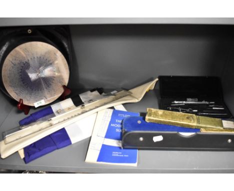
Lot 1374
Incredible hand-crafted costume worn by dancers performing during Apache Indian's set in the Birmingham 2022 Closing Ceremony. This costume includes a black, white and red playsuit and jacket printed with a map of Birmingham, black leather-look fingerless gloves, black patent boots and black cap. Full costume only.


Lot 2124
Early 19th Century Map Sampler of England and Wales Worked by M A Todd, 11 Years, 1807 embroidered within an oval cartouche with floral surround, incorporating mainly black and brown silk threads to the map, in a gilt frame with painted glass mount, 34cm by 39cmDue to the mounting only part of the floral border is visible. Some staining and discolouration overall, especially to the bottom left hand side, and a very small hole.


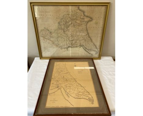
Lot 1271
A framed map of the East Riding of Yorkshire with Ainsty Liberty from the best Authorities published by John Stockdale, Piccadilly March 1806. Engraved by J Cary. Map size approx 42cm h x 52.5cm w. Together with a framed print of a map of Holderness by J Tuke. Frame size 47.5cm h x 40cm w, Image approx 39cm h x 29cm w.Condition ReportFold marks on E.R. of Yorkshire map and a fade line down the centre. Part coloured. Holderness print in fairly good condition.

Lot 1272
Three framed maps to include: J. Ellis 'A Modern Map of Yorkshire, Drawn from the lateft Survey's; Corrected & Improved from the best Authorities' hand coloured and engraved, a 'Scotia tabula II' hand coloured and engraved and a Scottish/ Northumberland road map of Tedborough, Kelso and Barwick. Maps in order: 25 x 19cm, 13.5 x 19cm, 19 x 12cm.Condition ReportGood condition. Slightly faded centre strip to map of Yorkshire.


Lot 1274
Robert Morden (British c.1650-1703): 'The North Riding of Yorkshire', 18thC engraved map with hand colouring 35 x 41cm together with Thomas Kitchin 'Engraver to H.R.H. The Duke of York ' 'A New Map of Dorsetshire' 18.5 x 24cm, hand coloured.Condition ReportRobert Morden with slight central stain, otherwise both in good condition for age.

Lot 1275
John Speede, circa 1610 'The North And East Ridings of Yorkshire' map with Hull and Richmond insets, to be sold by Thomas Bassett and Richard Chiswell, visible plate impression, coloured, framed and glazed. 39cm x 51.5cmCondition ReportCentral join, in double sided glazed frame. Small hole just below plate mark lower right.


![[Bleau] Denbigiensis Comitatus et Comitatus Flintensis; Denbigh et Flintshire, no date, hand-coloured engraved map, French te](https://cdn.globalauctionplatform.com/21519436-5913-4933-a642-aea2010b9a73/9b427c88-47ff-438e-8389-aef600f84d21/468x382.jpg)
Lot 1063
[Bleau] Denbigiensis Comitatus et Comitatus Flintensis; Denbigh et Flintshire, no date, hand-coloured engraved map, French text verso, framed, glazed front and rear;[Saxton] & Hole, Englalond Anglia Anglosaxonum Heptarchia, no date, engraved map, uncoloured, mounted framed and glazed;Ogilby (John), The Roads from Shrewsbury and Chester to Holywel com Flint, hand coloured road map, no date, mounted framed and glazed;[Morden], Comitatus Rotelandiae Tabula Nova, no date, hand-coloured engraved map, mounted framed and glazed;with seven small format maps of Buckinghamshire, Shropshire, Cumberland, Westmoreland, Chester, the road from Exeter to Barnstable and the road from London to Aylesbury. (11)


Lot 332
MAP OF THE COAST OF ARABIAthe title cartouche with the following details: 'the red sea & Persian Gulf drawn from the chart of the Eastern Ocean, publish'd in 1740, by order of ye Count de Maurepas, improv'd from particular surveys and regulated by Astronomical Observations', the reverse with letter of Authenticity from the Arabesque Gallery & Interiors stating that the map dates from 1747, 22cm x 35cm


Lot 248
KING DANIEL (Pub). The Vale-Royall of England or The County Palatine of Chester. Eng. title & fldg. & other eng. plates (repaired &/or relaid). Recased old embossed leather. 1656; also 2 other vols. (3).King - Missing plate of Chester and map of Isle of Man. Only 9 plates of Arms (of 11). Various repairs etc as catalogued.


Lot 151
SMITH C. A New Map of England & Wales Comprehending the Whole of the Turnpike Roads with the Great Rivers & Railways. Fldg. hand col. eng. map. Orig. cloth slip case. 1838; also Edward Stanford Ltd., The Oarsman's & Angler's Map of the River Thames, New Edition, fldg. col. map in orig. cloth. (2).


Lot 211
BRUCE A. B. The Life of William Denny, Ship-Builder, Dumbarton. Port. frontis & fldg. map. Worn orig. blue cloth, internal foxing. Pres. copy from Denny's mother, 1888; also Fairbairn, Useful Information for Engineers, plates & illus., orig. cloth, 1860 & various others, transport & engineering interest.


Lot 39
LEJEUNE BARON, Aide-De-Camp to Marshals Berthier, Davout & Oudinot. Memoirs. 2 vols. Rubbed dark half calf, rather poor internally. 1897; also H. N. Coleridge, Six Months in the West Indies, fldg. eng. map, 16mo, half calf, 1832 & Bruce's Travels in Abyssinia & Nubia, dark prize calf, 1873. (4).


Lot 309
Various Kent related Hasted maps to include, 18th century map of the hundred of Eyhorne Kent, 49 x 38cm another of the hundreds of Great Barnfield and Selbrittend and another of the hundreds of Cranbrooke Barkley and Rolvenden (3)Generally in a good condition with no major signs of damage or repair. All show signs of wear and discolouration that is commensurate with age.Map of Eyhorne- Some small nicks on the paper surface and some creases.Selbrittenden- small area of damage between the E & D of 'Hundred' in the lower right quadrantCranbrooke- most noticeable discolouration out of all three
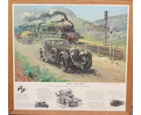
Lot 2015
A framed 'Bentley V Blue Train', Terenco Cuneo, print, 'From the Original Oil Painting'. With Printed Text across the bottom, frame measuring approx. 32" x 34"; together with a framed Great Western Railway map; a framed print of Dainton Conquered, Alan Fearnley; two framed sets of Wills' cigarette railwayana cards; David Shepherd The East Somerset Railway print and others. (Q)
Lot 12
NO RESERVE China.- Ellis (Henry) Journal of the Proceedings of the late Embassy to China..., first edition, portrait frontispiece, 7 hand-coloured aquatints, 2 engraved maps only (of 3, lacking folding map), some light marginal finger soiling, cracking to gutter in several places, some pages and a couple of plates loose or working loose, dis-bound, some bumping to corners, 4to, 1817.
Lot 14
NO RESERVE Europe.- Brydone (Patrick) A Tour through Sicily and Malta. In a series of Letters to William Beckford, 2 vol., second edition, engraved folding map, occasional scattered spotting, slight browning, contemporary calf, lightly rubbed, joints splitting but covers holding firm, 1775 § Davies (Rev J. Sanger) Dolomite Strongholds. The Last Untrodden Alpine Peaks, second edition, map and 9 plates, finger-soiling to half-title, cloth gilt, lightly rubbed, 1896 § Conway (Sir W. M.) The Alps from End to End, 16 plates, very occasional splitting at gutter, the odd spot, endpapers slightly browned with scattered spotting, covers rubbed, spine ends chipped with small loss to foot, t.e.g., others uncut, 1905, half-titles, all but first original cloth with spines sunned; with others travel and sport, v.s. (9)
![Herodotus. Historion logoi [graece]...Historiarum libri IX, Greek & Latin text in parallel columns, folding engraved map](https://cdn.globalauctionplatform.com/000945ca-6f1d-4be5-a1b9-aee700ed4404/2ac0e04e-299b-4ccc-a3a4-aee700f912d6/468x382.jpg)
Lot 162
Herodotus. Historion logoi [graece]...Historiarum libri IX, Greek & Latin text in parallel columns, folding engraved map (a couple of tears, repaired), worming to first half of volume (mostly single hole but worse at beginning and affecting map), lower corner of 3O4 torn away not affecting text, later half calf, worn, joints split with upper cover almost detached, lacking corners, [Wing H1584], E.Horton & J.Grover, for J.Dunmore [& others], 1679 § Plinius Secundus (Gaius) Naturalis Historiae, 3 vol., engraved additional titles, letterpress titles with woodcut printer's device, contemporary ink signature of Geo. Nicols, vol.3 broken with some leaves becoming loose, contemporary calf, rather worn, spine of vol.3 defective, Leiden & Rotterdam, Hackius, 1669-68; and another, folio & 8vo (5)
-
109182 item(s)/page