We found 109182 price guide item(s) matching your search

Refine your search

Year

Filter by Price Range
  • List
  • Grid
  • 109182 item(s)
    /page

Lot 96

PAGET, GUYTHE HISTORY OF THE ALTHORP AND PYTCHLEY HUNT 1634-1920 London, Collins, 1937. First Limited Edition, one of 600 copies SIGNED BY THE AUTHOR, large 4to, colour and sepia illustrations, maps, original parchment-backed red cloth boards, a very good copy. Plus: GLOVER, STEPHEN - THE HISTORY OF THE COUNTY OF DERBY. Derby, Henry Mozley and Son, 1829. First edition, 2 vols, folding map (laid down, slight repairs), an ex-lib copy with stamps to titles and labels to inner boards etc, later library quarter red calf, worn. Plus 8 other various volumes, 19th-20th C (11)

Lot 1458

Saxton (Christopher) and Hole (William)Lancastriae Comitatus palatinus olim pars Brigantum, (Lancashire)engraved map, hand coloured, 30 x 30.5cm (11 13/16 x 12in) Framed and glazed. Along with two antique maps of Lancashire. Please see accompanying image

Lot 207

Cole (Henry Hardy). Illustrations of Ancient Buildings in Kashmir. Prepared under the Authority of the Secretary of State for India in Council from Photographs, Plans, and Drawings taken by Order of the Government of India, published by W.H. Allen for the India Museum, 1869, 43 mounted carbon autotype prints (numbered 1-44), lithographed map and 14 plates, occasional spotting to plates and some photograph borders, biopredation affecting blank lower margin of pp. 13-14 and border of three following photographs and a plan, manuscript library shelf label to front pastedown, all edges gilt, original morocco-backed printed boards, heavily rubbed and slightly soiled, a little corner and edge wear, cloth loss to upper margin of lower board, folioThe photographs are by John Burke (1843-1900) and measure 26.5cm x 20cm and smaller.(Qty: 1)

Lot 611

A collection of vintage 20th Century travel related maps.Many of the maps canvas backed, to include an Ordnance Survey District of Bristol 1922, W  & A K Johnstons Motoring & Touring Map of Scotland, BP Europe map, Philips Main Road Map of England & Wales, a 1917 Railway Timetable for Hastings, St Leonards and other items. Largest measures 26 cm high x 18 cm wide.

Lot 2761

VINTAGE WALL MAP OF EUROPEAN TEMPERATURES FOR JULY; OLD MAP OF THE WEST COUNTRY

Lot 2927

WHITEWAYS CYDER WALL HANGING MAP, 202CM WIDE

Lot 31

SELECTION OF PRINTS INCLUDING THELWELL AND A MAP OF LEICESTERSHIRE (7)

Lot 247

A framed 1837 Moules map of Essex and framed watercolour of Leigh on sea, framed size 40 x 32cm.

Lot 21205

Portugal - Colonies - Mozambique : 1876-1990 EXTENSIVE ORIGINAL COLLECTION on leaves; starts Crown types,1876,Perf.12½ most to 300r inc.50r Green f.u.Perf.13½ to 300r, 1881-5 Colour changes inc.20r Rosine m.m.(thin spot), 1886 King types to 300r,1894 Perf.11½ vals.to 200r, Perf.12½ vals.to 300r, 1895 700th St.Anthony ovptd.vals.1898 Surcharges inc.both 2½r on 20r types c.d.s.1898-1901 Tablet types to 700r most m.m.1902 Surch.vals to 400r on 300r, 1902 Colour changes to 400r m.m.1911 'Republica' ovpts.to 700r m.m.1914 Ceres types to 1E, 1912 'Republica' ovpts.to 500r, 1913 all 3 Vasco da Gama sets, m.m.1920 and later Charity Tax sets m.m.1919-26 Ceres set to 20E m.m.1927 & 1928 C/Tax set m.m.1930-1 Albuquerque set, m.m.1933-47 'The Lusiads' set to 20E m.m.1938 V.da.G.set to 20E m.m.1939 Colonial Tour (Map) set m.m.1948 Fayima set m.m.1948-9 Views set to 20E m.m.Then comprehensive later issues through to 1990, inc.1951 Fishes set c.d.s.1953 Butterflies set m.m.Then AIRMAILS inc. 1938 set to 10E m.m.1946 to 3R, Similar set ovptd.'Taxe Percue' c.d.s.POSTAGE DUES inc. 1904 to 500R m.m.1911 Ovptd. Set m.m.Also many Tax sets, etc. Generally very clean, some minor faults noted. Many scarce items and high catalogue value.m.m.or c.d.s. (Some 100's)

Lot 440

E.R.B., part sets & odds, inc. Abbeys & Castles, Alpine Views, Coast & Country, Our Pets, War Map of The Western Front, Celebrated Bridges, Cinema Stars (large) etc., a few with slight foxing to reverse and corner knocks, a.m.r. (1), FR to VG, 63*

Lot 557

Trade cards, album containing mostly Lyons Maid issues inc. British Wildlife, Star Trek, Illustrated Map of the British Isles, etc, also Toni Bell, Team of all Time (Football), Tetley's, British Birds & others (mostly gd/vg) (1 full album)

Lot 774

Photographs / Ephemera, approx 200 b/w photos of family and military life during and after WW2 showing wireless operator, holidays, caravanning, bomb damage, vehicles, shop front etc, together with 1939 George VI New Testament, map of Hampshire photographs of the 1950's group 'The Coronets' (one annotated), also 2 books entitled 'Air Navigation Some Problems and Their Solution' by MJ Hearley and 'Astronomical Navigation Tables' vol M (mostly gd) (200+)

Lot 820

Ephemera, a mixed selection inc. 19th Century UK topo engravings, a quantity of Patriotic cards , a practice alphabet set illustrated by Hobday, watercolours by Cowham & others, map surveyed in 1777 to show proposed route of Basingstoke Canal, road book of England, Barratt loco cut-out cards, Theatre ads and Privilege tickets, Royalty and Max Miller Greeting card, adverts, bookmarks (glamour), White House card from Ronald Regan, Mansion House Menu 1870 plus 2 others etc (mainly gd)

Lot 849

Map, 'Cycling & General Guide Map to the Environs of Putney & Fulham', early 1900s with 21 illustrated adverts surrounding central map, framed & glazed, approx. 75cm x 70cm, (generally good, 2 small holes noted, some wear to frame corners)

Lot 1040

Postcards, France, a collection of 26 early chromo cards inc. Paris Exposition 1900, (11), Martinique map card, Political felt-applied card of Edward VII, Grande Roue Paris, Tourist advertising cards (4) etc (mostly gd/vg)

Lot 1072

Postcards, Isle of Wight, a collection of approx 170 cards, RP's and printed inc. street scenes, buildings, map cards, churches, multi-views, artist-drawn etc inc. Shanklin, Osborne, Ryde, Cowes, Alum Bay etc, vintage to 1960's (gd)

Lot 396

A hand-coloured map of the South East Peninsular & Malaysia, by A R Johnston, in gilt strip frame

Lot 398

Cary's Oxfordshire hand-coloured map, in gilt frame

Lot 114

Prints - Selling today's catch on the shore, gilt framed; still life flowers; In The Wood; reproduction map of Sussex; another The North Ridings of Yorkshire;coloured etching Nostell Priory (8)

Lot 1

Arundell (Francis Vyvyan Jago). A Visit to the Seven Churches of Asia; with an Excursion into Pisidia, 1st edition, John Rodwell, 1828, engraved folding map frontispiece (spotted and offset), approximately 50 lithographic inscriptions on 23 sheets (the inscriptions individually numbered, the numbering erratic, occasionally absent or amended in manuscript), occasional light spotting to text, bound with: [ibid.,] Some Notices on the Church of Landulph, by the Rector, Devonport: Ramsey and Carrington, 1840, 46 pp., errata leaf, spotted and browned throughout, contemporary half calf, spine refurbished, headcaps restored, 8vo (20.4 x 12.8 cm)First work: Atabey 36 (with 'numerous lithographed plates of inscriptions on 14 folding or 6 double-sheets'); Blackmer 48 (with '22 numbered lithographed plates of inscriptions on 14 folding sheets'). Arundell was chaplain to the English factory at Smyrna (Izmir) (Qty: 1)

Lot 10

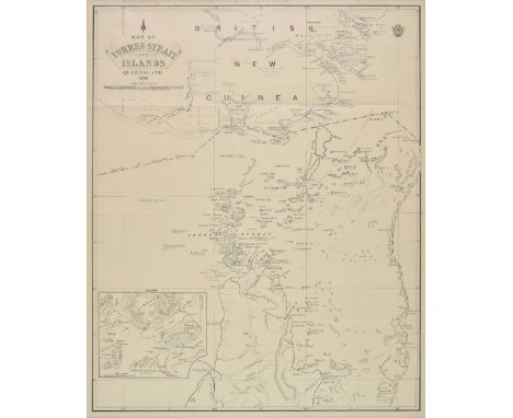
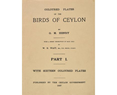
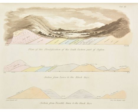
Carpenter (William B., & Thomson, Charles Wyville). Preliminary Report, by Dr. William B. Carpenter, V.P.R.S., of Dredging Operations in the Seas to the north of the British Islands, carried on in Her Majesty's Steam-Vessel 'Lightning,' by Dr. Carpenter and Dr. Wyville Thomson, Professor of Natural History in Queen's College, Belfast, [from the Proceedings of the Royal Society, No. 107, 1868], [London, 1868], pages 168-196, folding engraved map, ink stamp and reference numbers to title, bound with: Preliminary Report of the Scientific Exploration of the Deep Sea in H.M. Surveying-Vessel 'Porcupine,' during the Summer of 1869, conducted by Dr. Carpenter, J. Gwyn Jeffreys and Prof. Wyville Thomson, [being No. 121 of the Proceedings of the Royal Society], 1870, pages 397-492, a few diagrams to text, bound with Report on the Deep-Sea Researches carried on during the months of July, August, and September 1870, in H.M. Surveying-Ship 'Porcupine'..., [1870], pages 151-221, 6 folding engraved maps, scattered spotting, title excised at foot, bound with On the Undercurrent Theory of the Ocean, as Propounded by Recent Explorers, by Captain Spratt, [from the Proceedings of the Royal Society, No. 129, 1871], pages 528-556, folding engraved map, blank inscribed with author's compliments, front free endpaper inscribed by Wyville Thomson, contemporary half calf, black leather title label, paper label at head of spine, slight wear to extremities, 8vo, together with Moseley (Henry Nottidge) , Notes by a Naturalist on the "Challenger," being an Account of Various Observations made during the Voyage of H.M.S. "Challenger" round the World, in the years 1872-1876, under the Commands of Capt. Sir. G.S. Nares ... and Capt. F.T. Thomson, 1st edition, 1879, 2 colour lithograph plates (including frontispiece), folding map, text illustrations, title with signature William Moseley to upper blank margin, endpapers renewed, top edge gilt, original brown cloth, spine faded and lining strengthened, extremities slightly rubbed, 8vo, with Thomson (Charles Wyville) , The Depths of the Sea. An account of the General Results of the Dredging Cruises of H.M.SS. 'Porcupine' and 'Lightning' during the Summers of 1868, 1869, and 1870, under the Scientific Direction of Dr. Carpenter, J. Gwyn Jeffreys, and Dr. Wyville Thomson, 2nd edition, 1874, four double-page colour lithograph maps and one folding un-coloured map, illustrations and diagrams to text, spotting to first and last few leaves, bookplate of the Earl of Enniskillen, all edges gilt, contemporary dark blue calf by Bickers & Son, gilt decorated spine with red morocco title label (spine leather faded), 8vo, plus one other related 20th century reference work (Qty: 4)

Lot 108

Henry (George Morrison Reid). Coloured Plates of the Birds of Ceylon, with a Short Description of each Bird by W. E. Wait, 4 volumes, 1st edition, [Colombo:] Ceylon Government, 1927-35, 64 colour plates with tissue-guards, original card wrappers, contents of volumes 1-3 loose, volume 1 spine perished, volumes 3-4 wrappers damp-stained, 4to, together with: Woodhouse (Lionel George Ollyet, & George Morrison Reid Henry), The Butterfly Fauna of Ceylon, 1st edition, Colombo: Ceylon Government Press, 1942, 51 plates including frontispiece (most in colour), folding colour map, original card wrappers, slightly marked, 4toNissen IVB 965 and Wood 616 for the first item (both for volumes 1-3 only and listed under Wait); Nissen ZBI 4461 for the second item. Coloured Plates of the Birds of Ceylon was published to supplement Wait's Manual of the Birds of Ceylon (1925), which was printed without colour illustrations owing to financial constraints.(Qty: 5)

Lot 11

[Clerke, Charles]. A Journal of a Voyage round the World, in His Majesty's Ship the Dolphin, commanded by the Honourable Commander Byron ... in which is contained ... a Minute and Exact Description of the Streights of Magellan, and of the Gigantic People called Patagonians. Together with an Accurate Account of the Seven Islands lately discovered in the South Seas. By a Midshipman on Board the said Ship, printed for M. Cooper, 1767, iv + 75 pp., engraved frontispiece, browning, marginal chip to frontispiece, old marginal repair to A4 recto, without the folding world map and unpaginated 14-leaf insert containing additional material on the Patagonians noted in other copies (see note), 2 contemporary engravings of a bread-fruit and a bread-fruit tree mounted respectively to front free endpaper and title-page verso, bookplate of naval historian William Cuthbert Brian Tunstall to front pastedown, contemporary calf, joints rubbed, 8vo (19.9 x 11.4 cm)ESTC T67285 (locating seven copies only). Rare pirated abridgment of an unauthorized, anonymous account of the voyage originally published earlier the same year by Newbery and usually attributed to Byron's midshipman Charles Clerke (for which see Borba de Moraes, 1958 ed., p. 120, and Sabin 9732). Two other copies traced at auction in the last 50 years, both in the Franklin Brooke-Hitching collection, the first with page 26 ending 'and they eat their flesh raw', while the second had 'eat up a whole basket of ship biscuit at a meal'. Our copy has '[...] eat up a whole basket of ship biscuit at a meal, and they eat their flesh raw. They have no fixed habitations, but certain moveable cottages', and therefore appears to represent another, probably earlier setting of the text, with which the 14-leaf insert (and the world map) may not have been issued. It also retains the final two lines of page 24, erased in both Brooke-Hitching copies, and the final three lines of page 28 (containing a sentence ending 'jargon' on page 29), erased in the second.(Qty: 1)

Lot 128

Acade?mie des Sciences. Me?moires de l'Institut National des Sciences et Arts: Sciences Mathe?matiques et Physique, 14 volumes, Paris: mixed pubishers, 1798 - 1818, numerous engraved plates (some folding), half-titles, intermittent spotting or toning, volume 11 dated 1811 contains Cuvier (Georges and Brongniart, Alexandre) , Essai sur la Geographie Mineralogique des Environs de Paris, two folding engraved plates (lightly offset), one folding engraved hand-coloured map, some hinges cracked, late19th century red/brown quarter morocco gilt, later cloth sidings, upper covers faintly showing oval impression to boards beneath cloth (from earlier leather sides?), rubbed with some marks, gilt dulled, two volumes with a short split to upper joint at head, 3 headcaps slightly splitting, 4toSee PMM 276 for Georges Cuvier. For volume 6 of this series the title was altered to Memoires de l'Institut des Sciences, Lettres et Arts; and for volume 7 to Memoires de la Classe des Sciences Mathematiques et Physique de l'Institut National de France. In volumes 9-14 the word National is again omitted. In 1816 the Institut was remodelled and its transactions continued under the name Memoires de l'Academie Royale des Sciences de l'Institut de France.(Qty: 14)

Lot 133

Catcott (Alexander). A Treatise on the Deluge. Containing I. Remarks on the Lord Bishop of Clogher's Account of that Event. II. A full Explanation of the Scripture History of it. III. A Collection of all the Principal Heathen Accounts. IV. Natural Proofs of the Deluge, deduced from a great Variety of Circumstances, on and in the terraqueous Globe..., 2nd edition, London: Printed for the Author by E. Allen, 1768, title with early gignature to upper margin and torn to lower outer blank corner, two engraved plates (initial plate excised to lower outer blank corner), armorial bookplate to upper pastedown of John Parker of Browsholme, Yorkshire, contemporary calf, rebacked preserving original gilt decorated spine, 8vo, together with Worthington (William) , The Scripture-Theory of the Earth, throughout all its Revolutions, and all the Periods of its Existence, from the Creation, to the final Renovation of all Things, 1773, folding engraved map, contemporary half calf, rebacked retaining original morocco title label, 8vo (ESTC T85549), plus Hill (John) , The Family Herbal, or an Account of all those English Plants, which are Remarkable for their Virtues..., Bungay, 1812, hand-coloured engraved plates, cloth hinge repairs, near contemporary half calf, rebacked, 8vo (Qty: 3)

Lot 14

Dapper (Olfert). Description exacte des isles de l'archipel, et de quelques autres adjacentes; dont les principales sont Chypre, Rhodes, Candie, Samos, Chio, Negrepont, Lemnos, Paros, Delos, Patmos, avec un grand nombre d'autres ... traduite du Flamand, 1st edition in French, Amsterdam: George Gallet, 1703, half-title, additional engraved title-page, letterpress title-page in red and black, engraved folding map, 33 engraved plates of which 17 double-page, 43 engraved vignettes in the text, Collège Mazarin presentation leaf dated 1750 bound in at front, contemporary mottled calf, rebacked with original gilt spine laid down, arms of the Collège Mazarin gilt to sides, corners restored, folio (35.7 x 22 cm)Blackmer 453; Cobham-Jeffery p. 14; Atabey 323 for the second edition in French (1730). This edition is the second overall, following the work's original publication in Dutch in 1688. The plates include maps, plans, views and coins. A crisp, clean copy.(Qty: 1)

Lot 140

Darwin (Charles; King, Philip Parker and Fitzroy, Robert). Narrative of the Surveying Voyages of His Majesty's Ships Adventure and Beagle, between the Years 1826 and 1836, Describing their Examination of the Southern Shores of South America, and the Beagle's Circumnavigation of the Globe, 3 volumes in 4 (including Appendix to volume 2), 1st edition, 1839, 58 engraved plates, maps and charts (including eight loose folding maps contained in pockets, map of 'Southern Portion of South America' lacking in volume 1 and replaced with later folding map of whole country), half-titles to volumes 1, 2 & 3, without publisher's adverts at rear of Appendix, few folding maps with short closed tears to folds, some occasional spotting, endpapers renewed, original blind-stamped cloth gilt, all rebacked, preserving original spines, 8vo, together with a duplicate of volume 2, with 24 plates only, lacking frontispiece and two loose charts, some fraying to plates and dust-soiling, original cloth gilt, upper joint split, 8vo, plus a duplicate of volume 3 lacking both maps, bookplate of Merthyr Guest, in variant light purple/blue plain cloth binding with Fitzroy name on spine rather than darwin, spine faded to light green, 8voFreeman 10, variant a; Sabin 37826. The first volume of the narrative contains Captain King's account of the expedition in the Adventure between 1826 and 1830, which surveyed the coast of Patagonia and Tierra del Fuego. The second volume and Appendix describe the second voyage of the Beagle under Captain Fitzroy between 1831 and 1836, which visited Brazil, Argentina, Tierra del Fuego, Chile, Peru, the Galapagos Islands, Tahiti, New Zealand, Australia, and other islands and countries. The third volume is Darwin 's "first published book [and] is undoubtedly the most often read and stands second only to On the origin of Species as the most often printed" (Freeman p.31). This volume was published under two different titles: the first issue (as here) with the title starting Narrative of the Surveying Voyages..., and the second issue with the title Journal of Researches into the Geology and Natural History.... The second issue was also available as a separate work. The additional third volume in this lot with variant cloth was unknown to R.B. Freeman.(Qty: 6)

Lot 15

Davis (John Francis). Sketches of China; partly during an Inland Journey of Four Months, between Peking, Nanking, and Canton; with Notices and Observations relative to the Present War, 2 volumes, 1st edition, Charles Knight & Co., 1841, half-titles, folding map hand-coloured in outline, publisher's advertisement leaf, wood-engraved text illustrations and full-page plan of Chusan harbour to volume 2, volume 1 front free endpaper excised, folding map with 2-cm tear to inner fold affecting frame only, volume 2 endpapers oxidized, original purple cloth, gilt devices to front boards, spines sunned, sides slightly rubbed, tips bumped, 8voCordier Sinica 2114. Davis (1795-1890) was a respected Chinese scholar and served as governor-in-chief, Hong Kong, from 1844 to 1847. His Sketches in China was ' very well received and ran through many editions' (ODNB).(Qty: 2)

Lot 154

Darwin (Charles). Observations on the Parallel Roads of Glen Roy, and of other parts of Lochaber in Scotland, with an attempt to prove that they are of marine origin, [extracted from Philosophical Transactions of the Royal Society of London], 1839, comprising pp. 39-81 of the periodical publication, engraved map and lithographed plate, endpaper hinges repaired, contemporary diced calf, rebacked, slim 4toFreeman 1653. From the Philosophical Transactions, volume 129. "The evidence which Darwin obtained in South America and in atolls for changes of sea level was later responsible for leading him into error. In 1838 in attempting to explain the Parallel Roads of Glen Roy in Scotland, Darwin imagined that the land had sunk by over 1,000 feet and that the so-called roads were marine beaches. In 1862 it was shown by T.F. Jamieson that the glaciers of Ben Nevis had dammed back the waters of a lake, the level of which dropped twice as outlets were formed, and that the roads were lake beaches" (DSB). Darwin later wrote "my paper was one long gigantic blunder from beginning to end".(Qty: 1)

Lot 16

Des Hayes (Louis, Baron de Courmenin). Voiage de Levant, fait par le commandement du roy en lannée 1621, 3rd edition, Paris: Adrian Taupinart, 1645, half-title, engraved title-page, 7 engraved vignettes in the text including 3 full-page plans and 1 full-page of costumes, the 5 engraved folding maps and charts replaced by near-contemporary manuscript copies in pen and sepia ink with colour wash (and accordingly depicting Constantinople, the Bosphorus, the Dardanelles, Rhodes and Jerusalem), engraved title and costume vignette both with early hand-colouring, concomitant staining to facing leaves, contemporary inscription to half-title, marginal repair to signature K2, closed tear to the folding map of Jerusalem, occasional marginal pencil marks, 18th-century French calf, worn, upper spine compartment perished, 4to (21.2 x 14 cm)Cobham-Jeffery p. 26; Atabey 375 and Blackmer 479 for other editions; all editions are uncommon. 'Deshayes de Courmenin was sent to Jerusalem in 1621 to establsih a French consulat there; he travelled via Constantinople where he spent six weeks obtaining the necessary authorization. According to Rouillard, Deshayes showed unusual understanding of ... Turkish military and political organization' (Blackmer).(Qty: 1)

Lot 160

Farey (John). General View of the Agriculture and Minerals of Derbyshire; with Observations on the Means of their Improvement. Drawn up for the Consideration of the Board of Agriculture and Internal Improvement, volume 1 only (of three), 1st edition, 1811, two hand-coloured folding maps (one frayed & dust-soiled to blank margin), 3 hand-coloured plans (including 2 folding), occasional light toning to few leaves, edges untrimmed, modern boards, 8vo, together with Philosophical Transactions , An Account of the Great Derbyshire Denudation. By Mr. J. Farey, Sen. In a Letter to the Right Hon. Sir Joseph Banks, Bart. K.B.P.R.S., Read March 21, 1811, pages 242-256, engraved map, some spotting, disbound 4toGeologist John Farey (1766-1826) prepared the present work for the Board of Agriculture and contains his pioneering analysis of the geometry of faulting and an early discussion of English stratigraphy.(Qty: 1)

Lot 162

Loader (T. B.). T. B. Loader's Scientific and Commercial Map of England and Wales in which are delineated the canals, rail-roads & navigable rivers, the extent of the navigation of each river with the elevations of the canals, together with the geology and principal situations of mineral productions, 2nd edition, printed. W. Day, 1836, uncoloured lithographic map, sectionalised and laid on linen, large calligraphic cartouche, compass rose, table of geological references and table of geological productions peculiar to each county and a table of explanation, fourteen geological cross sections, 1355 x 1095 mm, contained in contemporary cloth slipcase with 'envelope style' lid, frayed and fadedA scarce geological map of England & Wales.(Qty: 1)

Lot 163

Walker (J & C). A Geological Map of England, Wales and part of Scotland, showing also the Inland Navigation with the Railroads & principal roads, circa 1860, engraved map with contemporary hand colouring, sectionalised and laid on linen, two geological profiles and a table of explanation, 940 x 650 mm, contained in a contemporary cloth slipcase with morocco gilt label to upper board, some wear to extremities, together with Ramsay (Andrew C.), Geological map of England & Wales, 3rd edition, published Edward Stanford, 1873, lithographic map with contemporary hand colouring, sectionalised and laid on linen, four geological profiles and a table of explanation, some overall toning and staining, 950 x 810 mm, contained in a contemporary cloth gilt slipcase, some fraying and wear, with Murchison (Sir Roderick), Geological map of England and Wales (with all the railways), 4th edition, 1858, engraved map with contemporary colour, sectionalised and laid on linen, slight dust soiling, 395 x 330 mm, bound in contemporary green cloth gilt boards, with two others similar by Stanford and Phillips, various sizes and condition (Qty: 5)

Lot 165

Griffith (Richard). Geological and Mining Report on the Leinster Coal Disctrict, 1st edition, Dublin : Graisberry and Campbell, 1814, title with perforated library stamp at head, and with ink library stamp to recto (and one to facing page), bound with Stephens (Walter) , Notes on the Mineralogy of Part of the Vicinity of Dublin..., 1st edition, 1812, 2 folding engraved plates (spotted), folding hand-coloured map (offset), bookplate of The University of Chicago Library, 20th century cloth, gilt lettered and numbered spine, 8vo (Qty: 1)

Lot 166

Griffith (Richard). Geological and Mining Survey of the Connaught Coal District in Ireland, Dublin: Graisberry and Campbell, 1818, detached hand-coloured folding section ( a few minor spots), detached hand-coloured folding map (several tears, some repaired), title with ink signature 'Joseph Verschoyle', 1st gathering partly detached and with dampstain, disbound, 8vo, together with another copy of the same, with hand-coloured folding section (repaired with some losses), lacking map, title and an occasional leaf with ink library stamp, recent cloth-backed boards, spine with gilt lettering-piece, 8vo, plus Robberds (J. W., Junior) , Geological and Historical Observations on the Eastern Vallies of Norfolk, Norwich: Bacon and Kinnebrook, 1826, folding engraved map, occasional minor spotting, front hinge cracked, original quarter morocco, a little marked, short split at head of upper joint, 8vo (Qty: 3)

Lot 170

Hulbert (Charles). Volcanic Wonders , and Scenes of Astonishment: Being Historic and Scientific Descriptions of the Volcanoes of the Azores, and a General View of Burning Mountains, in Various Parts of the Globe, 2nd edition, Shrewsbury, 1827 , single page engraved map, four engraved plates only (of 5, final plate provided in facsimile), some scattered spotting, modern cloth, slim 4to, together with Geological Society , Plates and Maps in Illustration of the Third Volume of the Transactions of the Geological Society, 1816, 27 engraved plates and maps (including 6 hand-coloured folding or double-page, and 6 hand-coloured single-page), original boards, printed title label and Earl of Ilchester label to upper board, spine worn with loss, slim 4to (Qty: 2)

Lot 172

Lancashire. Hall (Elias), A Mineralogical and Geological Map of the Coalfield of Lancashire with parts of Yorkshire, Cheshire & Derbyshire, Castleton Derbyshire & King Street Manchester, circa 1836, engraved map with bright contemporary hand colouring, sectionalised and laid on linen, calligraphic cartouche, table of explanation and a geological cross section, edged in blue silk, 960 x 1275 mm, contained in contemporary slip case with morocco gilt label to upper coverAn unusually bright example in very good condition.(Qty: 1)

Lot 173

Leigh (Charles). The Natural History of Lancashire, Cheshire, and the Peak, in Derbyshire: with an Account of the British, Phoenician, Armenian, Gr. and Rom. Antiquities in those Parts, 3 parts in one, 1st edition, Oxford: Printed for the Author, 1700, engraved portrait frontispiece, partially removed and torn bookplate to verso of title with consequent tiny hole, list of subscribers, double page engraved map of Lancashire, Cheshire & Derbyshire by Herman Moll, with contemporary outline hand colouring, twenty-four engraved plates, some lightly offset to text, contemporary half calf gilt, joints cracked, folio (Qty: 1)

Lot 177

Mammatt (Edward). A Collection of Geological Facts and Practical Observations, intended to elucidate the formation of the Ashby Coal-Field, in the Parish of Ashby-De-La-Zouch and the Neighbouring District; being the result of forty years' experience and research, Ashby-De-La-Zouche: Printed and sold by W. Hextall, & London: George Lawford, 1834, folding lithograph map frontispiece, 7 folding pr of iles, 24 plates of sections (23 hand-coloured), 102 h and -coloured lithograph plates, some scattered spotting throughout, contemporary half calf gilt, black skiver title label & blind decoration to spine, discreetly repaired at head & foot of spine, large 4to (Qty: 1)

Lot 178

Mammatt (Edward). A Collection of Geological Facts and Practical Observations, Intended to Elucidate the Formation of the Ashby Coal-Field..., Ashby -De-La-Zouch: W. Hextall, 1836, folding map (with short closed handling tear), 7 folding sections, 24 sections of strata (23 hand-coloured), 102 hand-coloured lithographed plates, some plates with pale stains on verso (sometimes showing through), occasional minor spotting (mainly to first few leaves), armorial bookplate of J. S. S. Sutton Hall, 20th century half calf, a little rubbed, blind-tooled spine with gilt lettering-piece, 4to (Qty: 1)

Lot 179

Mantell (Gideon Algernon). The Fossils of the South Downs; or Illustrations of the Geology of Sussex, 1st edition, 1822, 42 aquantint and engraved plates, including hand-coloured map and four plates with hand-colouring, several folding, a little light offsetting and some spotting (mainly to frontispiece), front endpapers with small ownership ink stamp and circular armorial bookplate, front hinge cracked, contemporary half calf, a little rubbed and scuffed, top panel of spine lifiting away, 4to (Qty: 1)

Lot 18

Donne (Thomas Edward). The Game Animals of New Zealand, 1st edition, John Murray, 1924, 40 halftone plates including frontispiece, folding map, spotting to text-block, contemporary ownership inscription to front free endpaper, original olive-green pictorial cloth gilt, upper outer corner of front board bumped, 8vo, together with: Wallace (Harold Frank), Stalks Abroad, being some Account of the Sport obtained during a Two Years' Tour of the World, 1st edition, Longmans, Green and Co., 1908, photogravure frontispiece, 48 halftone plates, free endpapers browned, original green pictorial cloth gilt, 8vo, Wolverton (Frederick Glyn, 4th Baron), Five Months' Sport in Somali Land, 1st edition, Chapman & Hall, Ld., 1894, folding map (spotted, short closed tear), 21 plates, 2 text illustrations, original tan pictorial cloth gilt, slightly darkened and faded, 8vo, Chapman (Abel, & Walter J. Buck), Wild Spain (Espana agreste), records of Sport with Rifle, Rod, and Gun, Natural History and Exploration, 1st edition, large-paper issue, Gurney and Jackson, 1893, map frontispiece, plates, edges untrimmed, original blue cloth, large 8vo, and 4 others, big-game hunting, original cloth, 8voCzech (Africa) pp. 292 (Wallace), 307 (Wolverton).(Qty: 8)

Lot 182

Mawe (John). Familiar Lessons on Mineralogy and Geology, Explaining the Easiest Methods of Discriminating Minerals..., 2nd edition, 1820, hand-coloured frontispiece, three plates (one hand-coloured), plates lightly offset, stitching broken in first gathering, front free endpaper adhered to pastedown, rear pastedown with adhered author's advertisement, front hinge cracked, original boards, front joint cracked, spine partly deficient, small 8vo, together with another copy of the same, 4th edition, 1822, four hand-coloured plates, including frontispiece, each lightly offset, title, frontispiece and first plate each strengthened at gutter, hinges strengthened, original boards, rebacked with vellum, extremities worn, small 8vo, plus The Mineralogy and Geology of Derbyshire..., Subjoined is a Glossary of Terms and Phrases used by Miners, reissue, [1816], three engraved plates (including spotted frontispiece) and single-page map, each lightly offset, front pastedown with bookplate of Peter Arkwright, front hinge strengthened, rear hinge cracked, contemporary half calf gilt, hinges cracked, some wear to extremities, 8voWard and Carozzi 1528 (for the first item).(Qty: 3)

Lot 183

Murchison (Roderick Impey ). The History of the Oldest Known Rocks containing Organic Remains, with a Brief Sketch of the Distribution of Gold over the Earth, 1st edition, 1854, folding lithograph map and 37 lithograph plates (including three folding) and folding hand-coloured engraved map contained in rear pocket, numerous wood engraved illustrations, scattered spotting, armorial bookplate of William Arthur Sparrow of Albrighton Hall, Shropshire to upper pastedown, original gilt and blind decorated dark green cloth, frayed at foot of spine, large 8vo, together with Outline of the Geology of the Neighbourhood of Cheltenham, new edition, augmented & revised by H.E. Strickland & James Buckman, Cheltenham & London, 1844, half-title, folding hand-coloured engraved map frontispiece, folding hand-coloured engraved sectional plate, 13 lithograph plates (one folding), publisher's advert leaf at rear, recent endpapers, original blind decorated cloth, rebacked, slim 8vo (Qty: 2)

Lot 184

Murchison (Roderick Impey, Edouard de Verneuil & Count Alexander von Keyserling). The Geology of Russia in Europe and the Ural Mountains, volume 1 only (of 2), 1st edition, London & Paris, 1845, 12 tinted lithographed plates and two futher plates, five hand-coloured cross sections, two hand-coloured folding maps, one heightened with gold, one with horizontal closed tear to upper margin, each cross-section and map with ink library stamp (in Russian) to verso, half-title (Russian ink stamp at head 'Otrada'), title with Russian ink library stamps to recto and ink shelfmark to verso, final leaf with Russian ink library stamp at foot, partly unopened, hinges strengthened with adhesive tape, original blindstamped cloth gilt, faded in places, some wear to extremities, front joint with short split at head, 4toWard and Carozzi 1623.(Qty: 1)

Lot 187

Phillips (John). Illustrations of the Geology of Yorkshire ; or, a description of the strata and organic remains of the Yorkshire Coast, part 1 only (of 2), 1st edition, York: Printed for the Author, 1829, hand-coloured lithograph map, 9 lithograph plates of cross-sections (all but one hand-coloured) and 14 lithograph plates, list of subscribers with additional subscribers slip inserted, some scattered spotting and occasional toning, 20th century ownership to front pastedown, original printed wrappers, worn, old paper repairs to spine and fore-edge of front pastedown, 4to (Qty: 1)

Lot 188

Priestley (Joseph). Historical Account of the Navigable Rivers, Canals, and Railways, of Great Britain, as a reference to Nichols, Priestley & Walker's New Map of Inland Navigation, 1831, frontispiece of an engraved map of England & Wales, folding plate at rear, some spotting and staining, publisher's quarter cloth, rebacked but retaining original spine, frayed and stained, 4to, together with Walker (John), Map of the Inland Navigation, Canals, and Rail Roads with the Situations of the various Mineral Productions throughout Great Britain, from actual surveys projected on the basis of the trigonometrical Survey made by order of The Honourable The Board of Ordnance..., published Richard Nichols, Wakefield, January 1st, 1830, very large engraved map with contemporary hand colouring, sectionalised and laid on linen, large calligraphic title and dedication, compass rose and table of explanation, inset map of Scotland, slight overall toning, marbled endpapers, 1920 x 1560 mm, contained in a contemporary calf book box, worn and rubbedPublished and intended to accompany Joseph Priestley's "Historical Account of the Navigable Rivers, Canals, and Railways, of Great Britain", The map contains a wealth of detail bringing together many aspects of the Industrial Revolution, namely the mining industry and the canal and railway networks.(Qty: 2)

Lot 19

Drummond (Alexander). Travels through Different Cities of Germany, Italy, Greece, and Several Parts of Asia, as far as the Banks of the Euphrates, 1st edition, printed by W. Strahan for the author, 1754, 35 engraved plates (several folding) including frontispiece, faint toning, occasional light spotting and offsetting, damp-staining in gutter of quires S-2A, map of Cyprus (p. 191) with old repairs verso, a few other folding plates with short closed tears at inner folds, later French manuscript annotations on slips mounted to pastedowns, contemporary speckled calf, rebacked and recornered, scuffed, folio (36 x 22.8 cm)Atabey 363; Blackmer 497; Cobham-Jeffery p. 12. 'First edition of this important work which displays an intimate knowledge of Cyprus' (Atabey). 'The plates include views, maps, and antiquities, the antiquities particularly from the island of Cyprus' (Blackmer). Drummond travelled through Europe, Asia Minor, Cyprus and Middle East between 1744 and 1750; from 1754 to 1756 he was British consul at Aleppo.(Qty: 1)

Lot 195

Scrope (G. Poulett). The Geology and Extinct Volcanos of Central France, 2nd edition, enlarged and improved, 1858, 17 sepia-printed illustrations and panoramas (correct as list), some folding, one with contemporary colour, most folding panoramas with pale dampstain to lower margin, one with mark to upper outer corner, final plate partly detached, two folding engraved maps with contemporary colour, contained in front and rear pocket (rear pocket with short tear), stitching broken in gathering B, hinges cracked, contemporary blind-stamped cloth gilt, a little mottled at foot, spine a trifle frayed at head, 8vo, together with another copy of the same edition, 17 plates (as above), four with small dampstain to fore edge, eight page publisher's catalogue at rear, two folding maps (as above), contained in front and rear pocket, one map with few splits to folds and slight wear where folds cross, the second map with several splits to folds and slight wear where folds cross, and with a portion detached, endpapers renewed, 20th century cloth, with contemporary cloth relaid, 8voWard and Carozzi 2016.(Qty: 2)

Lot 2

Baedeker (Karl) . Egypt. Handbook for Travellers, Part First: Lower Egypt, with the Fayum and the Peninsula of Sinai, Leipzig: Karl Baedeker, 1878, maps and plans, several folding, some with closed tears, original red cloth, contemporary ownership inscription ‘W I F Ramsden, Coldstream Guards, Aug 1882’ and printed label reading ‘Fasque’ to front board, rubbed and mottled, small 8vo, together with ibid., Switzerland and the Adjacent Portions of Italy, Savoy, and Tyrol, 17 th edition, Leipzig: Karl Baedeker, 1897, maps and plans, several folding, original red cloth, slightly marked, splitting to rear joint, small 8vo, plus Murray (John, publisher), Handbook for Travellers in Russia, Poland, and Finland; including the Crimea, Caucasus, Siberia, and Central Asia, 3 rd edition, revised, John Murray, 1875, folding maps, lacking the map in the end-pocket, inner hinges cracked, original maroon cloth, rubbed and marked, 8vo, and 1 similarSold not subject to return. This copy of Baedeker’s Egypt appears to have belonged to a soldier who served the Anglo-Egyptian War of 1882.(Qty: 4)

Lot 200

Townson (Robert). Travels in Hungary, with a short account of Vienna in the year 1793, 1st edition, G.G. and J. Robinson, 1797, half-title, 16 engraved plates (including frontispiece & 2 folding), folding hand-coloured engraved map (showing petrography & post roads), one folding engraved table, ink number stamps to title, offsetting to text from plates, marbled endpapers with mid 20th century bookplate of Robert J. Hayhurst to upper pastedown, contemporary speckled calf, gilt decorated spine and borders to boards, red morocco title label to spine, joints a little cracked at head & foot, impression mark to upper board, 4toIncludes a chapter entitled "Alpine Excursions", describing his plant hunting activities. Robert J. Hayhurst inherited and improved a successful group of retail pharmacies, John Hayhurst & Son, based in Nelson, Lancashire. He was a keen collector of naval history and of eighteenth-century literature in contemporary bindings.(Qty: 1)

Lot 209

Young (Rev. George). A Geological Survey of the Yorkshire Coast: Describing the Strata and Fossils occurring between the Humber and the Tees, from the German Ocean to the Plain of York, 2nd edition, Whitby: Printed at the Office of R. Kirby, 1828, engraved frontispiece,double-page engraved geological map and strata section (both hand-coloured), 17 lithograph plates (complete as list, all with contemporary hand-colouring and one double-page), subscribers' list & errata present at rear, title browned and spotted and with ink stamp and author inscription to verso, some other occasional spotting and of fsetting, ink library stamp and numbers to verso of title, modern half calf gilt, 4toLarge paper copy. Author's presentation inscription to verso of title 'Secession Church Student Library from the Author, Whitby, Septr. 4, 1844.'(Qty: 1)

Lot 21

Fermor (Patrick Leigh). The Traveller's Tree. A Journey through the Caribbean Islands, 1st edition, 1950, double page map, illustrations by A. Costa, small inscriptions to endpapers, original green cloth gilt, dust jacket, a few small chips and tears, repairs to verso, 8vo, together with Mani. Travels in the Southern Peloponnese, 1st edition, 1958, frontispiece by John Craxton, photographs by Joan Eyres Monsell, a few minor spots, original cloth, dust jacket, spine slightly rubbed and toned, 8vo, plus Roumeli. Travels in Northern Greece, 1st edition, 1966 (lacking dust jacket) (Qty: 3)

Lot 24

Gimlette (George Hart Desmond). Nepal and the Nepalese, 2nd edition ('for private circulation'), H. F. & G. Witherby, 1928, 5 photographic plates, one plate and quires C-D creased at lower outer corners, original green cloth, damp-staining to bottom edge of each board, 8vo, together with: Forty (Cecil Heber), Bangkok: its Life and Sport, with Some Account of Siam's Coastal and Island Game Areas, 1st edition, H. F. & G. Witherby, 1929, 6 photographic plates, original orange cloth, 8vo, Ainsworth (Leopold), The Confessions of a Planter in Malaya, 1st edition,1933, 7 tinted photographic plates, original green cloth, spine sunned, 8vo, Holdich (Thomas), Tibet, the Mysterious, 1st edition, Alston Rivers, Limited, [circa 1906], 33 plates (mainly from photographs), folding map, half-title spotted, plates toned, original green cloth gilt, 8vo, and 9 others, Himalayan or South-East Asian exploration, Witherby imprints, original cloth, 8voGimlette's work is rare, with Copac tracing one copy only of this edition, and one of an apparent first edition published the previous year, both in the British Library. Copac additionally locates eight copies for each of Forty and Ainsworth. Provenance (Witherby imprints): from the publisher's archive, with their ticket to front pastedowns.(Qty: 13)

Lot 240

Africa. Ortelius (Abraham), Presbiteri Johannis sive Abissinorum Imperii descriptio, [1598], hand coloured engraved map, large strapwork cartouche, some marginal worming, professionally repaired on verso, 375 x 440 mm, French text on versoMarcel van den Broecke. Ortelius Atlas maps, no. 175.(Qty: 1)

Lot 241

* Australasia. Map of the Torres Strait and Islands, Queensland, 1892, published to accompany the Annual Report of the Government Resident at Thursday Island, dated 4th May 1892, uncoloured lithographic map, inset map of Thursday and Prince of Wales Island, old folds, 650 x 525 mm, mounted, framed and glazed, together with, Rapkin (J.), Western Australia Swan River, New South Wales [and] Van Diemen's Island or Tasmania, circa 1850, together three engraved map with contemporary outline colouring, Tasmania with some later watercolour enhancement, each approximately 340 x 250 mm, framed and glazed, with, Virtue (James S., publisher), New Zealand and The Australian Colonies of Great Britain, circa 1890, lithographic map 235 x 310 mm, mounted, framed and glazed, plus, Australian Mining company Share certificates, late 19th and early 20th century, three share certificates for gold and silver mining companies, each approximately 215 x 315 mm, mounted in a three aperture mount, framed and glazed, and a map of North West Africa by Rigobert Bonne (Qty: 7)

Lot 244

* Brecknockshire. Speed (John), Breknoke both shyre and towne described, published John Sudbury & George Humble, [1611 - 1627], hand coloured engraved map, inset town plan of Brecknock, large strapwork cartouche and mileage scale, 385 x 505 mm, mounted, framed and glazed, together with, Ogilby (John), The continuation of the road from Chester to Cardiff com. Glamorgan..., circa 1675, hand coloured engraved strip road map, some staining and slight spotting, 340 x 440 mm, mounted, framed and glazed (Qty: 2)

Lot 245

Brecknockshire. A collection of fifty maps of Brecknockshire, 17th - 19th century, a good collection of engraved county maps, strip road maps and town plans, many with hand colouring, including examples by Dawson, Lewis, Cole & Roper, Leigh, Archer, Gardner, Senex, Owen & Bowen, Cowley, Osborne, Kitchin, Gibson, Rocque, Rollos, Van den Keere, Bill, Morden (playing card map and small county map), Seller/Grose, Carington Bowles, Cary, Paterson, Luffman, Langley, Darton, Reid [and] Hogson, occasional duplicates, various sizes and condition, contained in four modern lever arch files interspersed with photocopied extracts from Chubb, manuscript notes and photocopies of some of the mapsAn interesting collection containing some scarce maps, including John Bill, Robert Morden's paying card map, John Luffman and John Gibson(Qty: 50)

Lot 247

British county maps. Blaeu (Johannes), Penbrochia comitatus et comitatus Caermaridunum, Amsterdam, circa 1645, engraved map with contemporary outline colouring, 415 x 540 mm Latin text on verso, together with, Blaeu (Johannes), Westmoria comitatus Anglice Westmorland, Amsterdam, [1662], engraved map with contemporary hand colouring, 380 x 505 mm, Latin text on verso, with, Speed (John), Huntington both shire and shire towne with the ancient citie Ely described, published Thomas Bassett & Richard Chiswell, [1676], uncoloured engraved map, inset town plans of Huntingdon and Ely, central fold split and repaired on verso, 385 x 515 mm, English text on verso, plus, Blaeu (Johannes & Pont Timothy), Insulae quaedam Minores ex aebudis quae Mulam et Skiam insulas interjacent. Some of the smaller Westerne Iles lying between the Isles of Mull and Skye, Amsterdam, [1654], engraved map with contemporary hand colouring, slight creasing and offsetting, 395 x 530 mm, and, Blaeu (Johannes), Comitatus Salopiensis Anglice Shropshire, Amsterdam, circa 1645, hand coloured engraved map, one small printer's fold, 380 x 500 mm, Latin text on verso (Qty: 5)

Lot 248

* British Isles. Speed (John), Britain as it was devided in the tyme of Englishe Saxons especially during their Heptarchy, published John Sudbury & George Humble, circa 1627, hand coloured engraved map, strapwork cartouche and mileage scale, compass rose and numerous rhumb lines, fourteen historical scenes to vertical margins, 385 x 510 mm, English text on verso, framed and double glazedR.W.Shirley. Early Printed Maps of the British Isles, 1477 - 1650, 317.(Qty: 1)

Loading...Loading...
  • 109182 item(s)
    /page

Recently Viewed Lots